Category Archives: Expedition Vehicle Travel

An expedition vehicle is basically a four season capable RV that does not depend on hookups and has 4×4.

The Adventure Begins…on the road again and the wonderful 60 to 80’s!!

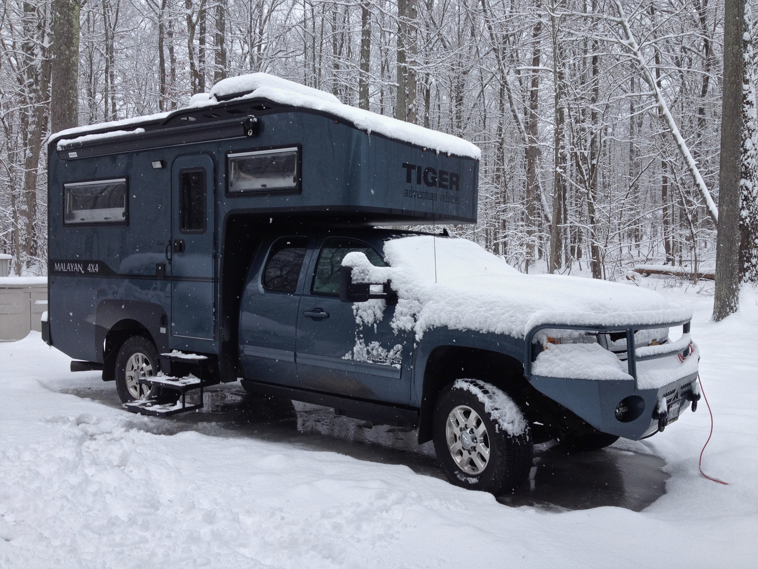
It was April, spring was beautiful in Arlington this year and it was hard to leave, especially as French friends were stopping by and we would not be there to see them.  But leave we did, as we had commitments in the south and to be honest, it would be nice to be warm after the winter we had experienced.  It had been one of the chillier ones in the Northeast and it was not made any warmer by visits to New York State and Maine with multiple feet of snow on the ground.  (Diesel heat in the Tiger is a wonderful thing!) So, we set off in fine form except for Denise who had sprained her ankle!

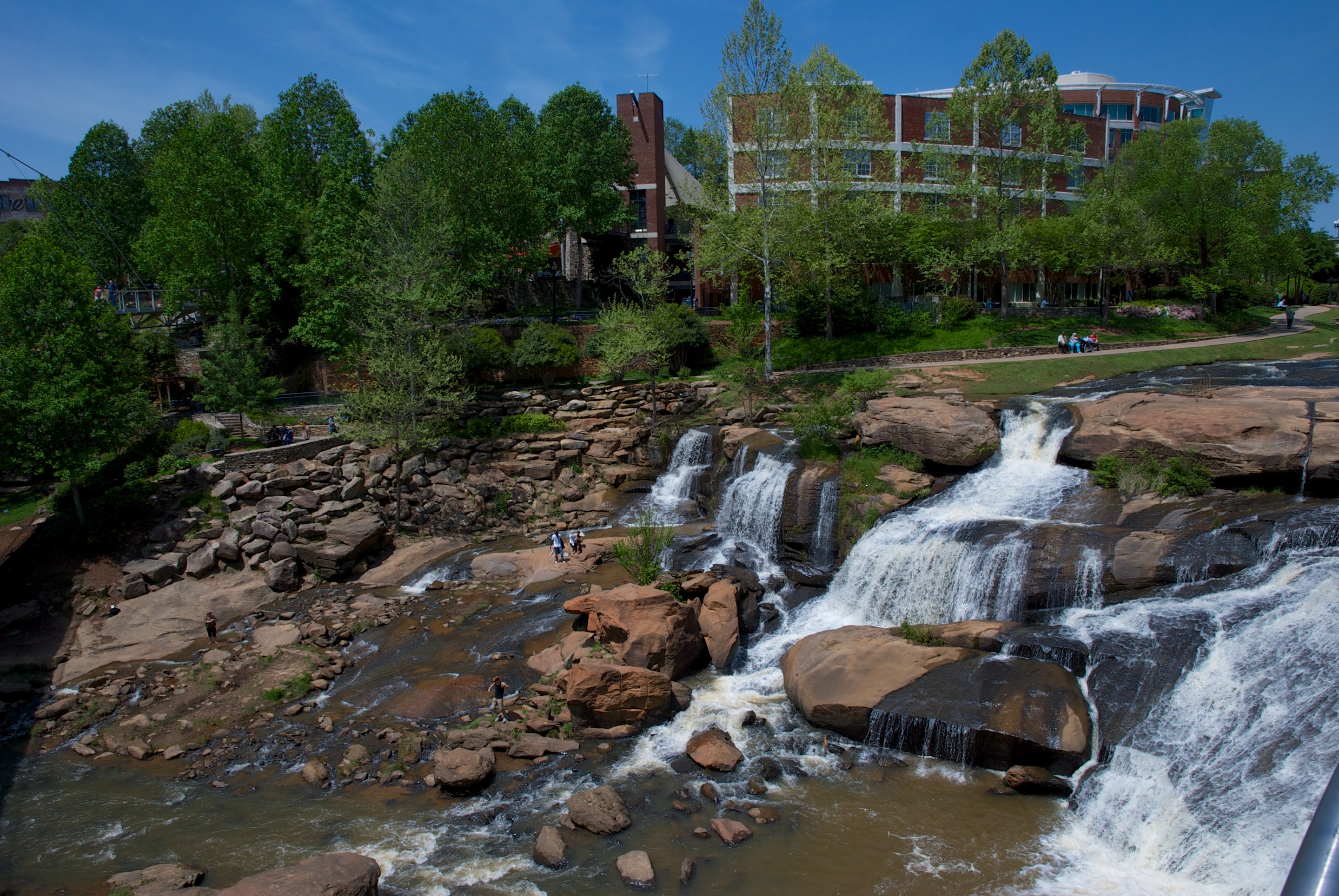
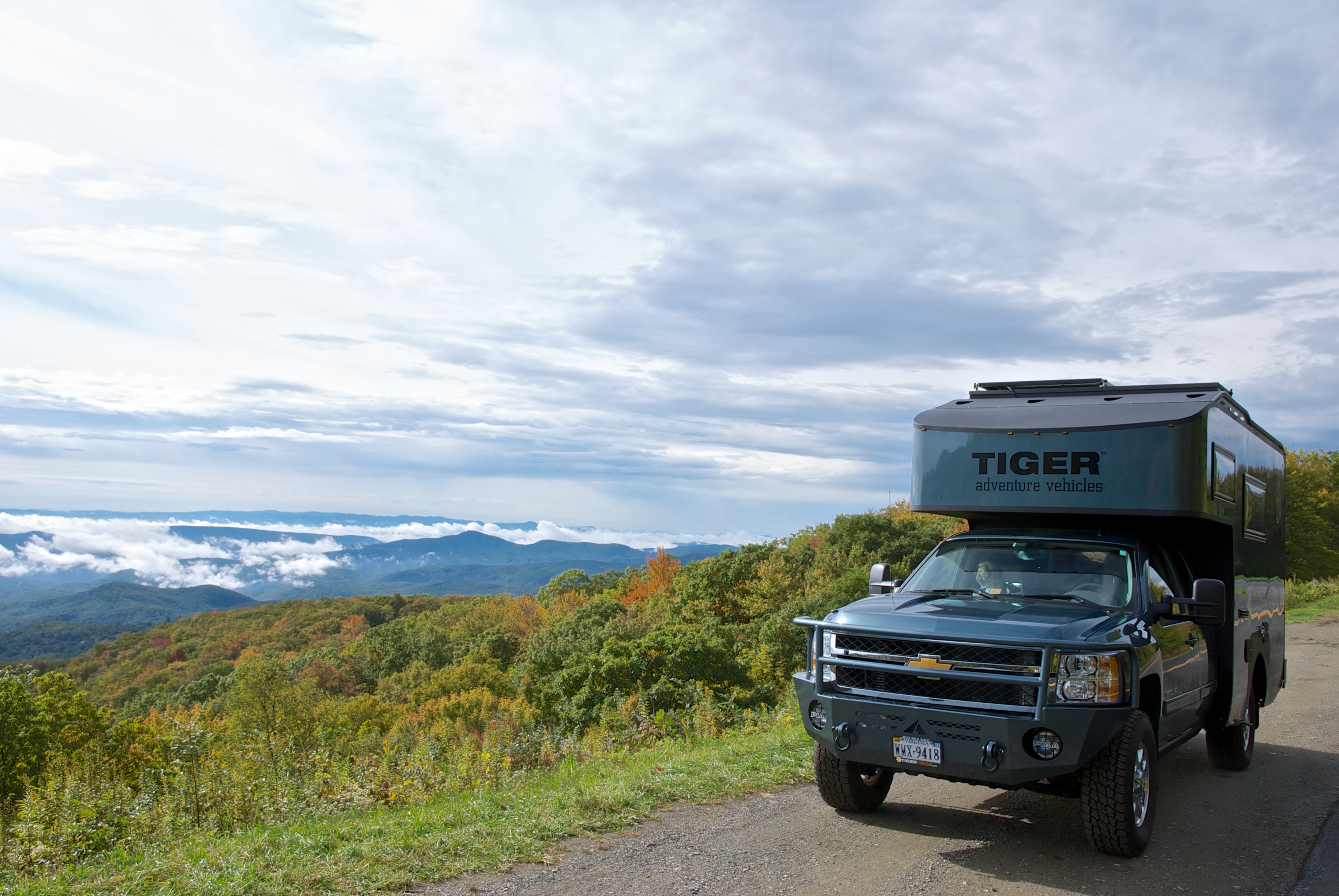
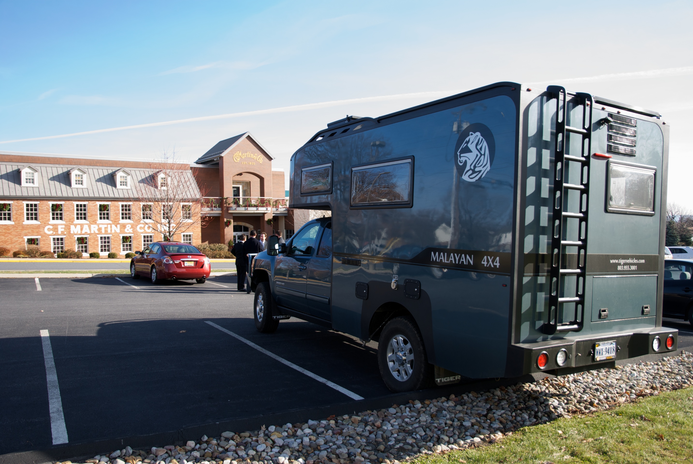
First stop was South Carolina, where we spent a morning at Tiger getting a couple of quick adjustments made, and then visited friends in Taylors, SC, a suburb of Greenville.  We had a wonderful visit (even Blue enjoyed visiting a new house and seeing a new dog!) and enjoyed a stroll down by the river in Greenville, followed by lunch with a view of the river.  The stroll was short as Denise’s ankle was still bothering her but it was a beautiful day and much too nice to be inside.

_DSC1538

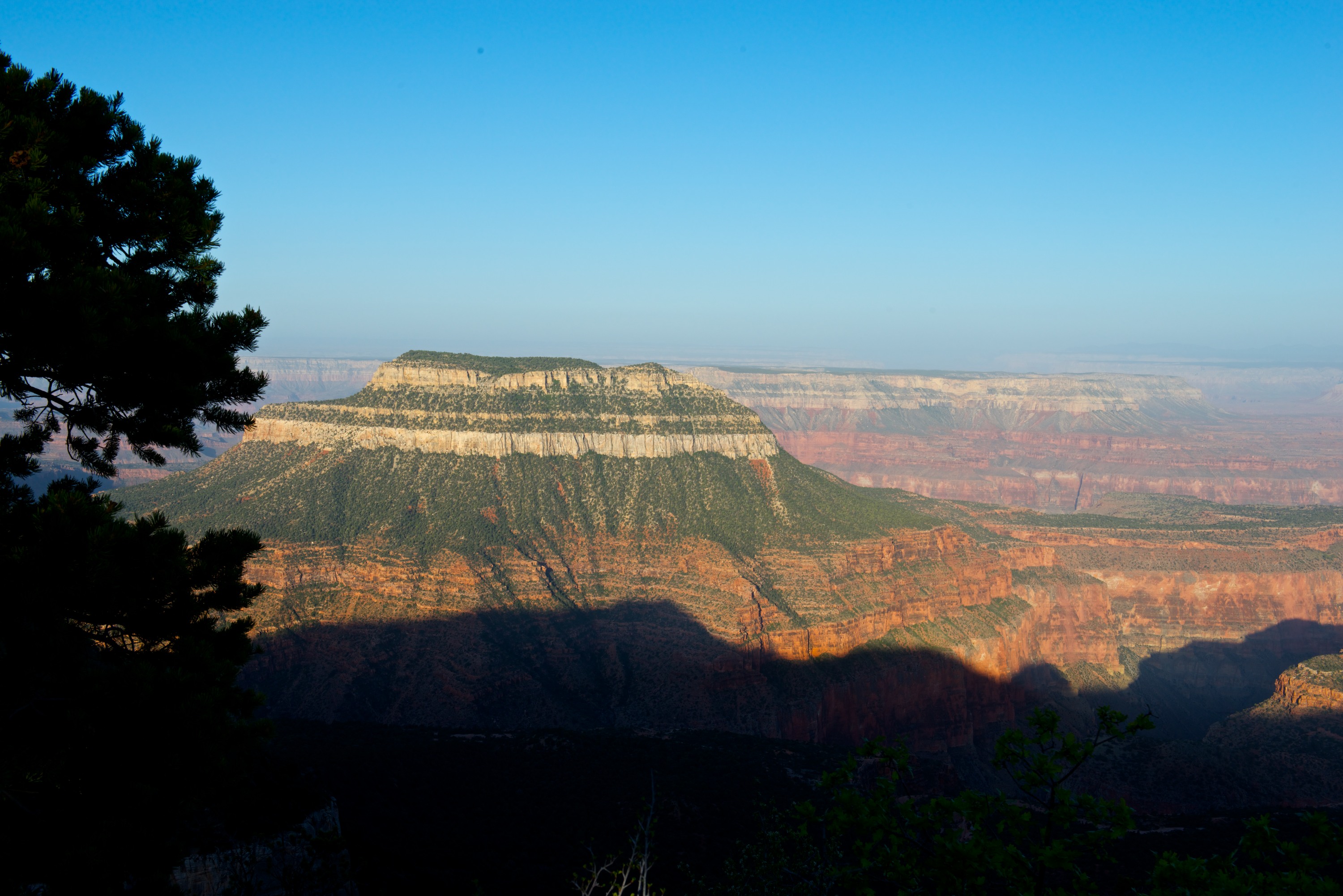
Then onto Savannah, GA where we visited a friend from Panamá and Liberia and discovered the Skidaway Island Campsite, where we camped in a wonderful shady spot.  (http://gastateparks.org/SkidawayIsland) The weather was kind, sunny and not too hot, and knowing nothing about Savannah, we signed up for the hop on hop off bus ride.  We barely scratched the surface of what Savannah had to offer but we did get a feel for the history and the charm of the city so it is on our “must return” list. Preview for the history buffs, Savannah was established as an English military colony to protect the rich plantations of South Carolina from the Spanish. Savannah’s old downtown is famed for its many lovely parks, each dedicated to an historic personage or theme.

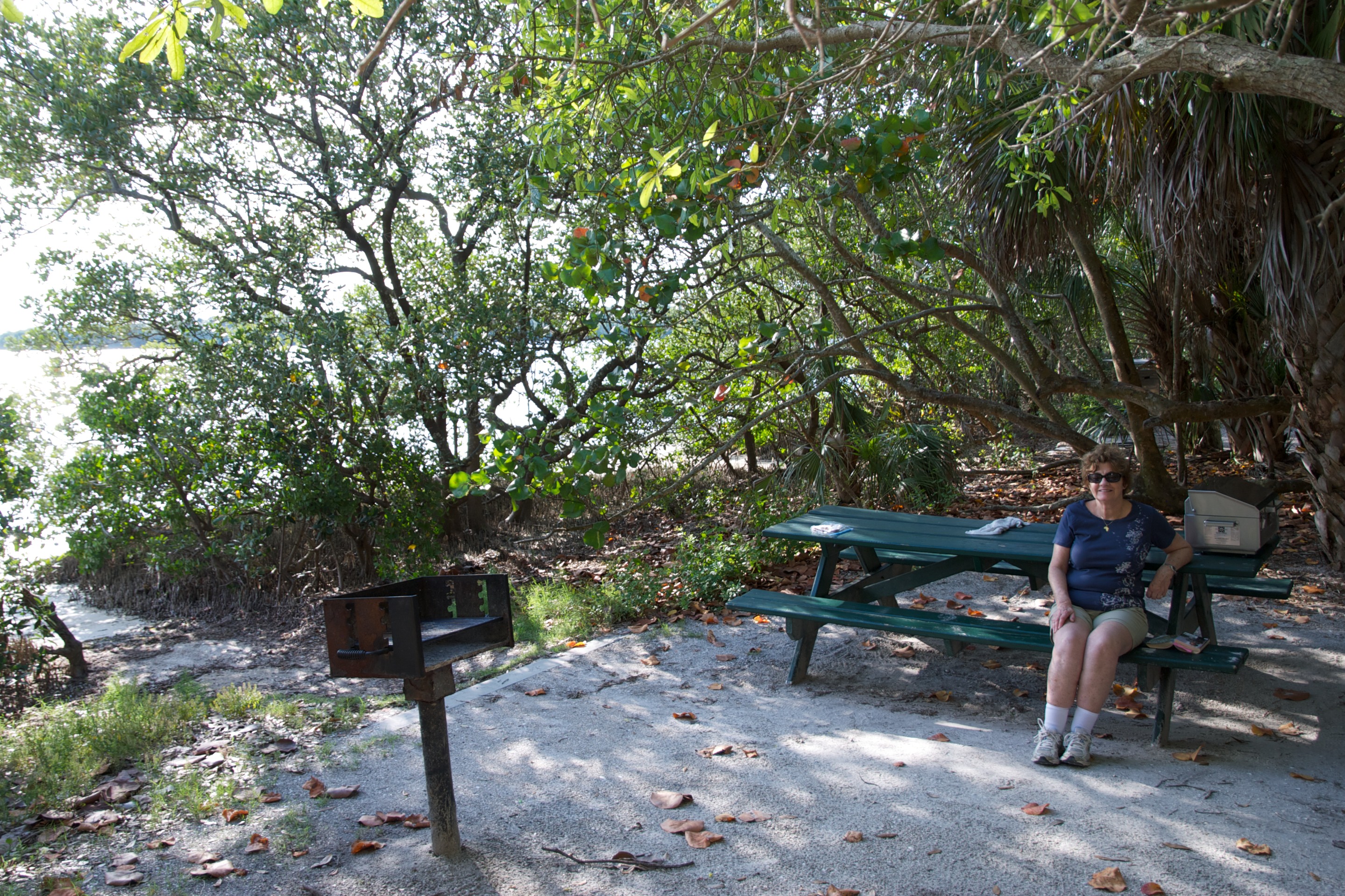
We then headed into Florida with rain and storms predicted for the day and night.  And storm it did, but despite downpours we made it safely to our campsite in the Ocala National Forest at Lake Delancy.  A charming Forestry Commission site, we were the only people there!  We dutifully paid our fee and dropped it in the box.  (http://www.fs.usda.gov/recarea/ocala/recarea/?recid=32360) It was soggy and humid all night but we were comfortable and headed south the next day to St. Petersburg, FL where we had reservations at Fort DeSoto Park campground for three nights.  Ft. DeSoto is on Mullet Key, a barrier island at the mouth of Tampa Bay and we had lovely views of the bay and a chorus line of mullets jumping out of the water for us and providing hours of entertainment as we sat by our camper and enjoyed the view.  (http://www.pinellascounty.org/park/05_ft_desoto.htm)

_DSC1577

Despite calling St. Petersburg home for decades, Fred had rarely visited the park. Denise’s ankle was improving so we were able to do couple of shortish walks, one on the beach and one in a nature trail, and also to visit the fort.  Fred was fascinated by one inlet which had hundreds of fiddler crabs all moving in unison.  We also saw multiple nesting ospreys with young in the nest.

Then, on to Orlando and our son’s MBA graduation.  We enjoyed a lovely family weekend, some excellent meals and the presence of both our children (and our son-in-law) as well as friends of our son’s.  Again the weather was determined to charm us with balmy temperatures and sunshine.

_ND83789

Our last stop in Florida was at a Harvest Host site, Golden Acres, where we camped for the night.  Golden Acres is a small farm which specializes in goats and sheep, though there are an assortment of chickens and guinea fowl running around the yard.  All the animals are guarded by big white fluffy Pyrenean dogs, who apparently excel at that and keep away other dogs, coyotes etc.  We bought some Mayhaw jelly, made from the wild may haw trees in the lake and look forward to enjoying it. (http://www.goldenacresranchflorida.com)

N.B. Any camper owner likes wine and is not a member of Harvest Hosts is missing a trick. (http://harvesthosts.com)

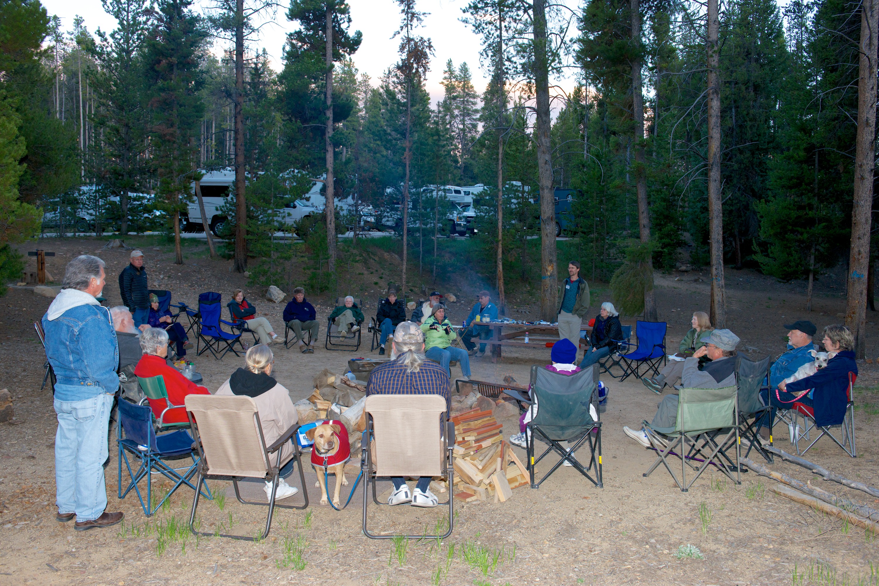
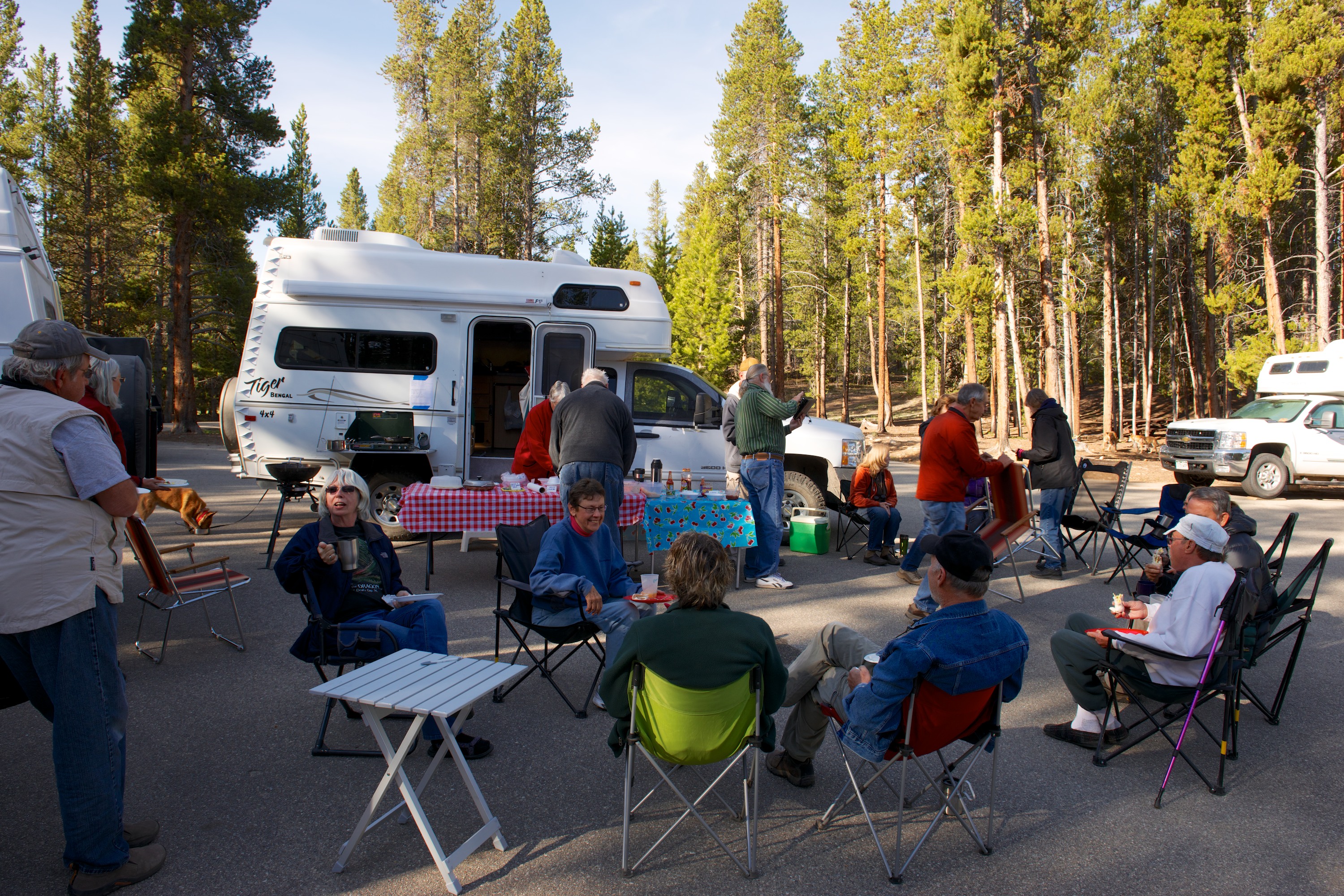
So what are the 60 to 80’s? That is the temperature range, in Fahrenheit, for some lovely camping weather. Warm enough to go out without a coat (a nice change from this winter) and cool enough overnight to be comfortable without air conditioning.

The Lion and Lamb Tour

The old adage is that March “comes in like a lion and goes out like a lamb.” We have just returned from a trip that began with camping in temperatures down to about 10F and ended with us running the air conditioner. We spent at lot of energy and money to create a true, four season camper, precisely so that we would not be limited in the winter, but we do have to confess though that we can see why more people do not travel in the northern USA in the winter. With apologies to W.C. Fields – it is basically closed, even in March.

We started in the Hudson Valley of New York State and headed into Connecticut for our first stop. We were not in the mood for interstates so we ambled across country on state roads enjoying the scenery and spent our first night at the New England Air Museum, near Bradley International Airport north of Hartford, Connecticut. (https://www.neam.org) We had visited the museum years ago and wanted a return visit as it is well worth an hour or three if you like planes as Fred does. He especially likes the Sikorsky flying boat and fully restored B-29. We could not see the outside planes unfortunately as they were still under snow but the inside sections kept us busy for several hours. As a bonus, the Museum also belongs to the Harvest Hosts camping group and we were able to spend the night in their parking lot, which was nice and flat and very convenient! (http://harvesthosts.com)

Lion-Lamb 1We had managed to find a KOA campsite near Plymouth, Massachusetts that is open year round so the following day we headed there first under beautiful blue skies and freezing temperatures to see if we did indeed have a reservation. We checked in and found them plowing our space so we left them to it and headed to Plimouth Plantation about 30 minutes away.

The Plimouth Platation had just opened and we were so glad that it had; it is a really magnificent display, much like Colonial Williamsburg or Olde Sturbridge Village. We passed a fascinating afternoon learning about the Pilgrims and the colony that was founded there and chatting to the costumed interpreters who were thrilled to chat, as there were very few visitors. It was another sunny but chilly day and we were happy to warm ourselves by their fires and hear about the hard winter they experienced after landing in November. Especially fascinating was the use of Original Pronunciation, which is a theme we had met before in Shakespearean plays and other works from the era. After warming up with a much-needed cappuccino, we went to admire the Plymouth Rock and then headed back to our campsite, which was now ready for our use. Our water access tap was still frozen but they found a hose to get us water from the next site over (still under snow) which was working.

The next day also dawned sunny and cold and we headed this time to Cape Cod. As we expected it was quite closed, but we enjoyed our day. We visited the Glass Museum at Sandwich and enjoyed the glass blowing demonstration, though managed not to buy anything! ) http://www.sandwichglassmuseum.org) Then back on the road through a series of quaint little towns with charming architecture. We ventured as far as the remnants of the Marconi transmission station tourist site (the actual station and site has since fallen into the sea) and went down onto the Marconi beach just to say that we had. Then we were back into Ndeke Luka to warm up and head back to our campsite.

Lion-Lamb 9The final leg of a trip was a visit to some friends in Cape Elizabeth, Maine. Unfortunately, the weather deteriorated (it even snowed on one day) but that only made us more determined to return to see it in better conditions, perhaps with leaves on the trees? But we visited Fort William and saw the most photographed light house in Maine, had a wonderful day shopping in Freeport and a wonderful meal at the Boat House, where the Maine lobster was fresh and much enjoyed.

Lion-Lamb

Next visit, we shall see more of Portland and her museums, all of which were (wait for it!) closed! We would also very much like to explore Maine further in future trips.

Lion-Lamb 11 Lion-Lamb 10

Hate to admit it, but these are even louder than the new air horns on Ndeke Luka. ;-(

Lion-Lamb 12

There really is a lake here, you just have to come back in the spring to see it.

Fall Frolics and a Touch of Midwinter Madness

Fall Frolics began this year in early October. Ndeke Luka had been left at Provan for some upgrades during our trip to the UK (see “The Sonne in Splendour”) so we began our trip by packing a rental car with the usual “stuff” including the cat and cat box and heading south. To our surprise, the cat did not like riding in a car, though he likes his camper! Which is just as well! Upon arrival in Columbia, SC and having reacquired Ndeke Luka, we headed off to Asheville for the first East Coast Overland Expo. http://www.overlandexpo.com/east/

As before, we camped at the Provan site and Fred also gave presentations and led panel discussions. Denise showed Ndeke Luka to interested buyers and those who were just generally interested, which proved to be a steady stream of folks. As part of the ever evolving life in a camper, we had some annoying issues with our composting toilet, which we have since solved. And yes, it is working perfectly again. Its quite amazing what one becomes expert in, from time to time!

We thoroughly enjoyed our stay at Expo both catching up with old friends and making new ones. We even managed to leave without acquiring a puppy from the Animal Shelter stall across the way. It was a close call at one point, but reality reared its head!

After Expo, we headed north up the Blue Ridge Parkway heading indirectly for the Hudson Valley and our granddaughter’s 4th birthday party. The fall color was just beginning at the middle elevations but was quite noticeable at the higher elevations. I must confess that the best color we saw was in Pennsylvania near Scranton, but our drive up the Parkway was pleasant. We camped at National Park Service Campsites, where it seemed to rain every night and we were so thankful for a warm, dry Malayan and that we were not trying to keep dry in a tent as we saw some bicyclists doing. We took advantage of a couple of the walking trails and decided that we would most certainly be back.

Fall Frolci  002

Fall Frolic  010

The highlight of this section of the Parkway was a visit to the Blue Ridge Music Center at mile 213. The Center has a most interesting museum explaining the development of music in the Blue Ridge as well as different instruments and local musicians. We were fortunate enough to be there for a live performance by Willard Gapheart and Bobby Patterson, which we enjoyed very much. We even bought a CD! Guitar geeks will love the song about “playing mountain music on my Henderson guitar.” (Hendersons, hand made in the area, are very highly sought after.)

Fall Frolci  003

On our way up 1-81 we stopped at a National Park Service Historic Site called Steamtown. We had seen the sign many times on our way up to the Hudson Valley and decided that this time we would finally stop and see what it was. Steamtown has a huge selection of various steam locomotives, both big and small, with outstanding historical and technical displays about how the railroads of the region developed. Quite fascinating; Fred was in seventh heaven.

While in the Hudson Valley, we always walk on the Wallkill Rail Trail when the weather permits. This trip we discovered a 940-foot long truss bridge, built in the mid 1800’s as a railway trestle bridge. It has been renovated and opened to the public in June 2013 to link parts of the Rail Trail. Apparently, there were always concerns of its sturdiness and ability to support trains but we enjoyed our walk and the views from the bridge without mishap!

Fall Frolic  011

We now turn to Midwinter Madness. Another trip to the Hudson Valley began in early December when the weather was considerably less pleasant than in October.

Our first overnight was at a lovely Delaware State Park called Lums Pond. Plans to walk around the actual “pond” were thwarted by sheeting rain but, as it is quite close to home, we will be back. The next day we headed to Winterthur, former home of Henry Francis Dupont. We had tickets to visit the mansion decked out in its Christmas finery with many Christmas trees and decorations and also to visit the Downtown Abbey exhibit. The latter was very interesting as it included costumes from the BBC series and the history of the various fabrics. We have visited a lot of stately homes in the UK and particularly enjoyed that the exhibit discussed parallels and contrasts of life and customs between British stately homes and the mansions of the era in the US. It felt like a very British day being very ”misty and moisty”. So cold and soggy that we passed on the garden tour. http://www.winterthur.org

We discovered that it is hard to find much open in December so we camped that night in a private campsite. The next day we visited and took a tour of the Martin Guitar Factory. Another fascinating spot, with an extensive museum that described the history of the Martin company and Martin guitars owned by the famous. The tour likewise showed us how handmade Martin is made, and why some cost as, little or as much, as they do. http://www.martinguitar.com

Fall Frolci  001

We have since made two more family trips to the Hudson Valley in Ndeke Luka. Temperatures were down in the lower teens during our last visit. We were parked on a sheet of ice and at least 6 inches of snow fell during our stay. The Malayan remained warm and cozy though we did have to run the heat day and night. The cat does like to be warm! We did have to break down and hook up the electricity towards the end of our stay. In cloudy and cold weather, the solar panels can only achieve so much when it is overcast and we were not driving. But we were pleased with Ndeke Luka’s performance; truly a four season camper!

Fall Frolic  012

Mountains, Mountains and the Monsoons of Kansas

The town of Ouray is called the Little Switzerland of Colorado and there were certain similarities. We must agree. Again, only the main road was paved but the snow capped peaks, the chalet style houses and the multitude of biergartens certainly tried to present a Swiss aspect. We admired and then continued on to Montrose for the necessary groceries.  Our next stop was the Black Canyon of the Gunniston National Park. (http://www.nps.gov/blca/index.htm) We were a little disappointed by this park. The canyon was indeed spectacular, especially the “Painted Wall” but the descent on the Portal road was denied us (10 inches too long), the boat ride through the gorge was not running (river was too high) and they asked us to leave the only space with shade at one of the lunch spots because we were 6 inches over the end of the white line parking place separators in an almost empty parking lot. We were left with a feeling that they were too concerned with nit picking and we were underwhelmed. Especially as a huge Class C RV was parked in a similar space on the other side and had no issues! But we found a great campsite on the way out, a small primitive campsite called Dry Gulch on the Corecanti Recreation Area. So small, we had to stop at the Big Elk Campground down the road to pay the fees the next morning! Dry Gulch was approved for traveling horses so we enjoyed the company of the two mules and one horse who shared the campground.

Gunniston  001 The famous wall.

Gunniston  003 Really hard to photograph, but the rocks here sparkled with all of the crystal in the rock.

Gunniston  002Zoom in and see the climbers. First one has an orange helmet; it is a LONG way down.

Heading towards Leadville now, we took the Cottonwood Pass at 12,106 feet. Another spectacular drive from the rapids running alongside the road (and a couple of rafts enjoying them) to the Taylor Park reservoir and then the well graded dirt road up to the peak and the notice telling us we were at the Continental Divide. Amazing (other than the views) were the three feet high snowbanks still showing the plough cuts on either side of the road. There was even a snowman (someone from Florida perhaps?!!). The descent was a series of hairpin bends and then we headed north towards Leadville, lunching beside the Arkansas River.

Tiger Rally 2014  0005 Looking west from Cottonwood Pass.

Tiger Rally 2014  0006

Leadville proved a pleasant small town though the altitude of 10,200 feet is noticeable. We have been above 8,000  feet so long we have forgotten what oxygen is! We enjoyed a visit to the Healy House Museum and Dewster Cabin. After learning all about mining, it was pleasant to visit a furnished house of the era and a “hunting box” log cabin used by a millionaire for hunting and checking on his investments! Each town’s history was a little different, the gold rush having started in the 1860’s in Leadville, followed by a silver rush a little earlier than Silverton. We also ordered a new induction cooktop for delivery overnight from Amazon. Our first cooktop, after giving yeoman service for 8 weeks, had decided to be difficult and was refusing to remain on. We were thrilled that, the following day, the new cooktop did indeed arrive and is now functioning perfectly. That said, Denise has determined that we will, indeed, install a diesel stove, as a backup.

And then it was on to the site of the Tiger Rally at Printer Boy Group Campsite. (Local mines were often named “Boy” or “Girl.”) A total off 23 Tigers came, of which ours was the only Malayan. It was amazing how many of the original vans and pop tops were still running and were present. It was a great weekend with lots of socializing (Tiger owners are great people!) and wonderful weather, not to mention constant discussions of various issues like solar power and battery charging.

Tiger Rally 2014  0001 Tiger Rally 2014  0002 Tiger Rally 2014  0003 Tiger Rally 2014  0004

And now we are on our way home driving through Kansas in a monsoon. Who knew that Kansas would look so green and in part so like the UK, even down to the rain.  Marginally better than tornados, no doubt, but for the last twenty four hours, it has poured and poured. The winds were so strong last night that the camper swayed. And the weather forecast for tomorrow in Kansas City…rain! We estimate another three days or so heading early tomorrow into Missouri, then into parts of Illinois to West Virginia and on to Virginia, depending on weather and visibility on the interstates. We’ll sum up our experiences then.

Silver by the Ton

Having mined out (!) the attractions of Silverton proper, the mining ghost town of Animas Forks beckoned to Fred and the Old One Hundred Mine and Tour was on the way, so we set off from Silverton to check both out. We made it the five miles to the Old One Hundred Mine promptly and in time to join their first tour at 10.30 AM, where we had the good fortune to be two of only ten or so people. It was a great tour that even Denise found interesting. We went down into the mine on an electric train wearing full yellow raincoats and hard hats and felt the water dripping onto us as we rode. The hard rock mines are apparently always full of water and there were streams running alongside the trail we took. Mining in the Silverton area dates from the 1880’s and seven levels had been cut into the mountain producing gold and silver, plus various base metals, before the mine closed in the 1960’s. We visited the most recent level, Level 7, on the bottom. Most of the ore was extracted from the higher levels, some three thousand feet above us. The tour included information on how the metals were mined, including actual tests of some of the equipment, like the drills and a mucker, a kind of scoop. And it was loud! You can see how miners lost their hearing with multiple drills going, and all the other equipment working, plus blasting of the ore. I am glad that I am not a miner! We returned to the surface and found the next group assembling for their tour. Many more on this tour! We walked up a short distance to photograph the original bunkhouse, which sits just visible perched at 13,000 feet, or the original entry point for Level 1.

Animas Forks  007 Got to look closely here (zoom in) but you can see the remains of the cable system that carried ore from the mines to the crushing station.

Animas Forks  008 Back in the day, these cable systems ran all over all of the hills. When combined with the railroads, they provided a very efficient way to move ore, and people. The network of cable systems was vast.

Animas Forks  009 Animas Forks  010 Animas Forks  011 Denise standing by a seam of ore.

Animas Forks  012“Tommyknockers” hidden away in the mine. The legend of the Tommyknocker reminds of nothing so much as the legends of “El Tio” in Potosi.

Animas Forks  020
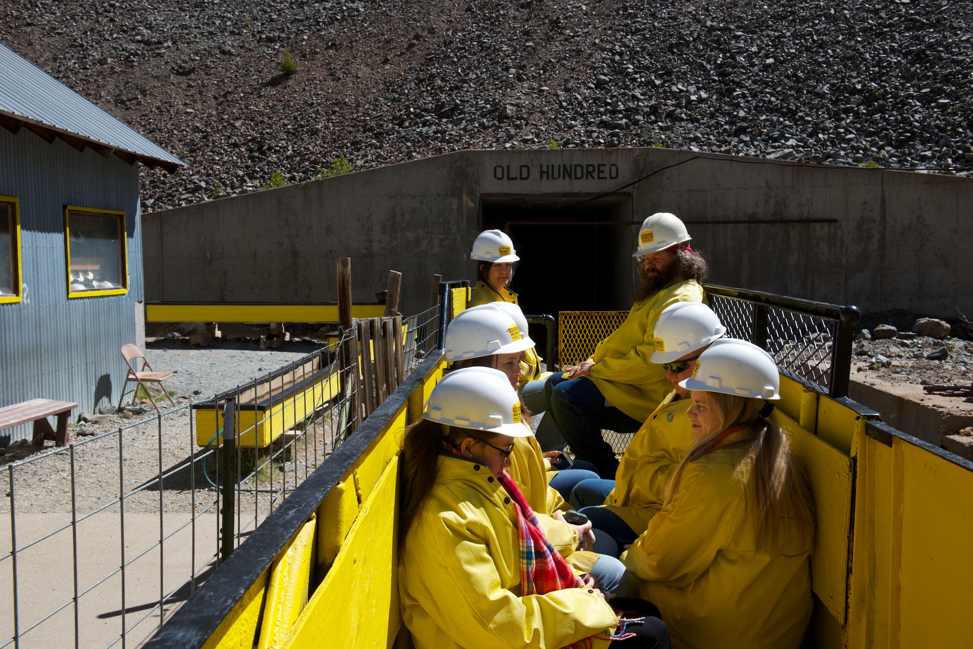
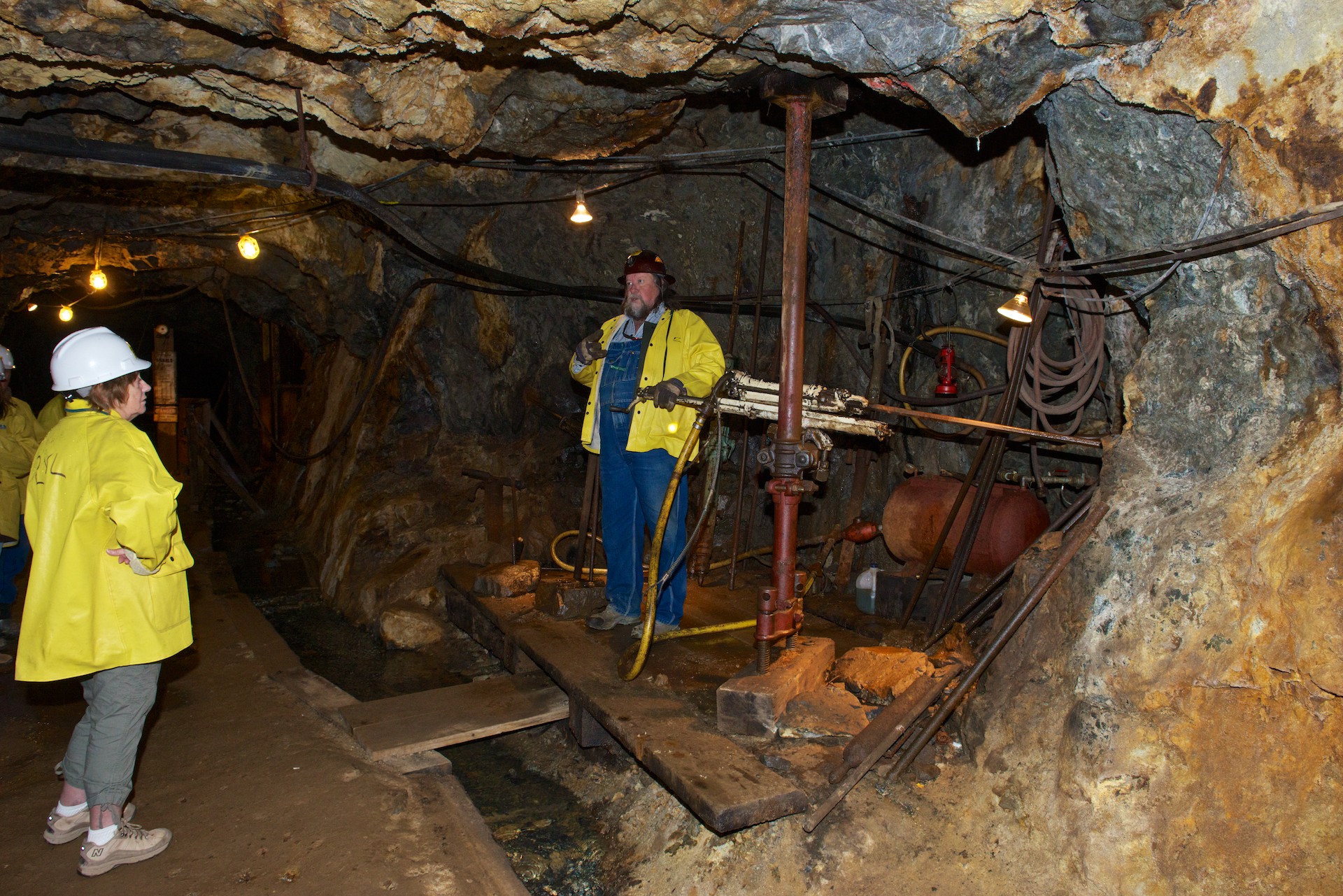
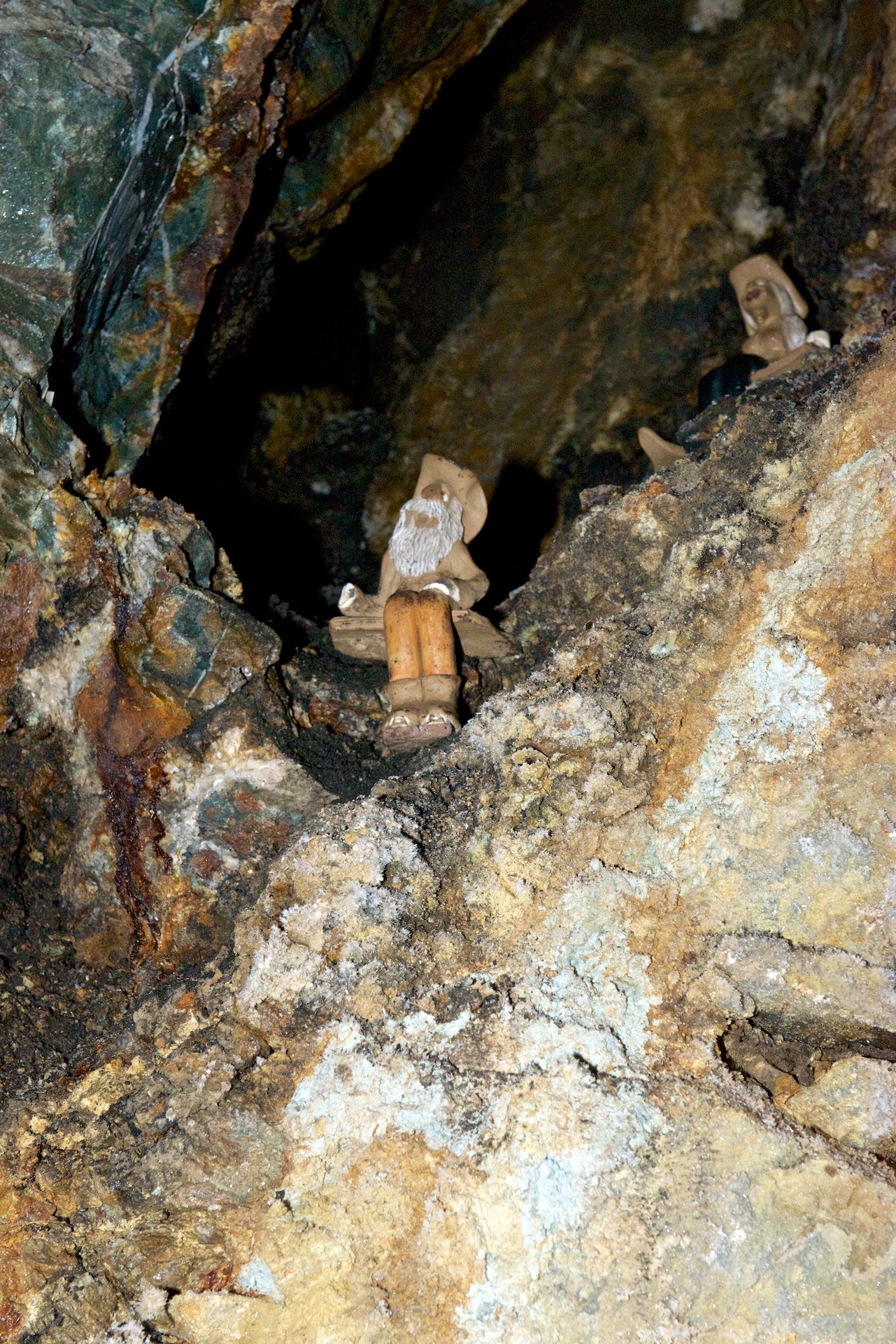
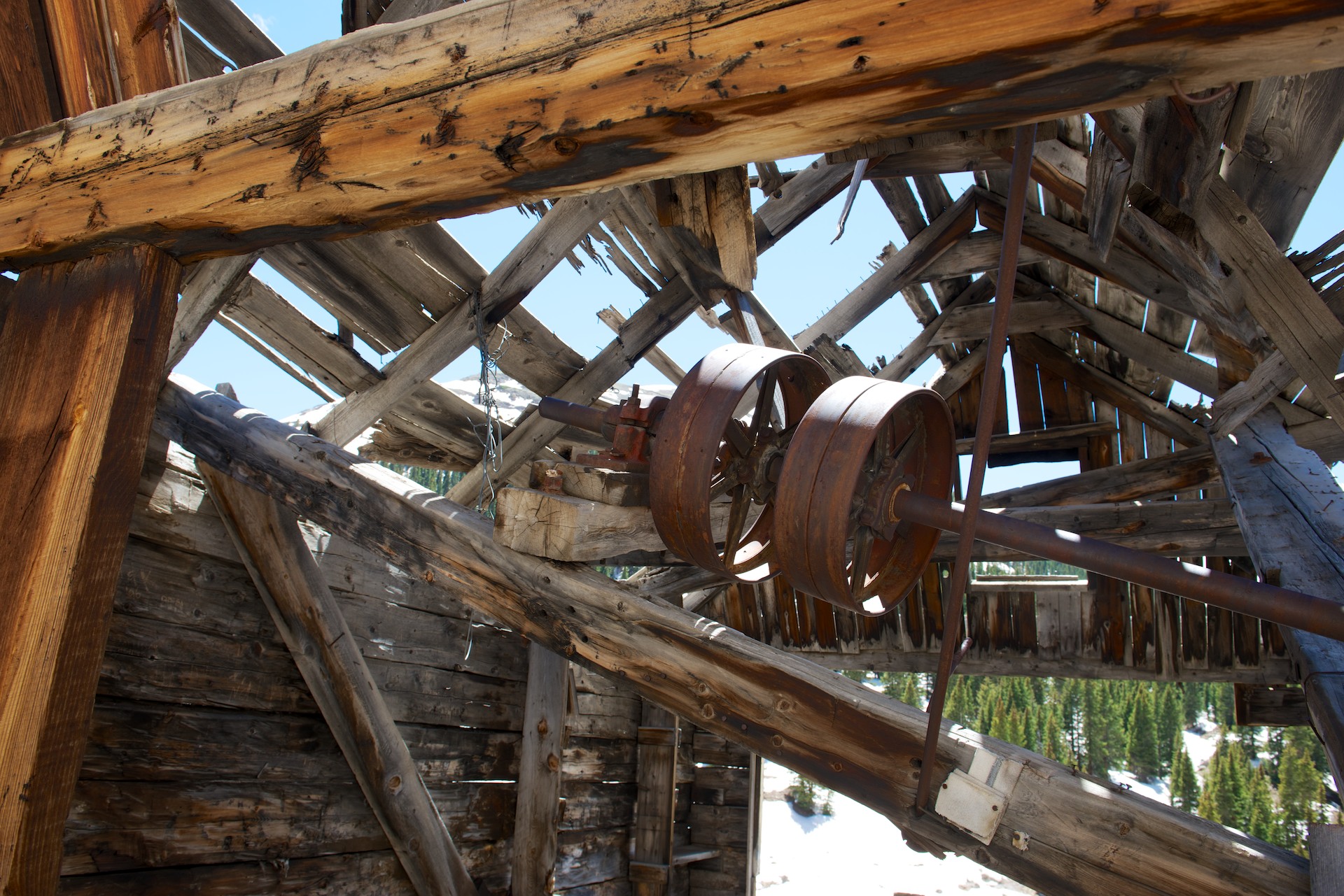
Mike with El Tio in Potosi, Bolivia. Note the offerings of coca leaves, alcohol, and a cigarette. Miners share some beliefs all over the world. (No coca leaves in Colorado.)

Animas Forks  013Long tele shot of the old bunk house. A wonder that anyone could actually sleep at that altitude.

We then headed for Animas Forks, about twelve miles from (and two thousand feet above) Silverton. The road was decent dirt as far as Eureka and then deteriorated and became much rockier and steeper. Fred had wanted to try the Cinnamon Pass to Lake City, which was rumored to be open but still difficult. After discussions with the Tourist Information Office in Silverton, he decided not to tackle it and indeed we gave a lift up to Animas Forks to a young hitchhiker who had been on our mine tour. Of course, we then met a ranger who commutes across it daily and he said that it was fine! But we were committed by then, so we enjoyed a fascinating visit to the old buildings and mine, walking through the snow runoff and even some snow. Imagine, snow on June 1. There is still considerable snow around in the upper altitudes and multiple roads are still closed because of snow. We were still very early in the tourist season. We returned to Silverton, dropped off our passenger and headed for Ouray and a campsite while the road was open.

Animas Forks  014 Ruins of an old ore mill. The mills were generally built on slopes so that gravity would help carry the ore from one level to another. Similarly, mines were usually laid out with the main entrance on the lowest level.

Animas Forks  015 Animas Forks  016 Animas Forks  017 Animas Forks  018

The main road from Silverton to Ouray had suffered a landslide and only one lane was open and only when the crews were not working. So Sunday was by far the best day to go to Ouray and minimize the delays. It was “ho hum another beautiful drive” down a winding road full of hairpin bends and lacking quite a few guardrails but we made it safely and camped in a lovely Forest Commission primitive campsite. In this case, that meant chemical toilets were available but no water. We need neither so for us the charm of the site was only emphasized by the view of the snowcapped peak.

Animas Forks  019

Still Kinda High!

We really liked the campsite we found in Durango, the United Campsite. It was on the free trolley line into Durango, which made getting around really easy and it also had the railway line for the Durango and Silverton Narrow Gauge Railway running through it! So we were able to wave at the steam train at least four times a day! (http://www.unitedcampgrounddurango.com)

Shopping completed, we settled in for the evening. The only excitement was a small Bleu jail break, but he was easily retrieved. He then went for a walk wearing his harness and leash. He is getting much more relaxed about going outside on his leash and is really enjoying it, especially the rolls in the sand that make him all dirty!

Our second day we were off on the trolley at 7.40 AM to the train station. We were off to Silverton on the train. (http://www.durangotrain.com) We had splurged for First Class Tickets so that Fred could stand on the rear observation platform and (we hoped) get good photos.  He was indeed able to do this for quite a bit of the time and he enjoyed it. Unfortunately, the day was somewhat overcast but we did get a little sunshine in between the clouds and the actual rain shower that accompanied us as we left Silverton. The scenery was spectacular as the train ran alongside the Animas River and as we steadily climbed the forest changed from pine to spruce and aspen, through a deep gorge with lots of snow melt churning. Meanwhile the San Juan Mountains and their snowy peaks were getting ever closer.

Durango-Silverton  0001There is something magic about an RV park with a train running through it.

Durango-Silverton  0003

Durango-Silverton  0004

Durango-Silverton  0006This young lady came out to meet the train when it stopped for water. She knew that handouts were in the offing!

Durango-Silverton  0007

Durango-Silverton  0008Looking back towards Durango.

Silverton is an old mining town that still has many of its original (saloons and brothels) buildings intact, though serving different purposes of course! We chose to go to Grumpy’s for lunch, primarily to hear the honky tonk piano player who adds to the atmosphere of an old saloon and hotel. In fact, several of the old bordellos now house restaurants!

Durango-Silverton  0009

We wanted more time there and determined to return with Ndeke Luka; this time though, it was back to the train and Durango.

Durango-Silverton  0010

Durango-Silverton  0011

Durango-Silverton  0013As always there were chores that needed to be done, laundry, shopping etc. We took the Trolley into Durango for a Himalayan lunch, which was actually quite good though the buffet had distinct Indian overtones. (http://www.himkitchen.com) We also visited the Train Museum, which included a huge model train layout, plus several of the old engines and old cars from the era. The general memorabilia was interesting.

Bleu was startled by some mule deer coming through our campsite and also by the train whistles. He was happy to leave Durango, but we enjoyed it and the spectacular scenery that accompanied our drive to Silverton.

Animas Forks  001

Like many small towns in the mountains, Silverton has only one paved road. We started our visit by riding the stagecoach. Only a short ride but fun! Our stagecoach horses were called Sonny and Cher, but the dog in the driver’s box was clearly in charge! We then visited the Jail and the Museum, both of which were fascinating. The jail was built in 1902 but was amazingly modern with steel cells and other modern features. The Museum included examples of various rocks and crystals found locally and a history of mining, with three levels of a mine showing equipment used to explain how mining of the era was done. We then wandered the town with our Walking Tour leaflet in our hands, taking notice of the dates of the buildings and the various uses to which they had been put.

Animas Forks  002 Animas Forks  003 Animas Forks  004 Animas Forks  005 Animas Forks  006

We confess to eating dinner at the Handlebar Restaurant (part of an old hotel) and it was excellent.  We even had dessert, homemade peach cobbler and vanilla ice cream and bread pudding with bourbon sauce before staggering back to Ndeke Luka. Silverton is at 9,500 feet so one notices the altitude sometimes! (http://www.handlebarssilverton.com)

(More photos to  come, WiFi permitting.)


Rocky Mountain High and Higher!

It is going to feel very strange when we finally do come down the mountain(s); we have been at anywhere from 6,000 to 12,000 feet in altitude for the last couple of weeks. We are actually used to it now! Memories of life in La Paz, Bolivia.

Although our goal when leaving Utah was Durango, Colorado, we allowed ourselves to succumb to temptation and stopped at Mesa Verde National Park.  Although we had already visited Bandelier National Monument and also Chaco, the ruins at Mesa Verde are on a much larger scale and we felt that this visit would complete the experience. So, we stopped at the Visitor Center and both acquired all the information we needed and checked out the excellent displays, before heading to check in at the campground. We then headed to the museum up the mountain. It was a longish drive, about 15 miles, and the views were quite wonderful. Canyons below, cliffs above and snow capped peaks in the distance – plus various outlooks where these could all be photographed. The museum was interesting with a selection of dioramas of Puebloan life at different times and stages of occupation at Mesa Verde and we watched the excellent movie, which gave a good background on the life and history of the pueblo, as far as it is known.

We then headed down to the “Spruce Tree House”. This house did not require the purchase of tickets for a ranger tour, though we did buy a self-guide booklet. We had a good idea of what we would see and indeed, the site was bigger and much more complete but we were able to recognize the various features.  There was a rebuilt kiva complete with entrance, so of course, Fred had to go down to take photos. The rebuilt kiva really brought the other ruins we had seen to life.

Mesa Verde  001

Mesa Verde  002

Mesa Verde  003
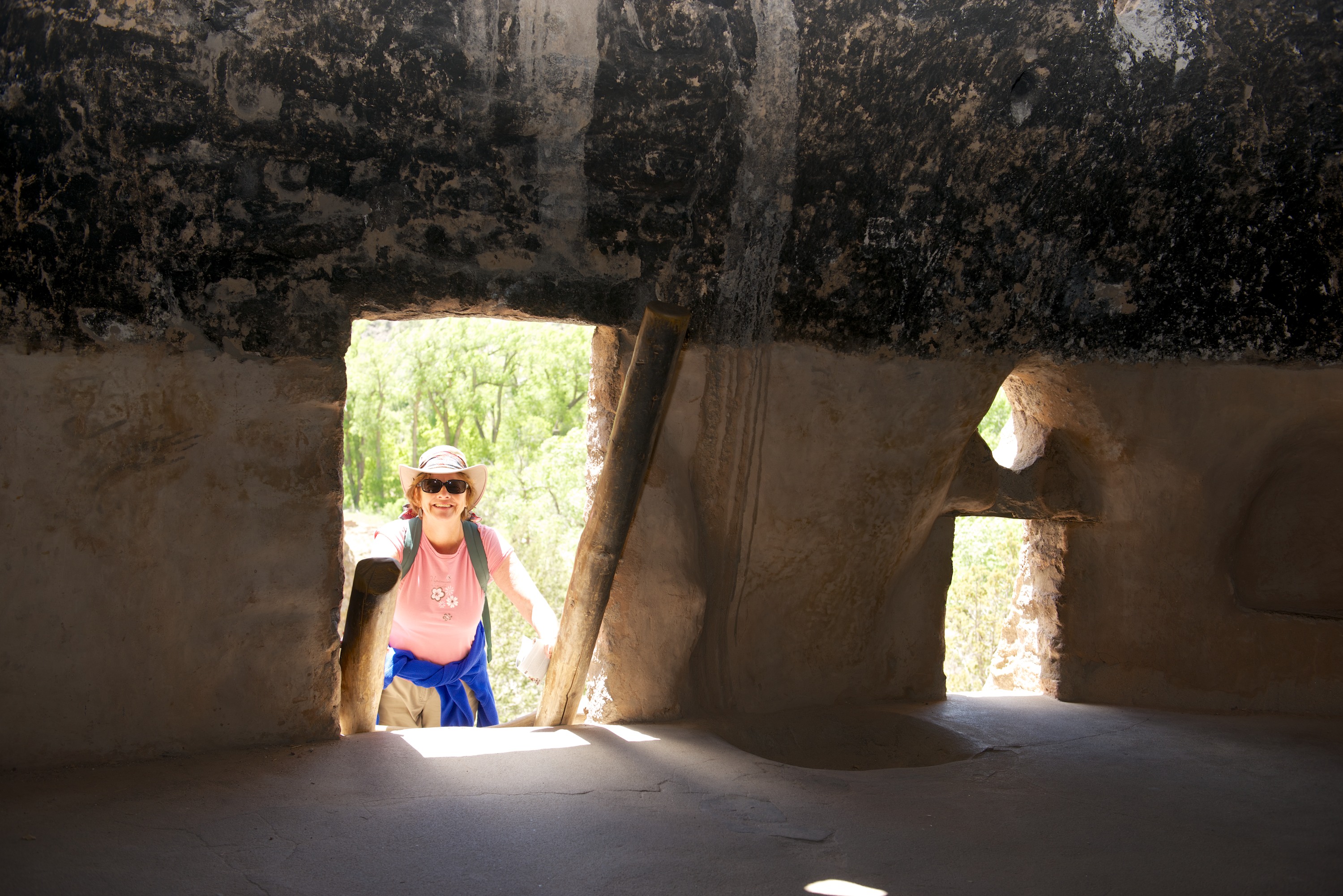
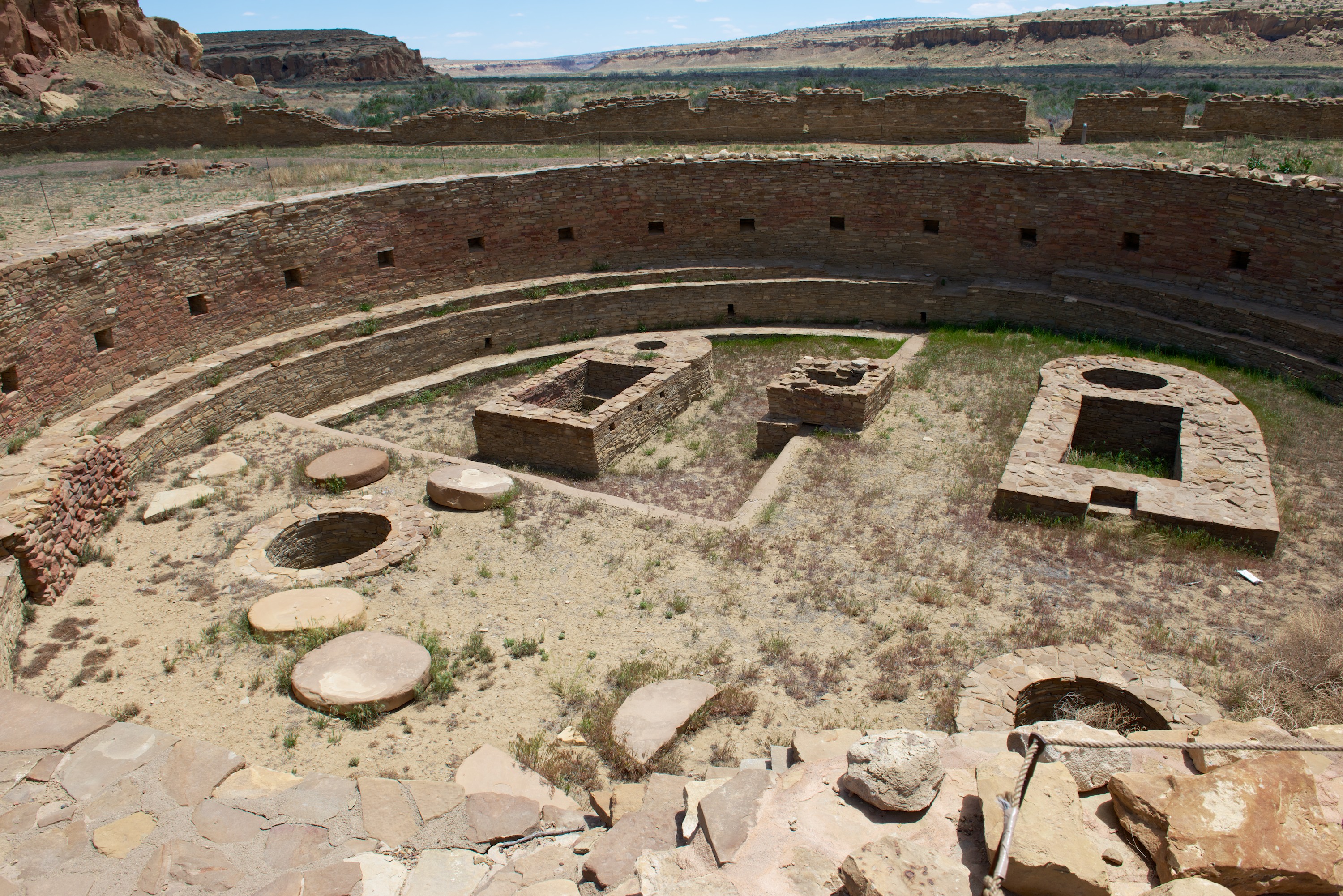
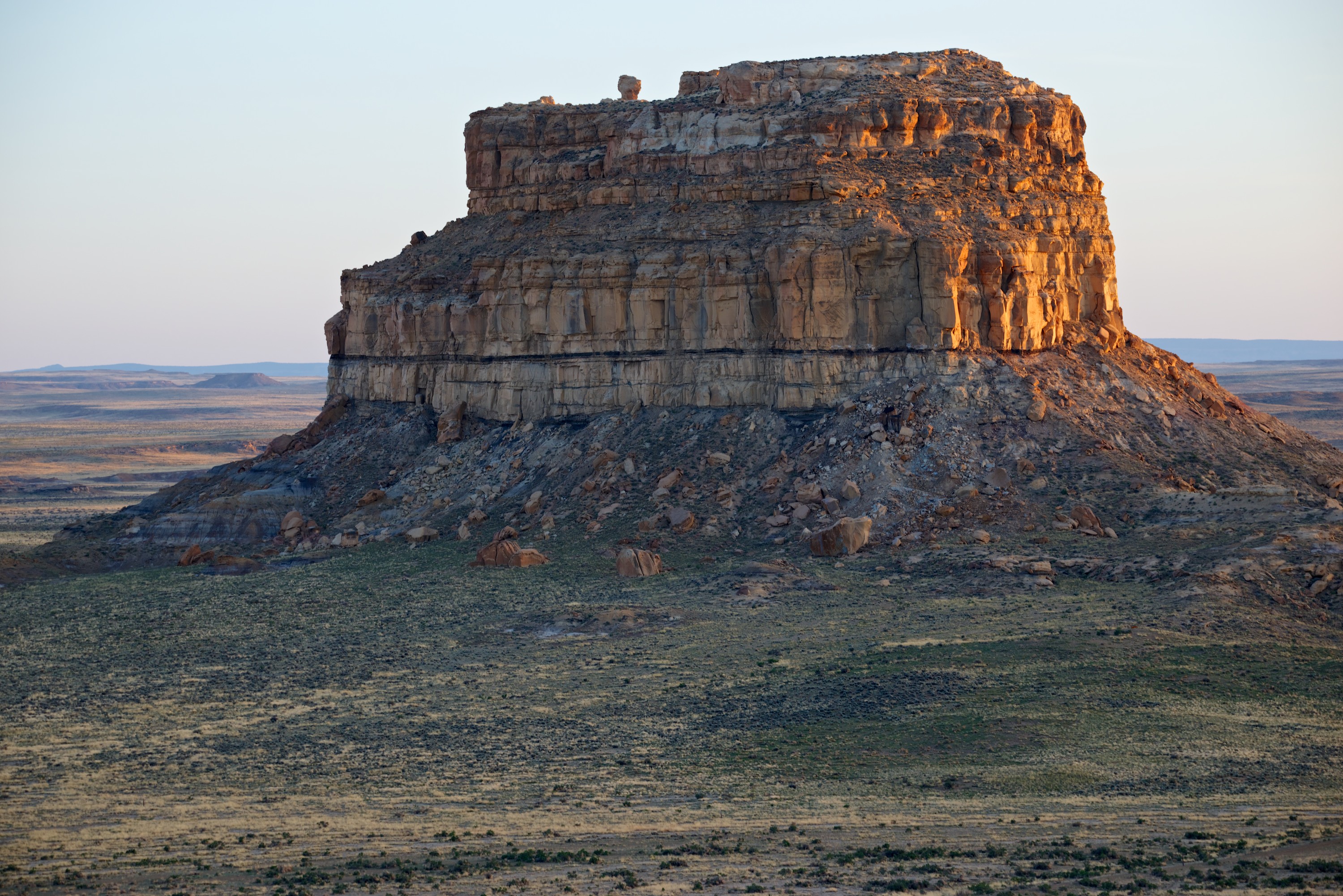
After hearing so much about “kivas” at other sites, we finally had some reconstructed ones.

Mesa Verde  004The kiva interior was quite spectacular.

After our visit, we drove the Mesa Top Loop.  This had a number of overlooks where we could see a pit house, visit the sun temple and also see across the valley to various sites including the Cliff Palace. This is probably the most famous of the sites at Mesa Verde and requires a ticket for a ranger led tour. We decided that the view from across the valley would be enough, especially when we saw the hordes of tourists milling around.    Mesa Verde  005For scale, zoom in on the people on the right.

The highlight of the evening was a number of mule deer grazing around the campsite. They seemed to have reserved their favorite site.Mesa Verde  006


They did not seem to need any “hookups.” 

Just a Little Corner of U (Utah, that is)

So much to see and so little time has led us to leave our explorations of Utah for the next trip west. However, we did enjoy the short time we spent there and will look forward to  next time.

After leaving Monument Valley, we headed into the Valley of the Gods, in the rain, to camp. We did stop at Mexican Hat to take a picture of the namesake rock. We were a little underwhelmed, it was quite small and, especially in the rain, looked rather bleak.

VGods  0001

Ndeke Luka quickly got covered in a nice layer of red mud, which makes it look rather macho! Jesting aside, we found a lovely campsite near some buttes in the Valley of the Gods and spent a relaxing day there. (https://www.utah.com/monumentvalley/ValleyOfTheGods.htm) N.B., The Valley of the Gods was used to film parts of the TV shows “Airwolf” and “Dr. Who.” Thanks to Tiger owner Jack Arnold for the suggestion that we go to the Garden: http://www.jackarnoldphoto.com

VGods  0002 Battleship Rock

VGods  0004 Pretty Balancing Rocks (Several hundred feet high.)

We took a walk in the afternoon, after the rain stopped, and Denise saw at least two new types of spring flowers. One of the joys of this trip, has been the number and variety of spring flowers that we have seen blooming in the desert. We do not always know what they are but we do enjoy seeing them.

As we were so close, we went to see the Natural Bridges National Monument. Our road led us out of the Valley of the Gods, up an amazing road to Cedar Mesa, via the Moki Dugway. The road was a series of steep and sharp curves, as we climbed up and the views back towards the Valley of the Gods were amazing, especially as the rain had cleared any dust or smoke. Quite spectacular. The link from “Dangerous Roads.org” sets the right tone:  http://www.dangerousroads.org/north-america/usa/783-mokee-dugway-usa.html

VGods  0005

There are three natural bridges at the Monument; Sipapu, Kachina and Owachomo.  (http://www.nps.gov/nabr/index.htm) There are trails to the bases of all three, the first two being a little rougher and more challenging than the third. We descended Sipapu to a marvelous oak grove at the stream under the bridge, via a series of paths, rocks, steps, ladders, and hand rails for great views and a little much needed exercise! We also climbed down to Owachomo, which proved somewhat easier and less strenuous (at least going down!) but also was well worth it.

The primitive campground at Natural Bridges was full, so we camped in the forest outside.

Natural Bridge  001Sipapu from the overlook. Hard to see the bridge at first, then you see the hole and can see how the water originally went around the pier of rock to the left of the photo.

Natural Bridge  002Sipapu from 3/4 of the way down. Note the beautiful green trees.


Natural Bridge  003Sipapu, seen from the bottom.

Natural Bridge  005 Denise at Owachomo.

Natural Bridge  004  

And on to Colorado. Utah we hardly knew you, but we’ll be back!

Arizona – Does anyone really know what time it is?

(With apologies to the the band, “Chicago.”)

We have never been in a state that made it so difficult to tell the time! Most of Arizona is NOT on Daylight Savings Time, but much of Arizona is on Navajo Reservations and they ARE on Daylight Savings Time. Just to make it more interesting, the Hopi reservations are on Arizona time. But fortunately, we have not been seriously early or late despite the challenges!  This is of course, one of the advantages of camping! One morning we left the campsite in Utah, drove four miles down the road back into Arizona and gained an hour and then lost it again on our return to the campsite! Endless opportunities for confusion.

En route to Flagstaff, we made a stop at the Painted Desert and Petrified Desert National Park. The colors of the desert were a bit muted due to the dust, stirred up by the howling gale, which was exceptionally strong that day, close to 50 mph. Talk about blowing a hoolie! We did brave the wind to see some wonderful petrified wood with its incredible colors, but I cannot say it was a pleasant experience.

PaintDesert  0002 PaintDesert  0003 Nifty custom built camper on an Iveco “Daily” 4×4. Owned by a charming French couple whom we met again at Sunset Crater.

PaintDesert  0004 PaintDesert  0006Dust blowing in the wind.

PaintDesert  0007 PaintDesert  0008 PaintDesert  0009 PaintDesert  0010You can really see the wood on the outside of this log.

On the last leg of our trip to Flagstaff, we made a little detour, to Meteor Crater. When Fred was a child, he crossed the United States twice by car, and both times drove right by the crater without stopping. This time, he was DETERMINED to see the thing. And from the south side. (Which requires a small scramble over the rocks to an old mine site.)

MeteorCrater  0003

MeteorCrater  0002Looking north towards the visitor center.

 MeteorCrater  0004Looking west towards the San Francisco mountains, over Flagstaff.

Once in Flagstaff, we needed to prepare both ourselves and Ndeke Luka for the Overland Expo, so we headed to the KOA campsite which was in a good location. We found it full of various campers and off road vehicles heading to Overland Expo, including Robinson Fuso and its owners, Jon and Emily Turner, with whom Fred had corresponded but had never met. So, it was fun to have company while we organized laundry and cleaned the Tiger. We went first to a car wash with large bays, then cleaned inside to make Ndeke Luka presentable. We did spend a day in Flagstaff learning both the local history by visiting the Riordan Historic Mansion, built by a local family who owned the lumber mill, and the geological history by visiting the Sunset Crater, a cinder cone just outside town. Flagstaff sits on the slopes of the San Francisco mountains, the remnants of a mega volcano that blew in prehistory and the whole area is a mass of lava and tuff and contains many craters. None are active, for now.

As we travel it is fun to meet and re-meet acquaintances. We met a French couple at Painted Desert and again at the Sunset Crater, where they were staying in the campsite. They too were impressed with the crater.

We also made a day trip to Sedona. The town was highly touristy, as we expected, but we did get a great pizza and salad for lunch. The drive up and down the Oak Canyon road was fun and the views from the top were great.

SedonaOEXPO  0001 SedonaOEXPO  0002 SedonaOEXPO  0003 SedonaOEXPO  0004

(Right after we left the Flagstaff area, there was a terrible fire in the Oak Canyon area. We saw the smoke from the Grand Canyon.)

With a clean camper and a larder full of food (not to mention the fridge), we set off for Mormon Lake Lodge, site of the Overland Expo.  This year’s event was very successful with several thousand attendees. We parked in the Provan Tiger section, along with a Bengal that Mark Guild had brought and a Malayan LT.  Fred gave four presentations and was also took part in two roundtables, so Denise was responsible for showing our Malayan HT.  Each day produced a steady stream of interested persons, so it was a busy time and quite hard work!  However, all the visitors seemed to like the vehicles and were appreciative.

SedonaOEXPO  0006Tigers, old style and new.

SedonaOEXPO  0005

Norlina Bleu, handing out Tiger literature. We had to explain that the cat was NOT included in the price.

Along with Robinson Fuso (and Jon and Emily) we then headed north to the Grand Canyon. (http://robinsonfuso.com/) We could not get a reservation for the North Rim Campsite, nor Point Sublime, but after a little research, we went into the Kaibab National Forest and camped on two of the Points on the Rainbow Rim Trail, overlooking the Canyon. With chairs placed in full view of the Canyon, it proved very pleasant to sit and enjoy an evening glass of wine. Our first campsite on North Timp Point was great. Our second, at Parissawampitts was a little more challenging but worked after Emily found a wonderful campsite. We enjoyed some great dirt roads, some walking and lots of great company. Denise also thoroughly enjoyed a one hour mule ride along the canyon rim on a greedy mule called Fancy.

GCanyon  0005 GCanyon  0001 GCanyon  0014 GCanyon  0015

Our last stop, barely in Arizona, was Monument Valley.  We set off to drive the circuit road, advertised as being unpaved and rough, for the full 17 miles and were soon exceedingly pleased that the Malayan drives so well off road. The road is indeed rough and reminded us of roads we have known and loved in Africa. Bleu, on the other hand, was not thrilled. He has decided he is not in favor of being an off road cat! He likes to ride on the dashboard when we are on unpaved roads as it bounces less but he keeps changing the settings on the GPS! But the drive was certainly worth it. It took us about 5 hours to make the tour and we loved every minute. The buttes and peaks are spectacular! We had a great day from a photography point of view with lots of amazing clouds as well as plenty of sunshine.

MValley  0001

Rain at Monument Valley.MValley  0002 MValley  0003 MValley  0004

Obligatory portraits at the Mittens.MValley  0006 MValley  0007Dog, selling jewelry.

MValley  0008Iconic shot, from John Ford’s Point.

MValley  0009 MValley  0010 Ndeke Luka, with the dancers and the totem pole.

MValley  0011You could really make a Western here …

MValley  0013 MValley  0014 MValley  0015 MValley  0016Tourists, calling it a day.

MValley  0017 MValley  0018Dramatic clouds.


Even more Enchantment

We regretfully left Santa Fe and headed to the Frijole Canyon of Bandelier National Monument, a site occupied until the 1400’s by the Ancestral Pueblo.  (http://www.nps.gov/band/index.htm) There are remains of a pueblo village, Tyuonyi, which includes a circle of homes, plus several kivas (underground meeting rooms), two of which had been rebuilt, while the others appeared simply as dips in the ground and had not been touched. We also climbed up to view the cliff dwellings, including the Alcove House with its reconstructed kiva and ruins of cliff houses.  The views along the cavern were quite green, at least in comparison to the barrenness around it, due to the stream running through it. The views of the canyon itself, with the mesa behind it were spectacular.  We camped at a very nice campsite at the National Monument, though by the evening, the weather had changed and it was windy and cold.  It reminded us what a joy it is to have a warm Tiger in which to retreat!  The cliffs, where the houses were built, were formed by volcanic ash hardening after a massive eruption and we next went to see the caldera, at Valle Grande, which resulted from the eruption.  The caldera formed a huge grassland area at 10,000 feet, with occasional small “hills”, where the volcanic action continues.  The purported elk herds were absent without leave, though perhaps that was because it was snowing!  The weather on this trip seems to swing from one extreme to another with gay abandon.

Bandelier  0002

Bandelier  0005

Bandelier  0006

Bandelier  0008 Reconstructed kiva called the “Alcove House.”

Bandelier  0009The Alcove House from the valley floor.

We then headed to the Chaco Cultural National Park. (http://www.nps.gov/chcu/index.htm)  En route, in additional to snow, it hailed and rained on us, though never enough to do any good and wash any of the dust off!  Our trip to Chaco proved remarkably easy and the Tiger acquitted itself well on the dirt roads. Denise loved driving!  Upon arrival, we purchased our camping spot but were told we could only stay one night.  A pity, but we decided to make the most of our time and set off to take photos of Fajada Butte, an amazing structure all on its own and of great significance to the Chacoan peoples who lived there for more than 400 years.  Near the campsite were also some petroglyphs, hard to see, but worth it for the ambience.  How many campsites have ancient rock art?

Next day, we were able to talk our way into a second night’s camping (someone had left early), so we signed up for that and then set out to view the sites.  There are five in total and we only saw three before exhaustion set in.  We began by hiking in a ranger guided tour to Una Vida, a small great house, most of which was under our feet as it has not been excavated.  The ranger was informative and we learned a lot about the sites as a whole.  We then climbed the cliff to view the petroglyphs (and take photos of course).  We then saw Chetro Ketl and Pueblo Bonito, both large sites with multiple buildings with many rooms and kivas, both the large Great Kivas and small kivas and round rooms.

It was a much warmer evening and Fred had energy to hike up to take evening photos of Fajada Butte.  I stayed behind to keep Blue company!  Blue is thriving as a camper cat and becoming more adventuresome all the time.  His leaps from the couch to the bed are quite amazing.

We left Chaco via dirt road, (this time with Fred driving) and were pleased again with Ndeke Luka’s stability.  We are headed to Arizona but stopped for the afternoon (and chores) in Gallup, NM at a very pleasant RV park on a Route 66 theme.  This is our first RV park for a week and we remain impressed with our constant solar power.  We have only plugged into RV park electrics on the three days in San Antonio when the temperature hit the upper 90’s. The air conditioning felt wonderful for sleeping!

Chaco  0001 How often can you camp right next to ancient ruins?

Chaco  0002

Chaco  0003Denise admires an ancestral Puebloan building sheltered by the rocks at the Chaco campground.

Chaco  0004 Defaced rock carvings.

Chaco  0005 The carvings are up on the the cliff.

Chaco  0006 Sunset in the campground.

Chaco  0007

Chaco  0010 Beautiful stonework.

Chaco  0013

Chaco  0014 The massive ruins of Pueblo Bonito rise four stories tall.

Chaco  0015 An excavated “great” kiva. All of these structures would have been underground.

Chaco  0016

Chaco  0017 The next great rock that will fall.

Chaco  0019

Chaco  0020 Unusual diagonal connection between rooms.

Chaco  0021 Original roof/floor beams, hundreds of years old.

Chaco  0022 Fajada (belted or sash) butte at sunset.