Monthly Archives: June 2014

Mountains, Mountains and the Monsoons of Kansas

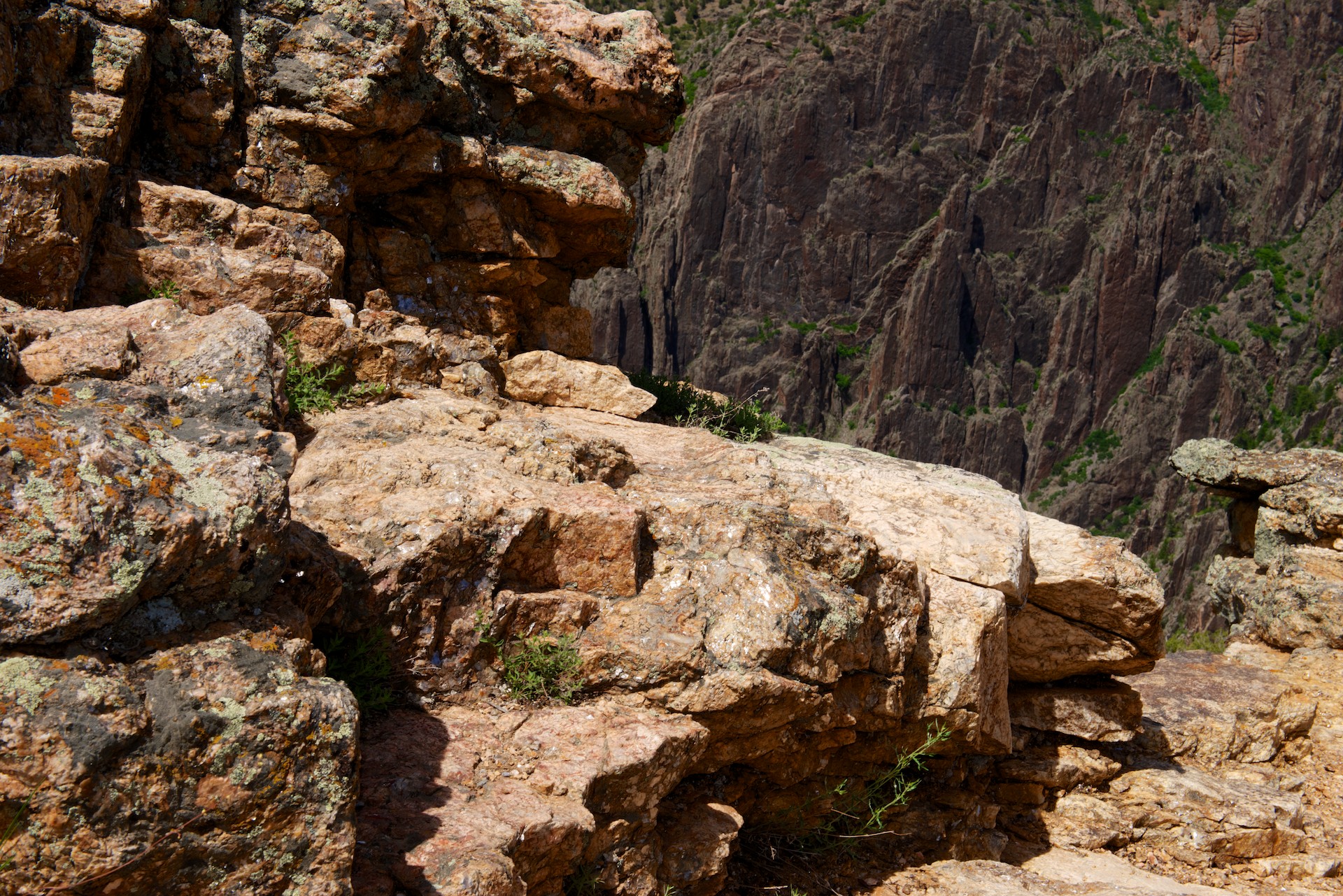
The town of Ouray is called the Little Switzerland of Colorado and there were certain similarities. We must agree. Again, only the main road was paved but the snow capped peaks, the chalet style houses and the multitude of biergartens certainly tried to present a Swiss aspect. We admired and then continued on to Montrose for the necessary groceries.  Our next stop was the Black Canyon of the Gunniston National Park. (http://www.nps.gov/blca/index.htm) We were a little disappointed by this park. The canyon was indeed spectacular, especially the “Painted Wall” but the descent on the Portal road was denied us (10 inches too long), the boat ride through the gorge was not running (river was too high) and they asked us to leave the only space with shade at one of the lunch spots because we were 6 inches over the end of the white line parking place separators in an almost empty parking lot. We were left with a feeling that they were too concerned with nit picking and we were underwhelmed. Especially as a huge Class C RV was parked in a similar space on the other side and had no issues! But we found a great campsite on the way out, a small primitive campsite called Dry Gulch on the Corecanti Recreation Area. So small, we had to stop at the Big Elk Campground down the road to pay the fees the next morning! Dry Gulch was approved for traveling horses so we enjoyed the company of the two mules and one horse who shared the campground.

Gunniston  001 The famous wall.

Gunniston  003 Really hard to photograph, but the rocks here sparkled with all of the crystal in the rock.

Gunniston  002
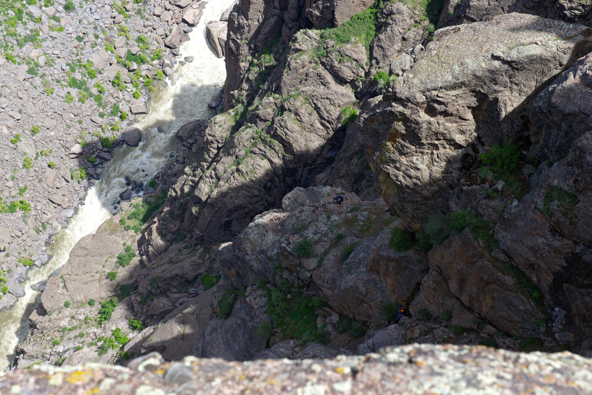
Zoom in and see the climbers. First one has an orange helmet; it is a LONG way down.

Heading towards Leadville now, we took the Cottonwood Pass at 12,106 feet. Another spectacular drive from the rapids running alongside the road (and a couple of rafts enjoying them) to the Taylor Park reservoir and then the well graded dirt road up to the peak and the notice telling us we were at the Continental Divide. Amazing (other than the views) were the three feet high snowbanks still showing the plough cuts on either side of the road. There was even a snowman (someone from Florida perhaps?!!). The descent was a series of hairpin bends and then we headed north towards Leadville, lunching beside the Arkansas River.

Tiger Rally 2014  0005 
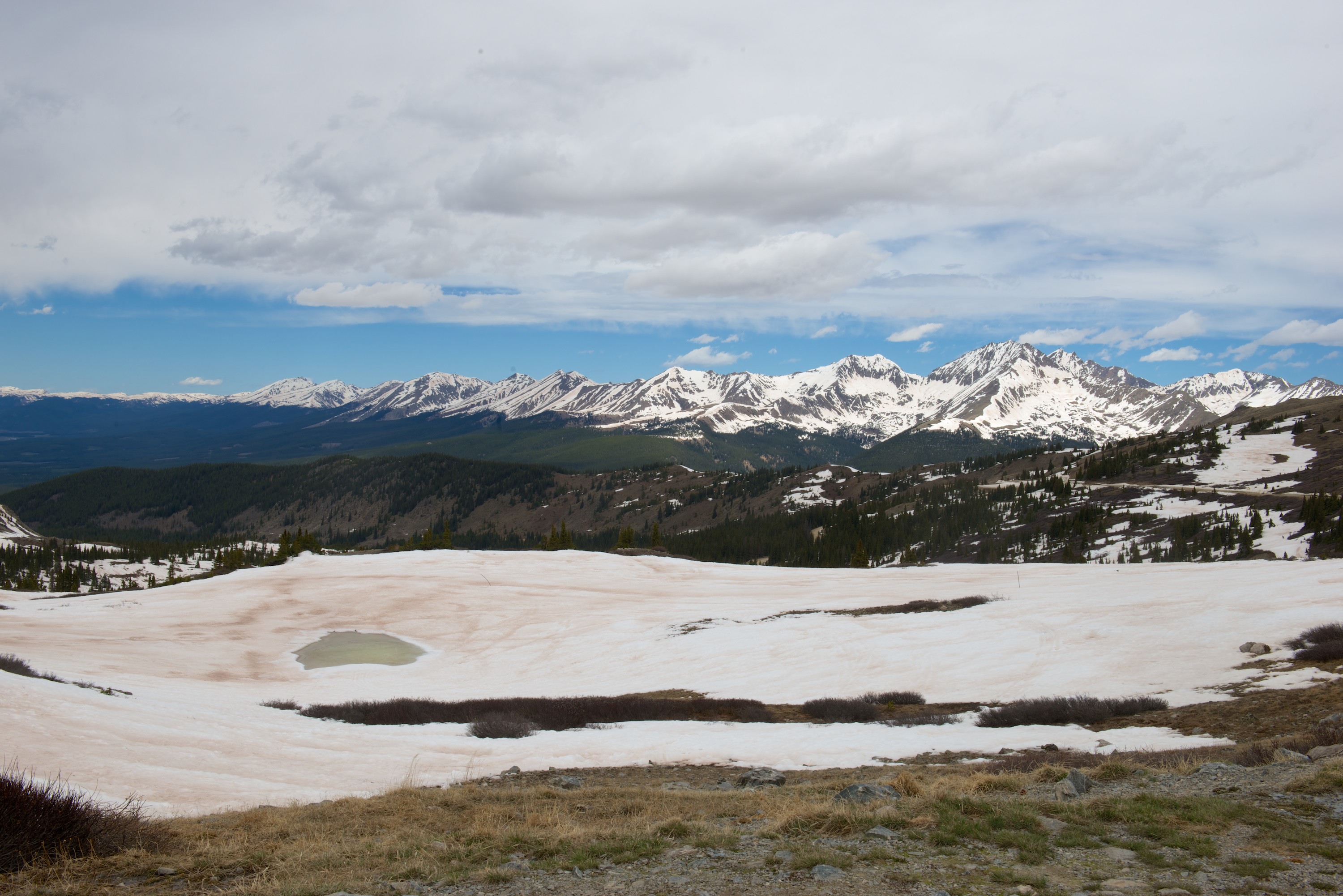
Looking west from Cottonwood Pass.

Tiger Rally 2014  0006

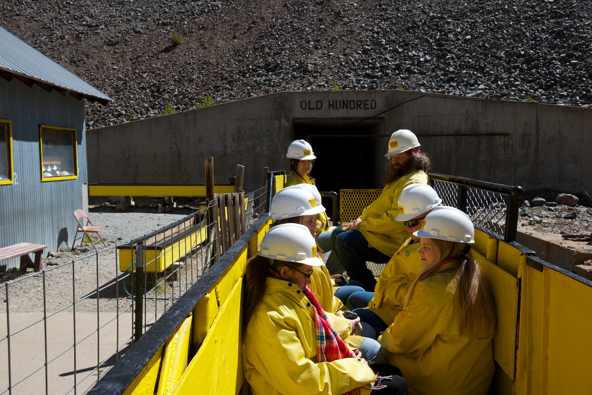
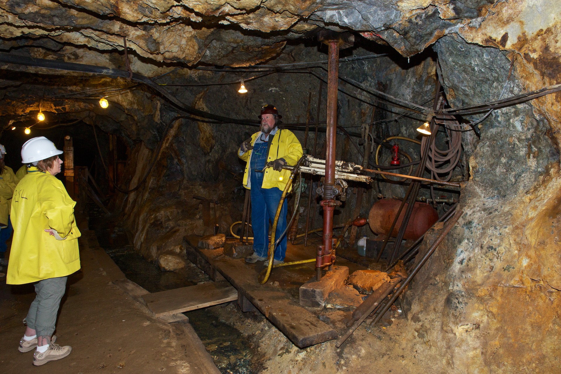
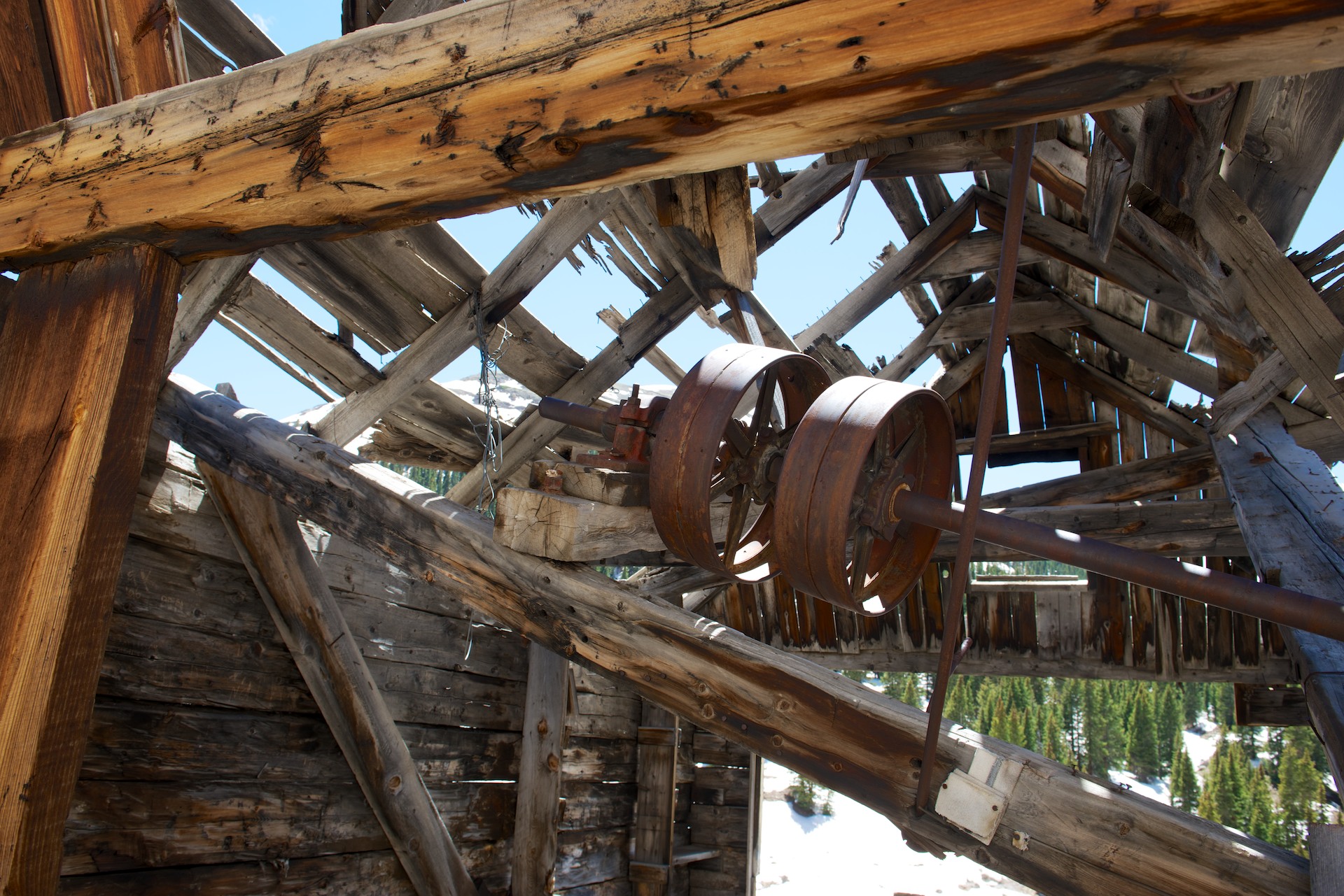
Leadville proved a pleasant small town though the altitude of 10,200 feet is noticeable. We have been above 8,000  feet so long we have forgotten what oxygen is! We enjoyed a visit to the Healy House Museum and Dewster Cabin. After learning all about mining, it was pleasant to visit a furnished house of the era and a “hunting box” log cabin used by a millionaire for hunting and checking on his investments! Each town’s history was a little different, the gold rush having started in the 1860’s in Leadville, followed by a silver rush a little earlier than Silverton. We also ordered a new induction cooktop for delivery overnight from Amazon. Our first cooktop, after giving yeoman service for 8 weeks, had decided to be difficult and was refusing to remain on. We were thrilled that, the following day, the new cooktop did indeed arrive and is now functioning perfectly. That said, Denise has determined that we will, indeed, install a diesel stove, as a backup.

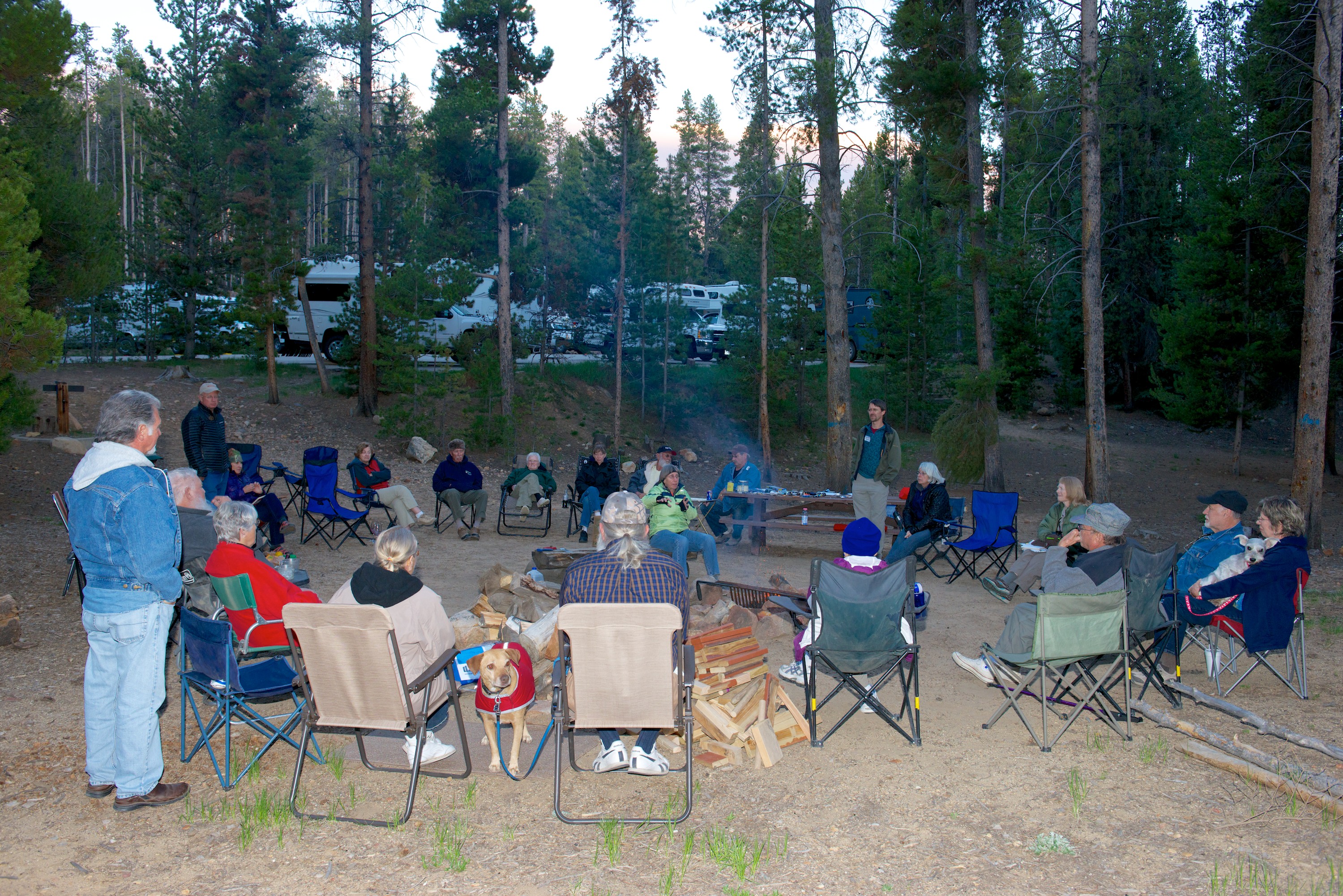
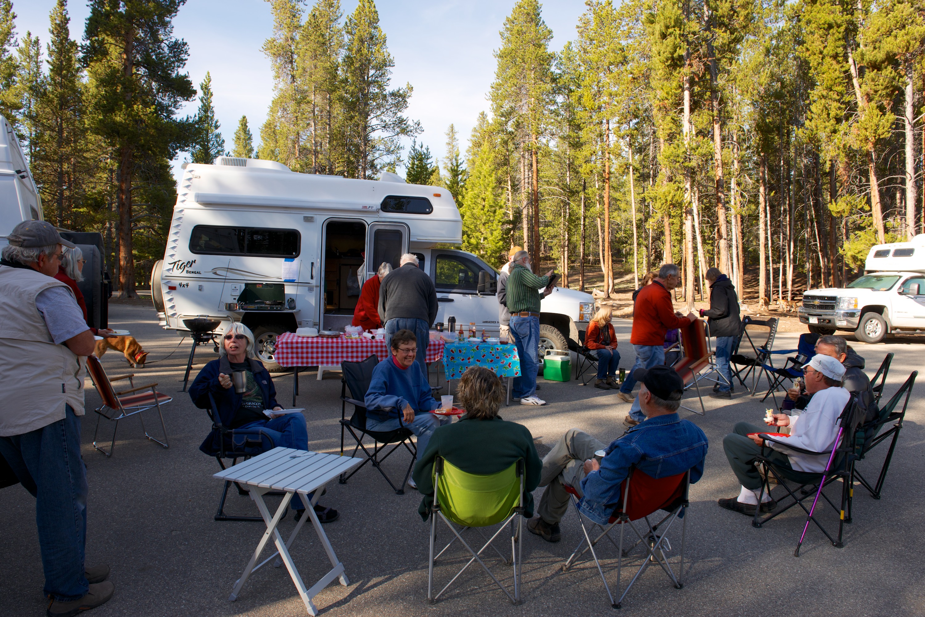
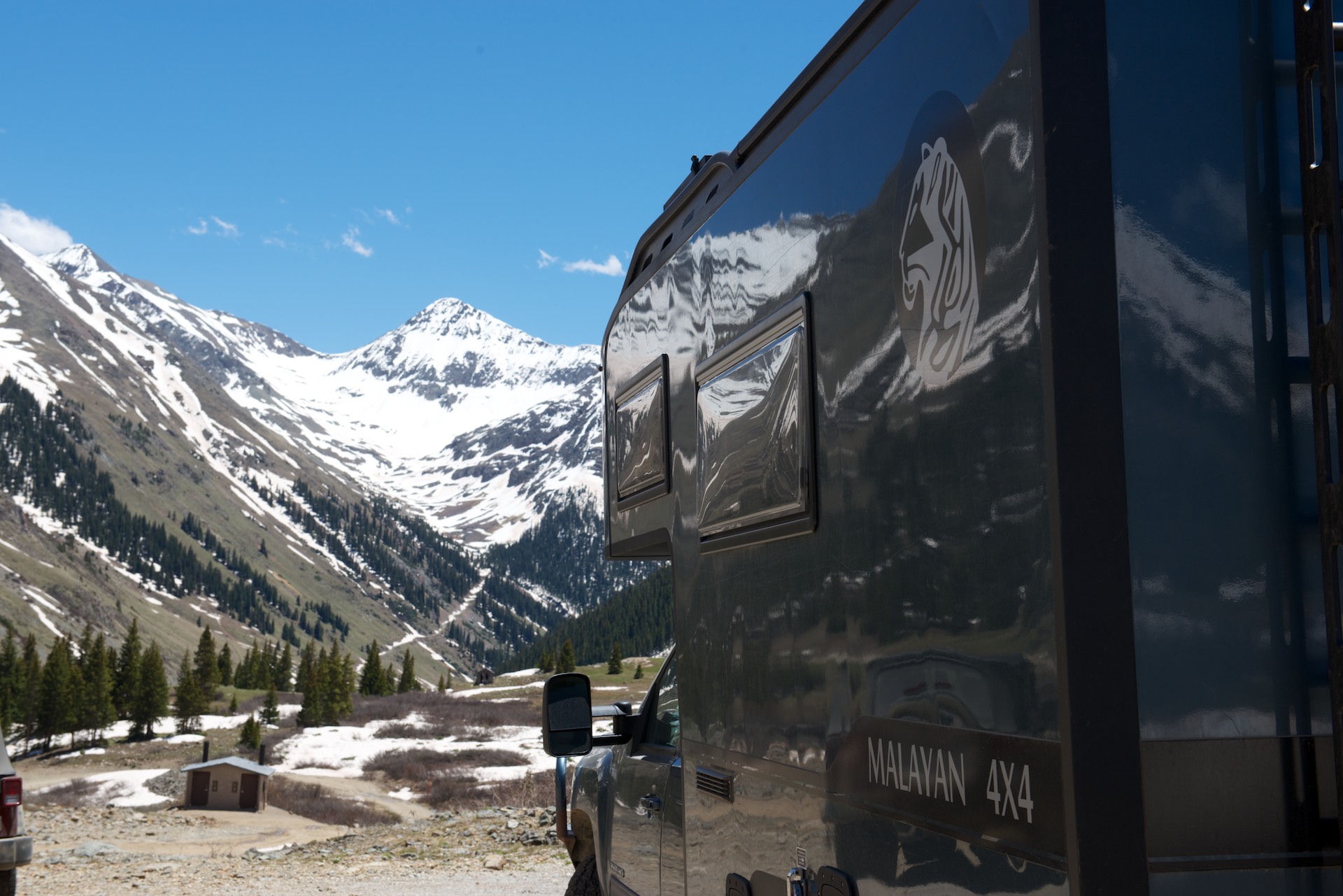
And then it was on to the site of the Tiger Rally at Printer Boy Group Campsite. (Local mines were often named “Boy” or “Girl.”) A total off 23 Tigers came, of which ours was the only Malayan. It was amazing how many of the original vans and pop tops were still running and were present. It was a great weekend with lots of socializing (Tiger owners are great people!) and wonderful weather, not to mention constant discussions of various issues like solar power and battery charging.

Tiger Rally 2014  0001 Tiger Rally 2014  0002 Tiger Rally 2014  0003 Tiger Rally 2014  0004

And now we are on our way home driving through Kansas in a monsoon. Who knew that Kansas would look so green and in part so like the UK, even down to the rain.  Marginally better than tornados, no doubt, but for the last twenty four hours, it has poured and poured. The winds were so strong last night that the camper swayed. And the weather forecast for tomorrow in Kansas City…rain! We estimate another three days or so heading early tomorrow into Missouri, then into parts of Illinois to West Virginia and on to Virginia, depending on weather and visibility on the interstates. We’ll sum up our experiences then.

Silver by the Ton

Having mined out (!) the attractions of Silverton proper, the mining ghost town of Animas Forks beckoned to Fred and the Old One Hundred Mine and Tour was on the way, so we set off from Silverton to check both out. We made it the five miles to the Old One Hundred Mine promptly and in time to join their first tour at 10.30 AM, where we had the good fortune to be two of only ten or so people. It was a great tour that even Denise found interesting. We went down into the mine on an electric train wearing full yellow raincoats and hard hats and felt the water dripping onto us as we rode. The hard rock mines are apparently always full of water and there were streams running alongside the trail we took. Mining in the Silverton area dates from the 1880’s and seven levels had been cut into the mountain producing gold and silver, plus various base metals, before the mine closed in the 1960’s. We visited the most recent level, Level 7, on the bottom. Most of the ore was extracted from the higher levels, some three thousand feet above us. The tour included information on how the metals were mined, including actual tests of some of the equipment, like the drills and a mucker, a kind of scoop. And it was loud! You can see how miners lost their hearing with multiple drills going, and all the other equipment working, plus blasting of the ore. I am glad that I am not a miner! We returned to the surface and found the next group assembling for their tour. Many more on this tour! We walked up a short distance to photograph the original bunkhouse, which sits just visible perched at 13,000 feet, or the original entry point for Level 1.

Animas Forks  007 Got to look closely here (zoom in) but you can see the remains of the cable system that carried ore from the mines to the crushing station.

Animas Forks  008 Back in the day, these cable systems ran all over all of the hills. When combined with the railroads, they provided a very efficient way to move ore, and people. The network of cable systems was vast.

Animas Forks  009 Animas Forks  010 Animas Forks  011 Denise standing by a seam of ore.

Animas Forks  012“Tommyknockers” hidden away in the mine. The legend of the Tommyknocker reminds of nothing so much as the legends of “El Tio” in Potosi.

Animas Forks  020
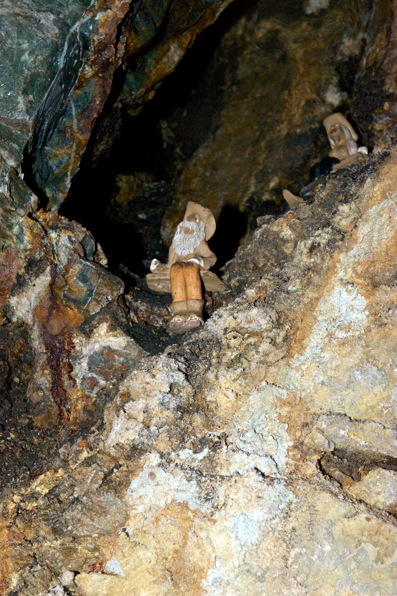
Mike with El Tio in Potosi, Bolivia. Note the offerings of coca leaves, alcohol, and a cigarette. Miners share some beliefs all over the world. (No coca leaves in Colorado.)

Animas Forks  013Long tele shot of the old bunk house. A wonder that anyone could actually sleep at that altitude.

We then headed for Animas Forks, about twelve miles from (and two thousand feet above) Silverton. The road was decent dirt as far as Eureka and then deteriorated and became much rockier and steeper. Fred had wanted to try the Cinnamon Pass to Lake City, which was rumored to be open but still difficult. After discussions with the Tourist Information Office in Silverton, he decided not to tackle it and indeed we gave a lift up to Animas Forks to a young hitchhiker who had been on our mine tour. Of course, we then met a ranger who commutes across it daily and he said that it was fine! But we were committed by then, so we enjoyed a fascinating visit to the old buildings and mine, walking through the snow runoff and even some snow. Imagine, snow on June 1. There is still considerable snow around in the upper altitudes and multiple roads are still closed because of snow. We were still very early in the tourist season. We returned to Silverton, dropped off our passenger and headed for Ouray and a campsite while the road was open.

Animas Forks  014 Ruins of an old ore mill. The mills were generally built on slopes so that gravity would help carry the ore from one level to another. Similarly, mines were usually laid out with the main entrance on the lowest level.

Animas Forks  015 Animas Forks  016 Animas Forks  017 Animas Forks  018

The main road from Silverton to Ouray had suffered a landslide and only one lane was open and only when the crews were not working. So Sunday was by far the best day to go to Ouray and minimize the delays. It was “ho hum another beautiful drive” down a winding road full of hairpin bends and lacking quite a few guardrails but we made it safely and camped in a lovely Forest Commission primitive campsite. In this case, that meant chemical toilets were available but no water. We need neither so for us the charm of the site was only emphasized by the view of the snowcapped peak.

Animas Forks  019

Still Kinda High!

We really liked the campsite we found in Durango, the United Campsite. It was on the free trolley line into Durango, which made getting around really easy and it also had the railway line for the Durango and Silverton Narrow Gauge Railway running through it! So we were able to wave at the steam train at least four times a day! (http://www.unitedcampgrounddurango.com)

Shopping completed, we settled in for the evening. The only excitement was a small Bleu jail break, but he was easily retrieved. He then went for a walk wearing his harness and leash. He is getting much more relaxed about going outside on his leash and is really enjoying it, especially the rolls in the sand that make him all dirty!

Our second day we were off on the trolley at 7.40 AM to the train station. We were off to Silverton on the train. (http://www.durangotrain.com) We had splurged for First Class Tickets so that Fred could stand on the rear observation platform and (we hoped) get good photos.  He was indeed able to do this for quite a bit of the time and he enjoyed it. Unfortunately, the day was somewhat overcast but we did get a little sunshine in between the clouds and the actual rain shower that accompanied us as we left Silverton. The scenery was spectacular as the train ran alongside the Animas River and as we steadily climbed the forest changed from pine to spruce and aspen, through a deep gorge with lots of snow melt churning. Meanwhile the San Juan Mountains and their snowy peaks were getting ever closer.

Durango-Silverton  0001There is something magic about an RV park with a train running through it.

Durango-Silverton  0003

Durango-Silverton  0004

Durango-Silverton  0006This young lady came out to meet the train when it stopped for water. She knew that handouts were in the offing!

Durango-Silverton  0007

Durango-Silverton  0008Looking back towards Durango.

Silverton is an old mining town that still has many of its original (saloons and brothels) buildings intact, though serving different purposes of course! We chose to go to Grumpy’s for lunch, primarily to hear the honky tonk piano player who adds to the atmosphere of an old saloon and hotel. In fact, several of the old bordellos now house restaurants!

Durango-Silverton  0009

We wanted more time there and determined to return with Ndeke Luka; this time though, it was back to the train and Durango.

Durango-Silverton  0010

Durango-Silverton  0011

Durango-Silverton  0013As always there were chores that needed to be done, laundry, shopping etc. We took the Trolley into Durango for a Himalayan lunch, which was actually quite good though the buffet had distinct Indian overtones. (http://www.himkitchen.com) We also visited the Train Museum, which included a huge model train layout, plus several of the old engines and old cars from the era. The general memorabilia was interesting.

Bleu was startled by some mule deer coming through our campsite and also by the train whistles. He was happy to leave Durango, but we enjoyed it and the spectacular scenery that accompanied our drive to Silverton.

Animas Forks  001

Like many small towns in the mountains, Silverton has only one paved road. We started our visit by riding the stagecoach. Only a short ride but fun! Our stagecoach horses were called Sonny and Cher, but the dog in the driver’s box was clearly in charge! We then visited the Jail and the Museum, both of which were fascinating. The jail was built in 1902 but was amazingly modern with steel cells and other modern features. The Museum included examples of various rocks and crystals found locally and a history of mining, with three levels of a mine showing equipment used to explain how mining of the era was done. We then wandered the town with our Walking Tour leaflet in our hands, taking notice of the dates of the buildings and the various uses to which they had been put.

Animas Forks  002 Animas Forks  003 Animas Forks  004 Animas Forks  005 Animas Forks  006

We confess to eating dinner at the Handlebar Restaurant (part of an old hotel) and it was excellent.  We even had dessert, homemade peach cobbler and vanilla ice cream and bread pudding with bourbon sauce before staggering back to Ndeke Luka. Silverton is at 9,500 feet so one notices the altitude sometimes! (http://www.handlebarssilverton.com)

(More photos to  come, WiFi permitting.)


Rocky Mountain High and Higher!

It is going to feel very strange when we finally do come down the mountain(s); we have been at anywhere from 6,000 to 12,000 feet in altitude for the last couple of weeks. We are actually used to it now! Memories of life in La Paz, Bolivia.

Although our goal when leaving Utah was Durango, Colorado, we allowed ourselves to succumb to temptation and stopped at Mesa Verde National Park.  Although we had already visited Bandelier National Monument and also Chaco, the ruins at Mesa Verde are on a much larger scale and we felt that this visit would complete the experience. So, we stopped at the Visitor Center and both acquired all the information we needed and checked out the excellent displays, before heading to check in at the campground. We then headed to the museum up the mountain. It was a longish drive, about 15 miles, and the views were quite wonderful. Canyons below, cliffs above and snow capped peaks in the distance – plus various outlooks where these could all be photographed. The museum was interesting with a selection of dioramas of Puebloan life at different times and stages of occupation at Mesa Verde and we watched the excellent movie, which gave a good background on the life and history of the pueblo, as far as it is known.

We then headed down to the “Spruce Tree House”. This house did not require the purchase of tickets for a ranger tour, though we did buy a self-guide booklet. We had a good idea of what we would see and indeed, the site was bigger and much more complete but we were able to recognize the various features.  There was a rebuilt kiva complete with entrance, so of course, Fred had to go down to take photos. The rebuilt kiva really brought the other ruins we had seen to life.

Mesa Verde  001

Mesa Verde  002

Mesa Verde  003After hearing so much about “kivas” at other sites, we finally had some reconstructed ones.

Mesa Verde  004The kiva interior was quite spectacular.

After our visit, we drove the Mesa Top Loop.  This had a number of overlooks where we could see a pit house, visit the sun temple and also see across the valley to various sites including the Cliff Palace. This is probably the most famous of the sites at Mesa Verde and requires a ticket for a ranger led tour. We decided that the view from across the valley would be enough, especially when we saw the hordes of tourists milling around.    Mesa Verde  005For scale, zoom in on the people on the right.

The highlight of the evening was a number of mule deer grazing around the campsite. They seemed to have reserved their favorite site.Mesa Verde  006


They did not seem to need any “hookups.”