Monthly Archives: May 2015

Playing in the Mud

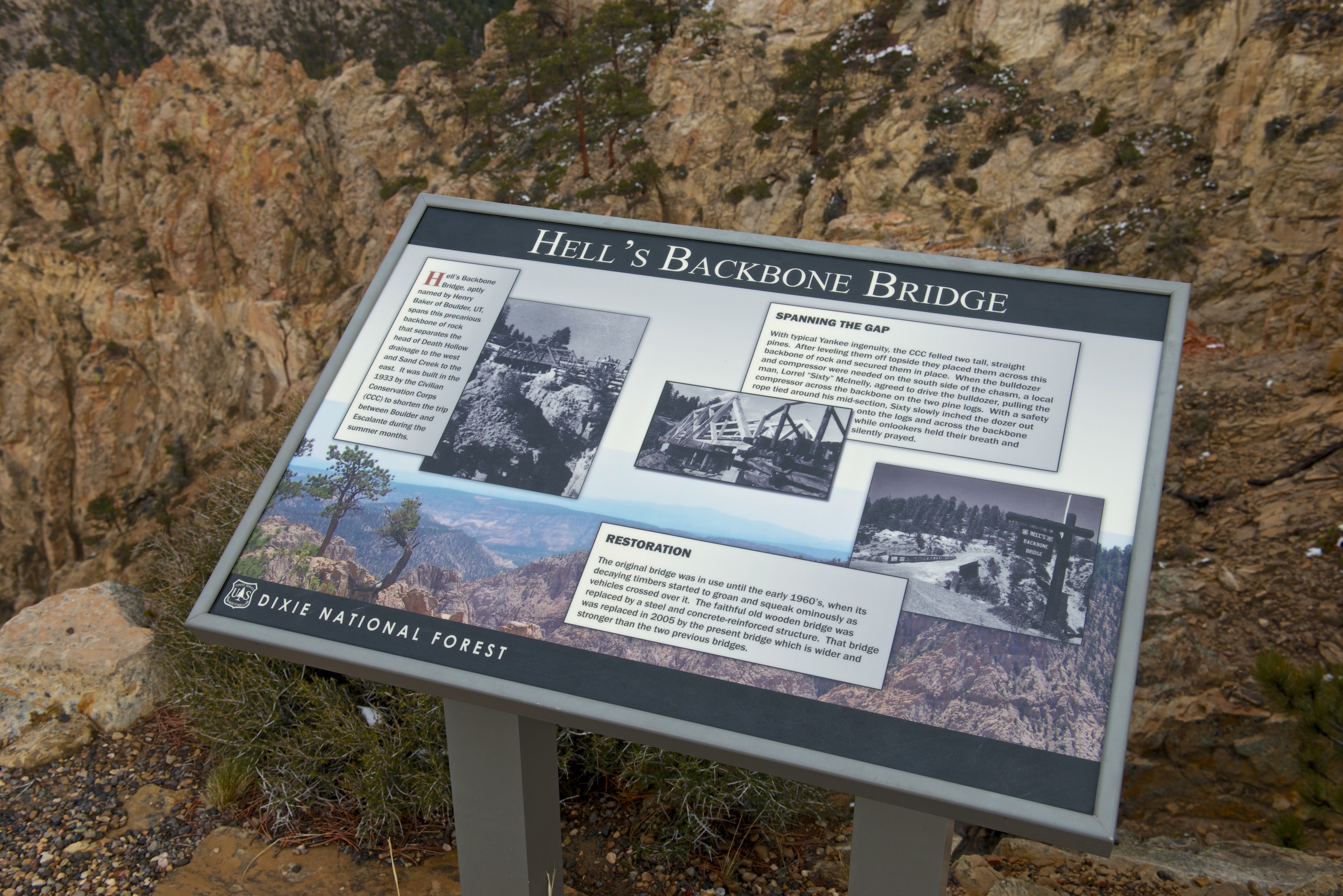
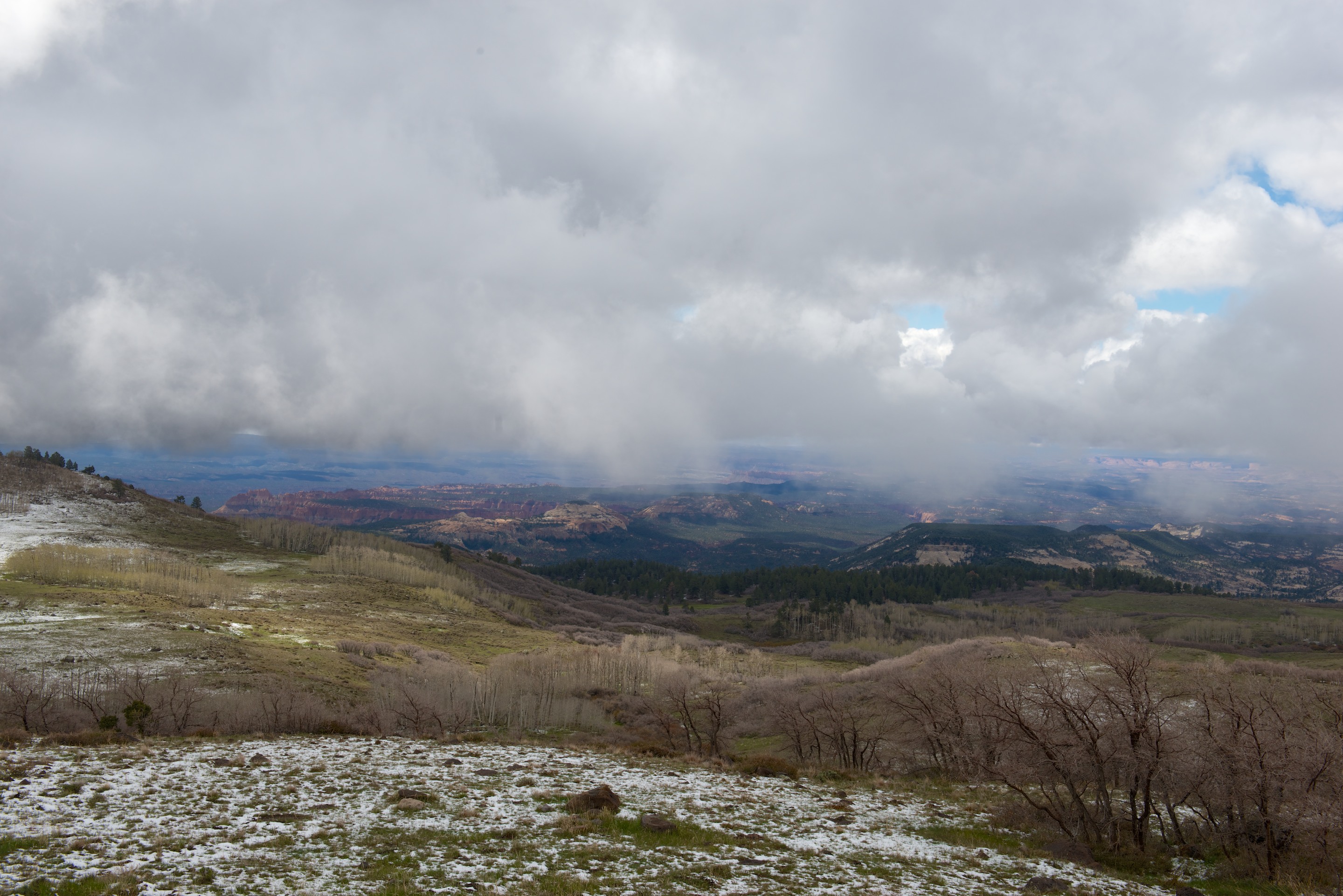
The next day dawned with a bright sun in the sky and so we decided to head for Capitol Reef after all, via  Hell’s Backbone. The Hell’s Backbone road turned out to be particularly ill named. It was, in fact, a lovely drive through the woods. The road was built in 1933 by the Civilian Conservation Corps to connect the towns of Escalante and Boulder. (In the summer only; the road was closed when it snowed.) Up until that time, Boulder received its mail by pack mule in the summer and in the winter not at all. Today it is a winding, mostly single lane road, but even with the snow, it was not too slick for a heavy 4×4 and a bit of care. The Hell’s Backbone ridge narrows to a knife edge at one point, spanned by a one lane bridge. The original wooden bridge, which lies in ruins below the present structure was started by a local tractor driver nicknamed “Sixty” for his love of speed. In this case, he drove his Caterpillar tractor across the gap, towing a compressor, on two leveled logs. (Somehow, a safety rope around his midsection doesn’t seem that reassuring.) We had no such troubles and crossed the bridge with ease.

N.B. These are large images and will expand, in two steps, when clicked.

_ND84102 _ND84097 _ND84106

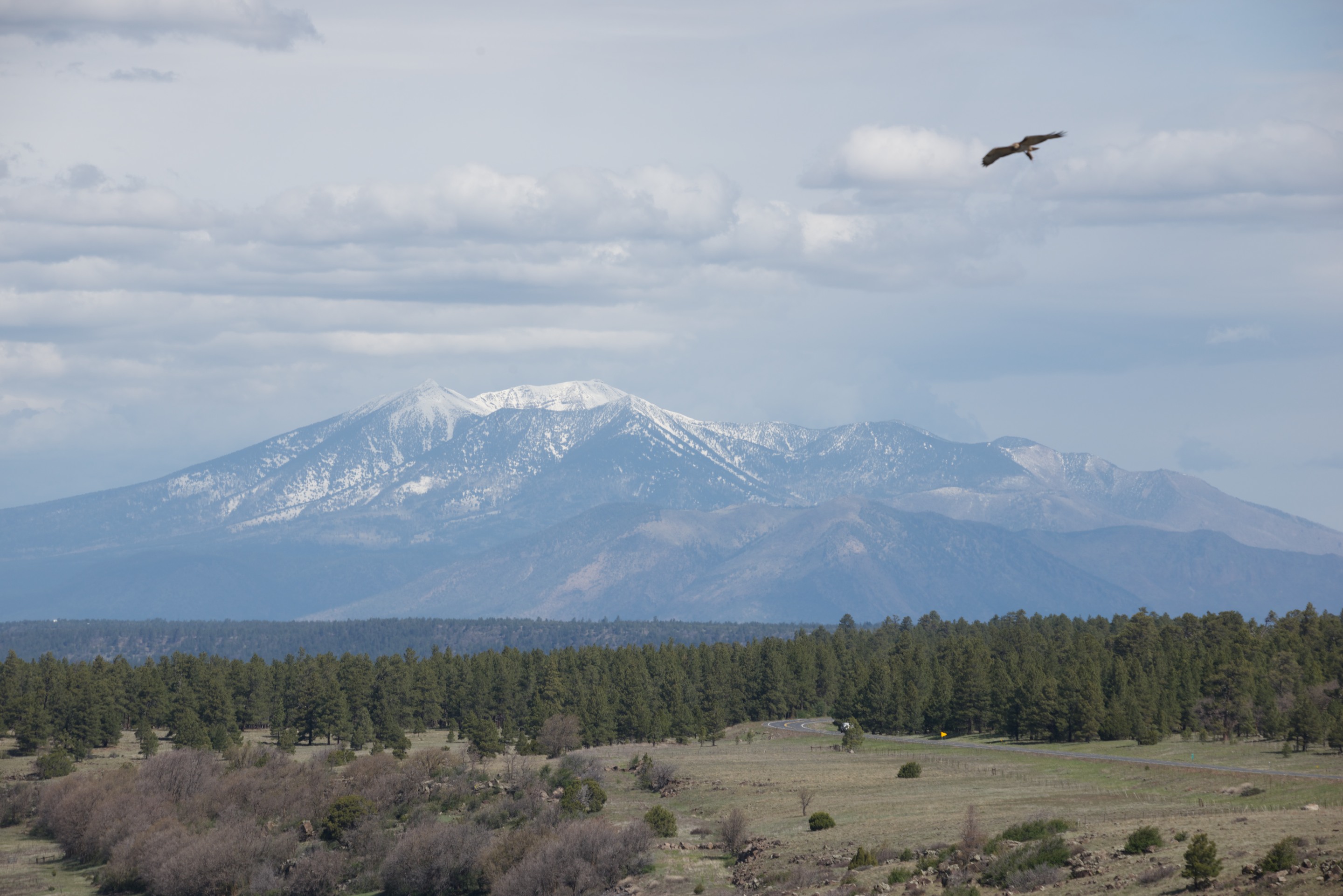
Rejoining Utah 12, we continued down to the main highway, enjoying spectacular views of the Capitol Reef from above.

_ND84107

_ND84110

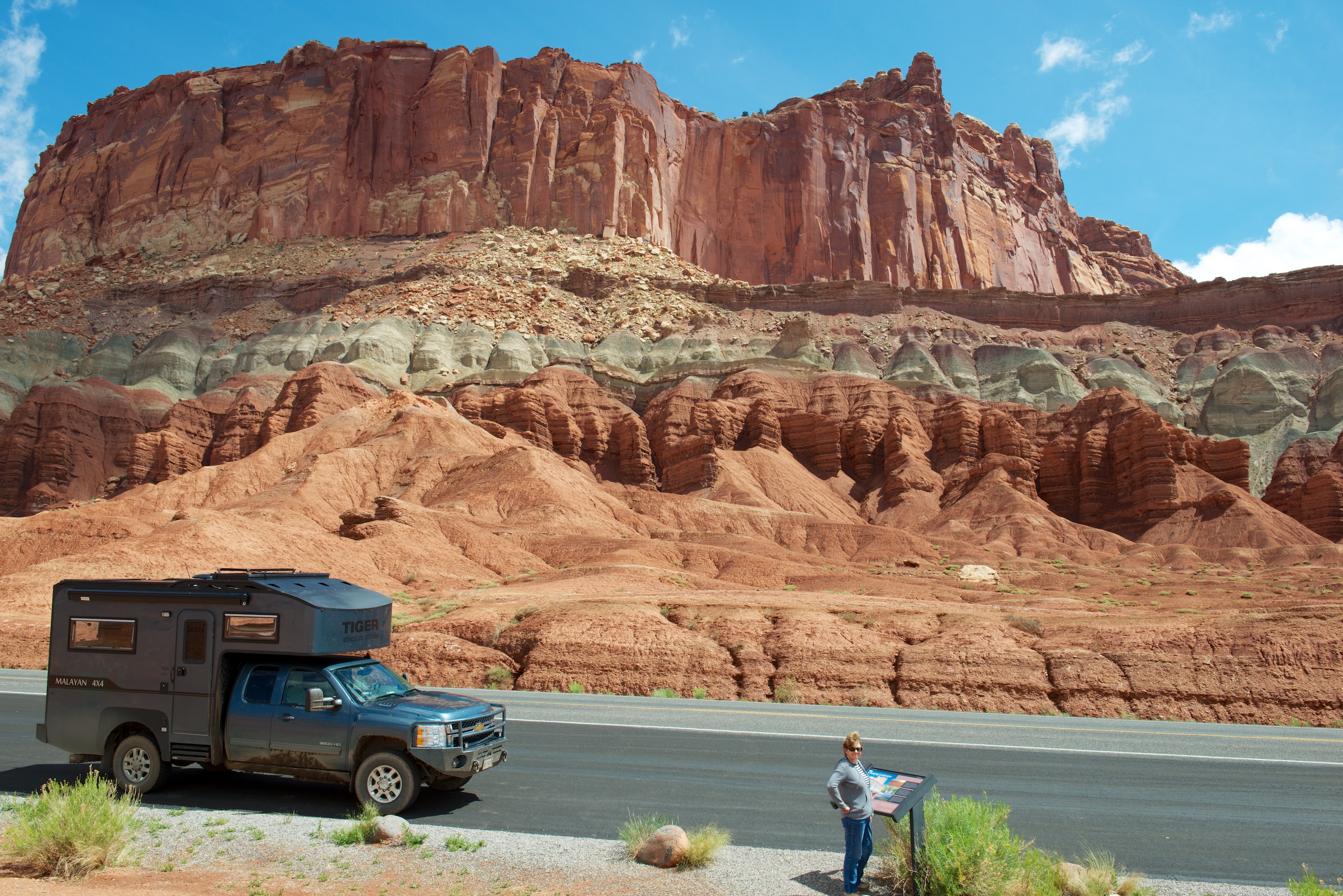
We enquired at the visitor center about visiting the famous temples of the Sun and Moon in the northern part of the park, and thence continuing on to the campground, but were told that the road was impassible. So we headed off down the paved sixteen mile scenic route. The road and parking lots were all packed for the Memorial Day holiday. We turned off on one of the dirt spurs to the Grand Wash, but it, too, was busy. There was no room to park at the turnaround; indeed, there were cars and RV’s scattered everywhere. We decided to give up and headed back to the asphalt, carefully obeying the speed limit and trying to avoid puddles. This earned us a horn bleat from a motor cycle that decided to zoom past just as Fred moved left. So much for speed limits!

We turned east and were joined for lunch by three deer._ND84111

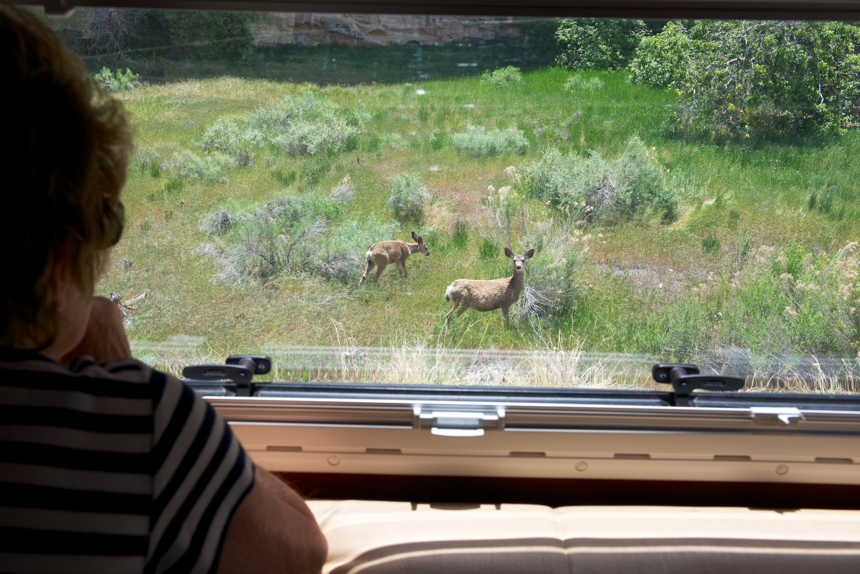
After lunch, we decided to ignore the dire warnings and try the Caineville Wash road heading north, which lies just outside the Park. This turned out to be remarkably easy dirt and in about an hour we came to a sign that confirmed that we were, indeed, on the right road.

_ND84117 _ND84118

It was very exciting to see the famous monoliths in the distance. We soon arrived at the turnoff for the Temples of the Sun and Moon. We turned in and were treated to some wonderful views of two mud monoliths.

The Temple of the Moon is the smaller of the two. Looking at the background, you can see that they are parts of an eroded cliff; a form of large hoodoo, if you will._ND84131

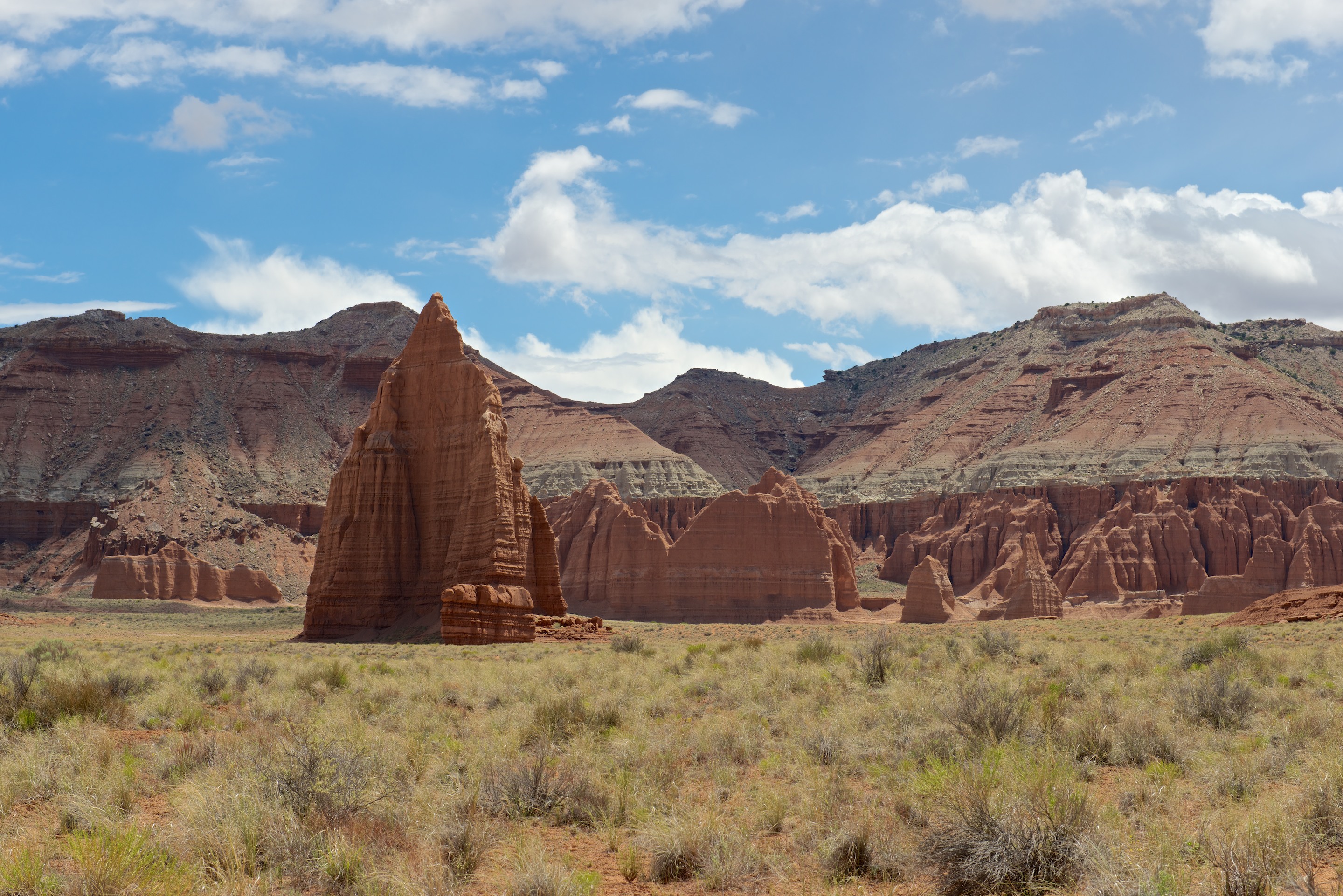
Temple of the Sun, backlighted._ND84130
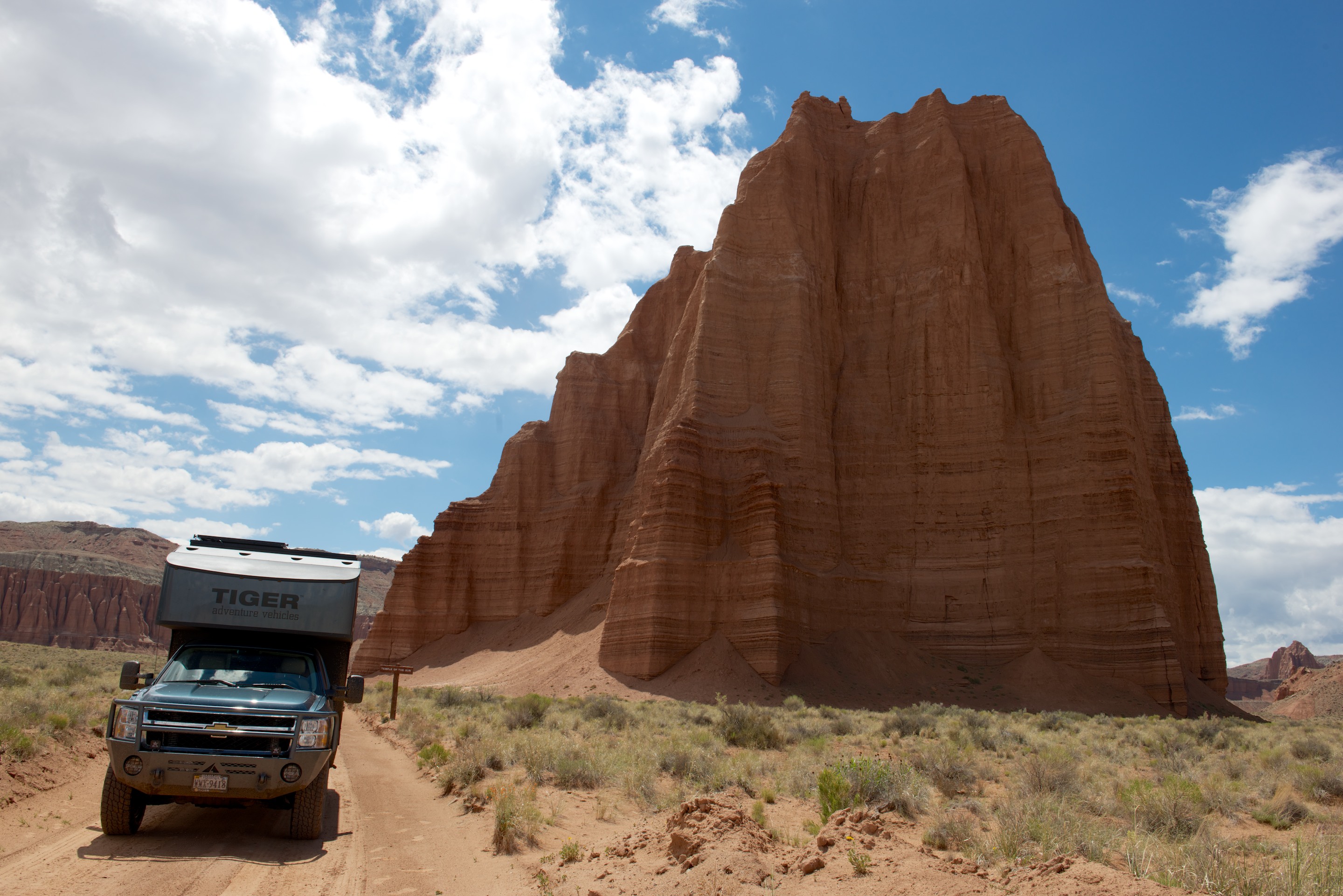
Lovely little rock table, near the Temple of the Moon._ND84124

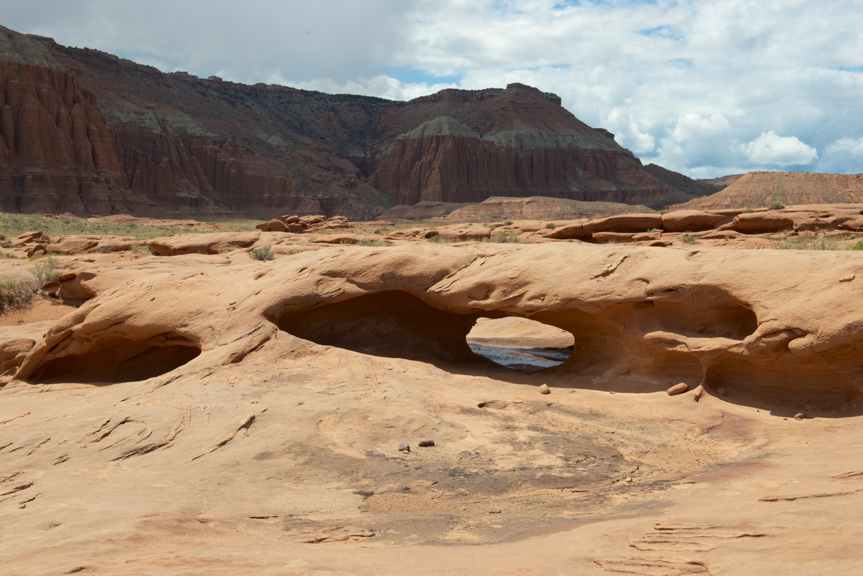
The smaller, Temple of the Moon, in all its glory._ND84120

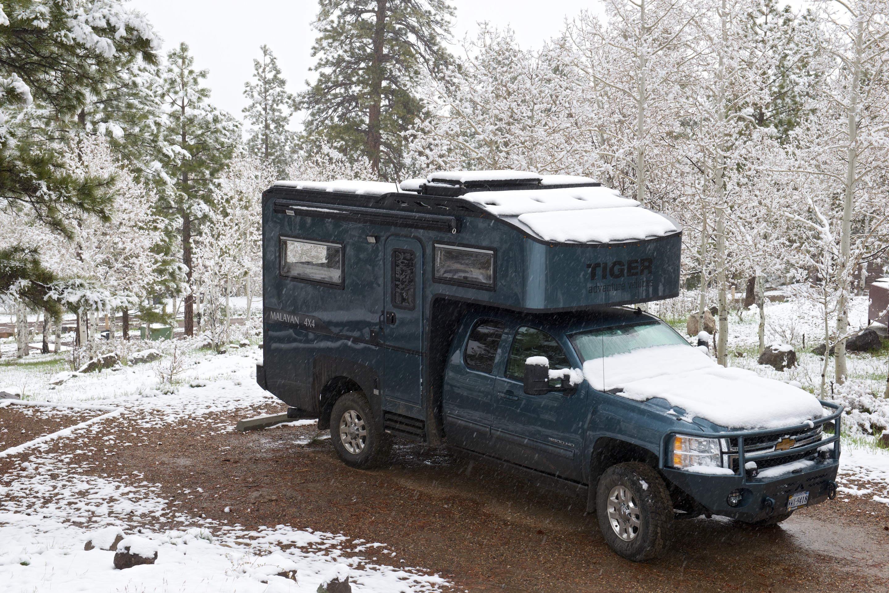
While the road was easy, we only saw four cars, including one SUV parked in the middle of the road. He was heading south and we wondered if he had broken down. While at the Temples we received the compliment of the day from a gentleman driving a Toyota Forerunner, “That’s one badass motorhome!” (We tend to agree.) From there the road got much better, if punctuated by muddy water crossings. It is clear that it will be very hard for us to get usable information on road conditions. Clearly, at 11,500 pounds, we are heavier than a common 4×4, but, at the same time, we are much, much more capable than an normal car or RV. Fred was wary of the mud, but, in the end, we did not even need to air down the tires.

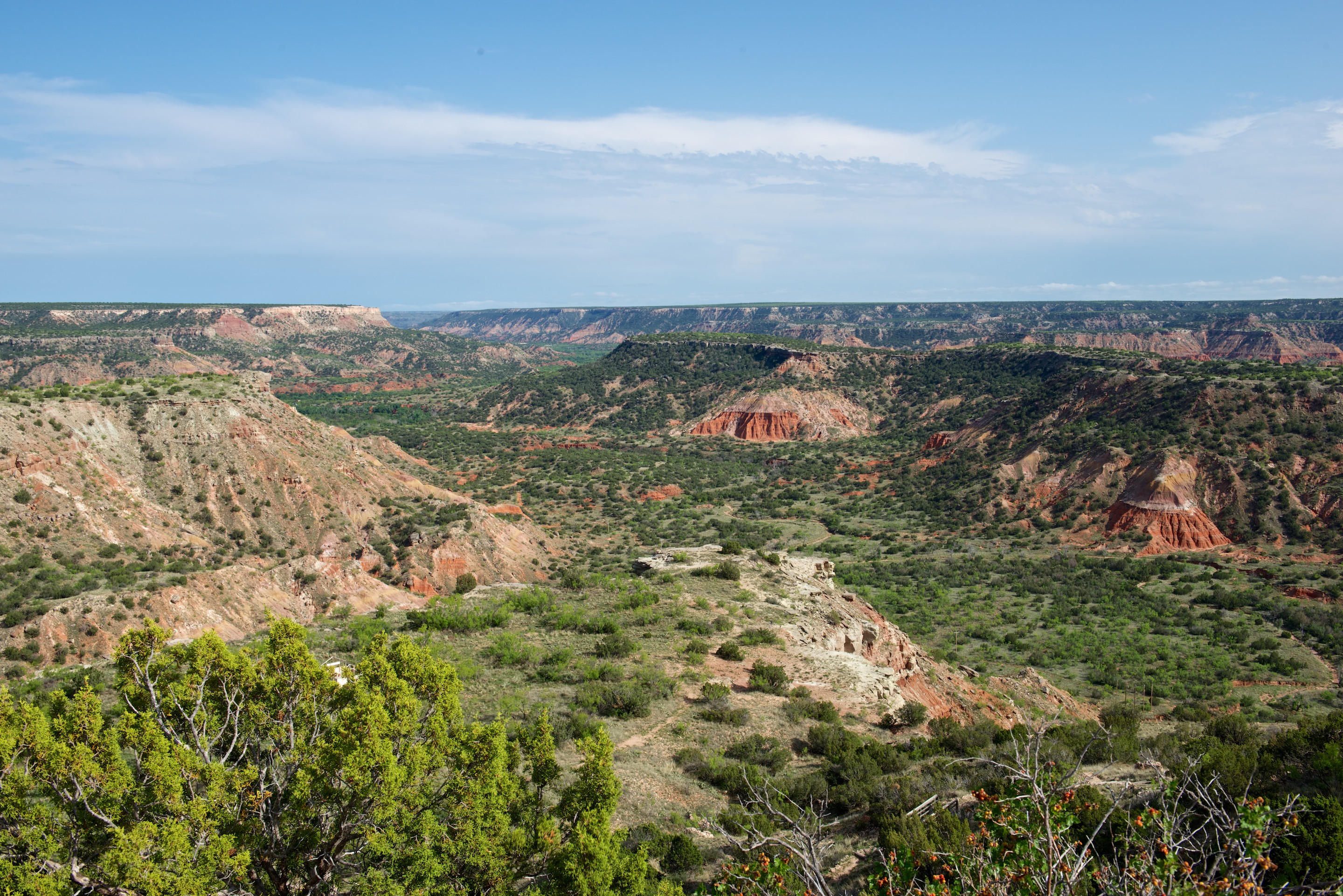
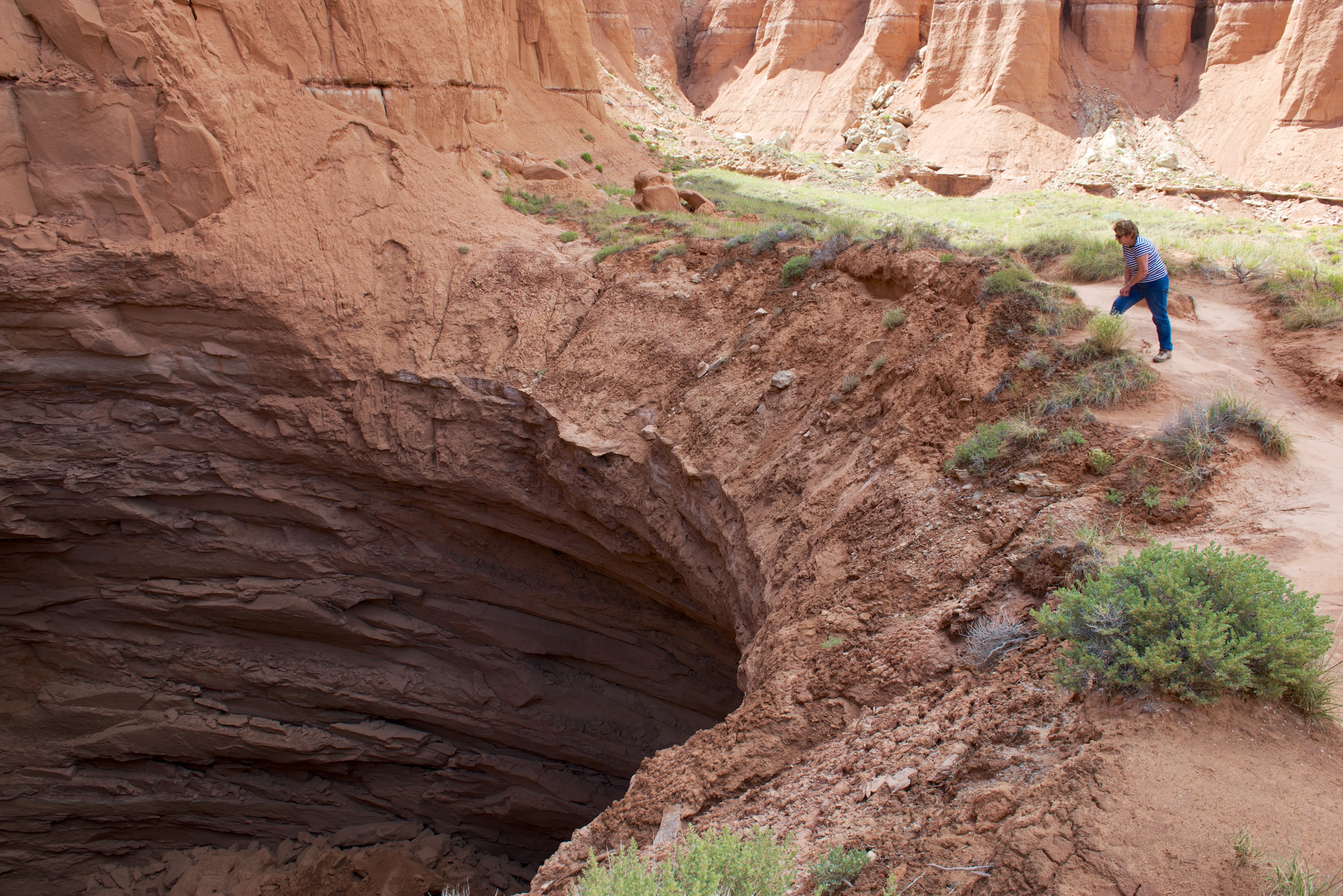
We continued and turned in to view the Gypsum Sinkhole. Denise found it and it turned out to be exactly what you would expect, a huge hole at the base of a cliff wall. We noted that one of the washes seemed to flow into a hole in the ground so the sinkhole will probably get bigger in the future.

_ND84132

All of the scenery was just lovely._ND84134

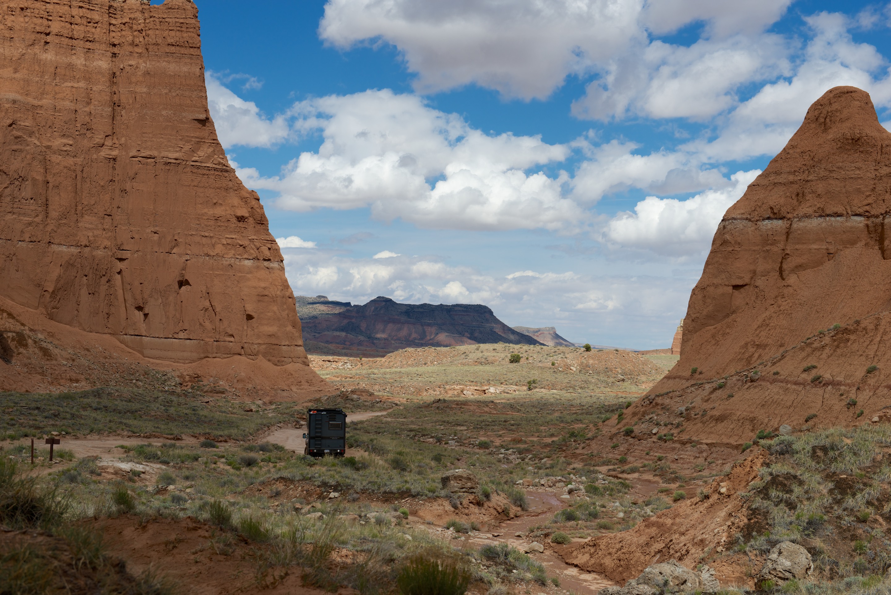
We continued to the end of the valley, passing beautiful scenery and enormous monoliths. Finally, there was a steep grind up the wall and a last view of the valley. (Sadly, the Chevrolet does not have the tightest turning circle, so one switchback required us to back and fill to get around the corner.)

_ND84137

The Cathedral Valley Campground had six sites and incredible views back towards Colorado. Stopping for the night was an easy decision. (And besides, the cat was tired of rough roads.)

_ND84138

A Tale of Two Parks

Provisioned, cleaned and warmer, we set off north to Utah, planning to visit the National Parks in  Southern Utah (or at least as many of them as we could manage).  Our big problem was the imminent Memorial Day holiday, which we knew would bring a lot of tourists to the region. So we decided to pay at least slight attention to the two most known parks, Zion and Bryce, as we wended our way towards Capitol Reef and Arches.  Well, the best laid plans of mice and men …

Our stop at Zion was interesting.  We drove in on State Route 9, and having established that we could fit through the tunnel with no additional charges, we crossed the southern section.  The scenery is indeed quite spectacular and we stopped at a couple of overlooks to admire, take photos and generally appreciate.  _ND83976 _ND83979 _ND83980 _ND83982

The tunnel itself was an amazing engineering/construction accomplishment and is all the more unusual for having five “windows” along its length.

_ND83986

_ND83995

These were used to provide ventilation and to expel construction debris. We also watched some climbers as they made their way up a stone face. (See if you can find them in the first photo.)

_ND83988

This may be a bit easier.

_ND83996

The sun even came out for a while, which helped the photos and our enjoyment level!

_ND83998

The main tourist area was a mess, the RV parking area was jammed with cars and a few campers, even at 4.30 PM.  We were not inspired by parking in town and taking two shuttles to see the glories of Zion tourist scenery, so we moved on, spending the night at a very pleasant campsite, the Zion River Resort in Virgin. While not inexpensive, this camp easily makes it into the top five nicest RV parks that we have visited. (http://www.zionriverresort.com) Fred wanted to drive the Kolob Terrace Road, which starts in Virgin but it was unfortunately closed for rebuilding.  So the next morning we heading to the Kolob Canyons section of Zion NP.   Again it was a cloudy day. What happened to the southwestern sunshine we enjoyed last year? We drove the five miles of tourist route and we took various photos on the way up.  We hiked the short trail at the top and appreciated the view, though we wore rain jackets as it looked very threatening.  We ate lunch there because Denise thought it might be clearing a little and indeed it did.  The sun almost came out a few times so we took another photo or two.

_ND84018 _ND84008

Continuing towards Bryce National Park, we took State Route 148 to 143, stopping at Cedar Breaks National Monument.  It was very closed but had some good views of an amphitheater filled with hoodoos.  Memories of Bolivia were upon us as we were back at 10,500 feet!  We stopped for the night just short of Panguitch in the Dixie National Forest at about 8,000 feet. We may be SOB’s (Survivors of Bolivia), but this obsession with altitude is getting old.

_ND84040

Our departure the next morning was somewhat delayed by a bird who somehow got into the air conditioner enclosure.  Fred had to take one of the grills off and encourage it to exit.  We never actually saw it fly off but the scratchings stopped, so our fingers are crossed that it did indeed leave.  (A tip of the hat to Dan Rehack, who gave us a Number 2 square drive when we got the Tiger, noting that it was the one, essential tool for all purposes on a Tiger!) We replaced the grill and headed to Bryce via Route 12,  which took us through some spectacular scenery.  Once in Bryce, we drove the full 18 miles to the end of the tourist scenic drive and took photos of the various sites.  We had some sunshine at last though it was still quite chilly.  We were unable to park at Bryce Overlook, but at Inspiration Overlook we not only climbed to all three levels but walked a section of the Rim Trail.  Denise’s ankle, though still weak, is doing a little better. The combination of clouds, rain squalls, and sun made for a couple of lovely photos.


We headed to Kodachrome Basin State Park hoping to camp but found “Camp Full” signs up.  So, we checked in with the Visitor Center for the Grand Staircase Escalante National Monument regarding camping permits.  We were dissuaded from dispersed camping in the Monument as yet another winter storm was approaching. We were told horror stories of Bentonite clay and told that camping permits were not available unless you could specify where you were going to camp, a bit challenging as we could not assess the road conditions in advance and thus had no idea where we might camp.  Apparently the roads in the Dixie National Forest are gravel and better than those in the Monument and one is less likely to get stuck.  So, here we are with a 36 hour storm approaching and campgrounds full for the Memorial Day Weekend.  We decided to head deeper into the Dixie National Forest on the promised gravel road and arrived at the Posey Lake campground (8,500 feet) just as it started hailing.  It was time to regroup and reevaluate what was going to happen next.  Somehow Capitol Reef National Park did not seem that appealing in the rain. We settled in for the night and happily cooked on the diesel stove, the extra heat being most welcome. We woke the next morning to a couple of inches of snow and it continued snowing until about 3.00 PM.

_ND84091

Needless to say, this seemed an excellent reason to stay put for a second night.  The campsite is lovely with pines, aspens and a lovely view of the lake (through the snow!), plus the usual chipmunks and a selection of wild turkeys.  So far no bears or mountain lions although there are food safes at all the campsites.

Let it Snow, Let it Snow, Let it Snow! (Overland EXPO West 2015)

This Overland Expo (http://www.overlandexpo.com will go down in history as the “difficult” and “different” one.  To put it mildly, the weather was not kind at all, and we all suffered.  We arrived on a chilly afternoon and settled Ndeke Luka into the Tiger spot.  We were soon joined by the the second Tiger show vehicle, a Bengal owned by Don, Barbie, and Mate Borinski, aka, “The Wanderers.” This was a thrill as Fred had perused their website for years during the design of Ndeke Luka. Donnie and Barbie produced mats and tents and all matter of things to make the site look better while Mate, the Australian Shepherd, supervised all aspects of the set up. It was windy and cold by evening, a foretaste of the weather to come. Mark Guild, the owner of Tiger Adventure Vehicles and his family arrived and it was fun to meet them and chat.

The Borinski's beautiful Bengal in the foreground.

The Borinski’s beautiful Bengal in the foreground.

Friday dawned cloudy and cold and then after a little morning sunshine, the heavens opened and reduced the parking and camping areas to quagmires. We were warm and dry in the Tiger, but the floor soon disappeared under a layer of mud.

Misty, Moisty Morning

We swept when we could but it was a losing battle. The mud and weather were too much for many, and we noted a steady stream of cars departing early. (In some cases, only after being towed or colliding with other vehicles.) Saturday was worse, adding snow to the mix and the weather didn’t really clear up until Sunday. (Blue cat was unimpressed and retreated to his cabover bed. Needless to say, jailbreaks were not a problem!)

And it felt just as miserable as it looks.

And it felt just as miserable as it looks.

This is when you are glad that you are camping inside, as opposed to beside, your vehicle!

This is when you are glad that you are camping inside, as opposed to beside, your vehicle!

Due to some cross communications, Fred’s dual battery course was conducted in an open tent without audio visual support. The attendees moved in close, both to hear better and to keep warm. The second session was much better; moving out of the tent into a moment of sunlight and lining up the participants to play the roles of “Starter Battery,” “Camper Battery,” “Relay” and other exciting characters. (Those who may wish to learn more on this subject will find information at the “Documents” page of this Blog.) Fred also gave a course, “Know Before You Go”, that deals with preparation for international travel and what can be expected when it all goes wrong. (aka, How not to get arrested/sick/robbed overseas.) Fred was also a discussant on panels on “Bribes and Border Crossings” and travel in Africa.

Fred also slipped away to attend Rick Howe’s session on shipping an overland camper while Denise enjoyed the Rob Blackwell’s presentation on travel in Iran and Turkey.

Beyond being a trade show, Overland Expo is a gathering of the tribes and an opportunity to meet many of what Denise calls Fred’s “imaginary friends.” This year we caught up with:

The Howes (http://www.travelin-tortuga.com/Travelin-Tortuga/index.html)

The Blackwells (http://www.whiteacorn.com)

Lance and Michelle of EarthCruiser (http://earthcruiser.com)

The Turners (http://robinsonfuso.com)

Cam Stone and Kris (http://www.mojoegriddle.com)

And we met many new ones. Many hours were spent in deep (and, according to Denise, sometimes pedantic) discussions of all aspects of travel and vehicle design.

Pretty XPCampers in the background.

Pretty XPCampers in the background.

Jon and Emily offer their reportage and photos here: http://robinsonfuso.com/2015/06/04/flagstaff-may-12-13/

On Monday we retreated to Flagstaff to do laundry, clean out the Tiger, and generally collapse, and not necessarily in that order! We got some nice photos on the way out.

Mountains above Flagstaff, Arizona. http://en.wikipedia.org/wiki/San_Francisco_Peaks

Mountains above Flagstaff, Arizona.
http://en.wikipedia.org/wiki/San_Francisco_Peaks

Note the mouse or vole in the talons.

Note the mouse or vole in the talons.

And Onwards to New Mexico

Once out of Florida, we knew we had a target date for arrival in Flagstaff so it was “pedal to the metal” time.  That said, we did manage to linger a few times along the way, though not as many as we would have liked.  We found a lovely National Park Service campground on Davis Bayou at the Gulf Islands National Seashore, near Biloxi,  in Mississippi and spent a very pleasant evening and night there.  We think that Blue stayed up too late there, checking out the wildlife!  He slept like a log all the next day!

We then headed into Louisiana on 1-10 but tried to cut across too far north.  All the charm and wonderful seafood we remember from our previous visit to Louisiana last year, was absent.  Oh well, we shall know better for the future … stay by the coast in Louisiana!  And then on to Dallas.  We had requested a driveway and some Texas brisket from an internet friend of Fred’s and indeed we received both!  A wonderfully large and effective washing machine solved our dirty laundry problem and a dinner at Spring Creek Barbecue produced brisket so tender you could cut it with a fork.  (http://www.springcreekbarbeque.com/garland.htm) To say that we ate too much is putting it mildly!  There is a lot to see and do in the Dallas Fort Worth area so we shall most definitely stay longer next time, but the weather was iffy the next day and storms were forecast, so we headed out. We did take a moment to view the ranch used as “South Fork” in the television, “Dallas.” (Ironically, neither of us has ever watched the show.)

And indeed we drove through a spectacular storm with sheeting rain and lots of thunder and lightning.  Fortunately for us, the tornadoes stayed north so we did not have to deal with those.  Two cars that had passed us at speed did end up in the ditch (KARMA!) and there was considerable standing water/flooding around the road.  We decided that we needed a dose of nature so headed to the Palo Duro State Park and obtained a space in the primitive camping area for two nights. The landscape around Palo Duro is a bit flat:

_ND83859

But then the canyon opens up:

_ND83804

Blue is getting much better at going outside on his leash and he enjoyed the smells of the campsite.  We had several wild turkeys near us, preening, fighting and just plain eating.  Mating season perhaps?  We also heard coyotes fairly close by, both in the evening and during the night.  The next day dawned decidedly “misty and moisty” so we headed out of the park and went to Canyon where there was a well recommended museum to see and a coffee shop to enjoy.

Both turned out to be excellent choices.  We sipped cappuccino and checked on  our lunch options, before heading to the Panhandle Plains Historic Museum at West Texas A & M University.  The girl at the coffee shop (http://www.palacecoffee.co/canyon/) did warn us that another severe weather front was heading in and indeed it was just starting to rain when we approached the museum and found that we would not fit in the museum reserved parking.  Fred asked a WTAMU policeman for advice and he gave us permission to use one of the university permit only parking lots.  He even drove us to the front door of the museum as it was raining hard at this point.  Denise’s first ever ride in a police car!

The Museum provided a thorough background to life in the Plains in all its aspects from Aboriginal Indians through Plains Indians to the early Spanish explorers an all those who followed.  It covered local paleontology, the petroleum industry, windmills, water use, dry farming and ranching and included a fully reconstructed pioneer town.  All items were original to the area and each had its origins and ownership displayed.  Great display of old cars as well, some with historic pictures with their owners. Definitely recommended. (http://www.panhandleplains.org/pages/home.asp)

For lunch we treated ourselves to a feast at Pepito’s Used Cars and Restaurant. No cars for sale, but the staff was charming and the food was quite good, all of the flavors being distinct. (No website: http://www.tripadvisor.com/Restaurant_Review-g55580-d2180144-Reviews-Pepito_s_Mexican_Restaurant-Canyon_Texas.html)

IMG_0353

The weather had cleared by the time we returned to Palo Duro so we took a short walk. Denise’s ankle is still bothering her, especially on rough surfaces so we could not hike.  We woke the next morning at 5.30 AM to the sounds of sheeting rain, thunder and lightning, again.  It was too loud to sleep, so in the end we gave up, got up and prepared for the road.  By the time we left it was sunny again as the front had passed.

From Canyon, we turned south to Lubbock. Denise is a great Buddy Holly fan so we went to visit the little museum/shrine. Other than having Buddy Holly’s last Strat, (For guitar geeks only: http://www.superoldies.com/buddyholly/guitar.html) the museum is a bit underwhelming. (http://www.mylubbock.us/departmental-websites/departments/buddy-holly-center/home)

_ND83860

On the other hand, the less known National Ranch Heritage Museum is simply wonderful, much like Weald and Downland Museum in England, or the museum of the American frontier in Staunton, Virginia. (http://www.depts.ttu.edu/ranchhc/) We had a great wander.

An impromptu stop at the Very Large Array, the National Radio Astronomy Observatory, also proved to be well worth it.  The array consists of 3 arms of antenna dishes, totaling 27 dishes, positioned on railway lines so that they can be moved around and extending up to 11 miles from the center.  All data is then fed into a supercomputer and such topics as black holes and galaxies are studied by astronomers all around the world.  The self guided tour was most interesting and we were lucky enough to watch some of the dishes being rotated.  (http://www.vla.nrao.edu) You will have seen the Very Large Array as a backdrop in several movies, including, “2010”, “Contact”, and “Independence Day”. For us it made a great backdrop for lunch.


The Adventure Begins…on the road again and the wonderful 60 to 80’s!!

It was April, spring was beautiful in Arlington this year and it was hard to leave, especially as French friends were stopping by and we would not be there to see them.  But leave we did, as we had commitments in the south and to be honest, it would be nice to be warm after the winter we had experienced.  It had been one of the chillier ones in the Northeast and it was not made any warmer by visits to New York State and Maine with multiple feet of snow on the ground.  (Diesel heat in the Tiger is a wonderful thing!) So, we set off in fine form except for Denise who had sprained her ankle!

First stop was South Carolina, where we spent a morning at Tiger getting a couple of quick adjustments made, and then visited friends in Taylors, SC, a suburb of Greenville.  We had a wonderful visit (even Blue enjoyed visiting a new house and seeing a new dog!) and enjoyed a stroll down by the river in Greenville, followed by lunch with a view of the river.  The stroll was short as Denise’s ankle was still bothering her but it was a beautiful day and much too nice to be inside.

_DSC1538

Then onto Savannah, GA where we visited a friend from Panamá and Liberia and discovered the Skidaway Island Campsite, where we camped in a wonderful shady spot.  (http://gastateparks.org/SkidawayIsland) The weather was kind, sunny and not too hot, and knowing nothing about Savannah, we signed up for the hop on hop off bus ride.  We barely scratched the surface of what Savannah had to offer but we did get a feel for the history and the charm of the city so it is on our “must return” list. Preview for the history buffs, Savannah was established as an English military colony to protect the rich plantations of South Carolina from the Spanish. Savannah’s old downtown is famed for its many lovely parks, each dedicated to an historic personage or theme.

We then headed into Florida with rain and storms predicted for the day and night.  And storm it did, but despite downpours we made it safely to our campsite in the Ocala National Forest at Lake Delancy.  A charming Forestry Commission site, we were the only people there!  We dutifully paid our fee and dropped it in the box.  (http://www.fs.usda.gov/recarea/ocala/recarea/?recid=32360) It was soggy and humid all night but we were comfortable and headed south the next day to St. Petersburg, FL where we had reservations at Fort DeSoto Park campground for three nights.  Ft. DeSoto is on Mullet Key, a barrier island at the mouth of Tampa Bay and we had lovely views of the bay and a chorus line of mullets jumping out of the water for us and providing hours of entertainment as we sat by our camper and enjoyed the view.  (http://www.pinellascounty.org/park/05_ft_desoto.htm)

_DSC1577

Despite calling St. Petersburg home for decades, Fred had rarely visited the park. Denise’s ankle was improving so we were able to do couple of shortish walks, one on the beach and one in a nature trail, and also to visit the fort.  Fred was fascinated by one inlet which had hundreds of fiddler crabs all moving in unison.  We also saw multiple nesting ospreys with young in the nest.

Then, on to Orlando and our son’s MBA graduation.  We enjoyed a lovely family weekend, some excellent meals and the presence of both our children (and our son-in-law) as well as friends of our son’s.  Again the weather was determined to charm us with balmy temperatures and sunshine.

_ND83789

Our last stop in Florida was at a Harvest Host site, Golden Acres, where we camped for the night.  Golden Acres is a small farm which specializes in goats and sheep, though there are an assortment of chickens and guinea fowl running around the yard.  All the animals are guarded by big white fluffy Pyrenean dogs, who apparently excel at that and keep away other dogs, coyotes etc.  We bought some Mayhaw jelly, made from the wild may haw trees in the lake and look forward to enjoying it. (http://www.goldenacresranchflorida.com)

N.B. Any camper owner likes wine and is not a member of Harvest Hosts is missing a trick. (http://harvesthosts.com)

So what are the 60 to 80’s? That is the temperature range, in Fahrenheit, for some lovely camping weather. Warm enough to go out without a coat (a nice change from this winter) and cool enough overnight to be comfortable without air conditioning.