Provisioned, cleaned and warmer, we set off north to Utah, planning to visit the National Parks in Southern Utah (or at least as many of them as we could manage). Our big problem was the imminent Memorial Day holiday, which we knew would bring a lot of tourists to the region. So we decided to pay at least slight attention to the two most known parks, Zion and Bryce, as we wended our way towards Capitol Reef and Arches. Well, the best laid plans of mice and men …
Our stop at Zion was interesting. We drove in on State Route 9, and having established that we could fit through the tunnel with no additional charges, we crossed the southern section. The scenery is indeed quite spectacular and we stopped at a couple of overlooks to admire, take photos and generally appreciate. 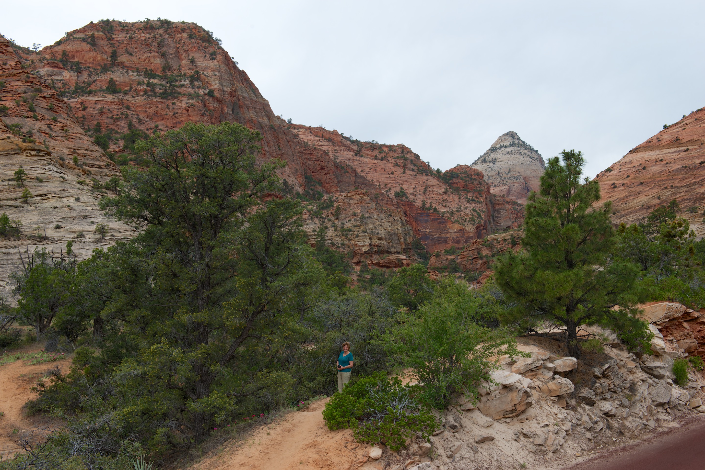


The tunnel itself was an amazing engineering/construction accomplishment and is all the more unusual for having five “windows” along its length.
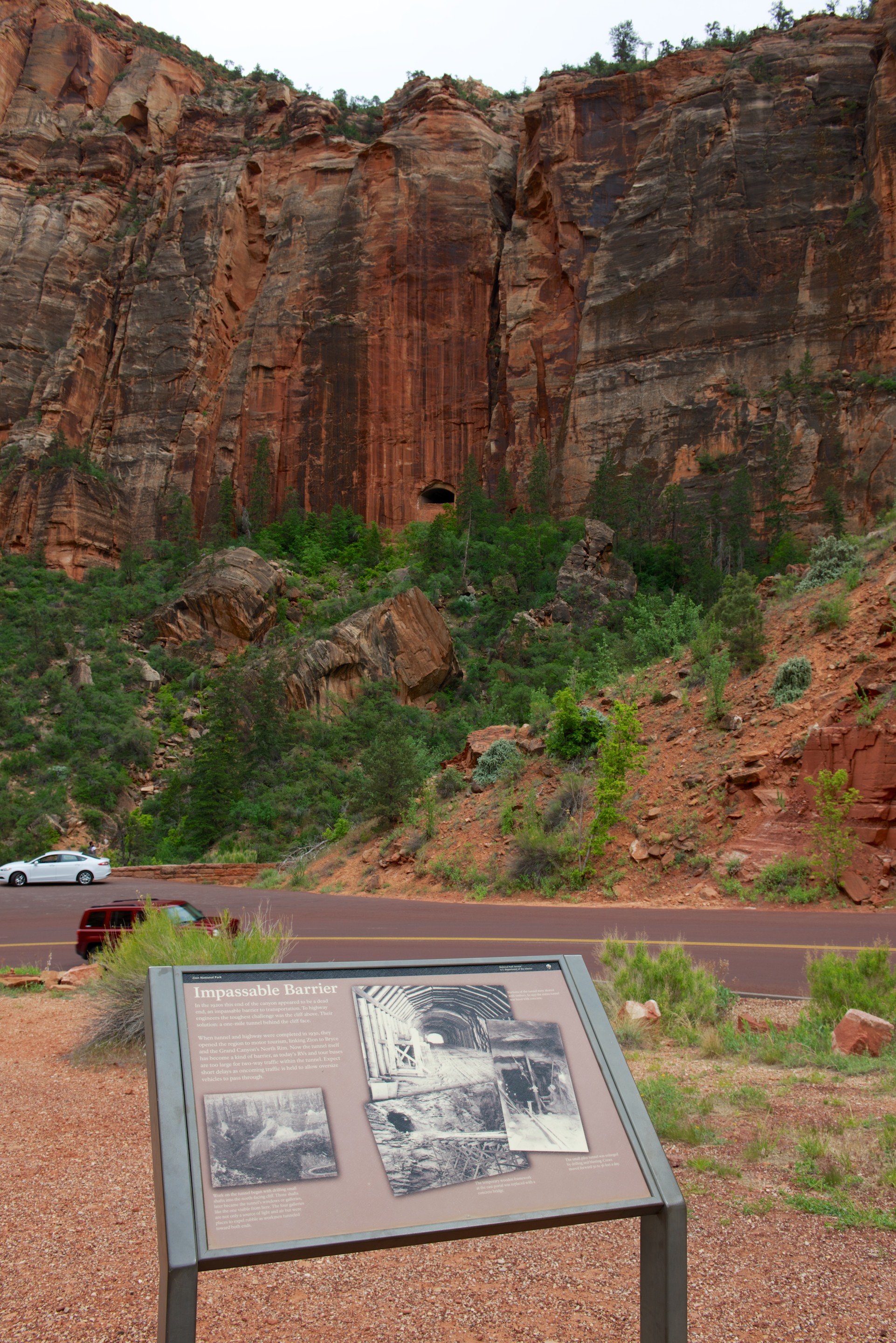

These were used to provide ventilation and to expel construction debris. We also watched some climbers as they made their way up a stone face. (See if you can find them in the first photo.)

This may be a bit easier.

The sun even came out for a while, which helped the photos and our enjoyment level!

The main tourist area was a mess, the RV parking area was jammed with cars and a few campers, even at 4.30 PM. We were not inspired by parking in town and taking two shuttles to see the glories of Zion tourist scenery, so we moved on, spending the night at a very pleasant campsite, the Zion River Resort in Virgin. While not inexpensive, this camp easily makes it into the top five nicest RV parks that we have visited. (http://www.zionriverresort.com) Fred wanted to drive the Kolob Terrace Road, which starts in Virgin but it was unfortunately closed for rebuilding. So the next morning we heading to the Kolob Canyons section of Zion NP. Again it was a cloudy day. What happened to the southwestern sunshine we enjoyed last year? We drove the five miles of tourist route and we took various photos on the way up. We hiked the short trail at the top and appreciated the view, though we wore rain jackets as it looked very threatening. We ate lunch there because Denise thought it might be clearing a little and indeed it did. The sun almost came out a few times so we took another photo or two.


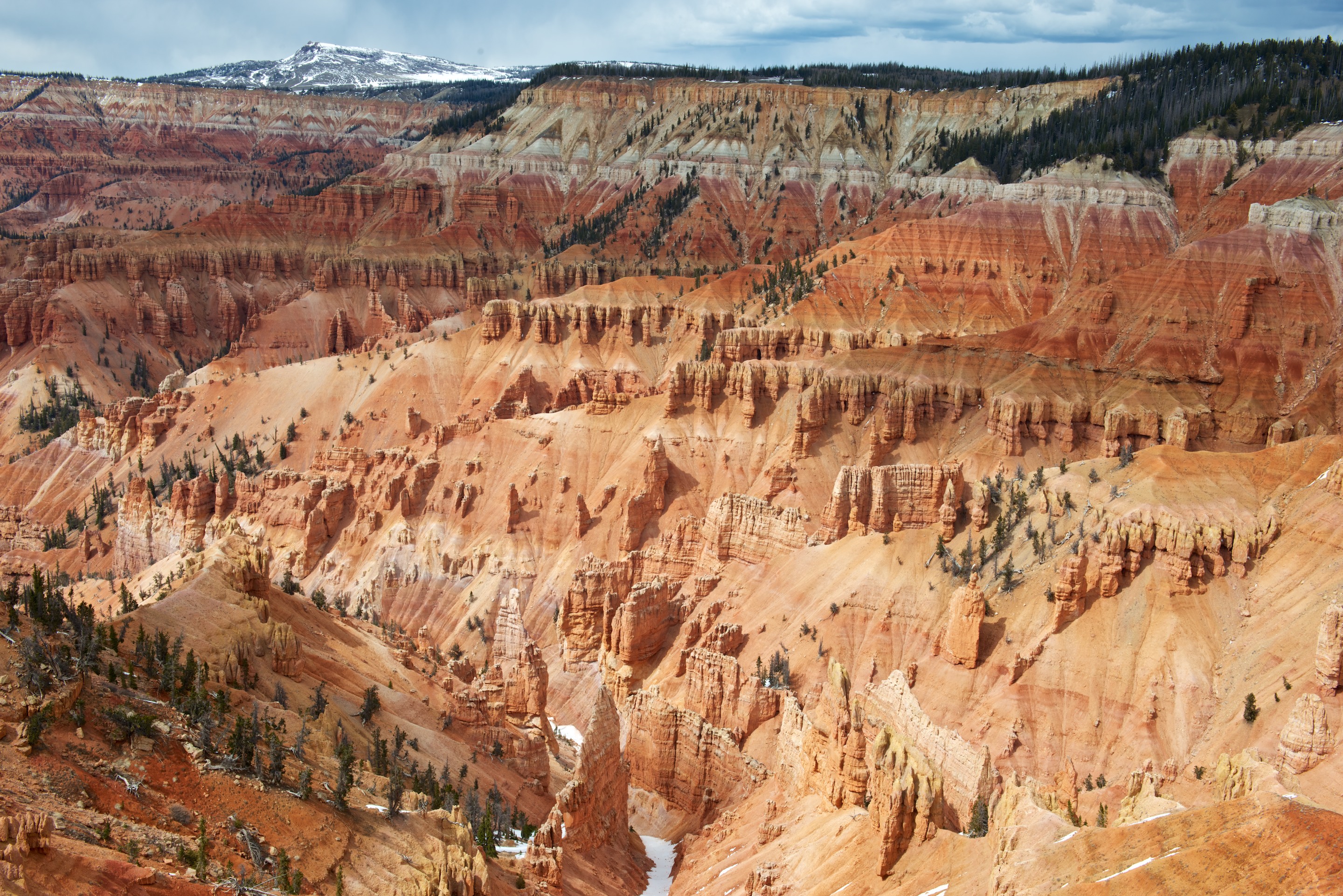
Continuing towards Bryce National Park, we took State Route 148 to 143, stopping at Cedar Breaks National Monument. It was very closed but had some good views of an amphitheater filled with hoodoos. Memories of Bolivia were upon us as we were back at 10,500 feet! We stopped for the night just short of Panguitch in the Dixie National Forest at about 8,000 feet. We may be SOB’s (Survivors of Bolivia), but this obsession with altitude is getting old.
Our departure the next morning was somewhat delayed by a bird who somehow got into the air conditioner enclosure. Fred had to take one of the grills off and encourage it to exit. We never actually saw it fly off but the scratchings stopped, so our fingers are crossed that it did indeed leave. (A tip of the hat to Dan Rehack, who gave us a Number 2 square drive when we got the Tiger, noting that it was the one, essential tool for all purposes on a Tiger!) We replaced the grill and headed to Bryce via Route 12, which took us through some spectacular scenery. Once in Bryce, we drove the full 18 miles to the end of the tourist scenic drive and took photos of the various sites. We had some sunshine at last though it was still quite chilly. We were unable to park at Bryce Overlook, but at Inspiration Overlook we not only climbed to all three levels but walked a section of the Rim Trail. Denise’s ankle, though still weak, is doing a little better. The combination of clouds, rain squalls, and sun made for a couple of lovely photos.


We headed to Kodachrome Basin State Park hoping to camp but found “Camp Full” signs up. So, we checked in with the Visitor Center for the Grand Staircase Escalante National Monument regarding camping permits. We were dissuaded from dispersed camping in the Monument as yet another winter storm was approaching. We were told horror stories of Bentonite clay and told that camping permits were not available unless you could specify where you were going to camp, a bit challenging as we could not assess the road conditions in advance and thus had no idea where we might camp. Apparently the roads in the Dixie National Forest are gravel and better than those in the Monument and one is less likely to get stuck. So, here we are with a 36 hour storm approaching and campgrounds full for the Memorial Day Weekend. We decided to head deeper into the Dixie National Forest on the promised gravel road and arrived at the Posey Lake campground (8,500 feet) just as it started hailing. It was time to regroup and reevaluate what was going to happen next. Somehow Capitol Reef National Park did not seem that appealing in the rain. We settled in for the night and happily cooked on the diesel stove, the extra heat being most welcome. We woke the next morning to a couple of inches of snow and it continued snowing until about 3.00 PM.
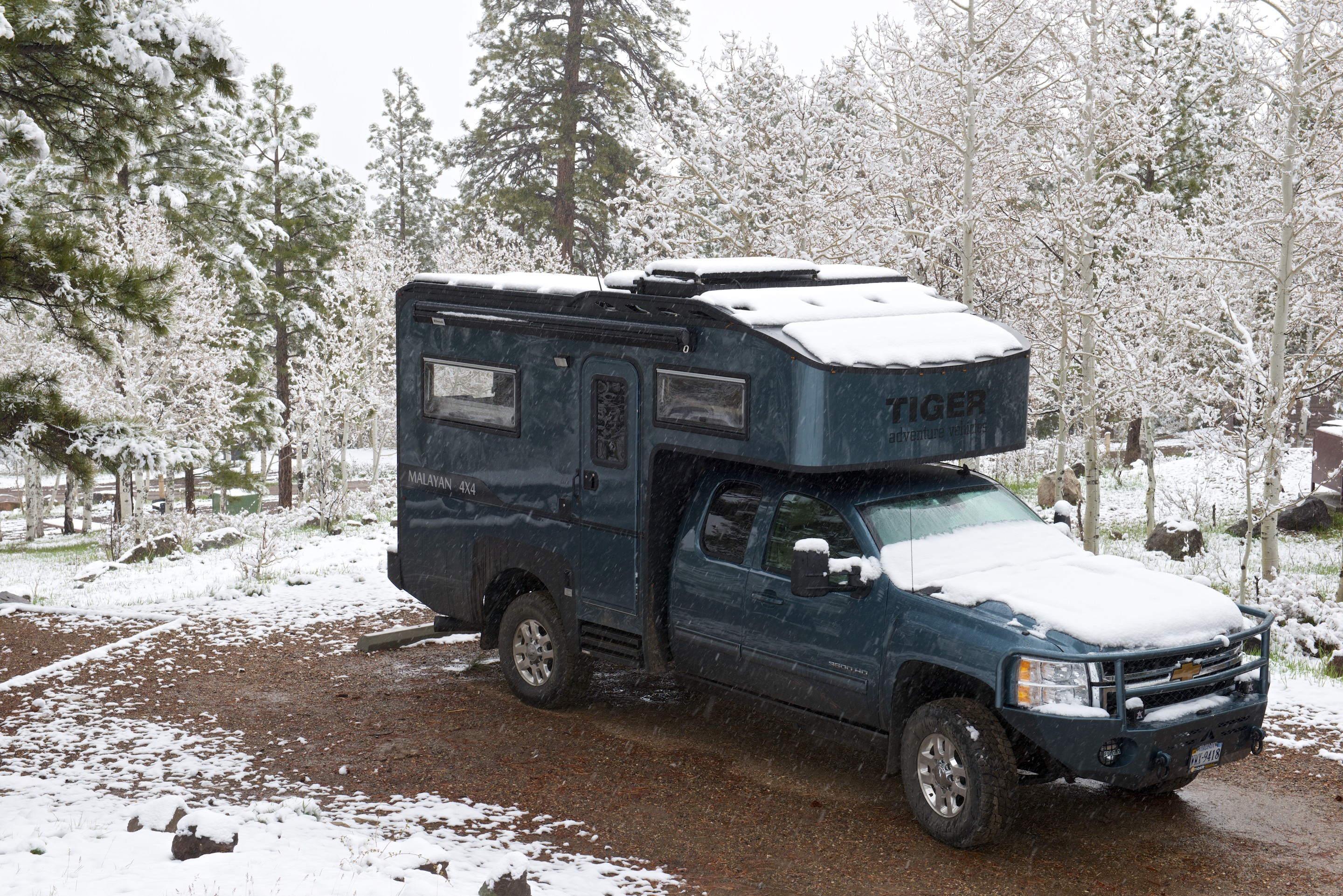
Needless to say, this seemed an excellent reason to stay put for a second night. The campsite is lovely with pines, aspens and a lovely view of the lake (through the snow!), plus the usual chipmunks and a selection of wild turkeys. So far no bears or mountain lions although there are food safes at all the campsites.
