Arriving in UK, we went straight to Denise’s brother’s house for another wonderful visit. Our timing was great as there was a family reunion for his wife’s birthday.
Three generations! (And DOGS)
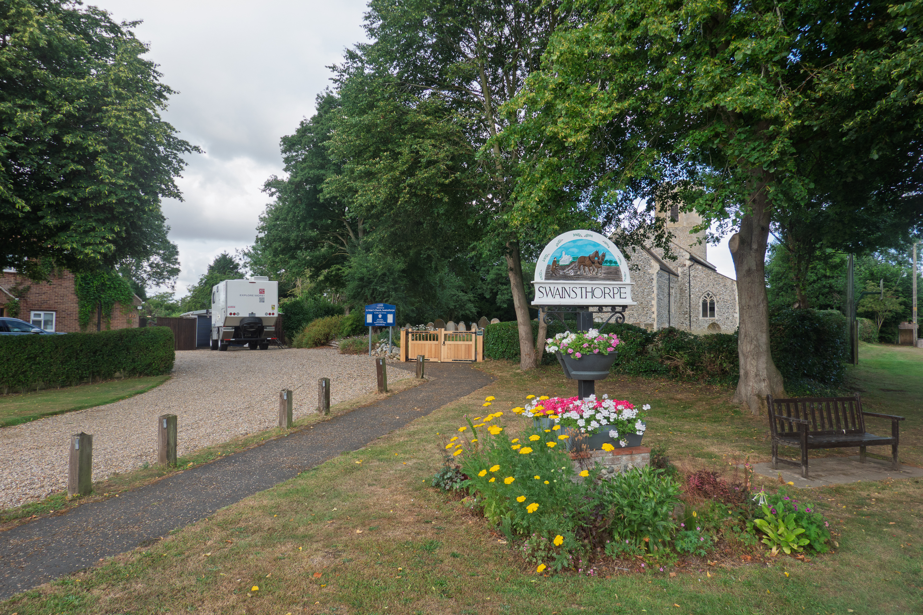
We then headed north to visit a friend from Bangui who is now retired in Norwich. We had never been to Norwich and it was interesting to visit a new part of the country. Charles was a mining engineer when we knew him in the Central African Republic. Now retired, he manages the village church, which, conveniently, is right next door.
The original tower is round but the extension. where the bells are located, is octagonal.
The NaveOne of the many carved angels in the ceiling.
It is a long, vertiginous climb to get above the bells.
Wiew from the top of the tower.
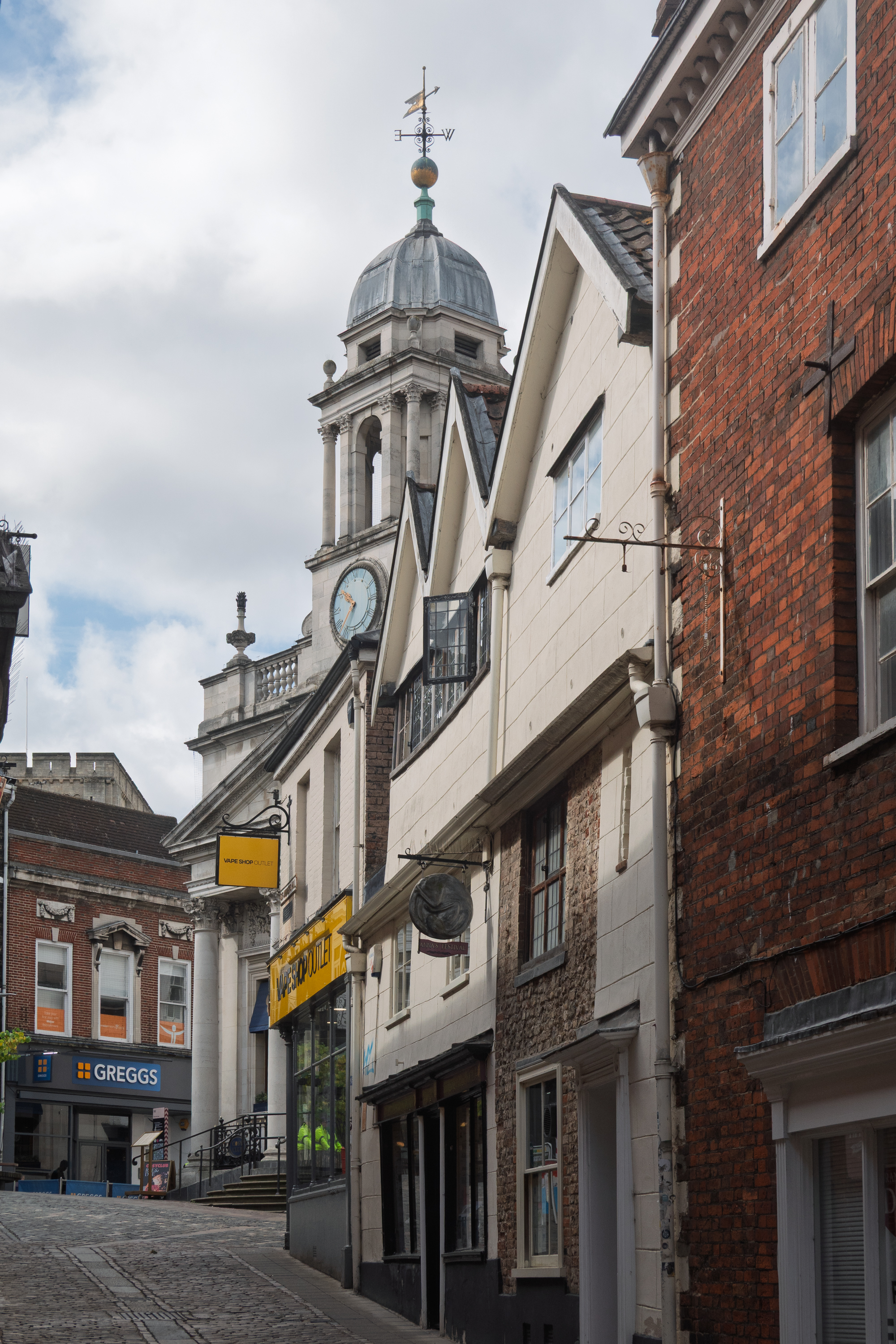
We went into Norwich proper for a day of sightseeing and shopping. Partly due to the original construction of a Motte and Bailey fortress and a dry moat, parts of the city are on very different levels. (https://en.wikipedia.org/wiki/Norwich)
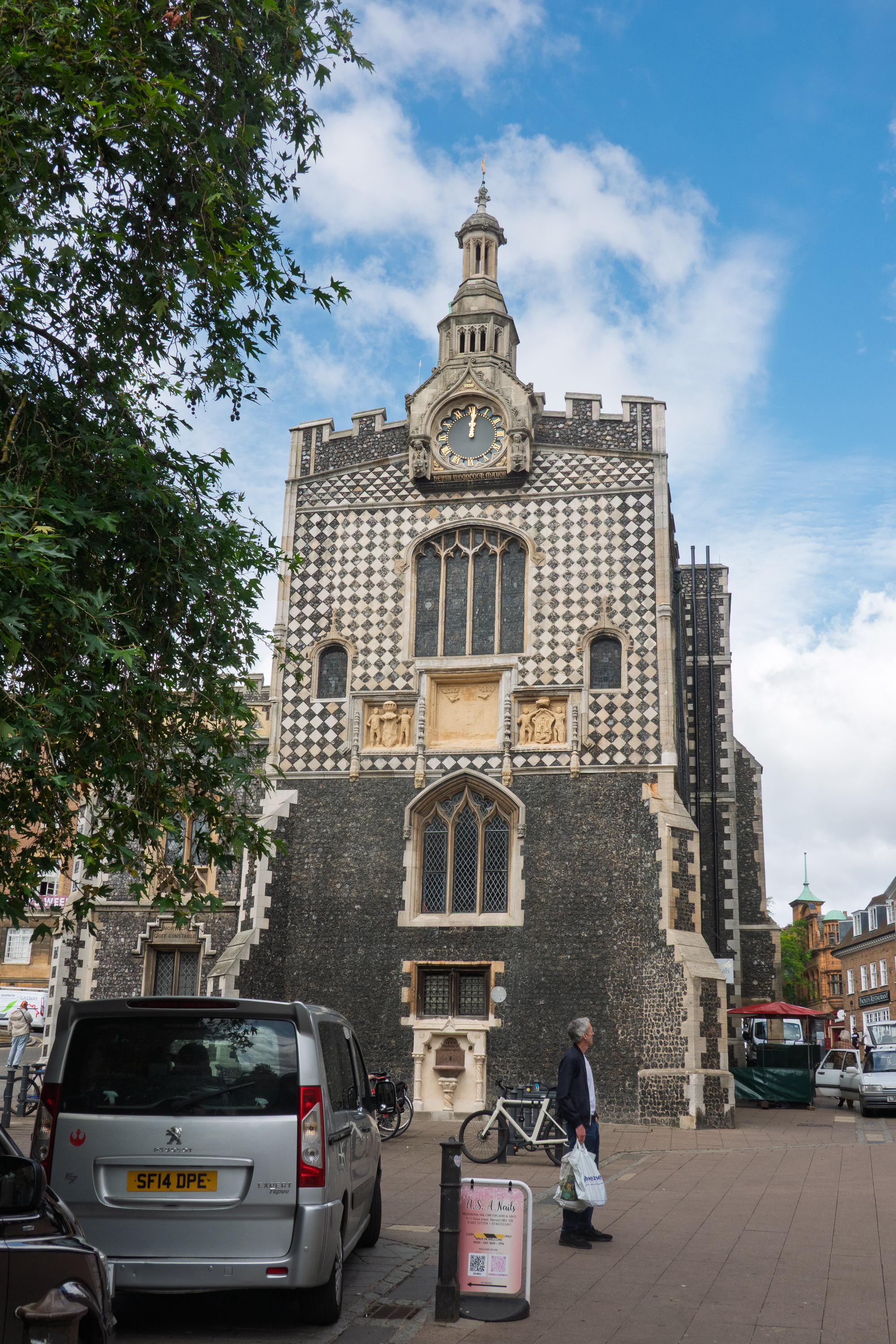
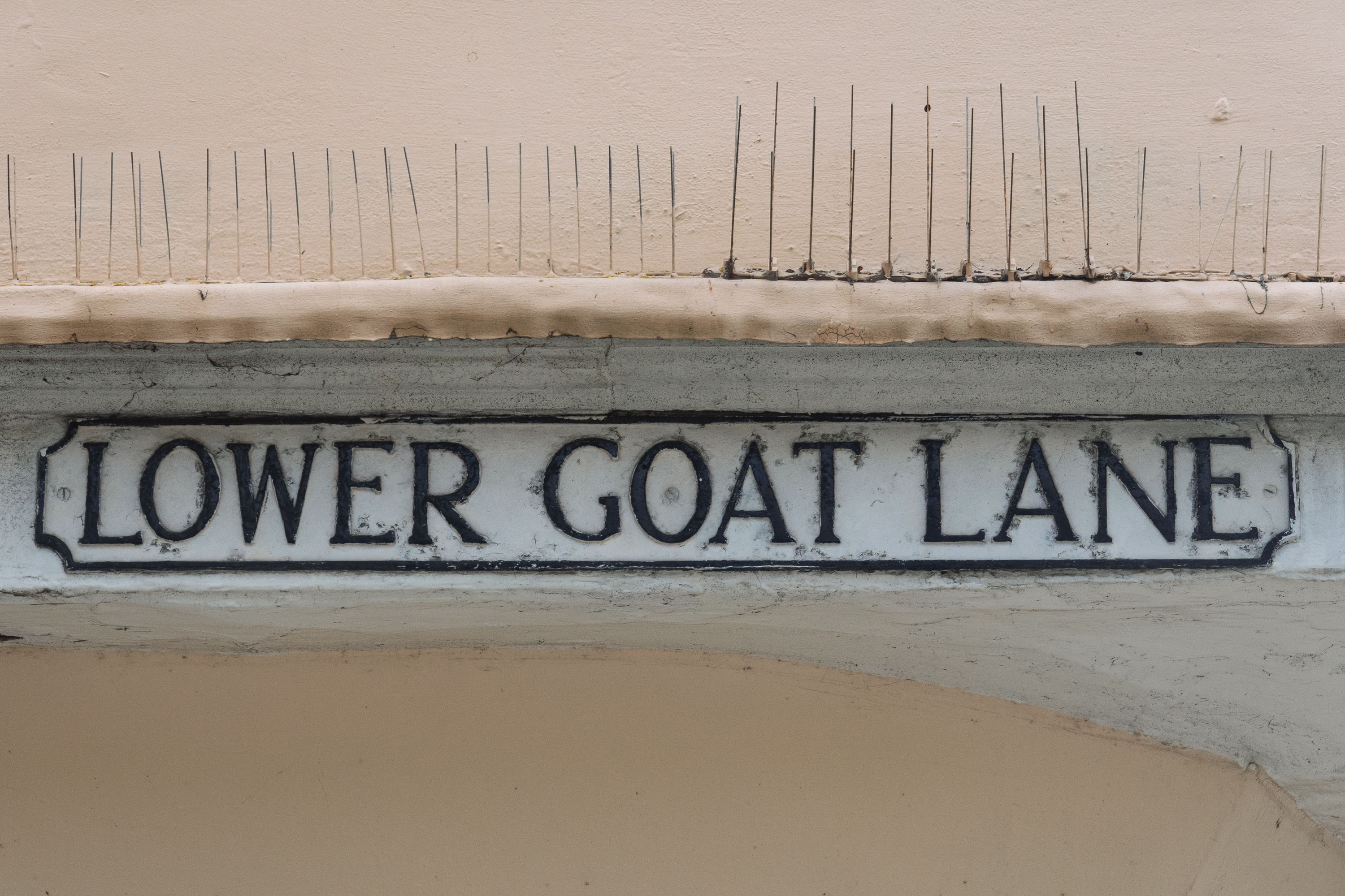
GuildhallIs there an upper goat?Leaning into your neighbor.
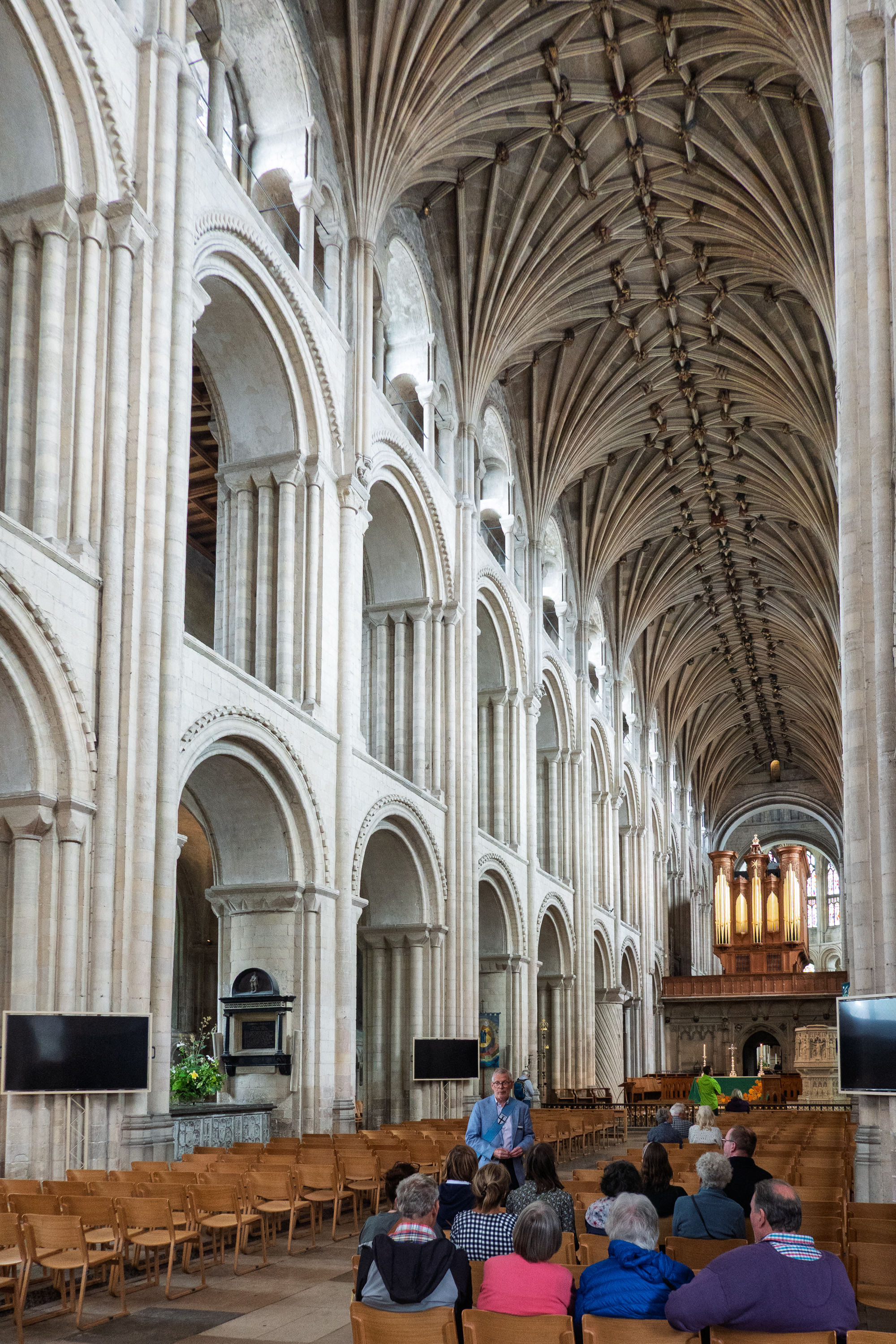
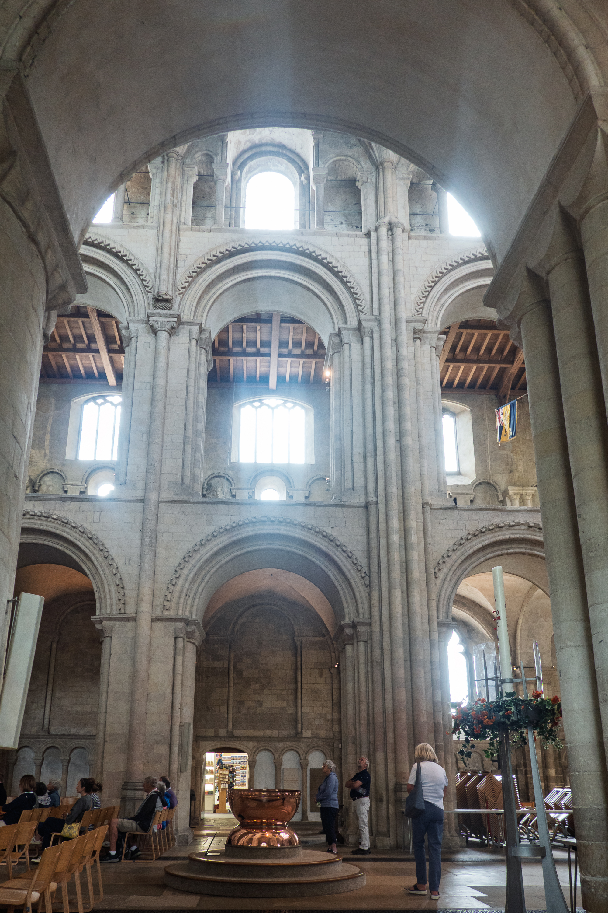
And, of course, we visited the cathedral. (https://en.wikipedia.org/wiki/Norwich_Cathedral) There are many things special about Norwich cathedral, but perhaps nothing is more unique than the baptismal font, made from copper vessels from the Rowntree chocolate factory.
No, not an orphan, but rather a private road, not “adopted” by the city.Steep streetOld prison door.
Tour group forming up in the nave.
Following the maze outline in the cloister.
The chocolate font
Choir organ
Misericord choir stalls.
Grafitti. It is said that there are actually staves of music carved into the walls somewhere.
Prior to the Reformation, the interior, like that of most cathedrals, was painted and decorated. Now only scattered fragments remain.Lest you forget …
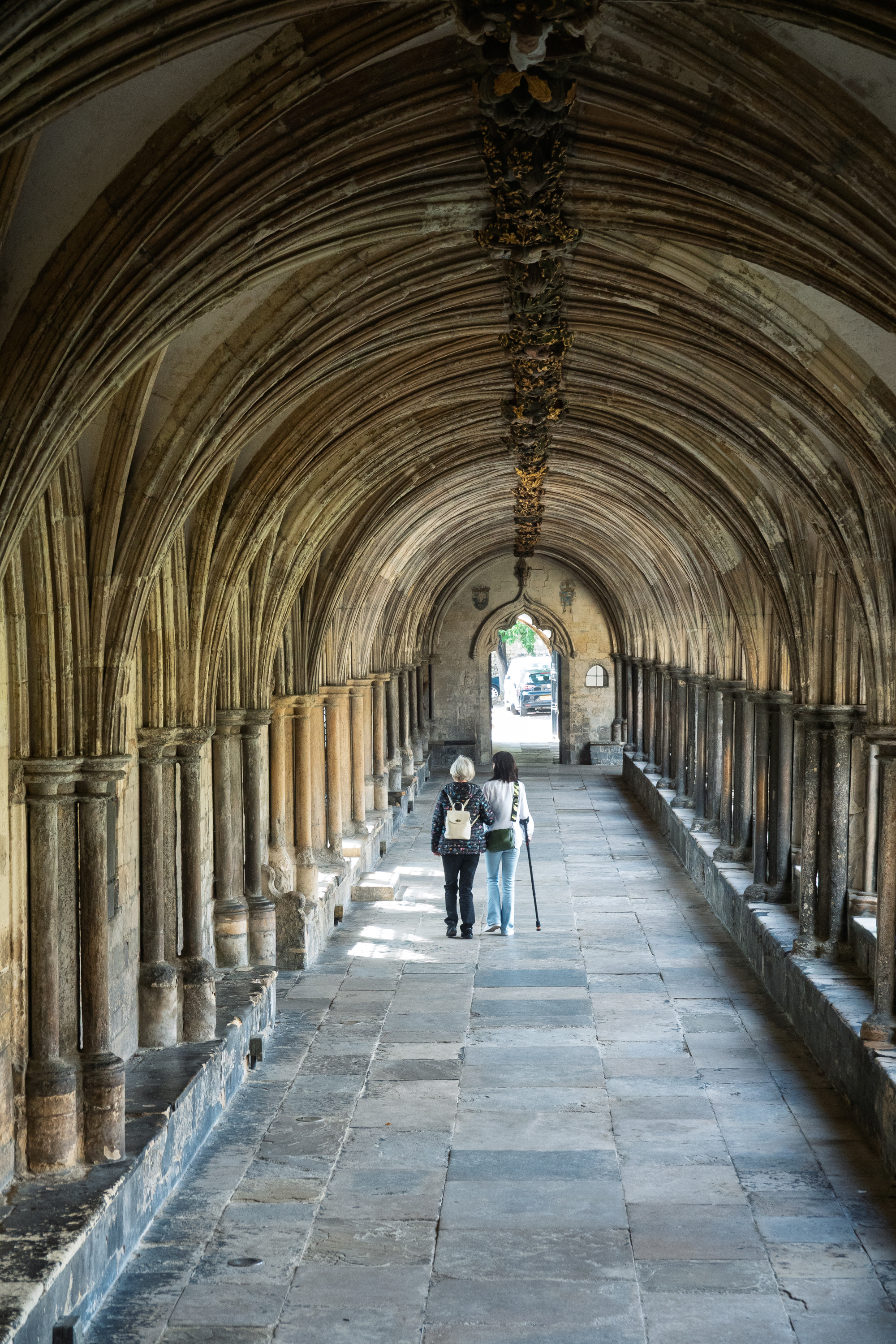
Cloister
Chapel with old battle flags, a reminder that this is the Church of England.
Norwich castle was closed for repairs, but we gave it a wave before leaving town. Like many English castles, it is a relic of the Norman Conquest. (https://en.wikipedia.org/wiki/Norwich_Castle)
From Norwich, we turned north for a family visit and a spa day at Atkinson Vos.
We like stopping off at campsites we have previously visited. Here at Lurcher Farm Cottage we watched all of the dogs going through agility and other training. Woof!
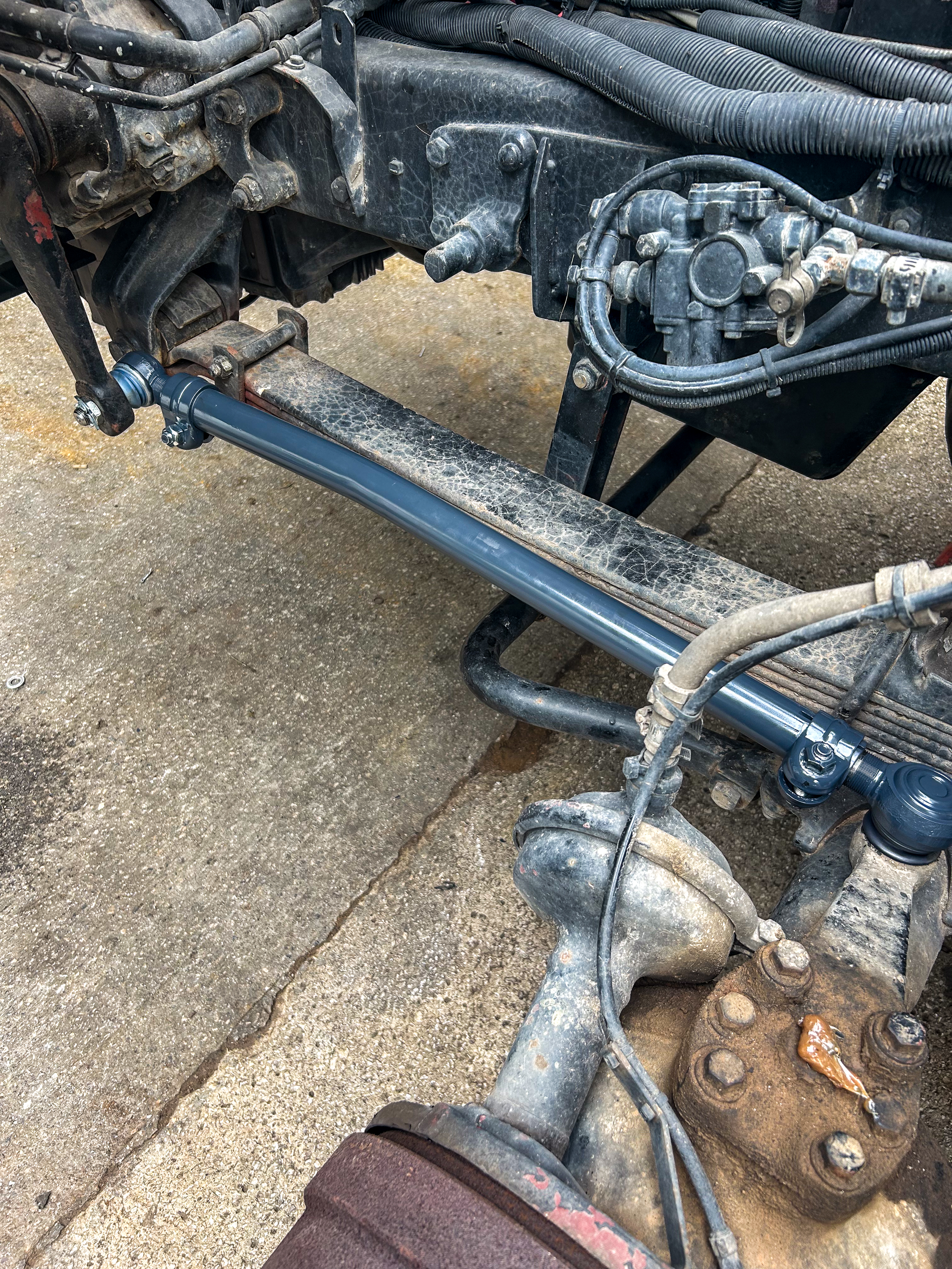
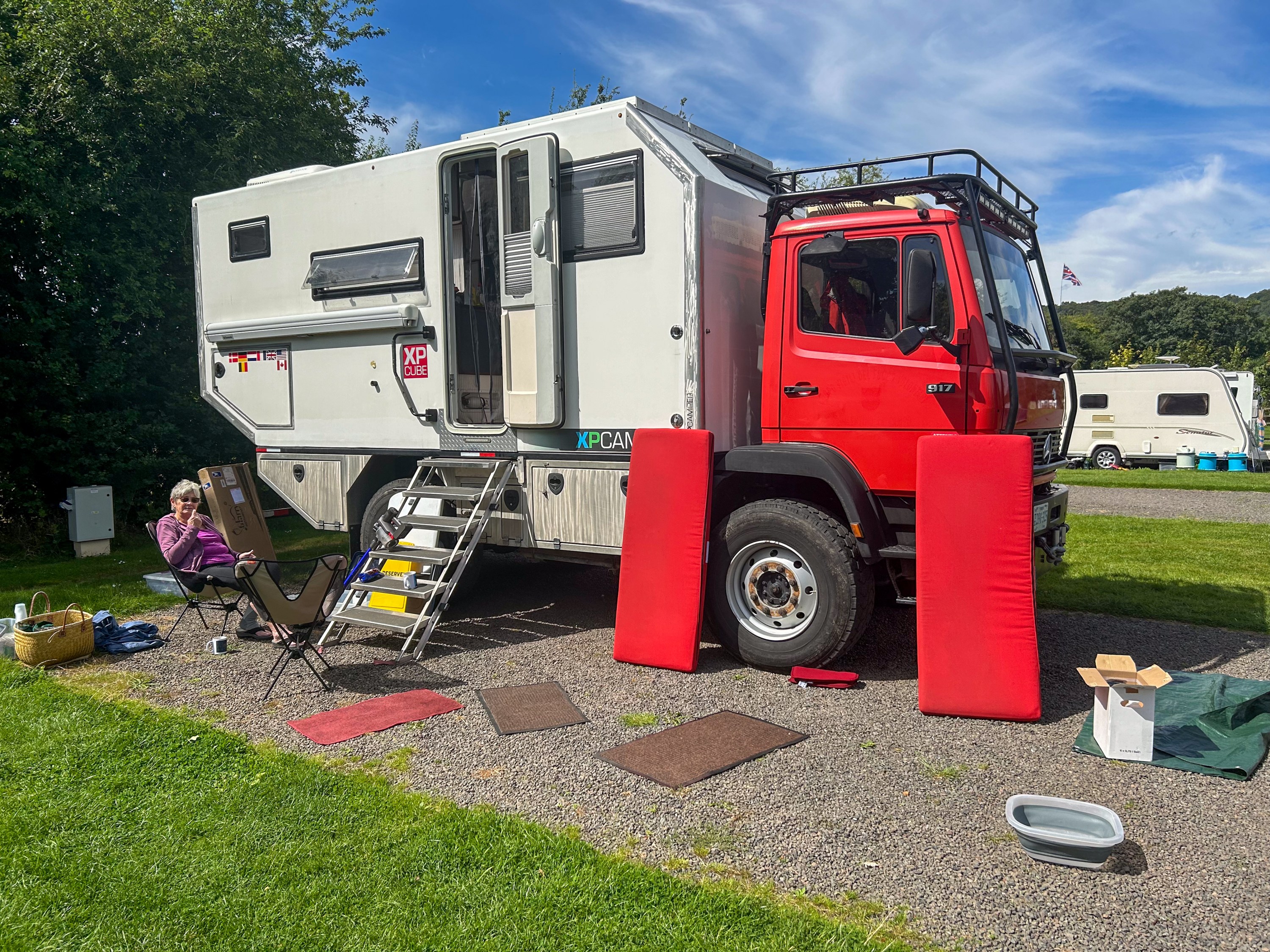
Back at Atkinson Vos we replaced the rubber bushings that mount the cab and installed the new drag link. The drag link was pure unobtanium – out of stock in UK, France, Germany, Belguim, Spain, etc. Thanks to our friends on the German LN2 forum, we got a lead on a factory in Slovenia that makes custom parts. (https://www.ln2-forum.de) The language was a challenge, but we got a fractured German message, “You send money, we send part!” Fingers crossed, we did, and the shiny new part was promptly delivered. And, unlike the Mercedes Benz original, both tie rods ends can be replaced! Beautiful!
And the blue paint just makes it even spiffier!
And the air leaks? We thought that we might have to do some massive replumbing. Turns out that none of the Mercedes Benz air lines were leaking. The only leaks were on the new lines put in to run the fire pump and other things. When the pump was removed, these were simply tied off. So we removed them all and hopefully, the problem is solved!
Things we don’t need.
All of this accomplished, we returned the truck to Bristol for storage and went out for a wonderful dinner with Motorhome Matt and his lovely wife. (https://www.motorhomematt.co.uk) He is our hero as he always finds space for us to store the truck.
The next morning our taxi showed up for the run to Heathrow – the same Albanian driver who picked us up in the Spring. He greeted us like old friends. We really have been doing this too long!
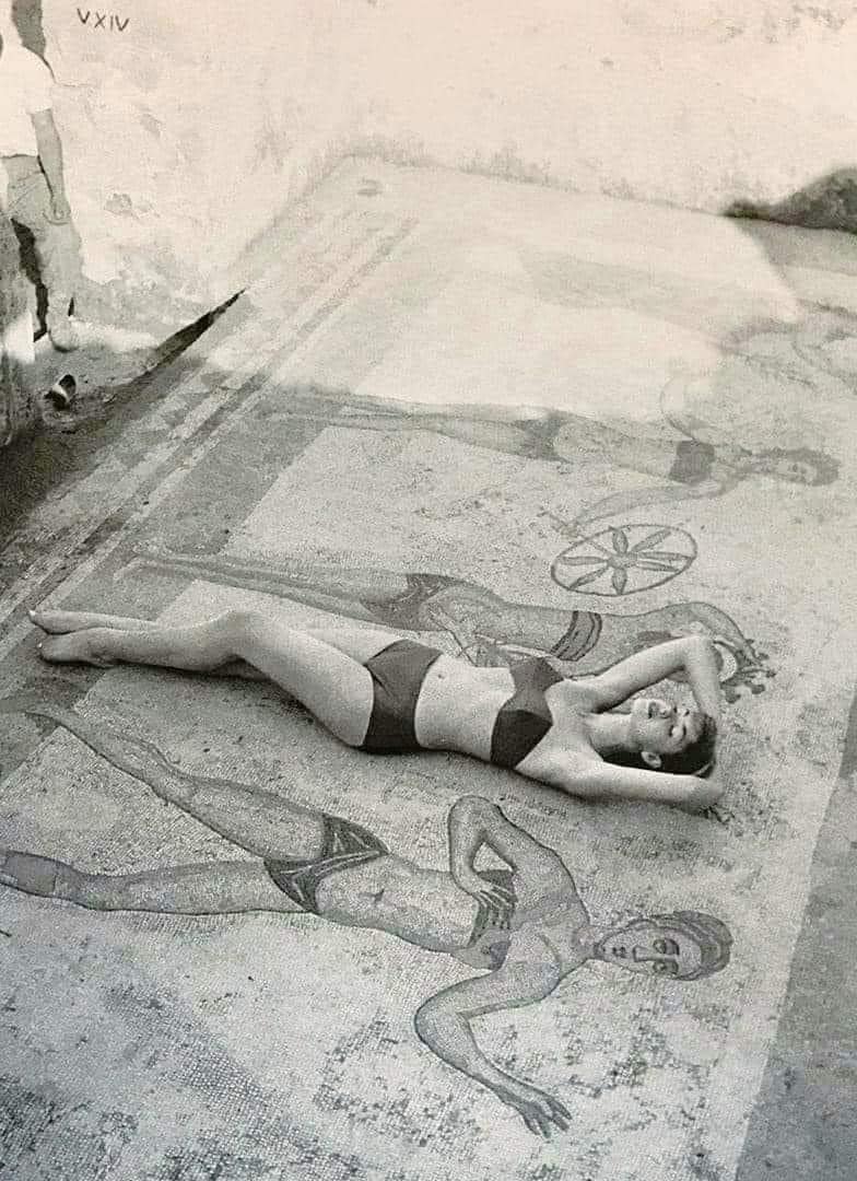
The Villa Romana del Casale near Piazza Armerina, is famous for its mosaics. Especially one, the so called “Bikini Girls.” So naturally, this was at the top of Fred’s list. Denise was less impressed, wondering why, when there was so much total nudity in ancient art, “bikinis” should attract attention. Fair question. And Fred wondered why an ancient home owner, with all of the various subjects to choose from, from Gods to heroes, hunts to wars, would choose bikini girls. We set out to find out.
Probably looted several times, by various invaders, the villa was finally covered by a landslide in the 12th century. So while some of the mosaics were lost, many are still completely intact. Unlike many sites, most of the walls are still intact and so you have a real sense of walking through the villa. You can get a feel of the layout of the house.
The interior is dark and to protect the mosaics, you walk around on elevated platforms.
Denise admires the vestigial frescoes at the front door.
Peristyle with impluvium. “Impluvium” is a fancy word for the place where rain is allowed to fall, and be captured in a pond.
Each of the medallions around the peristyle is a different, critter and each is very exact – you can tell lions from bears from leopards. (and tigers, oh my.)
Stepping through the doorway, you come on a chariot race. Note that, unlike the movie “Ben-Hur,” these are real, stripped down racing chariots.
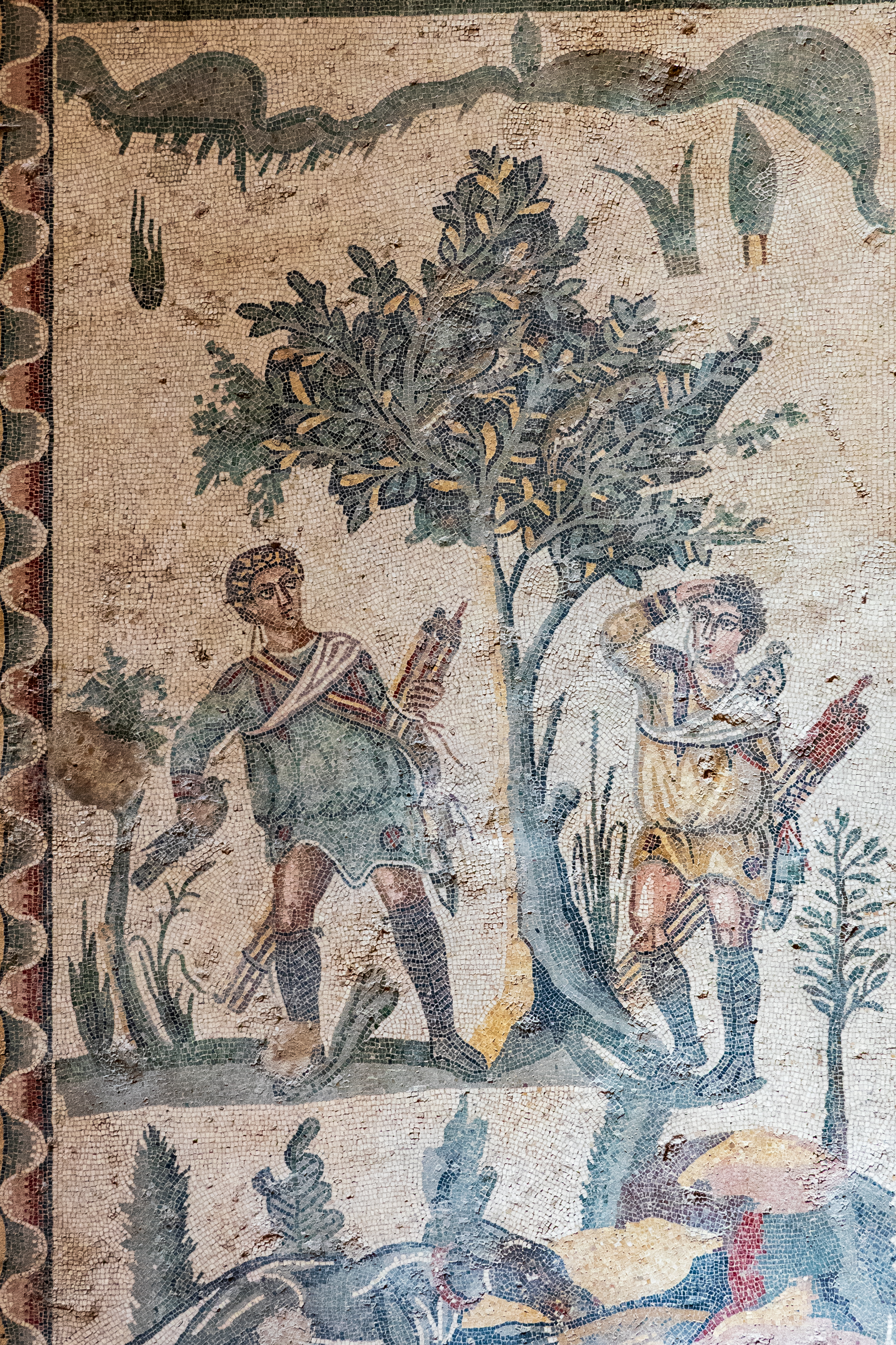
And, to answer Fred’s question, the showpiece of the villa was indeed a huge hunting scene that stretched from side to side – a magnificent walkway. It was much too large, and dark for me to photograph in its entirety, but it covered all aspects of hunting. Fortunately there is a public domain image of the entire hunt, available on the web. (Note that the saturation in this image has been pushed, hard. The actual colors that you can see are more accurate in my images.
Love the action – loading the ship from the left and unloading from the right. Note the details or ropes, cages, etc. And why is the man on the lower left beating the other man?Loading an antelope onto a ship. Note the cages on deck.Here two men, beaters?, appear to be searching for birds in a tree.Hunting a wolf with hounds. It is recorded that the Roman Army used dogs.Note the drama. The man in yellow (same man, perhaps a slave, is down and has been wounded. The man in red, the master?, spears the boar supported by the attacking dogs.Successful hunt. Slaves (?) bringing home the boar. The dog is VERY interested, The master (?) is making an offering, perhaps for the survival of the man in yellow, who is holding the horse. A groom?Bonidatius may have been a gladiator, which his victories recorded in this image.
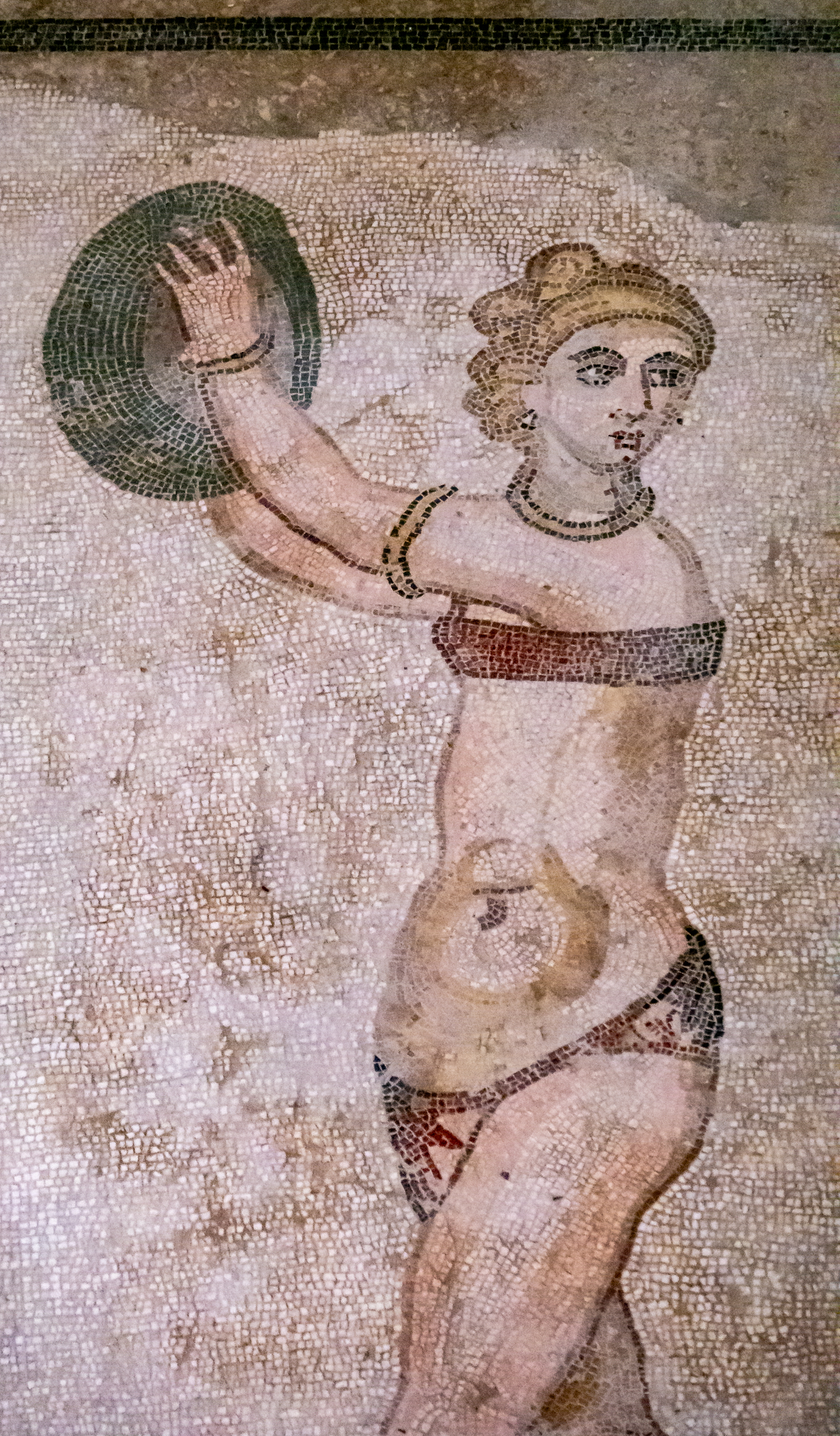
And yes, we did see the bikini girls. It appears that the image is of games, long jump (with weights), discus, running (relay?), and a ball game. Two of the girls have won prizes, awarded by the lady in the lower left. The section in the upper left is confusing. Was the mosaic of the girls put down over a previous, geometric design floor?
As you can see, the mosaics are life size.
Toi the victor, a crown and laurel.
Why can I not get “Miss Congeniality” out of my mind?
Discus is just the thing to liven up your garden party. And we think beach volleyball is something new.
Roman chariots were often raced by teams, represented by color, blue, green, white, and red. This bizarre image shows each of the colors being pulled by a different pair of birds. The actual layout of the spina of the circus is exactly correct and the team in the lower right is being awarded a laurel branch.
And yes, there are adventure stories as well.
Odysseus offers a cup to the cyclops. Or, in this case, tri-clops. Odd too in that the cyclops is eating a sheep, and not one of Odysseus’s men. Obviously, there a many variations to the story.
So while the life size girls were interesting, the villa, as a whole, was much, much more. A fabulous visit.
As we left the GPS took us through the center of the town of Piazza Armerina. There is a bypass, there is no access to this road from the west. (???) This drive proved quite exciting as we climbed up through the hill town on a steep, cobblestone street, with cars parked on both sides, and about a foot of clearance on either side. However, once we made it through that, the trip to the Mons Gibel Campground in Belpasso was easier.
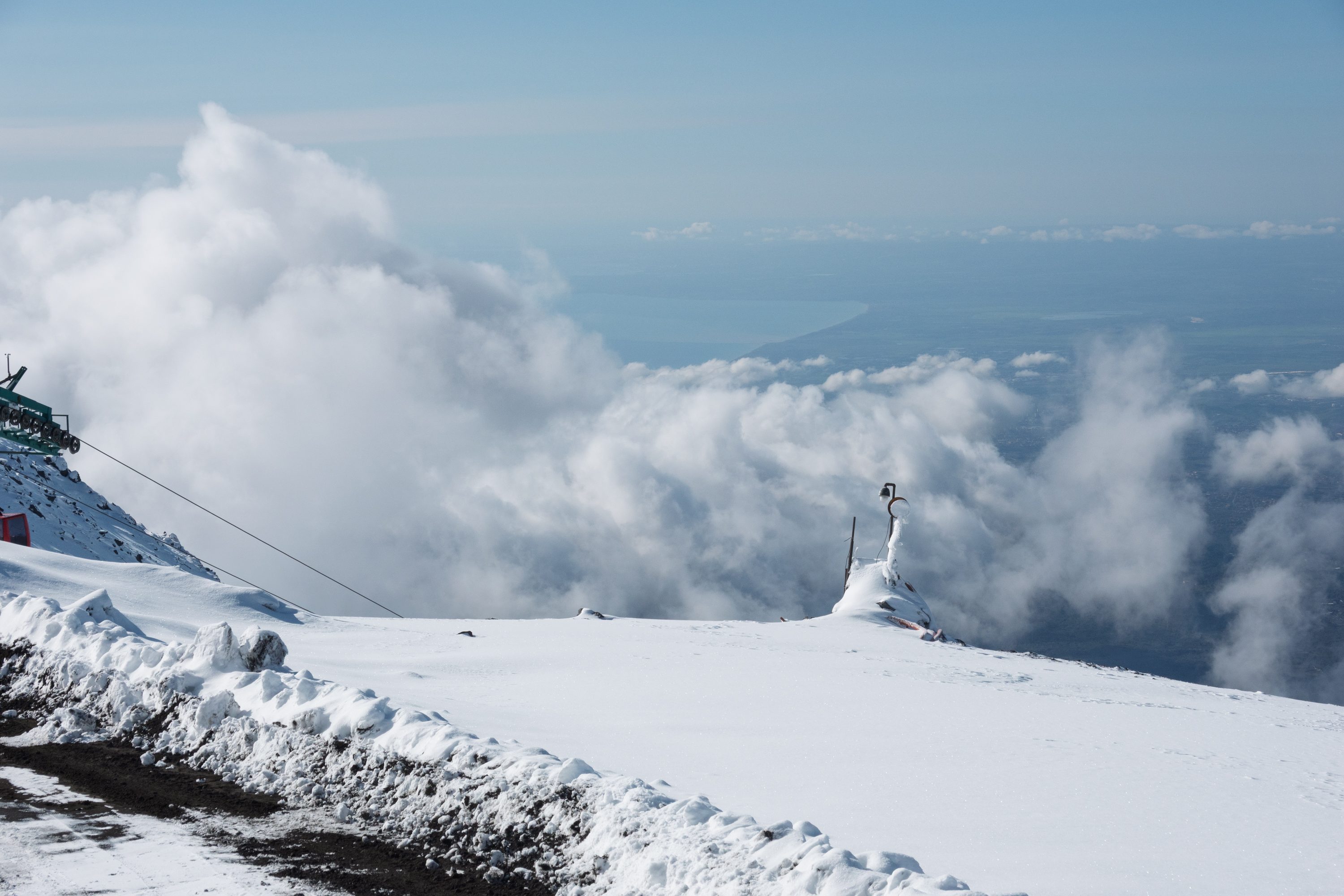
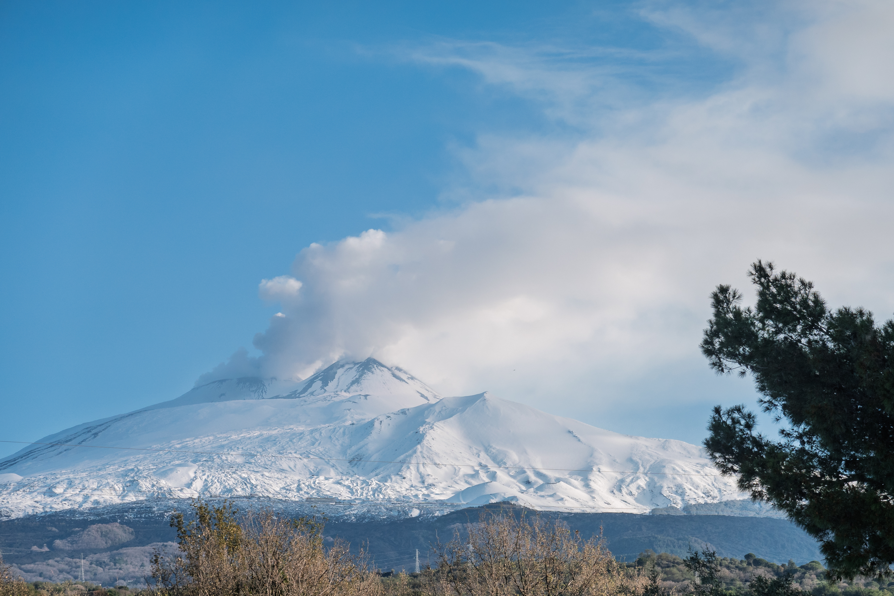
As we neared the campground we had a spectacular view of Mt. Etna, covered in snow. Sadly, we could not stop for a photo, as we were on the motorway. After the usual grind through one lane roads, we reached our very nice campground up on the slopes. We did have to wait a day for it to stop raining however!! But the next day proved amazing and we headed off at 8 AM to get the maximum viewing time.
View from the campground. Lots of smoke. We heard “booms” in the night.
While it turned out that there was actually plenty of parking up at the refuge, we shared a shuttle with a German couple. On arriving, we noted that the rain the previous day at the campground had fallen as snow on the mountain. About three inches of fresh snow everywhere. We should have worn our snow boots!! But we managed fine with hiking shoes. We took the cable car from the refuge up to the 2500m level. This cable car is at least the third to have been built as the volcano keeps destroying them.
A fun ride – note the old pylons to the right.
Stepping out of the upper cable car station we watched the clouds roll in below us.
Clouds below and smoke above.
With the clouds rolling in, it was time to take the cable car back down.
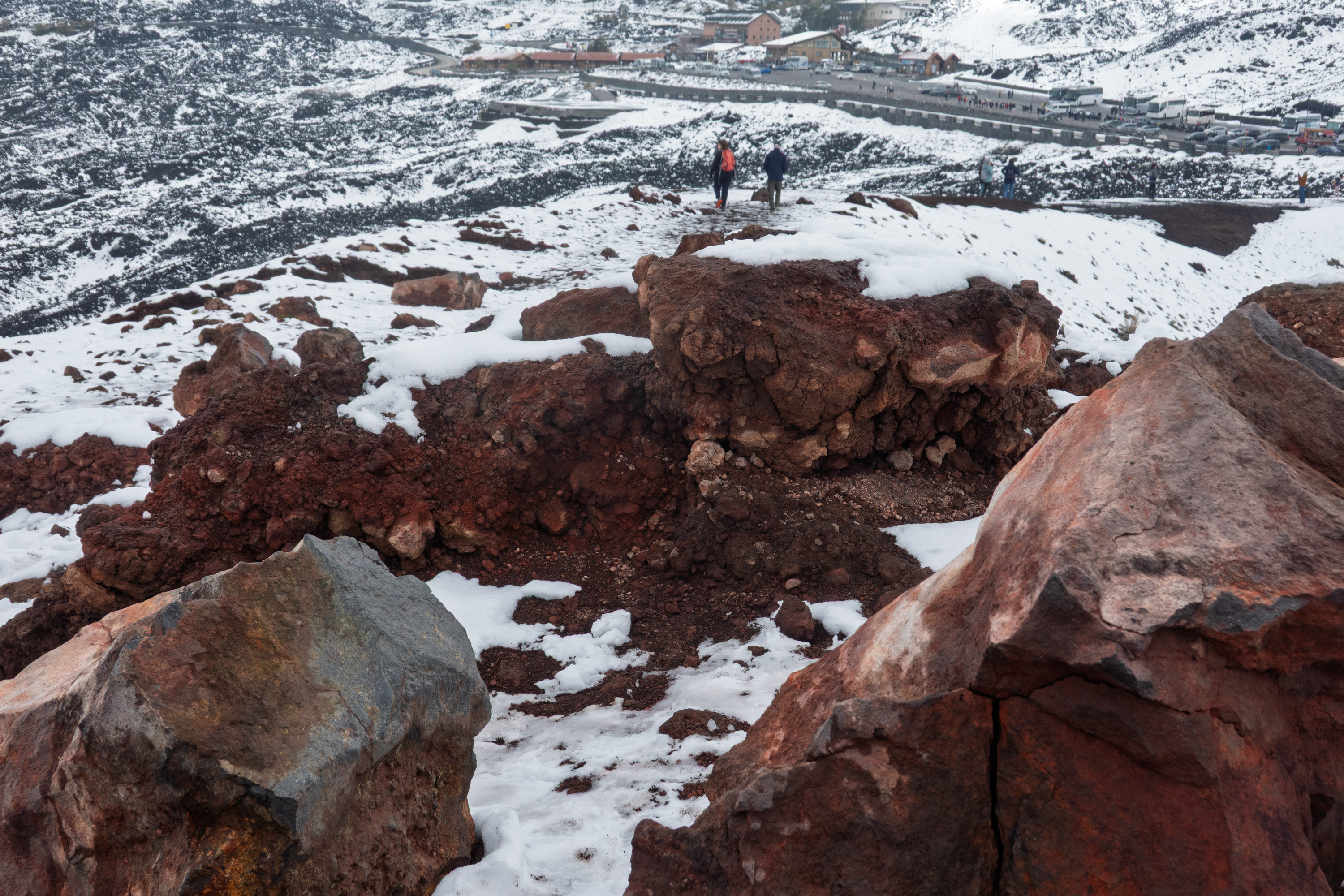
Back near the parking lot, we marveled at the distinctly different types and textures of rocks thrown out of the carters.
And a final beauty shot. If you enlarge, you can see the refuge/parking lot, right at the snow line, and the cable car route up the mountain.
The next day we headed for Messina to catch the ferry to the mainland. This proved to be remarkably easy and we found the embarkation point with no trouble thanks to the GPS. The crossing was about 20 minutes and we again enjoyed sunshine and calm seas.
A bright, sunny crossing. About 20 minutes.
Parked at the bow.
Unlike the overnight ferries, there was no attempt to pack everyone in – the premium was on a rapid load and unload. (Made it much easier to get out of the truck!)
We landed in Bergen and took a coach to our hotel. They had no space until 3:00 PM and were not terribly helpful about anything, so we jammed our luggage in their luggage room, which was totally uncontrolled and full to the brim. That done, we set out to discover Bergen on a grey, damp day.
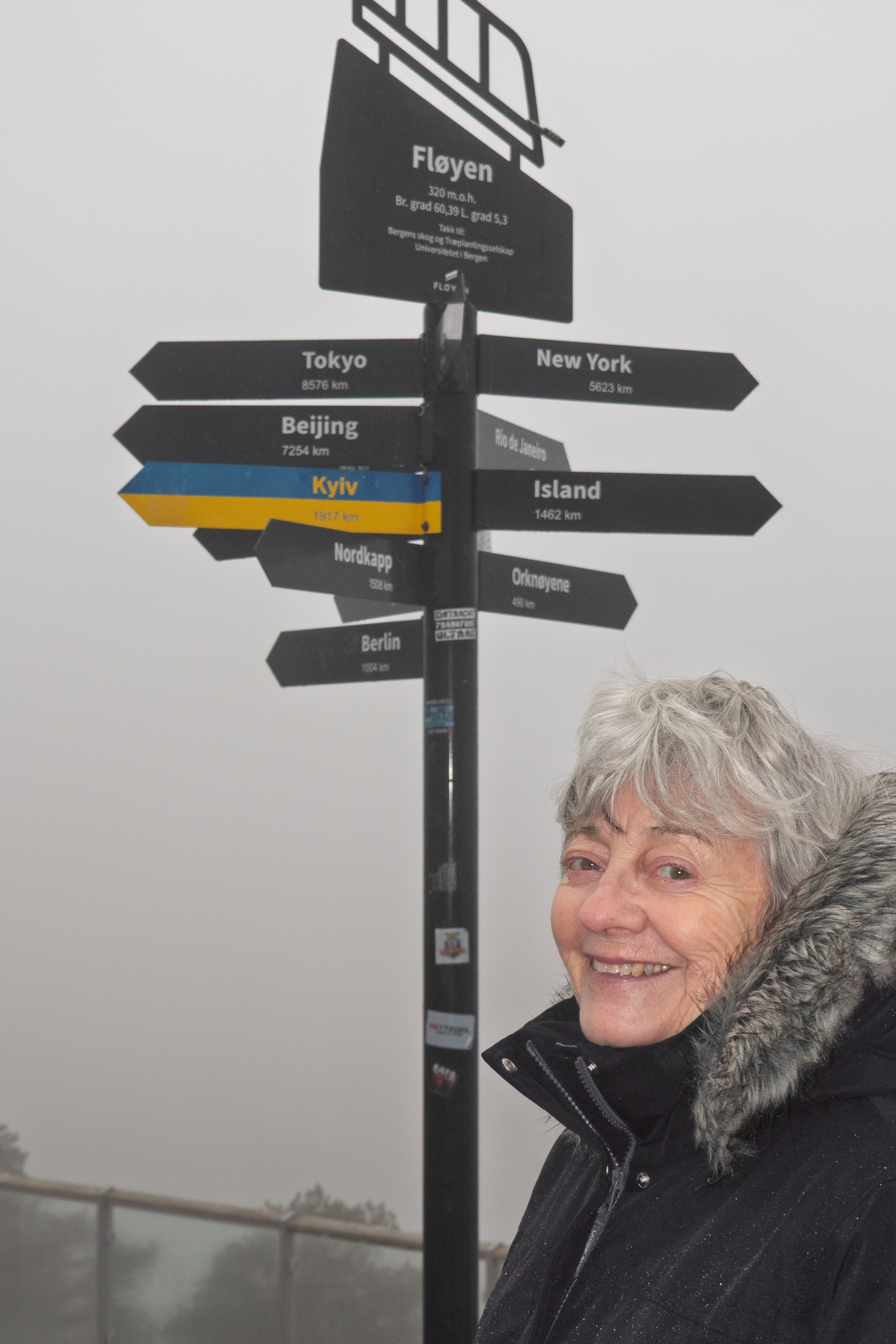
First stop was a coffee shop for sustenance! Then we headed for the cable car to go up the Floien, which provides wonderful views of the city. And indeed the view was spectacular and we were just in time to see it before the clouds rolled in and the view disappeared!
Great view! But enjoy it quick, the clouds are rolling in!
Denise determining where we are.
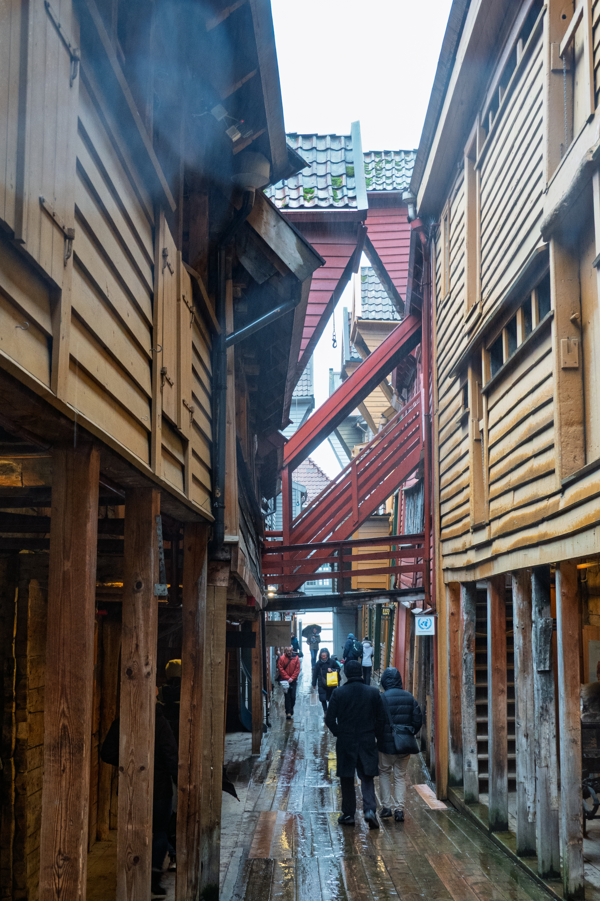
Escaping the souvenir stands, we re-boarded the cable car and descended to the waterfront. Then, as it began to rain, we headed to the Hanseatic Museum. In Lübeck in Germany, we first remarked on the importance of the Hanseatic League, in the development of trading and society in general in the early Middle Ages. Their trading routes stretched from Tallinn to London. We had seen mention of the League in Denmark, Holland and in northern Germany with Bergen the most northern reach of the League. For those who need a review before the quiz, here you go: https://en.wikipedia.org/wiki/Hanseatic_League
The museum was housed in a “tenement” or multi story house where visiting traders would lodge while doing business in Bergen. (See image at the top.) Cod was brought from Northern Norway and exchanged for grain and other goods from further south.
It seems that, at least initially, the Germans sailed to Bergen in the summer, and then overwintered, hence the need for the communal housing. In the beginning, they could not bring their wives, but eventually some married local women and settled in Bergen.
Tenements along the Bryggen, Bergen’s old waterfront. Repurposed as stores, hotels, and museums.
Back of the tenements.Original tenement repurposed into a boutique store.Communal kitchenWhat do you do if you get bored waiting for dinner? You carve graffiti.Original painted decorations over a doorway.
The bridges between the buildings reminded of the lady bridges in Jeddah. Only here the goal was to stay out of the rain and snow.Ornate lamp. Dated 1938??Most of the common rooms had big heaters.Hand washing station.
The German influence is so strong that local wags joke that it is impossible to make a sentence in Norwegian without using at least one German word.
As we were definitely in the off season, we found a lot of restaurants closed. We ended a tiny little pizzeria run by some charming Syrians. It was excellent!
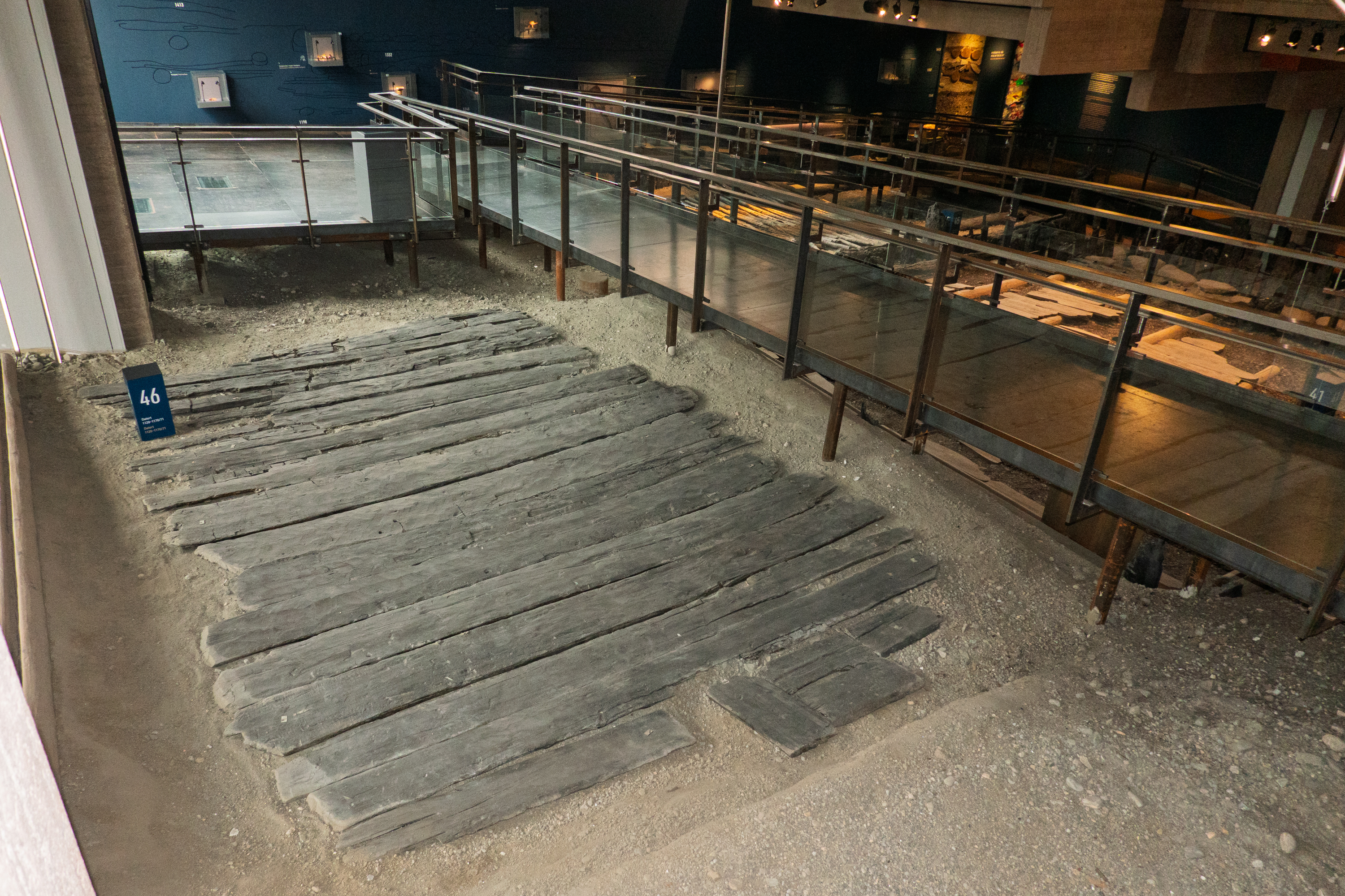
We then wandered along the Bryggen, the old port with its colored houses facing the sea and narrow, cobbled lanes between buildings We went to the Bryggens Museum, which has remnants of old buildings and displays of the history of the port.
Original, wooden flooring.
A very official document, complete with seals.
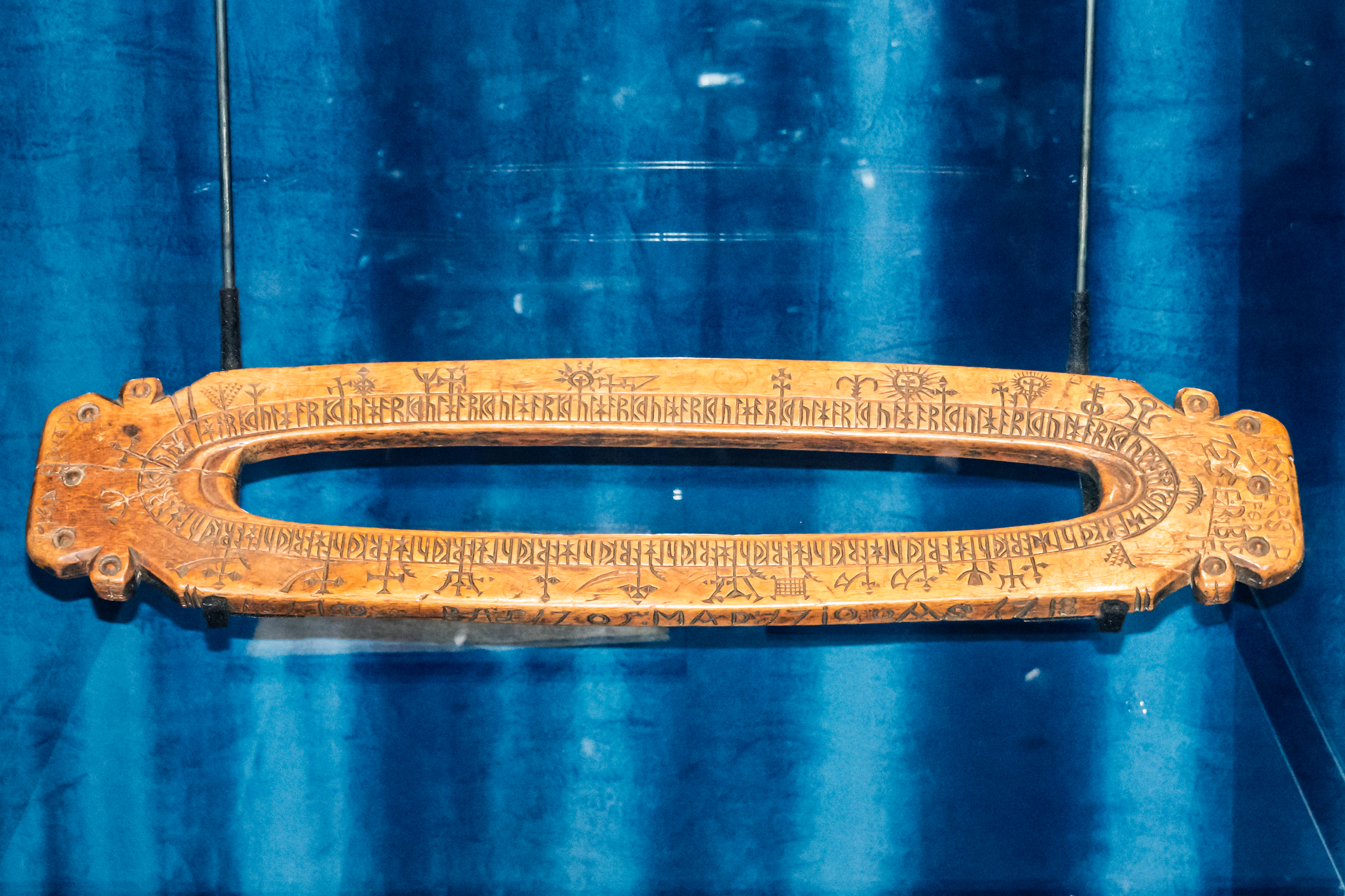
Fascinating “perpetual” calendar, marked in runes, but with Christian saints’ days marked.
On the second floor was an amazing exhibit of the Law Code set by King Magnus VI, (the Lagabote, the Law Mender,) in 1274. It had some amazingly modern ideas. (https://en.wikipedia.org/wiki/Magnus_the_Lawmender)
The next day we headed to the train station to take the train from Bergen to Oslo, known to be an amazing mountain trip. We were getting ready to take our luggage to the platform when we were notified that the train was cancelled due to landslides. Bummer! Here is the trip we wanted! (https://www.visitnorway.com/plan-your-trip/getting-around/by-train/the-bergen-railway/) Maybe next time.
In a near panic, we grabbed a taxi and headed for the airport. Once there, we were stunned to learn that there are no ticket sales points – all tickets must be purchased on line. We found a bench and went to work. We finally got through to SAS, and once we were in the system a charming desk clerk, who turned out to be the supervisor, got us onto the next flight. It might have been cheaper to have flown to the US, but we were able to maintain our Oslo hotel reservations, and British Airways flight to the UK for the following day
As we had decided to return to the US by sea, we found ourselves with a few days to spend in Wales. Our last Welsh visit was to the northern castles about 38 years ago, so it was time to discover some of the south.
We started off staying at Our Welsh Caravan and Camping (https://ourwelsh.co.uk/), near the village of Gilfach Koch. The campground itself was roomy and featured sheep all around.
We had hoped to visit Caerphilly Castle, but it turned out that we were rather farther away than we had hoped. So we cast around for a different place to visit and found the Royal Mint in the nearby (we thought) village of Llantrisant .
Google maps kept suggesting very complex routes, so we started out on Welsh cycle route number four (https://en.wikipedia.org/wiki/National_Cycle_Route_4 ) which we expected to be pretty manageable. Silly us. It proved to be quite a challenge. We started off up a steep hill and then the trail disappeared leaving us up on the ridge with spectacular views but riding a rut along a field.
The track was rough, but the views were wonderful.
We managed to get to the top of the hill and met some mountain bike cyclists descending a much better trail (almost a road). We asked for directions and continued towards the Mint. After a series of odd streets and tracks, we made it. Note to all – don’t ride small wheel bikes on Welsh bike trails!
The first order of business was lunch, to fortify ourselves after our travails. The cream tea looked excellent but more than we could manage. The Royal Mint was a most interesting site and the tour was excellent. (https://www.royalmint.com/) Because it was a non working Sunday, we were allowed onto the Mint floor. This meant that we were able to view the buckets of coins that had been prepared for the sixty countries of the world, including some, like Cuba and Ecuador, that we had lived in. Sadly, they discouraged the taking of samples. Unfortunately no photography was allowed. We resolved to stay on the Google route back to the campground but we again found ourselves walking on steep, overgrown paths and faced with locked gates! But we made it, and even managed to find a supermarket where we could purchase some items we were lacking. It is worth noting that there were lots of road works going on and all of these included bicycle accommodation, so things may be easier in the future.
Our next stop was a campground outside St. Davids. (https://en.wikipedia.org/wiki/St_Davids) We were up on the cliff and we arrived on a cloudy, rainy, windy afternoon with absolutely no view. However the staff assured us that the views were spectacular, when it stopped raining!!
After the rain, the sky was magnificent, and yes, we could see the Irish Sea.
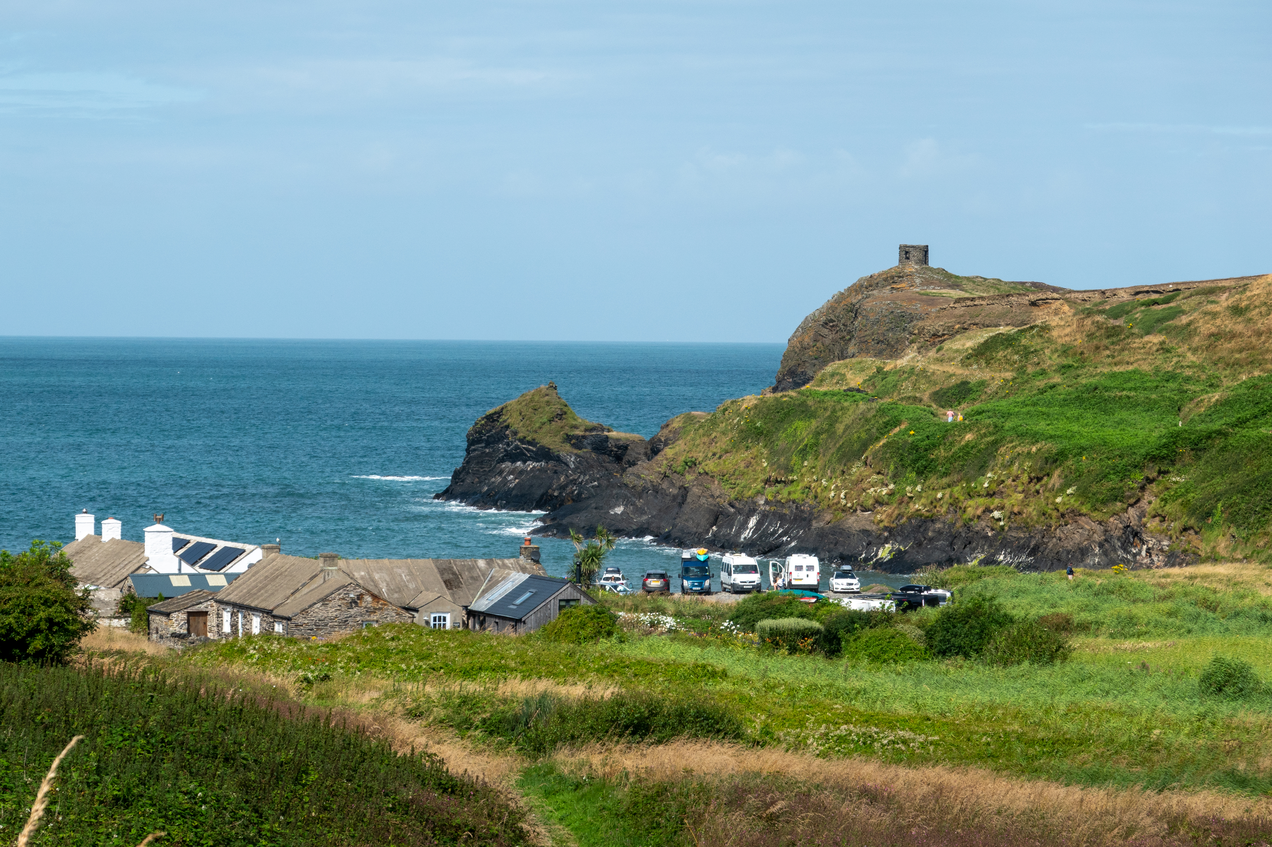
View of the village with the ruins of mining buildings and workers cottages.
Denise captures the view.
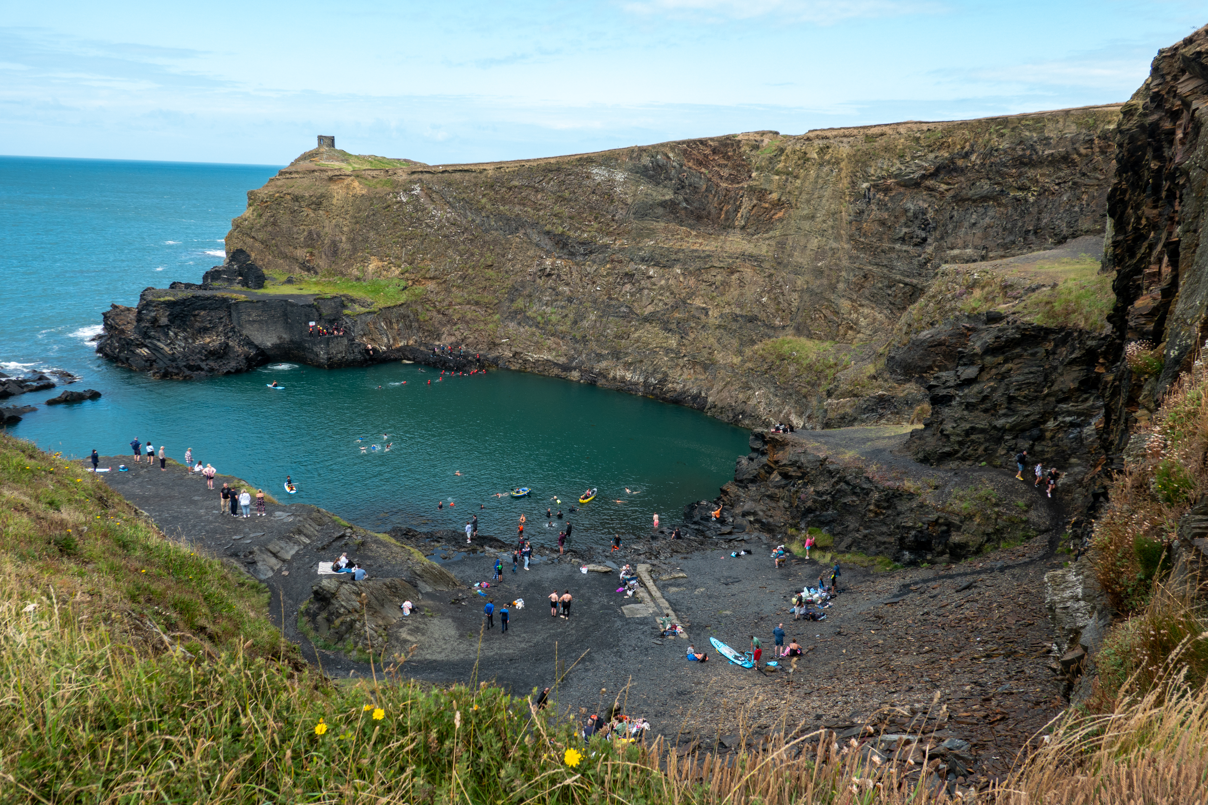
The lagoon is a deep bay, formed when the ocean was allowed to full the pit of an old slate quarry. The slate turns the water a glorious blue. Sorry, no Brooke Shields at this lagoon.
Once there, we enjoyed the views of the coves and small beaches. A fund raising morning was underway with people jumping in the lagoon to earn money for charity. We skipped the jump and paid up in cash! We continued along the coast for a bit before returning to the campground. Never found any remains of the horse drawn tramway that was used to haul the slate to a nearby harbor, just the path.
The next day was dry but looked rather more unsettled. We took the summer bus into St. Davids to explore and, of course, to lunch. The place was heaving, but we managed to find a table at a local pub and had a dose of fish and chips. Then we headed down to the cathedral and the ruins of the Bishops’ Palace. (https://en.wikipedia.org/wiki/St_Davids_Bishops_Palace)
The cathedral seen from the ruins of the Bishops’ Palace.
Each room had detailed annotations and this great hall has bees’ nests, set off with orange cones. Don’t disturb the workers!
Though in ruins, it was clear how the palace had worked and it was most interesting. We then went to visit the Cathedral. (https://en.wikipedia.org/wiki/St_Davids_Cathedral) More than any other church we have visited, you could really see where new wings and expansions had been added over the years.
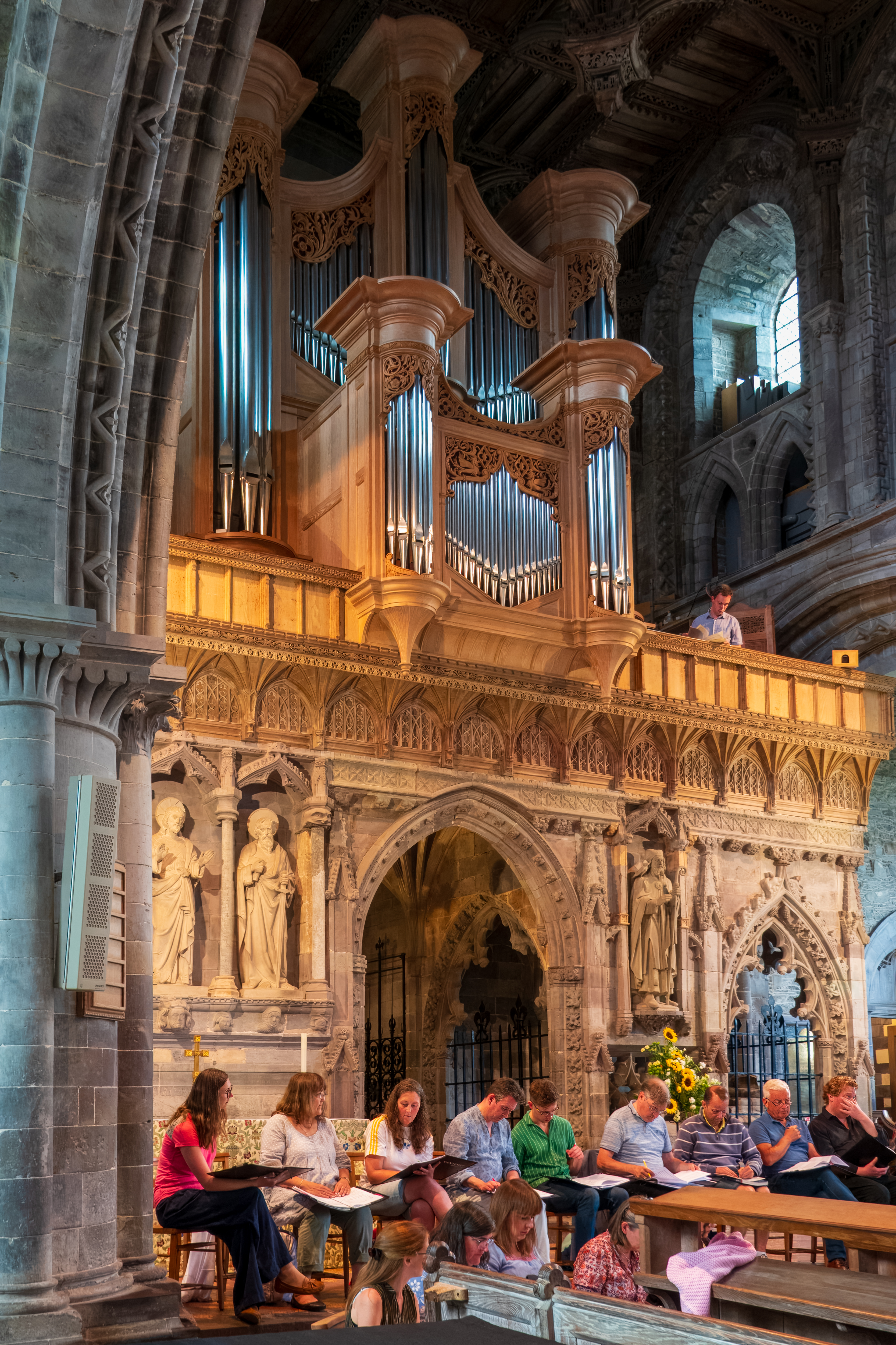
We managed to arrive as the choir was practicing, which was fun!
Choir practicing outside the rood screen.The choir space, behind the rood screen.
St Davids is known as the smallest CITY in the UK and is a charming spot. See correction in the comments! Seems that a cathedral brings benefits.
St Davids was the first cathedral choir in the UK to use girls rather than boys with the men.Formerly external window, now made into a small inside altar.
The original plan had been to continue up towards Anglesea but we changed our minds and headed to the Welsh and English Marches instead to visit Offa’s Dyke. (https://en.wikipedia.org/wiki/Offa’s_Dyke) We camped in a great site in a field beside the railway line. (https://panpwntoncampsite.co.uk/) We love trains!
The campground was on the obligatory narrow lane. This one was long and quite a challenge with the usual parked vehicles and bushes to scrape the side of the truck, but we made it, several times.
We drove REALLY slowly, climbing the bank to avoid the parked cars.
We walked into the town of Knighton to visit the Information Center and learn about the history of the dyke.
Looking down the High Street.
And looking up the street to the market cross.
Yes, we seem to have a thing about the walls, Hadrian, Antoinine, and now Offa, that surrounded England. Gotta control those pesky Scots and Welsh!
The dyke and ditch are hard to recognize; it is amazing that anything can be seen at all.
Denise crosses the line.
Just outside of Knighton is the Spaceguard Centre, one of the more unusual sites we have found. (https://spaceguardcentre.com) The Centre is dedicated to locating and tracking objects, like asteroids and comets, which might strike the earth. We were wary about tackling the steep hill on our E-bikes, so we ground our way up in the 917, navigating long, single track lanes.
Fred got kudos from the director for making all of the turns and grades!
The views over the marches were spectacular.
The Centre is on a dark, remote mountaintop and studies Near Earth Objects in conjunction with NASA and other observatories world wide. The Director gave us a fascinating tour, full of information. You will never be able to watch the movie Armageddon again and the views over the Marches are stunning.
The road up the mountain was of course, a single lane road but we fortunately did not meet (too) many other vehicles either on our way up or down! The visits are timed so that visitors can descend before the next group goes up. This helps!!
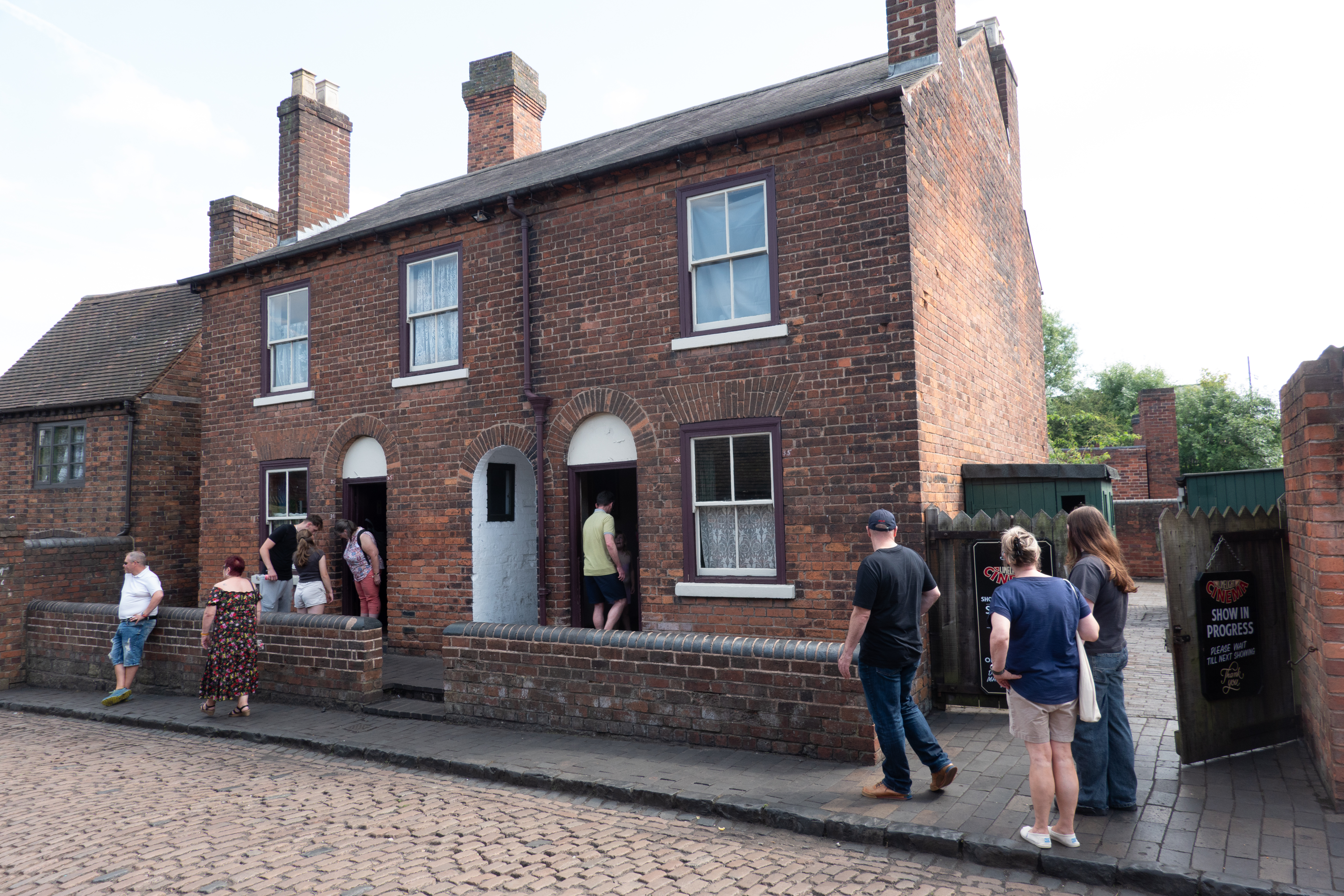
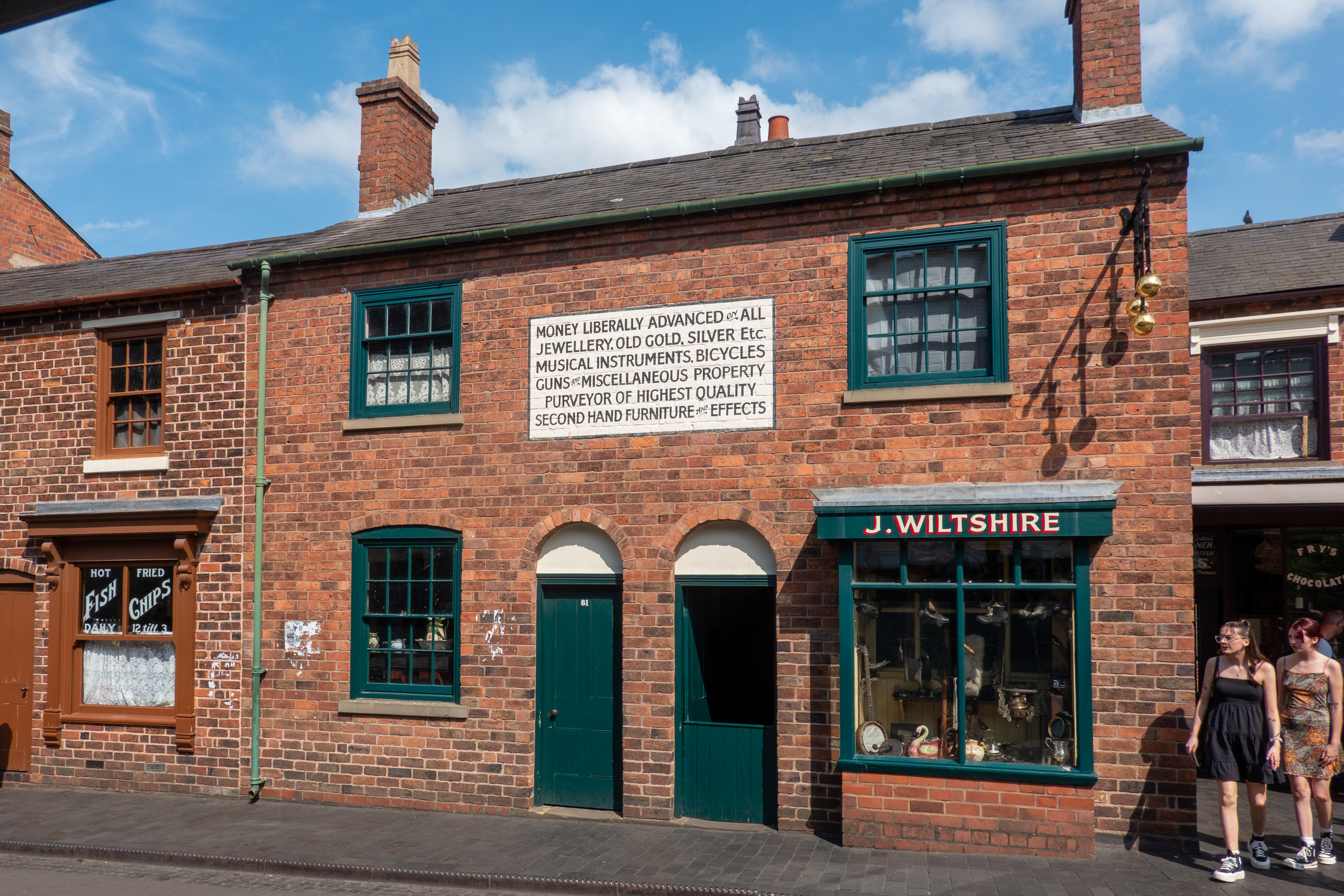
Then it was time to head back to Yatton, to store the camper and begin the final stage of our journey on an Oceania cruise. En route we stopped near Birmingham and visited the Black Country living museum. We love outdoor museums. (https://bclm.com/)
Some of the cottages.
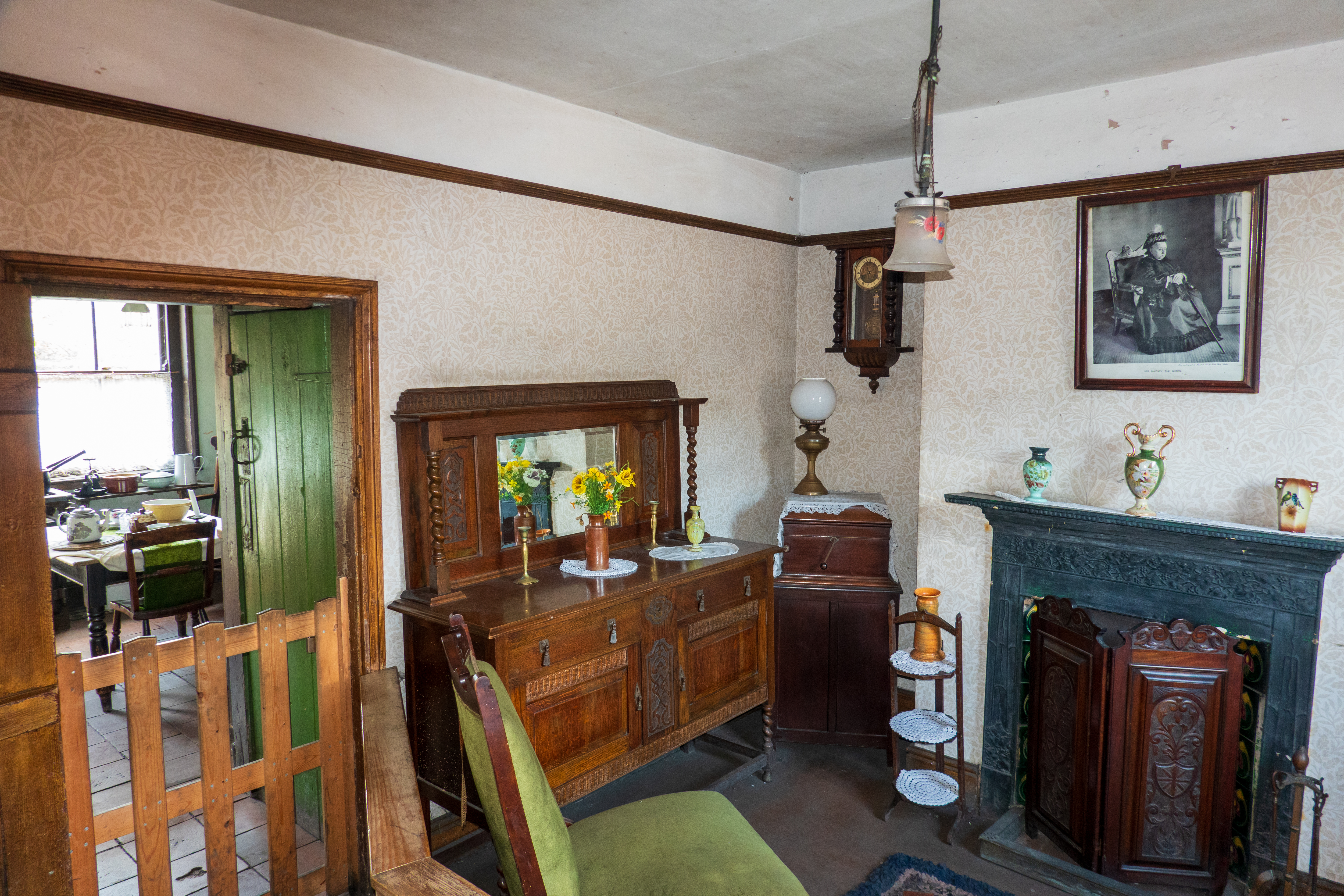
This house was meticulously reconstructed, even down to the tilt. It tilts because of subsidence, caused by mining tunnels settling.
In this case, they were able to locate and interview a previous occupant of the house, and decorate with actual possessions.Denise loved the old car window banner.
We finished by giving the camper a full cleaning and preparation for storage for the winter.
On the spur of the moment, we decided to head to Chiemsee. What is Chiemsee? A large lake (German: “see”) in Bavaria and a popular vacation spot. (https://en.wikipedia.org/wiki/Chiemsee)
We found what proved to be a great campground in the town of Prien. Chatting with the owners, we learned that the family has owned the land for over 500 years. It was no longer big enough to farm but made a great campground. They had a small restaurant and also washing machines. (Regular readers will note a theme here.) We were thrilled and made good use of both the first night. (https://www.camping-prien-chiemsee.de/startseite.html)
The next day we set off to ride the old steam train, built in 1887, which was one of the reasons we were visiting. It was pulled by a diesel locomotive on the day we went, but it was still a fun ride to the port at the lakeside. (https://en.wikipedia.org/wiki/Chiemsee-Bahn)
Not steam, but the cars are the originals.
The tram, running since 1897, only goes 1.8 kilometers, from the train station to the ferry port at Stock, but it is a lot of fun.
Our ticket included a ferry ride to the island of Herreninsel, where we could visit the unfinished palace of Herrenchiemsee, built by King Ludwig II of Bavaria. (https://www.chiemsee-schifffahrt.de/en/home)
The little diesel that did.
The palace was intended to be a copy of Versailles, as King Ludwig was absolutely obsessed (crackers?) with Louis XIV, the Sun King.
Yes, it does look like Versailles.
View down the grand allee to the lake.
It was intended as a monument to absolute monarchy and decorated as splendidly as possible. The amount of gold leaf is amazing and frankly overwhelms. Pictures? Only outside; photography is prohibited inside. Pity, as there are some interesting things to see, including a huge table, which could be hoisted, fully laid, from a room below the dining space. (No need for pesky servants in the room!) And, of course, opulent rooms, public and private. Also lots and lots of unfinished building. Running out of money is a bummer, no matter what your budget. (https://en.wikipedia.org/wiki/Herrenchiemsee) In the end the whole mess, which he never occupied, raises more questions than it answers. It is one thing to admire the king of another country, but to copy a palace, almost room for room? That’s simply silly.
The palace is a distance from the ferry dock and we do like horse carriages, so we rode back. We were, however, eaten alive by the literal clouds of mosquitoes that the heat had brought out, and which were seeking the shade of the carriages! Never saw the like anywhere in Africa!
Fortunately, the mosquitos did not follow us onto the ferry. Returning to shore, we had time for a much needed ice cream before the train returned to Prien and returned us to our bicycles. A most enjoyable day.
We rode our bikes up the steep hill to visit the little church of St. Jakobus in the even tinier village of Urschalling.
The church is known for its frescos. The originals date from the 12th century, but most have been covered with new, gothic frescos from around 1390. The church is open, you can only step into a small anteroom – the there is a grille which keeps you out of the main church and, of course, protects the delicate frescos. Does rather limit your photography, however, and means that you have only a dark and distant view of the frescoes themselves.
The frescos had been painted or plastered over for years.
Dome was added around 1711.
Amazingly, this church, which dates from around 1200, is a stop over on several famous pilgrimage routes, including the Saint James (Santiago) route to Compostela. (https://de.wikipedia.org/wiki/St._Jakobus_(Urschalling) (You may need to have your browser translate.) The frescos are wonderful and the tiny church is a gem.
Note the Byzantine styling.Saint Philomena?
We then continued our route towards Freiburg im Breisgau with a stop at the Womopark Neckartal Stellplatz in Warnau. We had planned to take the Lake Constance route, but the only road through the mountains to Freiburg goes through the Freiburg low emission zone, so we had to detour to the north. This is the first time that a low emission zone has actually made us change our plans. The only reason to visit Warnau was to break the journey but it proved to be a pleasant spot and we actually stayed for two nights. On our second night, we took our host’s recommendation and went to the biergarten in the local tennis club for a typical Schwabian meal. They had a kind of a tasting menu and it was great. We thoroughly enjoyed our taste of local food – one of the best meals of the trip. (http://www.maultäschle.de) Just the kind of serendipity we love.
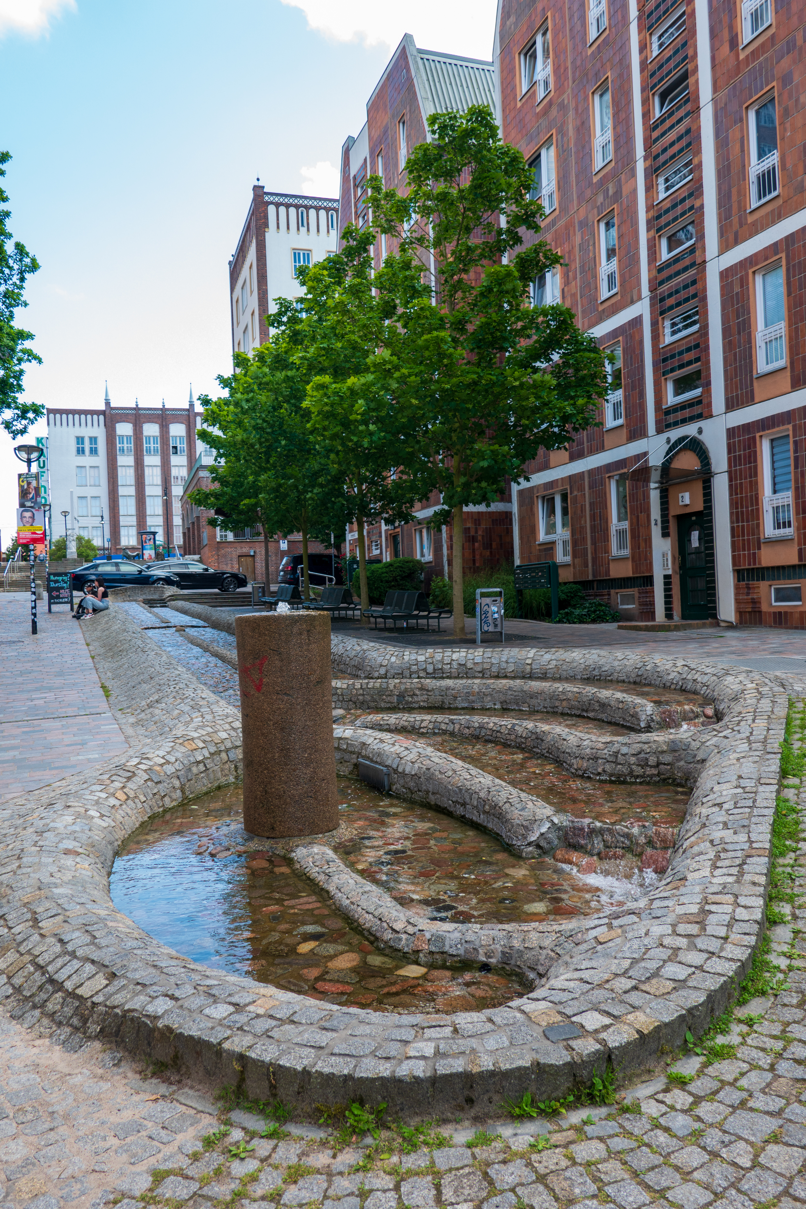
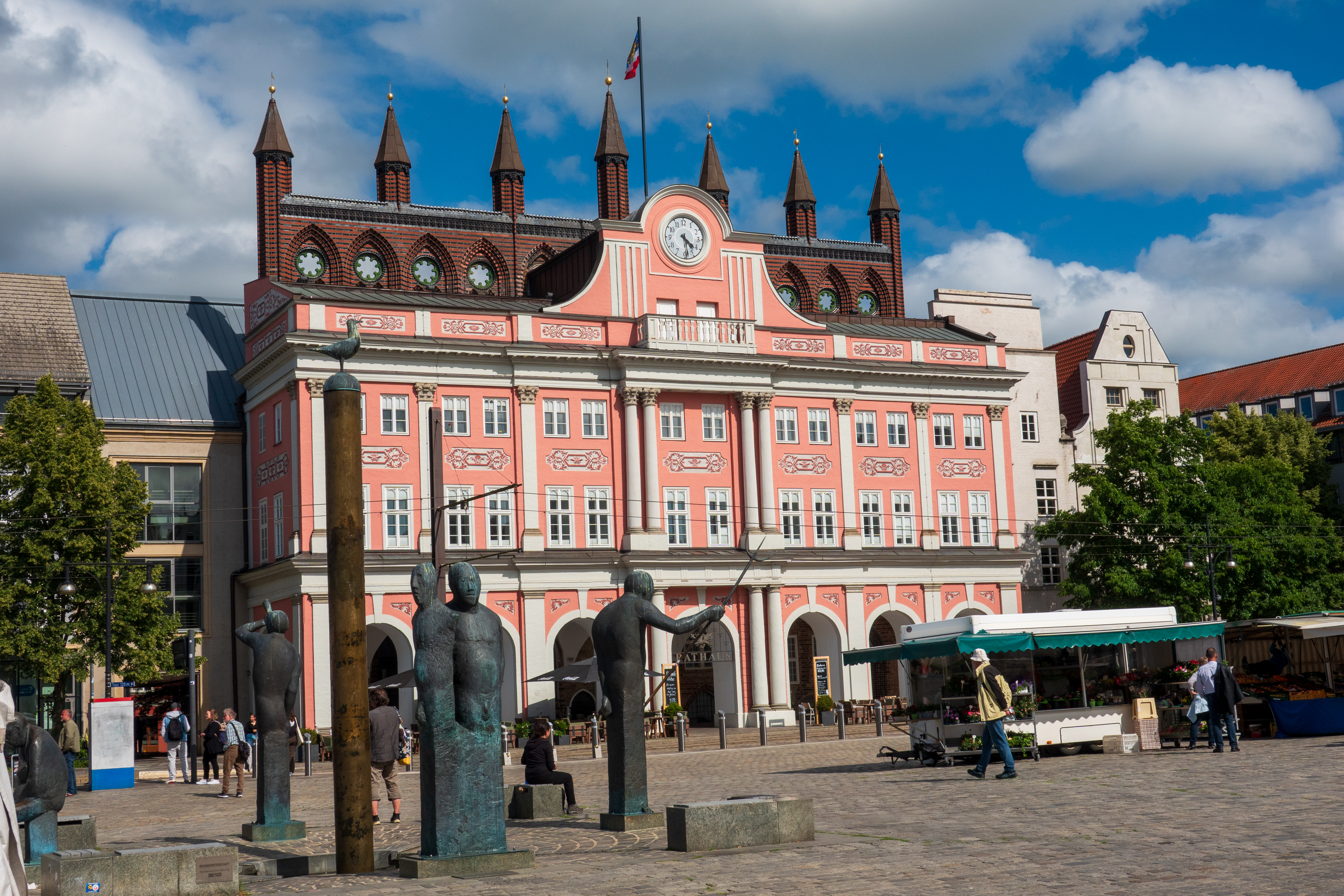
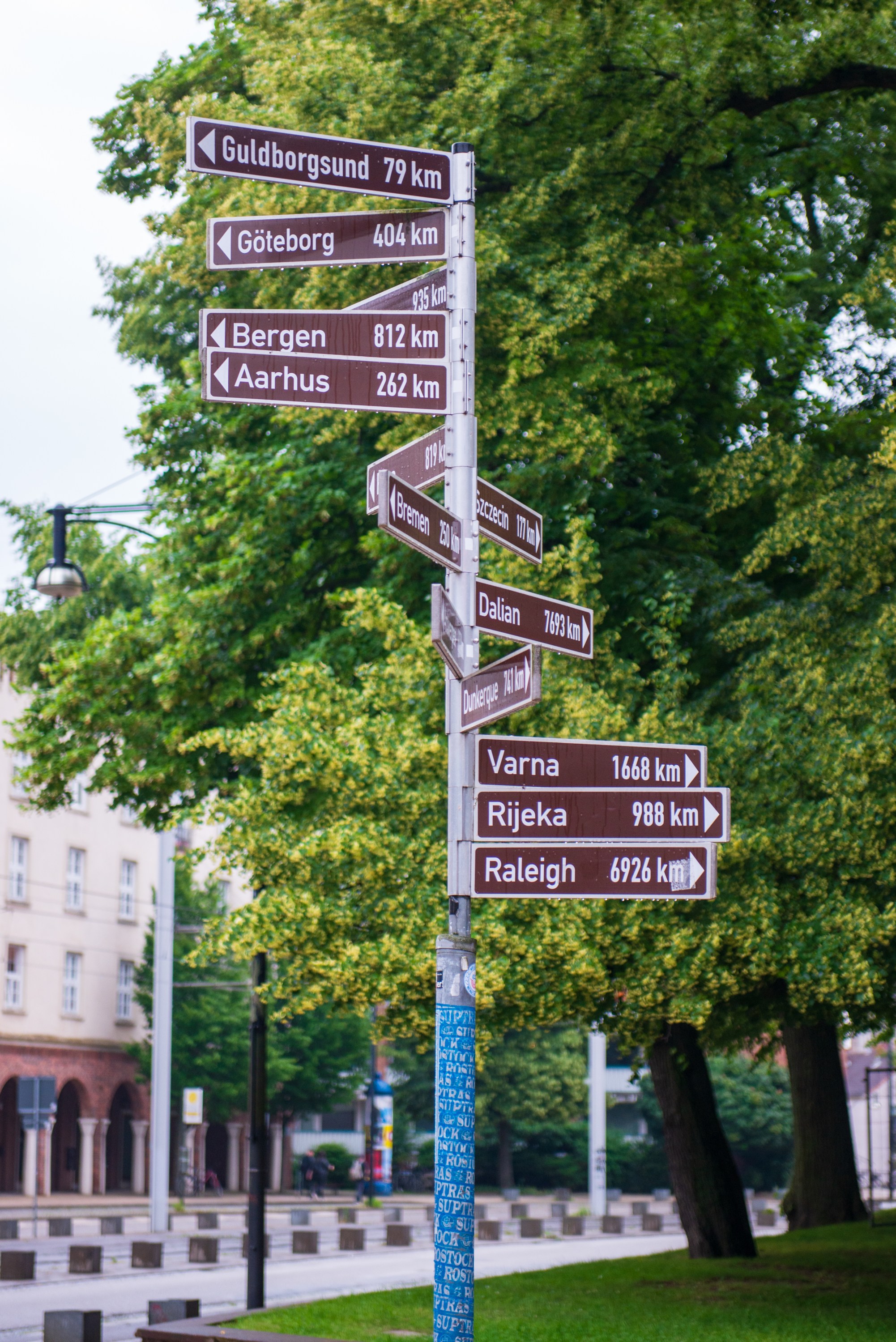
We landed in Rostock and headed for the city parking lot by the port, which accepts campers for a fee. It was a lovely location in easy walking distance of the Old Town and after we were organized (and early enough for a prime waterfront spot), we walked into town to have a look and had a coffee and an apple strudel (shared).
Lots of space when we arrived.
By the weekend it was packed.
Rostock is not high on the list of scenic towns in Germany, but parts were very pretty.
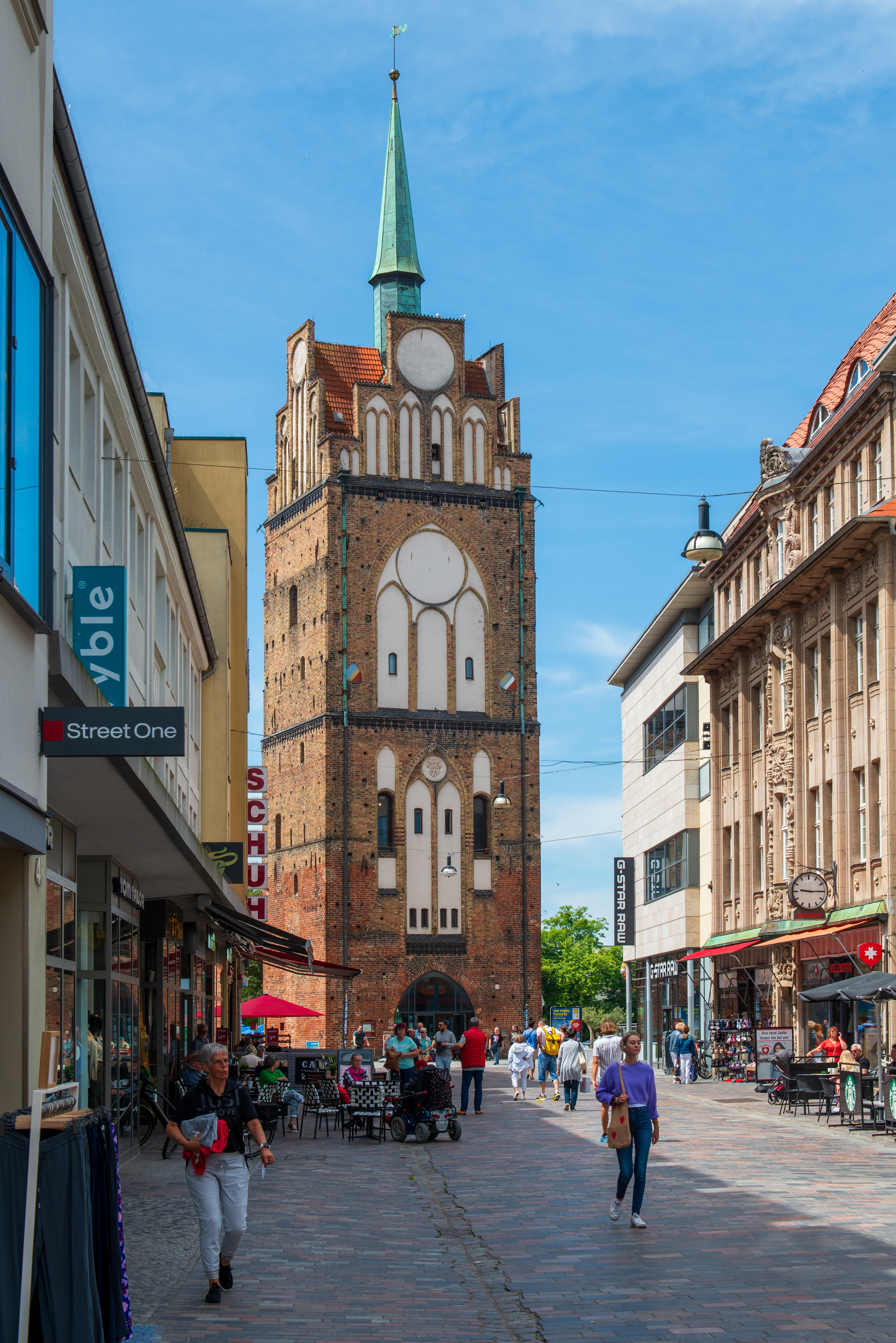
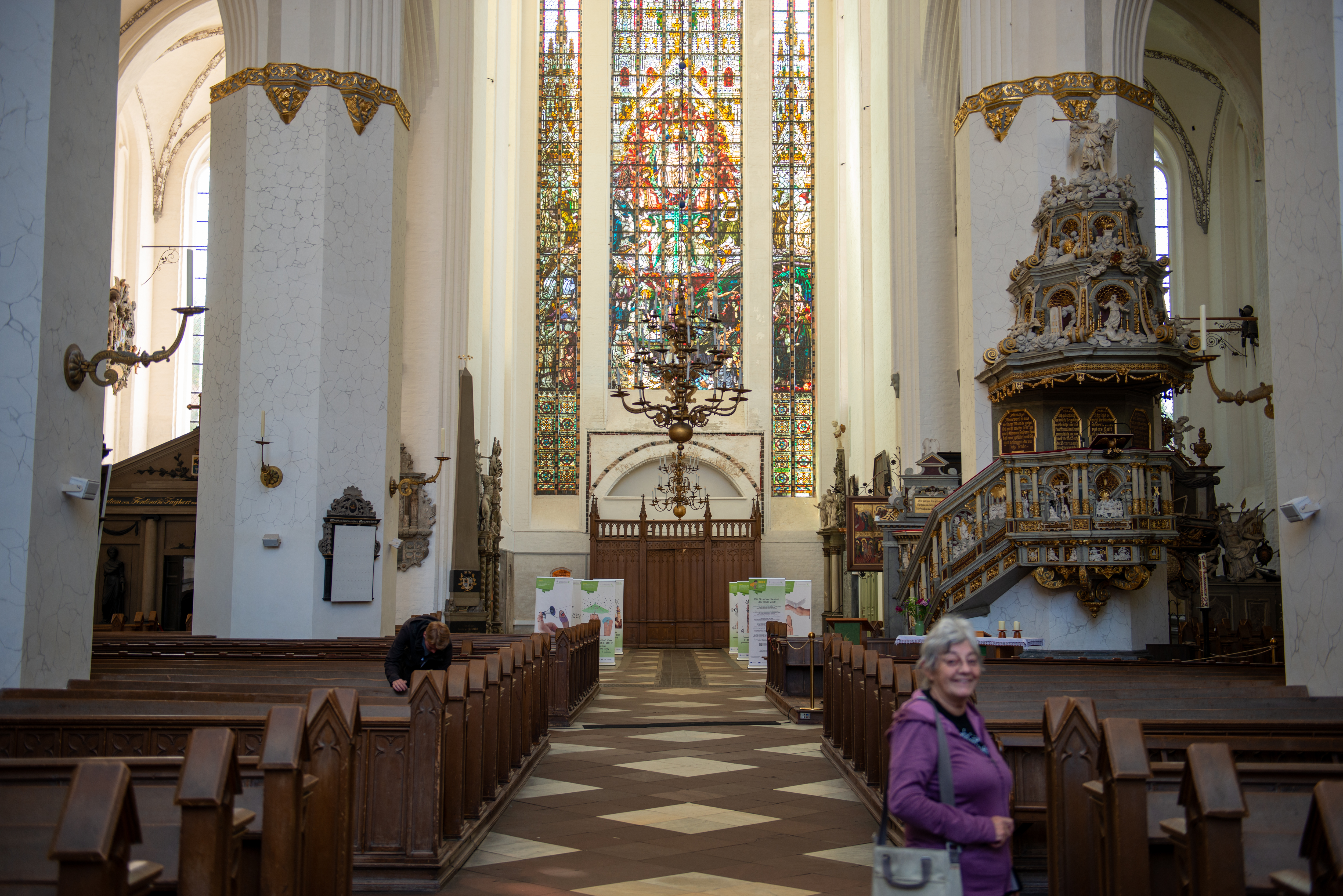
The next day we headed to the Marienkirche, the Church of Saint Mary. A first hall church was built there in 1290, rebuilt as a three nave church and basilica in 1290 and completed in 1398 and 1454. 9https://en.wikipedia.org/wiki/St._Mary%27s_Church,_Rostock)
Behind Denise are the “Last Judgement” window and the ornate pulpit.
It is quite an amazing church, with a huge organ from 1770. The organ has has been rebuilt several times.
Simply massive.
We were able to hear it for three short pieces and thoroughly enjoyed it.
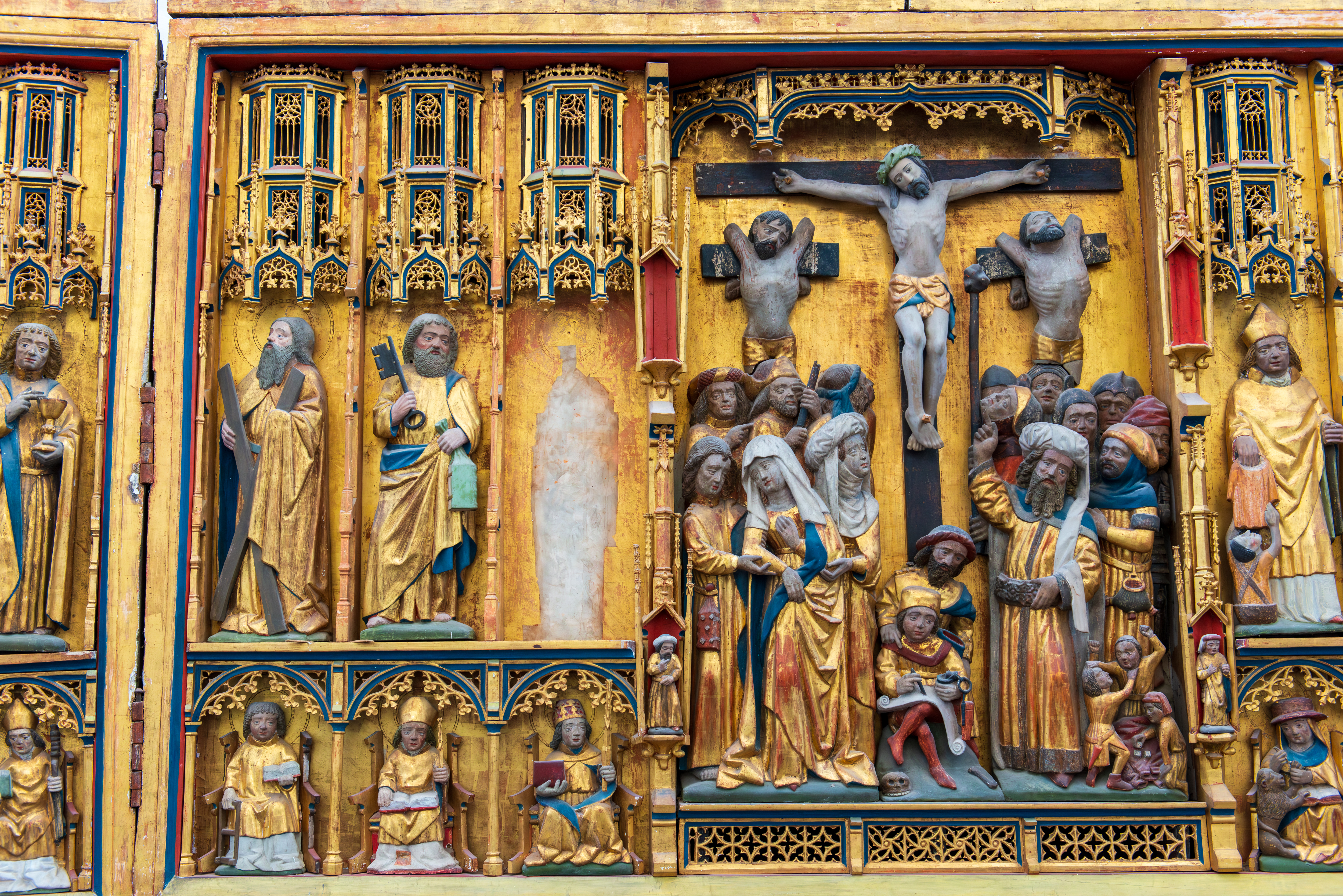
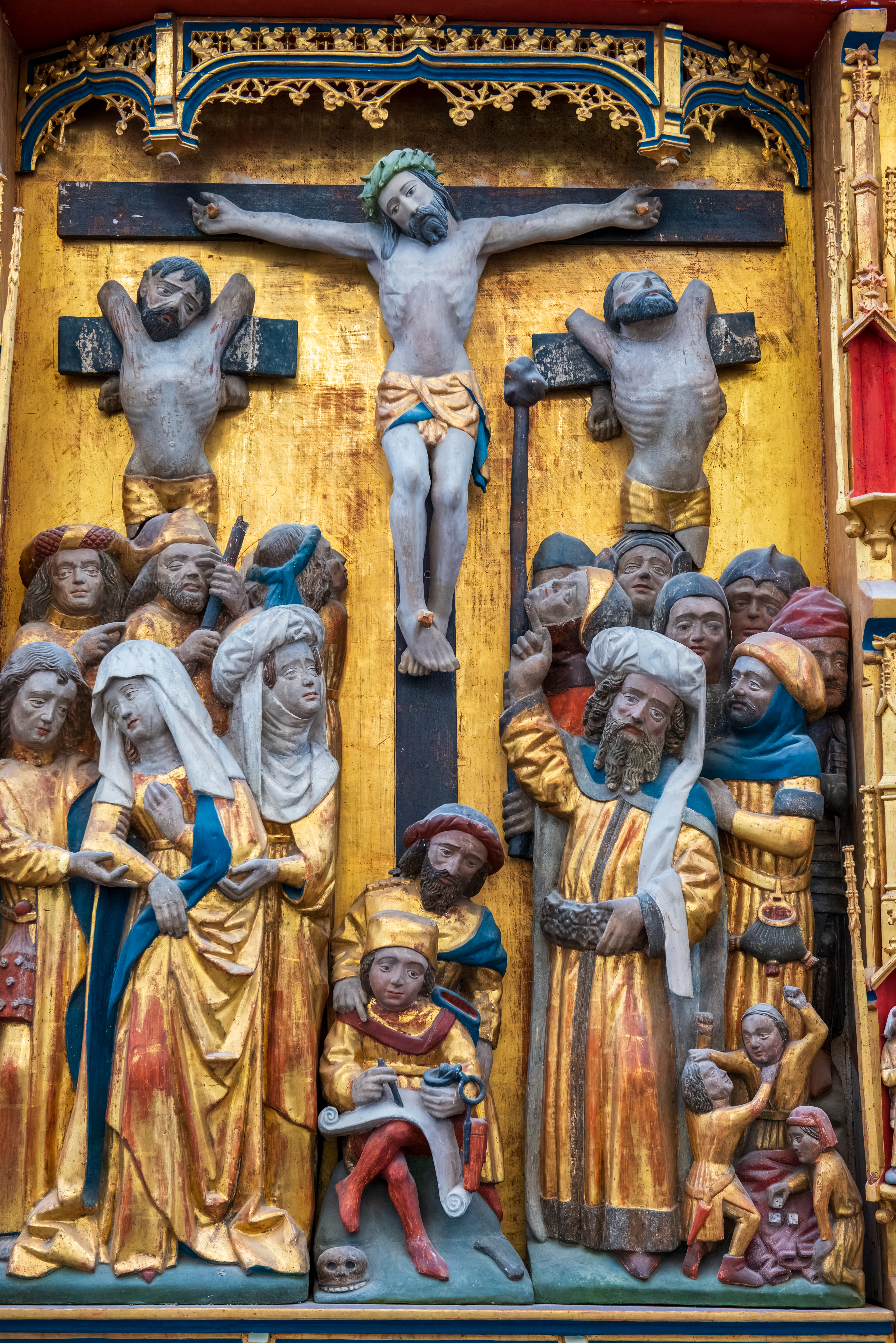
Many European churches have fold out, triptych paintings or carvings, often placed behind an altar. This one was the main altar of the church of Saint Nicolas. The Saint Nicolas Church was badly damaged during the war.
The triptych as presented today.
The triptych was removed for safekeeping during the war. When it came back, one of the saints (St. Nicolas?) was missing.
Things you find in the basement. Not much is known of the origin of this painting on wood, but zoom in and you can find almost every Christian moment/message/symbol, even the Shroud of Turin. Today it rests on one of the walls, a reminder that medieval churches were literally Bibles in stone for people who could not read.
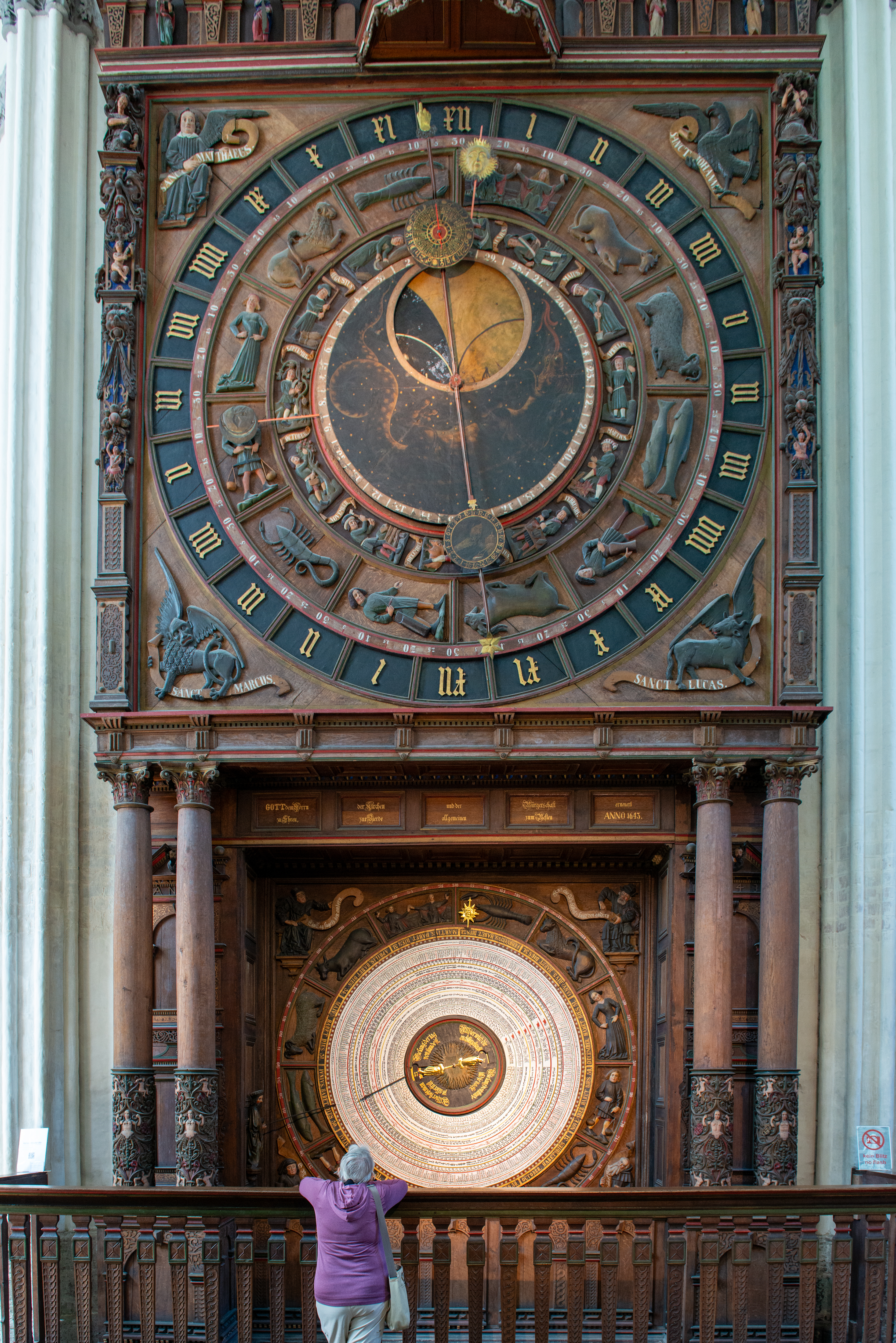
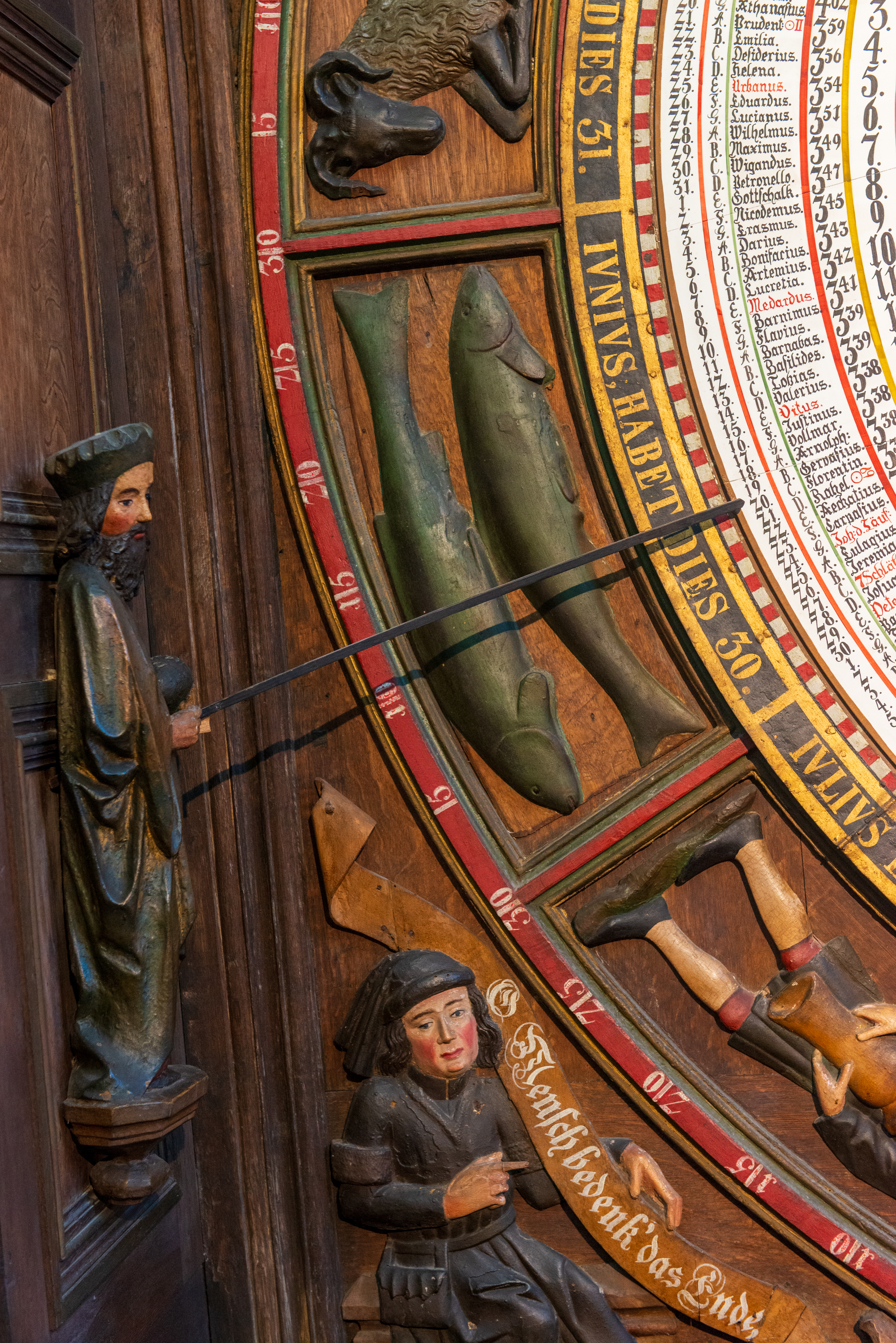
The Church also has an amazing Astronomical Clock from 1472.
Denise getting oriented as to time, space, and the sign of the Zodiac.
It is wound daily, by hand, and still runs on the original medieval clockwork mechanism, which was restored in 1977. At noon, the Apostles visit the Jesus, but they are so far up, you can barely see them. There there is a calendar plate with information on the day and year, with time, zodiac, solar altitude, and phase of the moon. The calendar plate has been replaced four times.
The gentleman in the picture on the left is pointing to the date and time of our visit. You can’t wear it, like a Rolex Day/Date, but it tells you so much more. Note the reminder – June (IVNIVS) has 30 days. Did you remember the I – J and the Y – U shifts? Fans of Indiana Jones and the Last Crusade will get it. And watch their step.
You are here, in time. First time we have ever seen Gemini, the twins, presented as two fish.
Remember learning to read a clock when you were a child. This is the mother of all clock faces.
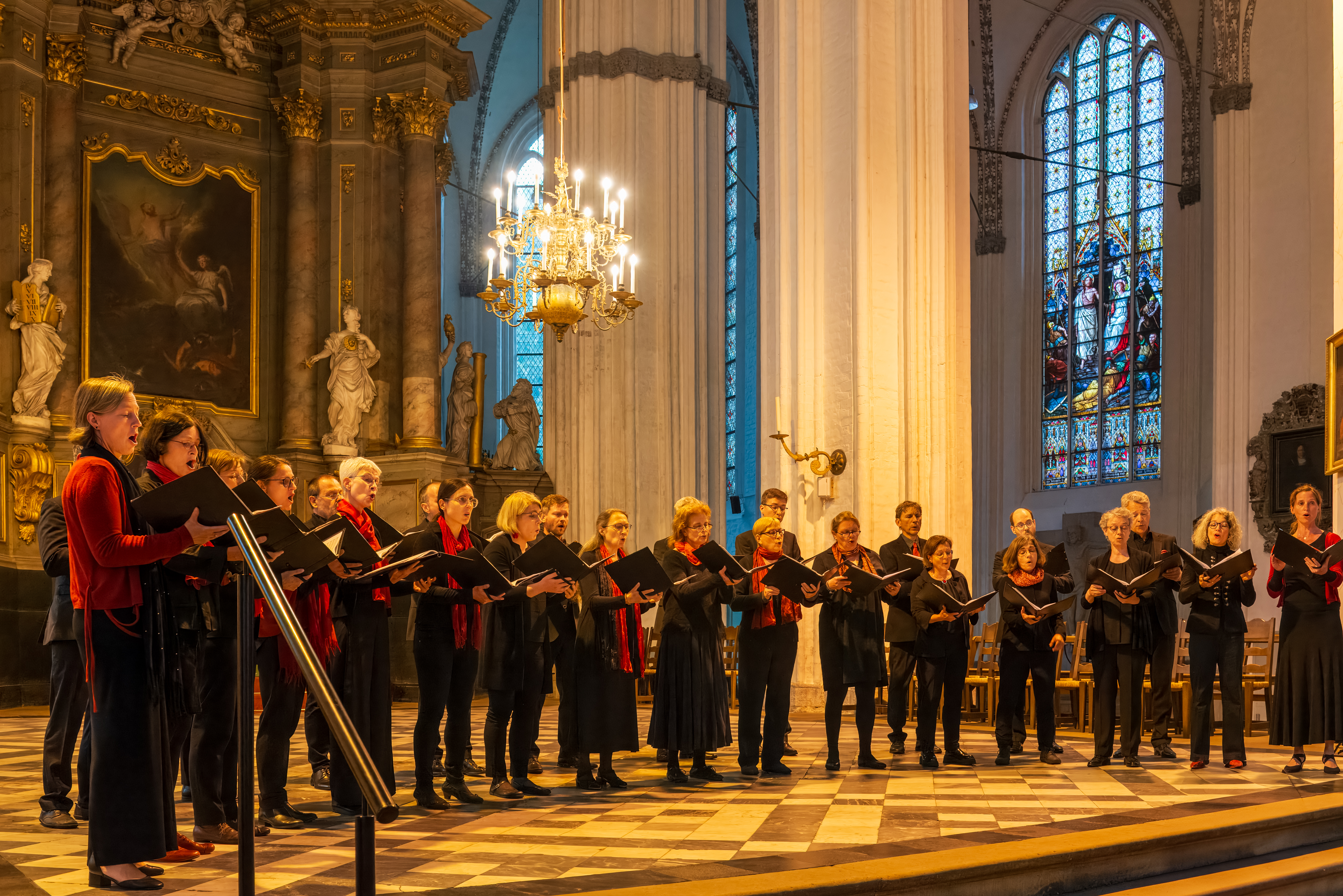
While at the Church, we saw a leaflet for a choral concert on the Friday evening. A visiting choir from Schwerin was to sing a dozen settings of “Songs of Praise, Psalms and Prayers”. We decided to extend our time by a day so that we could attend.
We headed for a currywurst as a late lunch followed by an ice cream extravaganza on the street.
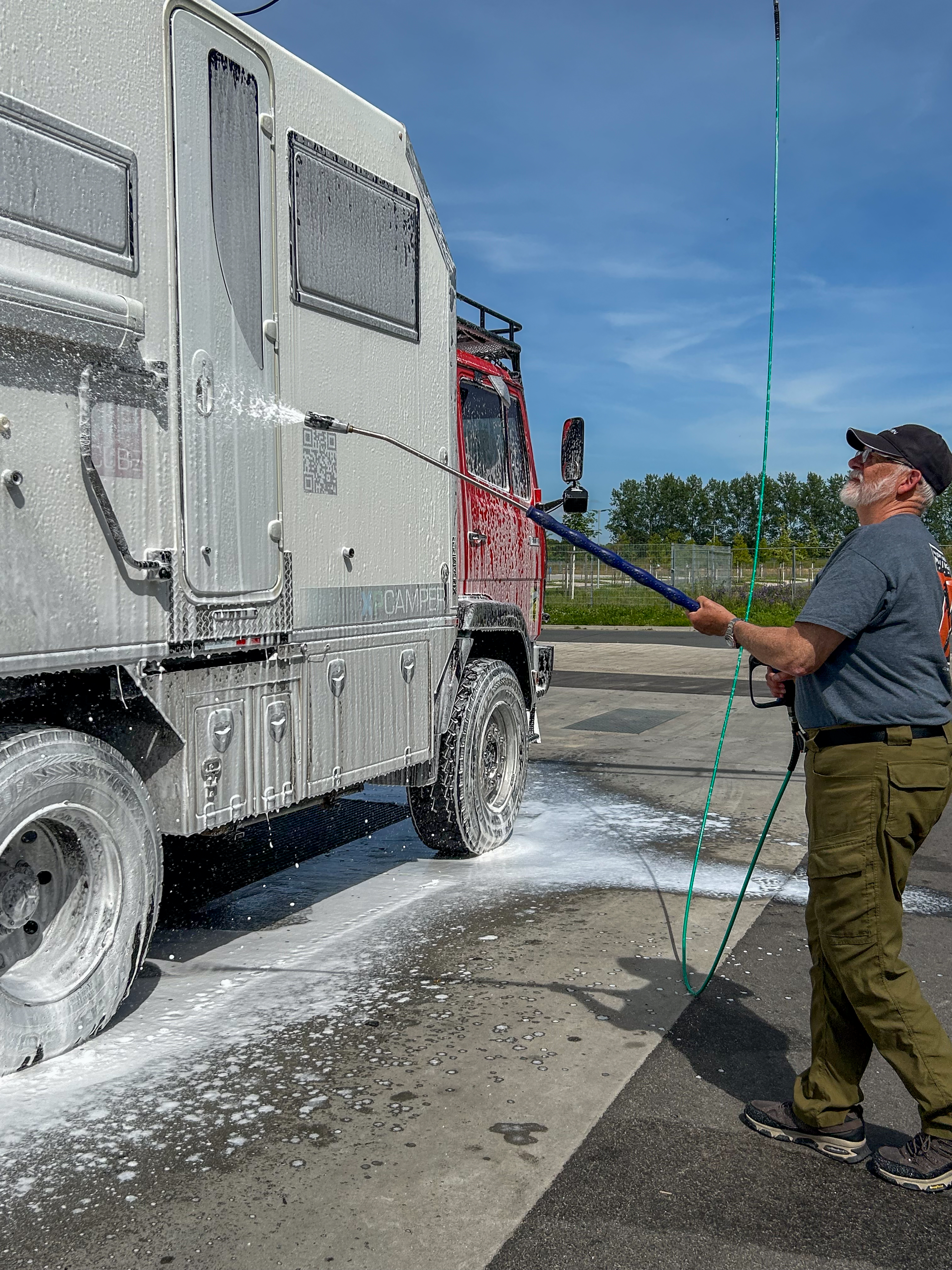
Then we went off to wash the camper as it was dirty. It had proved hard to find a car wash that could handle a camper. We followed a gentleman washing his tractor trailer in preparation for a show! Fortunately he could explain how everything worked.
REALLY needed a brush, but things were still better.
The following day was laundry day and grocery shopping day. Both at the same place and great fun. The grocery store was huge and had absolutely everything.
Rain was forecast but fortunately stopped, just before we left for the concert. The visiting choir consisted of 24 singers and they sang a selection of settings to psalms and other sacred music from Gabrielli to Stravinsky, Mendelssohn to William Mundy (1529 to 1591). Everything was a cappella and the pitch note was given by their director using a tuning fork against his head. He often sang the notes of all four parts. Really quite amazing and beautifully sung.
High altar in the background.
We decided that our next stop was to be Lutherstadt Wittenberg, part of the Martin Luther Trail.
Crossing the big bridge/tunnel from Copenhagen to the southern part of Sweden, we discovered different kroner (the Danish ones had been challenging enough!), and yet another language that we did not speak! We have found being unable to speak these languages more challenging than we expected. We have clearly gotten too comfortable touring where we have no problems communicating.
We headed for Vaxjo because Denise wanted to see the “Glass Country” of southern Sweden. Vaxjo is lake vacation land and we stayed at a nice site backing onto a pretty lake. When the sun came out, it was just beautiful. They gave us a lovely site with a wooden deck, but it rained too much to use it.
The next morning, we got on the bikes and headed into town, with a pause under an overpass to let a cloudburst pass.
Downtown Vaxjo turned out to be very pretty, with more lakes, a scenic church, and graduating students marching everywhere.
Our first stop was the glass museum, which turned out to be more of a display of artistic glass pieces than an actual museum.
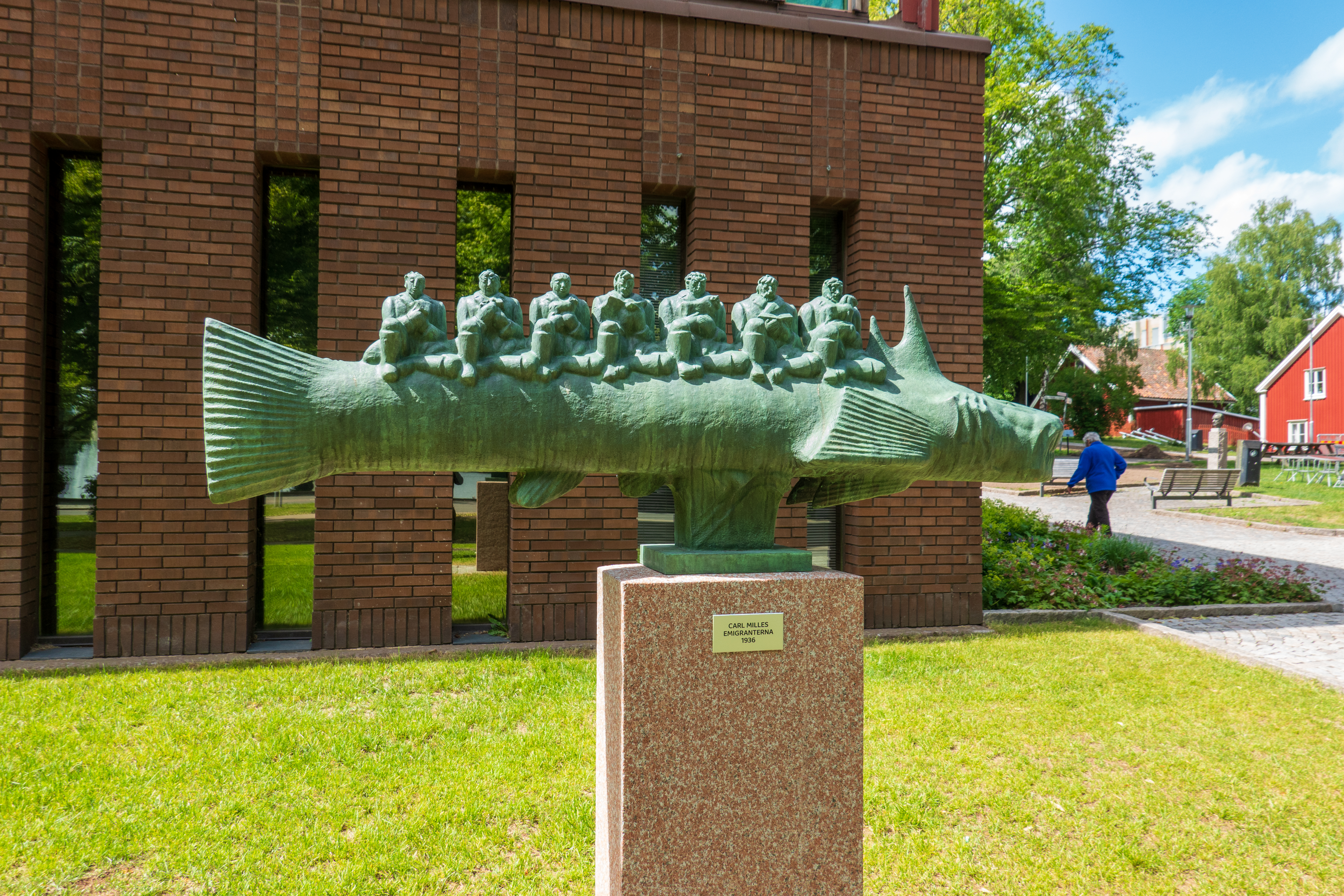
But we very much enjoyed the Museum of Swedish Emigration, which dealt with the vast number of Swedes, who had emigrated to the US, including mode of transportation and where they settled in the US. Some fascinating artifacts and stories of Swedes on the Titanic – some made it, many did not. We had seen a mirror image museum in Duluth, Minnesota.
Artistic representation of immigrants on a fish.
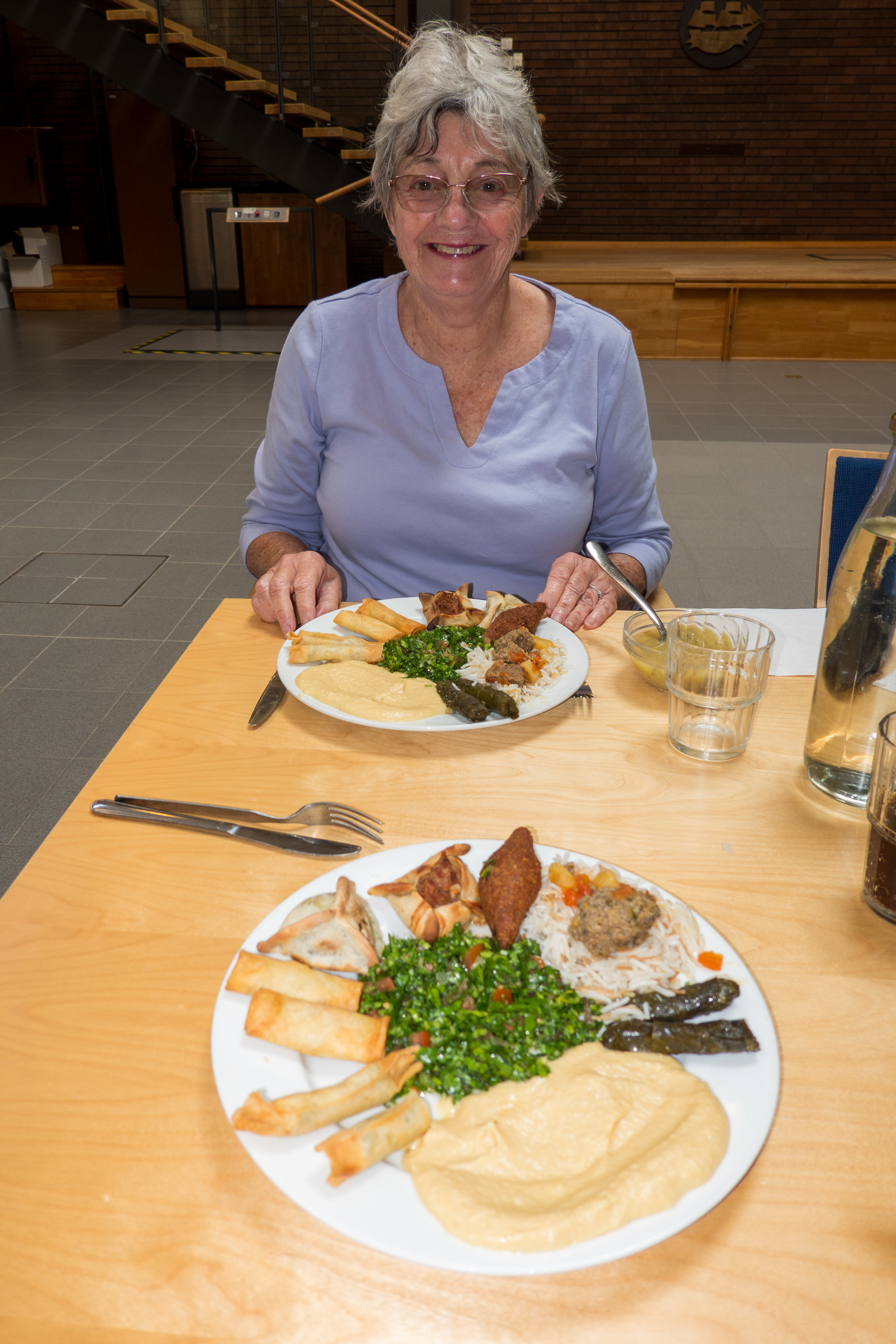
The Museum had a lunch counter serving Lebanese food, to our surprise. So, of course, we ate lunch there and had a nice chat with the owner and her mother.. An interesting reminder not to focus exclusively on immigration to the United States. There are immigrants going everywhere – anywhere they can make a better life.
After lunch, we took advantage of a break in the rain and wandered the town a little, visiting the church. As might be expected, the church featured some interesting glass decorations.
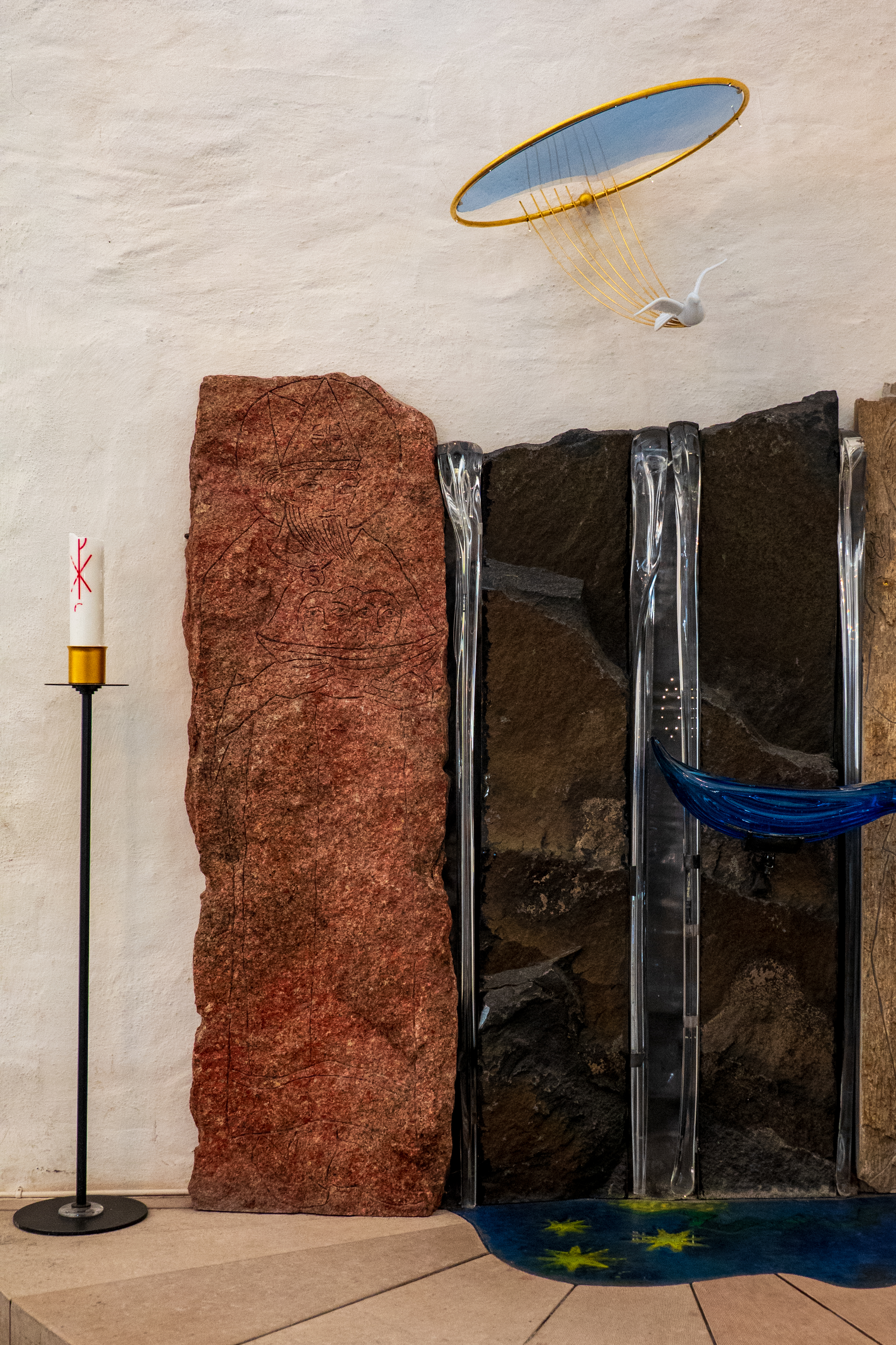
Tree of life with votive candles.
We always light a candle for all of our friends and the state of the world as a whole.
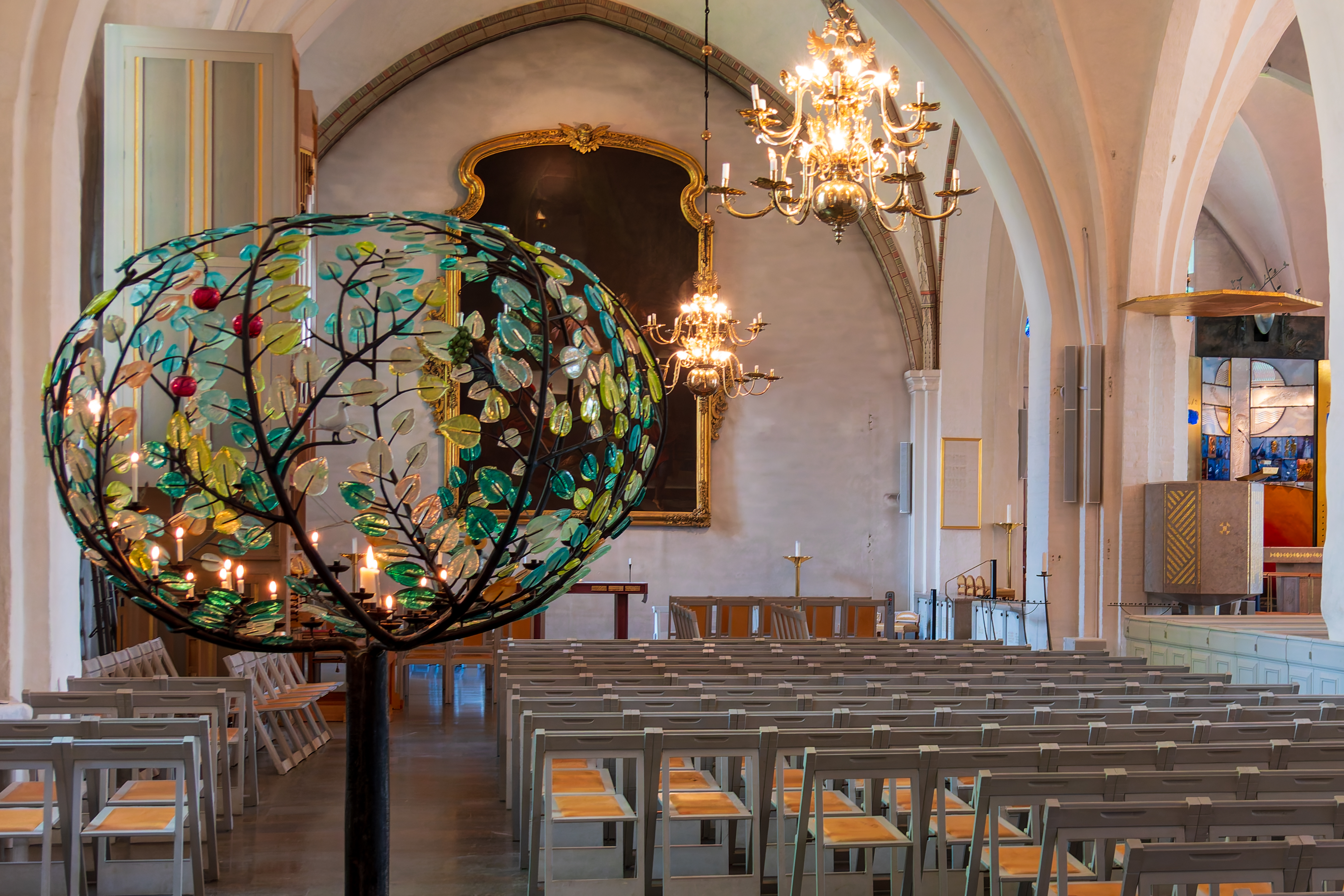
Unique baptistery. (Click to expand and admire the dove.)
Pretty glass decoration in three dimensions.
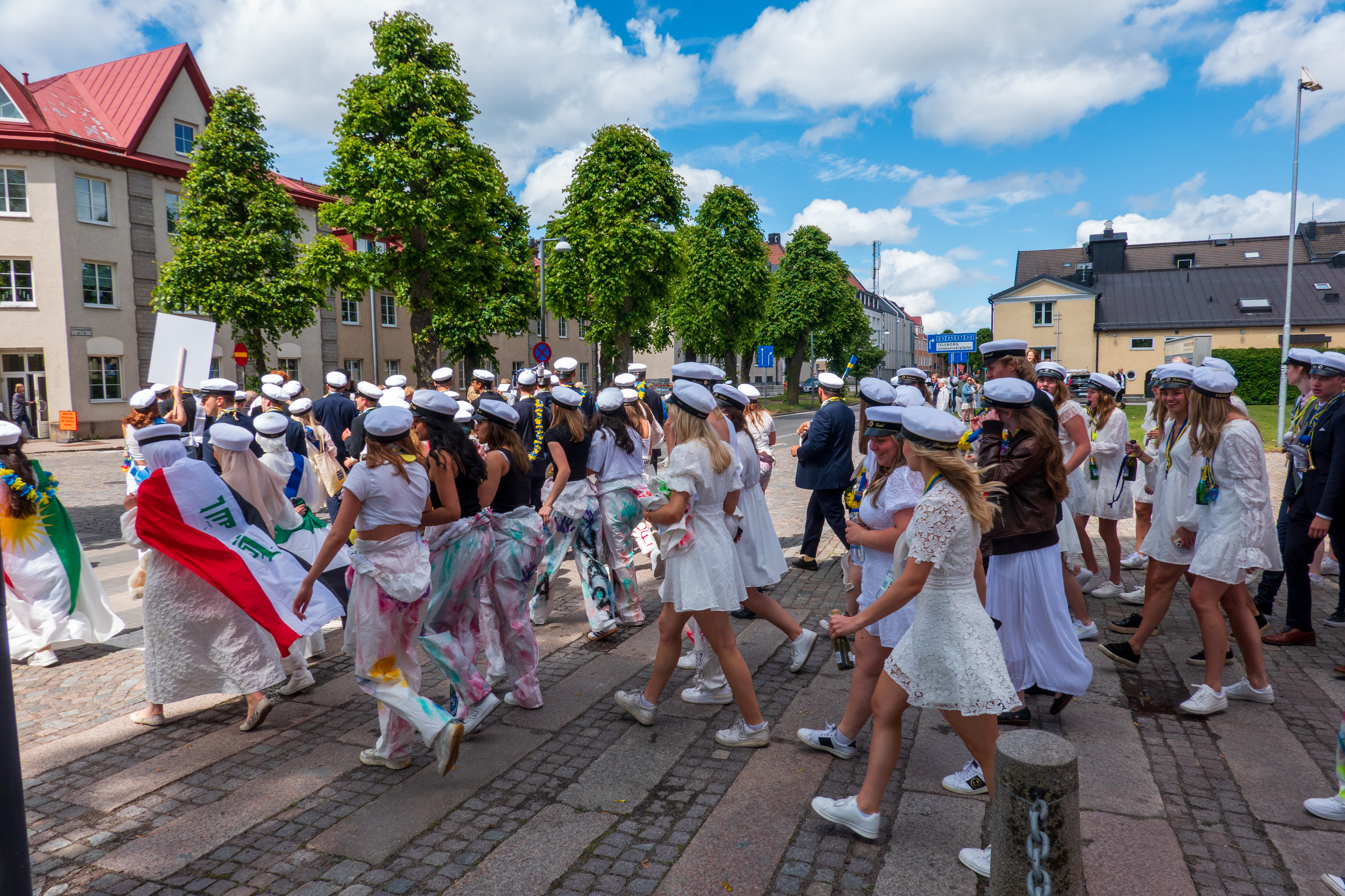
Stepping outside the church, we applauded a parade of graduating students, many wearing the flags of their home nations. We then dashed for the camper before the next deluge. Yes, rain is still a common feature of our travels!
Every graduation needs a band.Many of the students were wearing the flags of their home countries.
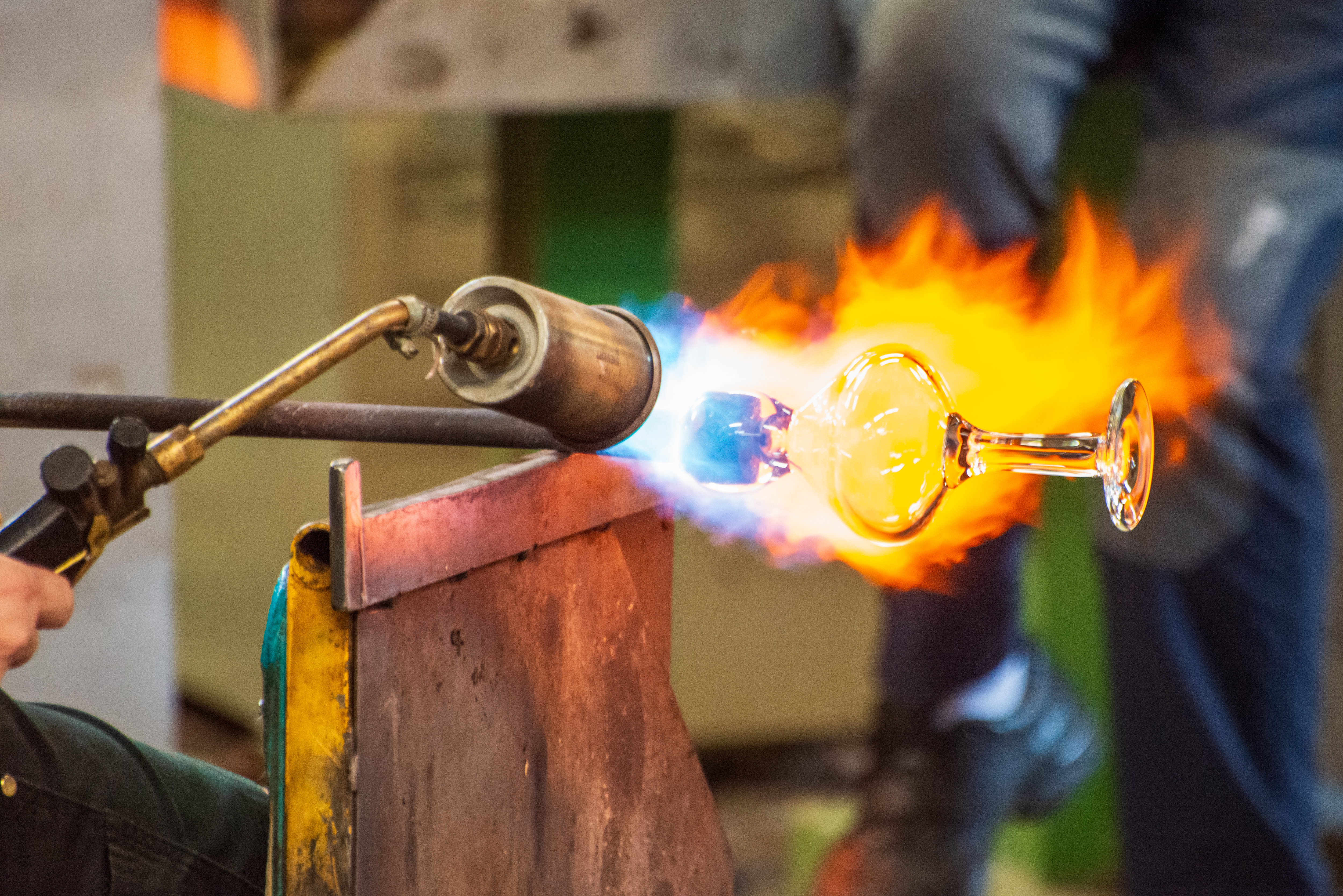
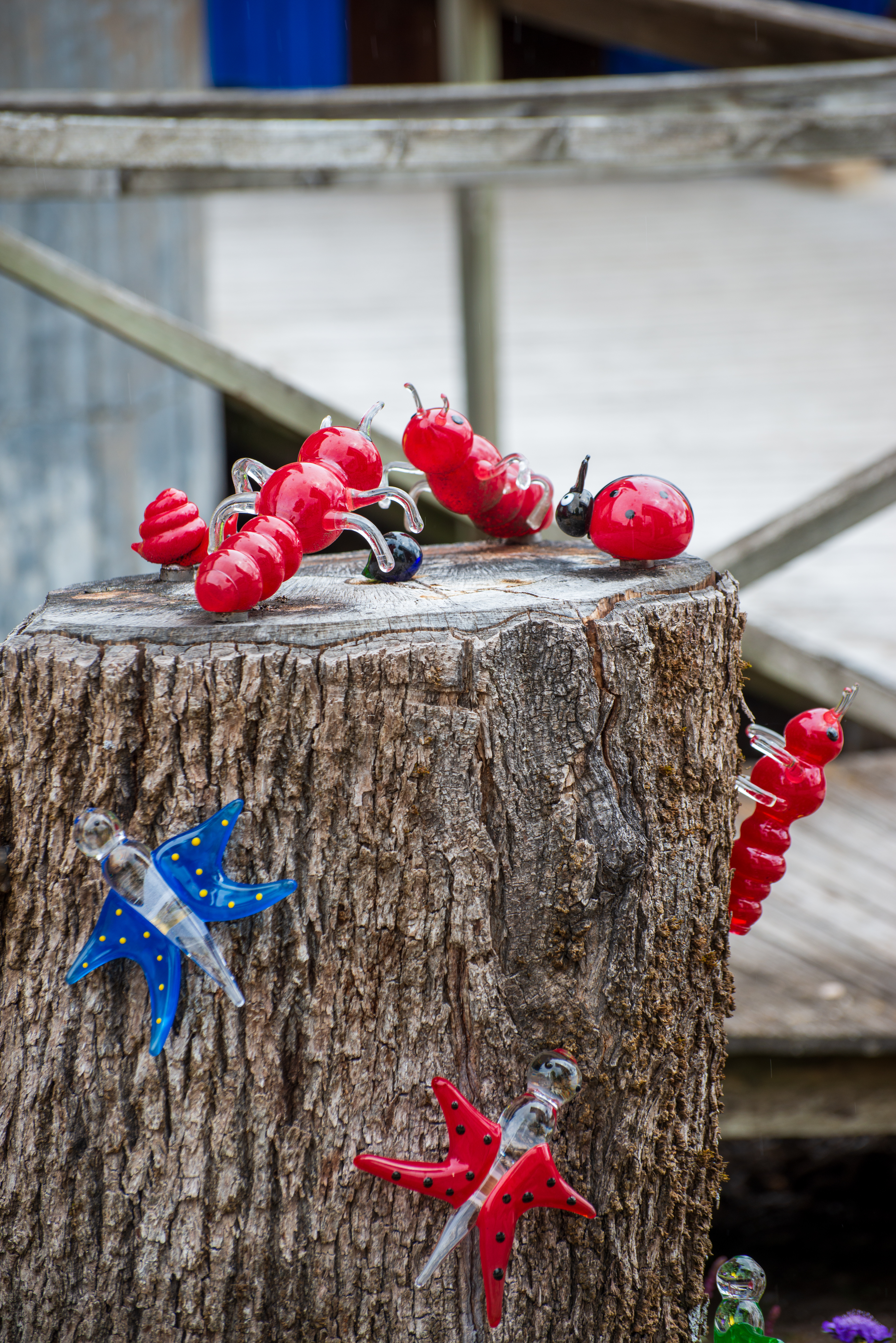
Next day we headed east and stopped at a couple of glass blowing workshops and sales points. The best was the Bergdala Glass works where we could watch glass blowers in action. The whole process is fascinating and a complete OSHA nightmare!
Glass insects on a stump in the parking lot.
Glass blowing has always been labor intensive and glass decorating even more so.
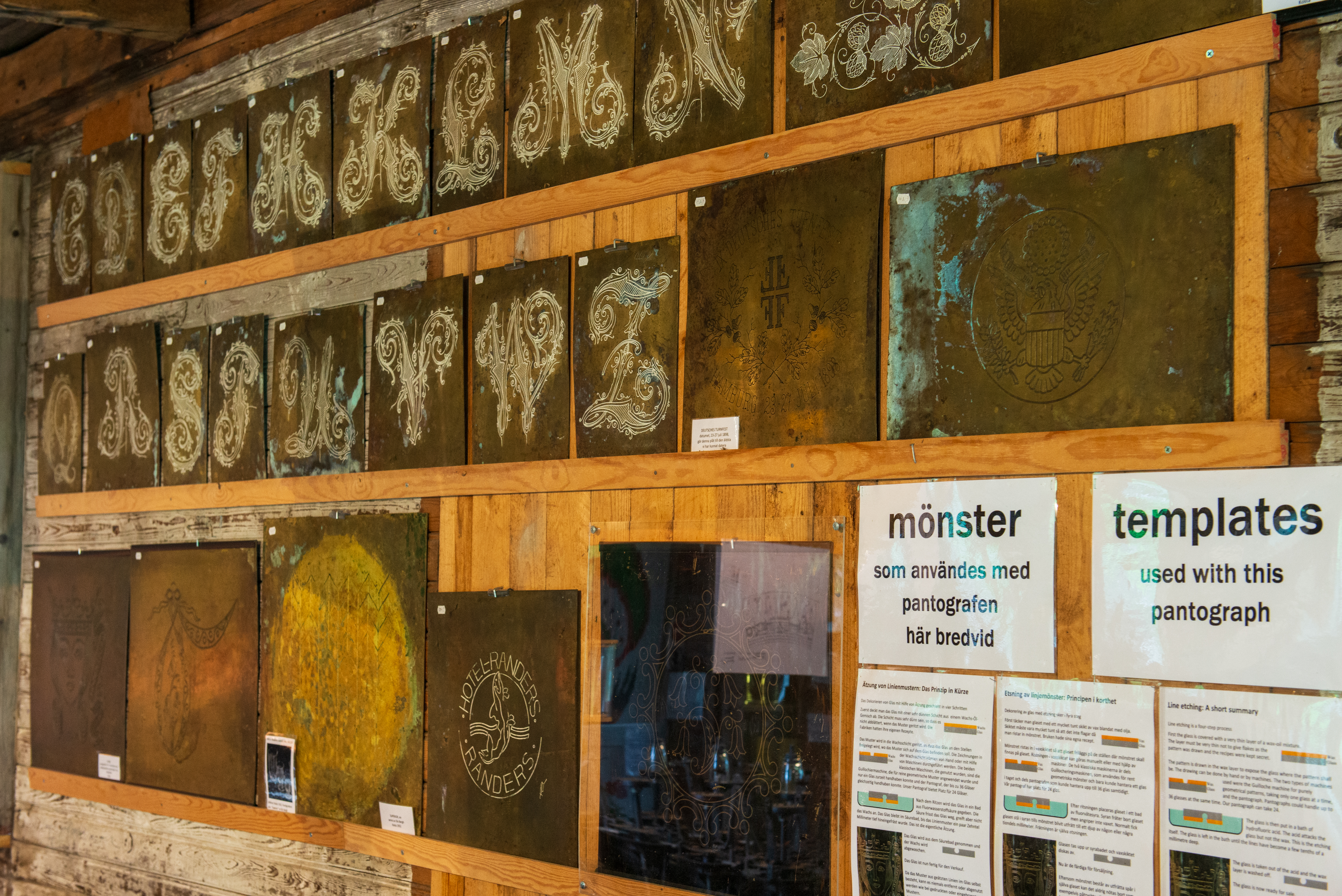
Templates for patterns that would be cut by the machine in the image to the right.
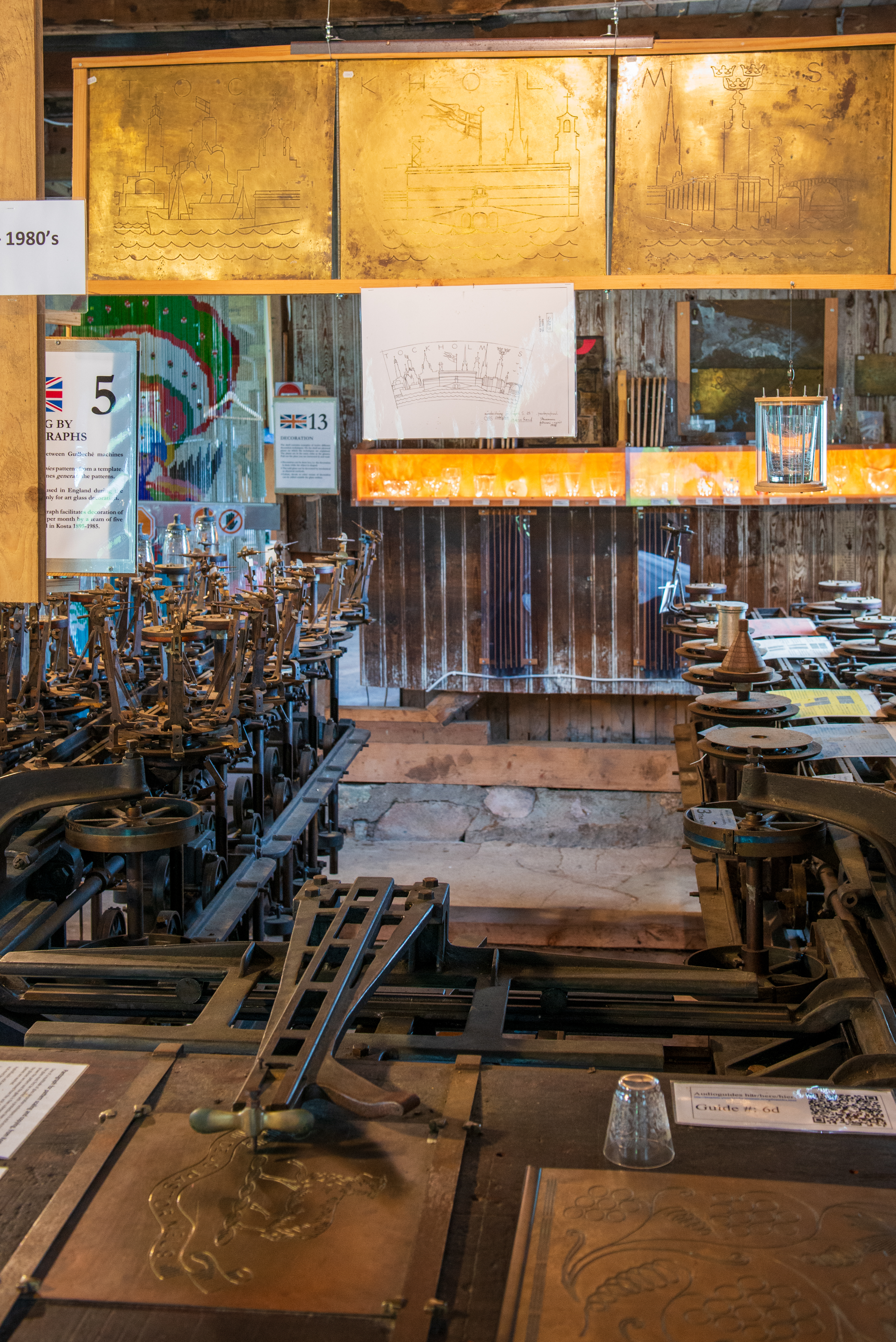
As the (very) skilled operator traced the pattern in the foreground, it would be cut into a dozen glasses at the back.
This device would put a design on one glass at a time, but required no great skill to use.
In the 1800’s there were some amazing machines developed to automate the process and make decorated glass more accessible for more people. Next to the glass blowing demonstrations there is a fascinating museum, full of historical glass moulding and decorating machinery, dating back to the 19th century. The Museum docent was very knowledgeable and explained it all to us. We tend to think of programming as something to do with computers. These machines were programmed with various cams and gears. The process is quite complex but very interesting. Drill down on the various links in this site: https://bergdala-glastekniska-museum.se/eng-index.html Lot of interesting reading for mechanically inclined souls who want to learn a bit about the industrial revolution and the transition of a luxury good into a commonly available product. Like most people, we have always just looked at glassware and never considered what it took to create it.
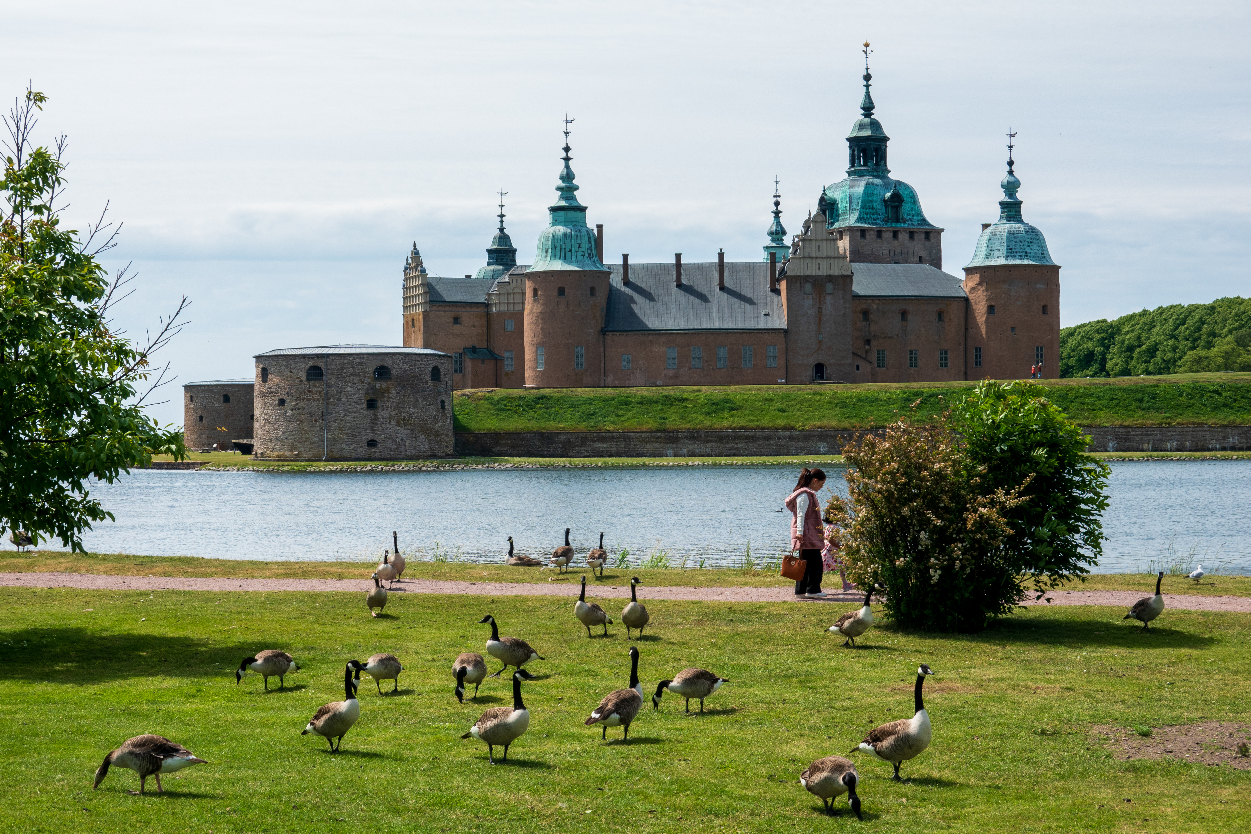
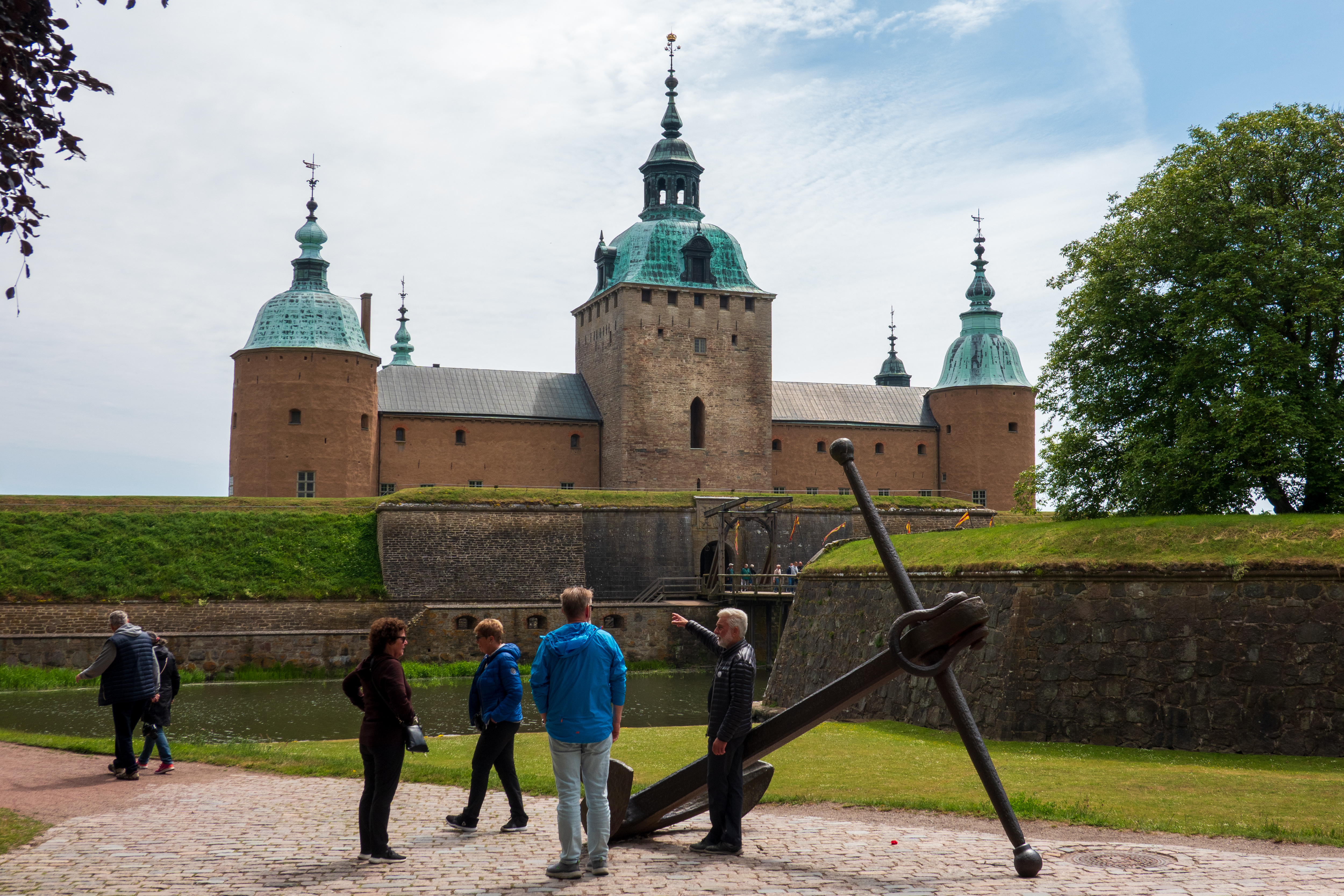
Our last stop on the Swedish mainland was Kalmar, which has a lovely old castle dating back to 1180.
Speaking of immigrants, the Canada geese have moved in.
Initially a defense tower to protect against pirate attack and attacks by other enemies, it was slowly extended and was indeed a mighty fortress as it was strategically placed on what was, historically, the southern border with Denmark. The Swedes and the Danes have a long and turbulent history. Later it was transformed into a Renaissance palace. It remains a symbol of Kalmar and was long a site of international politics, courtly intrigues and sieges and battles.
Main entrance. Note the square tower in the middle, the oldest part of the castle.
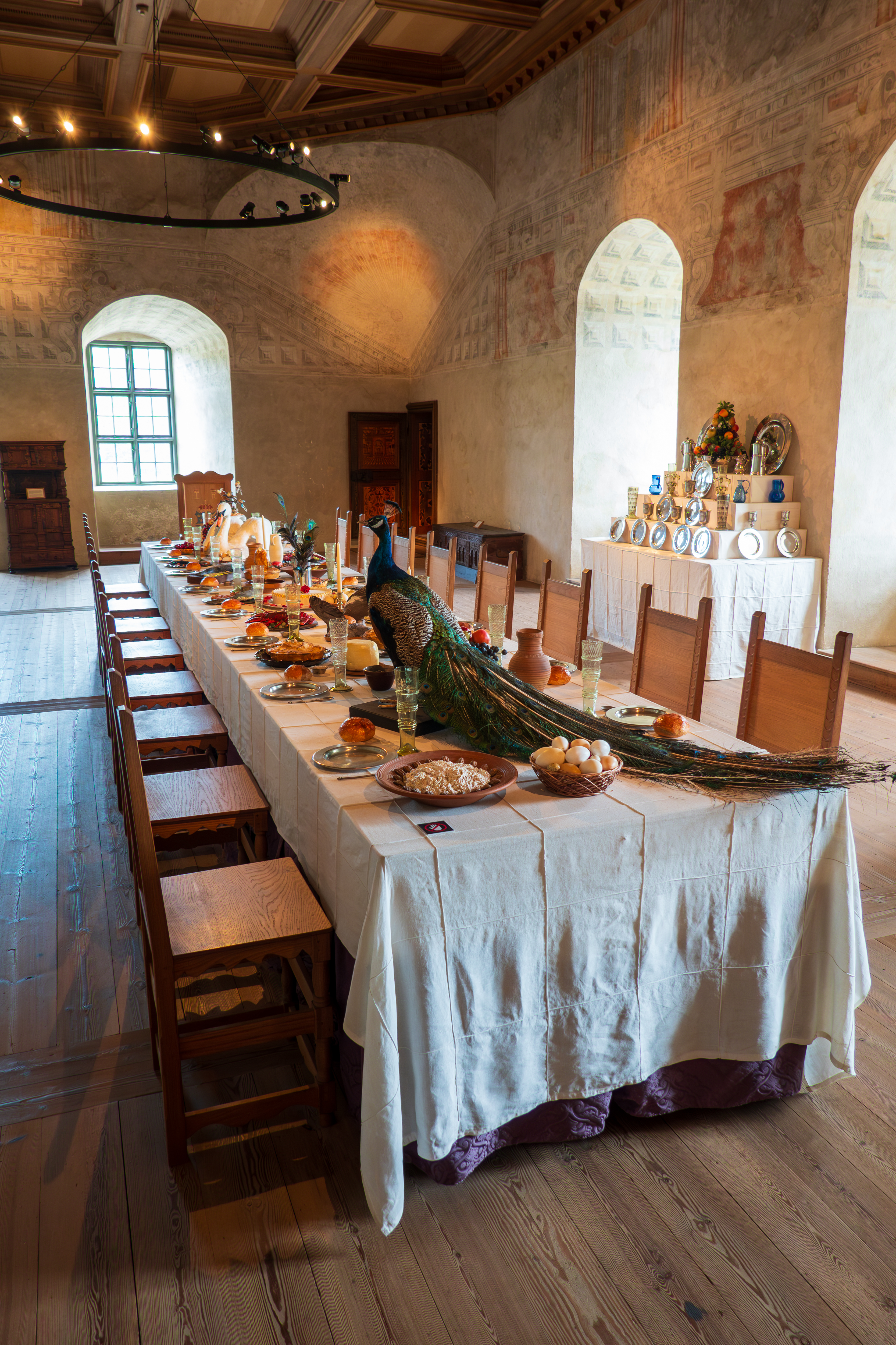
We thoroughly enjoyed our visit and admired the models of the castle at different stages of development over the centuries, the various items of medieval furniture, and a huge, walk through, multi media presentation on witches, their trials, and their burning(!!). (Not our favorite exhibit.)
A table in the Grey Hall was set for a dinner during a specific visit of the king of the era, including a white swan and a peacock with full tail plumes on the table and a selection of typical foods, like fish pie with a pastry fish standing on it.
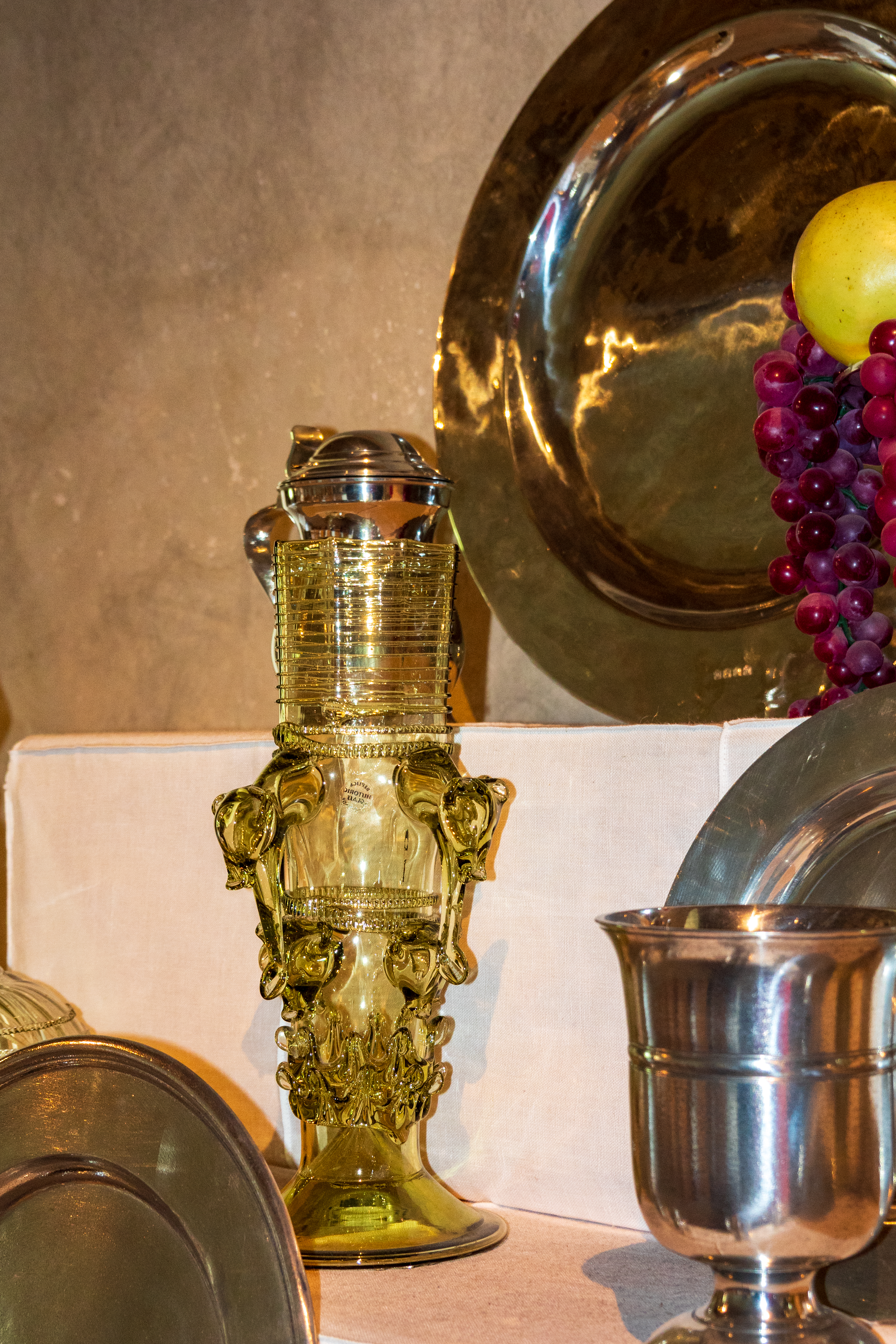
Note the moulded, decorated glasses. (Click to expand.)Where all of that food is prepared.
Decorated glassware – now has a new meaning.
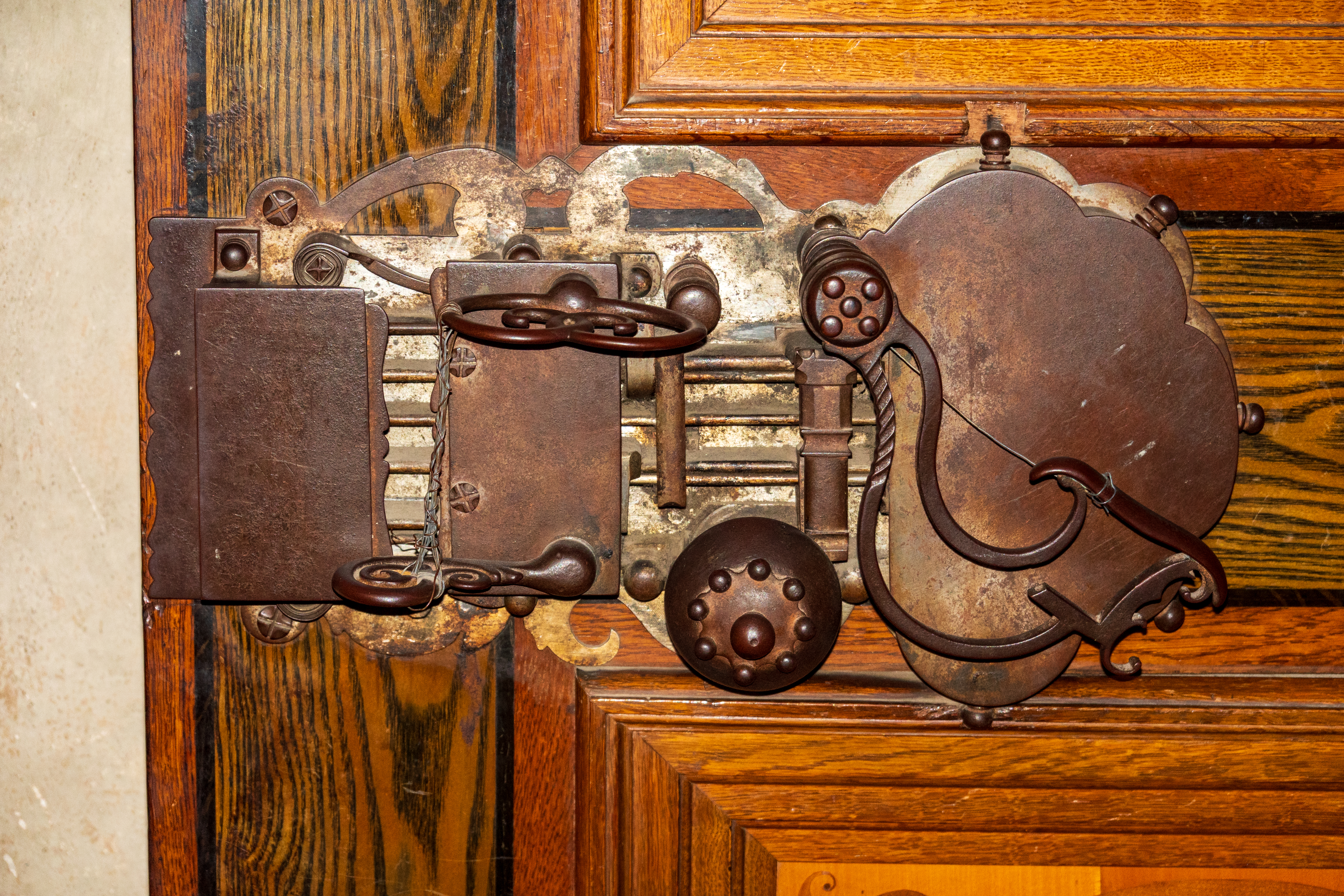
Ornate lock.
The castle was used as a women’s prison at times.Royal Apartment
Hollywood gets it wrong. You can’t pick the lock when there is no door. They simply lower you through the ceiling, if they don’t simply drop you.Detail of hunting scene around the ceiling.
After a cycle through town, we returned to our campsite to take on fresh water and drain our grey water. We were parked at the service point when we suddenly noticed smoke rising. Lots of smoke. A large camper had caught on fire and, within moments, flames were leaping towards the sky. A scary situation, with campers all around it. Fred encouraged them all to move, which they did, before tires began exploding. The fire department came and stayed until it was out and just a burned out hulk on the ground. The firemen told Fred that they do not try to extinguish an RV fire – too much diesel fuel to spread and too much propane. They control the spread and let it burn out. What a dreadful thing to happen.
We then drove onto the island of Oland and found a stellplatz by a small harbor where we could camp.
We set out on our bicycles to visit an Iron Age Burial site with a number of different stones, some set in a circle, some in a boat shape, and some burial mounds. It was most interesting and a good ride.
The next day, we awoke to sea mist and had to wait for it to clear before daring to ride the roads.
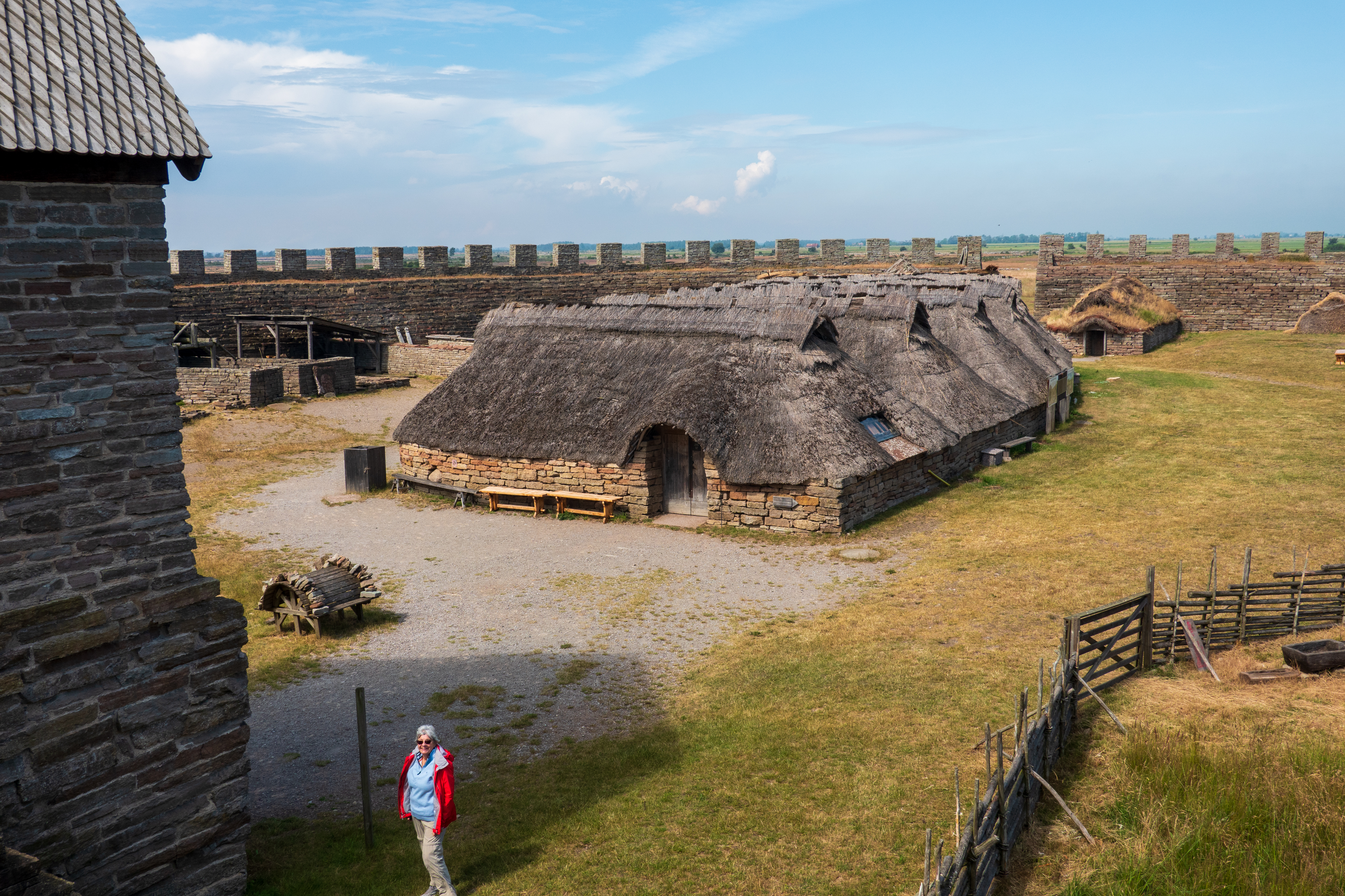
By afternoon it was clear and we headed off for the Eketorp Fort, a 5th century reconstruction.
We knew it was closed (it was Monday after all!) but the gate was open and at least 20 visitors were rambling around.
Fighter planes dueling overhead. We could hear, but never see them
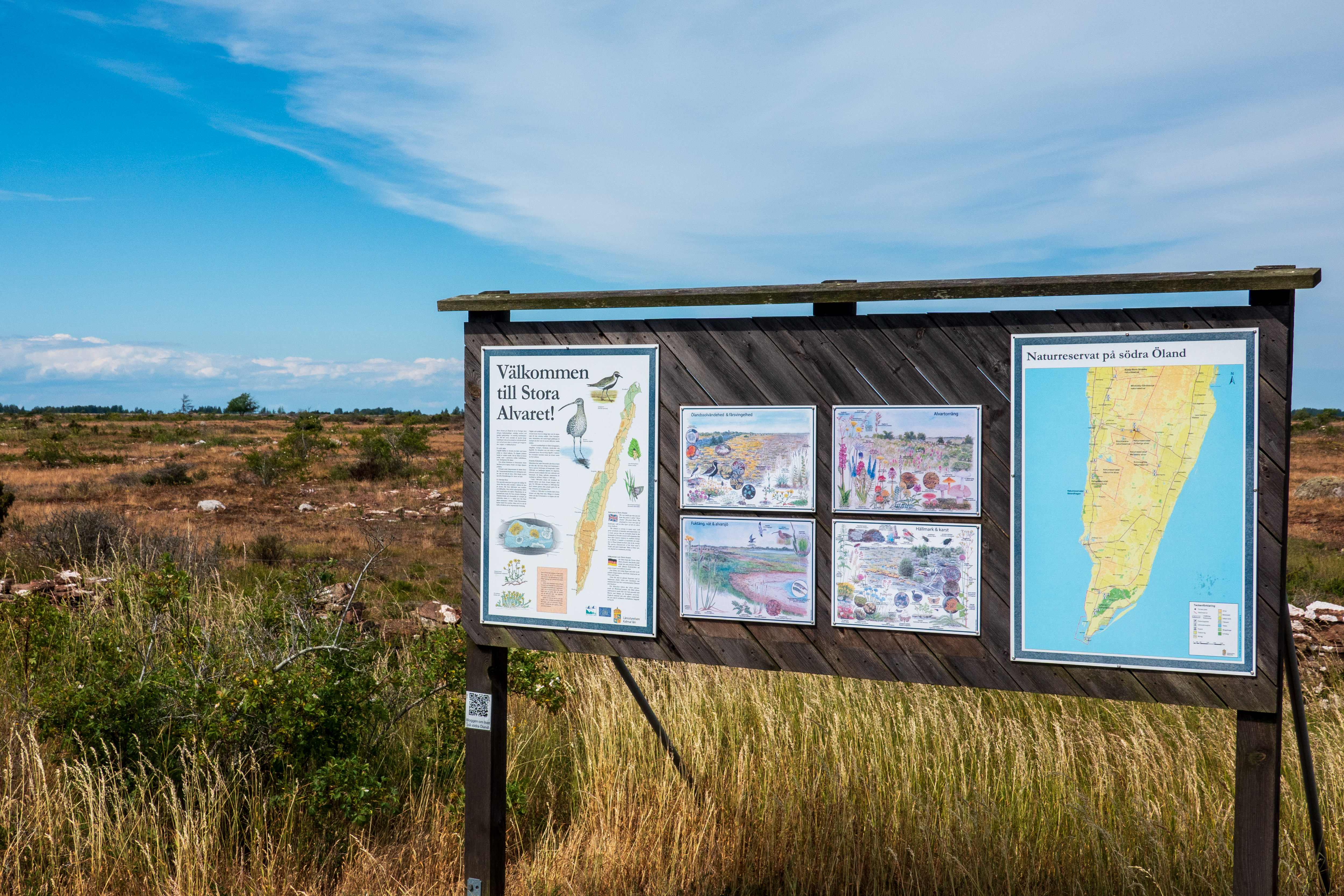
There is obviously more to discover, archeologists have reconstructed what they can, and a certain amount of guess work has taken place. But there is a lovely view from the battlements, over the flat area called Stora Alvaret.
This is a limestone “pavement,” which is a habitat for numerous rare and endangered species.
It has a very thin earth layer so agriculture is limited, unlike in the northern part of the island where there are more trees and much better topsoil and intensive agriculture. By 4.00 PM the sea mist was wafting back, so that was the end of our biking. The next day we headed for Trelleborg and the ferry to Rostock.
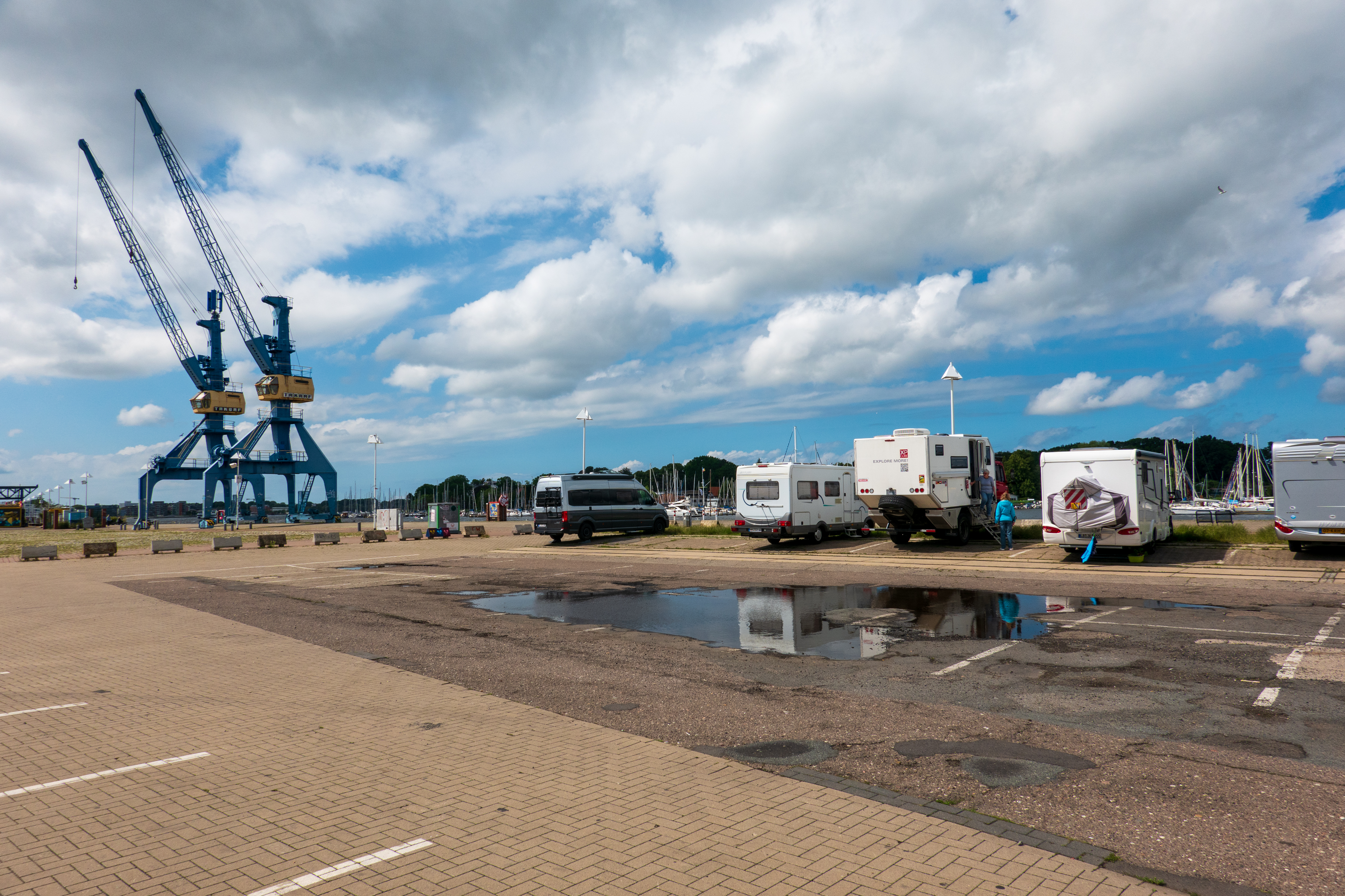
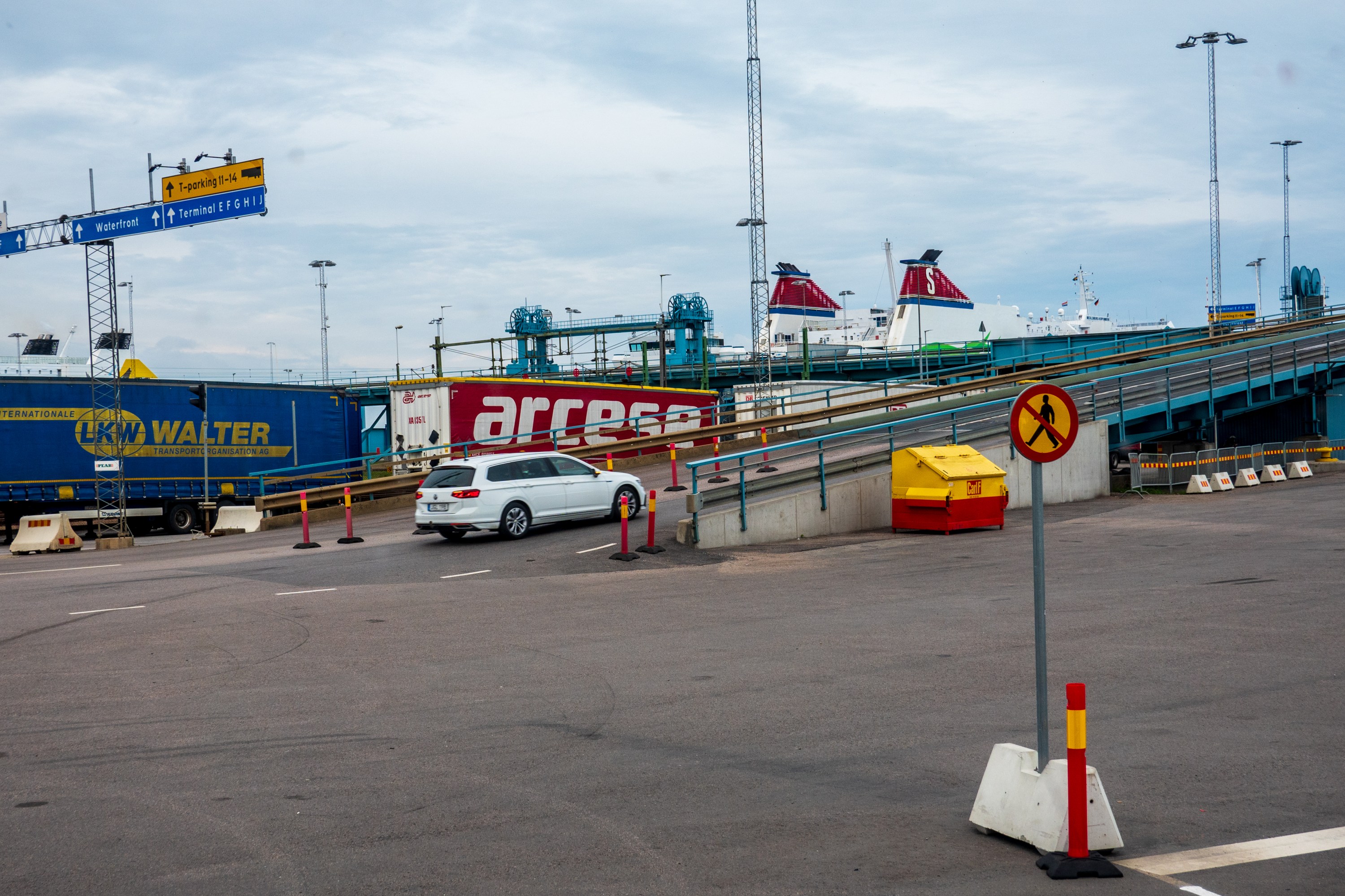
The ferry to Rostock was our third ferry ride and we initially found it less pleasant than the others. After a long day’s drive, we camped at the port which worked well, except that our on line registration did not go through and we had to reregister to enter. Of course, our credit card was billed twice so, we had to report that to the appropriate credit card. Grrr!
You will note that some of our campsites are decidedly industrial.
The ferry departed at 7.30 AM with final registration at 6.30 AM. We were there before 6.00 AM and had no problems with the check in or navigating the ramps.
Once on board, we headed for the cafe and a pleasant second breakfast – been a long day since 4.00 AM!
The ferry was smaller than we expected for a six hour trip and to our surprise had very limited seating. The only lounges, for which you had to pay extra, had almost no windows and the economy class, airline style seating was crammed together. There was a large cafe area, furnished with hard chairs and tables, and several families had spread blankets in the corners. Interestedly, there was a reserved area for long haul truckers, with its own cafeteria line.
We decided to book a cabin as the thought of spending six hours in a cafe environment did not appeal. It was a great decision, the cabin was very pleasant with a bed for Fred to catch up on his sleep and a sofa for Denise to sit and read.
So, it would be nearly a week before our parts could arrive. As they used to say in parts of West Africa, “What to do?”
Having pretty much mined out the tourist attractions of Nijmegen and Arnhem, we decided to head north to Enkhuizen to visit the Zuiderzee Museum, which had been recommended to us. This would allow us to answer that burning question, what exactly is the Zuiderzee? (Hint, look here: https://en.wikipedia.org/wiki/Zuiderzee)
We found a campsite in easy walking and biking distance of all sorts of useful places, like the Vomar Supermarket and the museum, and checked in – happy to get the perfect spot. Oh, the joys of easy access to a supermarket! We made at least three visits on the day we were there, as one can only carry so much on a bicycle! Fred even got a hair cut from a Kurd who shaved him with seemed to be a dry razor! Scary as all get out, but, amazingly, no irritation.
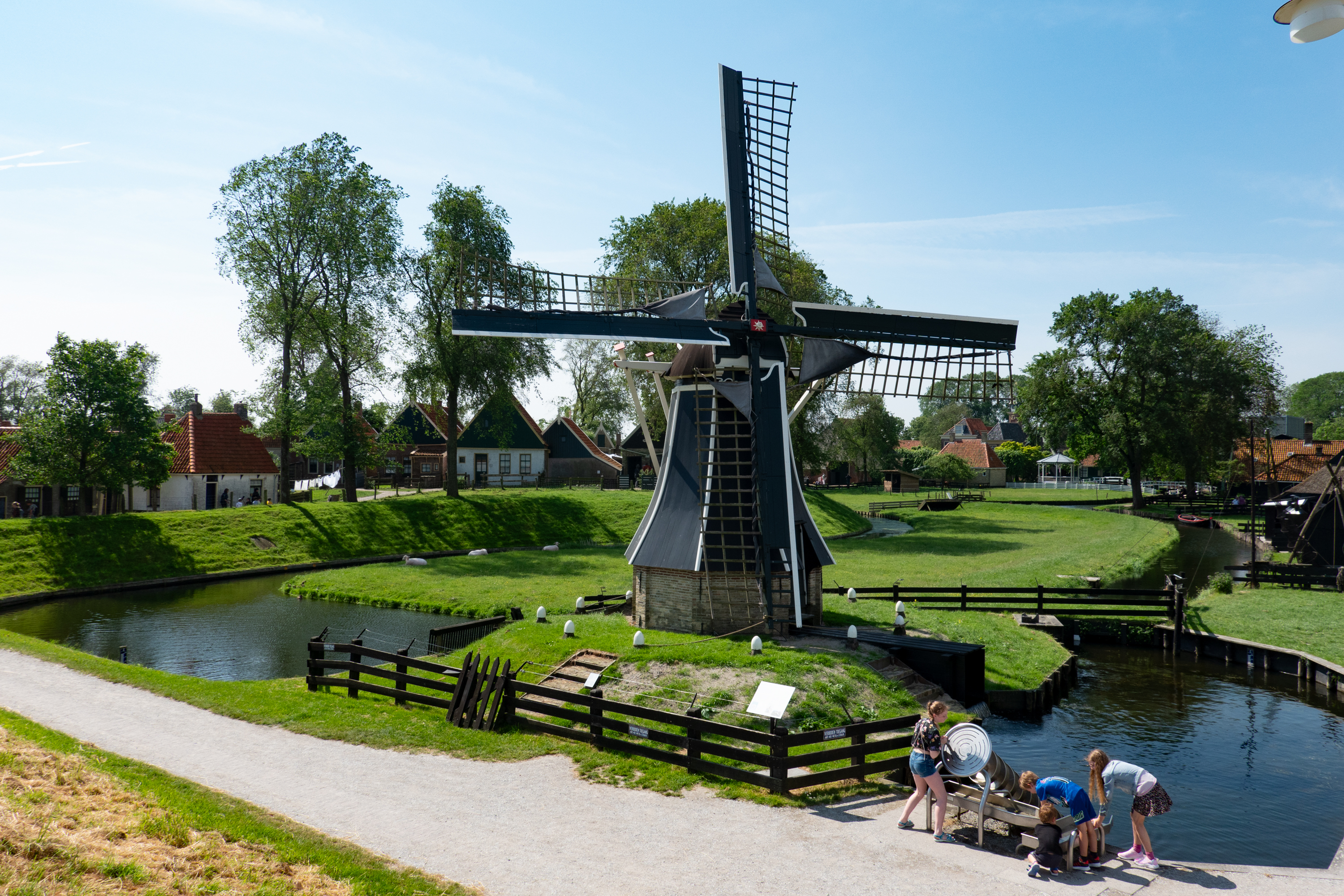
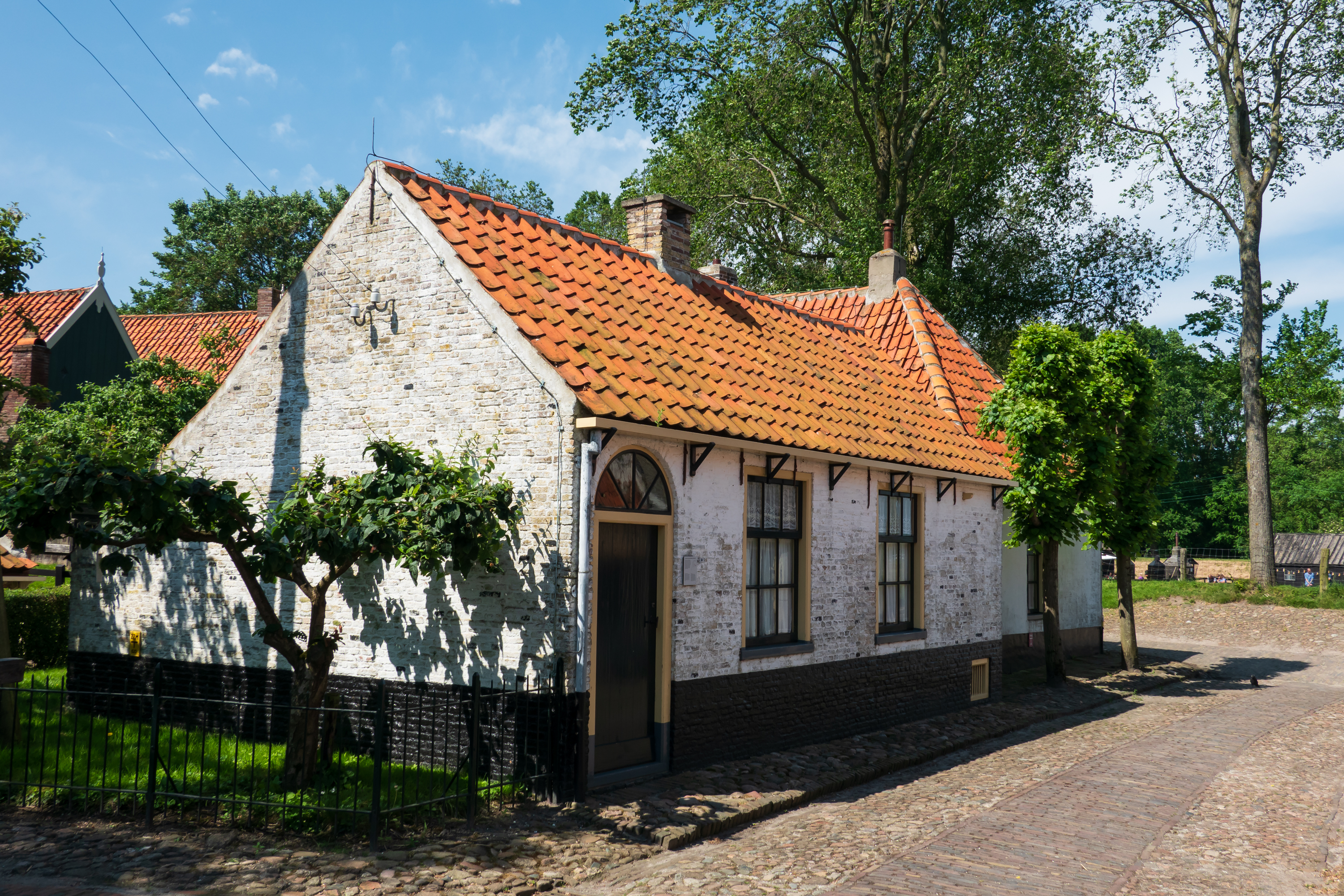
We enjoyed our museum visit. The weather was lovely and we started with the outdoor town with its displays and buildings of the turn of the nineteenth century. We are suckers for places like Williamsburg, old Sturbridge village, and the Weal and Downland museum.
Looking down from the dyke at one of the windmills that pumped out the water. The kids are playing with a model of an Archimedes screw.City street.
Kids playing.Drooling over the goodies and trying to take an artsy craftsy picture.Nifty duplex – perfect place to raise a dozen kids per side.
Canals everywhere and all used to move things.Drugstore.Not sure I want my washing station right there. The steam laundry looks better!
This fellow wanted to help us with our coffee and cake.Looking from the dyke out over the Zuiderzee.Very basic town house.“Magic” gutters. Here they feed the rain barrel outside the house.When you have all of that water and decomposing vegetation, you can harvest methane gas!
Sabot sailing boat, complete with lee board. Very Dutch!During the summer, all cooking was done using this paraffin stove.Pull the gutter in and it fills your water barrel inside the house.Boat with lee board pulled up.
Fred especially enjoyed the steam laundry with its engine. Who would have imagined that there would have been a need for a large, mechanical laundry? And that the owner would become one of the wealthiest people in town. (Nice house!)
Firing up the boiler.Always important to get good help.The laundry owner’s house even had a cellar, under the stairs.
The power shaft along the roof ran washers and other machines.The laundry owner’s house was definitely up market.
We also learned some more about the herring fishing industry and the reasons for and effects of building the dyke on the local population. Folks whose houses were on the wrong side of the dyke got wetter.
The car park is at a considerable distance and a ferry runs from the museum to the town on a continuous cycle. We took advantage of this and made the round trip on the ferry, which gave us good views of the town of Enkhuizen from the water and of the bridge that runs across the dyke.
The watergate.
Fishing vessels.Citroen 2CV (We love these old beasts.)
Finishing the outdoor museum, we moved on to the indoor part of the museum. The theme here is water, especially the history of horrific floods that lead to the dyke across the mouth of the Zuiderzee. There were also exhibits of local life and industry, including some wonderful old films. The boat house held a wide range of local boats, including an ice boat.
After another night of heavy rain and thunderstorms (and a somewhat waterlogged campground), we headed back to Nijmegen for the bicycle repair the following day.
The parts were in and the GoCycle rep had brought them down from Amsterdam personally. After what seemed at times an eternity of waiting, the actual replacement of the board took ten minutes, and solved the problem. GoCycle also checked our battery that would not charge and provided a new one as a warranty repair. Bikes repaired, the ride back to the campground was super easy!
Our campground in Malden sits right between the two major drop zones of the 82nd Airborne. We crossed the Maas-Waal canal to the west of town anytime we drove anywhere. Our rides into town to tour or visit the bike shop went right down the route of the old road. The sense of history was palpable.
To our east, in the Groesbeek landing zone, is the Freedom Museum. (https://freedommuseum.com/#) This museum, a bit like the Peace Museum in Caen, France, touches on a subject that most British and Americans cannot really understand – life under occupation. The US and Britain suffered terrible losses, but we never suffered an occupation by a foreign army. Occupation raises many complex issues as each person tries to decide where to place themself on the spectrum between full collaboration and active resistance. There are some very thoughtful exercises you can do to help you understand the challenges. And the usual selections of moving maps and and bomb shelter where you can feel a raid. Not at all the usual military museum – highly recommended.
Finally, on a day with a decent weather forecast and rain jackets in hand, we set off to Arnhem to see the bridge that really was too far. We started by taking the bus to the station in Nijmegen, then the nifty double decker train to Arnhem (which took about 10 minutes!).
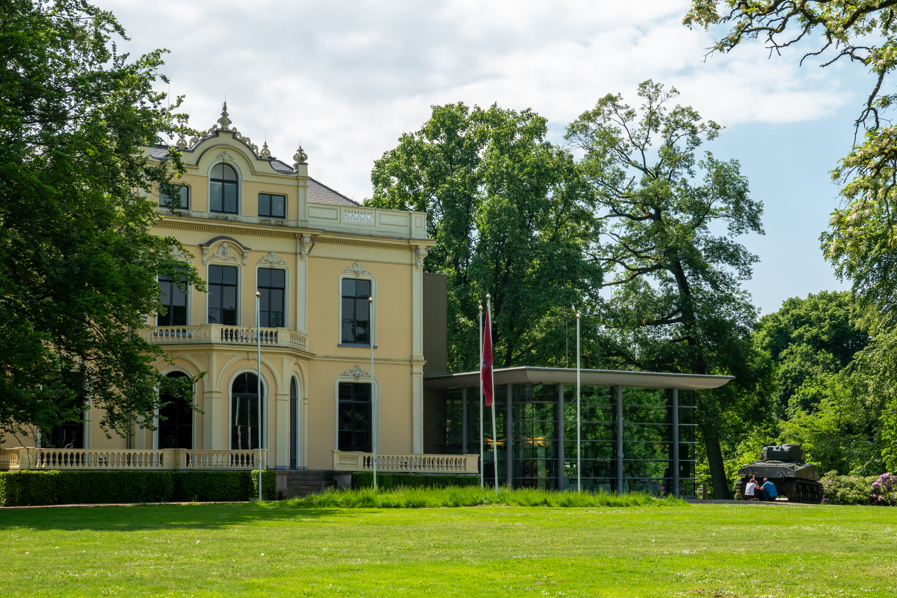
Once in Arnhem, we found the bus at the station to take us to Oosterbeek, home of the Airborne Museum in Hartenstein. (https://en.wikipedia.org/wiki/Airborne_Museum_’Hartenstein’) If Arnhem itself is a bit gritty, Oosterbeek is a lovely spa suburb.
A very different museum from the Freedom Museum, this museum is based on the important role that the Villa Hartenstein played to both the Allies and the Germans, both of whom used it as their headquarters (at different times!) during Operation Market Garden.
The villa. See the wikipedia link for a wartime photo.
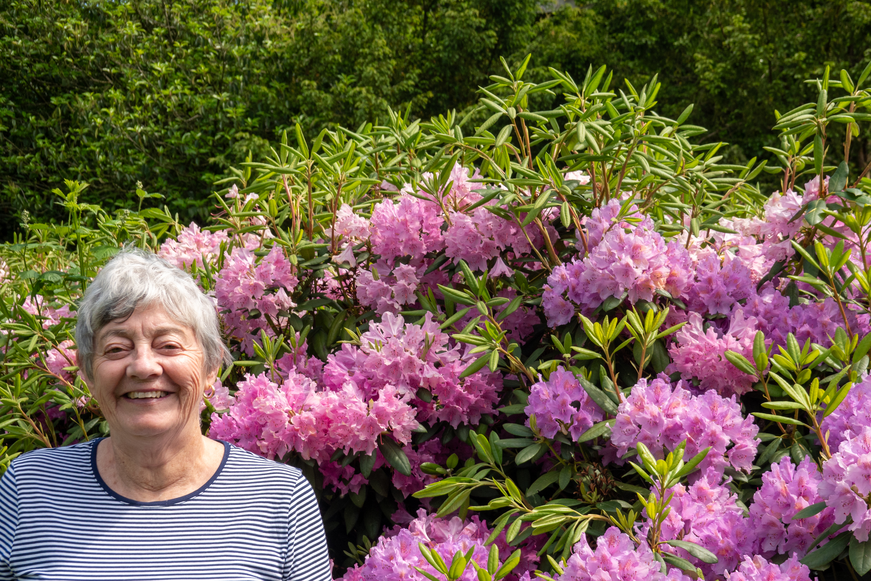
Denise among the Rhododendrons.
The museum is known for the “Airborne Experience,” which lets you walk through the battle from one side to the other. It was well done. The actual room that Colonel Urquhart used as his headquarters has been restored, complete with mannikins. The nearby St. Elizabeth hospital was used by both sides, at the same time. A most challenging arrangement!
Next to the museum was a lovely restaurant. We joined a decidedly upmarket crowd (and a few cyclists) for a nice lunch in the sun.
After taking the bus back into town, we walked until we could see the Arnhem bridge.
Unlike Nijmegen, this is a replacement bridge.
Photo taken, we headed back to the station to repeat our journey back to the camper. And it did not rain!
We found a lovely aire/stellpatz just south of Nijmegen (https://camperplaatsmalden.nl) and settled in to what was to become our new home for a long time! The camperplaats Malden is a working farm and we often had a decidedly bovine serenade and bouquet!
We are never the biggest thing around.
We had picked Nijmegen as the local GoCycle dealer, FIJN-Fietsen (https://fijn-fietsen.nl) is listed on the GoCycle website as having a GoCycle guru. We had also chosen Nijmegen as it is on the “Bridge too Far” road and we had wanted to visit some of the sites of Operation Market Garden. Nijmegen is also probably the oldest town in the Netherlands, dating back to the Romans, at least.
What was Operation Market Garden? In short, in my amateur opinion, albeit shared by several authors, it is yet another proof that General Montgomery was not very good, and worse, not willing to own up to his failings. (See: General Sosabowski) For a reasonable overview, start with the Wikipedia (https://en.wikipedia.org/wiki/Operation_Market_Garden) and move on to books by Cornelius Ryan or Trevor Beevor.
Setting out from the campsite, we rode through a pretty forest and dropped right onto the amazing Dutch cycle route network. In fact, we reached town so quickly that we overshot our turn! The “guru” turned out to be Roy Fijn, the owner of the shop and a wonderful bike nut and GoCycle enthusiast. Roy took the time to look at both bicycles and found a quirk with the one that did have power, plus the need for new brake pads. So he agreed to place the order for the parts and hoped they would be in the following day. Great news!
Unfortunately, Murphy noticed the situation and struck! That night we learned that the parts (motherboards) were only available in the UK and there were only two there. They would be sent but due to the holiday weekend (yes, another one!) it would be the following week before they arrived. Fred meanwhile was managing to cycle with no power, as Holland is fortunately quite flat! So we set out to plot how to spend the next few days.
The weather forecast in Nijmegen was decent for the following day, so we organized the bikes and set out to visit Nijmegen. We found the old town and Market Square easily and began our visit with coffee and apple pie (with whipped cream of course) watching huge trucks descend the narrow, medieval pedestrian walkway we had just climbed. Great fun!
We weren’t even sure we could ride our bikes up this street, and then the big trucks started heading down!
After Denise raided the cheese shop, we moved on to the city tourist office and then went to the Church of St. Stevens. (https://en.wikipedia.org/wiki/Saint_Stephen%27s_Church,_Nijmegen) This was most interesting as it is now a Protestant church. It had been both Catholic and Protestant multiple times in the past, depending on the politics of the day and this was clearly visible especially when looking at the altar.
Spare, even compared to English cathedrals. Services are still held on Sundays.
Double arches leading from the market to the cathedral.
Glorious organ.
Tombs under the altar spaces.
It was then time to find the remains of the old castle which had been demolished in 1795 to make cement. (!!! Talk about commercializing your history!) (https://en.intonijmegen.com/discover/history/historicaltimeline/demolition-of-the-castle-nijmegen-loses-its-crown-jewel) We found the ruins of the St Nicholas Chapel, also known as the Valkhof Chapel, which dates back to 1030. This makes it one of the oldest surviving stone buildings in the Netherlands. We also saw the Barbarossa ruins which date back to 1155. Both were part of this huge castle. The view of the Bridge, which had been taken by the US 82nd Airborne during Operation Market Garden, in 1944, was also good. Though the trees could have used a trim as they rather intruded on the view. There is an excellent site outlining a personal view of Market Garden and Nijmegen. (https://alondoninheritance.com/out-of-london/operation-market-garden-nijmegen-and-the-valkhof/) The Valkhof park was a center of German defense of Nijmegen.
We decided to get a better view and went down to the river’s edge, where we found restaurants as well as a great view of the bridge!
We could not resist and thoroughly enjoyed our lunch as we watched barges passing by on the river. Trivia. This bridge was actually built by the Germans as the Dutch blew the original, 1930’s bridge, when the Germans invaded. In Market Garden, this was the bridge that was not too far, but was, perhaps, too late.
We even got a bit of sun.
Nothing runs like a Deere. In this case, a barge load of them.
Nijmegen has a lot of museums. One of the more interesting ones is the De Bastei Museum. (https://www.debastei.nl/en) The De Bastei (“the bastion”) museum, which was built into the remaining ramparts of the old castle, literally, an old gun bastion, is a bit of an interesting train wreck of museums, covering ruins, dating back to the Romans, and concluding with do it yourself mechanical exhibits which allow you to try to bridge the river, Roman style, set up a river powered ferry, and control flooding. Hours of education and entertainment! The museum brought to life the centuries long relationship between the river and the town from the earliest days when the Romans first established a town there to the present day.
It had cooled off and dark clouds were amassing, so we decided to head for home. Unfortunately the rain started very quickly and was heavy at times, so we arrived back at the camper looking like chilled drowned rats! Hot cappuccinos were required!
The next day quickly became laundry day with all the wet clothes to deal with. We found a local Revolution laundry about twenty minutes drive away, conveniently located by a DIY store so that we could A: park the truck and B: Fred could shop for Rust-oleum paint so that Fred can repaint the roof rack over the cab – it is rusting, We were successful in both endeavors, but the actual painting will have to await a week of sunshine!