Category Archives: Expedition Vehicle Travel

An expedition vehicle is basically a four season capable RV that does not depend on hookups and has 4×4.

From the Future to the Past – Travels in the Langue d’oc

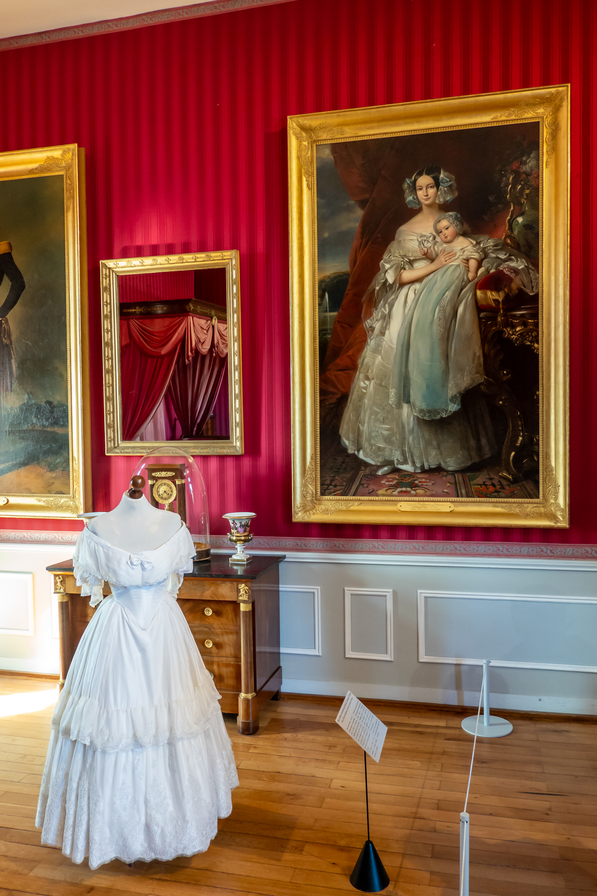
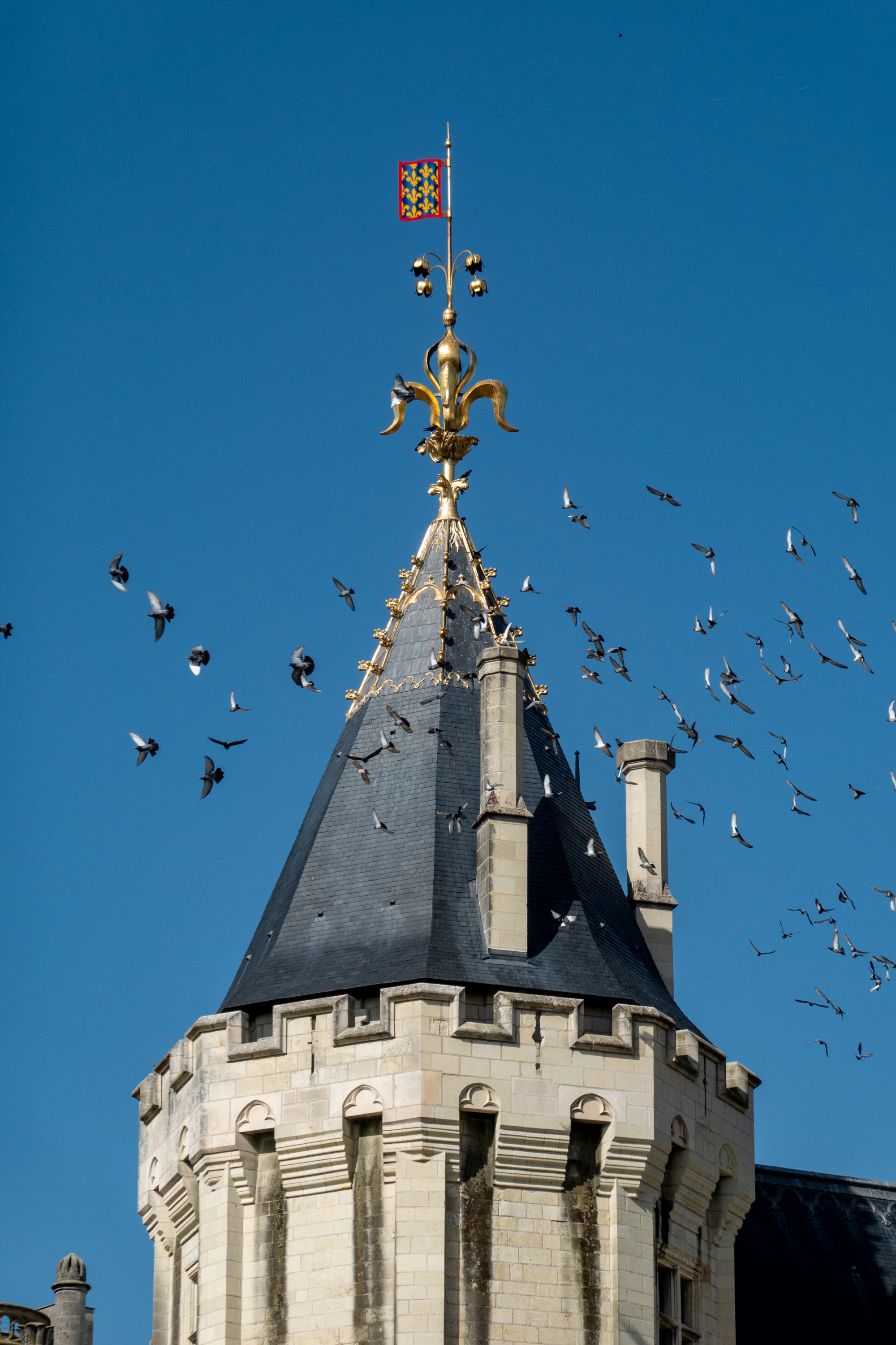
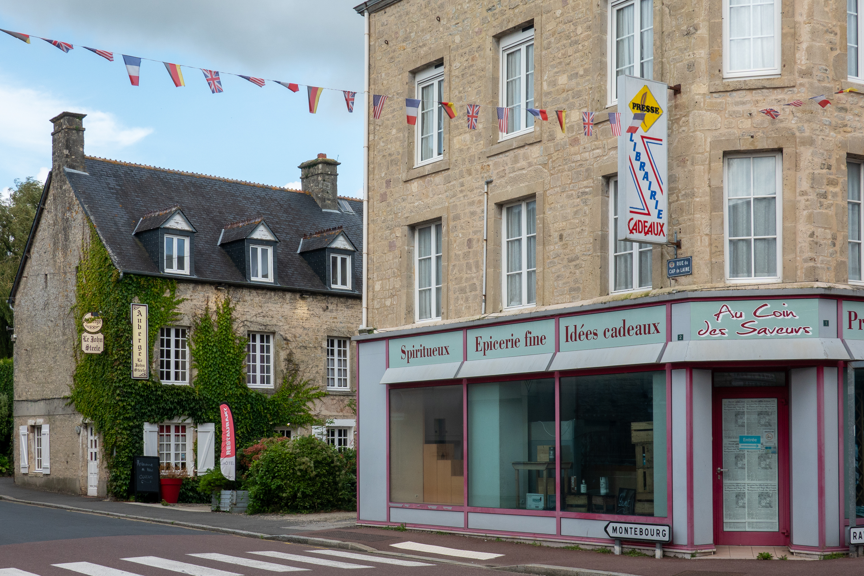
An important and tragic part of French history is the conflict between the Langue d’oïl and the Langue d’oc; a conflict of language, religion and, of course, political power.

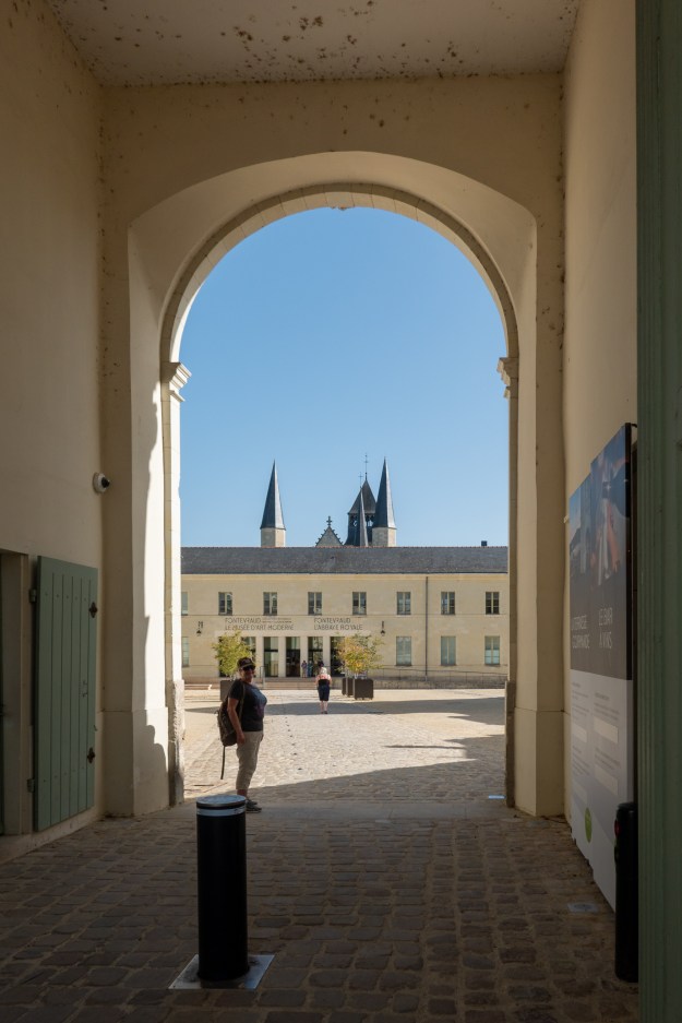
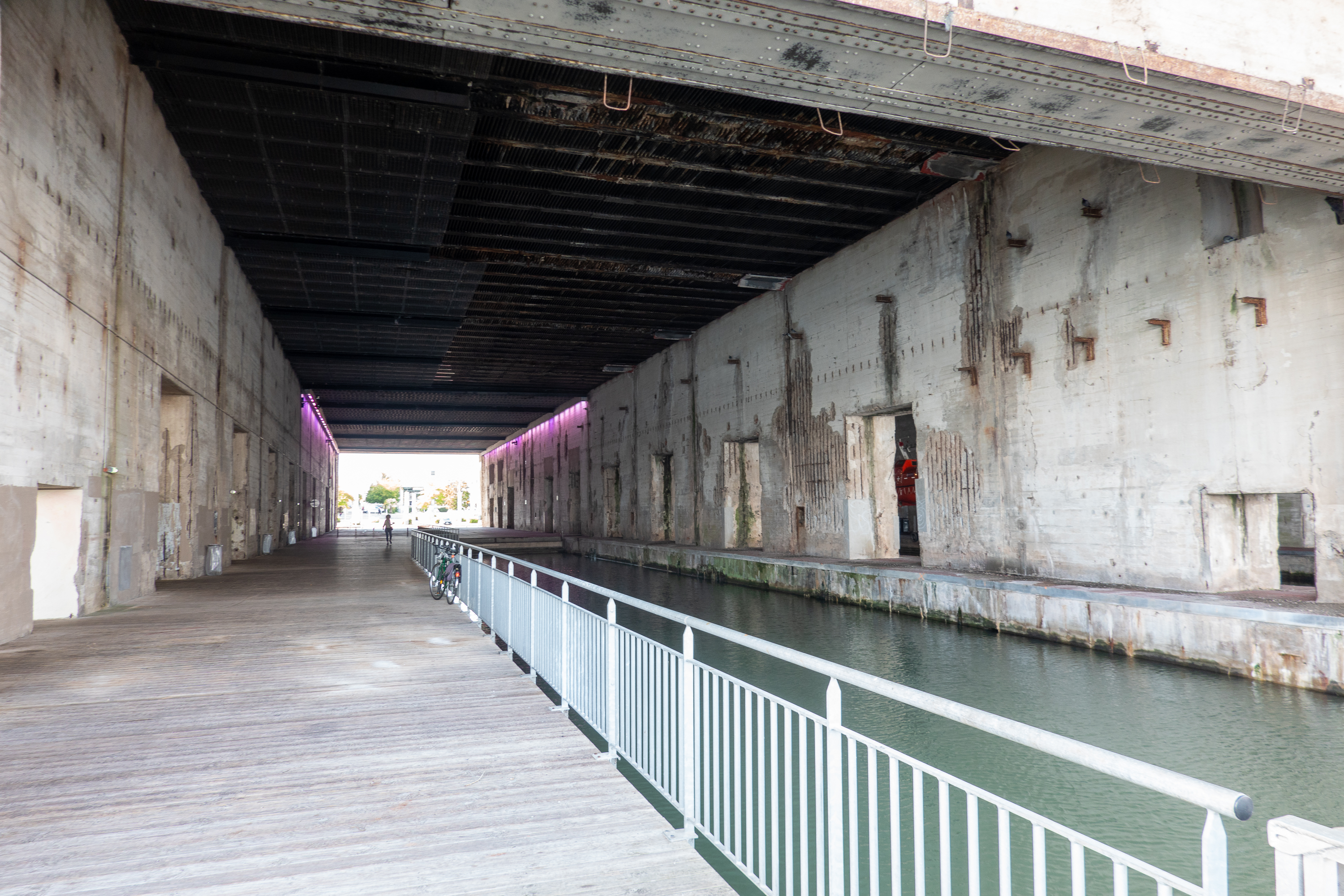
Toulouse was an early capital of the Langue d’oc. We had not planned to spend time in Toulouse a we tend to prefer smaller, less congested spots. Then Denise noticed that there is a Cité de l’espace or Space Museum in Toulouse. And then we discovered that there is an aire right across the street. We were off. When we got there, we realized that it would required 250 yards or so in the low emission zone but we managed to get there without being stopped. We felt like we were tip toeing down the street, a challenge in a nine ton truck! Picture an elephant trying to sneak by.

It was a rather cold, grey day, but we thoroughly enjoyed our visit.  There was lots of space information of different kinds but all from a European point of view.  There is a lot more European space research than we had known.  (Despite our best efforts, we are still a bit US/UK centric in our thinking.)

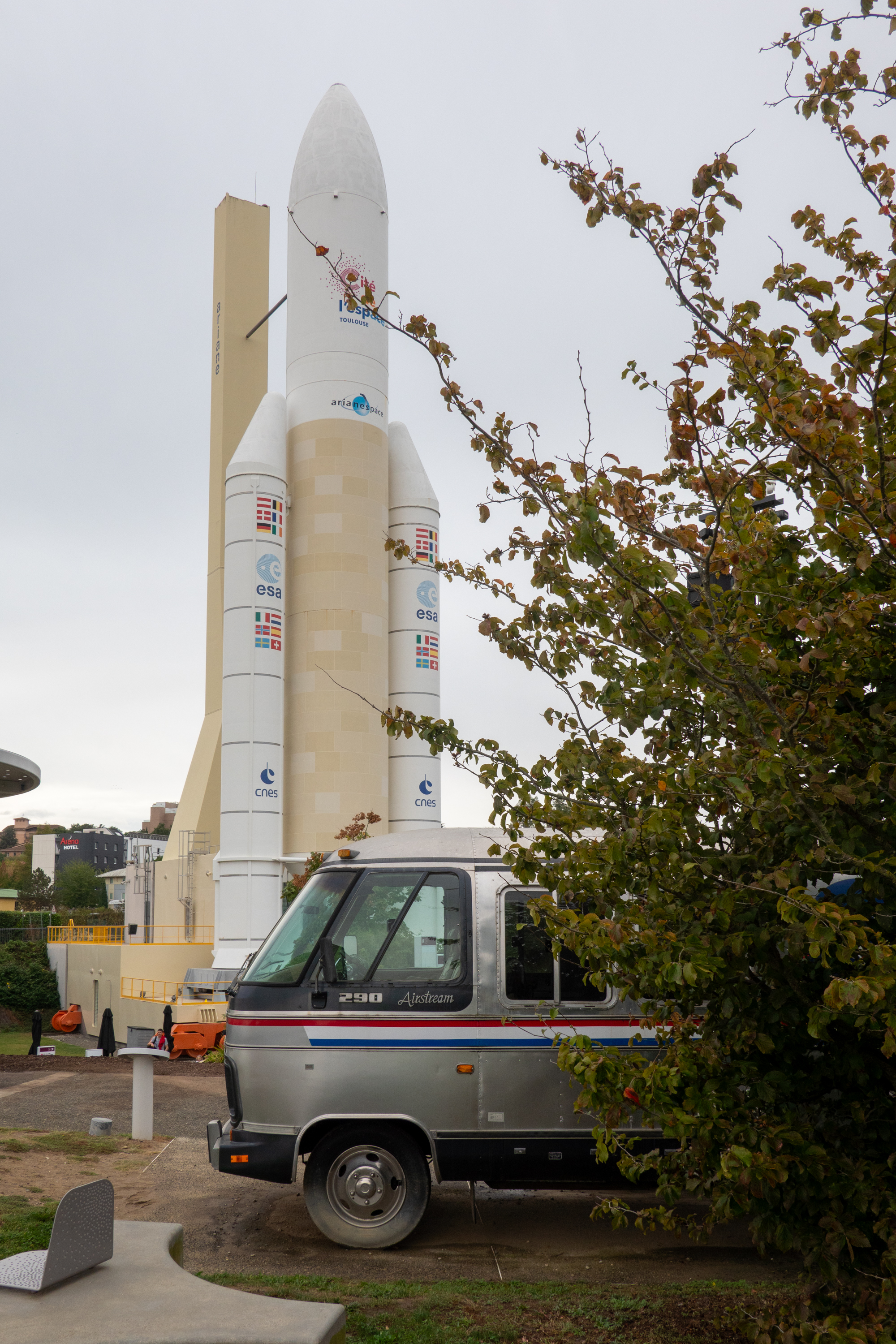
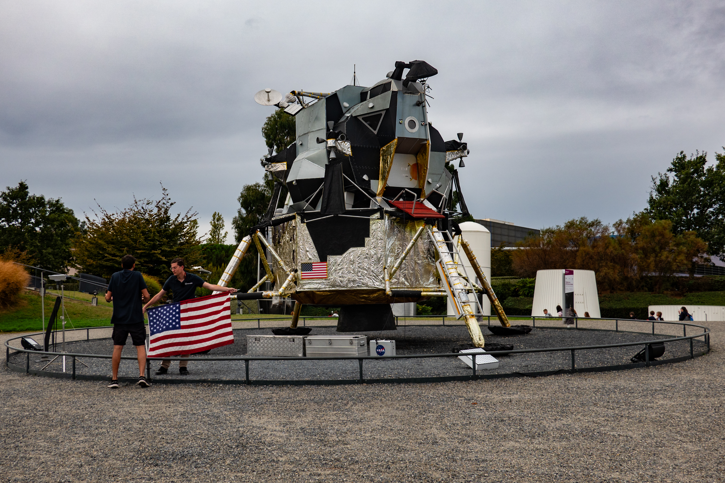
We saw an Ariane rocket and a replica of the US moon landing module. 

They did a nice presentation on the moon landing, but Fred was disappointed that there were no astronauts getting out of the lander.

We kind of liked the RV connection of the Winnebago motorhome that was used to transport astronauts around Cape Kennedy.

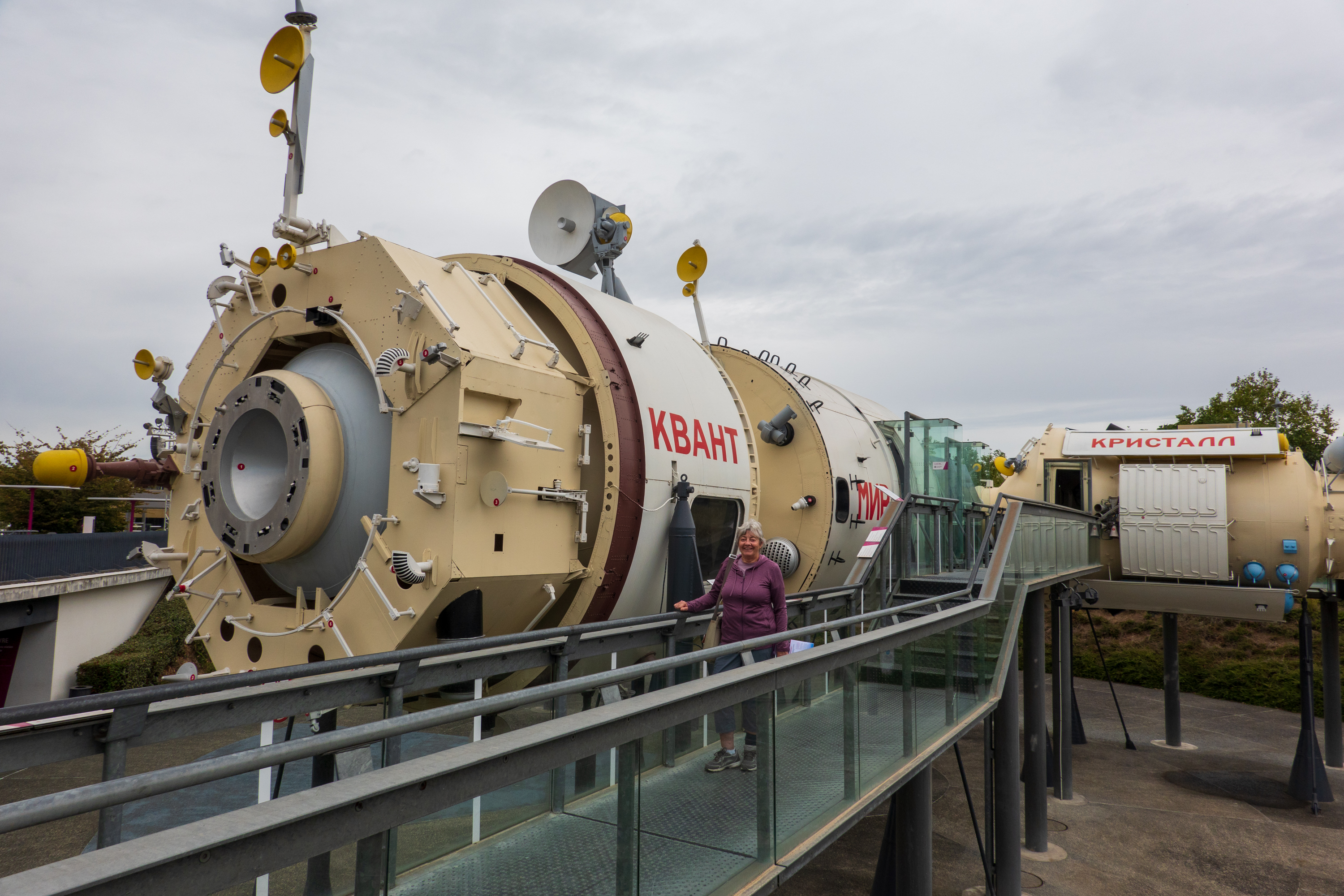
We wandered through a replica of the space station Mir.

An absolute warren inside.

There was an interesting presentation on the Mars rovers on a replica of the Mars landscape. It features radio controlled replicas of two Mars rovers, Perseverance (US) and, Zhurong (PRC). 

He must be chilly on Mars without an overcoat!

Finally, we saw both a Planetarium presentation (blah) and an amazing Canadian 3D film about asteroids.  The information on asteroids was exceptional and included where they are found, what they are made of, and various plans to deal with them if one should  become dangerous. 

There are also exhibit halls with lots of digital information and such fun experiences such as what it would be like to walk on the moon.

All in all, it was a great day. Cultural observation. We are in the off season, so the Cité de l’espace was running at reduced capacity. This meant that they shut down the snack bars, but kept the full service restaurant – sort of the opposite of what we might expect at a US attraction in the off season.

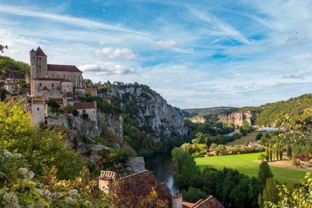
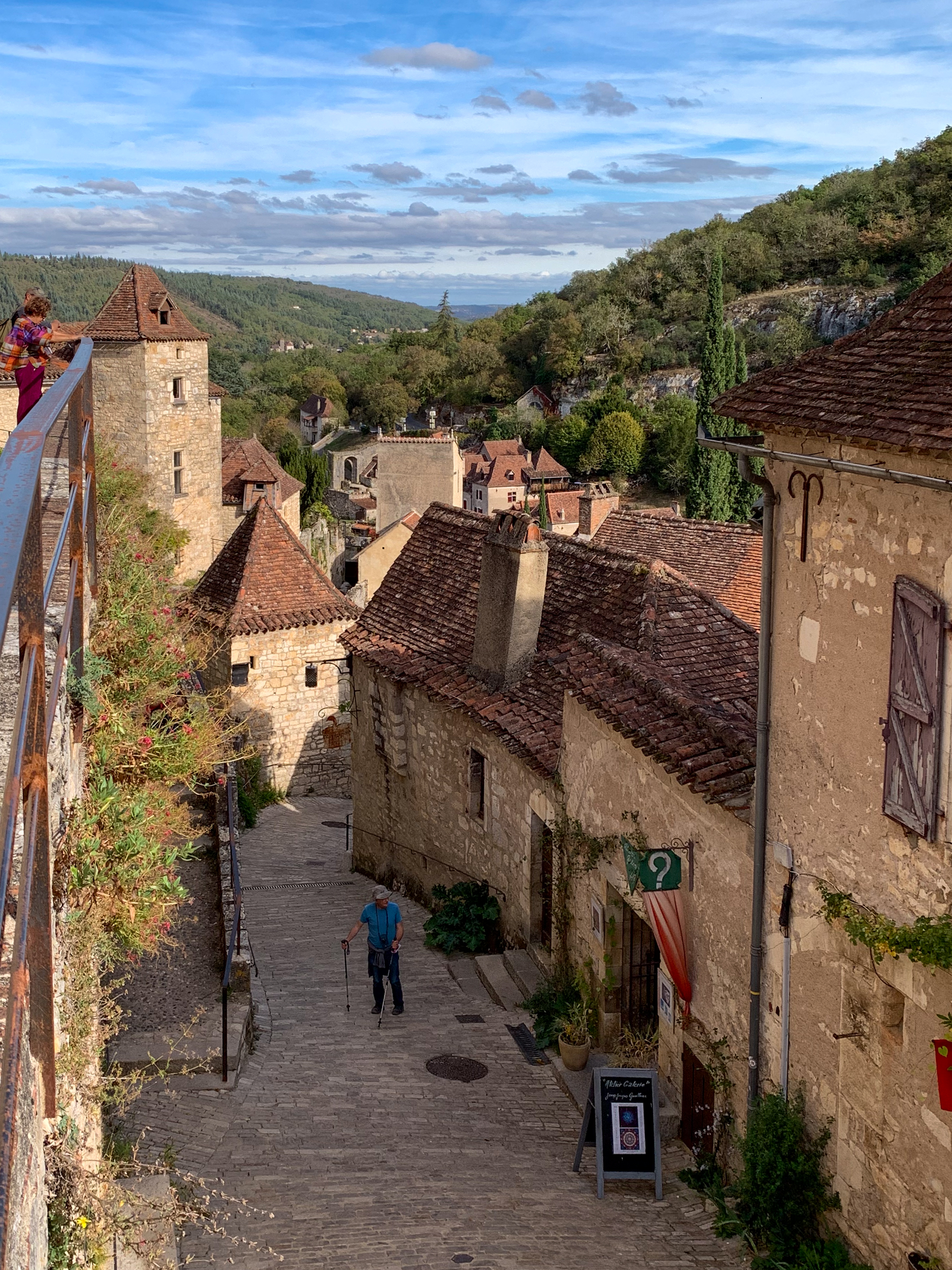
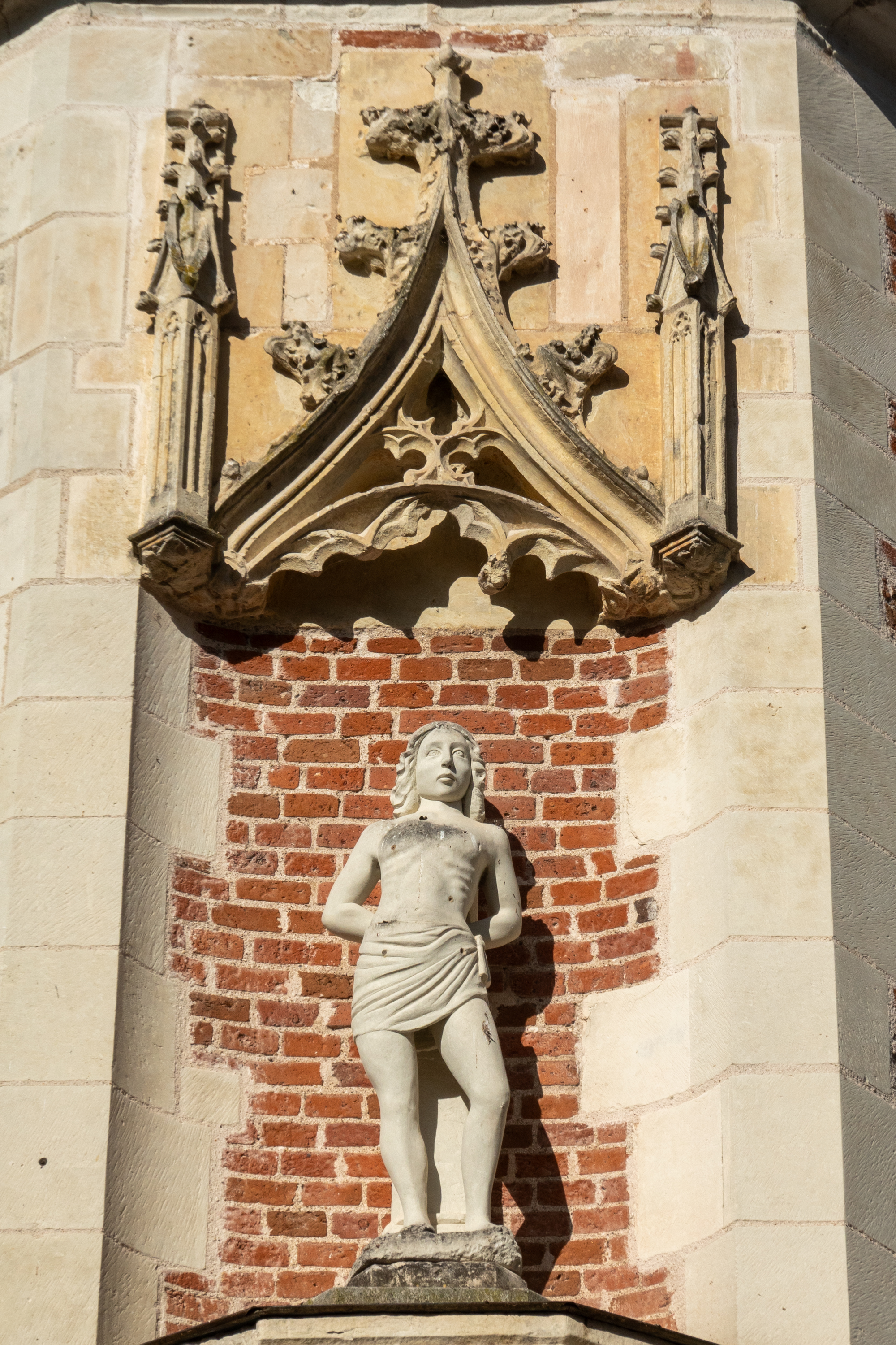
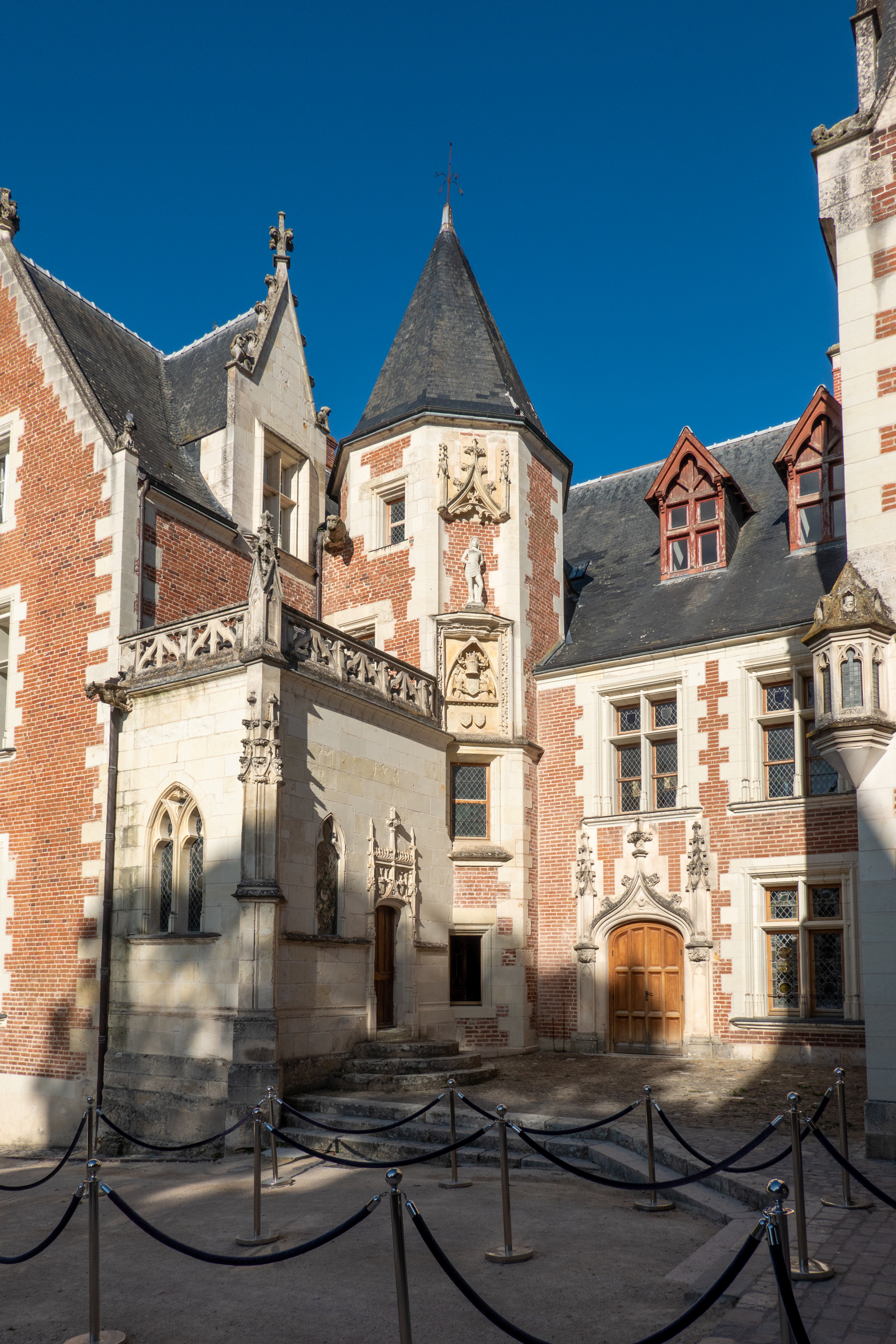
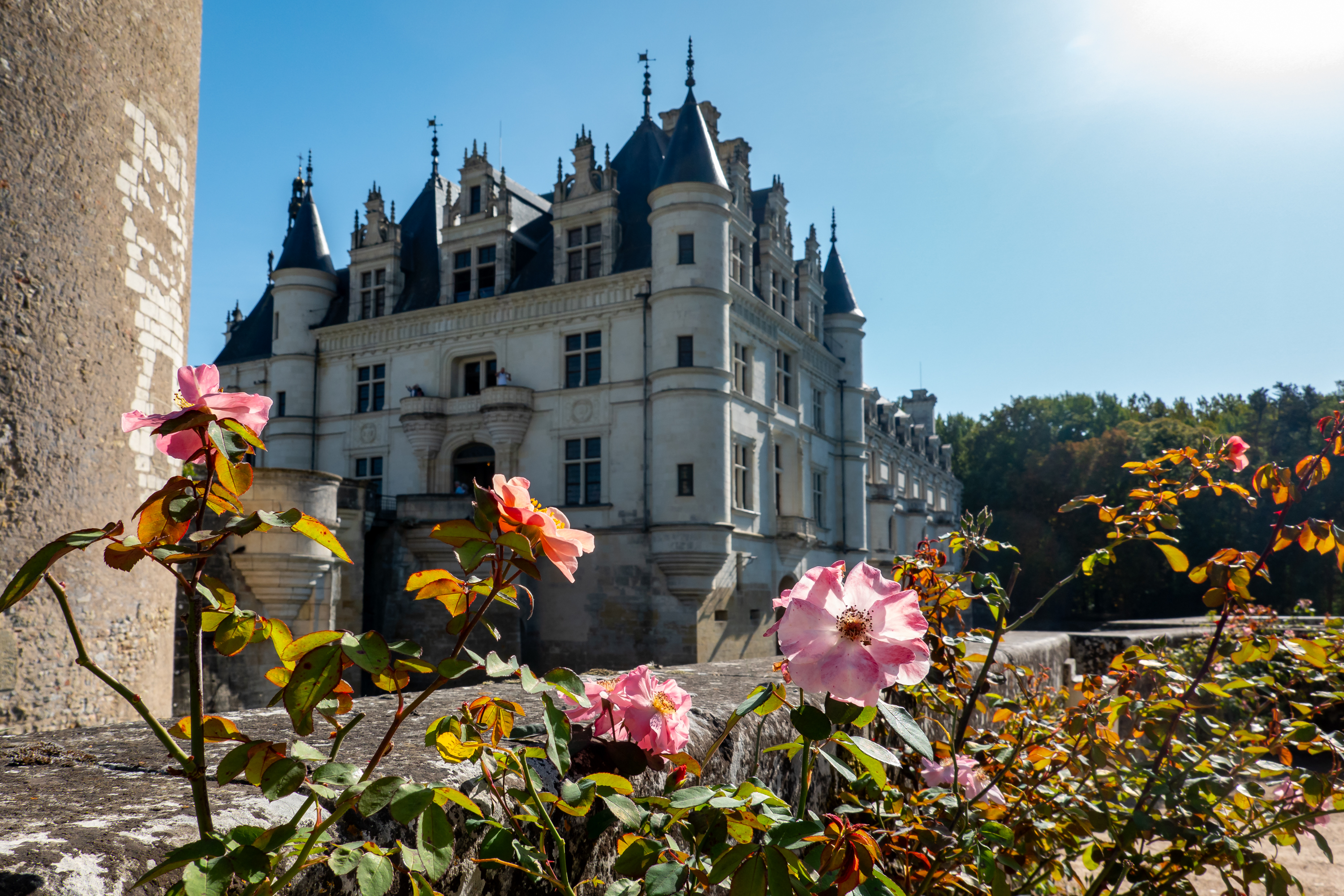
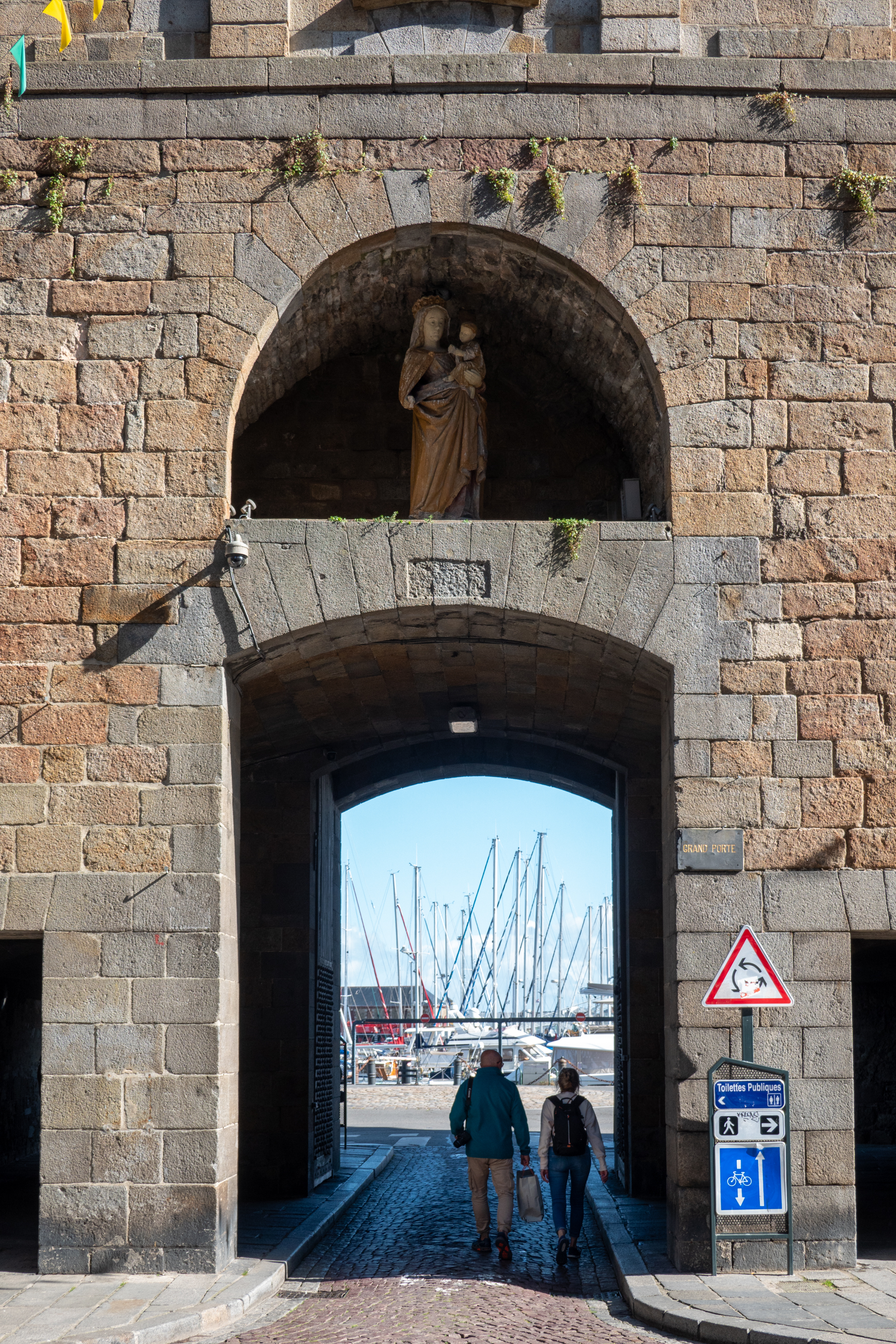
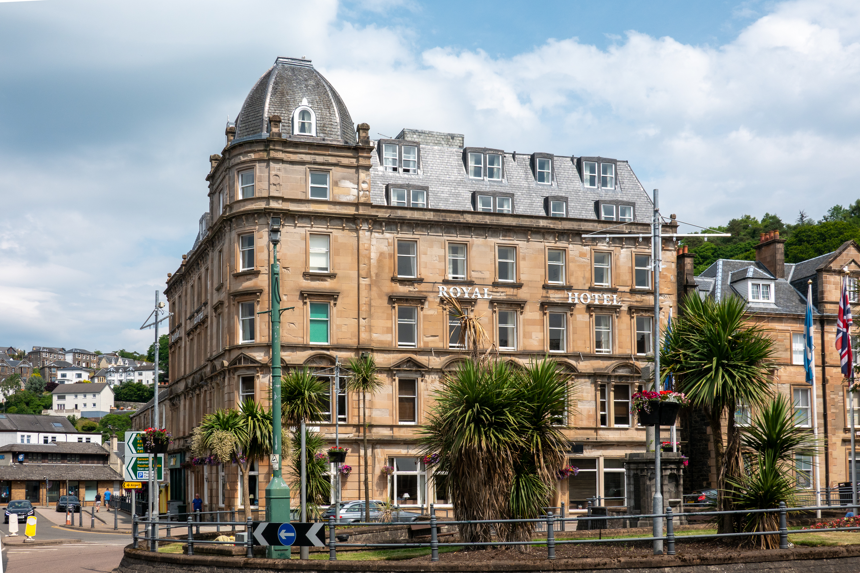
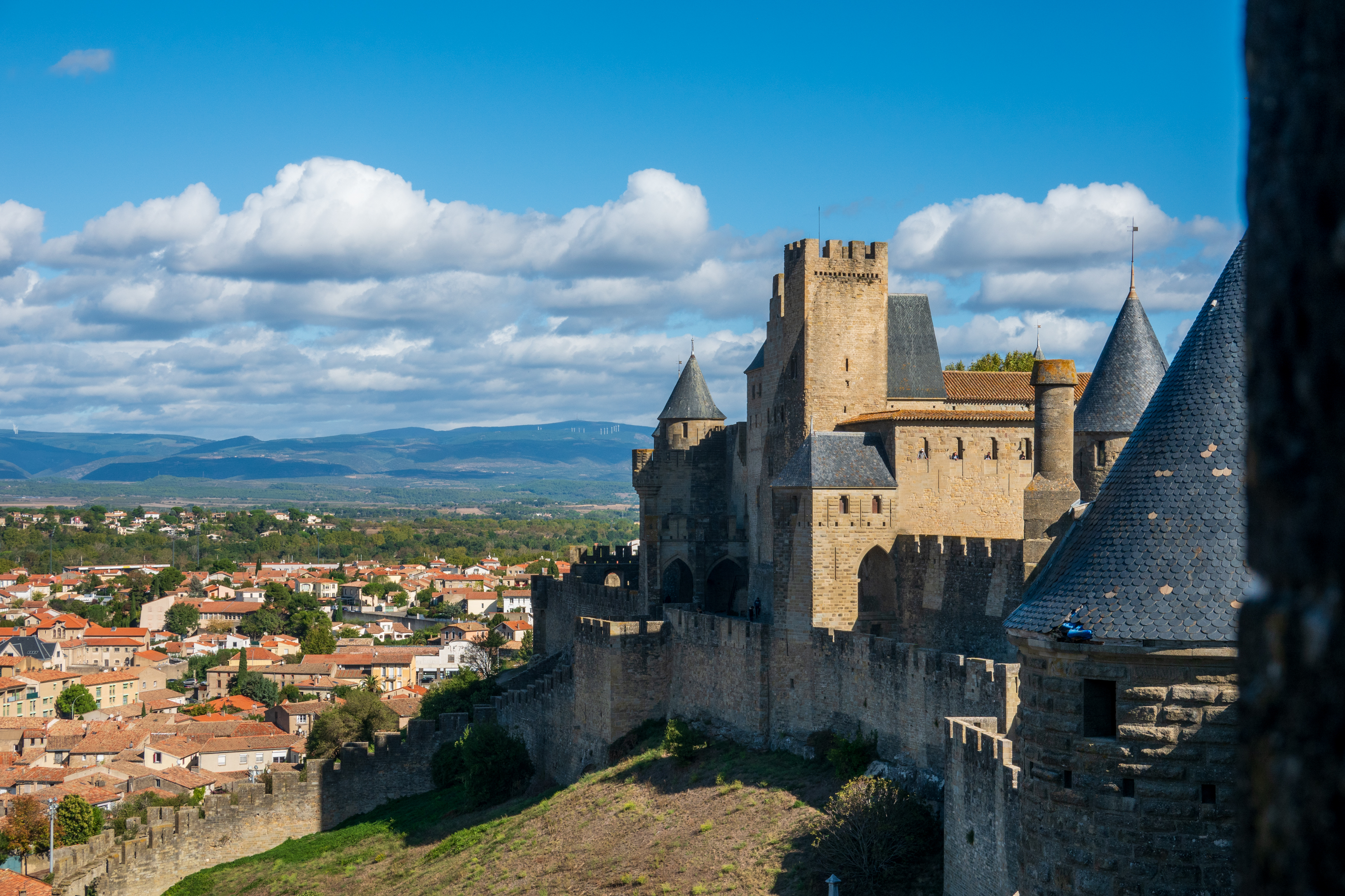
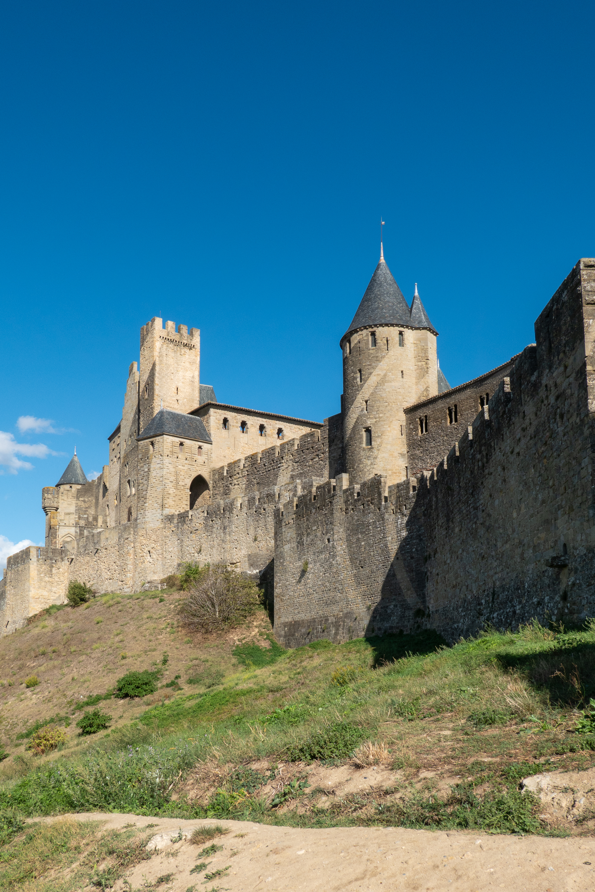
Moving into the past, we headed to Carcassone. Carcassone simply drips history: https://en.wikipedia.org/wiki/Carcassonne In popular fiction, the author Kate Mosse has written several books that touch on Carcasonne, the most famous being “Labyrinth.” Central to all of this is the Cathar heresy which resulted in the only crusade ever declared against Christians: https://en.wikipedia.org/wiki/Albigensian_Crusade Today, Carcasonne is a major tourist attraction.

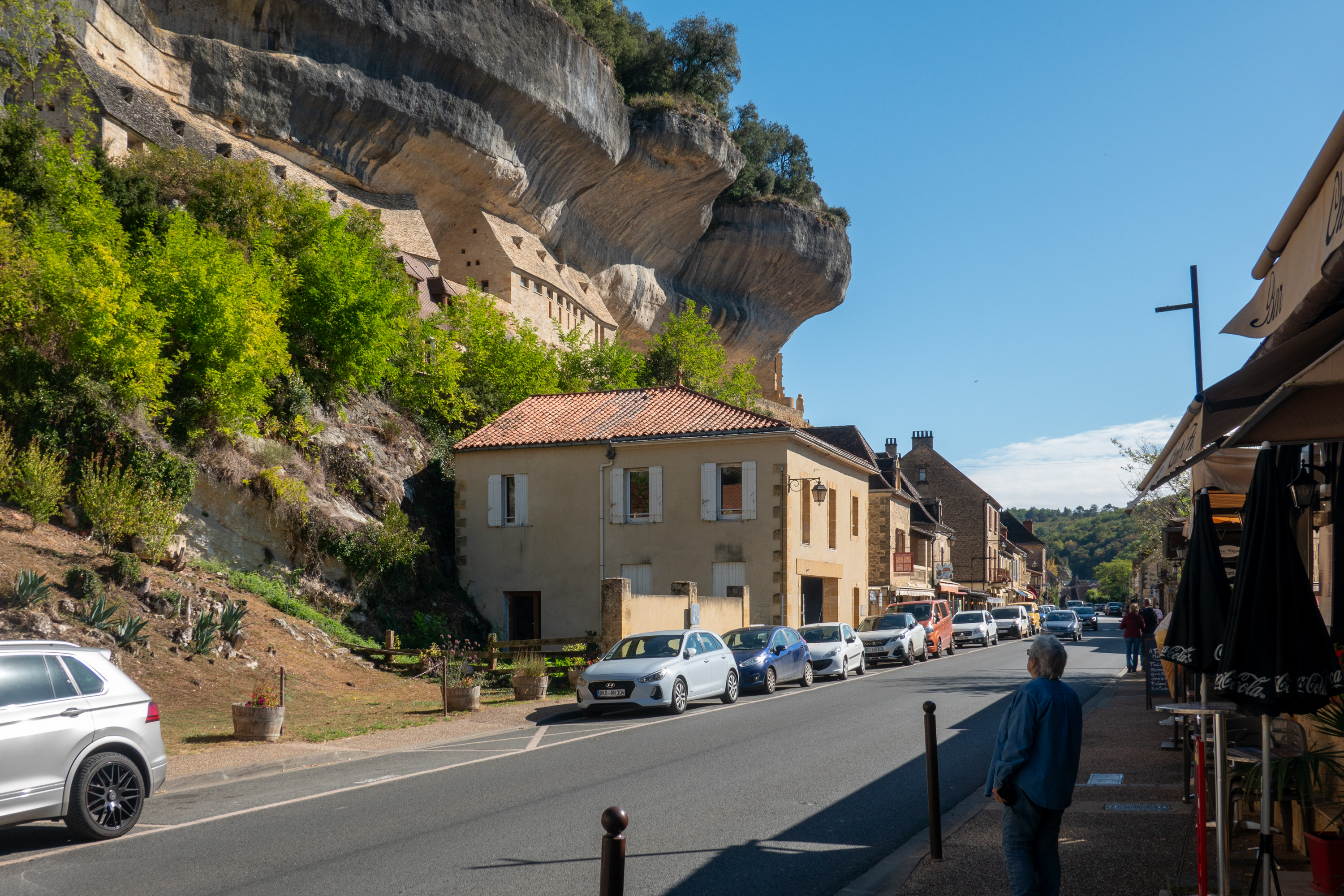
The closest aire we could find was in the little town of Bram, about ten kilometers away. Bram was a castrum (old Roman fort site) in the Langue d’oc, When attacked in 1210 by French crusaders, 100 prisoners had their noses cropped, their lips cut off, and their eyes gauged out. One man was left with one eye so that he could guide the others away. With a hand on the shoulder of the one in front, and the one-eyed man at their head, a file of blind prisoners wound its way to Lastours (Cabaret), a visible demonstration of the ineffable mercy of God’s Christian Army. (Sarcasm alert.) Today there is no trace of the medieval fortifications, but the street layout preserves the traditional “circulade” or circular layout.

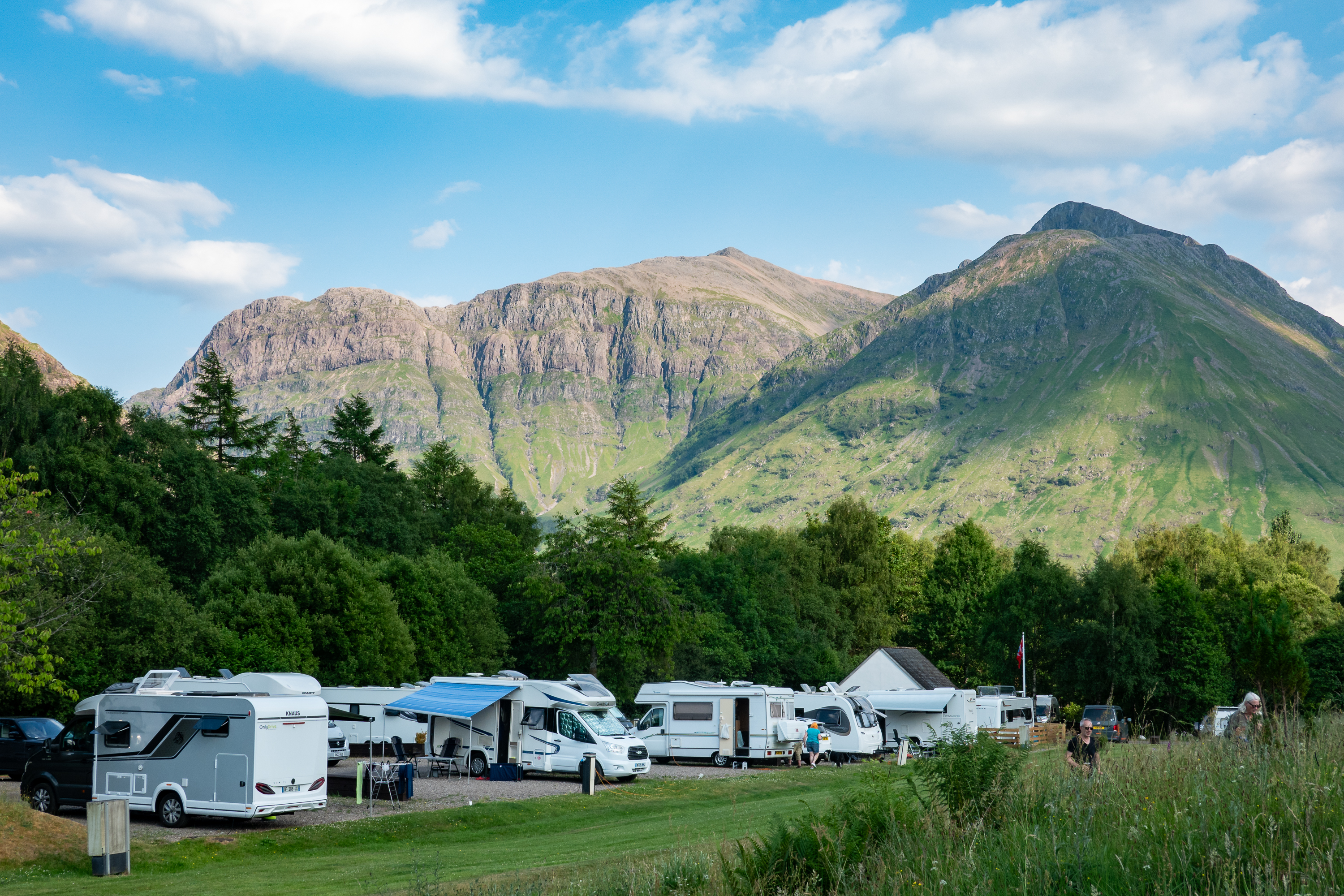
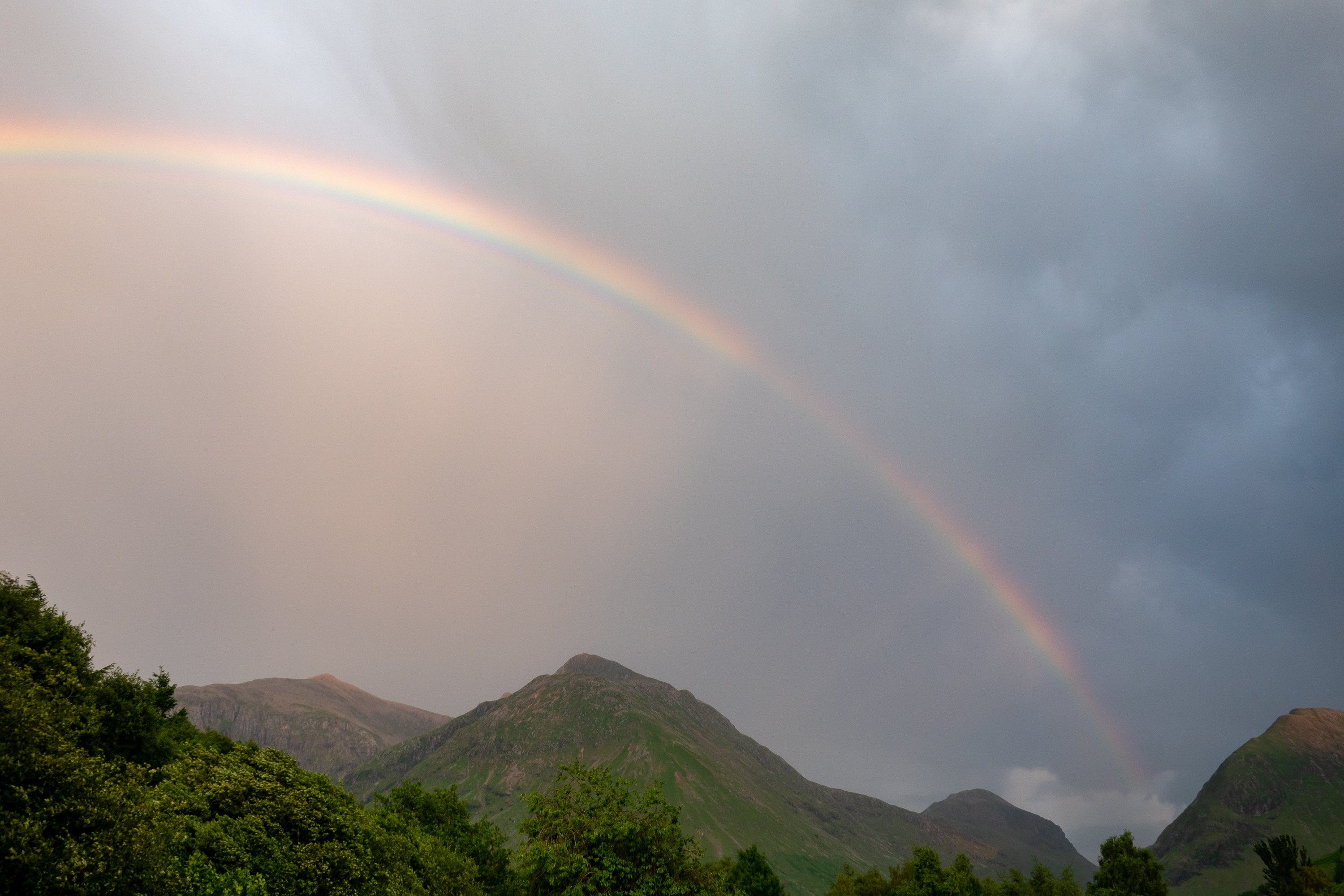
Both the aire and the town proved to be delightful.  The aire is beside a lovely lake and beautiful views greeted us each day.  We originally planned to take the train to Carcasonne, but discovered that we would have a major trek from the aire to the Bram station and from the Carcasonne station to the old city. As Denise has a badly sprained ankle, long walks were not optimal. Then we discovered a camper parking lot, just five minutes from the old town and, with the next sunny day, we were off.

Arriving at the parking lot, we were reminded that we are not the biggest dog around – not by a long shot.

The joys of the off season – lots of spaces!


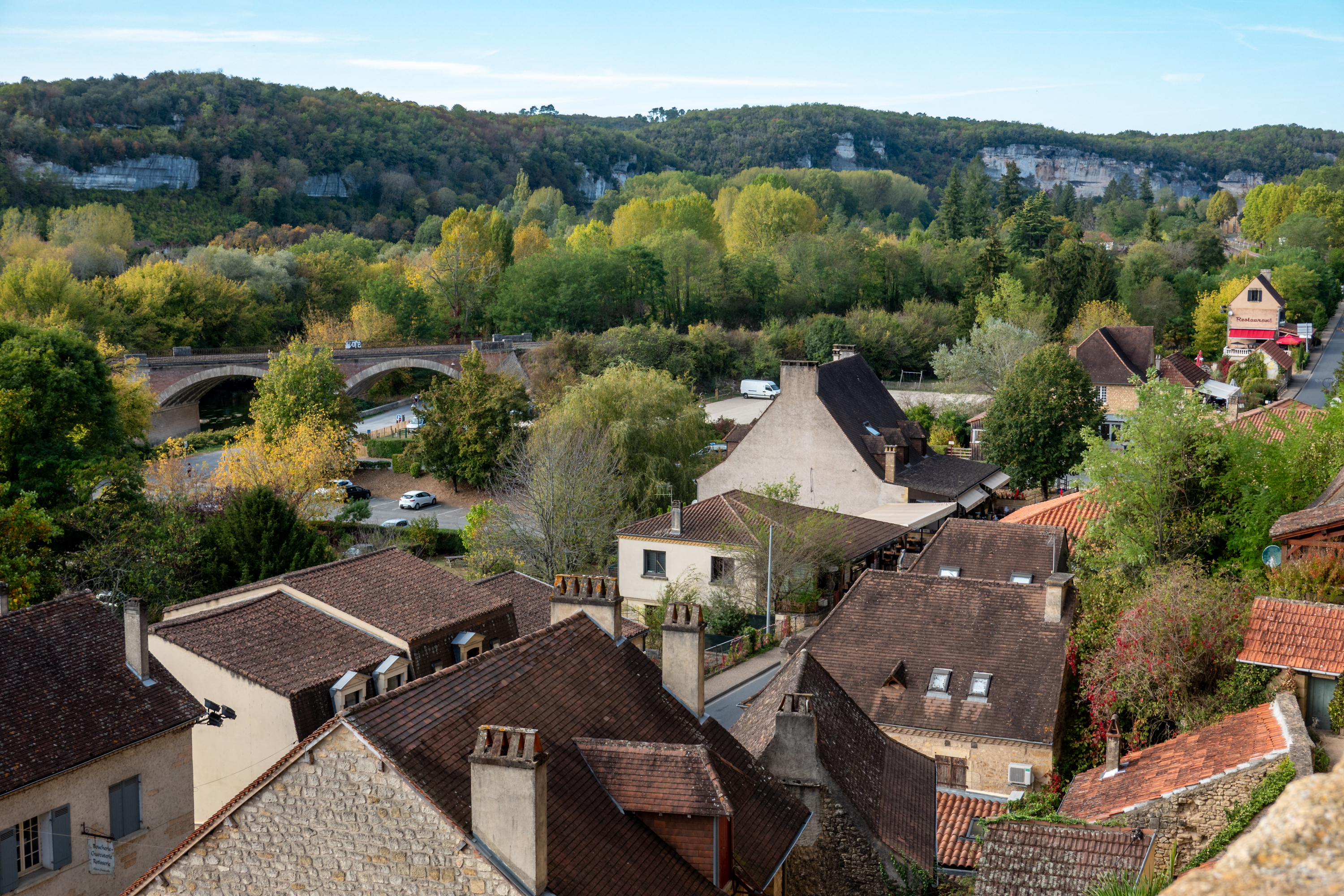
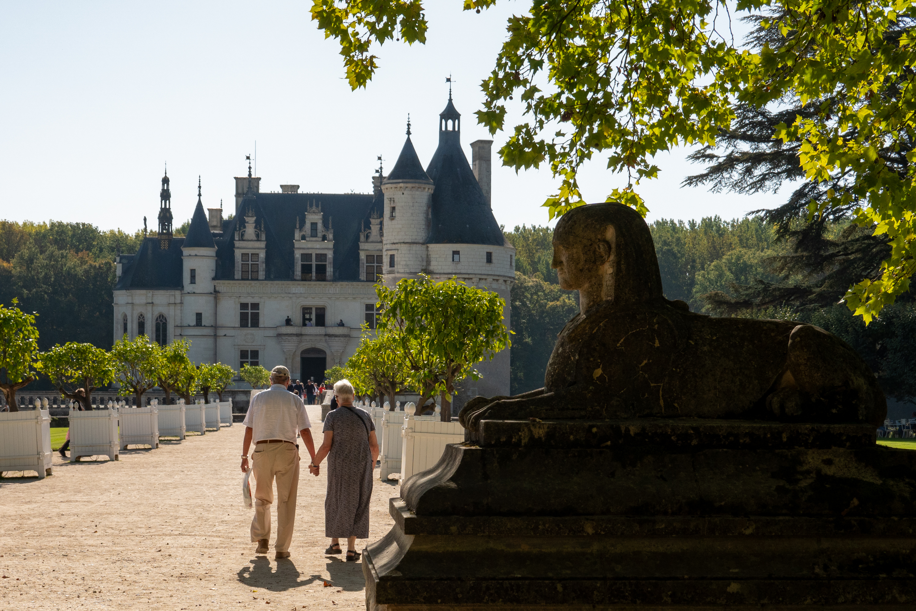
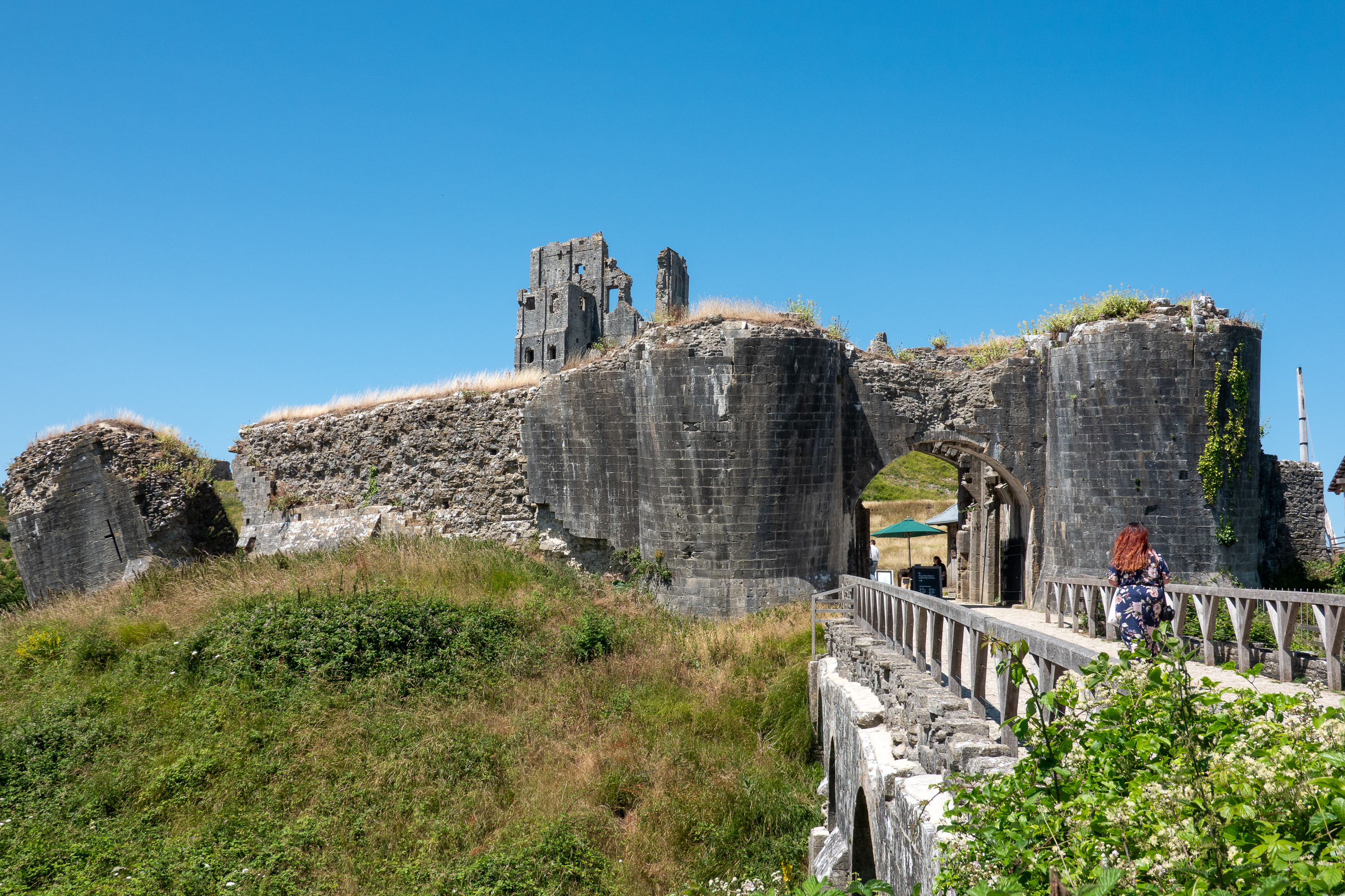
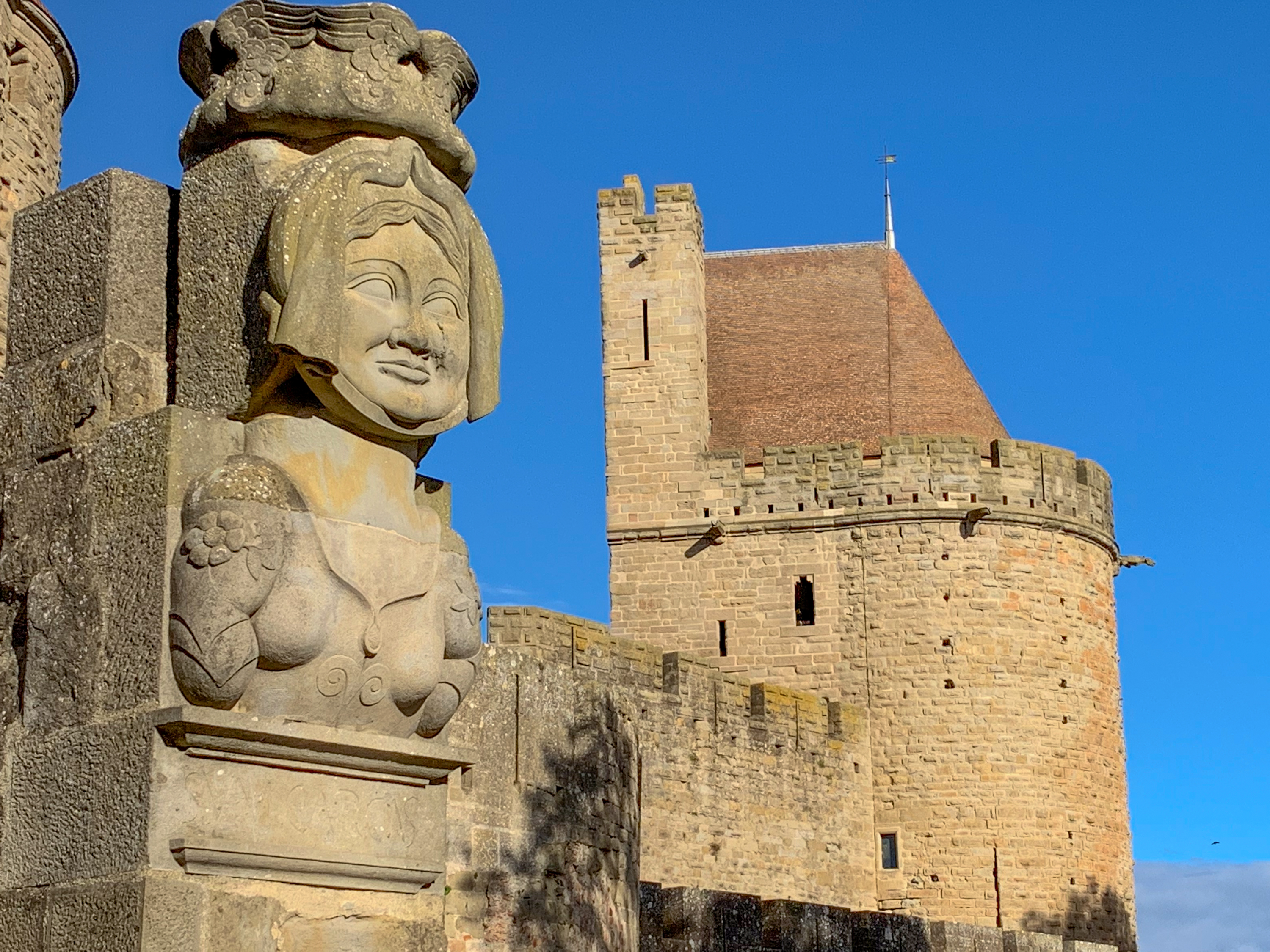
The approach to the old city is simply stunning.

Military history nuts will note the off set of the outer gatehouse, bridge and inner towers.
Dame Carcas still guards her city, but now she welcomes French tourists with money!

One of the legends of the origin of the name “Carcasonne” dates back to Charlemagne. At the time, the city was ruled by the Moors. When their ruler, Ballak, was killed fighting Charlemagne, his widow, Dame Carcas, held the city against the French. The French settled down to a siege.

After five years, Dame Carcas hit upon a ruse to get the French to give up. She fattened up some pigs and then had them thrown over the walls to the French, who, by this time, were feeling the privations of the siege as well. When the French saw that the Moors had so much food that they could give it away to their attackers, they gave up and lifted the siege. As they marched away, they could hear all of the bells ringing, thus “Carcas sonne!” (sonner = sound or ring, as a bell) Any truth? Probably not a lot, as Charlemagne would have only been about 17 years old and the French had already taken the city, but it was enough to name the city and reminds of the long history of conflict in the region. (And lets us continue our search for strong women in history.)

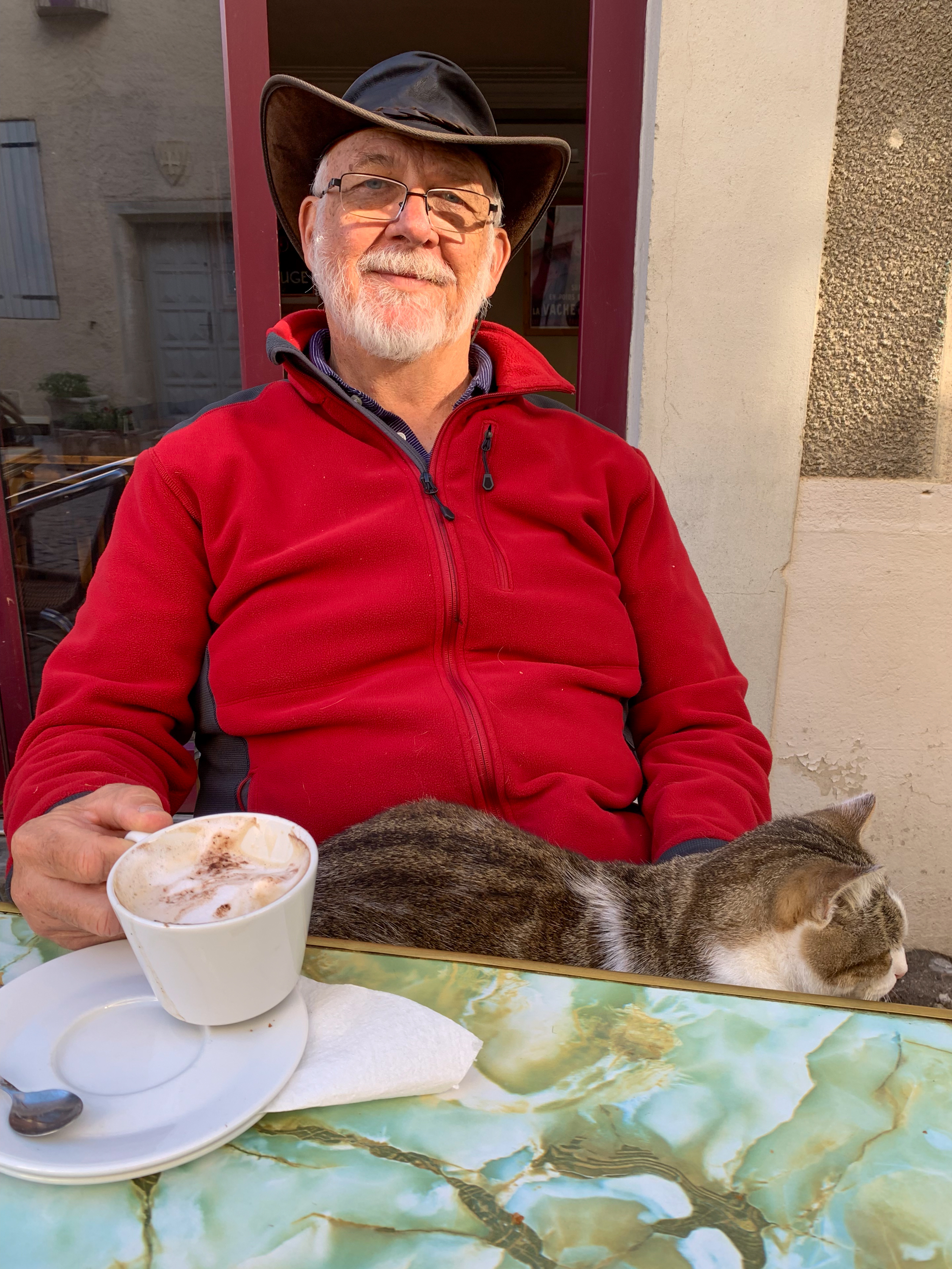
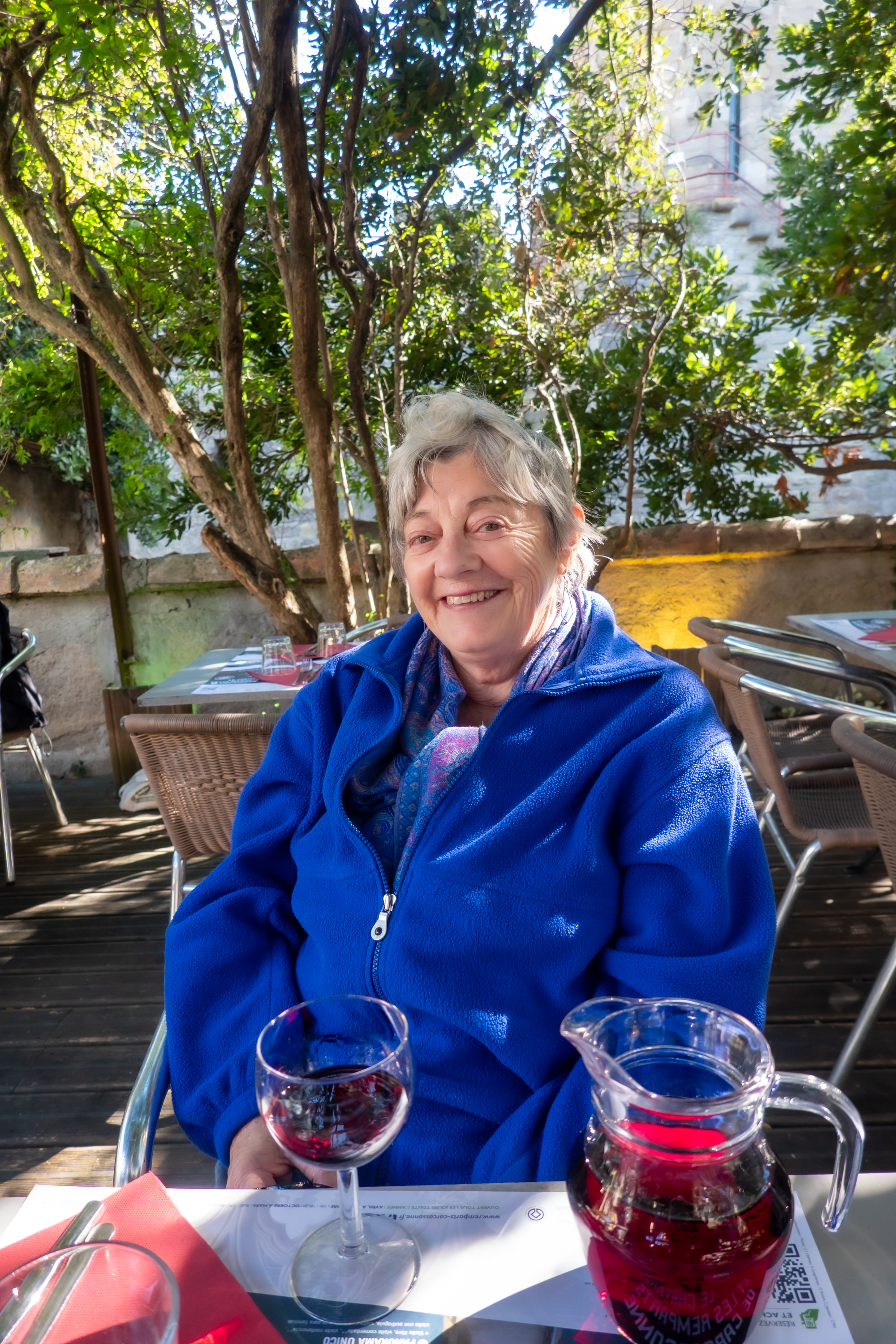
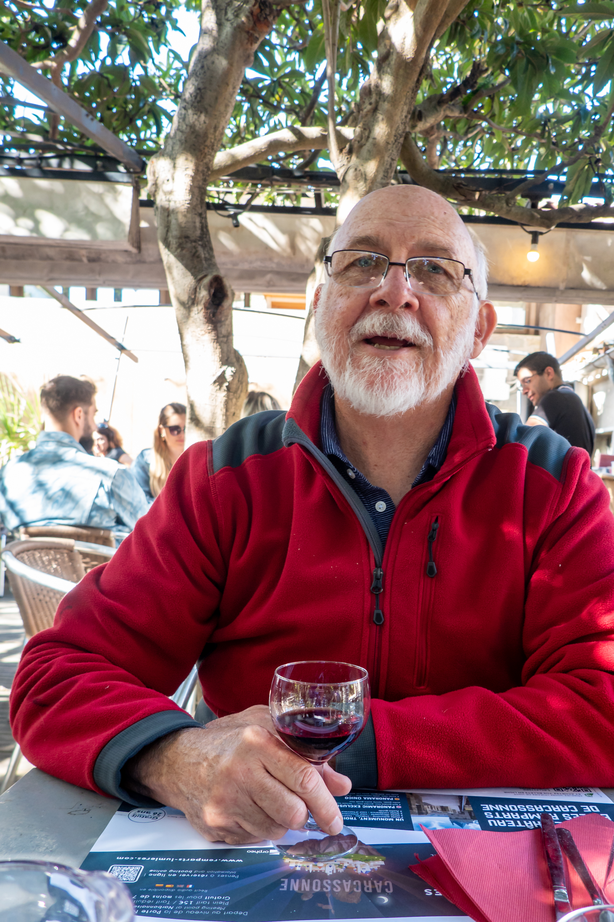
Naturally, we started OUR siege with a cup of coffee at a cafe, where a local cat came over instantly to meet Fred and take over his lap! Denise was afraid Fred would never leave!

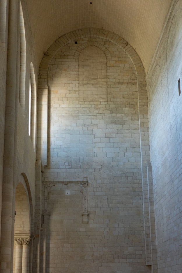
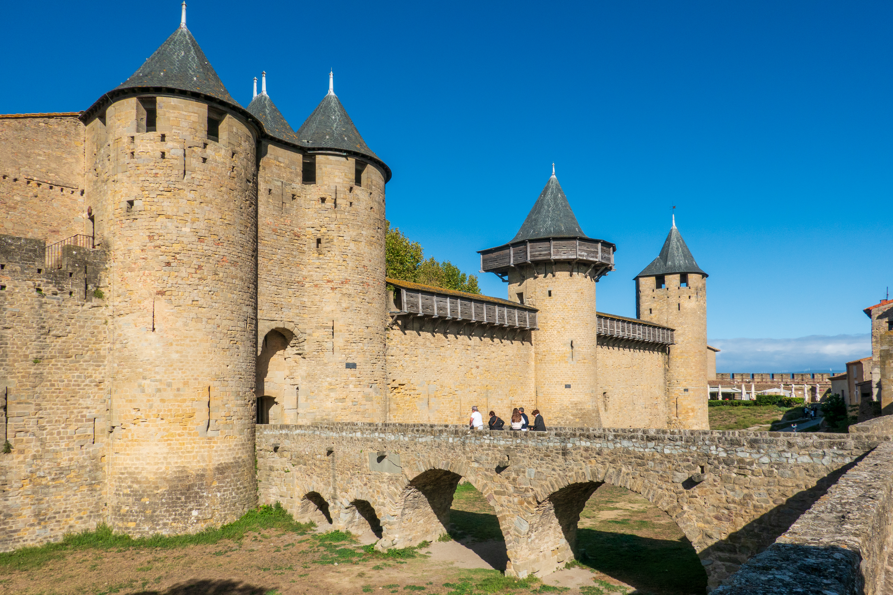
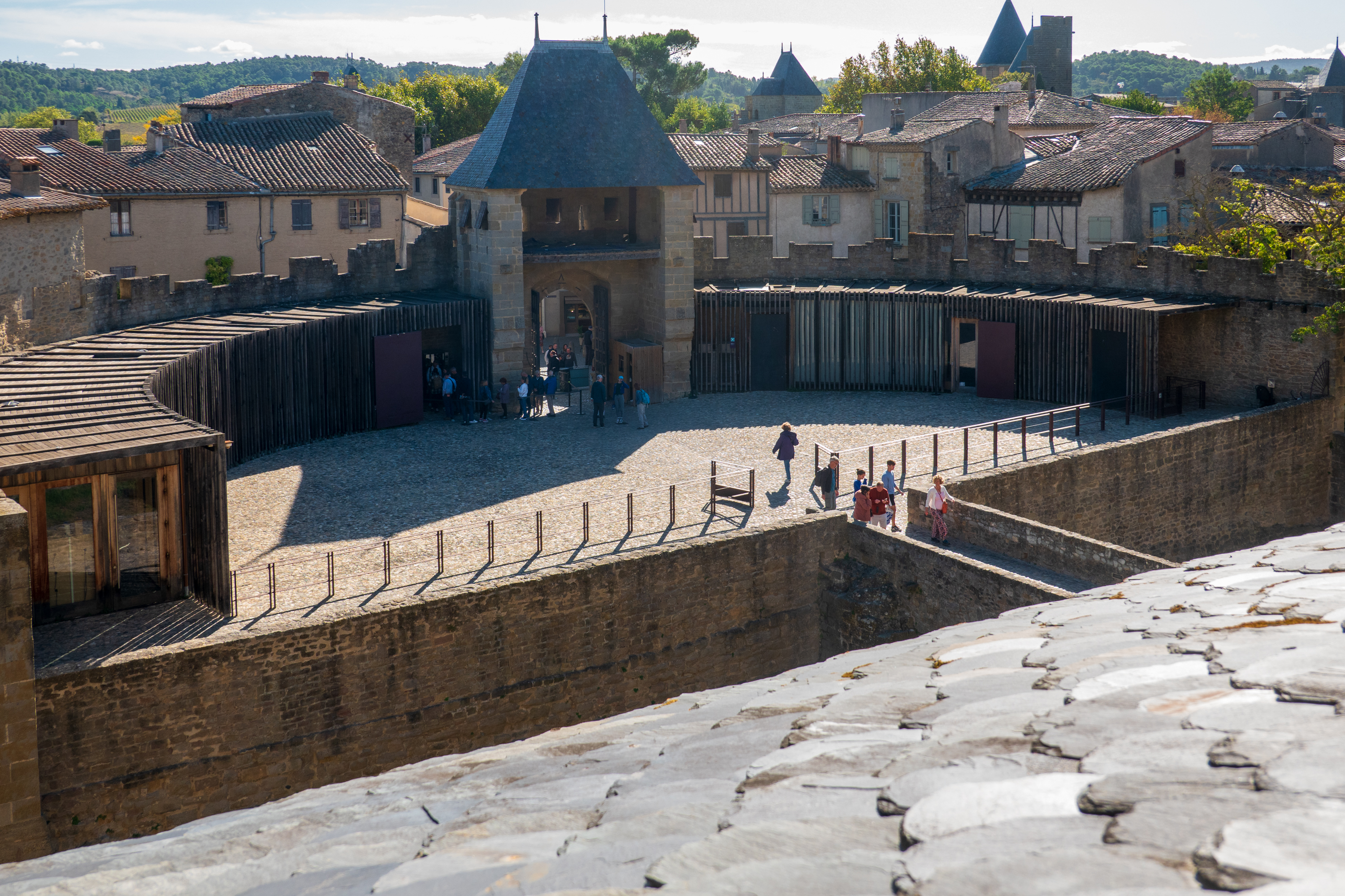
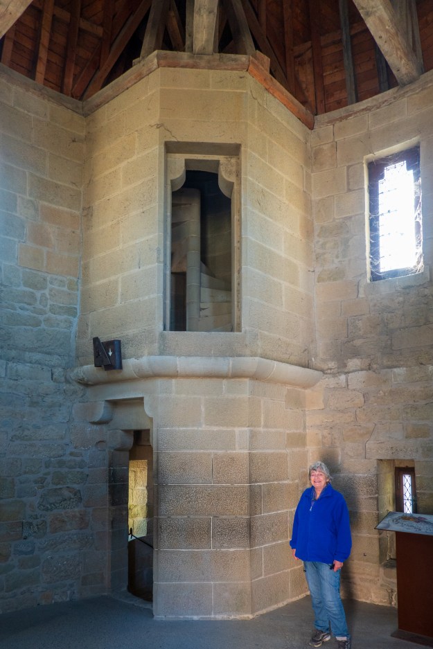
We then enjoyed a short tour in a horse pulled carriage and learned a lot about the ramparts and the different eras of their construction, beginning with the Gallo Roman one.  We tend to be military/fortification nuts and it is rare to have a guide so well versed in the intricacies of medieval fortifications.

The ramparts had enclosed the old, and then only, city, before the “modern” Bastide St. Louis was created outside, during the seventeenth century.

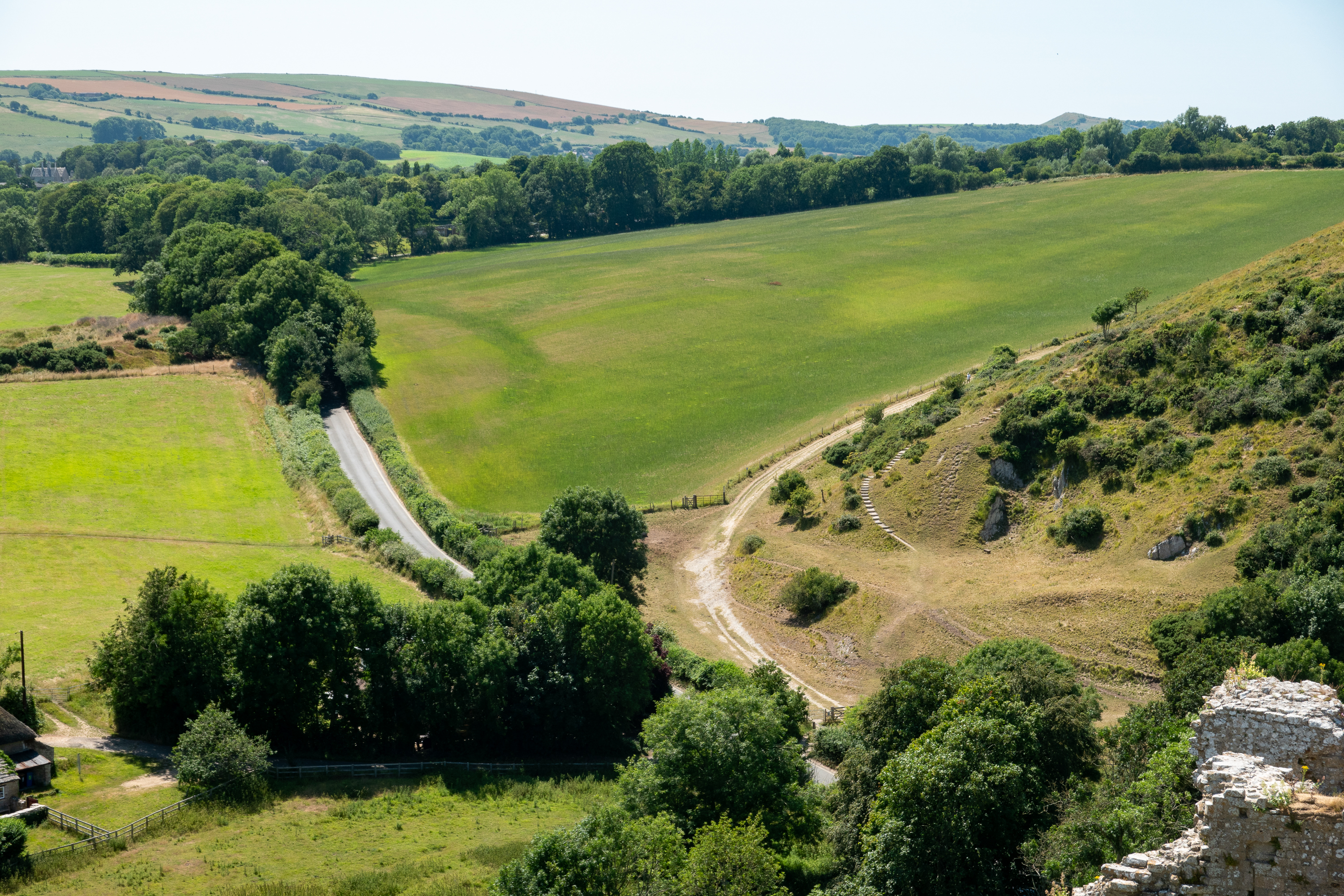
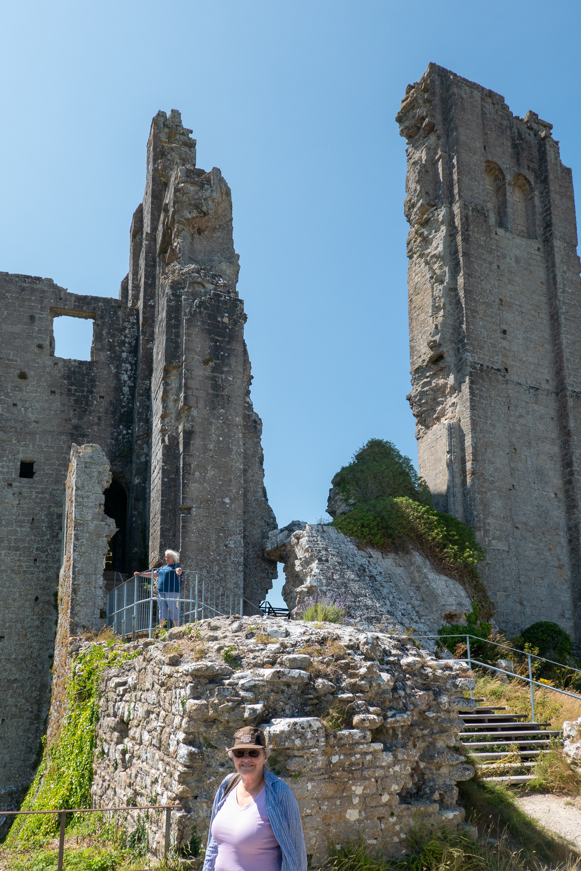
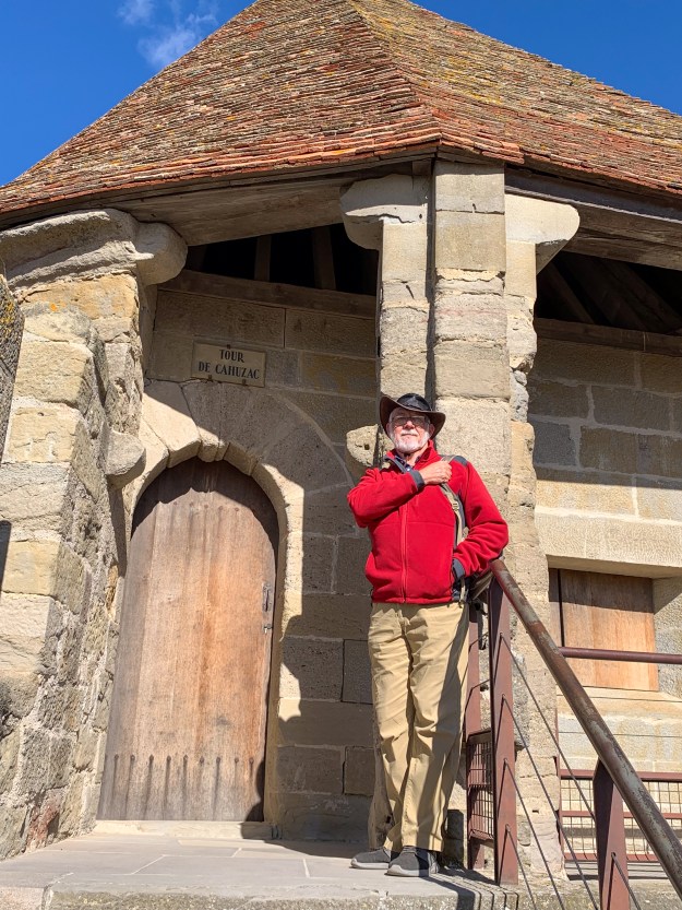
We then tackled the ramparts ourselves, walking up and down multiple sets of steps to towers, which all had fantastic views. 

The inner ward, the oldest part of the city. The part that fell to the crusaders.

Fred has a bit of an obsession about the way that movies consistently fail to present medieval fortresses correctly, starting with the detail that they were usually plastered smooth and white washed or painted. They typically were not grey or craggy.

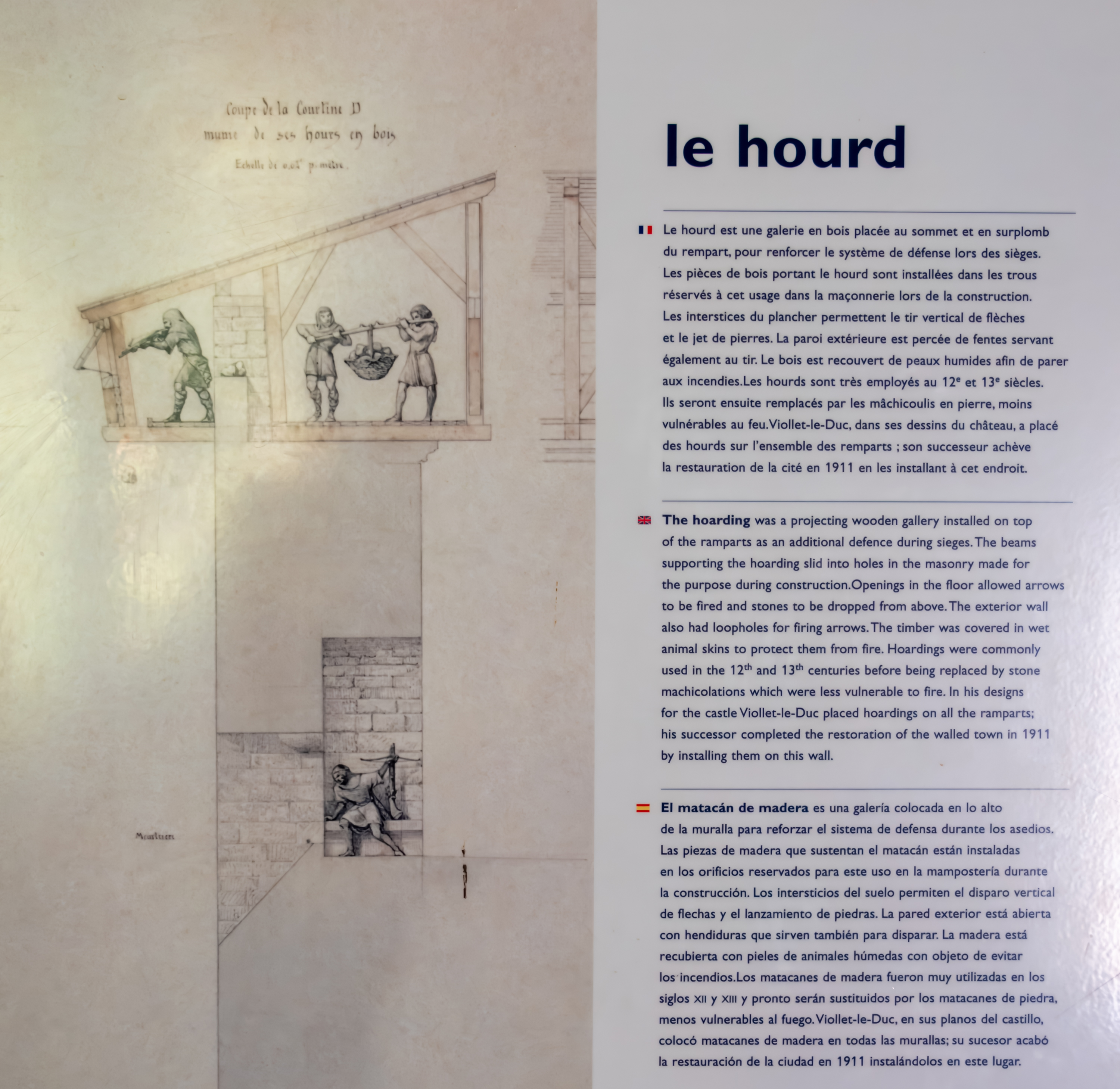
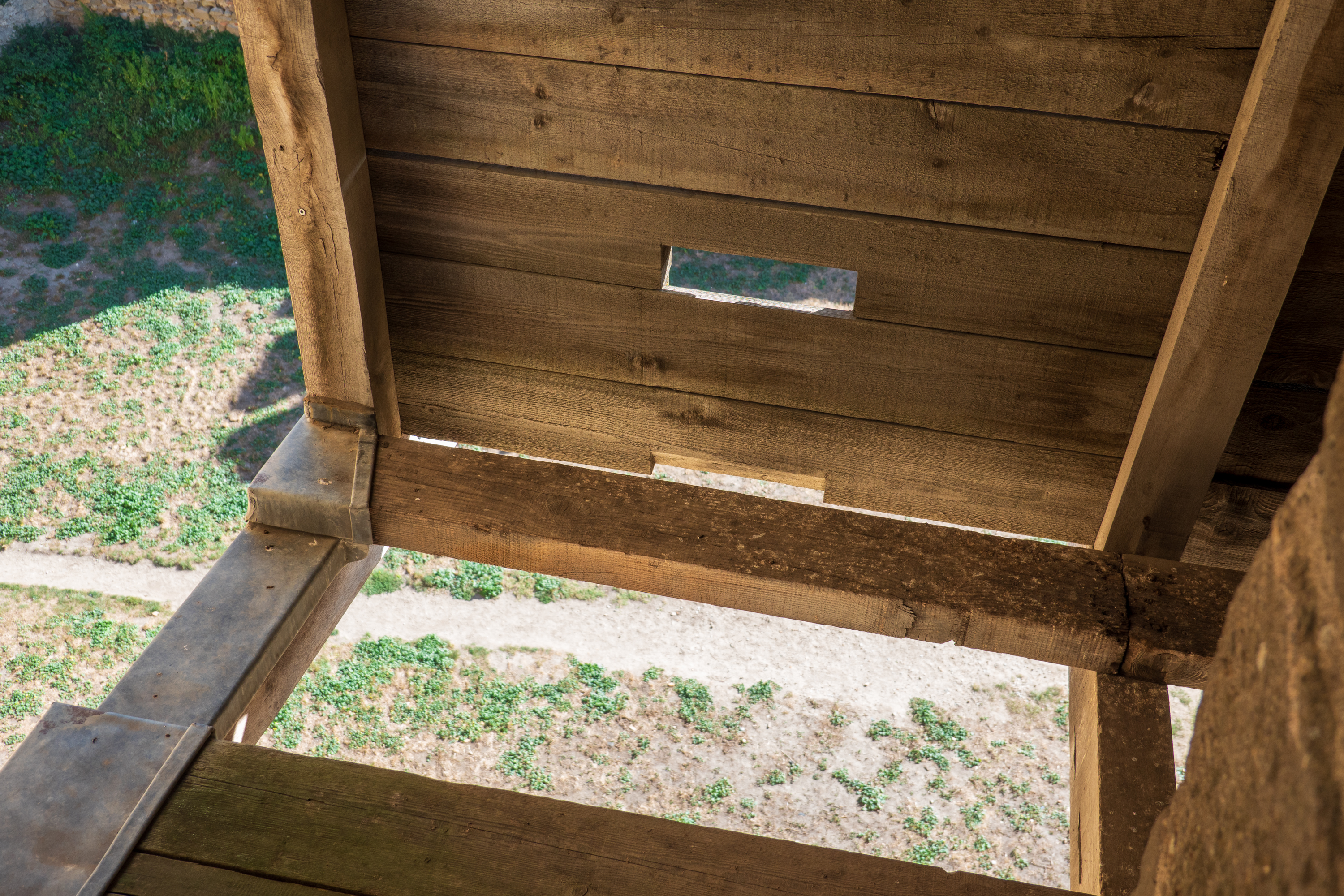
Another example is hoardings and they are beautifully reproduced at Carcasonne. Basically, hoardings are wooden structures used to protect defenders on the walls, conceal their numbers, and allow them to drop nasty things on attackers. (https://en.wikipedia.org/wiki/Hoarding_(castle))

The Wikipedia liked this image as well!
Denise, protected from attack.
Expand to read the explanation.
Drop stones here, but watch your step.
Outer gatehouse, from inner wall. Even if it should fall to the attackers, note that all of the battlements and the bridge, are exposed to fire from the inner defenses. Bridges were often of wood, so that they could be burned if lost to an attacker.

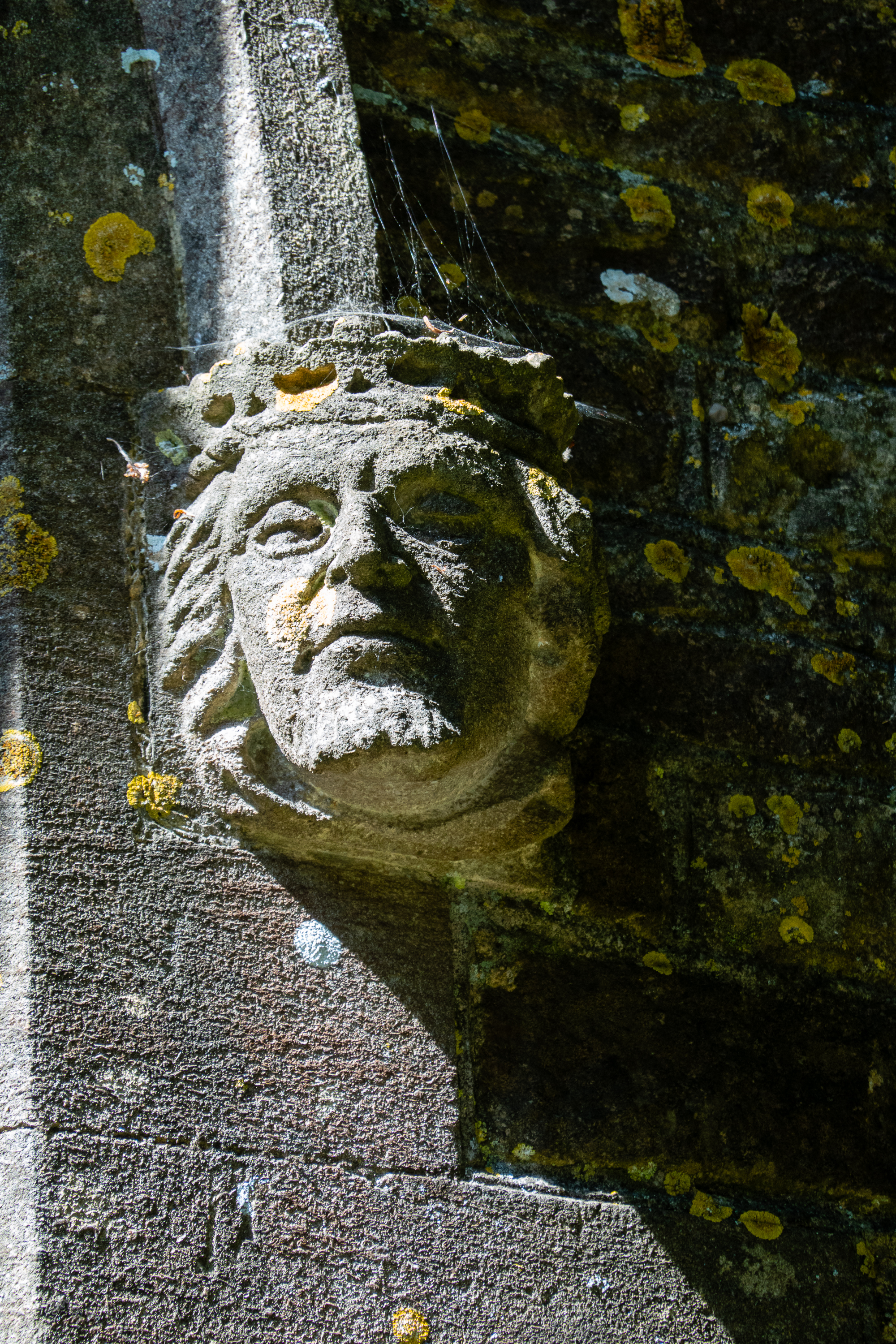
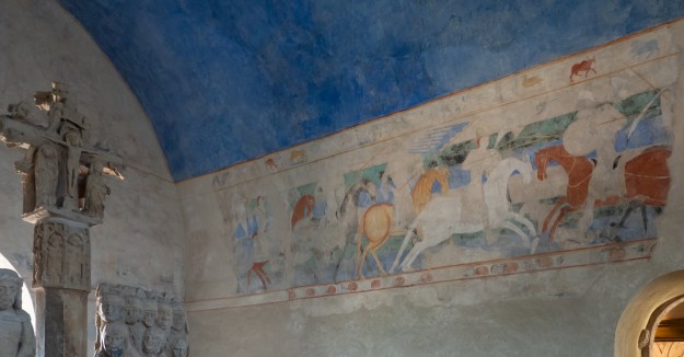
At various points in the ramparts were explanations of different history in small museums. 

It seems that each tower dates from a different era, all the way back to the Romans.
And, yes, parts of Carcasonne have the same curved streets.

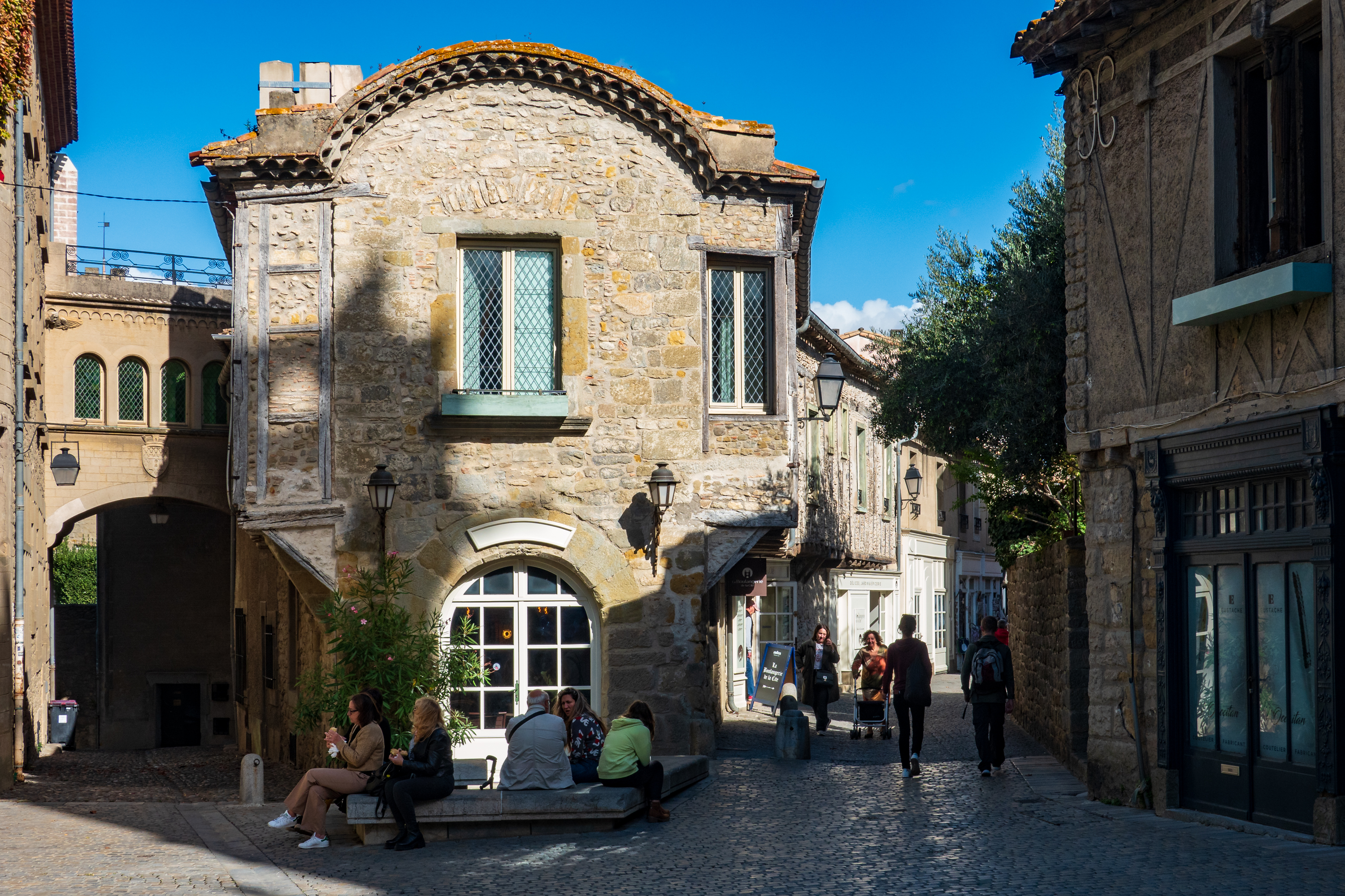
The walk around the ramparts took nearly 2 hours, by which time we were hungry.  We headed back to our coffee site for a Cassoulet, which was excellent.  We sat out in the rear on a lovely terrace.  There was no cat, however!  Fred was disappointed!

Sangria is best by the pitcher!
Not a cat, but very good.
From the lower city you can see that there was really only one side that could be attacked with towers, etc.

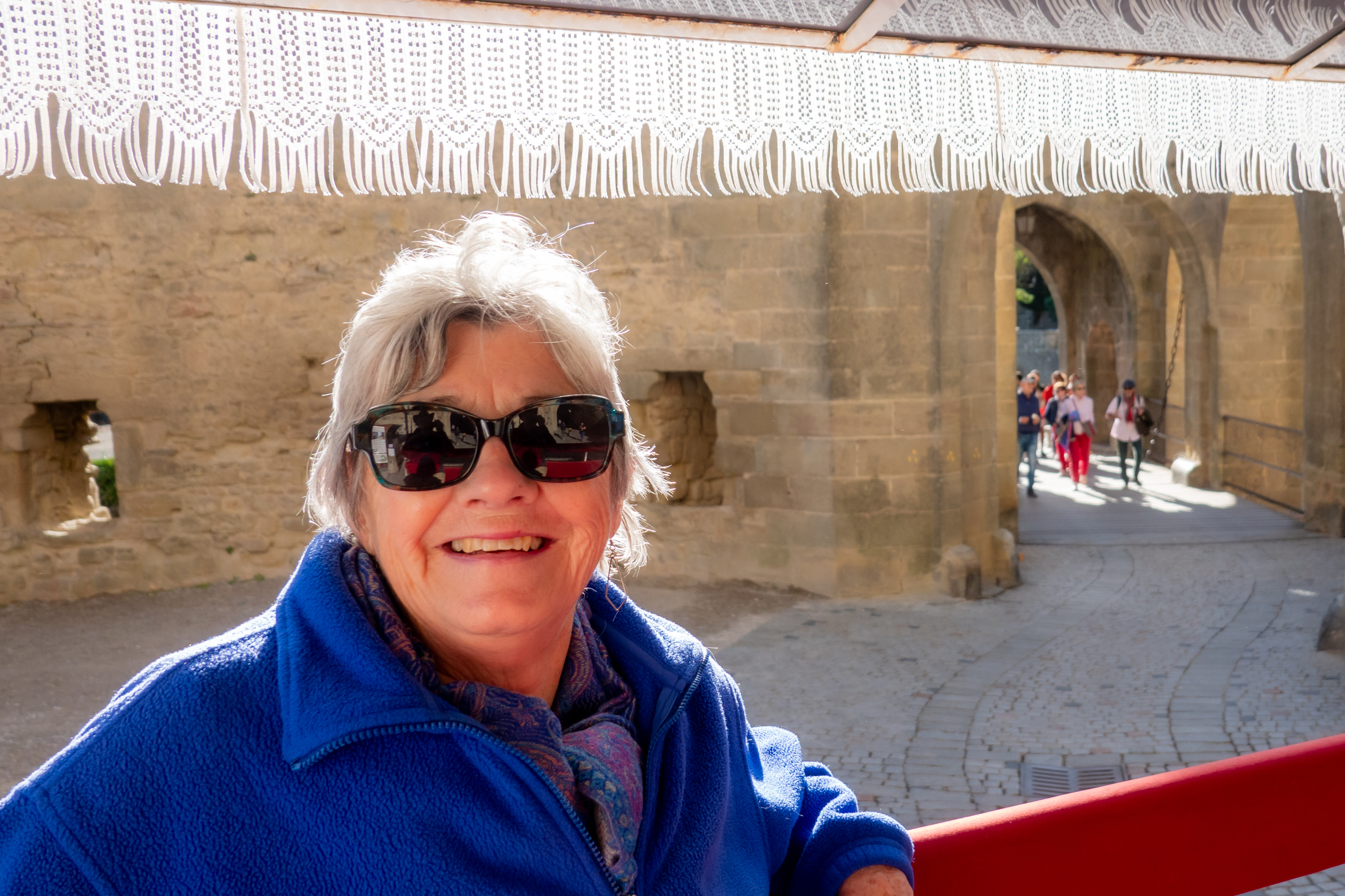
Finally, we took the Little Tourist Train, which ran past some of the ramparts and then into parts of the lower town.  So we learned more facts about both.  A great day.

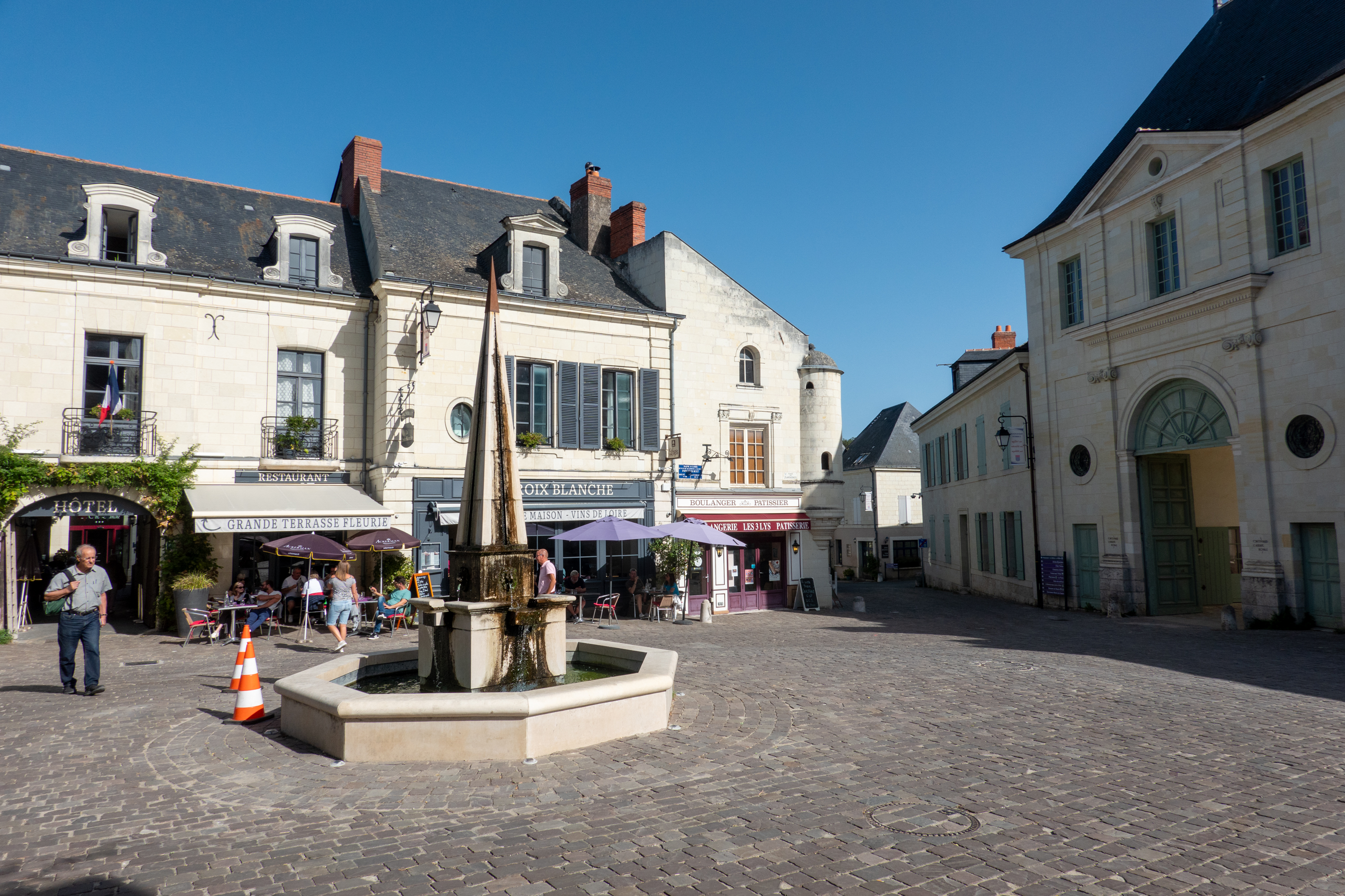
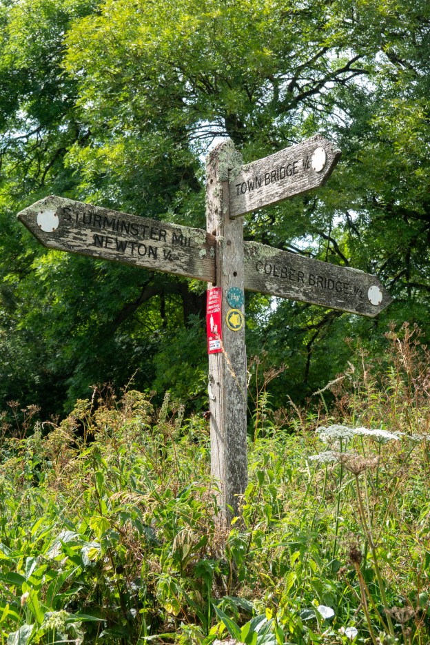
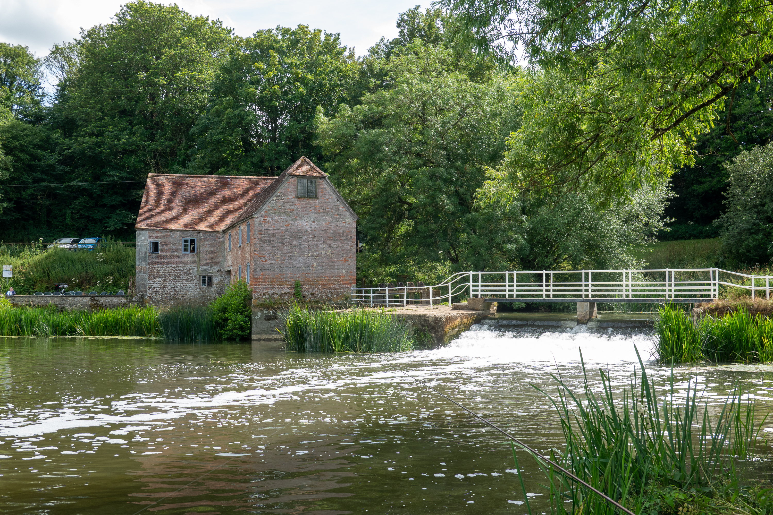
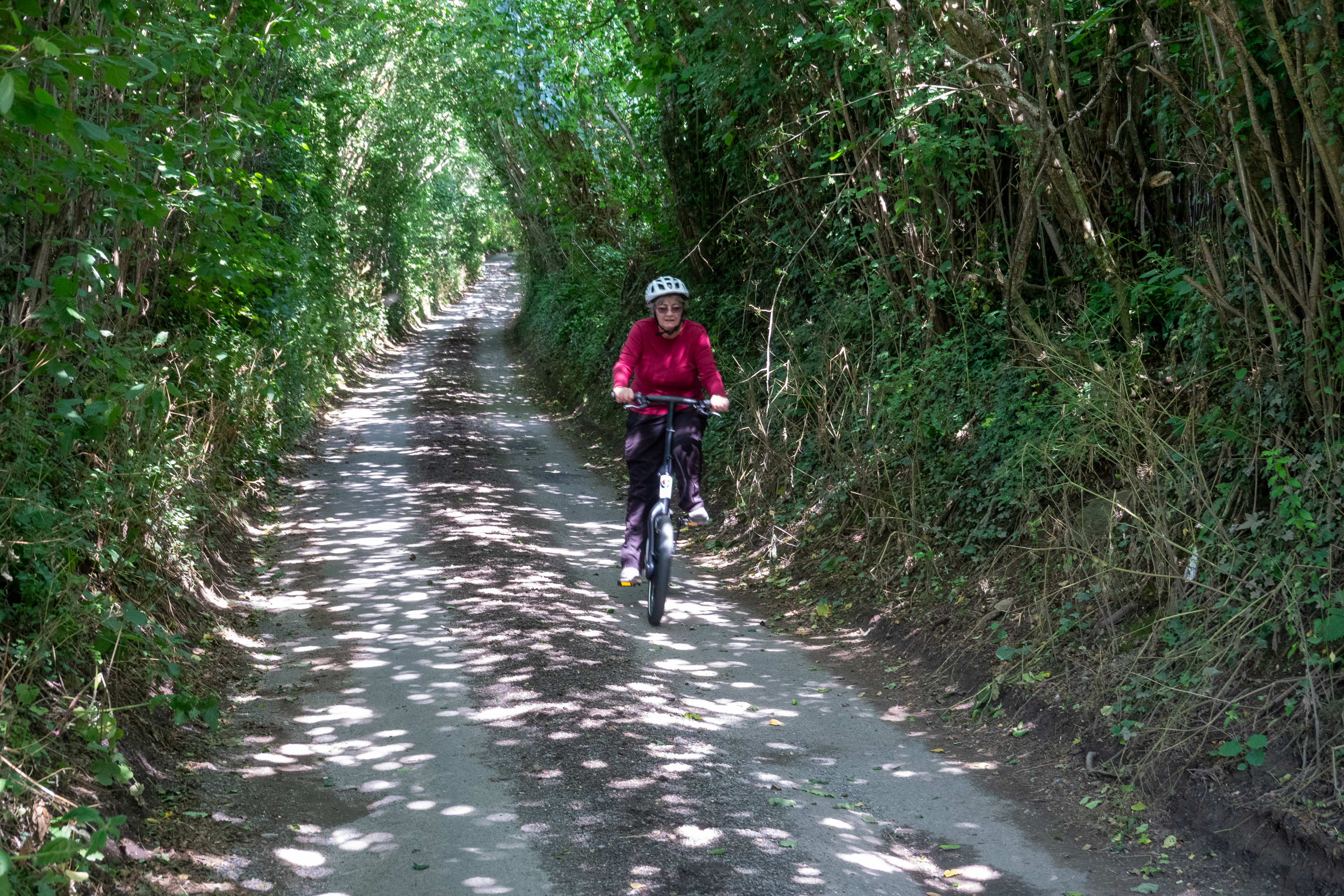
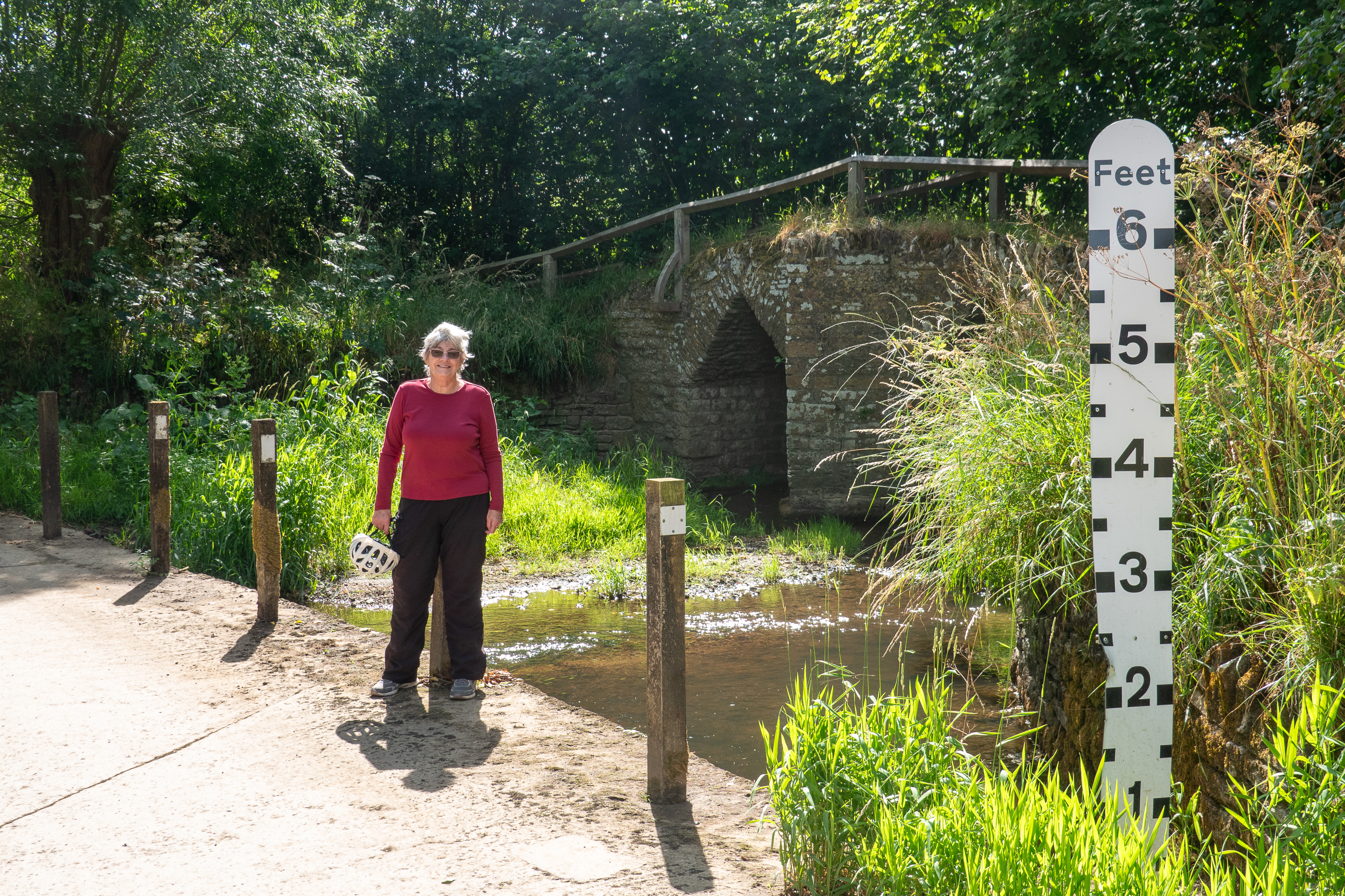
The following day was much cooler but we did take our bikes into Bram. Bram lies on a plain, beside the Canal du Midi, with the Pyrenees to the south.

Looking towards Spain.

We admired the circular town center.

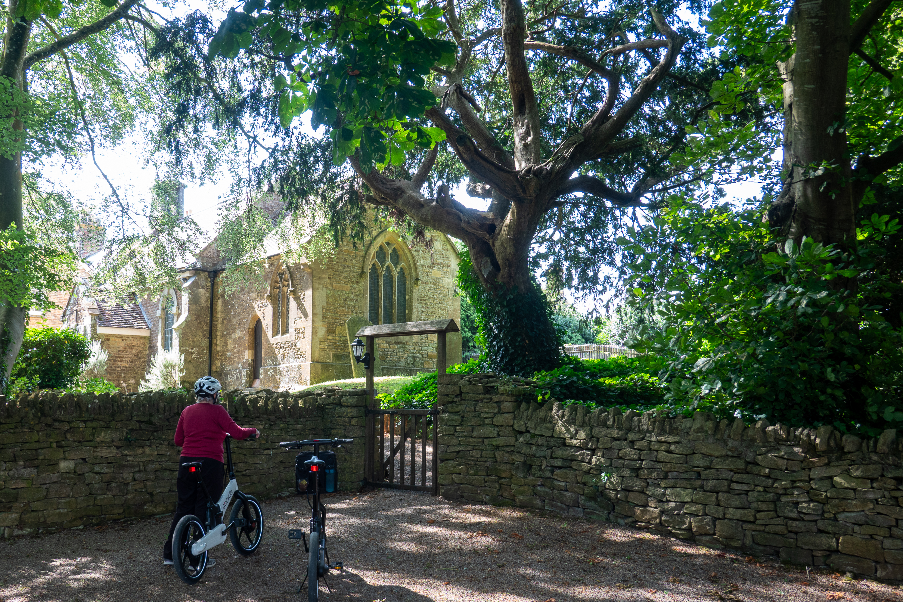
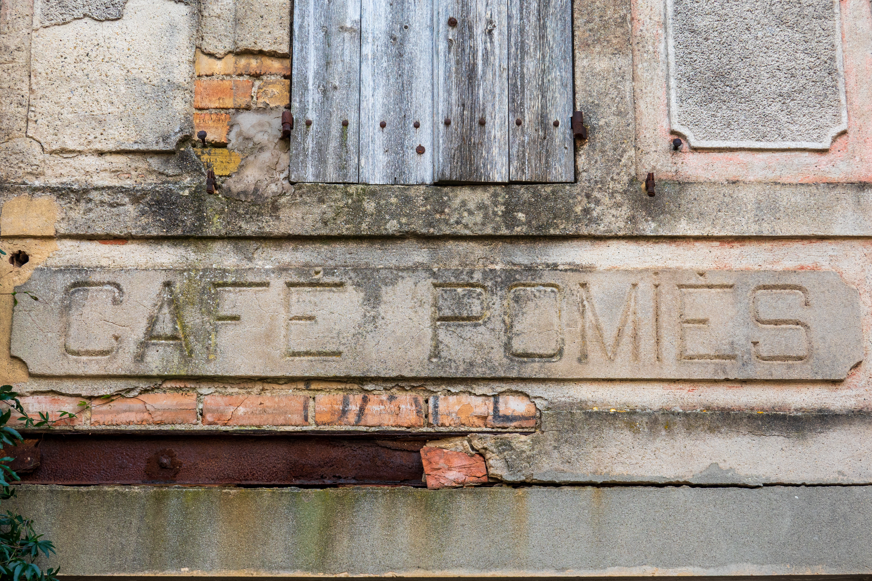
As it was Sunday, we were not able to visit the church but the curved streets were interesting.  Lots of buildings looked abandoned.

Billiards hall
Cafe

After a quick visit to view the Canal du Midi, we returned to the camper, ready for some warmth!

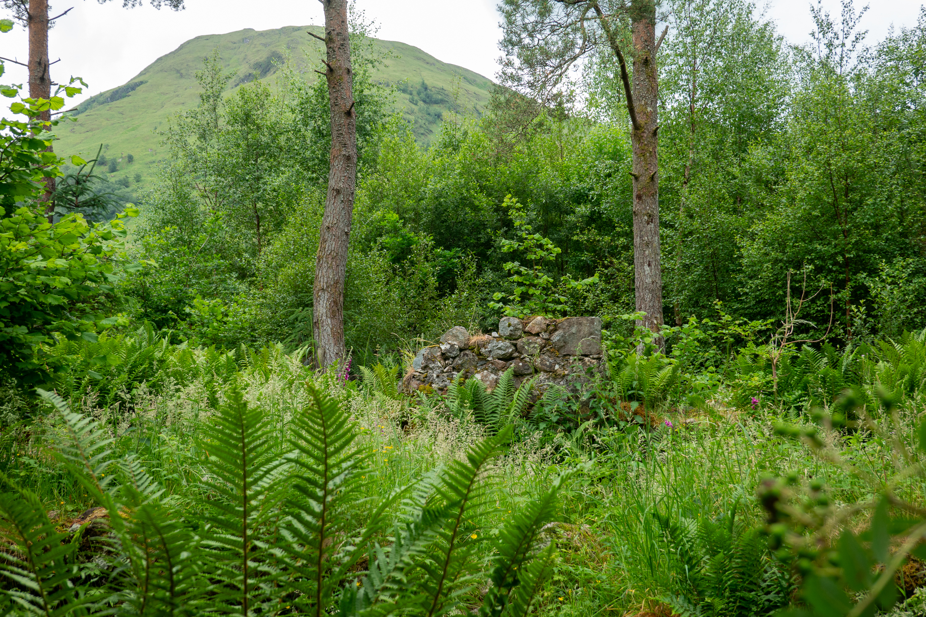
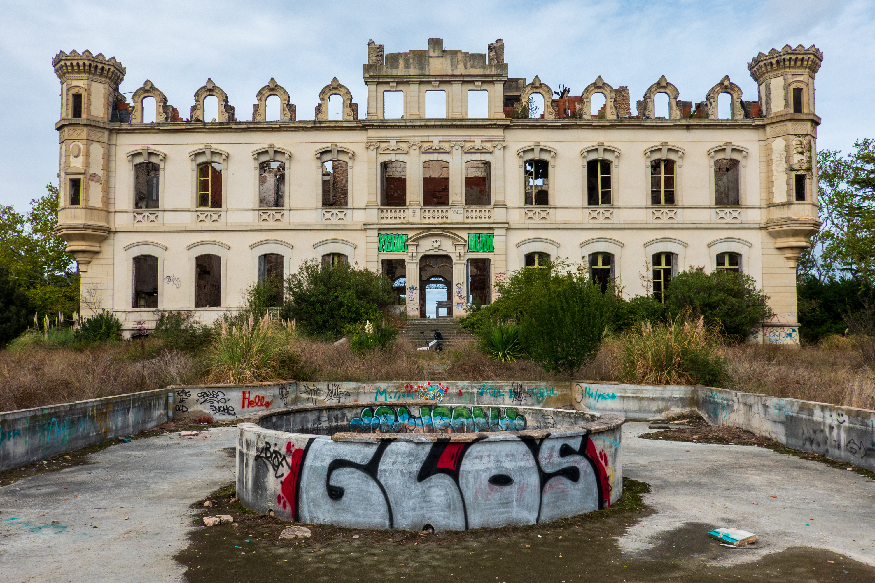
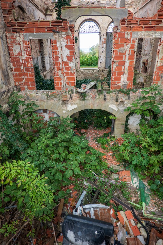
We found some interesting mentions of an abandoned chateau, the Chateau de Valgros, so Fred set out on his bike to find it.

Parts of the trail were a bit spicy!

And there it was, abandoned and the victim to two fires. A plan to make it into luxury apartments never panned out. Beautiful building, but a bit of a fixer-upper.

View of the back from what would have been the formal gardens.

Next up, the search for wine and cheese.

The Dordogne Beckoned

And where, you may ask, is the Dordogne? Well, it is a Department of France with a long, long history. Long as in back to the Middle Ages? Nope, longer. How ’bout the Gauls and Romans? Nope, longer. Greeks? Too soon. OK, we’ll give you neolithic, and that is why we are here. The Lascaux cave paintings are the stuff of legend.

As we headed south our first stop was at an aire on a country horse farm.  It was excellent and provided power, water and a bag of tomatoes when we arrived!  We enjoyed visiting with the horses and went to the neighboring town of Bellac for groceries and laundry.  And on to Montignac where we camped in a pleasant aire, an easy, if very steep, 20 minute drive to the Lascaux caves.

And on to a complex explanation. Visitors are no longer allowed in most of the original caves because of deterioration to the paintings.  (They are a bit old.) In the 1960’s a full size replica of the original cave was constructed inside another cave nearby. After careful measurement, some 85% of the paintings were recreated by craftsmen using similar dyes, tools and methods to those used by Cro-Magnon man – a six year undertaking.  This is Lascaux II.  More recently, a digital presentation of the cave has been opened in a nearby modern building, complete with films and other high tech displays.  That is Lascaux IV.

We chose to go to Lascaux II because we wanted the feeling of being in a real cave rather than a representation of one.  It was fabulous. 

The masterpiece. The paintings were done into a depression in the rock so that they have a three dimensional effect of the animals springing out at you.

We had an excellent guide who knew all about his subject and the paintings were large and amazingly colorful.

A visit to a different set of caves in Rouffingnac proved interesting.  This cave had been excavated to install a small electric mining train, which enabled them to limit the number of visitors.  (We are suckers for trains of any size or kind!) They had opened up the cave passages to build the railway. Most of these paintings, or mostly outlines, had been painted while the artists were on their backs and cover the ceiling. The paintings themselves are much less colorful and impressive until you realize that you have ridden a train for some thirty minutes through passages that have been cleared of mud. In neolithic times, you would have had to crawl in and then lie on your back to see much. Clearly, this was not a temple or gathering place for a lot of people.

There are many, many caves all over this area, some with paintings, and some with classic commercial cave stalactites and stalagmites.  It would take weeks to see them all but we enjoyed the ones we did see. 

We camped in Las Eyzies-de-Tayac-Sineuil (say that three times fast) for our Rouffingnac visit and while there we visited the excellent National Museum of Prehistory.

The museum, is built into the ruins of Las Eyzies Chateau, which, in turn, was built directly into the side of the cliff. The Museum has thousands of examples of tools, artifacts, statues, and recreations of paintings and dwelling caves from the Cro-Magnon era, culled from the entire area.

From the Chateau you can admire the village and narrow valley. The campground is just beyond the railway viaduct.
Denise at the ruins of a tower in the Chateau.
Beautiful old street with houses built into the cliff.

Moving east, we drove to Cahors, which has a most interesting fortified medieval bridge, built in from 1308 to 1378, called the Valentré Bridge, which we wanted to see.  It is a UNESCO World Heritage site. 

We knew we would have to park and take the bikes to see it as all the roads around it had weight limitations.  But when we made it to the large car park that allowed camper parking, it became clear that it was a mess, full of double parked cars, residential campers and there was not a chance we could park.  And then someone parked beyond the end of a row. Grrr! In fact, we barely got out.  Since I could not get my own shot of the Valentre bridge, I am shamelessly stealing this amazing shot by my neighbor Bruce Dale. Bruce did this for a living for National Geographic and you can see more of his great work at: https://brucedale.com

For the photo geeks, this was hand held. You try it.

So we gave up on Cahors and drove to St. Cirq Lapopie, a village east of Cahors, that Denise wanted to visit.

It was an amazing visit.  We camped down by the river with a full view of the hilltop village above us.

We took the bikes, grateful for their electric feature, and climbed the steep winding road to the village.  This village defined the term “vertical real estate” and the views from it were amazing.  We visited the church of St Cyr and Ste Julitte, saints dating from the fourth century, and saw at least some of the 13 historic buildings there! 

Unfortunately, a lot of the artisanal shops that Denise wanted to visit were closed.  The shoulder season really closes up in October.  But a cafe on the main square was open and we enjoyed a coffee and an ice-cream before heading back down the hill.

Both the road we took in and the road by which we left were amazing. 

As narrow as it looks. Fortunately there was not a lot of traffic and, for once, none of it was big trucks!

They were one lane, winding roads along the cliffs with incredible views and we came upon a couple of small villages which did not even show on the map. 

For example, the village of Lugangnac had a full size old fashioned windmill with sails and a chapel beside the road with a plaque “For Bread and Prayer”. 

We stopped at the next larger village Limogne en Quercy for coffee in the village square.

Classic French village square.
It’s REALLY big!

Denise went wandering while Fred ordered coffee and went to the boulangerie to acquire a treat to eat with it.  He came back with apple goodies and an absolutely huge bread that we shall be eating for months! (He is no longer allowed into a boulangerie without adult supervision.)

Coffee and goodies accomplished, we pressed on towards Toulouse. From the Neolithic to the Space Age!

Amboise, Or an Island in the Loire, Part Two.

Clean clothes in hand, we set out for the Fontevraud Royal Abbey. Established in 1101 the Abbey was always headed by an Abbess, despite the presence of monks. It became a prison during the French Revolution and remained one until 1963.  It was then renovated to show its former life. Perhaps the Abbey’s greatest claim to fame is as the resting place of three of the great (or infamous) Plantagenets – Henry II, Eleanor of Aquitaine, and their son, Richard, known as the Lionhearted. A reminder that a lot of “English” monarchs really had their roots in France. There are lots of serious books about the Plantagenets; for something a little, but not much, lighter, try the historical fiction of Sharon Kay Penman. (https://sharonkaypenman.com/book-category/us-editions/) Penman’s books cover eras and characters made popular in various TV shows, plays, and movies, such as “Cadfael”, “Richard III”, “Robin Hood”, “The Kingdom of Heaven”, “The Lion in Winter”, and many others.

We enjoyed a wonderful (full menu) lunch on the square before touring the Abbey.

Lunch to the left, Abby to the right.
The Germans used the prison as well.

We finished our day at the Clos des Cordeliers. (https://www.clos-des-cordeliers.com)

Graffiti left by a Parisian sentenced to ten years of hard labor.

According to legend, the prison was so harsh that it was called a “prison for guards.”
Note the food slot at the bottom of the door.

The Clos des Cordeliers is part of France Passion, so we were able to spend the night. We enjoyed a great tasting and chat with the staff and we learned that the harvest had just finished, so everyone was happy!  We bought several bottles and moved the camper for the night.

In Saumer, the aire was on an island in the middle of the Loire. A quick pop across the bridge on the bike and you were in the old town. And now, reaching Amboise, we parked on yet another island in a very dry River Loire. So we got on our bikes and popped across another bridge to reconnoiter.

Wild, rainbow effect in the sky.

The main street was busy with tourists. So, naturally, we stopped for a coffee and a goody. And we came back for a wine tasting in a gallery under the castle.

Love buildings built over the road. Site of the dreaded flat tire!

We had come to Amboise specifically to see the Clos Lucé and the Parc Leonardo da Vinci. We found it and, the next morning, returned just as it opened.

The chateau Clos Lucé was originally a fortified residence. Unusual in that all you can see from the road is a nondescript gate.

Were it not for the signs, you would never notice the entrance.
Step inside the gate and it is a whole new world. A very comfortable house, still joined to the original military tower, and huge, extensive gardens.

Leonardo da Vinci spent the last three years of his life here, at the invitation, in 1516, of Francois 1 of  France, and so left a treasure trove of possessions. 

Front door to the main house.
View towards the castle.
Prayer offerings in the chapel wall. Note the dates.

The house itself was fascinating and included Leonardo’s bed chamber, a “loggia” or gallery, the Oratory of Anne of Brittany, with frescos painted by some of Leonardo’s students and other fascinating rooms. The whole effect was light and airy.

Beautiful ceiling decorations.

Leonardo’s workshops were a series of three rooms, each concentrating on his various interests.  Denise liked the painting one best, it included a copy of the Mona Lisa, which is easier to view than the one at the Louvre!  Leonardo’s easel and paintbrushes, workbenches and his last drawings including a cat series that Fred liked especially.

Musical instruments. The middle one appears to be an African banjo.
Cats and Horses

There was a clever display of Leonardo receiving a visit from the Cardinal Luigi of Aragon. The latter made an extensive journey though Europe. The journey was detailed by Antonio de Beatis, his secretary and it is a fascinating story for anyone interested in the famous painting, the Mona Lisa, or simply European life at the time. Read more here: https://monalisa.org/2012/09/08/the-travel-journal-of-antonio-de-beatis/

A work in progress.
And Leonardo receives the Cardinal from Aragon.

In the basement were exhibits of a number of Leonard’s inventions, including mockups and miniatures.

Not as far fetched as you might think. Since ancient times, armored shelters were built to protect battering rams, sappers, and others when attacking walled cities and forts. And modern tanks still use sloping armor – certain physics haven’t changed!

This one is armor geek supreme – a breech loading gun, using a worm gear to close the breech. Why is this significant? Leonardo designed a form of tank and the only way the guns could be reloaded safely was from inside the tank, through the breech. But, for another few hundred years, most cannon would be muzzle loading.

Sadly, this mockup is just a toy for children and does not have any of Da Vicnci’s mechanism inside. But it gives a idea.

And he also built a windup, spring powered car as well as a paddle boat with flywheels to smooth out the power. And, of course, a helicopter! As with so many of his ideas, the problem was the lack of any kind of real motor, a problem that didn’t really get solved until the invention of the steam engine.

Then in the Parc we were able to see them full size, including moving bridges and Archimedes Screws and such.  A fabulous visit. People talk about a person being a “Renaissance Person.” Leonardo Da Vinci was the whole renaissance in one person.

No, I couldn’t get it to take off!

We also visited the Chateau of Amboise, which is an interesting juxtaposition of fortification and more modern chateau. 

The the older battlements leveled, this new, free standing building was erected on the site, with stunning views over the river.

It was confiscated during the French Revolution and returned to the one remaining (surviving) member of the family that had owned it afterwards.  Needless to say, it required restoration.  The main floor contained medieval furniture and the upper floors Regency furniture as it was restored post Revolution.

Fred also got a very nasty flat caused by sharp flints (silex), which are everywhere in the region.  Fortunately he found a great bike shop to help him fix the flat.

Our final stop in the Loire Valley was the Chateau of Chenonceaux.  We felt a need to see at least one well visited and well known chateau!  In actual fact, we benefited from summer weather and fall crowds (that is – none!) so we had an excellent day.  We had planned to go to an Aire right beside the chateau entrance, but the access was so narrow, we parked in the free parking just outside.  (And besides, we had already touched a railway crossing sign trying to make the first turn. Grrr! Annoying, as had we come in through the chateau entrance, as opposed to the GPS direct route, we would have made the turn easily. As we did the second time!)

The next morning we awoke to a roaring noise. We panicked as loud noises are never good!
Turned out to be a hot air ballon.

It was an easy walk to the chateau. We started by admiring a row of Citroens of all different ages.

The blue car is a Citroen SM. Equipped with a Maserati engine it finally had enough power to fully exploit its amazing hydro pneumatic suspension.
The red car is an old Traction Avant – front wheel drive. Citroens were always the most innovative cars around.


There are hundreds of chateaux in the Loire valley, but Chenonceau (https://en.wikipedia.org/wiki/Château_de_Chenonceau) stands out because it was built on the site of a fortified mill (!!) on a tiny river island and later expanded with a bridge out over the water. It was also the home of a number of powerful and competing women. (https://www.chenonceau.com/wp-content/uploads/2018/03/guide-2018-UK.pdf)

This painting, said to be Katherine Briçonnet, caught my eye. (https://en.wikipedia.org/wiki/Katherine_Briçonnet)

Unlike many of the others, she looks like someone you could meet today, mastic collar not withstanding.

And she was largely responsible for transforming the mill into one of the most remarkable chateaux in the world. So, unlike the Medici lady (https://en.wikipedia.org/wiki/Catherine_de%27_Medic), you probably would like to meet her.

And, with that, we headed back for dinner.

And on to the Loire Valley

Our first stop was the small town of Saumur, where we found a pleasant campground, with a view of the Chateau, on an island in the river Loire.  The drought was obviously quite serious in this part of France as there was very little water in the Loire.  It was primarily stretches of sand with water in a few sections.  Fred assembled the bikes and we set out for the Tourist Information office for a map.  We also discovered the Maison de Vin, next door, and learned a lot about the many local “appellations” or types of wine.  The Information Office also recommended a Bakery/Patissier called La Duchesse Anne, to which we repaired forthwith! It was indeed wonderful and we enjoyed coffee and a cake there on three consecutive days!

Yes, it tastes as good as it looks.

The following day we cycled out to the Musee de Champignons or Mushroom Museum.  It was an interesting concept that both tracked the history of mushrooms, displayed the various kinds, and also grew them for sale. 

The cliffs along the Loire are made of a soft limestone which produces natural caves. And, as the rock is so soft, the caves have been expanded into quarries, wine cellars, houses, and mushroom farms.

We wandered through quite fascinated by the different methods of cultivation and ended our visit with a purchase of what turned out to be wonderfully tasty mushrooms.  Denise wishes she had bought more. Even Fred ate them.

Mushrooms growing out of blocks of compost.
Shiitakes in the wild.
Denise admires a quarry exhibit, showing how the blocks are cut out.
Passage from one chamber to another.
Don’t know what kind it is, but it is colorful.

No, they don’t leave the mushrooms in the dark and feed them stuff, but they are grown on various types of composted material. And there is not a lot of light, either.

In the afternoon, we cycled to the Musée de Blindes or Tank Museum.  Yes, another one! Fred enjoyed it!  Denise made it through! (https://www.museedesblindes.fr/en/)

One of their claims to fame is the only running Tiger II. (The Bovington museum boasts a running Tiger I.) The Tiger tanks were slow, but their heavy armor made them impervious to almost every Allied anti-tank weapon. The low velocity 75mm gun, fitted on most Sherman tanks, could not penetrate the armor at any range. The high velocity 88mm, on the other hand, was very accurate and could penetrate any Allied tank at out to two miles. Terrifying.

There are books on all of this. Let us just say that Fred is not a great fan of General Leslie McNair. But, in a Darwinian way, he was right – there were never enough Tigers or Panthers to change the balance – but this was no comfort to the Allied tankers who got off the first shot, only to watch it bounce of without causing damage. The superior German armor was defeated with air power – bombing the factories and close air support, and numbers. One German tanker complained, “We run out of ammunition before they run out of tanks!” The complexity and weight of these tanks meant that many had to be abandoned when they broke down.

The ultimate armored nightmare of World War II, the Tiger II tank. The Germans could simply not produce enough or keep them running.
Half of the Tiger nightmare – the massive front armor.
A special feature of the museum is that the history of many of their vehicles is known. The plaque next to this self-propelled gun shows it being examined by US troops after it was knocked out.
Two armor piercing hits. The upper shattered the armor and the lower burned its way through.
French armored doctrine makes extensive use of high speed armored reconnaissance vehicles equipped with anti-tank guns, This unusual beast has four “grousers” or cleated metal wheels for extra traction while still maintaining the speed of a wheeled vehicle. (https://en.wikipedia.org/wiki/Panhard_EBR)

Our final jaunt was in the trusty Little Tourist Train which took us up the big hill to the Chateau, now a museum, and showed us some of the old part of town which we had not discovered for ourselves. 

Saumur Chateau
The birds of Saumur Chateau

Our greatest discovery has been the Revolution Launderette/Lavarie. (Now “WashME.” https://www.revolution-laundry.com/fr-fr/) We first found one in Skipton and were delighted to find them in France as well. Generally found in supermarket parking lots, they are easy to get to and have a BIG washing machine and dryer. (‘murican Speed Queen.) So you can shop while doing the laundry and there is room to do the sheets, etc. And did we mention that they take credit cards and the soap in included? Perfect!

It is a challenge to do the grocery shopping on a bicycle without proper panniers. (Looking at YOU GoCycle!) But this Carrefour City was simply lovely.
And, if you are feeling homesick, they have a section of American style foods.

The Loire campaign has begun.

Chez les Bretons

For the title of this post to make any sense, you have to understand Asterix, a wonderful, anachronistic French comic strip about a Gaul and his buddies who defy the Romans. They travel the Roman world, having great adventures and making lots of jokes about peoples and cultures. For example, the Brits, who have not discovered tea yet, stop fighting the Romans every day at four o’clock to drink hot water “with a spot of milk.” The Swiss interrupt orgies to clean up all the cheese, the Spanish roads are terrible and packed with tourists in August, and they are still digging a tunnel under the Channel while listening to four long haired troubadours. (No one thinks they will amount to much.) Romans all have funny names, like the dirty centurion “Insalubrious” and he is assigned boring guard duty at the town of “Tedium.” Of course, the Gaullish bard, who signs badly, is “Cacafonix.” And the translation of these names and jokes between English and French is great. See more: https://en.wikipedia.org/wiki/Asterix

At any rate, Asterix’s best buddy is Obelix who delivers Menhirs. And Bretagne, or Brittany, is famous for its menhirs. So, we are chez les bretons, looking for menhirs.

Menhirs are great big rocks, set upright, usually called “standing stones” in English: https://en.wikipedia.org/wiki/Menhir These things are everywhere. We saw them in the Orkneys and, in France, at Carnac, they are arranged in long rows. So, as we were now up to date on WW2 history, we decided it was time for something even older and headed to Carnac.  After settling in at a campground named “Le Dolmen” (guess what they have at the gate), we unloaded the bikes and headed out to explore. 

Not many KOA’s can boast a megalithic tomb at the gate.

Our first stop was the tumulus and Chapel of St. Michel. 

At first glance, an ordinary little church built on a hill. But this hill is a tumulus, that is, a large mound of earth, piled over a dolmen, or neolithic tomb. You can still see the entrances to the underground galleries, but you can no longer go inside the tunnels or burial chamber. A neat example of something hiding in plain sight; unless you knew that the hill was artificial, it simply looks like any other hill. Probably no accident that there is a church on top; it probably sits on an ancient temple.

Unfortunately, the burial tumulus and the chapel are closed but the view of Carnac from the top is spectacular. 

As we cycled back down the hill, we fell upon the Sunday morning market in full swing. Denise can never turn her back on a market, so we parked the bikes and went to see what they had available.  Answer? A lot.  After stocking up on vegetables and admiring the fish and meat stalls, (and wishing the fridge was big enough to buy some), we stopped for a coffee in the town square. 

We saw several of these market trucks which open out into full grocery store style counters.
The coffee was actually terrible! And we could not buy a goodie as the line at the boulangerie stretched down the block. But we enjoyed watching the world go by (buy?).

As we returned to the bikes, we found a stall selling strawberries, so we bought two tubs (and had a free raspberry tub thrown in!)  So, laden with loot, we returned to the camper for lunch and to sort out purchases.

We then set out to view the rows of menhirs which cover the surrounding areas.  It is assumed that they had a religious significance and there were  burial mounds with stone roofs in some areas. 

We decided to take the “Little Tourist  Train” so we could see more of the surrounding area. The train route included Carnac Beach, which was obviously no longer as active as during the summer months, but still quite busy.  We returned to the bikes and cycled out past several of the groupings. At one point Fred climbed a tower to get a better view of the rows of stones.  The groupings cover a length of 10 Km from start to finish.  Talking of finish, we finished with an ice cream and returned to the campground!

We then headed north to St. Malo and checked into a huge and very busy Aire on a most convenient bus route to the Intra Muros or old walled part of St. Malo.  (Never understood why the French use the very Spanish term “Intramuros.”) We took advantage of the bus the next day as it was very windy and bike riding risked to be unpleasant.  Plus bus rides are always fun!

Tourist strip, just warming up.

We enjoyed wandering the old cobbled streets walked along the ramparts and admired the forts off the coast, which were closed for the season. 

These are the rocks that probably stopped the English fire ship “Vesuvius.”

St. Malo was hotly contested over the years. In 1693, During the war of English Succession, the English under Admiral John Benbow, attacked with fire ships. There was massive damage and, sadly, the most famous casualty was a local cat.

For the history geeks, the round tower in other photos is to the left of the picture, as is the fort on an island, photographed above. The fireship “Vesuvius” grounded, “a pistol shot distance,” before it hit the city wall, probably on the rocks in the photos above.

Following our tour of the windy ramparts, we worked our way down to the cathedral.

After a lovely lunch and a great ice-cream, we found our return bus and went back to the camper.

Our final visit, on the following day and on our way out of town, was to the Aquarium.  It was both fun and educational, beginning with small tanks with lots of information on the smaller fish they contained.  As we moved along the tanks got bigger and bigger, with resulting bigger fish.

Finally, we saw huge tanks with with sharks, rays and other large fish.  

Back to Omaha, and Beyond

We chose a campsite on the cliffs above Omaha Beach and really felt the history of the location. Felt like we were camping with ghosts. As part of our we-ain’t-at-a-KOA tonight series, Wilderstandnest 73 is right in the campsite. What, you ask, is a Wilderstandnest? Follow the link: http://www.atlantikwall.co.uk/atlantikwall/fn_p_wn73_vierville_sur_mer.php The pictures are good, but sadly, they are very small.

We took the bicycles and rode down into Vierville sur Mer which brought us onto the beach. 

The beach is beautiful on a sunny afternoon. Not at all like the morning of 6 June 1944.

Looking at the cliffs behind us, made us very much aware of the challenges faced during the Normandy landing.  They are steep except for five draws, which were of course the main objectives for the Allies and guarded by the Germans. No movie has yet managed to show just how steep the cliff is behind Omaha beach. (“Saving Private Ryan” is close, but the reality was still worse.) (https://warfarehistorynetwork.com/article/vierville-sur-mer-cracking-a-cricial-draw-at-omaha-beach/#:~:text=The%20Vierville%2Dsur%2DMer%20Draw%2C%20a%20road%20that%20cut,long%2C%20crescent%2Dshaped%20shoreline.)

Realizing that the Vierville draw was not actually taken on D-Day, we cycled along the beach to Les Moulins to see if we could guess where the troops finally got off the beach. We actually got it right – fairly logical if you scan the cliffs. Afterwards we turned back towards Viervielle for a coffee and ice-cream at the hotel where we had had coffee and Calvados in 1989!  The Calvados, in 1989, was a gift from a gentleman who walked up to us and said, “Thank you. Because of you I don’t speak German.” Later, down on the beach we met a German tourist in tears. We didn’t ask.

It was an emotional moment to see it all again. But perhaps the best thing is that it was simply full of tourists and people on the beach, enjoying a sunny afternoon.

Denise having coffee. Monument to the US 29th Infantry is in the background, built on the top of an Wilderstandnest.
Sunrise over Omaha Beach

Our next stop was Ste Mere Eglise, which we had also visited in 1989.  Famous as the goal of a paratrooper raid where one of the paratroopers, John Steele, got hooked onto the church steeple and hung there for a few hours.  He was however rescued and lived to tell the tale and jump again. And he has returned to Saint Mere Eglise.

The bottom of this cross is an old Roman column.

We enjoyed a coffee at a bistro at the side of the church. There are lots of displays of photos from 1944. It was amazing to compare those photos with the pleasant scenes of tourists today.

Church interior.
Stained glass window in the Church.
Denise standing on a corner looking at June 1944 photos of the same spot.

We also visited the Airborne Museum, which had been upgraded since our last visit.  (https://airborne-museum.org/en/homepage/) It is huge and on the list of must visits. A new “experience” includes a walk in the dark (red light) through a mockup of a C47 with paratroopers inside.  At the end of the plane, you step out the door onto a clear glass area with a view of the terrain below in miniature.  As guns flash around you and wind hits your face, it gaves a small sense of how it must have been.  Quite disconcerting.

The Auberge John Steele, where, if memory serves, we stayed in 1989.
The church from the main street.

We had not planned to stop at Mont St Michel, which we had visited in 1989, but once we saw it on the skyline, we could not resist.  It has become very much a tourist goal and the parking is regulated. Close in camping is impossible without a reservation, which we did not have.  But we found a lovely Aire, La Bidonnière in the little village of Ardevon, right nearby.  Next morning we cycled back towards the Mont via a cycle path.

The first sight we saw was parachutists walking back to their buses.

There is no longer an issue with the famous tided, as a huge bridge has been built across the sands and you can easily walk or cycle right to the base of the Mont.  Entry to the Mont is on foot only and shuttle busses run from the car parks.

Obligatory tourist shot with the bridge just visible in the background.

While we were admiring the view, we were overflown (again) by the last flying Noratlas in France, dropping another stick of parachutists.

A great show, but why? Friend of ours cracked the code. It was Saint Michael’s day and Saint Michael is the patron saint of paratroopers.

It was a cool cloudy day but we were fortunate to see the Mont in sunlight for a short while. 

The beauty shot

We then went for a traditional galette lunch at a cafe in Beauvoir, bought some bread and cider, and returned to the camper via country lanes and wonderful views of the small stone built villages and fields.

Still life of velo and baguette.
The Mont at sunset.

While we were in Mont St. Michel, it became clear that we were having some odd electrical behavior. Fred was concerned that we were not charging our camper battery adequately due to a possible starter battery malfunction.  So, we located an auto electrician who also advertised heavy truck repairs and headed for Rennes.  The company was most helpful and a charming gentleman tested the batteries and the alternator before pronouncing everything in perfect working order, a relief to both of us. (Mildly amazing, in fact, as the batteries are about five years old. Clearly that side of the system is working well.)

As we were slightly off route, we headed for St. Nazaire were Fred wanted to visit the former German submarine pens.  The Battle of the Atlantic has been called the longest battle of the war and winning it kept Great Britain in the war and made possible the Normandy invasion. There are many, many studies, Fred recommends Jonathan Dimbleby’s book as he spends a lot of time on the strategic and diplomatic challenges of the Atlantic battles; the “why” as well as the “what.” Obviously, the major German protagonists were submarines based in France. Early on, the Germans realized that the submarines were at their most vulnerable when in port and thus constructed an amazing series of massive, bomb proof buildings. (https://en.wikipedia.org/wiki/Submarine_pen#:~:text=the%20preliminary%20stage.-,France,metres%20of%20concrete%20were%20used.) Fans of the famous Dam Busters squadron will recall that they, and the US Army Air Force, tried mightily to destroy them. Most are still intact.

We found the pens easily – bit too big to miss – and there is an Aire right beside them.  It was very much an industrial area, so the Aire was just an uninspiring parking lot, but it served its purpose for a night. 

Doesn’t look that special, until you realize that it is all concrete.
The roof was specially designed to absorb bomb blast and covered with anti-aircraft batteries.

Each pen could hold up to four submarines in the water and at least two on the dry side. There were massive gantries to lift the boars and, of course, workshops, stores, and everything necessary to keep the submarines at sea.

View from the water side.

The highlight of the visit from Fred’s point of view was the amazing construction of the pens. 

Here you can see where one of the land side walls has been chipped out. That must have taken some time and effort as it is all reinforced concrete.

Denise thoroughly enjoyed the Escal’ Atlantique, a multi-media attraction which explained the role of the St. Nazaire shipyards in the building of such famous ocean liners as the Normandie, the France, and, more recently, the Queen Mary. (https://www.saint-nazaire-tourisme.com/les-visites/les-sites-de-visite/escalatlantic/). Although later eclipsed by LeHavre for the transatlantic crossing, St. Nazaire remained a major port for transit to the US, Asia, Africa, and South America.  The display is set up showing interiors of the liners of different eras, with cabin views, deck views, engine views, and certain artifacts from the different liners.  You can even send a “day” walking the promenade deck, feeling the wind. The tour ended with  a short film followed by a drop in a lifeboat back to the lower level.  A cool ending to a most interesting visit.  A short walk back to the camper led us past a Carrefour so we were able to make a purchase or two!

The Road to Omaha

Beach that is ….

In September we flew back into Heathrow. Most flights from the US to Europe depart between five and nine P.M. Most people are not very sleepy at this time and thus they stay awake for much of the flight. By the time you are finally asleep you are landing at between midnight and three A.M. your time, just when you want to sleep. But now you are on the ground in Europe at dawn, local time. Is it any wonder Americans always whine about jet lag? We took the late flight at about 10:30 P.M. This makes it much easier to go to sleep on the plane and a (tiny) bit easier to wake up as it is closer to 6 A.M., your time, when you land The fact that it is around 10 A.M. local time means you have less time to stay awake – a bonus. Jet lag is always tough, especially as you get older, but we find that taking a later flight helps.

We landed on time and stepped into an empty immigration hall. We quickly found our taxi driver and were off to Reading Station.  We had time to catch the next direct train to Yatton and were congratulating ourselves on a successful day, until we exited Yatton station to find no taxis.  A gentleman standing there told us that he had booked a taxi, but that someone else had taken it! Fred went into the Station pub to ask for advice and called their taxi list to no avail until the very last service, primarily a Bristol Airport taxi service, agreed to fetch us!  A most charming driver dropped us at the Congresbury Arms Hotel (https://congresburyarms.co.uk), which we had used on our departure.  The next morning, Matt, the owner of the storage lot (https://www.motorhomematt.co.uk/about/matt-sims/), joined us for coffee and then drove us to the 917.  Cannot say enough good things about Matt and his company: (https://www.thatleisureshop.com).

The 917 had developed a fuel leak and after all of the successful work that Atkinson Vos had done, we decided that it would be easier to return to them than to try to find another garage. And so we set off for the wilds of Yorkshire for a much, much easier trip. It always helps to have tightened steering and to know where you are going!

Our first stop was Settle, Yorkshire, where we felt right at home as we stopped at the supermarket and returned to Jack the Farmer’s field for the night. (https://www.campingandcaravanningclub.co.uk/campsites/uk/north-yorkshire/settle/lodgebarn/) Then it was off to Atkinson Vos, where we were greeted as old friends. The leak was quickly found and fixed, some new projects done, and the entire front end reviewed. In the process they discovered, and re-welded, a broken heat shield. Another most useful visit. 

Back at Jack’s we had a night of rain which showed us that we had developed a leak in the front window.  Probably because the truck had been washed for us. After a quick visit to Denise’s cousin in Wetherby, Fred dealt with the leak at our next stop, at another favorite campsite, near Mansfield (https://www.campingandcaravanningclub.co.uk/campsites/uk/nottinghamshire/newark/lurcherfarmcottage/). Old home week.

We then continued south to Kingsfold to an amazing site we had discovered, only about a mile from Denise’s sister’s house.  A “certificated site” on the grounds of a lovely country house (with sheep) and with charming owners.  (https://theoakswestsussex.co.uk) Other than needing to telephone to be let in or out of the gate, it was a perfectly idyllic spot. 


After a great visit to Denise’s sister (and a mega thunderstorm which proved that the leak needed additional attention) we headed for the Channel Tunnel. The Channel Tunnel passage on Le Shuttle proved to be exceedingly easy and fast. 

We spent the night before our passage doing laundry in a campground near Folkestone and had a mere 20 minutes to drive to the check in. 

We had watched several videos shot by travelers taking Le Shuttle, but it was still with great trepidation that we typed in our number at the first gate. Suddenly, up popped a “Hello Mr. Cook!” message. We printed our boarding pass/hang tag and proceeded to the departure lounge, OK, the departure parking lot. The whole process is analogous to an airport, only you drive and it is spread over literally miles, each step/road getting you closer. Find the terminal on a map/satellite view program – the facility is simply huge. But this makes it easy for them to sort tall/wide/regular vehicles as well as commercial trucks. And, of course, all of these vehicle trains share the tunnel with the Eurostar passenger service. In September there were hourly departures and there are even more in the high season.

At the departure holding area we went inside for a coffee and a bottle of Bailey’s (show your boarding pass, please) for our faux Irish coffees at night and then we returned to the truck to await our call. We enjoyed watching the dogs bounding into the animal control area.

When the big board called our group (again, just like an airport), we followed the signs marked “France” and drove to UK emigration, and then to firearms control where we were shunted off to the side. We thought we had been selected for a customs check, but it turned out that, despite our ticket being marked “No LPG” we had been sent to the gas shut off check. I guess it is automatic – if it is a motor home, it must have gas. The charming inspector asked if we knew how to turn off our gas and we replied that we didn’t have any. He apologized at our having been sent over, but could not send us on as we were blocked by a motor home that could not find their gas fitting. So we chatted for a moment until things were sorted out and then drove on to French immigration. Thereafter we joined the queue on the bridge and worked our way down the ramp and onto the train. Inside the train we drove through car after car until we were stopped behind another vehicle. We dutifully set the parking brake, put the truck in gear, and rolled a window half way down. Within minutes we were moving and Fred was snoozing.

Once across, we headed to the Cité de Europe and specifically the enormous Carrefour hypermarket.  We stocked up on meat and vegetables barely avoiding being blown away as we loaded the truck.  The winds at that point were at least 50mph, it was most unpleasant.  We then headed off to our first night in France, at a camping aire in Eaucourt.  It was a charming spot, run by the Mairie (mayor’s office) and we enjoyed the experience.

A representative of the Mairie came by in the evening and collected our €10. We did not need water or electricity and there was no charge to dump grey water. The ratio of one motorhome service point to four places is amazing. And great chats with our neighbors.

We then headed to Les Andelys, so that we could visit the Chateau Gaillard, built by Richard the Lionheart.  How often can you look up from a campground and see a sight like this?


We climbed up to the castle, the same afternoon, as the forecast was for rain overnight and most of the following day.  It was a most interesting visit, which we followed up with coffee and cake by the River Seine.

Sometimes you REALLY need a loaf of bread. (Fred went to the bakery next door.)

View from the waterfront.
You can’t have a castle without nifty underground rooms.
One reason for the castle, a bend in the river Seine.
The Inner Ward with its distinctive rounded wall. (The curved surfaces made it more resistant to stones from trebuchets.)
This is a simply stunning view of the castle, taken from the hill above. (Photo by Roman Geber) As Denise has a badly sprained ankle, we could not attempt the climb. (And he had better weather!) Click on this photo; it is simply huge.

To the left is the upper courtyard or bastion. To the right, inner ward with the keep towering above. The walls of the lower courtyard are all gone.

As impressive as the ruins are, they are, after all ruins. This digital recreation helps you understand jus what a massive structure this was: (http://www.virtuhall.com/chateau-gaillard-EN.html) Finally, if you want to know why all of this was done, and how it ended, read here: (https://en.wikipedia.org/wiki/Château_Gaillard) Richard may have been a cruel, murderous villain, but he knew how to build a castle! Sadly, for the Anglo-Norman dynasty, his brother, Jean sans Terre (John Lackland – the King John of Robin Hood and Magna Carta) failed the first rule of castle warfare – you ALWAYS move to lift the siege.

From Les Andelys, we moved on to Caen to visit the famous “Museum of Peace” now called the Caen Memorial (https://normandy.memorial-caen.com/museum/d-day-landings-and-battle-normandy )

Denise admires the flags.

The museum attempts a comprehensive review of the events leading up to D-Day, starting in 1918. As a result, it is much more a broad historical overview than a “guns and tanks” exhibit. The focus is more “why” than “what” and the focus is on the French experience, from occupation to liberation. All in all, a most thoughtful place to visit – build right on top of a former German headquarters. As a side note, Caen was so badly damaged during the war that the current city is almost completely modern. There was a terrible price paid for liberation. In the case of Caen, most of it was paid by the Brits and Canadians.

In Bayeux we camped in an aire in the parking lot of the Battle of Normandy Museum. (https://www.bayeuxmuseum.com/en/memorial-museum-battle-of-normandy/) This is more of a classic guns and tanks museum, but it adds the dimension of covering the whole month long battle of Normandy.

Cool to camp with tanks in the back yard.
When is a tank not a tank? When it is a tank destroyer. This beast was fitted with a gun so heavy that they had to mount a literal counter weight at the back of the turret.

It is easy to forget that D-Day was merely the beginning and most of the hardest and most costly fighting came later in the battles of the hedgerows and the armor slaughter around Caen. (https://en.wikipedia.org/wiki/Operation_Overlord) Bayeux was spared the fate of Caen and Saint-Lo and, as a result is a much more picturesque place to visit.

We started our visit with a stop at a creperie for lunch.


Delightful terrace overlooking the river which was being torn up to reduce flooding. Mme. la Duck let us know that she was not pleased. We, on the other hand, had a great meal.

There is so much going on in this photo; steps down to the river, building over the river, and beautiful flowers.
Beautiful half timbered building.
Denise crashes a wedding.
Street view

The real focus of our visit to Bayeux was to revisit the famous tapestry. (Which is not, in fact, a tapestry.) For reasons that escape us, the Viking ship that we took over had huge images from the Bayeux Tapestry on every stairway landing and we spent the whole crossing practicing our latin reading the captions. There is so much to say about this document from its role as propaganda to its window into the dress and customs of a bygone era. Simply put, you must go see it to appreciate it. In the interim, this is is amazing. How is your anglo, as opposed to franco, latin? (https://www.bayeuxmuseum.com/en/the-bayeux-tapestry/discover-the-bayeux-tapestry/explore-online/)

At Longues-sur-mere, right near Bayeux there is a well preserved German artillery emplacement. Four guns, a command bunker and related ammunition bunkers, machine gun nests and mortar pits. The site is well preserved and well worth a visit. (https://en.wikipedia.org/wiki/Longues-sur-Mer_battery)

Denise at the battery.
View from the top of a bunker. Omaha beach is to the left.
Breech
View from the command bunker, right on the cliff edge.
Ammunition Bunker
Mortar Pit
Looking east towards Arromanches. Some of the ships sunk to form an enormous artificial harbor are still there.
Only one of the bunkers shows obvious shell damage.
The roof started to come down.

And we continued on to Omaha.

Down to Dorset

With the 917 spruced up, we considered spending time on the North Wales coast with a base in Anglesey. We picked two sites that looked good for biking, but neither had space.  So we looked at Dorset as we were looking for proximity to the Bristol area where we would be storing the 917. We found a small site that would take us for six nights. On the way down we stopped at a pub restaurant called The Oak in Upton Snodsbury, courtesy of BritStops.  We confess that we had not only afternoon tea but a lovely dinner.  (https://www.theoakuptonsnodsbury.co.uk/ ) Well worth a return visit and yes, there really is a place called Upton Snodsbury.

The campground in Hazelbury Brian (another real name), REALLY is in the country, and we drove endless small country roads to reach it!  At least it seemed that way!  It turned out to be a lovely site with beautiful views of a large pond, sheep in a distant field (of course), and excellent facilities, including a much sought after washing machine and dryer.  This was a big plus as we were preparing the camper for storage and we needed to store clean clothes and sheets.

As is often the case, we had a list of places we wanted to visit in Dorset; Corfe Castle, the steam railway, Durdle Door, and the Tank Museum. With that list, we SHOULD have realized that all of the major roads in Dorset would run east/west and we should therefore pick a campsite well in the south. Instead, we had chosen a small site well in the north of the county. One result was long “exciting” drives down single track roads which seemed to take hours to cover very short distances.

We made the Tank Museum, in Bovington, our first destination.  The Tank Museum is located on the edge of the Royal Tank Regiment HQ and it was most interesting to follow a tank down the road, especially one with “L” plate for learner attached to the rear! Fred had always wanted to visit this museum and it proved quite fascinating.  The Tank Museum is best known to (normal) people, that is, people who are not armor nuts, for its support of Brad Pitt’s movie “Fury.” (https://en.wikipedia.org/wiki/Fury_(2014_film) The movie may or may not break new ground in the war movie genre, but it is distinguished by the appearance of the only German “Tiger” tank that can still be driven. Thus, unlike most war movies, the tanks in the movie were near period perfect, as opposed to the modern tanks which are typically used in movies and look “wrong” to hard core history fans. 

We did not try to take a lot of photos inside as you really have to visit for yourself. The displays are excellent and provide some fascinating background on the very specific problems that tanks were invented to solve (trenches, barbed wire, machine guns), the challenges (why not use a wheeled vehicle, how do you keep the tracks from coming off?), and the solutions that were found and how they evolved. The museum itself is very high quality, with superb exhibits, including cut aways, and talking mannequins, complete with class and regionally correct accents! A surprising stand out was the tour of the World War I (The Great War) trenches, where you walk from the British to the German side. It was a most evocative recreation of the trenches and experiences of the soldiers.  Unfortunately the more modern Cold War Displays were closed for a private event. A definite must see. (https://tankmuseum.org/) YouTube Channel: https://www.youtube.com/@thetankmuseum/videos

On the way home, Denise wanted to see the Durdle Door, a rock formation on the coast.  There was unfortunately a mass of cars and campers parked along the narrow road and we missed the sign for the car park.  To be honest with the number of people there, it was probably full anyway.  So we gave that up and will visit in the future.

But the other result of choosing our campsite was the serendipitous discovery of an ancient mill, a rare medieval “packhorse bridge,” and a wonderful old church. While doing the laundry, we examined the Ordinance Survey map on the wall. Once we located ourselves on the map, our attention was drawn to the word “bridge” in gothic print. We discovered that the gothic print meant a medieval site and we started digging on the internet. We found a wonderful web post by “Tess of the Vale” and resolved to explore. (https://tessofthevale.com/2021/04/30/fifehead-neville/) Some other folks at the campsite talked about the old mill at Sturminster Newton so we fired up the bikes and we were off!

Where is the water wheel? It was removed for a turbine.

A volunteer was manning the mill and was in charge of grinding the flour that day and he proved a most knowledgable and excellent guide.  He showed us around and explained the link between the mill, which was originally a fulling mill and made swanskin waterproof cloth (https://en.wikipedia.org/wiki/Swanskin_cloth) and the fishing industry of Nova Scotia, which fascinated us after our visit to Nova Scotia – we saw both sides of the exchange. We tend to think of mills as places to grind grain, but, in reality, they were medieval power plants that could drive anything from saws (saw mills), to trip hammers (fulling mill), to, of course, grinding mills.

We then headed for Fifehead Neville along the Dark Lane, a lane with trees from both sides touching overhead. 

Denise hurtling down the Dark Lane.

Parts of it were so narrow that we had to dismount and pull our bikes (and ourselves) into the hedges in order to let a normal car pass.  As we cycled along we suddenly saw the medieval bridge for which we were looking, the pack horse bridge.  We cycled right by it!  A pack horse bridge is built without parapets so that the cargo on the backs of pack animals would not be squashed and damaged. 

The water can get deep!

We also enjoyed a visit to All Saints Church in Fifehead Neville. Fifehead is an old name, meaning “five hides” and Neville is a modification of a French family name. Many villages in the area are named Fifehead “Something,” and all date back to the Conquest. All Saints Church is impressively old. The population of Fifehead Neville was 147 in 2011 – not a huge town.

There are two modern war memorial plaques in the church. Not much information on Private Rolls. He may have been seconded to a New Zealand engineer group, digging mines under the German lines. Cecil Collins was almost certainly lost in the sinking of HMS Charybdis off the Channel Isles. (https://en.wikipedia.org/wiki/HMS_Charybdis_(88)?fbclid=IwAR0o1WL3dcg0-8Hxbx1ZNkV0xEpYbr5wWfqxRn7xysO_zKgEouTo6sXxNBM)

Our final visit in Dorset was to take the steam train from Nordern to Swanage and then back to Corfe Castle.  It was a much larger engine than most tourist steam train engines and pulled several carriages. 

We picked a nice sunny day for this and enjoyed a walk along the beach at Swanage.

Then it was back on the train to visit the Corfe Castle ruins.  The ruins are a fair climb up from the village.

View of a replica trebuchet in the outer Bailey. Gives a sense of the elevation of the Keep.

The views from the summit of the ruins were spectacular, both distant views and the views of the village of Corfe below.  The Castle was built by William the Conqueror and sold off by Elizabeth the First. The castle withstood some amazing sieges during English civil wars.

Mary Bankes, who held Corfe for the Royalists for three years, until betrayed by a “turncoat” officer. (Yes, being a “turncoat” was a literal thing.)

The castle was finally “slighted” by the parliamentarians but it is interesting to note that even with tons of explosives, the walls did not disintegrate, but rather fell as large, intact sections. Some amazing masonry.  (https://en.wikipedia.org/wiki/Corfe_Castle

Tired and thirsty, we returned to the station and took the train back to Nordern to pick up the 917.

Then it was back to the campsite. The Cerne Abbas giant will have to await our next trip! Finally, we dropped the 917 off at its storage site and caught the train towards Heathrow and thence a flight back to the US.

The Pride of Lyme Park

We took the 917 to Atkinson Vos early in the morning and, after a quick review of the work list, they dropped us at the train station, where we shared the platform with a whole classroom of elementary children, off on a school trip. The parents all offered us condolences, but the children were, in fact, delightful.

While the 917 had its spa week, we went to stay in the little market town of Glossop, Derbyshire. One of our daughter’s favorite teachers from Botswana was foolish enough to invite us to stay and we jumped at the opportunity. From Bentham we took the train to Lancaster for our first change, only to learn at an “incident” had blocked all of the trains from the north. (The incident may have been a suicide.) After a moment’s confusion, we were all put on the next train south to Preston, and from there, we were able to get trains to Manchester and finally Glossop, still arriving almost on time. Simply amazing how well it all worked.

Our host volunteers at Lyme Park. Yes, THAT Lyme Park, the “Pemberley” that Jennifer Ehle (Elizabeth Darcy) sees in the Colin Firth “Pride and Prejudice.” To the annoyance of all at Lyme Park, only the exterior was used. Probably just as well, the interior ghosts might not have liked a film crew. Don’t know how the ghosts of the phantom funeral procession, that is said to haunt the grounds, took to the filming.

It all began with Sir Thomas d’Anyers, who fought with the Black Prince at the Battle of Crécy. Sir Thomas had recovered the Black Prince’s Standard and was rewarded with an annuity of 40 Marks a year drawn on the Black Prince’s Cheshire estates. This led to a coat of arms that featured the recovered standard.

The Legh family married into the d’Anyers family and thus acquired the land. The history of the Legh family is as complex as they come. Sir Piers Legh acquired the property by marrying into the d’Anyers family, was knighted by Richard II in 1397 and beheaded in 1899, after a failed coup. “When you strike at the king, don’t miss!” The family saga is even harder to follow as many shared the same name. (https://en.wikipedia.org/wiki/Leghs_of_Lyme)

Tudor coat of arms, a golden English lion and a Welsh red dragon. The Stuarts of Scotland replaced it with the Scotch unicorn that you see today.

If you were in the nobility, it always helped that your house showed your loyalty; you could never tell when royalty might come to stay.

The architecture of the house itself is similarly muddled, with odd staircases and passages.

Where we live, in Virginia, people do a lot of remodeling so as not to move further from Washington. But our “remodeling” has nothing on the scale of what was done to Lyme Park over the centuries – simply vast. All in all, however, quite a house. And more than you could ever want to know can be found, here: https://www.thornber.net/cheshire/htmlfiles/houseoflyme.pdf

Two of the more interesting Leghs.

Thomas Peter Legh
Seven kids by seven women; none of whom was his wife.
Thomas Legh, the eldest son of Thomas Peter. Always bothered that he was illegitimate, he traveled to the middle east, including Petra. A man after Fred’s own heart, he wrote “Narrative of a Journey in Egypt and the Country Beyond the Cataracts.” On Wellington’ staff at Waterloo.
Martha Benet, Mrs. Peter Legh XIII. She lost two sons in infancy and her daughters could not inherit.
Read this and you will start traveling! And these, unlike Fred’s excerpt, are originals

As a child, Fred had an ancient children’s book, which was full of tales by Victorian and other travelers. Made a huge impression as one of the chapters covered a visit to Petra, a place where he had actually been. Another chapter was an excerpt from Burton’s “Mecca Pilgrim.”

Fred’s book was old, but here, at Lyme Park, we were looking at an original edition. Took the better part of a lifetime, but we did make it to Jeddah, as close as non-Muslims can get to Mecca.

When you own an old house, adding modern plumbing is both a relief and a challenge! Didn’t find a Jacuzzi.

The Facade features a clock, and, on each side, a dressing room with a port hole.

Clock mechanism with massive weights.
Makers plaque on the clock.
Port hole from the Wig Room. You do have a wig room in your house, don’t you?

Some slightly less formal art on the walls.

Whatever the ghosts may have thought, we really enjoyed our private tour. (https://en.wikipedia.org/wiki/Lyme_Park)

What Elizabeth saw as she came around the bend.
Tourists getting their picture taken.

After a wonderful week, we hopped back on the train – no delays this time, and headed back to Bentham, arriving in the rain. We picked up the truck and headed back to Settle but oh, the changes! Now we had a speedometer that worked, clear glass in the passenger side mirror, a new radiator hose and, wonder of wonders, the steering was tighter. Soooo much easier to navigate the narrow lanes!

Settle was really beginning to feel like home.

The moon over Settle.

The Road South

It was time to head south but time was an issue as we were expected at Atkinson Vos on June 26.  So we headed to Thurso and then opted to return down the A9, which had less spectacular scenery but would be a faster drive in the 917.  There is no doubt that the rest of the NC 500 would have been amazing but also very narrow and slow for us.  We spent the night at Dingwall and then continued south to Glen Coe. 

The Glen Coe campsite, surrounded by mountains, was beautiful and walking distance from Glencoe village and Glen Coe Visitor Center.  Watching the clouds on the peaks around us was spectacular. 

We walked to the Glen Coe Visitor Center. Beyond films about the massacre, the highlight of the center is a meticulously reconstructed traditional Scottish house.

Called a creel house, these buildings, once common, are now a bit of a lost art.

The use of earth and thatch produces a house that is actually well insulated against the bitter cold of Scottish winters.
Central Hearth
Notice the peat sod blocks, stacked in a chevron pattern.

It was clear that the weather was changing, so we set the following day as our Oban visit day. We drove through only one rainstorm.  Oban is noted as a ferry port and the jumping off point for tours of the Western Isles.

Oban waterfront.

We liked Oban and enjoyed a seafood lunch on the quay, but did not have time to take a ferry to the Western Isles ourselves. We shall have to return! 

Ferry to the Isles
Oban has been a tourist center since Victorian times and it still has a tiny railroad statiion.

The balance of our time in Glen Coe was spent on maintenance and relaxation.  Our skylight had thrown the cords that controlled the shade and, in the land of near Midnight Sun, we needed the shade to work if we were to sleep past about three A.M. We pulled the skylight apart and got lucky as we were able to fix the misbehaving cords. On a maintenance roll, we even cleaned a fan or two.

When the rain broke, we had a lovely rainbow.

We also walked to the village and, quite by accident, stumbled on one of the massacre sites, hidden in the trees just off the trail.

An amazingly poignant site, all alone in the forest.

Glencoe village is tiny, but it was interesting to see ancient houses being expanded with modern cinderblock construction.

Upon leaving, we turned south through the Glen Coe Pass, a scenic drive through the mountains.

Beautiful Scottish scenery with beautiful Scottish rain. This was a sissy road, it had guard rails.

Descending the mountains we drove on to the Stirling area, stopping at a campsite below Witches Craig, with the Wallace (aka Braveheart) memorial in the background.

We had picked the Stirling area as Fred really wanted to see the Falkirk Wheel, an amazing device for lifting canal boats without the use of locks. We booked a tour so that could actually experience the lift and descent for ourselves. Fred also wanted to see the “Warwolf” but, alas, it was long gone. https://en.wikipedia.org/wiki/Warwolf

Wallace Memorial
Gears keep the gondolas level.
Sailing out at the upper level.
And into the tunnel which goes under the Antonine Wall.
The lower basin leads out to the Forth and Clyde Canal.

Basically, the wheel works on the Archimedes principle of displacement – each of the two gondolas, filled with water, always weighs the same amount as a boat displaces it own weight. Thus it takes very little energy to turn the wheel as it is always balanced. https://en.wikipedia.org/wiki/Falkirk_Wheel

Readers of our blog will note our obsession with Hadrian’s Wall. But Fred had always wanted to see the much less known Antonine Wall. Built by the emperor Antonius Pius, it lies to the north of Hadrian’s Wall and was mostly earthworks. (History nuts are like that.) https://en.wikipedia.org/wiki/Antonine_Wall

There is very little left of the Antonine Wall and it is notoriously hard to find, so we were amazed to learn that we had actually stumbled on what was reported to be the best site to visit. We HAD to go! We set off to walk the couple of miles though the trees to see it. 

There is a lot less there than at the various Hadrian’s Wall sites, but we could see a plan of the fort with various remnants and the ditch surrounding the fort. 

Classic Roman design, dig a ditch, pile the dirt up behind, and drive wooden stakes into the earth,
Like Hadrian’s Wall, the wall was manned mostly by auxiliary troops, this time from Gaul.
You weren’t going to be able to charge across this.

Also visible were the pits for protective pointed stakes, an early form of barbed wire.  The wall was apparently attacked several times and destroyed before being finally abandoned.  There were excellent explanatory boards in various spots. It is amazing what can be determined with careful study – most of us would simply see some rocks in a field.

What you actually see before excavation.

We stopped next at the Battle of Bannockburn site.  Far from being the tourist trap we feared, we thoroughly enjoyed an excellent historical presentation of the causes of the battle and its political results.  The guide was superb and was able to answer many off topic questions.  We walked as much of the battlefield as we could (a lot took place in the back gardens of the local houses) but we could walk where Robert the Bruce stood to see the progress of the battle.

We continued south to Settle, back to our former campsite, and then delivered the truck to Atkinson Vos as pre-arranged. (https://www.campingandcaravanningclub.co.uk/campsites/uk/north-yorkshire/settle/lodgebarn/)

Stirling Castle from the Bannockburn site.
We have spent so much time at Farmer Jack’s site in Settle, that we are feeling quite proprietary. (Jack told us that didn’t need to worry about reservations – just show up!)