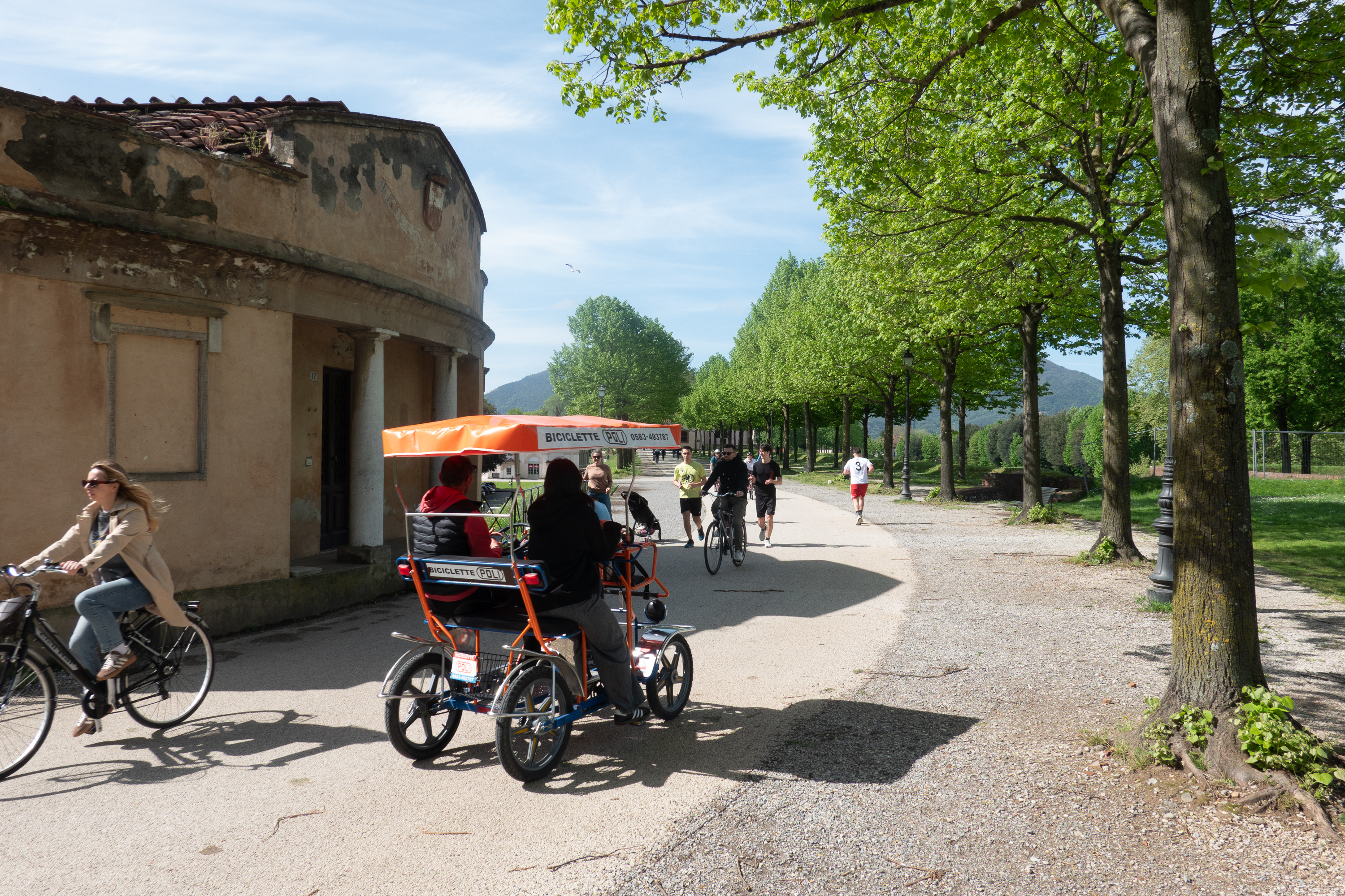
Then it was on to Chefchaouen, our final stop before taking the ferry to Spain.
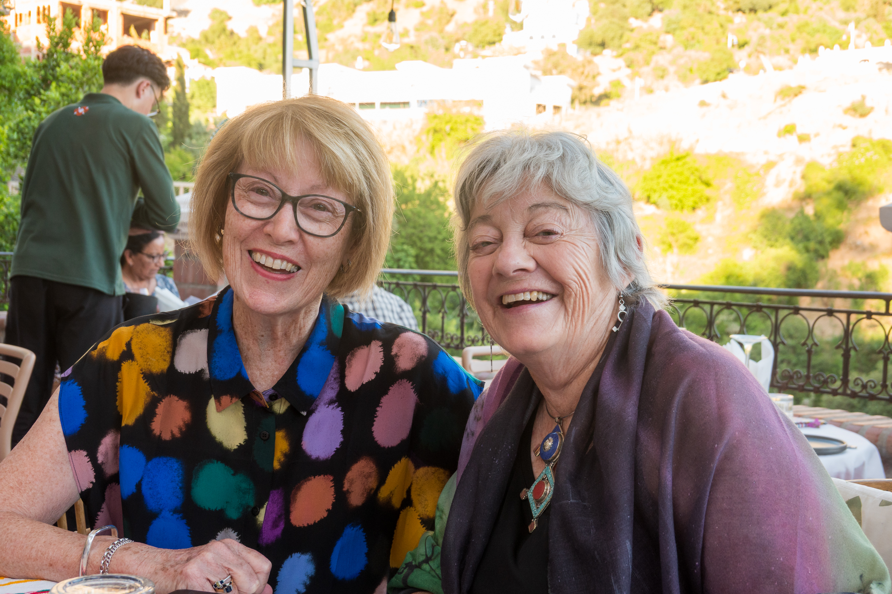
Overlanding friends declared Chefchaouen to be their favorite city in Morocco. But we had another reason to visit – we were going to meet up with one of Denise’s school friends from Sydney Girls High School. We had visited them in Australia, and, amazingly, they were visiting Morocco. (https://pbase.com/diplostrat/oz_reunion) Took some back and forth, but we managed to synchronize our schedules and we set a date.
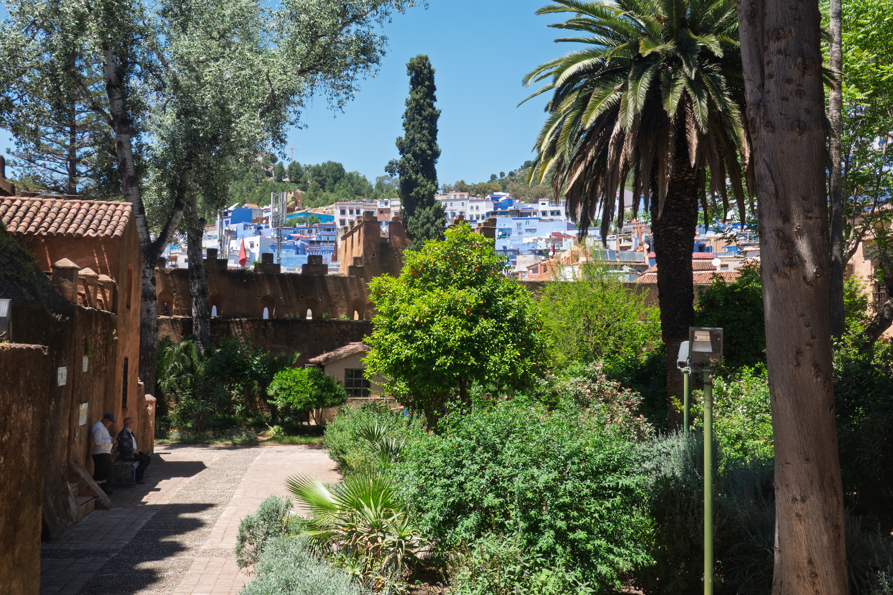
Chefchaouen has a fabled history. (https://en.wikipedia.org/wiki/Chefchaouen) We camped in a lovely campground up high above the town, with fantastic views and even some shade. Great thrills as the GPS sent us up a one lane road so steep that we had to use our crawler gear. That’s steep! (There was, of course, an easier road.)
We enjoyed the ugly camper parade.
Built on an old east bloc military truck.
Smart, modern camper.
Our Dutch friends from Fez.
No fires while we were there.
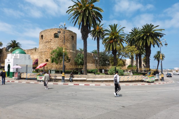
Chefchaouen seen from above.
Afraid to go into town too early, as everything would be closed, we walked down the very steep hill one afternoon to explore.
Denise arrives at the gate. (The tires are not originals.)
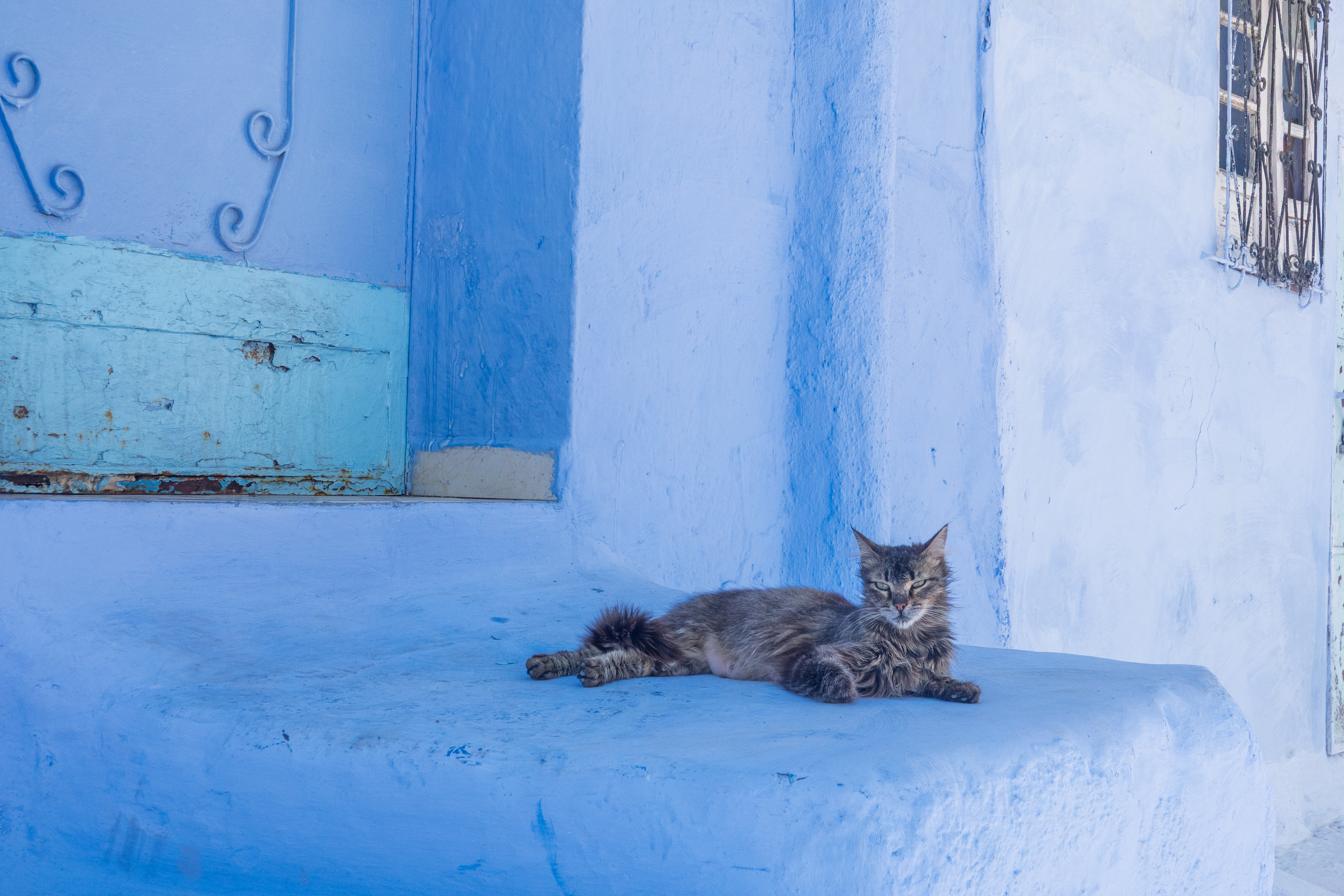
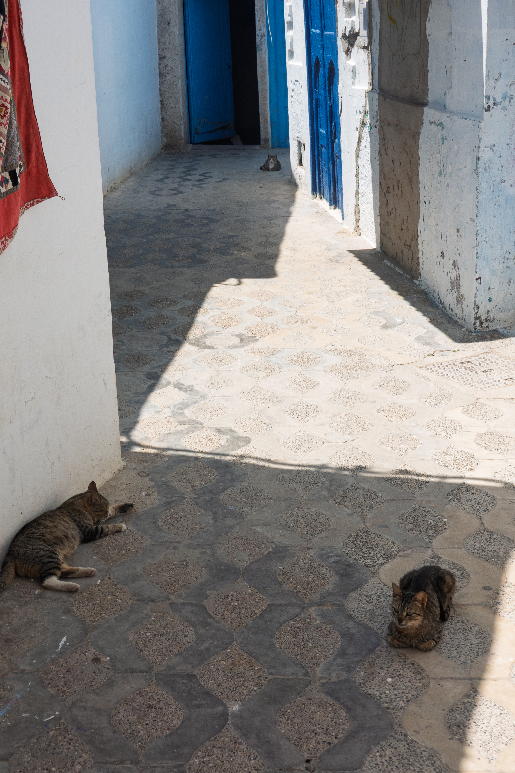
Feline reception
Flat dog
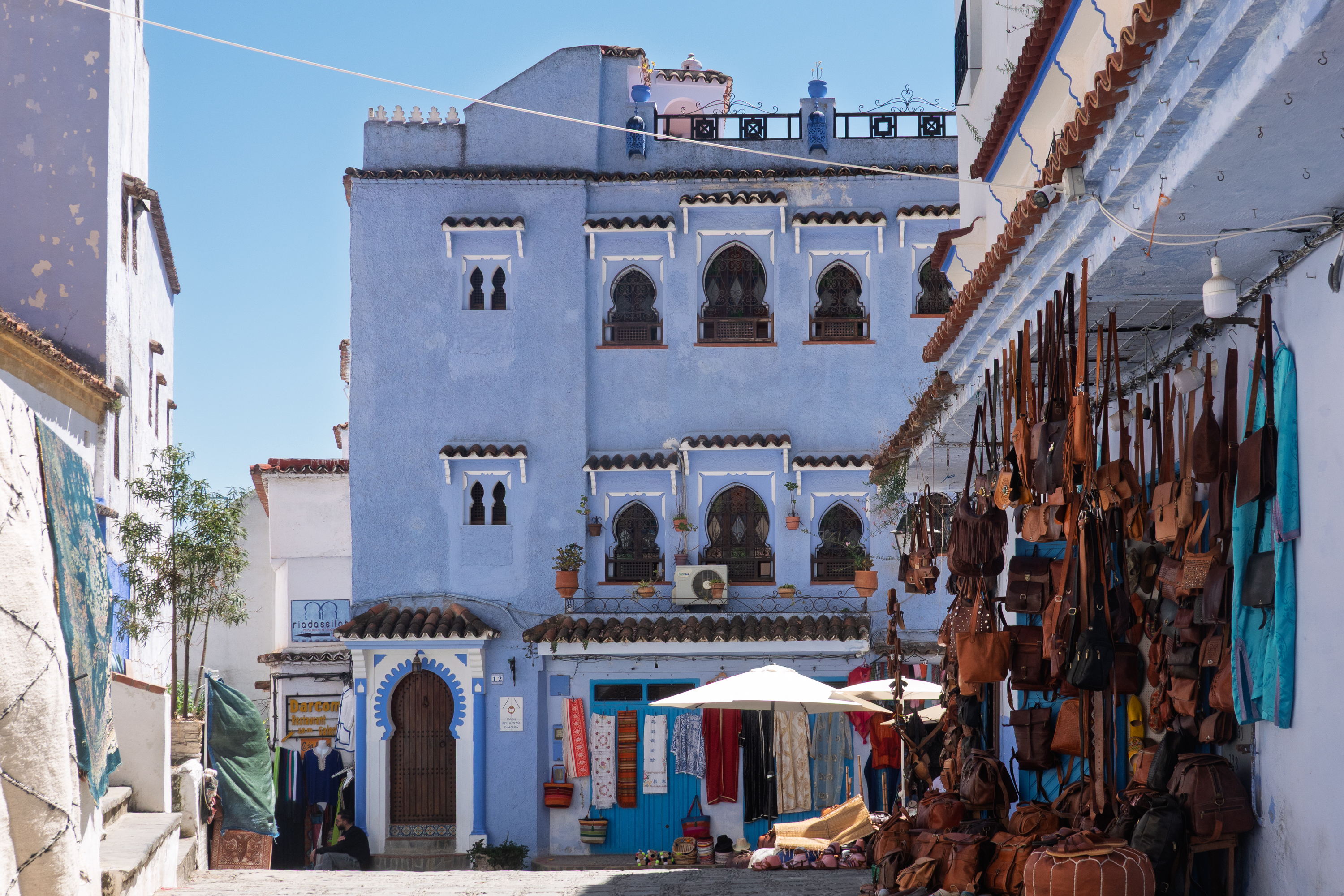
The streets of the Medina are, of course, narrow and very steep and many are just steps. Chefchaouen is noted for its blue buildings (most Moroccan buildings are either white or cream.)
There really are a lot of blue buildings.
We made our way to the Place Uta-el-Hammam where we were able to acquire the necessary ice-cream, before entering the Kasbah and museum.
Upper floors of pisé, rammed earth, or adobe. The sign on the door may say “Pain” but the ice cream was great!
The Kasbah rising above the town square.
Begun in the fifteenth century, the Kasbah shows a lot of Andalusian influence.
The “Portuguese” tower.Prison – not where you want to end up.
Beautiful, cool gardens.Art gallery inside the Kasbah.
Fred climbed up to the ramparts to admire the views and we both admired the beautiful gardens.
Overlooking the square.
We then headed back up to our campground with a delightful taxi driver, who offered his services for the following day.
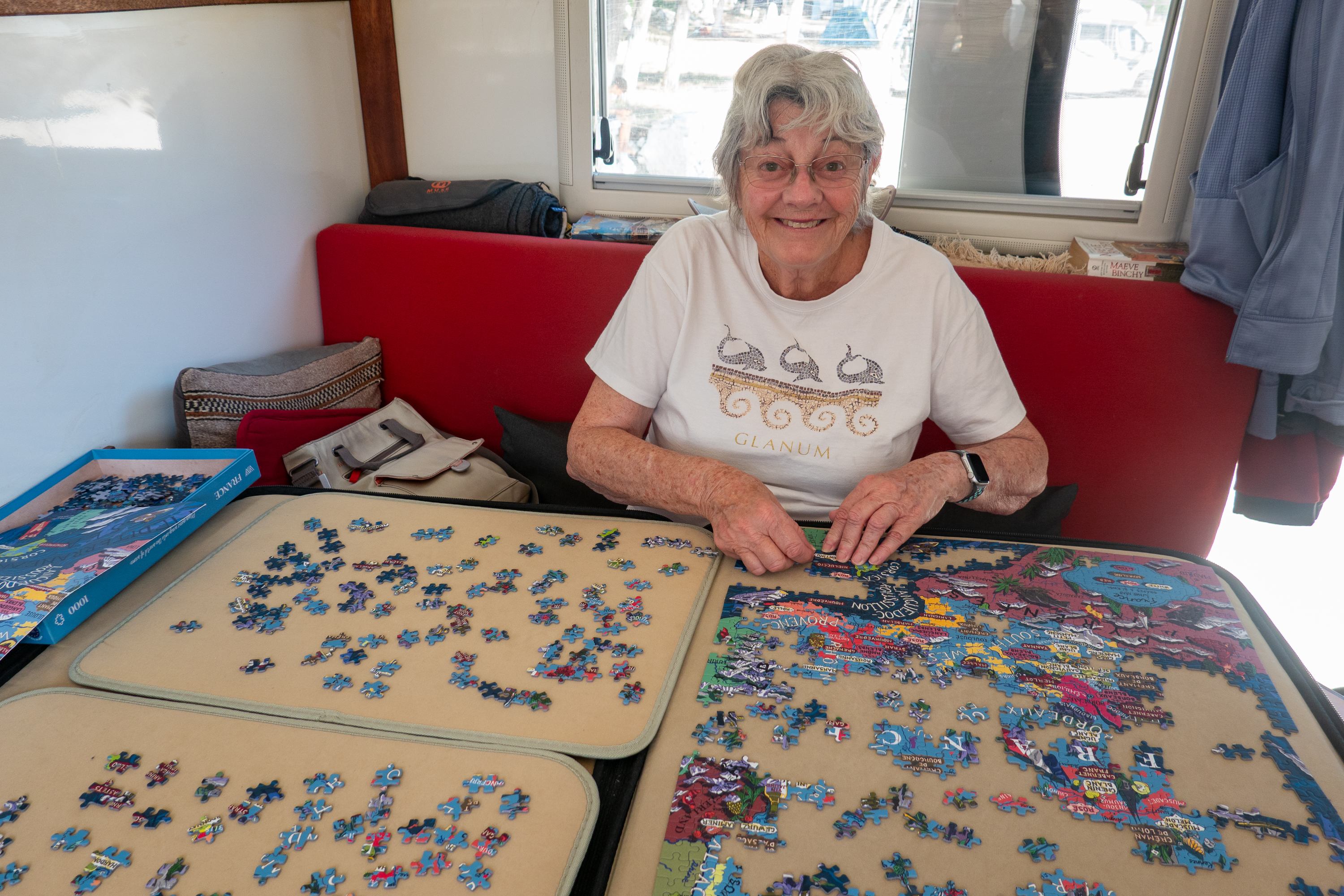
We put a few more pieces into our puzzle of French wines.
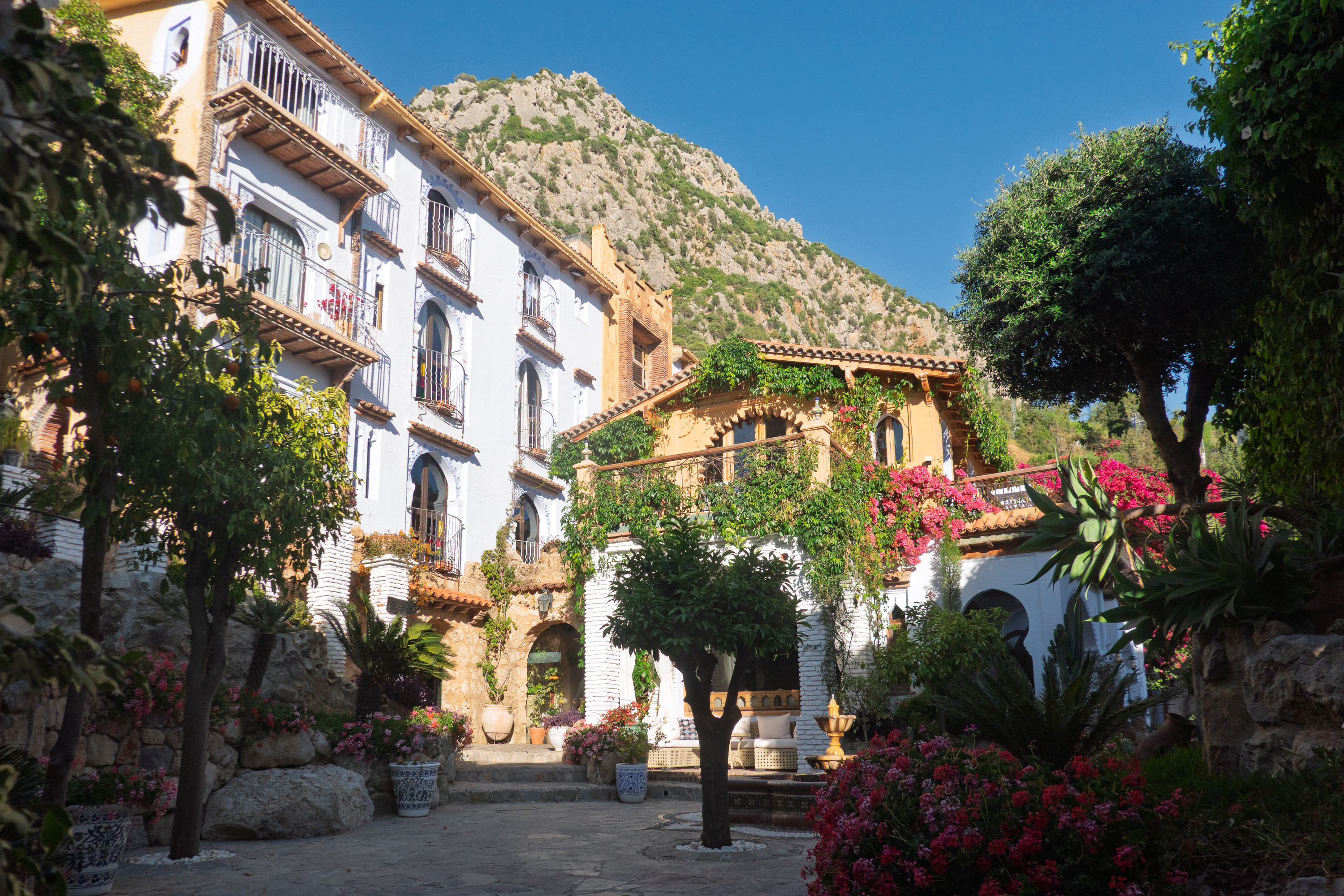
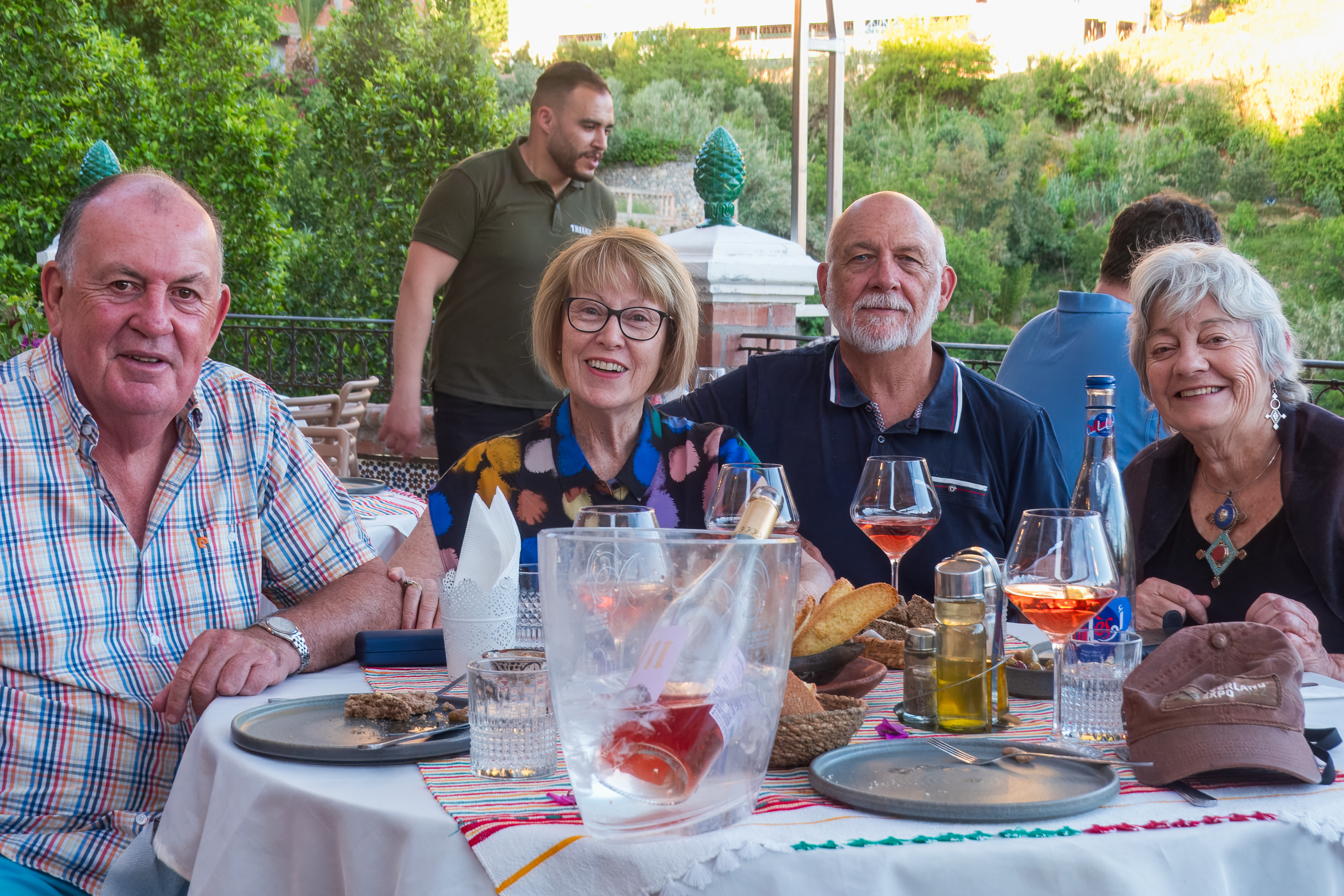
We were meeting our friends from Sydney, for dinner and needed transport into the town in the early evening and transport back to the campground afterwards. We were not going to tackle all those stairs again! With the taxi driver’s phone number in hand, we were all set. We met our friends in the delightful hotel in which they were staying. We then walked into town to a lovely restaurant. Was a bit of culture shock, as we were suddenly in a mass tourism area, a change from the more isolated campgrounds where we have been staying.
Their hotel was simply beautiful.
Dinner by the river.
“Girls who wear, the brown and yellow, stand in line each by her fellow, sweetly sing, or loudly bellow – Sydney Girls High School!”
We then called for our taxi back to the camper. He showed up right on time, with his cousin, and we all had a great natter driving back up the hill.
After a very early start the next day, we made it to Tangier Med for our ferry, only to discover that it was going to be two hours late arriving. This upended all our plans for arrival in, and travel beyond, Algeciras. Fortunately, we were chatting with the young Spanish couple who parked next to us at the “Jurassic Park” hotel. They told us of a free parking lot, right next to the large Carrefour supermarket in Algeciras. So we had a solution to the problem. The ferry did finally arrive almost two and a half hours late and we successfully boarded for the short trip. The crew was clearly in a hurry as, no sooner were we out of our truck than we were off. If the ship could have left a rooster tail …
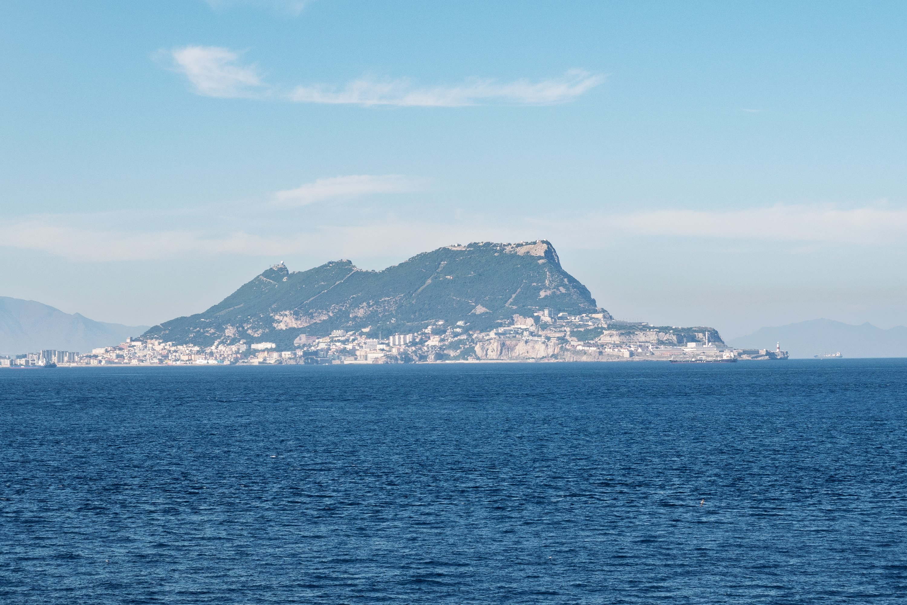
Varooom!And, rising from the mists, Jebel Tarik,
A farewell to Morocco, Jebel Musa.also known as the rock of Gibraltar.
Customs and immigration in Spain were easy, but appallingly slow. But, after what felt like an eternity, we were on our way to the Carrefour. We shopped, found the parking lot, had a light dinner at the very Spanish hour of around ten PM, and collapsed into bed.
Nifty 6×6 Sprinter. That’s right, not 6×4, but a real 6×6.
The Gara Medouar successfully viewed, and the Mummy successfully avoided, we headed to Rissani to acquire some fruit and vegetables.
The gate to Rissani.
The latter were limited but we purchased some wonderful melons and also some fresh dates. This area is melon growing country and they were freshly picked. In fact we passed many small trucks, loaded to the gunnels with melons, heading to the main cities.
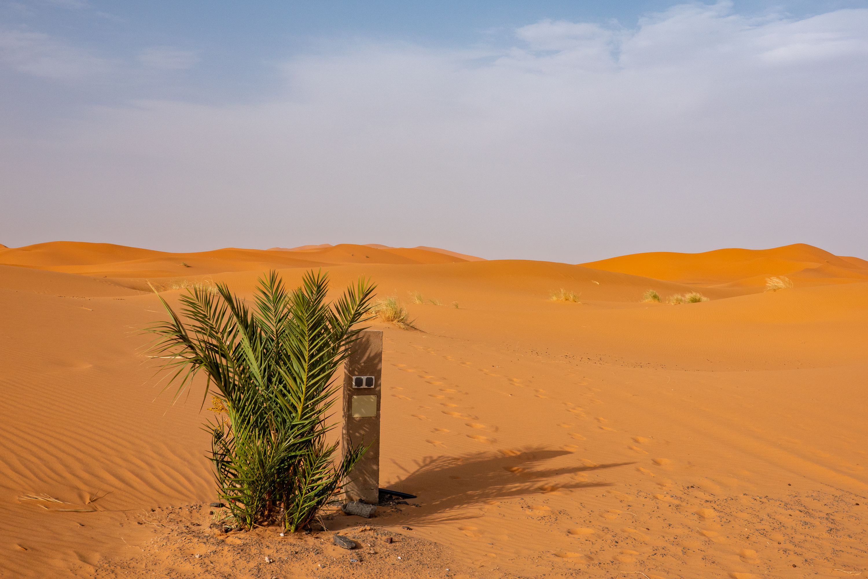
Partially for old times sake, Denise wanted to at least see the dunes on the very southern and western edge of Morocco, the Chebbi Erg. (Morocco does not actually have a lot of sand dunes.) We had seen dunes in the Sahara in 1974 and in Jordan in 2017, where we rode a camel and camped in the desert, tourist style. So we headed to a lovely campground called Haven La Chance. (https://www.havenlachancehotel.com) It was very hot (about 100F) but the campground did have some shade.
Hiding from the sun.
As promised, it did back right onto the dunes so we could easily wander out and do some sand walking. Fred was in no mood to see if he could stick nine tons of truck in the sand. He had dealt with than when he was younger! And it was no fun, even with a lighter vehicle!
There is a long, sad story about this. It features dry spindle bearings and an open rear differential. One learns from hard lessons!
We are used to being the odd camper out, so it was comforting that there were about five other expedition campers, built on a variety of trucks from a German Mann to a Unimog. One even had 3 axles and was going to be shipped to Canada. One wonders why such a huge truck would be needed there. But it looks comfortable.
Based on a Unimog
Built on an IVECO
Detachable – the camper can be shipped separately as a marine container.
Power pole, right in the sand.
View down the dunes.
Finally heading north at last, our next stop was a campground with the delightful name of the Kasbah Hotel Jurassique, in the Ziz Gorge. We quickly dubbed it “Jurassic Park.” (https://www.kasbahjurassique.com) It was a great campground, with a washing machine (!) so we stayed an extra day to do laundry. When we arrived, there was only one other camper there, and they left the next morning. But after having the place to ourselves all day, the next evening a half a dozen campers arrived as well as an equal number of motorcyclists. Met a nice young Spanish couple.
Hiding from the sun, part II.
We also ate dinner there and it was excellent. We both decided to have shish kebabs rather than face another tagine. Our kebabs arrived and were much enjoyed; then another set arrived. There was no way we could eat four more mixed shish kebabs, so we asked very nicely if we could take them with us. Of course, but don’t ask for a doggie bag – just take the plate and bring it back when you can! Thus we ended up with a delightful dinner the next night.
The next great challenge ahead was the Legionnaire Tunnel. (https://sahara-overland.com/tag/tunnel-de-legionnaires/) Dug in the ’20’s, it is said to have 3.5m of clearance. We are 3.55m. Yet we saw trucks passing all the time. The hotel owner assured us that we would have no problems. Hmmmm. We set out with just touch of trepidation, with Fred carefully eyeballing every truck that passed.
Is it REALLY only 3.5m?
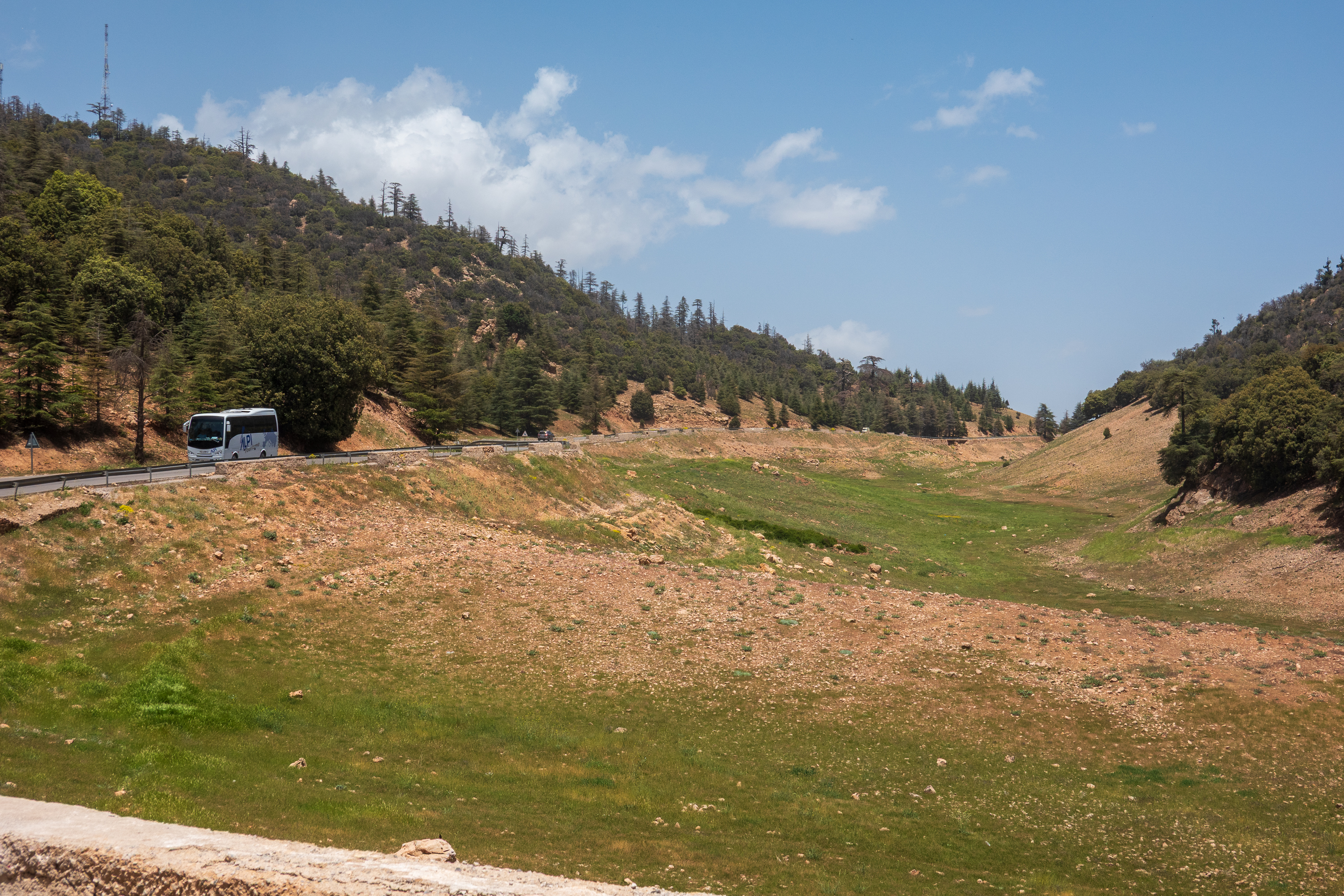
Turns out, we fit with no problems. And then we moved into snow country. Yes, it snows in the Atlas and they close the roads. This area is used as summer pasture for sheep and they even have snow barriers, made out of adobe.
Not a flake in sight.
Some of the valleys were really green. Shocking after the south.
Never seen a snow barrier made of adobe before.
Moving up the Ziz valley we admired the views and the dense agriculture on the valley floor.
Every bit of flat, wet land was cultivated. In multiple layers – dates on top and vegetables underneath in the shade.
Say “Cheese!” And don’t step back.
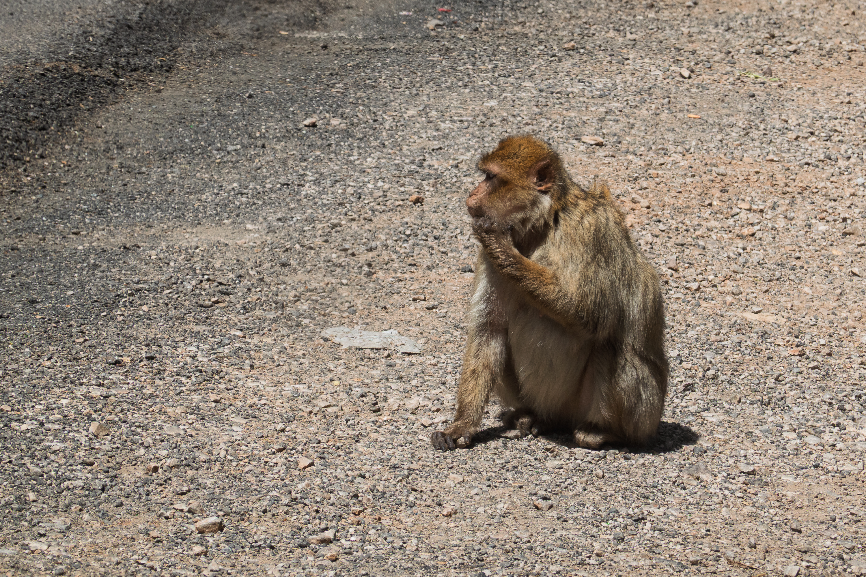
And on to Azrou, where, during the descent to the town, we saw more trees than we had seen in the last three weeks. The town itself is encircled by cedars and holm oaks, and we saw a number of Barbary apes in the picnic areas, obviously awaiting goodies.
We settled into a nice, locally run campground. (“My grandmother planted the cherry trees.”)
Nest on the roof.
Parking by the mosque in the town square.
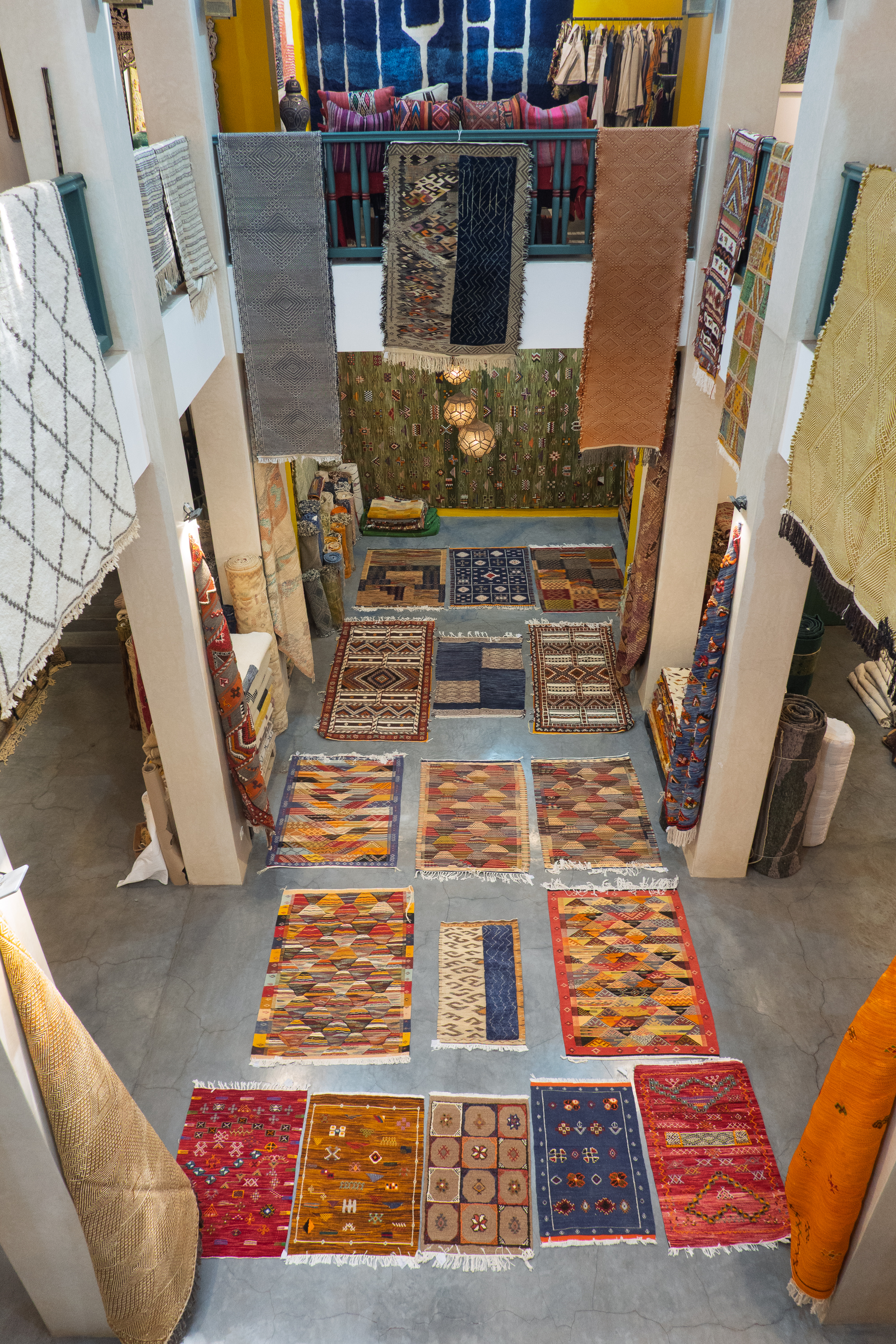
Azrou is famous as a source of Amazigh carpets, so, the next morning we drove into town. A little too early. Moroccans really do not start their businesses until almost noon. We wanted to look at a carpet place and, of course, they were all closed. However, one man in the souk, who was open, agreed to find one of the carpet vendors, who was having coffee. And once he opened up, he realized that we needed more choice and took us to his warehouse. So we headed deeper into the souk, down an alley, and up the stairs. We had a wonderful time shopping (more tea) and made some (too many?) purchases.
Spread out a few more. The range of prices was amazing. Antique carpets, of course, but the white ones were about four times the price of others.
Did you buy at the source? Can’t get much closer than this.
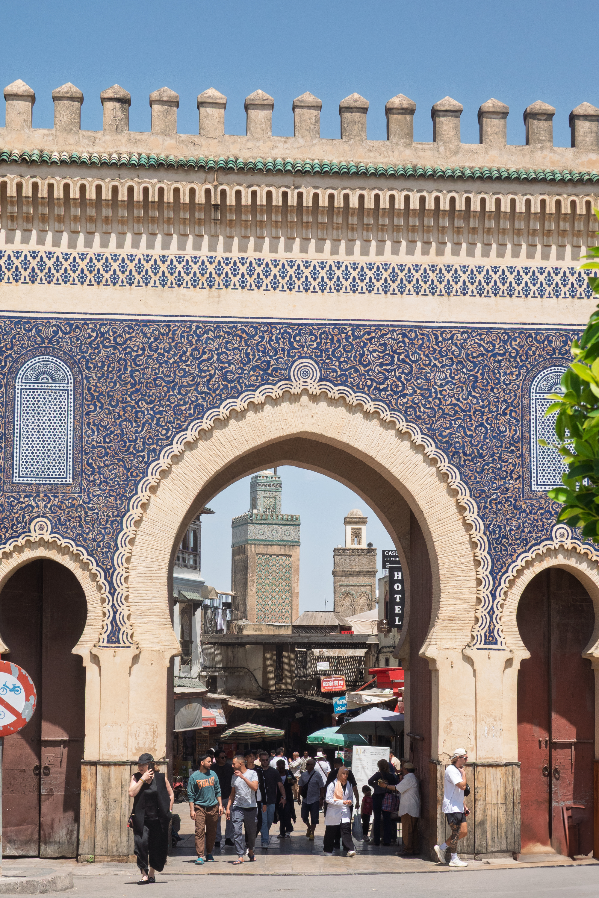
And on to our next stop, Fes. One cannot go to Morocco and not go to Fes! Like many, we stayed at the Diamant Vert (Green Diamond), basically a huge water park with bungalows and a campground attached. Finally met the Dutch couple with a twin of our truck – they drove into, but decided not to stay at the campground in Zagora. Fred was off for technobabble about suspensions, etc.
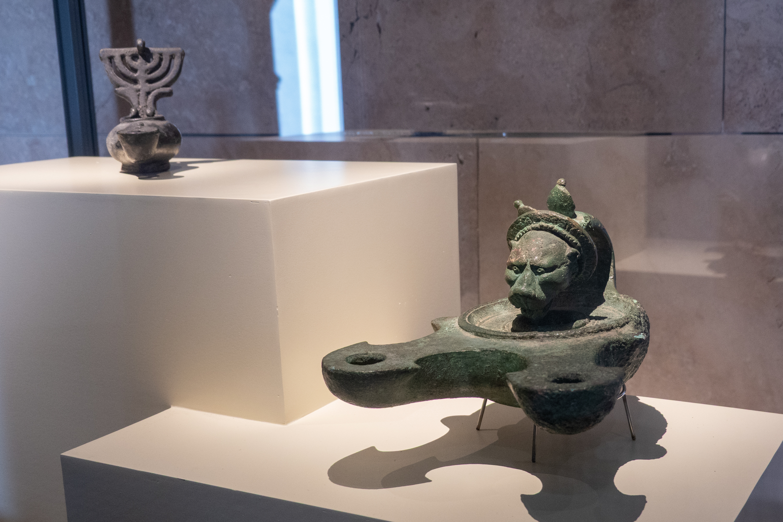
We took a taxi from our campsite and asked to be taken to the Musee Dar el-Blatha. Trick was, the driver didn’t know where it was and we had to use our phone GPS to get there! The Musee Dar el-Blatha was most interesting. It was originally a palace, begun by Moulay el-Hassan in 1873 and is now a Museum of Arts and Traditions with exhibits back to Roman times, at least. All very well done. It has retained its Moorish features, with beautifully decorated wooden doorways and tile work.
Beautiful Alms cup. So did this belong to a person measuring out alms, or did it belong to the begger?
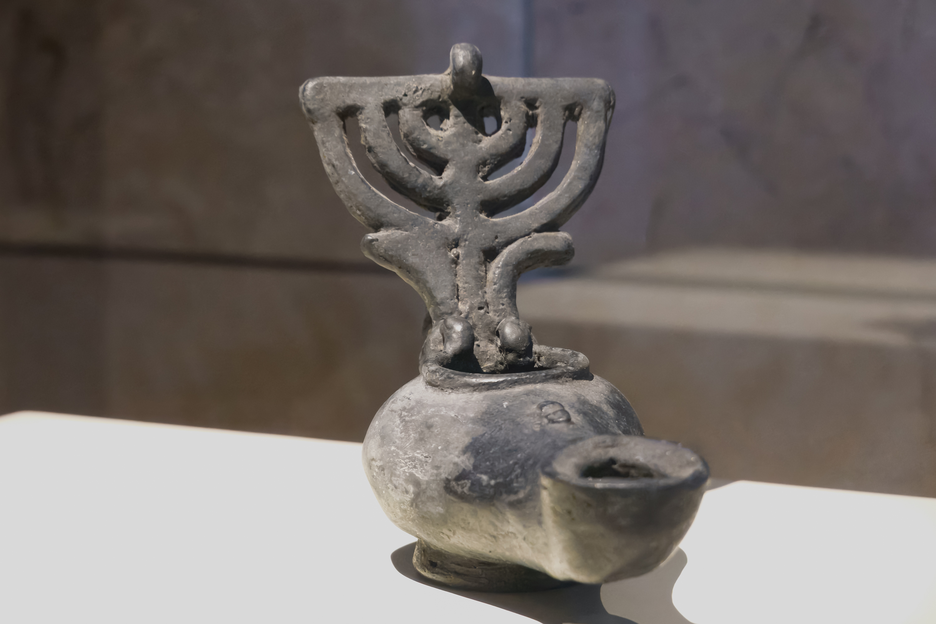
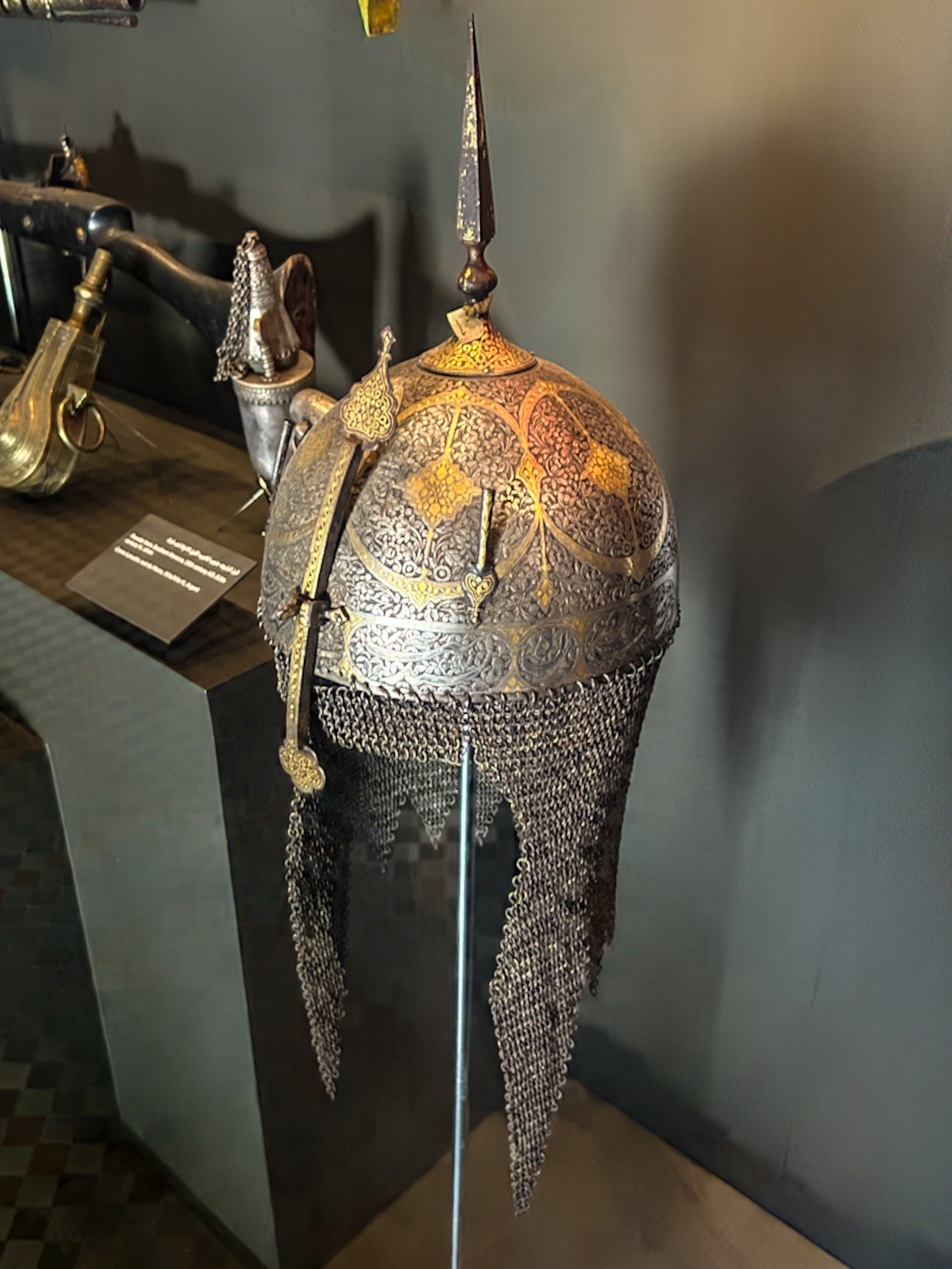
Roman era oil lamp, note the menorah decoration.Roman double lamp.The arabs were always big on astronomy and this is a big astrolabe. Beautiful helmet. Notice the nose guard – almost the same as Frankish helmets of the same era.
Ornate wooden minbar, or pulpit.Very complex moorish oil lamp.Scroll, pen, and inkwell.Kettles.
The museum still has its beautiful gardens.
Sadly, about half way through, one of the guards decided that we could not longer take pictures with a camera, only a phone. ???
Well Grrr! And we were just about to photograph some beautiful clothes!
So we gave up on the museum and went out to find lunch.
We decided on a Moroccan restaurant near the souk. Our table was two flights of stairs up from the street, and then up on a tiny balcony. Amazing! Don’t find this at McDonalds.
The stairs are as steep as they look! The food was as good as the view.
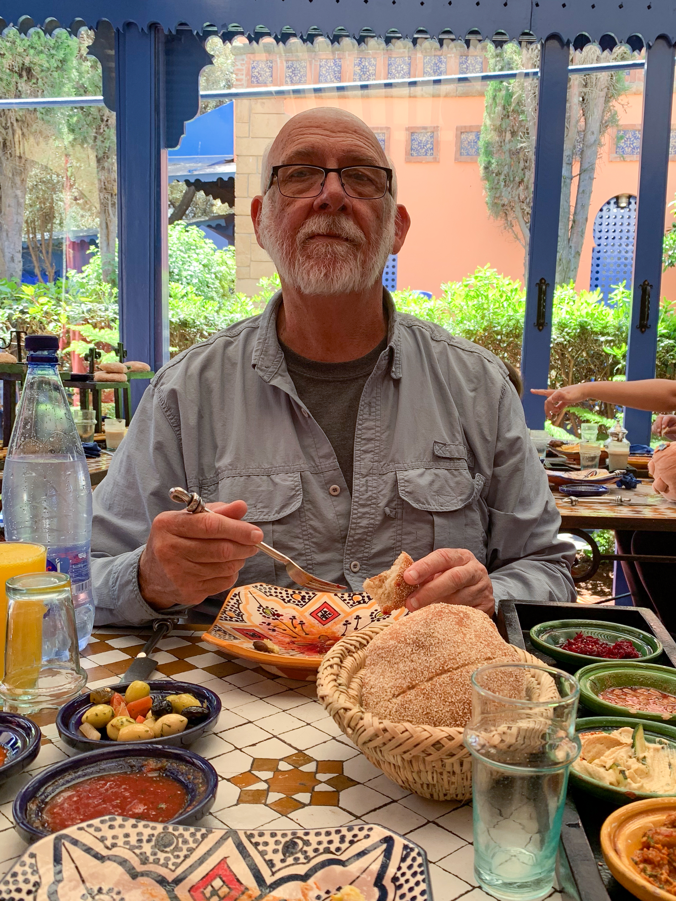
Denise enjoyed her last Pastilla or chicken and almond pie!
After lunch, we plunged into the souk, looking for gifts.
Denise buying Argane oil goodies. The young lady on the right spoke rather rocky French, but great English. Asked where she learned her English, she replied, “Netflix.” Gotta love that cultural imperialism!Really nifty house in the market. Everyone builds up to catch the breeze and to shade the lower levels.
Market Gate
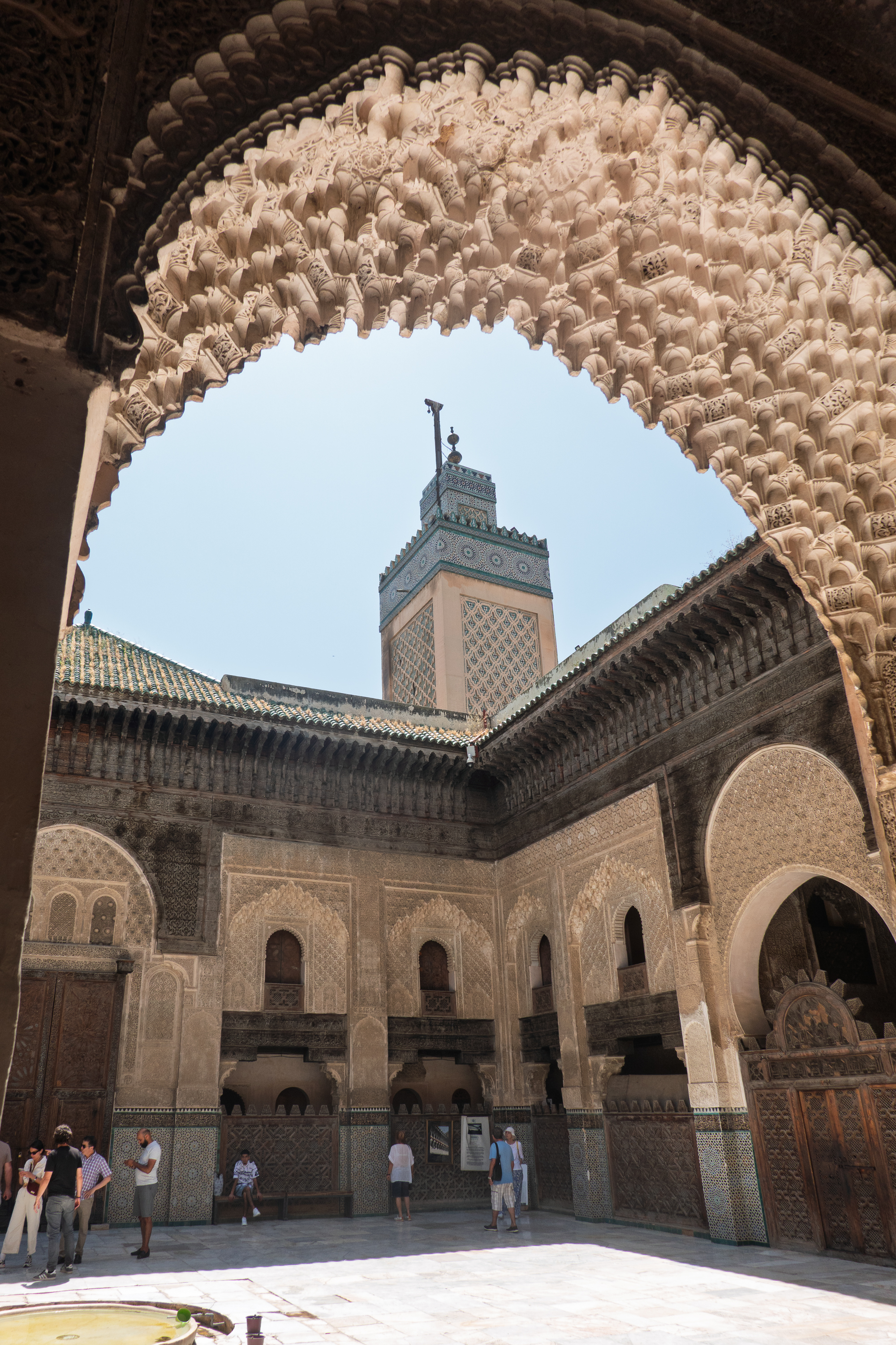
Once past the hour of prayer, when it is closed, we found the Bou Inania Medersa. (https://en.wikipedia.org/wiki/Bou_Inania_Madrasa) Constructed between 1350 and 1355, it is an Islamic school, a medersa/madrasa that is also used daily as a mosque. The decoration and tiling is quite lovely.
View into the courtyard.
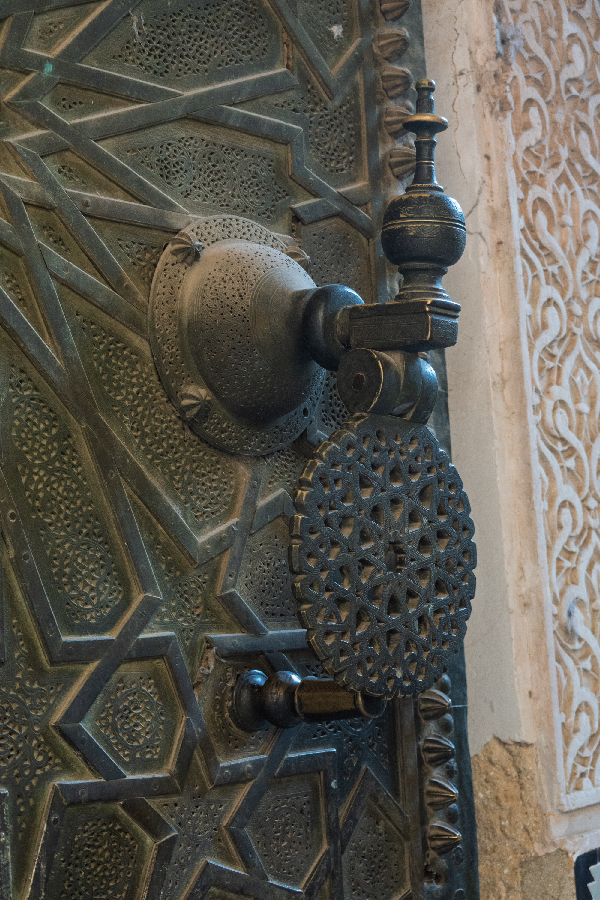
Knocker on the door.
Denise looks inside with the street behind her.
Central Courtyard
Prayer/teaching area of mosque
Arabesque and geometric decoration
Beautiful wooden ceiling.
In the museum, we had seen parts of a water clock. There is one outside the medersa. We know what they looked like, and where they were, but not how they actually worked. Somehow, metal balls fell from the top into metal bowls. Incomplete – no bowls, no balls, but way cool! (https://en.wikipedia.org/wiki/Dar_al-Magana) Look at the Wiki link for an historic image. Amazing to stand in the same place.
Bowls on the lower posts and balls (?) on the upper? A mystery for the ages.
Then it was on to Chefchaouen, our final visit before taking the ferry to Spain.
After leaving Ouarzarte, we headed down the Draa Valley through the desert plateaus of Jebel Tifernine, and through the hills of Ait Sauna. Then the road climbs through steep canyons towards the Tizi-n-Tinififft Pass. We stopped at the top of one of the long grades and had a most amazing shop with a roadside vendor. He had some really beautiful pieces, including a huge, decorated Tuareg cross. (Also called an “Agadez” cross, although each town traditionally has its own variation.)
Chatting with some German overlanders. N.B. That town is a LONG way down.
This guy had his Tuareg headdress, but we’ll give him a pass, because had some amazing things for sale. Right by the side of the road.
There is always the question – is this authentic and what is it worth? Basically, it is worth what you will pay for it and what the seller will accept. And, unless you are going to try to sell it, what do you care? Authentic? Who knows, but it is hard to believe that anyone would go to the effort to fake this. Unlike the typical tourist junk found in the souk, this is a unique piece and very few non Tuareg would wear it. Denise loves it as it is another matching bookend to our trans-Sahara trip of 1974. The cross was on a typical, over the top, Tuareg necklace. Fred was impressed that it was strung with wire – should be strong. Nope. Broke. So now we have a winter project to restring a million beads! In the meantime, Denise has it on a simple collar.
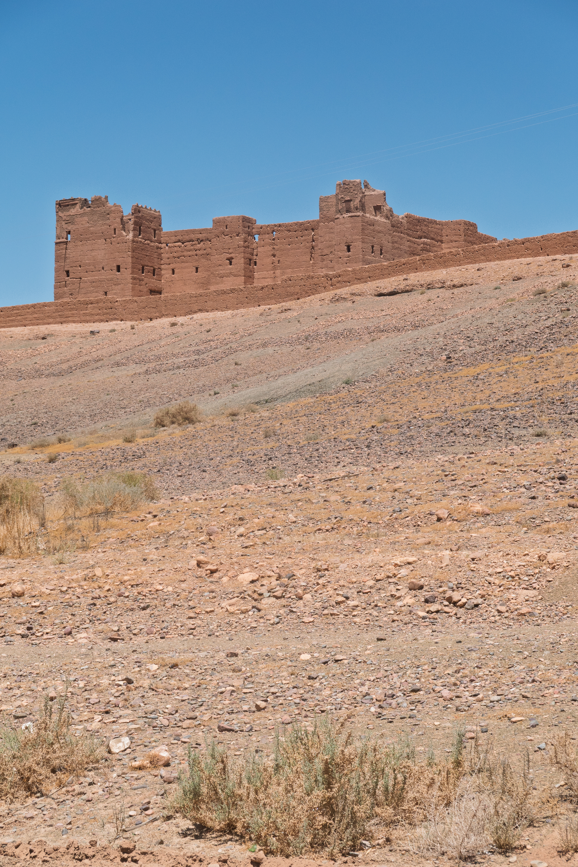
This route we took is known as the Route of the Kasbahs and several large ones can be seen. They are however in various states of repair. We stopped at one but were told to leave as they were going to be using it for filming a British TV “Survivor” show. We were somewhat irritated as no filming was taking place and we were refused permission to even take pictures of the valley. Most unusual. The gentlemen working in the parking area were most apologetic. Fortunately, there is no shortage of kasbahs in Morocco.
Setting up for filming.
Classic date palm oasis. The valley had them one after the other.
We spent the night at a campground in Zagora. We went into town to find an ATM. Our visit got off to a grim start as we watched a truck loaded with gas bottles run over a pedestrian. The ambulance was amazingly swift, but it looked to be too late. Sobered, we stopped at a supermarket before taking a taxi back to campground, loaded with groceries. We enjoyed an evening meal at the campground and chatted to the German tourists we had met along the way. Interesting the way we kept leap frogging some of the same people.
The campground features wild architecture.
Taking on water. Few KOA’s have such an elegant installation.
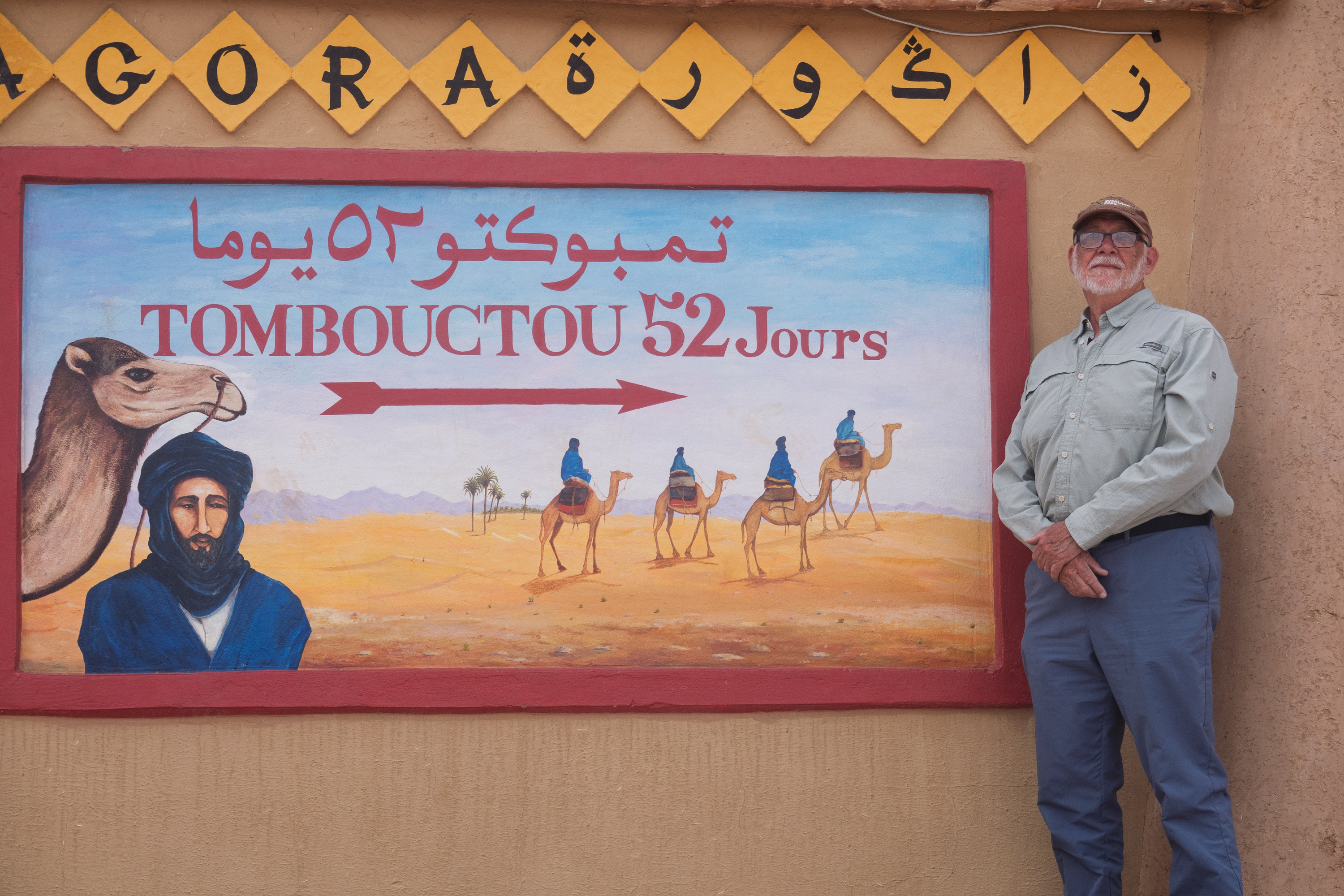
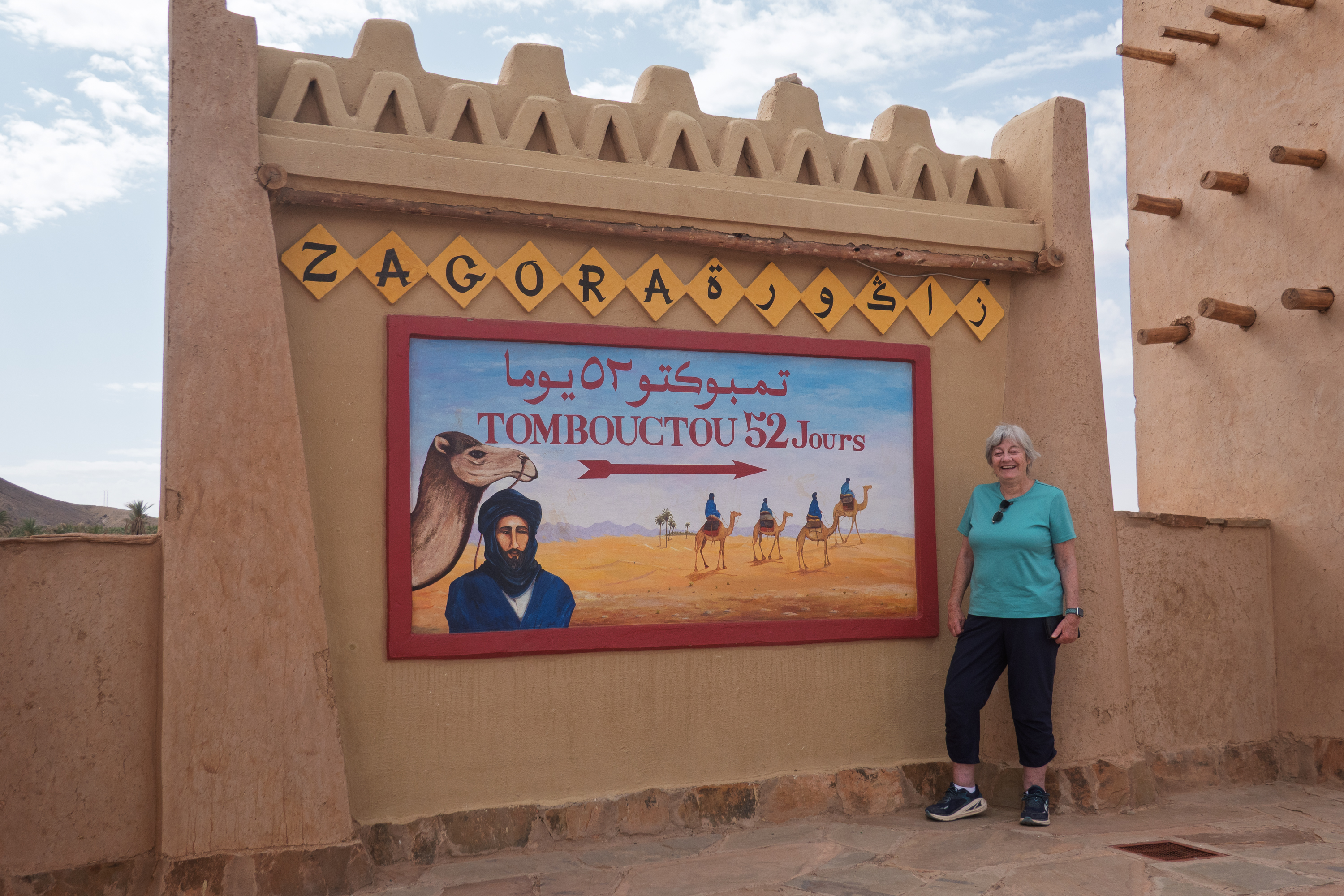
The next morning, we headed to Tamegroute, just in the south. On the way out of town, we had to stop and take the obligatory photo at the “Timbuktu, 52 Days by Camel” sign. Zagora was an important stop in the trade into Morocco from the Sahara and countries to the south of it. The trans Sahara trade dates back to ancient times and there were several eastern, central, and western routes. From below the Sahara came gold, ivory, slaves and other products. From north of the Sahara came salt, cloth, beads, metal and metal products, and more. By the colonial period, this trade had became a thing of legend – think “Beau Geste” and other tales of the Foreign Legion.
Tourist One
Tourist Two
52 days by camel. Could we do it in the 917? Of course, except for a few details. You cannot cross the land border between Morocco and Algeria and northern Mali is home to a branch of Al Qaeda – the same folks who tried to burn all of the sacred books in Timbuktu. Sad; would be a cool trip.
Tamegroute developed into an absolutely fascinating visit. It contains the Zaouia Nassiriya, a center of Islamic learning, home to a Sufi order, tombs, and a Qu’ranic library dating from the 11th century. The library is believed to have once held as many as 50,000 books, but it is down to about 4,000, the rest having been spread all over Morocco. We started by taking a guide and going to see the library. The tour of the library was given by a scholar who explained the ages and types of Arabic script used. The library contains a Qu’uran from the 11th century with gazelle-skin covers. There is calligraphy with gold dust and saffron illuminations and treatises on algebra, astronomy and literature. All of the books are behind glass and, sadly, no photography is permitted. But all of them are amazing and some are simply beautiful. Readers may remember our visit to the “Book of Kells” at Trinity College in Dublin. Same idea, but sadly, on a much smaller scale.
The tomb of the center’s founder, Mohammed Bou Nassi, has become a pilgrimage site, especially for people with chronic illnesses who stay at the tomb, hoping for a cure.
The tomb is closed to non Muslims but simply beautiful.
We then moved on to the Ksar and we learned about the seven trades concentrated there, each with its own kasbah and mosque. He showed us where he lived, which looked like one main room with an outer small room where his wife was cooking fish over a small wood fire. He invited us to lunch but we declined. There was no way six little fish would feed five adults adequately. We felt that would be an imposition.
In a land where the sun is very strong, much of the ksar is under shelter. Buildings are all topped with lots of roof terraces to use once the sun goes down.
We bought two loaves of wonderful bread, but the lady, a Amazigh (Berber) did not want her face photographed.
We were then shown the pottery section of the Ksar, in which seven families produce pottery with a traditional green glaze. We were shown all the stages of production, all manual, for the various platters, bowls, cups and plates produced there. It was emphasized that all pottery is for use in the house. Some pieces were decorated but all were usable as any decorations were made with herbal dyes and were quite safe for food.
Denise watches a bowl being turned on the wheel. The wheel is driven with the feet.
The yard was a hive of activity – mixing the clay, firing the ovens and the rest. Each profession has its own mosque.
And, as might be expected, we ended up at the back of the pottery cooperative store. But we were game and, after a cup of tea, we were on our way with (lots of) goodies. You can’t negotiate a decent price without tea.
No one will take you seriously if you do not ask for tea.
Driving out of town, we shed a tear for the closing of USAID.
Bus/truck stop waiting area with sign for a USAID hydraulic project.
Looking for a place to break the trip we stumbled across a listing for a campsite, six kilometers off the road, literally nowhere. We had to try it.
Camping Serdrar turned out to be charming. (https://www.facebook.com/campingserdrar/) The owner, a recent graduate with a degree in marketing, explained that the site was on the family farm. With the drought, they could no longer make it as a farm, but as a camp/hotel/restaurant, catering largely to the motorcycle trade, they were doing well. We ordered dinner and it was very good.
It is all about getting as much shade as you can!
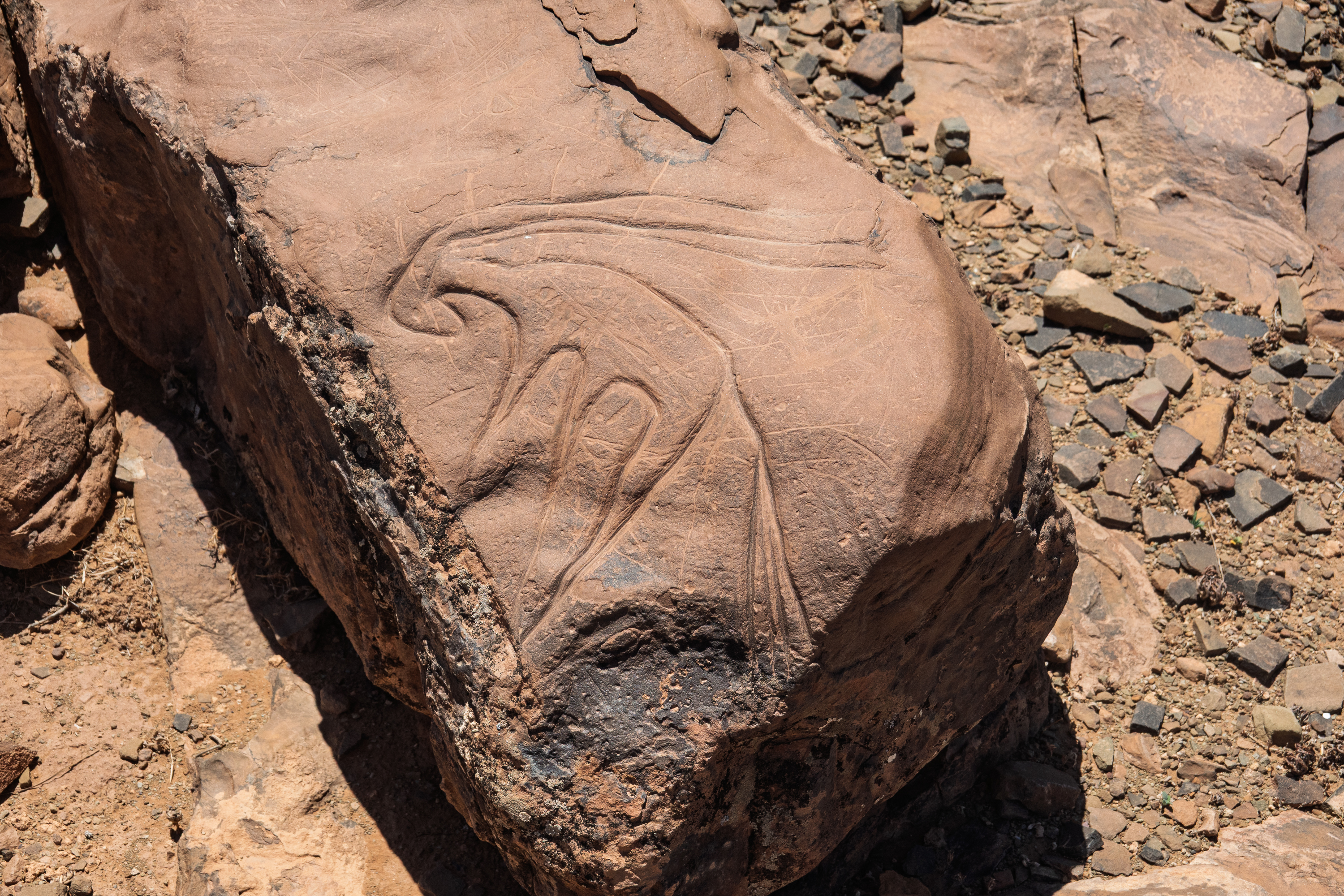
We liked the place so much that we stayed an extra night so we could go visit the neolithic rock carvings at Ait Ouazik. The track was a bit of a grind, but the visit was really interesting. We saw cave paintings in our trans-Sahara trip of 1974 and it is always sobering to realize that the Sahara was once much wetter.
Parking. There is actually an intended “visitor center” closer to town, but it is not in use.Traffic and washboard!
Denise and the guardian admire the rocks.Think the bird is an Arab, pooping on the Berber “Free Man” symbol.
There is a guardian, living in a small building at the site. From the internet and from conversations with people who come to study the carvings, he is wonderfully well informed and really made our visit. Still, it must be a very lonely existence.
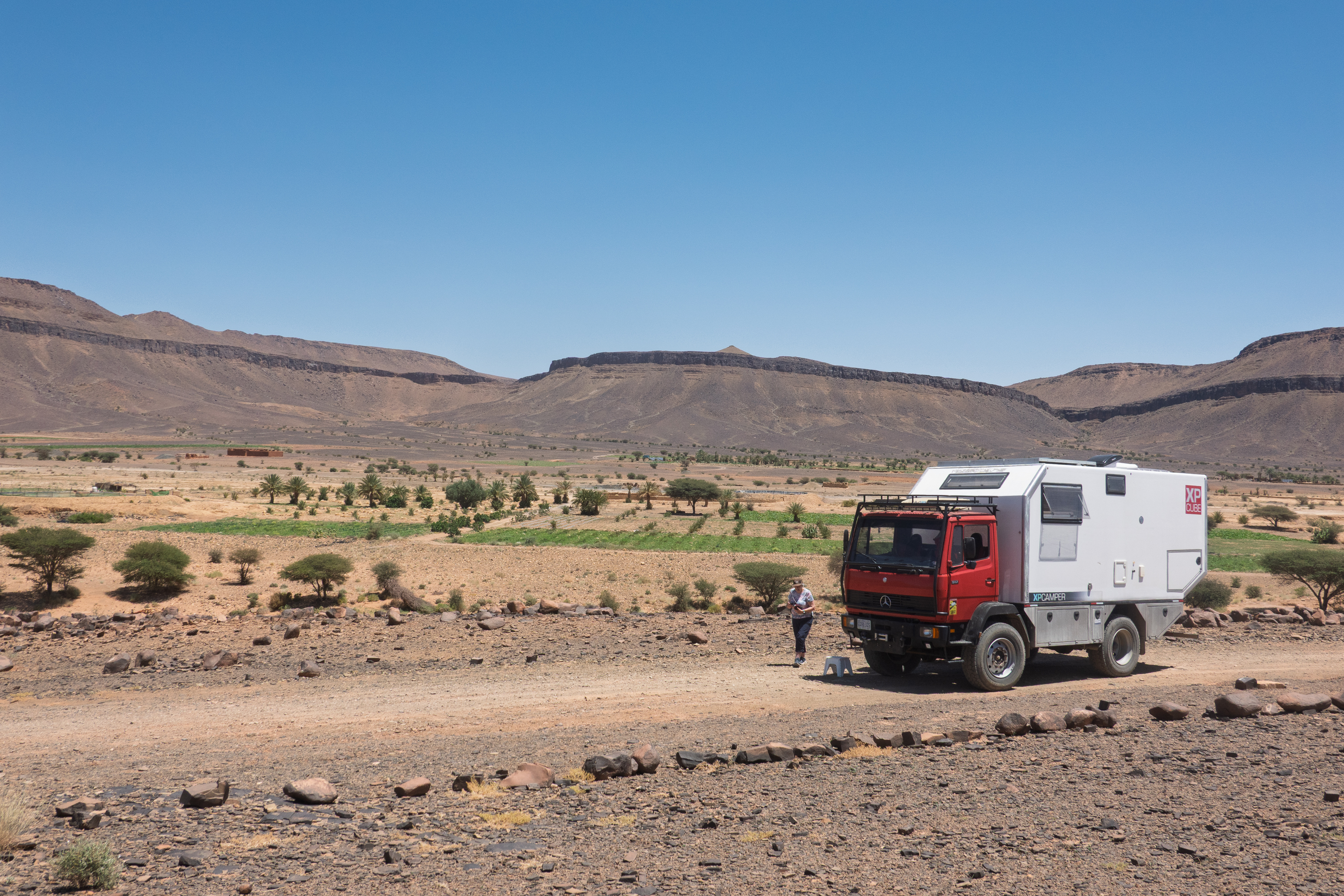
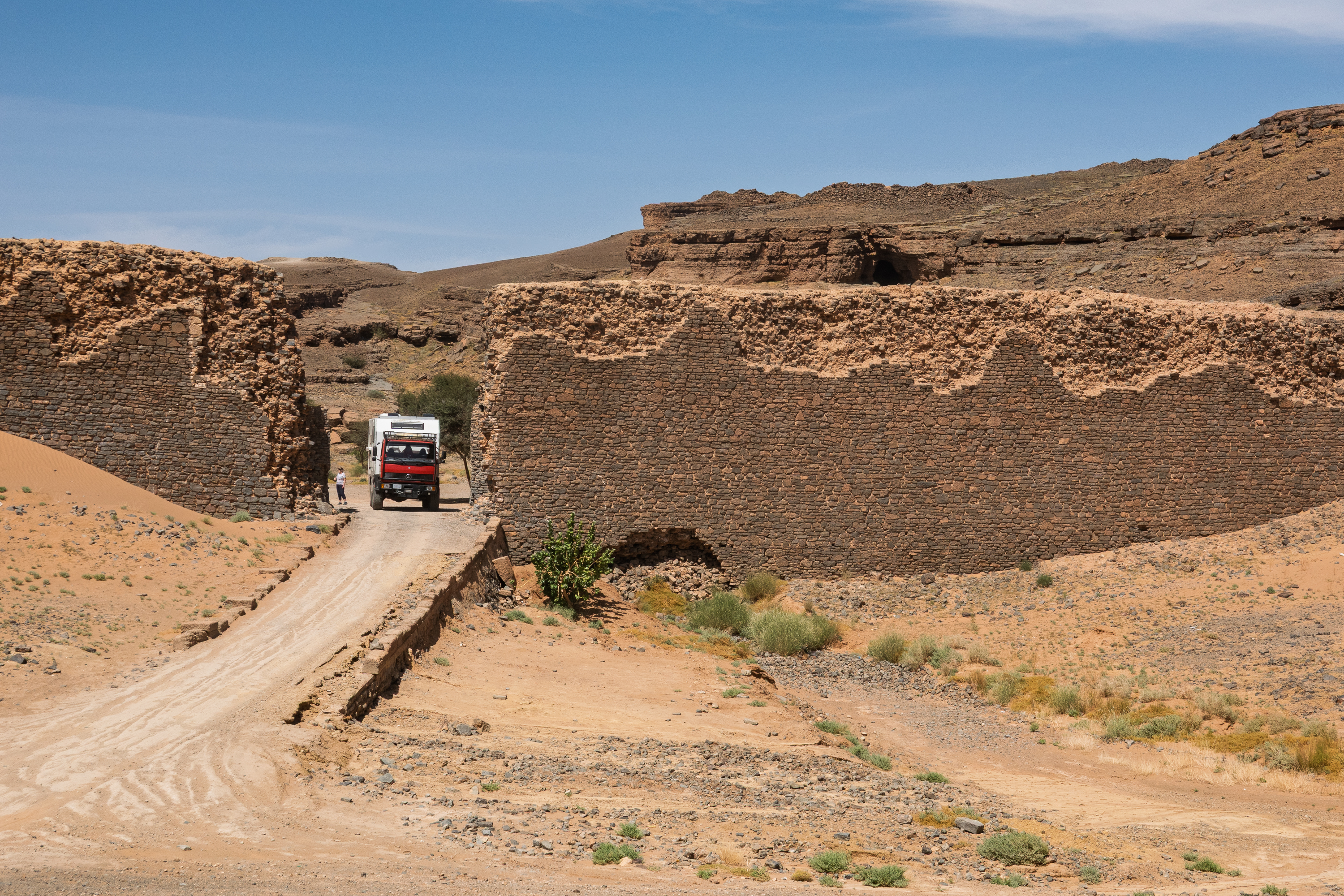
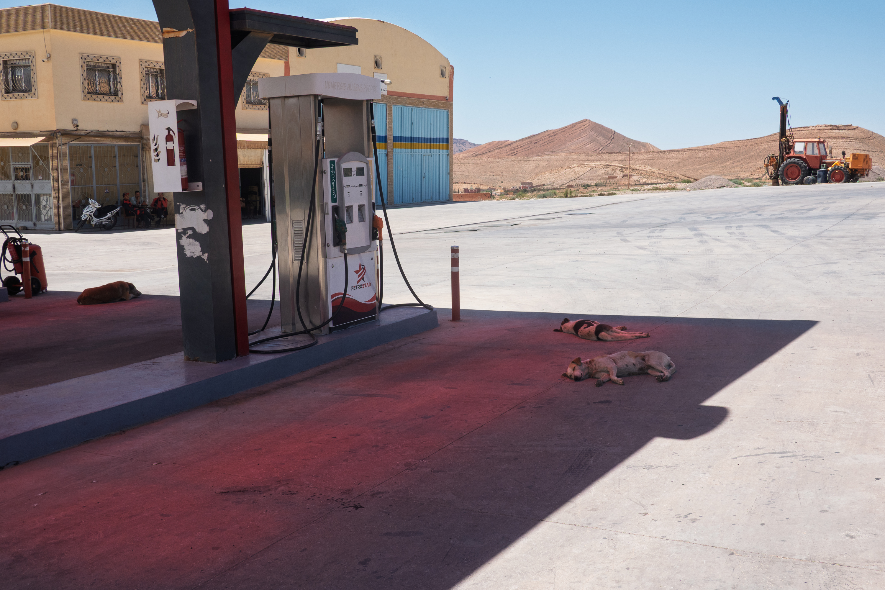
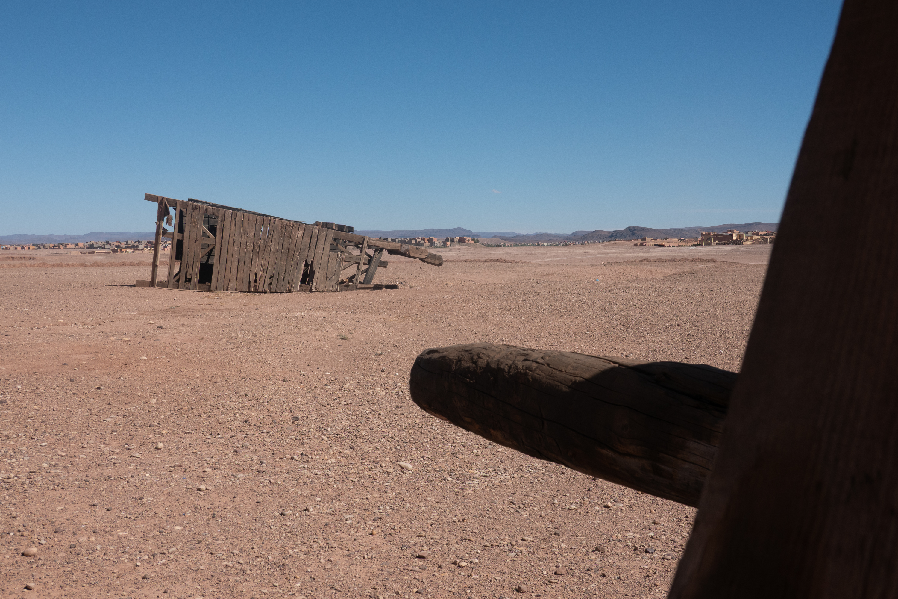
We then continued on towards Gara Medouar. Most Moroccan service stations are huge, beautiful places, usually with a restaurant or coffee shop, store, car wash and more. But sometimes the lunch options were more basic.
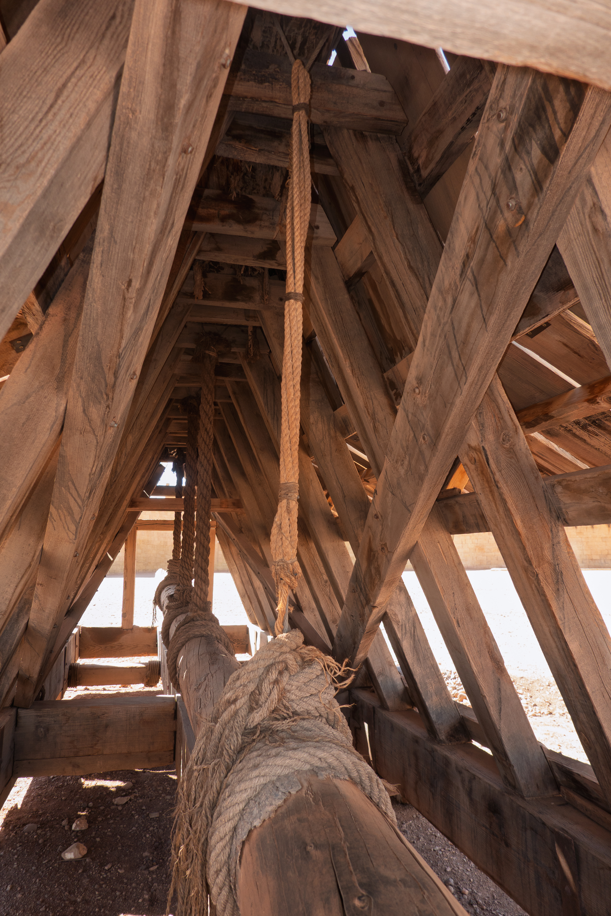
There really isn’t much there – a nifty shaped mountain and two ancient walls.
Gara Medouar in the distance. Actually kind of exciting.
All the rest, for example, the ramp, was added for movies and most of it has been removed. But you can really see why it has featured in so many films. (https://en.wikipedia.org/wiki/Gara_Medouar) Sadly, the site’s popularity for films and as a 4×4 destination has actually limited serious study.
The walls are original the ramp, not so much.
So we parked where the ruins of “Hamunaptra” once stood and explored a bit.
There is an easy walking/motorcycle track up to the top and stunning views in all directions.
The area where we parked was filled with “Egyptian” temples for the movie.
And, despite the isolation, there was a souvenir vendor waiting for us at the top. We looked, but, unlike the gentleman on the road, he did not have anything of particular interest.
Looking towards Rissani and the dunes beyond.
We did not do any real serious exploration of the top rim but admired the views. At the end of the day, the vendor got on his motorcycle and left the mountain to us.
It was dark, and we were careful not to open any ancient books.
From Taroudant we headed east towards Ouarzazarte. The road was slower than we expected, despite being a major route. It was paved, but there were a lot of bumps and drop offs on the edge of the road. But we made it in one piece, though we did learn to tape all our cupboards inside the camper. Fred was gettin very tired of putting all our books and cupboard doors back after every drive! Aside from the odd dubious road surface, we enjoyed glorious views and steep grades everywhere.
The views go on forever.
Let sleeping dogs lie, and lying dogs sleep. In the shade.
Our first stop was Ait Benhaddou. (https://en.wikipedia.org/wiki/Aït_Benhaddou) We had heard that it was possible to wild camp on the ridge overlooking Ait Benaddou and we drove up onto the ridge to evaluate.
A lot steeper than it looks and the wind …
Once we got there, however, the wind was fierce, to the point that Fred was not able to open his cab door easily and it was very noisy. It would not have been a pleasant night at all. So we carefully descended and headed into the “new” village to find a campsite. We had however put the truck in 4 wheel drive to get up onto the ridge and the truck decided it no longer wished to go back into 2 wheel drive. At least the light on the dash remained on. We put this problem aside for the moment, found the campground and set up for the night.
The best time to admire the old Ksar of Ait Benaddou is at either dusk or dawn when the rays of the sun show the buildings most clearly. (There is a reason photogs call this the “golden hour.”) So, after a quick meal, we walked the length of the village to a viewpoint from which we could take photos. We were a little late, but we enjoyed the view.
We also found a wonderful shop selling interesting jewelry items and were able to purchase one, although we had not brought much cash with us. The owner gave us a super deal. Sadly, he was closed the next day so we were not able to stop back with extra cash.
The next morning Fred got up early and headed out for more photos. His timing was a little better!
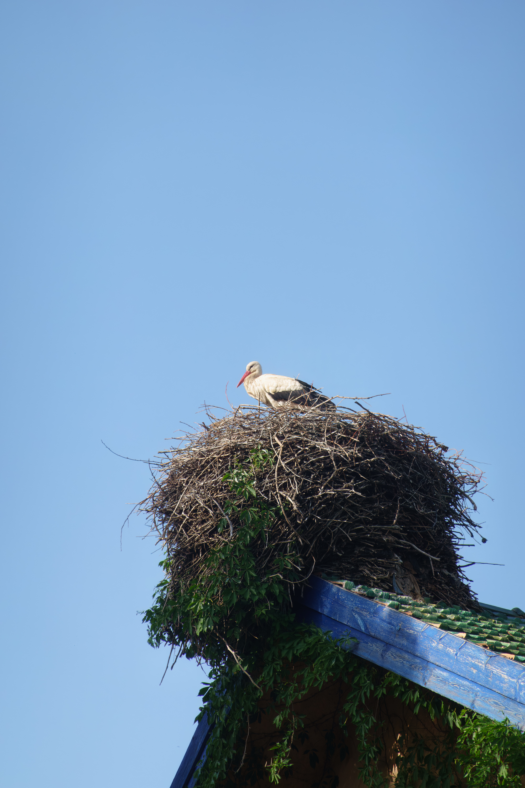
Morocco has a lot of devout birds. Storks love to nest up high and minarets are just perfect!
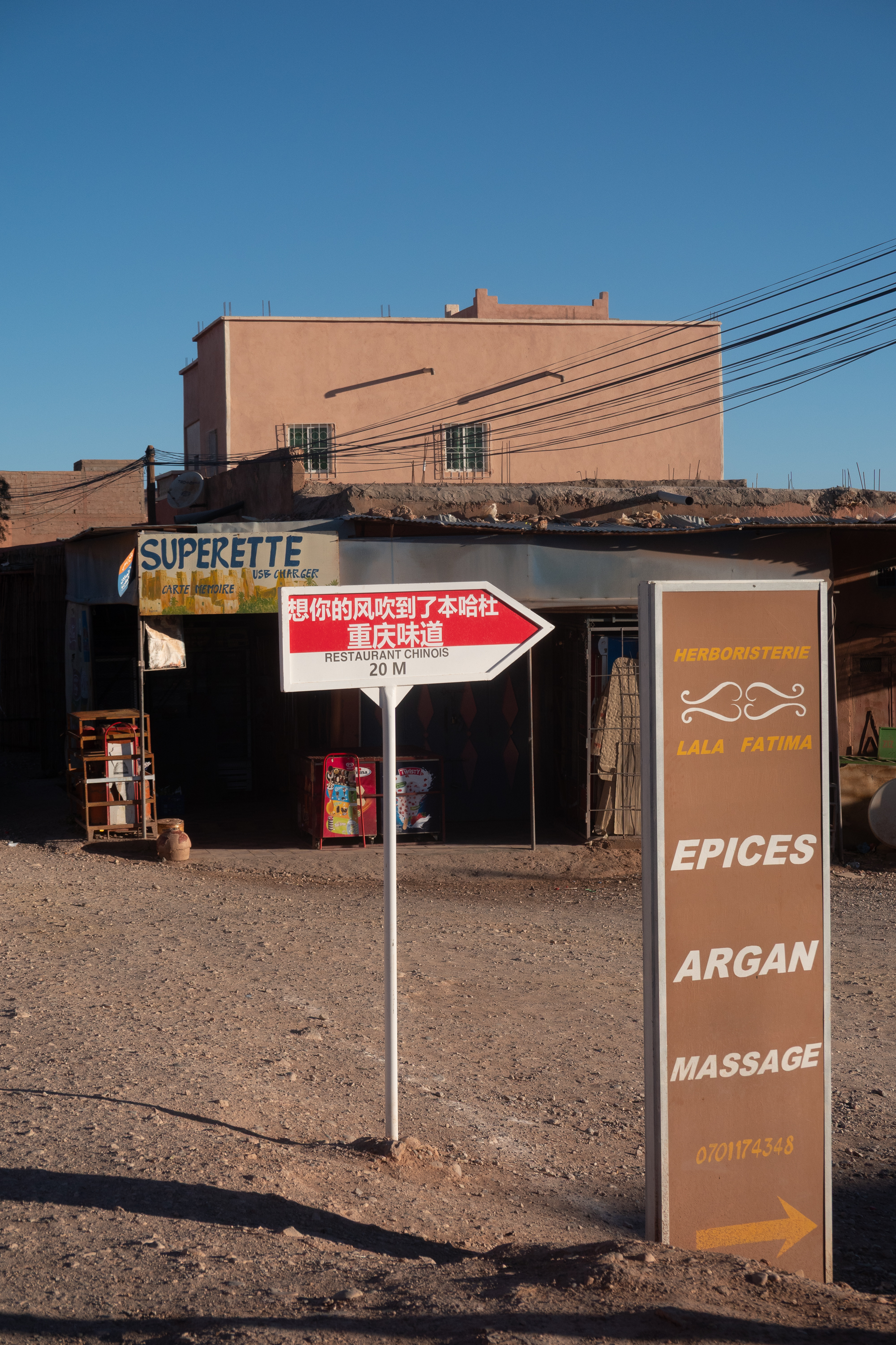
We then headed out to visit the Ksar and crossed the bridge over the Wadi Mellah. The Ksar is a fortified cluster of kasbahs, some decorated, on a steep slope, with mud brick houses behind them. It is an evocative site, which has been used by several film directors for films as far back as “Lawrence of Arabia,” up to “The Mummy”, “Game of Thrones” and the second “Gladiator”. In fact, friends who visited this week told us that they were filming a French film there!
Everything you need, including Chinese food.
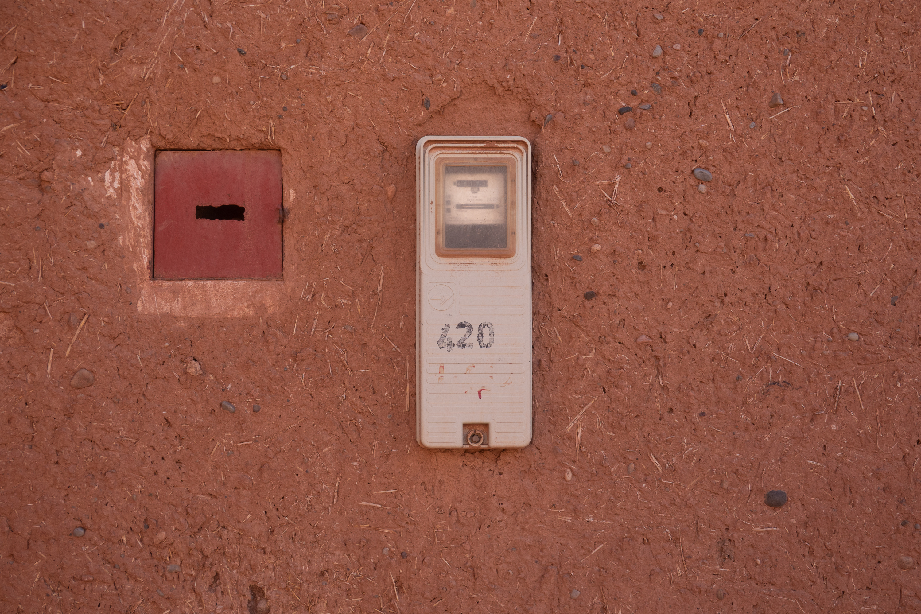
Kind of cool to see a modern electric meter, set in a mud brick wall.
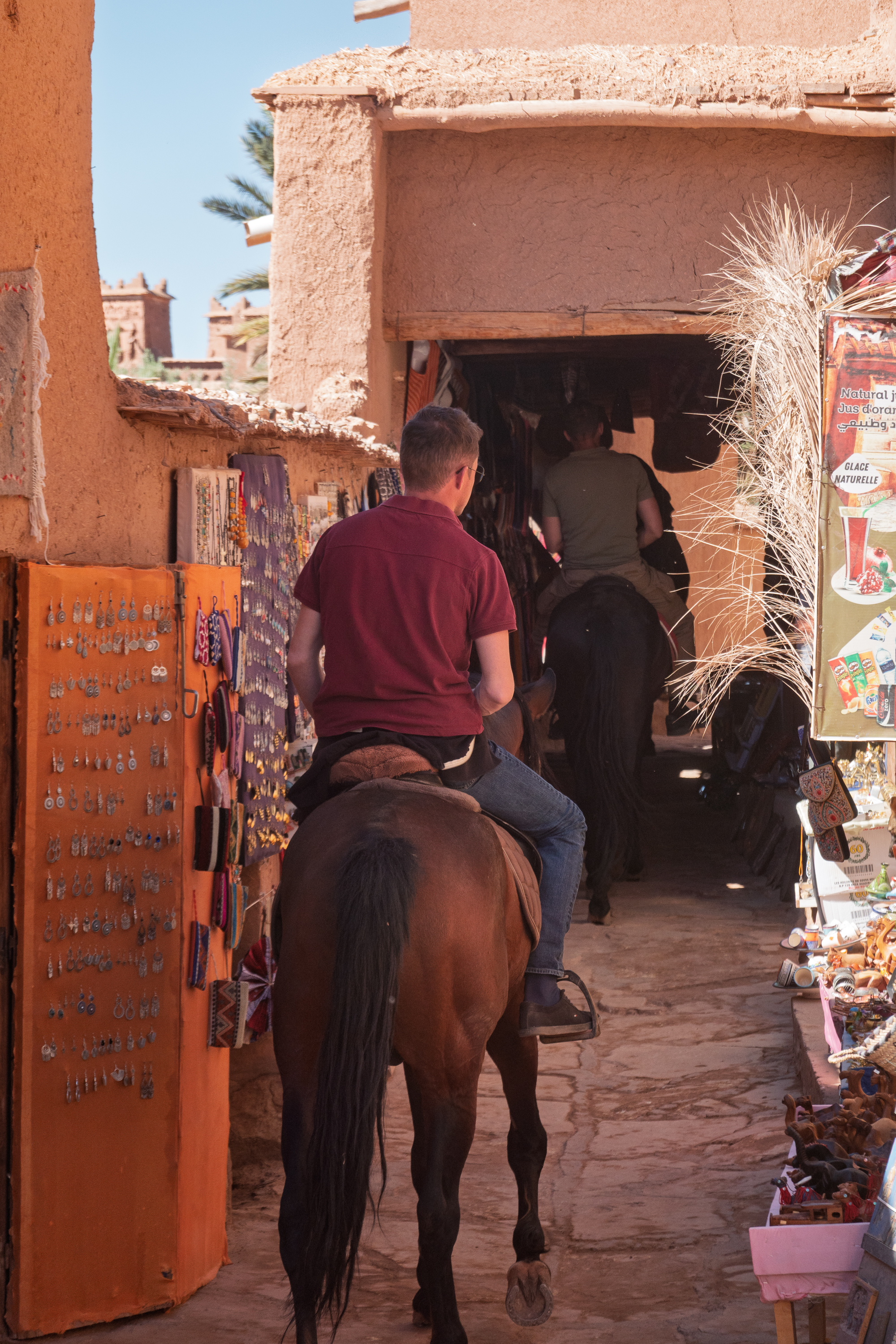
Traffic included more than just tourists.
We ran the gauntlet of vendors selling earrings and everything else until we found a tiny shop run by a a charming Mauritanian gentleman. We had a great visit (and tea) and bought some Tuareg items. (And some of them might even be authentic! They certainly brought back memories of Niger in 1974.) It was interesting, his shop was small, but his merchandise appeared, to our inexpert eyes a least, to be much, much better than that sold in other stalls.
Most of this looked like the real deal.
Seen a lot of tourists, come and go.
After a long discussion with a young lady artist, we bought a modern, but spectacular painting of a Tuareg face, complete with real fabric head covering. Quite unique.
Kittens playing in the market.
Beautiful ceiling in the gate house. Ait Ben Haddou goes to great lengths to assure that no modern materials are used.
Back across the river in the new town, we bought argan products from a lovely lady at a co-op. We had never heard of argan, but it is a most remarkable tree/seed/oil and unique to the Maghreb. (https://en.wikipedia.org/wiki/Argan_oil)
We next headed to the Atlas Film Studios in Ouazazarte. (https://ouarzazatestudios.com/accueil/?lang=en) A quick negotiation with the guardian confirmed that we could park for the night – one of our more dramatic sites!
Serious parking lot guards!
Hungry, we had a lovely lunch in the Oscar Hotel, which is part of the complex. (Took us a minute to get the name.) We were a bit surprised to find a hotel on site, but, it actually makes sense when actors and crews arrive for a movie and generates additional revenue for the studio. And tourists like it as well!
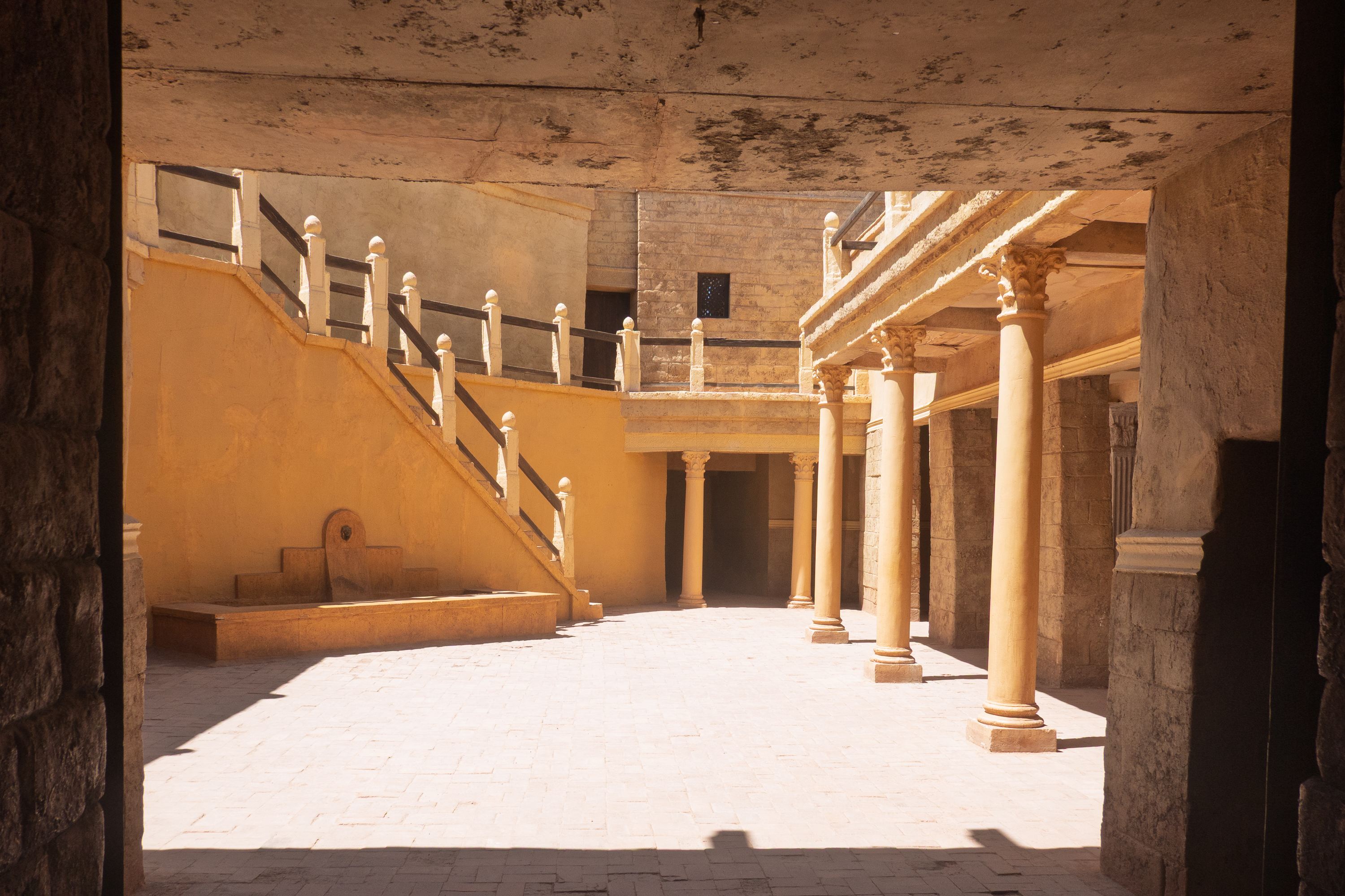
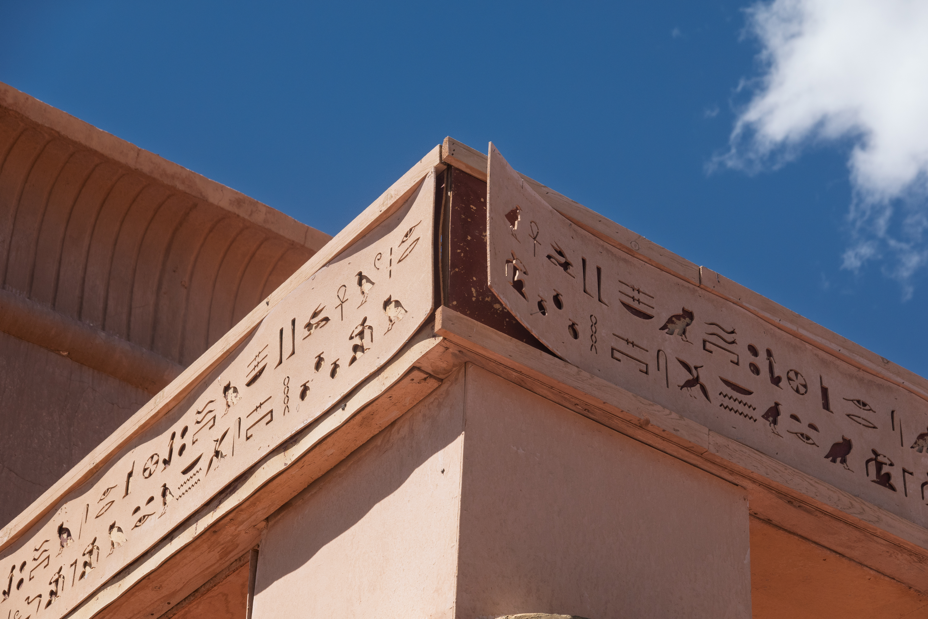
After lunch, we set off to tour the studio. The studio is rather straightforward, with a couple of big soundstages, some still dressed for past productions, and a large backlot which features a maze of “ancient” streets and houses. And temples, both Egyptian and Tibetan.
Absolutely amazing the number of Egyptian/Cleopatra/similar movies and TV shows.
Long way to Tibet.
All purpose Roman/Ben-Hur courtyard.
Some are in the classic plywood, plaster, and steel scaffolding, but some are mud brick. In the dry climate the don’t deteriorate that fast and can be redressed for different movies.
The Egyptians built for the ages. Movie sets? Not so much!
The sound stages contained the tomb passages from “The Mummy” and prison corridors from “Prison Break.” Interesting to see them from the outside.
This street was built for “The Last Temptation of the Christ” and appeared for 30 seconds. Now redressed for other movies.
The other side of the street.
Tomb passages from the outside – looks different inside.
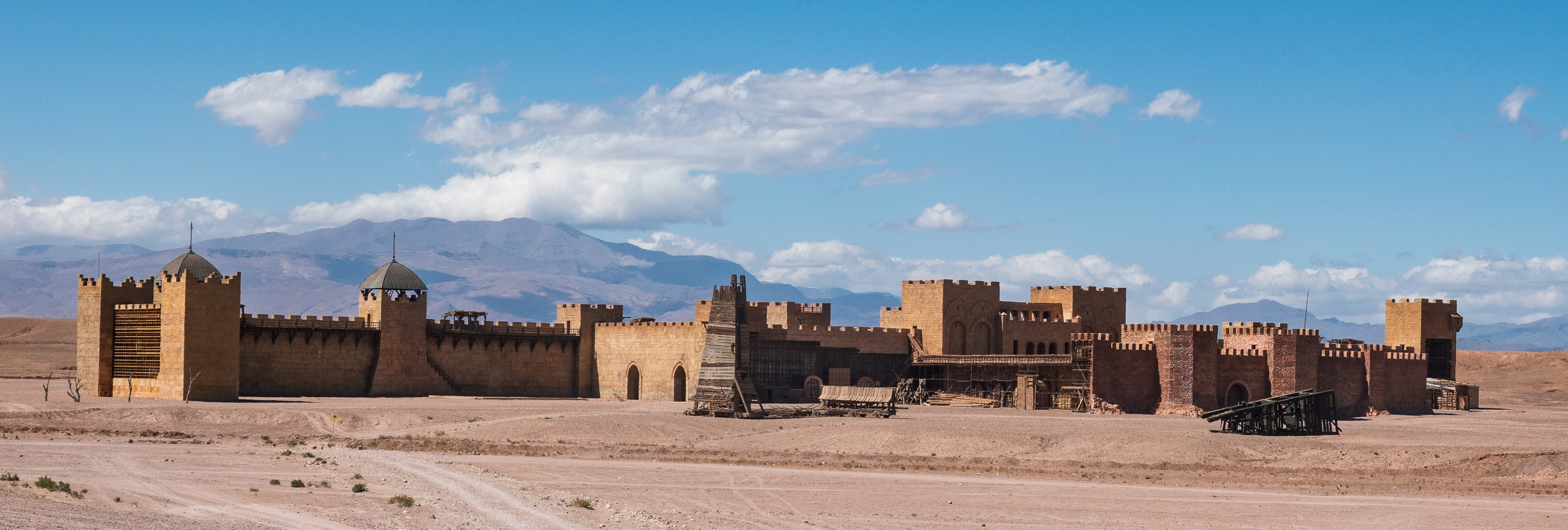
We paid a little extra so we could visit the Jerusalem set from the Kingdom of Heaven film, which is a huge set and built at a distance from the rest. They warned that it was a dirt road! Actually, there was no real road and the site was surrounded by a trench to keep out cars. Fred loved it!
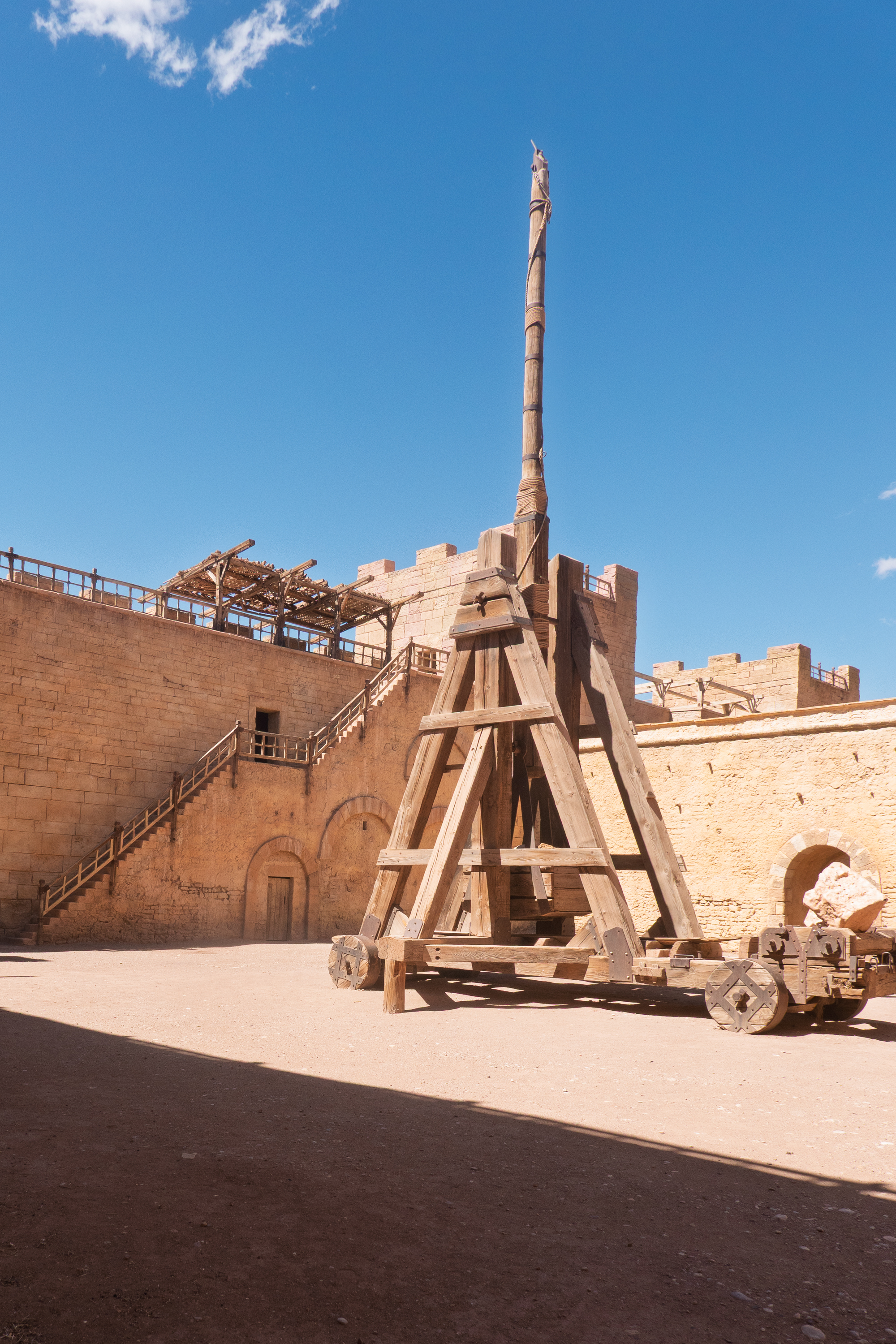
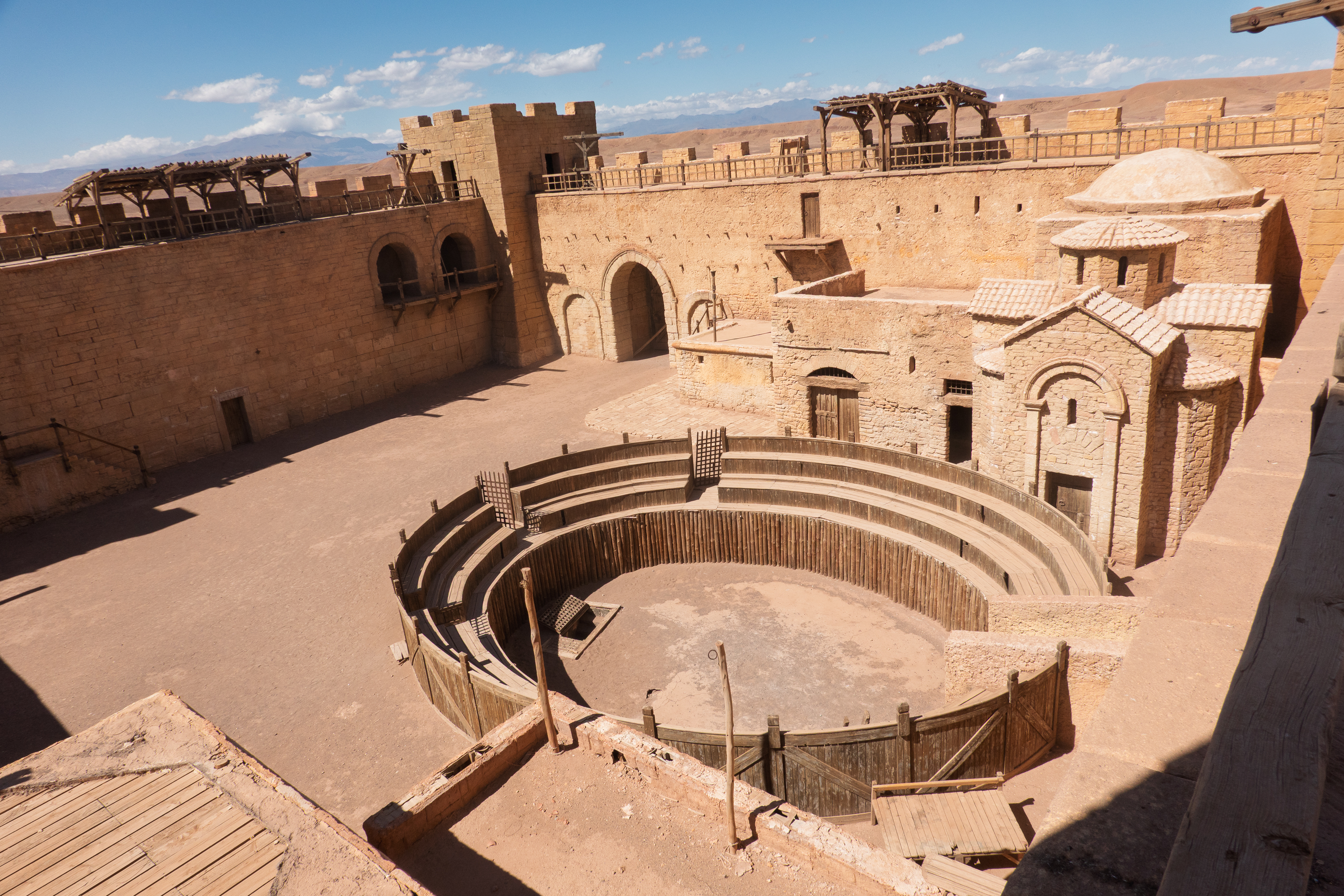
The Jerusalem set is huge, arranged so that it can be used from both sides, and now features “Game of Thrones” and “Gladiator” add ons. Oh, and no one cleans up after a battle. Siege towers, standing, fallen, and burned, everywhere. Along with trebuchets and battering ram. Messy!
Will have to rewatch “Kingdom of Heaven” with the pause button at hand to see if we can recognize all of the different sites. You really have to appreciate the tremendous planning to coordinate the set and the various shots needed for the movie. You don’t need to build anything that you won’t use.
Not what you want to see coming up to your city!
Defensive trebuchet to shoot out.Scaffolding inside a tower.
Inner courtyardNote the beautiful detailing.
Fred on his trebuchetSome of the galleries are finished. The others are simply practical.
We could have taken this picture of a real Moroccan palace. Note all of the details. Of course, some of this would come naturally to Moroccan craftsmen.
Crane for dropping oil over the side.
A “Gladiator” training arena grafted on to Jerusalem.
Siege tower – unburned.
Battering ram. Of course, Fred had to see if it would actually work.
Yup, it still works. There is a steel cable hidden in the rope.
Remember the tower that was pulled over? Still there.
And, who can forget the “Jewel of the Nile”?
We stopped in town to make a stab at figuring out why the 4×4 light would not go out. Not totally successful. We then retired to the commercial campground for the night.
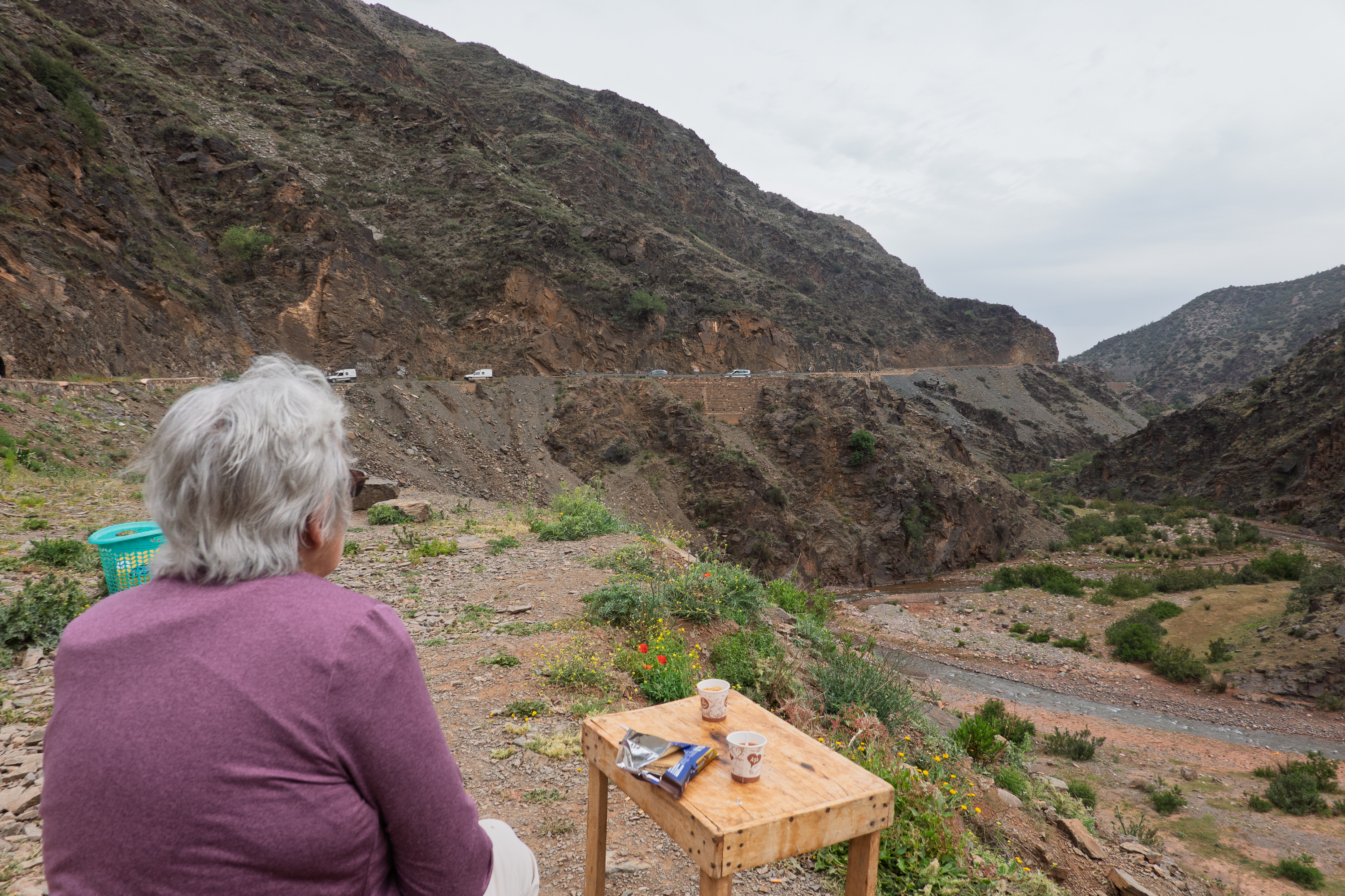
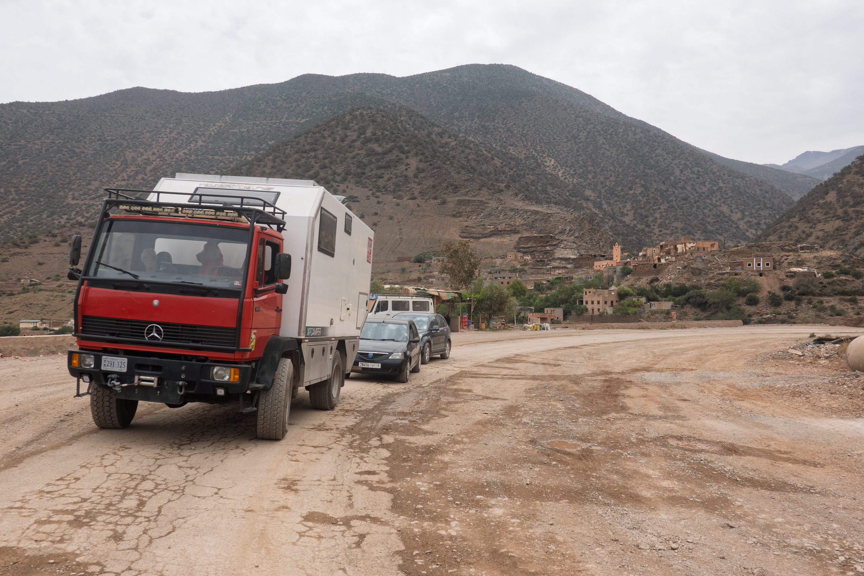
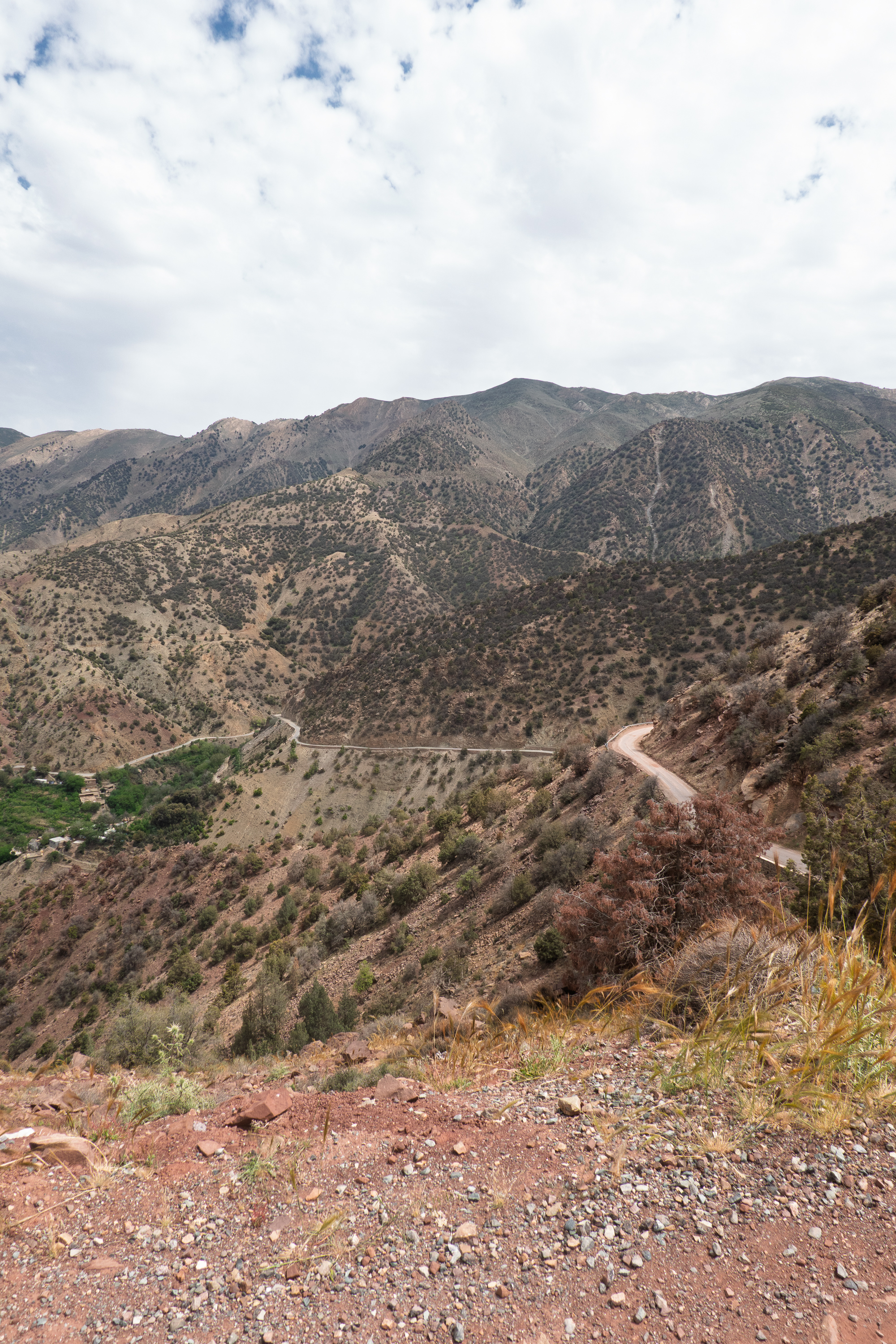
We decided to take the road through the Tizi N’Test pass to Taroudant instead of taking the interstate to Agadir and then east to Taroudant. It was a national road so we did not expect it to be that difficult and it would be a lot more interesting. Constructed in the 1930’s, it is the highest pass in Morocco – and we needed at least one superlative. Well it certainly was interesting – the views were spectacular. We knew that the road was being repaired after the terrible earthquake. We did not realize that that included well over 50% of the road. Nor did we appreciate the tremendous destruction of the villages in the back country. Reconstructing a mountain road means that there is no possible alternate route. When the road is full of huge boulders which have been dug out of the cliff face by serious road building equipment, you just have to wait until they have been removed before you can pass. We expected a 4 to 5 hour trip and got an 8 hour one. And it was very rough and dusty. We had hoped that we might be able to wild camp in the mountains, but there were simply no safe spots. But, as noted, the views were indeed spectacular!
A good trip begins with a coffee stop.
Denise admires the view of vehicles grinding up the grade.
The line of cars starts to build.
And the rocks fall down with an earthshaking crash.
These two Dutch motorhomes were flying.
Sadly, no picture can ever capture the scope of the scene. And this pull off, one of the very few, was too steep for camping.
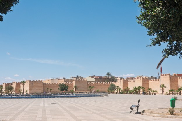
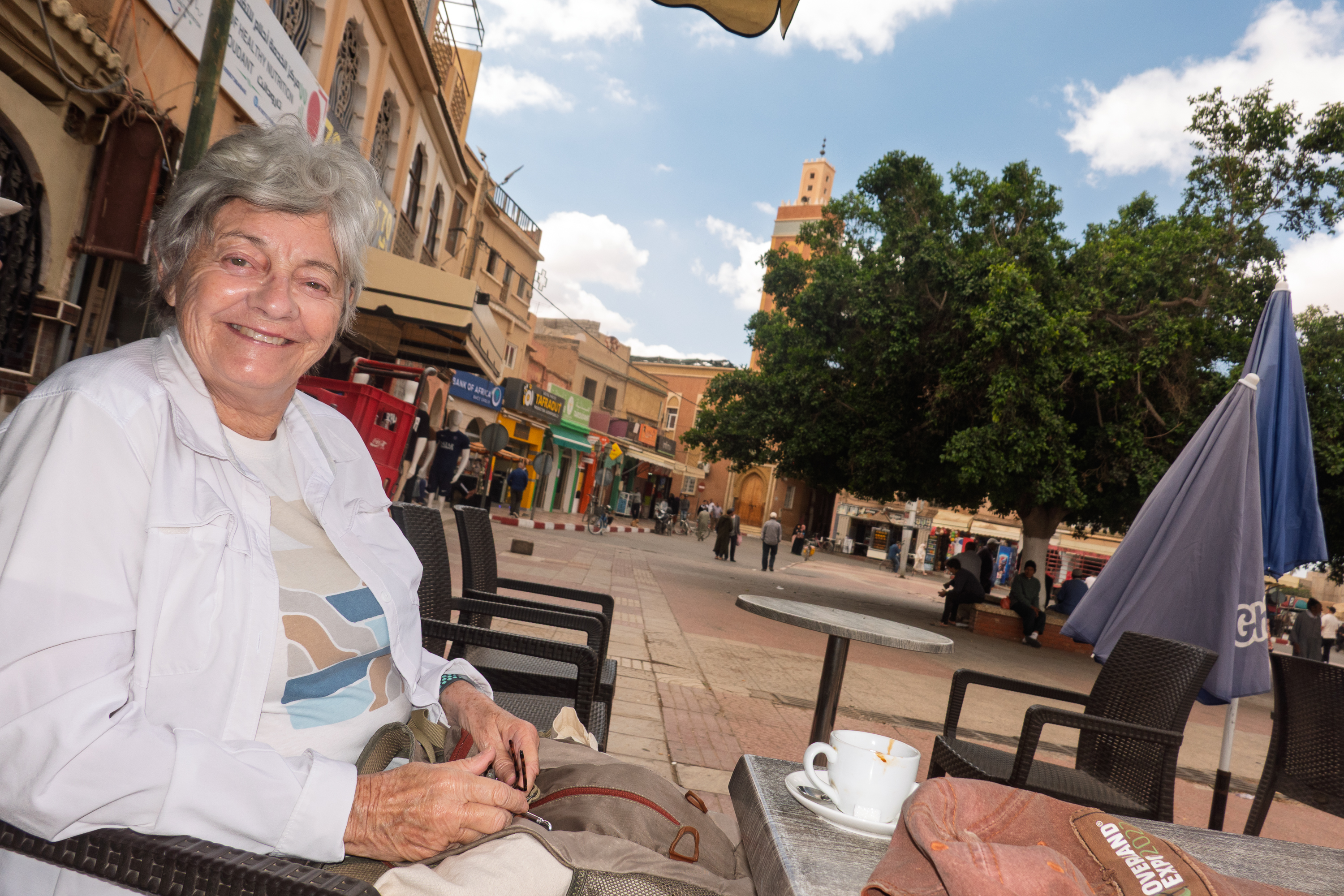
Taroudant was our next stop. It proved to be much more fun than we expected. A small, fortified town, it still has its ramparts, though in some parts they have had to be repaired.
One of the recommended ways to enjoy the ramparts is to take a horse carriage around them. We love these and it gave us a much better idea of the old town than walking would have.
We then picked a restaurant for a cup of coffee in the main square and noted the Toureg man selling items in the shade of a large tree. This, again, reminded us of our trip through Niger and Algeria, back in 1974.
You don’t this welcome at Starbucks.
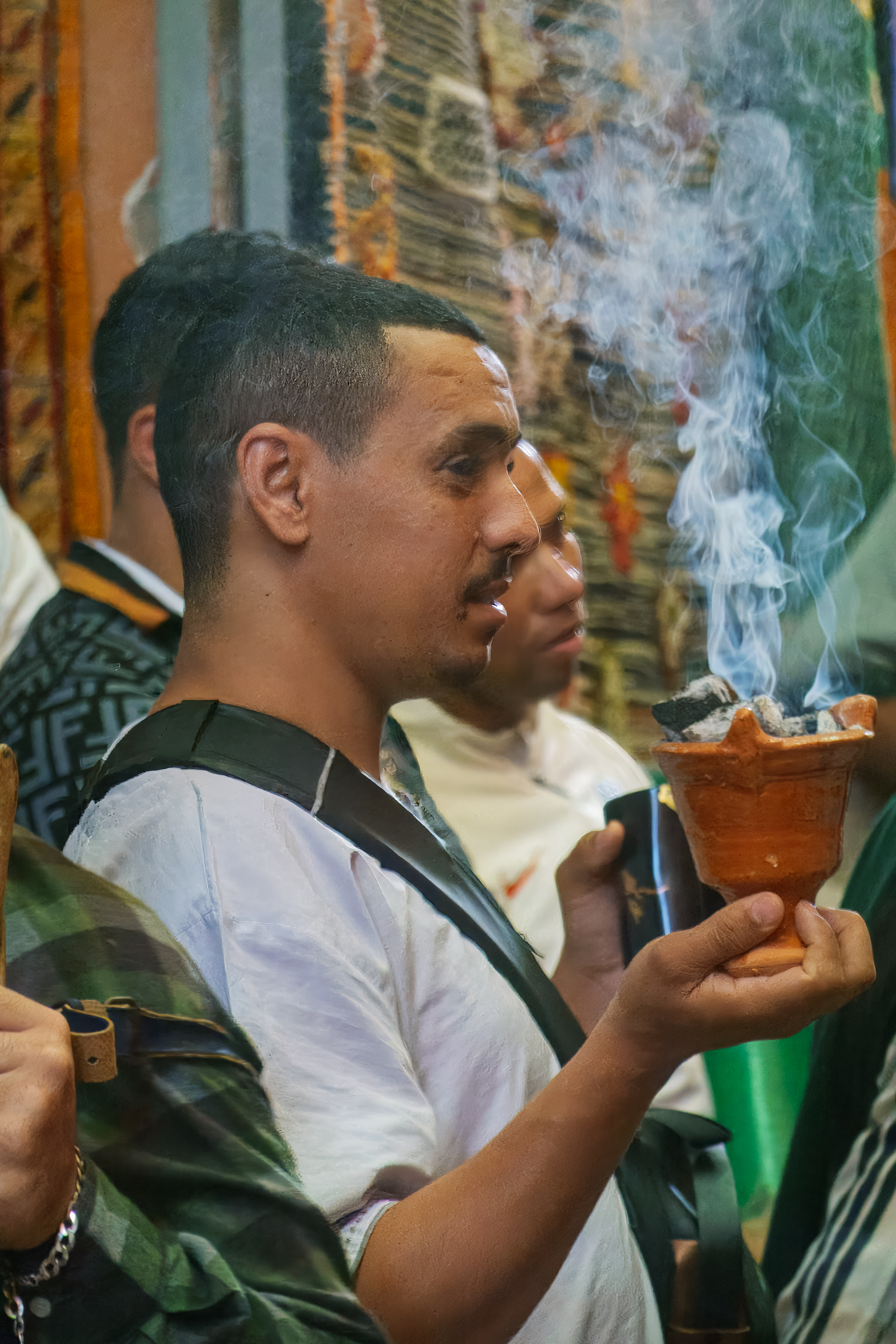
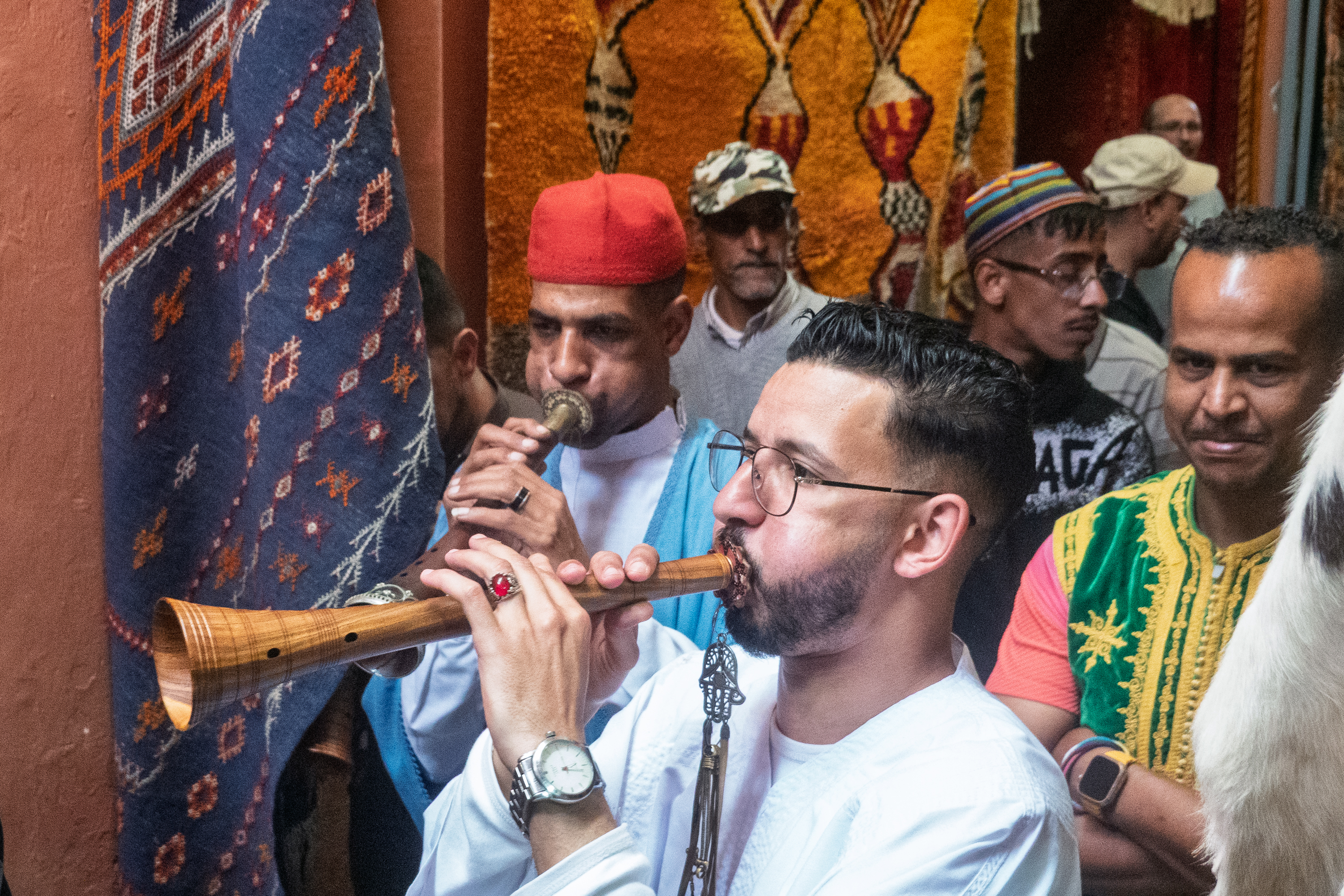
As we were drinking our coffee and people watching, an older man in a costume and carrying a golden flag walked by, heading for the souk. This was interesting, so we followed. Then we heard the sound of drums and pipes and we had to investigate. Follow that music!
It proved to be a number of people playing pipes and drums and carrying flags. They set off and proceeded to stop at various places in the souk to play and burn incense.
We were not sure of the reason for the parade, (Probably religious, Sufi?) but it was great fun and we joined the many people following them and taking photos whenever they stopped. If they could take photos, so could we. And there was not a tourist in sight. They had a beat and they danced to it.
The woodwinds section.
We headed back to the main square for lunch and watched the band come by again.
And percussion.
This gentleman was doing a solo act in the square.
After lunch, Denise sought out vegetable and fruit barrows to supplement her food stocks. Then we walked to the taxi rank and got a ride back to the campground.
Our Swiss friends from the Ferry and later, Volublilis.
Casablanca is a huge city; not at all what you might expect. We drove for more than an hour through suburbs full of big apartment blocks, and passed miles of beach resorts. There was a spectacular amount of building all around. Huge apartment complexes all along the road as far as the eye can see! Some looked like tourist rentals, others like lower cost housing.
We ended up staying in a sort of abandoned campground, with a guardian, some 40 minutes drive south of the city. Everything was terribly run down, but actually clean and serviceable. It was clearly once a lovely facility.
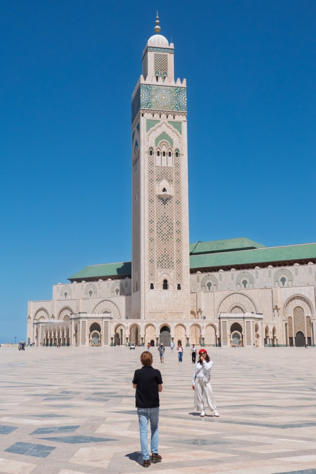
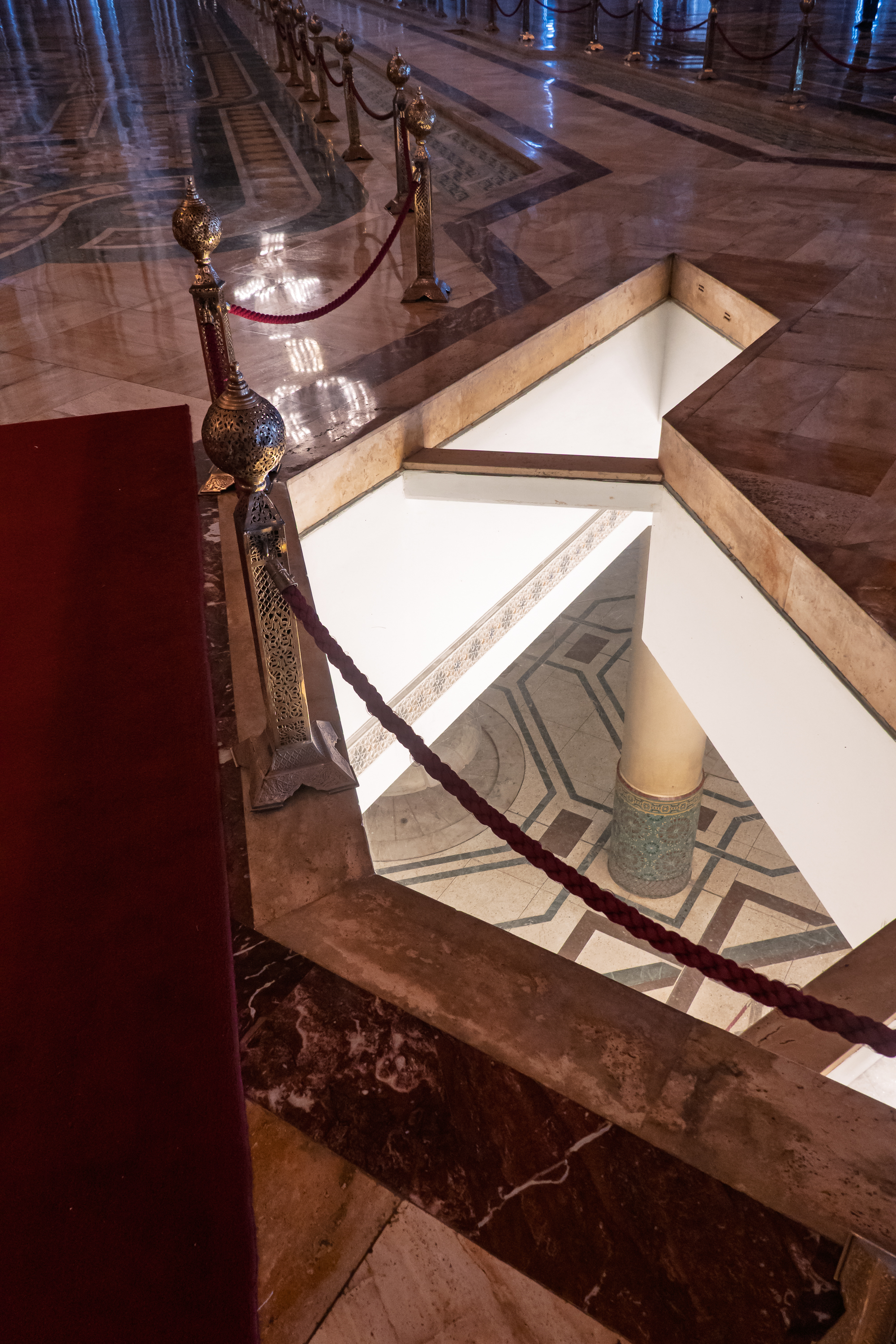
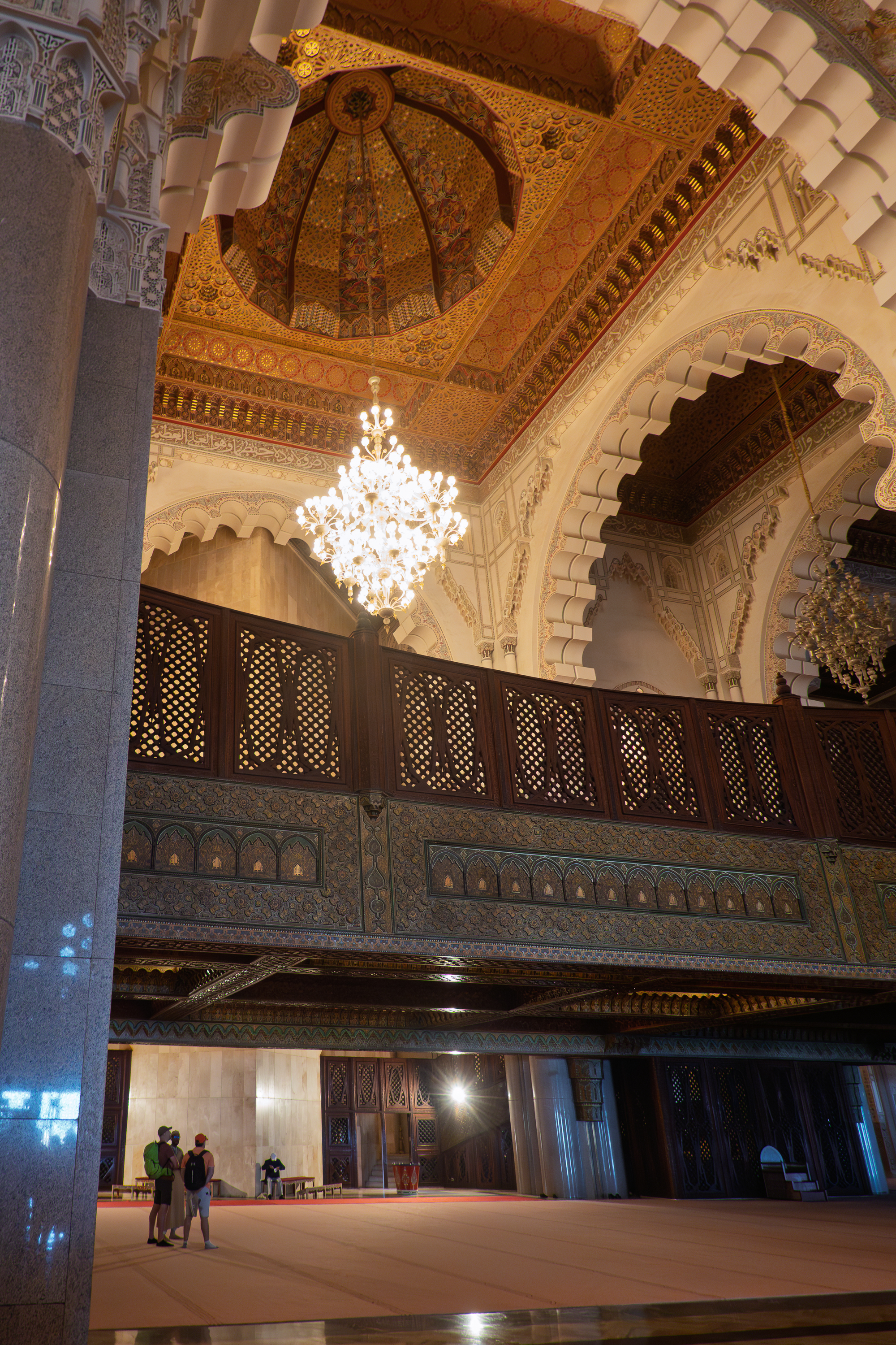
One of the great attractions of Casablanca is the Hassan II mosque, Interestingly for a country as liberal as Morocco, this is one of the very few mosques open to non-Muslims. (https://en.wikipedia.org/wiki/Hassan_II_Mosque) We had to visit, so, the next day we set off with a Spanish gentleman, also was also staying in the campground. We were some forty minutes south of the mosque, so we were happy to let the taxi navigate the endless roundabouts and swirling traffic. We had not pre-booked tickets but were able to walk right in.
It is as big as it looks, and as ornate as any cathedral.
The tours all split up into different languages. The English speaking group was huge so we opted for the Spanish speaking group. It seemed like a better idea, and it proved to be an excellent one. We had a super guide who spoke at length on what it means to be a Moslem in Morocco, discussed the roles of both men and women in the mosque, and generally covered how the mosque fits into daily life. He also gave information on the construction of the spectacular mosque.
Denise takes it all in.
View down to the washing area,
Washing fountain
Women’s gallery. As in some synagogues, worshipers are segregated by sex.On important holy days, all of these would be in use.
As with Judaism, Islam requires ritual washing before attending prayers. You may wash at home or at the mosque, which, in this case, has massive facilities.
By the time the tour finished it was lunch time. We walked over to Rick’s Cafe thinking that although the actual movie was filmed in Hollywood, it would be fun to have a burger at Rick’s. Once we got there we changed our minds. There was an expensive, full French luncheon menu only. And lines of people waiting. This was one tourist trap we could miss.
Cannon on the walls of the medina.
So we set off in search of La Sqala, a Moroccan restaurant on the edge of the Medina, with an excellent reputation. (https://sqala.ma/la-sqala-english/) Although the restaurant clearly caters to tourists, at least 50% of the diners were Moroccans. A good sign.
People say there are not enough pictures of Fred in the blog. Be careful what you wish for.
After lunch we flagged a petit taxi and set off looking for the Abderrahman Slaoui Museum museum. (https://en.wikipedia.org/wiki/Abderrahman_Slaoui_Museum) The taxi driver was not heading were we wanted to go, but after getting approval to drop his other passenger first, we were off. “You’ll never find it otherwise.” As always, Moroccans go above and beyond. He then plunged into the souk. We were grateful that the taxi had no extra paint – it was narrow!
Cathedral – we actually skipped this one.
Bummer – museum closed! We have a thing about finding holidays.
Arab League Park
Family enjoying the park.
Our museum visit a bust, it was time for coffee, ice cream, and colonial architecture.
Beautiful old building.
The cold water is a really nice touch in the heat.
We returned to the mosque to await pick up.
Surf’s up.
But the beach is rocky.
Back at the campsite, we enjoyed a pick up tapas style dinner with our Spanish friend, complete with Kirkland artichoke hearts from Costco, Spain.
French, Arabic, and Klingon? Greek? No – Amazigh, or Berber.
Our next destination was Marrakesh. If the movie put Casablanca on everyone’s mind, then the Crosby, Stills, and Nash song, “Marrakesh” did the same for Marrakesh.
When on the road to Marrakech, you should always stop for Mexican food. (Actually not that bad.)
Marrakesh, proved to be a much more manageable city by our standards. The campsite, north of the city, was pleasant. We initially parked by our big brother, a huge Expo truck.
People always think that the 917 is large, until they see it next to another expo truck.
OK, Not sure that an American Class A would be my first choice for Morocco – or anywhere in Europe, for that matter.
Blast from the past: Motorcycle tour group living out of the backs of their cars, just was we did for decades.
Our campsite outside of Jos, Nigeria, 1974. Indoor plumbing is nice!
The campsite booked us a taxi taking a maximum of six persons for 100 dirham (about $10 total) and we were off!.
We began by taking a one hour horse and carriage ride – a bit pricier than the taxi! This gave us a chance to orient ourselves a bit and we were dropped at the entrance to the souk.
Parking
Water stop.
We entered, started to wander, and saw a sign for coffee on a rooftop cafe restaurant. Perfect! We entered the ground floor doorway, looked right and saw an incredible carpet display. So we headed right and found ourselves in an amazing three story carpet warehouse with rugs of all shapes and sizes from all the carpet making areas.
Street in the souk.
Beautiful display.
Three floors of rugs.
Ibrahim, the manager/owner was wonderful and pulled out rugs from all over. We looked at lots before deciding to think about it and heading upstairs to the roof for lunch.
Morocco is all about getting up onto the roof.
This proved to be a wonderful place. Shady, with a charming young lady serving the excellent Moroccan food. We had a lovely lunch and then returned downstairs to spend some money and to arrange to have the carpets shipped to DC.
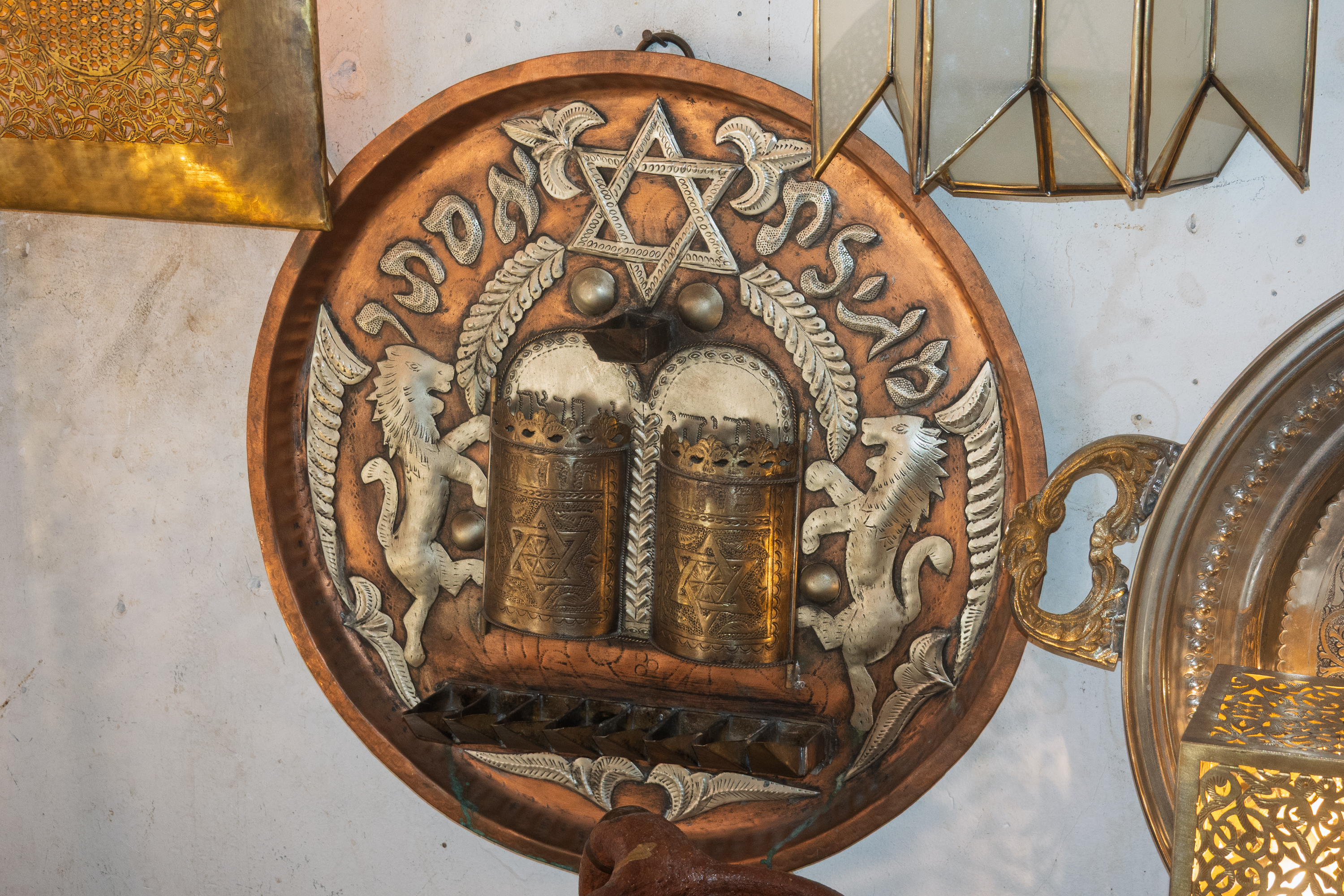
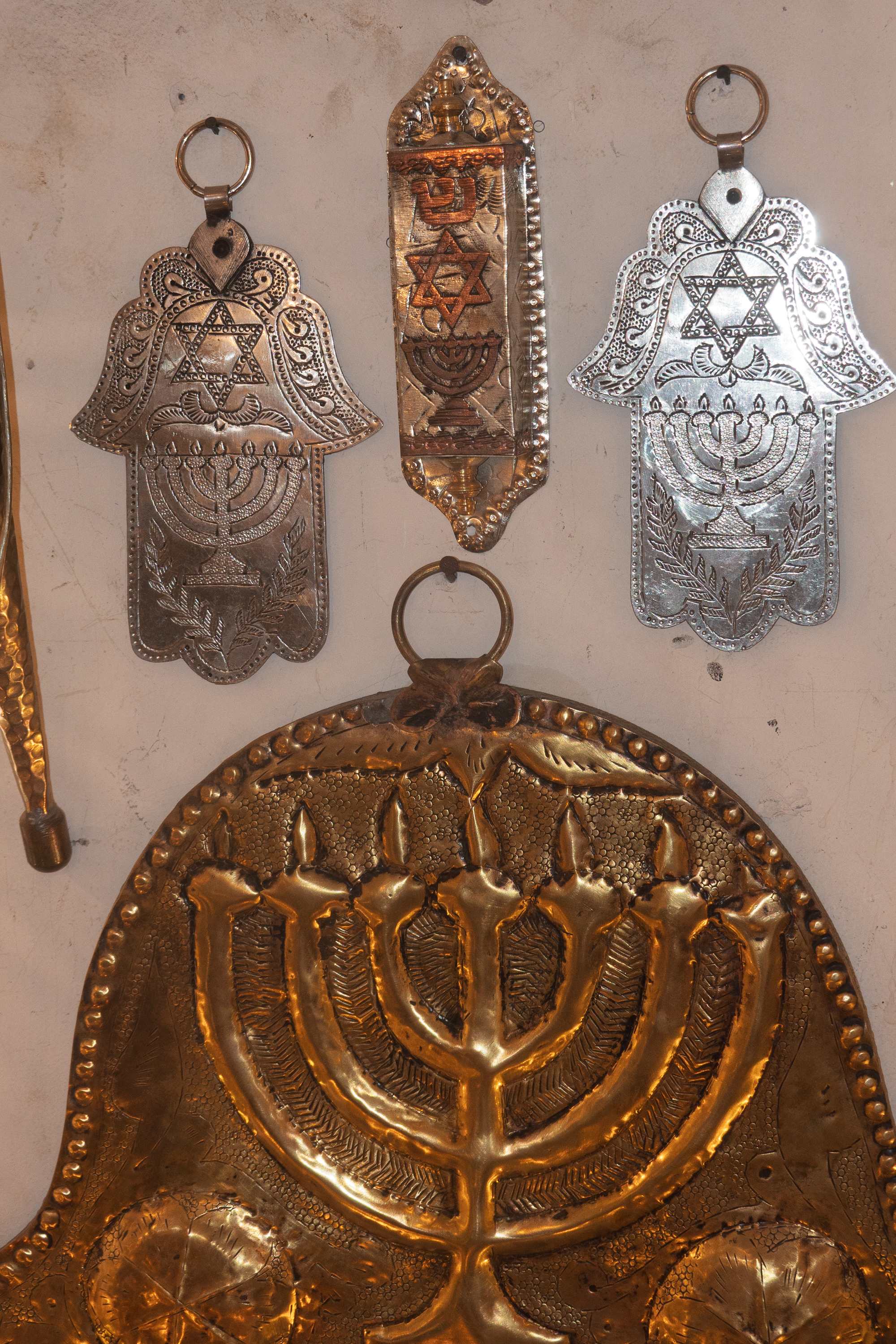
After lunch we stopped into a metal store to admire lamps. We noticed some interesting Judaica.
The Hamsa, or Hand of Fatima or Miriam. Whatever you call it, it protects against evil.
Morocco has always had a large Jewish population, especially after the “Reconquista” in 1492, when Ferdinand and Isabela began the serious expulsion of Moors and Jews from Spain. (https://en.wikipedia.org/wiki/Reconquista) After 1948 many Moroccan Jews emigrated to Israel. Today the Jewish population is low. The interrelationship between Morocco and Spain, and between Christians, Jews, and Muslims in this area is well beyond this blog and fills books. Let us just say that it is much deeper and more complex than many realize and covers everything from politics, to food, to religion, to music, to language, and beyond. (Almost any Spanish word that begins with the letter “a” comes from the Arabic. For example, “Azucar” comes from “Al Zukar.” The movie “El Cid” only begins to scratch the surface of this complex mix.
We went looking for the museum of Moroccan music. (https://museedelamusique.ma/en/) This was housed in an 18th century house deep in the souk.
Down here? Really?
The building was a fascinating maze, almost as interesting as the musical exhibits themselves. Narrow stairs led to wandering passages. Sadly, there was no live music during our visit.
Performance hall. Here they encouraged you to touch the instruments.The decoration was breath taking. Note the skylight to let the light in and the heat out.
Where might this stair lead?
Much of the souk was damaged in the earthquake.
We spent a little more time in the souk before heading back for our taxi pickup
During our second day, we visited Jemma el Fnaa, the main square, a UNESCO site and, frankly, a bit of an annoying tourist trap.
“THE” SquareCarriages awaiting tourists.And, yes, we paid for this one. But it did get us some peace.
We REALLY do not like being accosted by touts or having money demanded by snake charmers. Pity, because otherwise, we would have sat down and enjoyed a show. We walked past the famous Koutoubia mosque, which is said to have been the model for the Alhambra, in Spain, and went back deep into the souk.
We purchased some slippers for a friend. After deep discussions of price, the shoe seller had a cousin lead us to the leather store to buy some purses for other friends.
Brushing each piece with a flame, to show that it is not Chinese plastic.
We made these cats happy as we bought a lot. But, of course, first we demanded tea. Not going to set a price until we have mint tea. What do we look like? Tourists?
Yes, you also have to watch for cars and motorbikes.
We then headed for the same rooftop restaurant for another lunch! Just as good as the day before and the young lady seemed both surprised and genuinely happy to see us come back. We felt like old friends.
This time we simply returned to the campsite in a petit taxi, our own Marrakech Express. Much easier than trying to link up with a booked taxi.
We had a pleasant crossing. The weather was so calm that we arrived at Tangier Med about two hours early.
We then tried to follow rather vague instructions (in Italian and Arabic) about how to disembark. The first line we stood in wanted the importation papers for the truck, which were, of course, in the truck and not accessible. There were several of us in the same situation. We were told to go to another line and get an escort to go down to the garage for our papers. The second line told all of this that that was nonsense. They would process immigration and we should all handle the vehicles on the pier. So our passports were duly stamped and we disembarked, prepared to process the vehicle in customs. This we did, but it took at least two hours. One hour before we were able to begin the process, and one hour while they decided what to do as we had no carte grise (grey card, the universal European auto registry), only Virginia registration papers, which are white. (carte blanche?)
In the end, they came back with our temporary import permit and we were off on the motorway for our first campsite, just north of Asilah. Never heard of Asilah? Neither had we. (https://en.wikipedia.org/wiki/Asilah) How about the old imperialist line “Perdicaris alive or el Raisuni dead!” Raisuni built a palace in Asilah, allegedly with the proceeds from ransoming Perdicaris (And sorry Ms. Bergen, Perdicaris was a man.) (https://en.wikipedia.org/wiki/Perdicaris_affair)
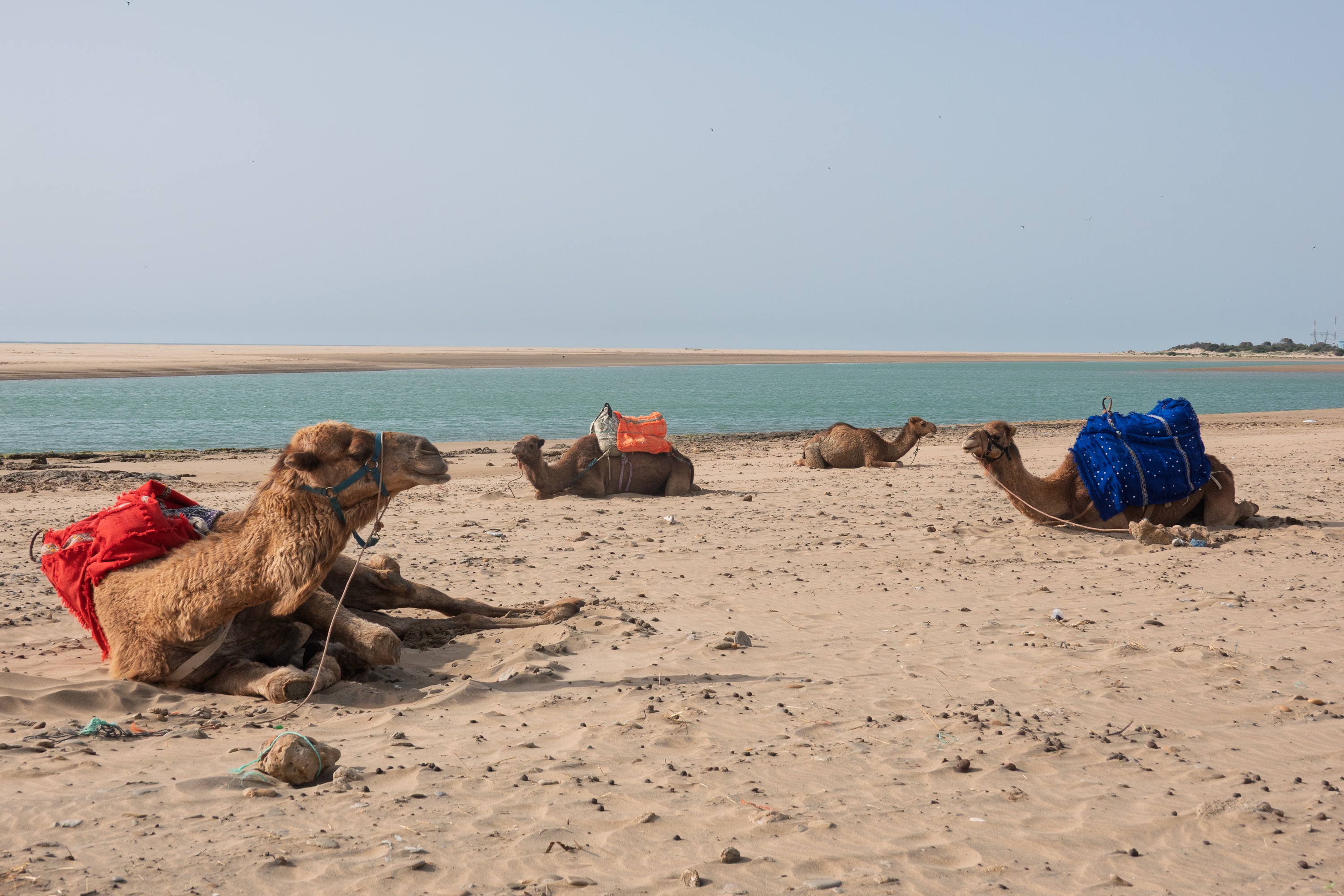
Asilah is a classic Moroccan coastal city, overshadowed by the more famous Tangier and Casablanca. Today that means a classic, historic center, surrounded by vast new, modern housing blocks and thousands of beach vacation developments. Miles and miles of them.
Camels on the beach.
The campground proved to be pleasant and we settled in. The next day was the Muslim holy day of Friday and hence, like Sunday in the United States, the town was likely to be closed. So we stayed home, only paying a visit to a small supermarket about four kilometers away on our bicycles.
It seems that, in Morocco, couscous is most often served on Friday and for lunch. It being Friday, we ordered couscous for dinner. It was good but not wonderful. Note taken – next time order it at lunch!
That is a BIG bread!
Our European router does not have service in Morocco, so we headed into Asilah the next day in search of a local SIM card. The taxi driver took us by the INWI telecom store, but it was still closed at 10:00 AM. It was supposed to open at 9:00 AM. We noted the location and the taxi dropped us at the entrance to the Medina.
Asilah has lots of round towers.
Motorcyclists
After a quick reconnaissance, and, of course, a coffee for people and traffic watching, we wandered back to the shop and found it open. Happily, the gentleman at the shop spoke a bit of French, a bit of English, and a lot of SIM. Within 15 minutes, we had a month’s unlimited 4G service for about $50. Didn’t even have to change the password!
Denise needed fruit and vegetables and she made some judicious purchases (bearing in mind that Fred would have to carry them!) from some street vendors. Amongst them were some wonderful strawberries. We also found a much needed ATM. Morocco is a country that likes to be paid in cash. Credit cards need only rarely apply.
Modern city square.
Old Portuguese church.
After a quick wander through the modern part of town, we headed back towards the Medina. Lunch was excellent, at a restaurant recommended by our taxi driver. We then set off in earnest to explore the old fort and Medina.
We checked out the shops …
and the cats. Now that the clouds were clearing, it was getting warmer.
The classic Asilah waterfront picture.Denise joins the crowds admiring the ocean.We admired el Raisuni’s palace, sadly not open to the public.
Most of the streets were narrow for shade.
Asilah is know for art festivals and there was whimsical street art everywhere.
Interesting cultural juxtaposition. There are lots of riads (traditional hotels) facing the ocean and the upper balconies are popular for sun bathing in less than one might wear in public.
We came upon a gentleman playing a traditional three stringed guitar type instrument. Fred found it tough going, although the lack of frets makes it easy to play any scale you want.
Three stings, no frets. (https://en.wikipedia.org/wiki/Sintir)We finished the day with a bottle of bubbly, to celebrate our wedding anniversary.
A pleasant, low key introduction to a new country.
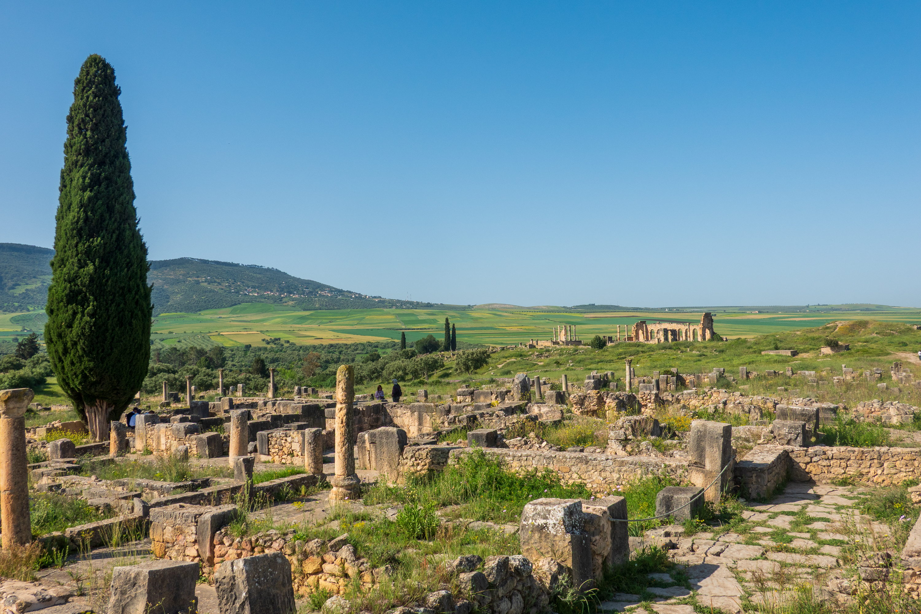
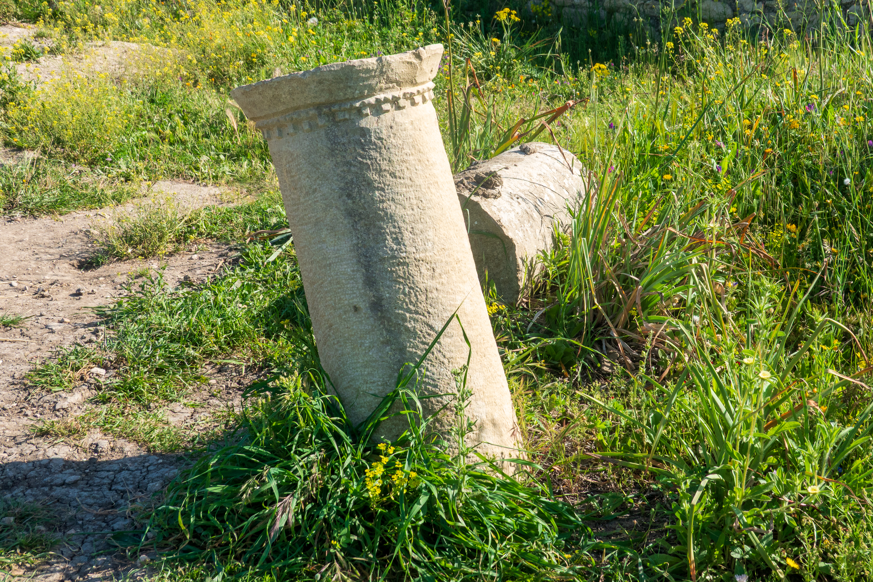
We set off the next day to the Roman site of Volubilis. We found a nearby campsite and, after determining that the mountains looked too mean for biking, set off to visit the next day. Arrived early in the morning, before the heat, before the tour busses, and before the ticket office opened.
coffee while you wait.
Our multiple visits to Roman sites in Jordan, in Paestum, and in Herculanum, had given us a greater understanding of what we were seeing and we were quite happy without a guide.
The basilica on the hill.
There are a lot of wonderful mosaics, but sadly, they are not protected and are aging with the sun.
Diana getting into the tub. And spilling the water. Fortunately, she has staff. (And no peeking – there is a whole. sad story about the gentleman on the right..
Hercules with the wild dog.
Portrait?
Baby Hercules with snakes.
Impluvium, to catch the rain, inside a wealthy home.Every Roman town had a decumanus, a main east – west street. Gate at the top would have lead to Tangier.
Denise admires an olive press.Fred enjoys the crowd at the basilica.
We strolled the decumanus, which would have been a main shopping street, with covered galleries on the sides, the sewer underneath, and lots of shops, temples, and wealthy homes.
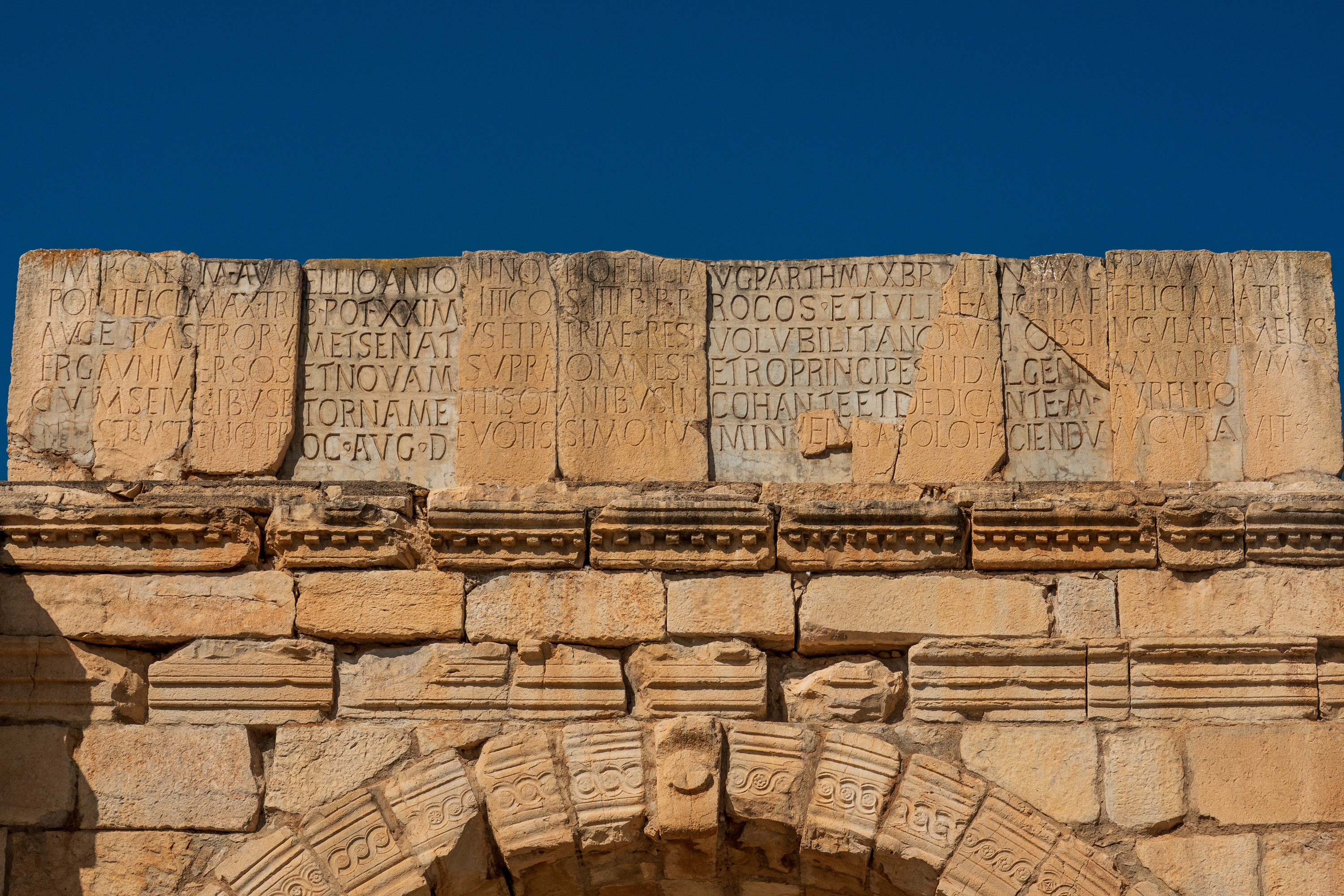
Triumphal arch at the bottom of the decumanus. Fans of the film “Patton” will recognize this arch.
Always remember to dedicate your arch to the emperor who gave you a tax break.
We planned then to head into Meknes to shop at the big Carrefour. Fred had a little trouble getting enough air pressure for the brakes to release, so there was a short delay in leaving. Heat? Altitude? We wondered why. All would become clear at Carrefour.
Arriving in Meknes, it was clear that we could not get into the formal car park, but the guardian had managed to fit us right up against the stadium wall, with lots of room for our ladder. Parking guardians are everywhere and can achieve great things. So off we went for a great Euro style shop. Happy, happy. After loading our groceries, Fred realized he had insufficient air pressure to move. We had a serious leak not good at all.
So, Fred chatted with the guardian. “You don’t happen to have a cousin who is a diesel mechanic, do you?” “Let me think.”
Fifteen minutes later, the guardian led Fred around the corner to a man working on a car parked outside a small auto parts store. The mechanic agreed to come look at the truck. He could hear the leak but rising the cab was difficult as we were on a slope against a wall, and with no air pressure, we could not release the brakes to roll back. So we raised the cab, braced it with non-OSHA approved blocks of wood and found the leak. And, when the first repair did not hold, the mechanic went off to the market for a new hose.
The perfect parking space.New white hose.
This installed and tested, we were charged the princely sum of $30.00. We were needless to say, thrilled, and paid a tip. And to the guardian as well.
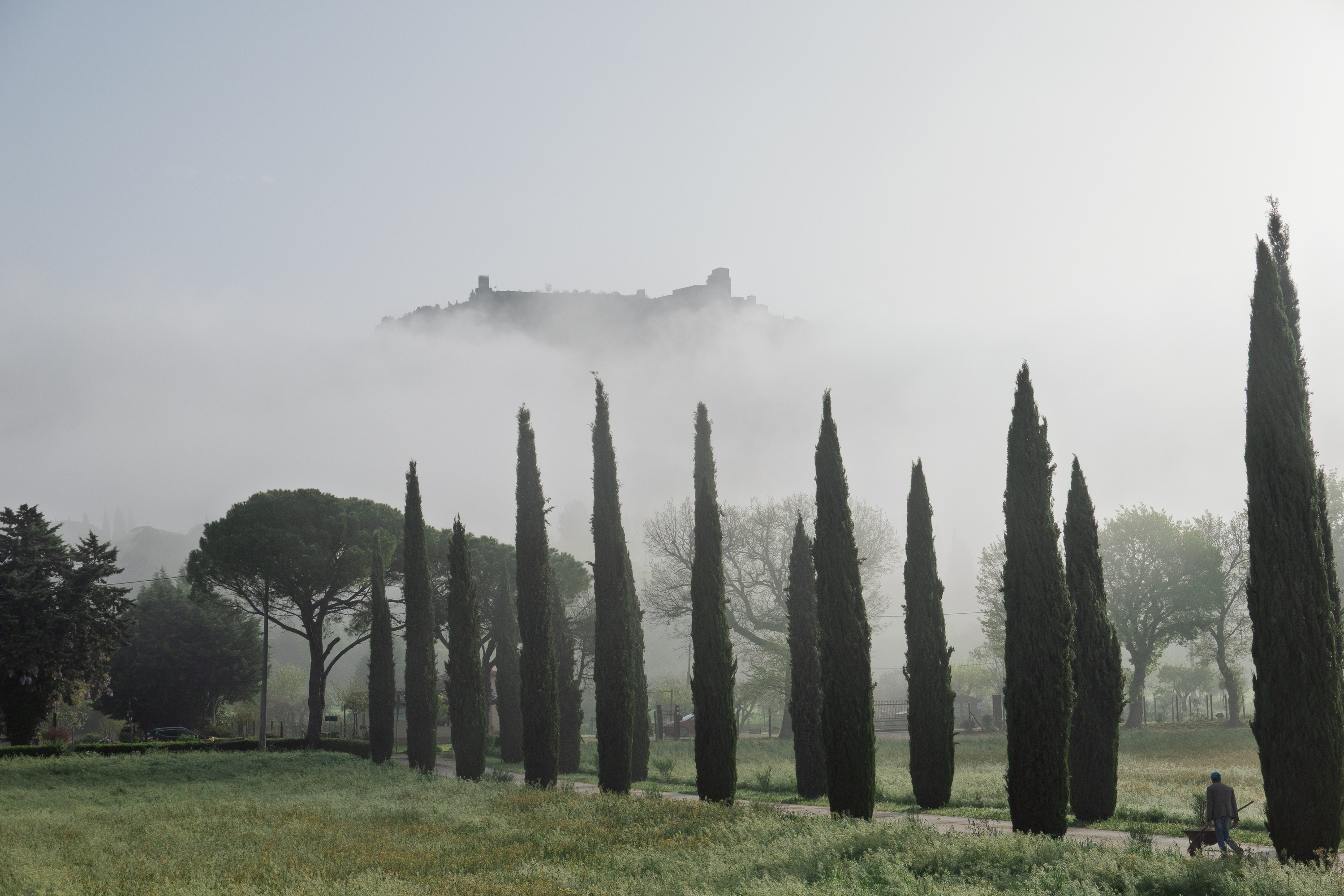
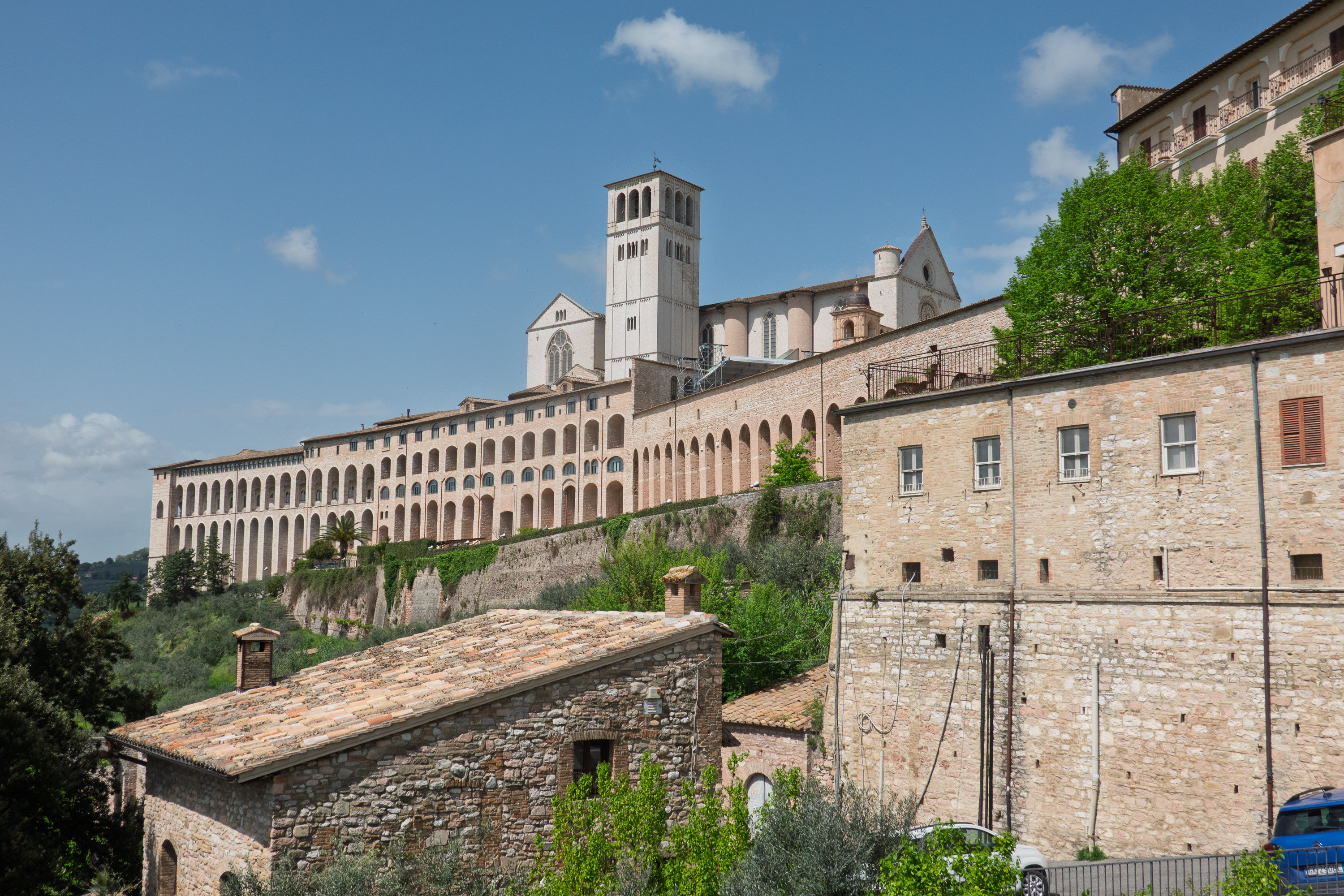
The cloud and threatening rain that dogged our last day in Rome became serious rain as we headed north to Assisi. In fact, the downpour lasted all night and most of the morning of the following day.
Basilica of St. Francis by night.Assisi through the clouds from our campsite. Rather romantic, if soggy.
In the afternoon, with umbrella in hand, we walked to the local supermarket to stock up on a few items. We escaped the rain but watched it settle in again for the night. But the weather report said the next day would be fine and it was. We purchased bus tickets and boarded the bus to ride up the very steep hill to the town of Assisi.
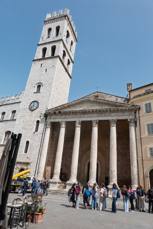
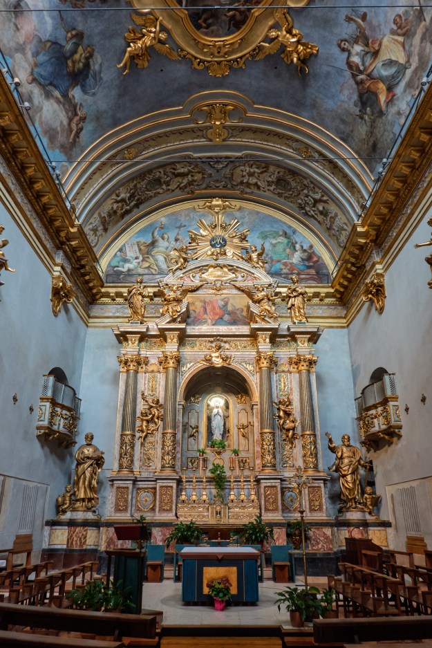
Known for being the birthplace of St. Francis, Assisi is very much a town of religious importance to the Roman Catholic Church with a large number of churches. The Basilica of St. Francis is a site of pilgrimage.
View from the hike into town.
Looking back towards our camper over a youth choir rehearsing.
The construction of the Basilica began in 1228 immediately after the canonization of Francis of Assisi. It consists of two churches, the Upper and the Lower, which has a a crypt, where St. Francis is buried. Both churches are decorated with frescoes by such artists as Giotto and his contemporaries. The frescoes are spectacular but unfortunately photography is forbidden. There are more details and photos in Wikipedia for those who are interested.
View over the valley
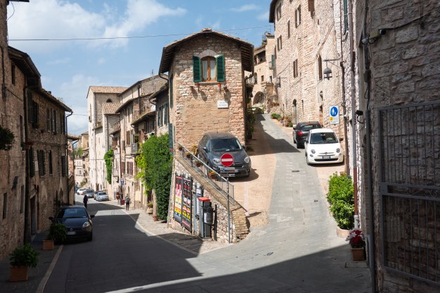
You know it is steep when then put steps right in the middle of the street
We always gawk at narrow or steep streets. These were both.
We explored the town and had lunch in a restaurant built into a medieval house with arches.
A fun experience, as was the gelato (of course) that we enjoyed later in our exploration. We then walked down the hill, back to our campground. Much more fun to walk down than up!
Pretty fountain with fish.
Our final stop in Italy was in Lucca. This was during Holy Weekend and we were unable to find a space near Cinque Terre as everything was full. We spent four nights there and it rained solidly for two of the days (and turned our site to mud!) but again we had one sunny day to visit Lucca.
We walked a section of the city wall before deciding to rent a pedal surrey! We actually rented an electric one and enjoyed a full circuit of the town in splendor and ease! Lucca was a fun town to wander, with a busy pedestrian shopping street and lots of restaurants.
Lots of European towns have vestiges of ancient walls. In Lucca, the circuit of the medieval walls is complete and the walls are so wide, there is a road on top. (Thankfully limited to bicycles and pedestrians.) Lucca’s walls are so spectacular, that they even have their own museum and you can walk the streets and follow the outline of the old Roman walls.
Denise on the wall.Right this way!
Fred, trolling for passengers.Why is this plaza round?
We even found the old Roman amphitheater. The galleries have long since been converted to houses, but the arena floor boasts a range of restaurants. We went elsewhere as this was the only place in Lucca where we were accosted by touts.
On Easter Monday we set off for Genoa again in preparation for the ferry to Morocco. It was an interesting drive that followed the coast line. We had already noted that most houses in Italy are painted a light brown, however as we drove, we began to see houses of pink, or blue, or darker brown. As mentioned earlier, we dd not get to see the Cinque Terre towns, but we did get some idea of them from the hill towns with varied colored houses.
We had booked a camper storage lot for the night before our ferry departure as the ferry check in began at 7:00 AM. We asked at a campground but the owner was skeptical – the road was narrow and everyone double parked. The owner of the storage lot assured us that, no matter how narrow it looked, we would fit. He was right, but we held our breaths! The lot was huge, winding back at multiple levels. And he even had a dump station and drinking water. While most of the vehicles were in storage, we were clearly not the first to spend the night.
Yup! Just as narrow as it looks.
Home for the night – we only stay in deluxe facilities.
We arrived about 7:30 AM and received boarding passes very quickly from GNV. However. we also needed police clearance and the police did not arrive until 8.30 am. There was, of course, a huge queue by then! We declined to join it and waited for the crowd to thin before standing in line. Passports stamped, we waited in line until about 11:00 AM when we were boarded on the ferry. We found our cabin and moved in, this time equipped with warm clothes for the hyper GNV air conditioning. Ferries can’t match the standards of cruise ships, but this was not bad and even had a double bed.
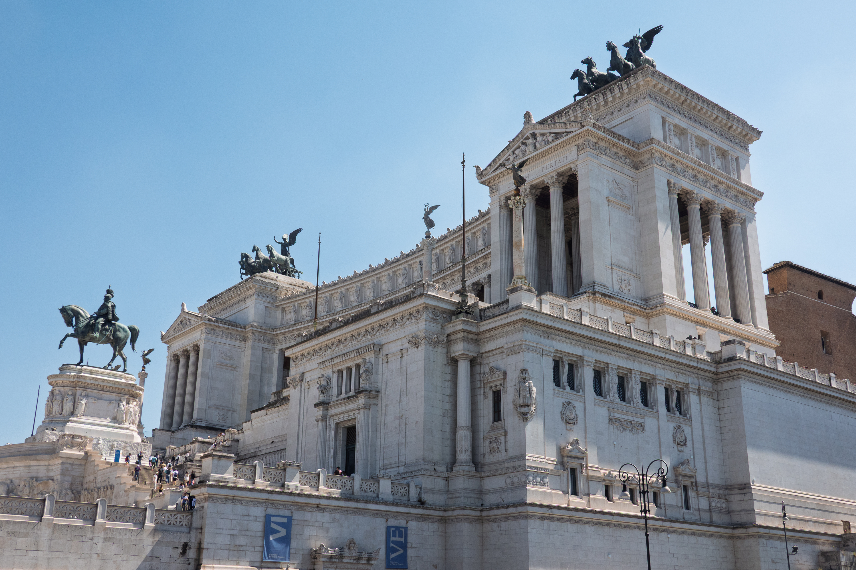
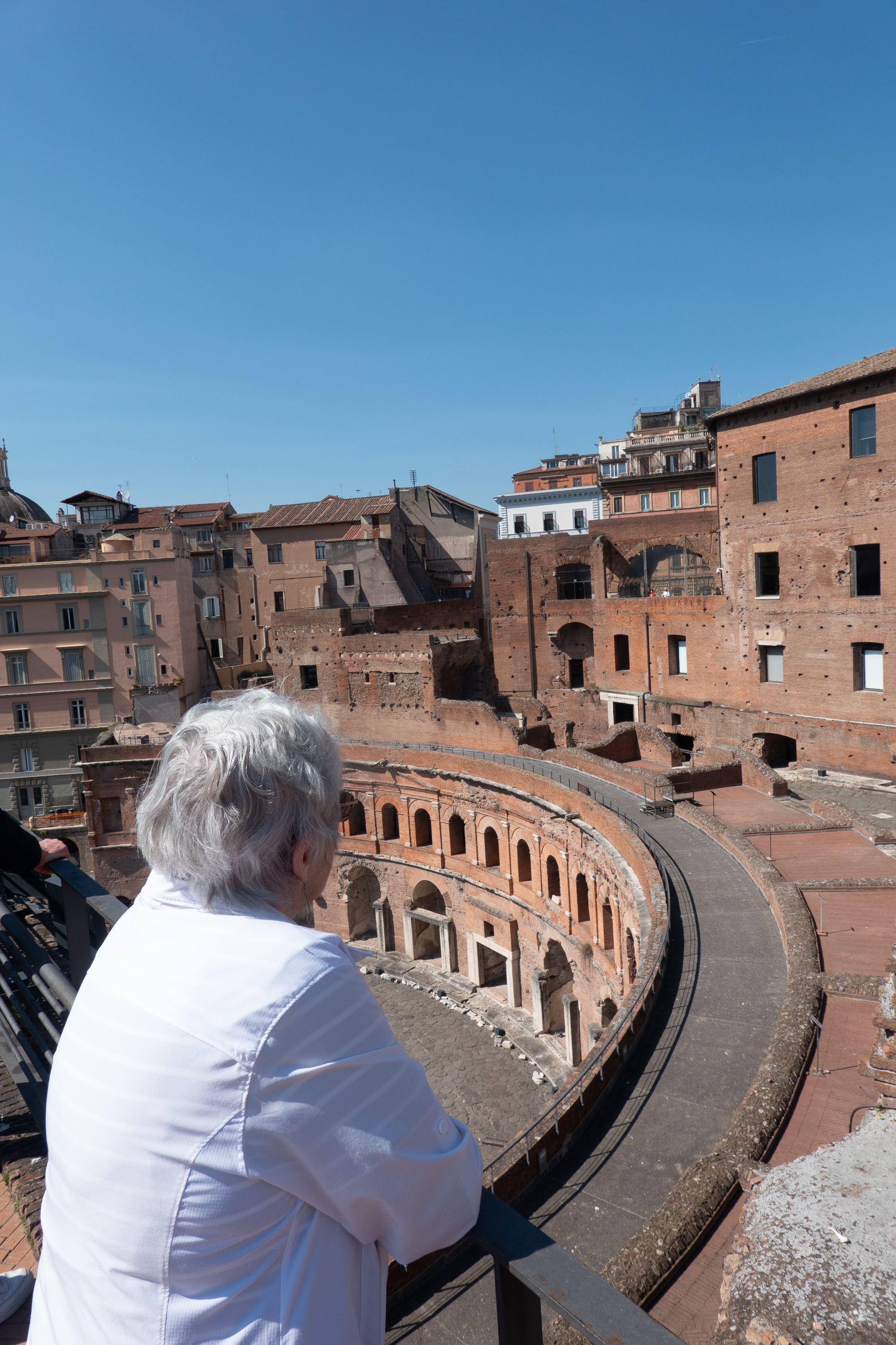
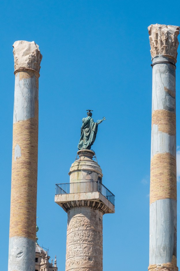
On our second day we started out to see Trajan’s Monument and Market. A city bus took us to the Piazza Venezia where we saw the huge Vittorio Emmanuel II Monument, built to celebrate the unification of Italy.
You can see why Mussolini liked to give speeches here.
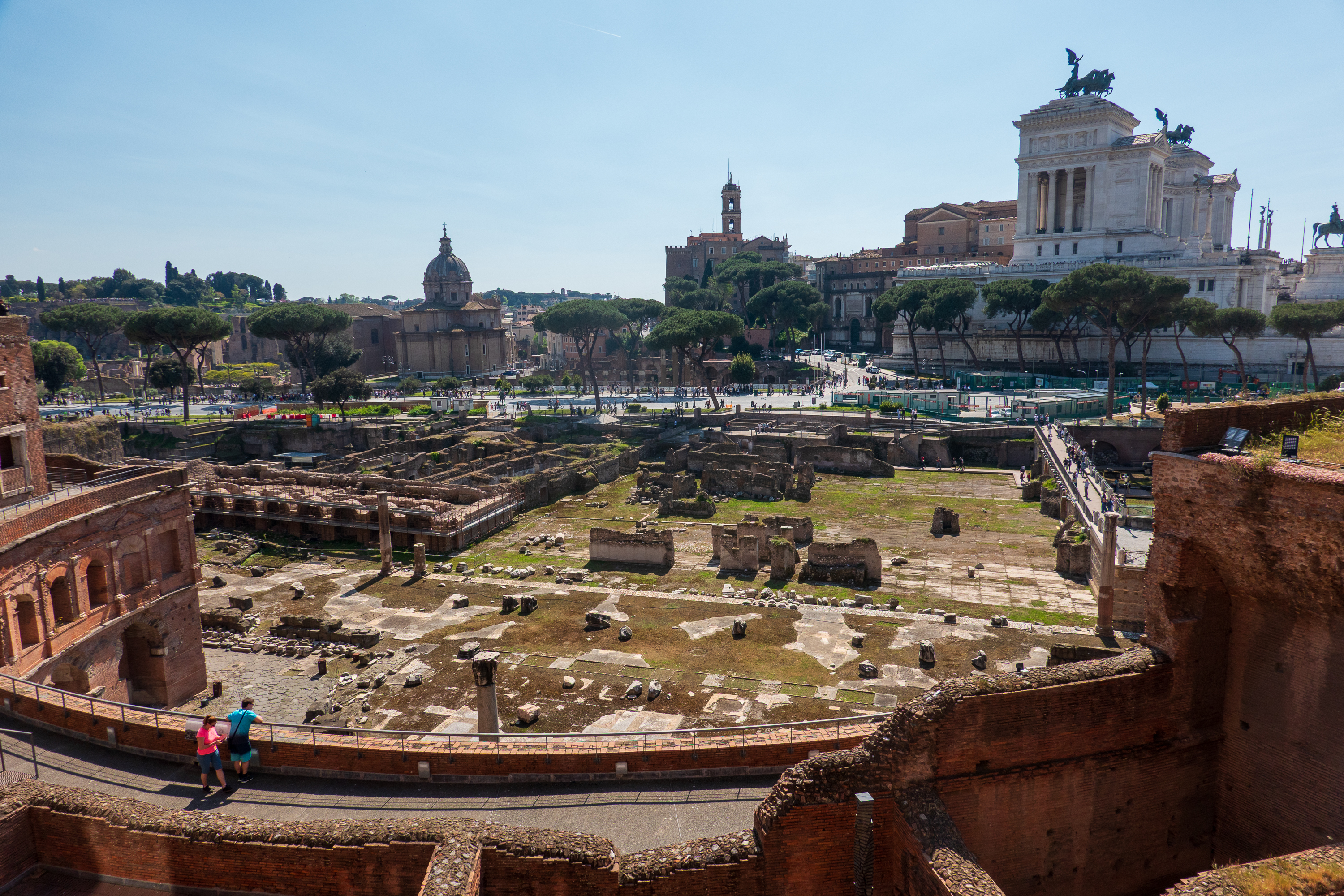
We crossed the square to Trajan’s Column and continued walking on the bridges across and above the Forum to the building known as Trajan’s Market, now home to the Museum of the Imperial Forums. (https://www.mercatiditraiano.it/en)
Trajan’s Column from the Forum side.
Trajan’s Column from the Market side.
Trajan was an accomplished emperor. Some of those accomplishments came at the expense of other nations and, sadly, some have impacts that carry on to this day. (https://en.wikipedia.org/wiki/Trajan) The column is famous for its very detailed images of the Roman Army on campaign. It is so tall, that the ancient Romans would never have been able to see it up close. Today, we can actually examine the images: https://www.trajans-column.org/?page_id=107 History nuts like Fred can stare at them for hours, and then critique all of the movies about Rome.
“Trajan’s Market” was actually more likely to have been a huge, multi-story administrative complex, rather than a shopping center, it was quite impressive. We really enjoyed the Museum. We were unaware that there were, in fact, different forums built or expanded by different emperors over the centuries! The view from the roof over the Forum was spectacular.
Shops or offices, the galleries are huge.
There are the remains of many statues, quite a few, as you might imagine, of Damian’s.
The detail is quite amazing.
Artistic sculpture
Makers mark on an amphora. Adds a very human touch.
Fred was fascinated at the integration of this modern building into the ruins.
Denise admires the Market.
The Forum from the top of Trajan’s Market.
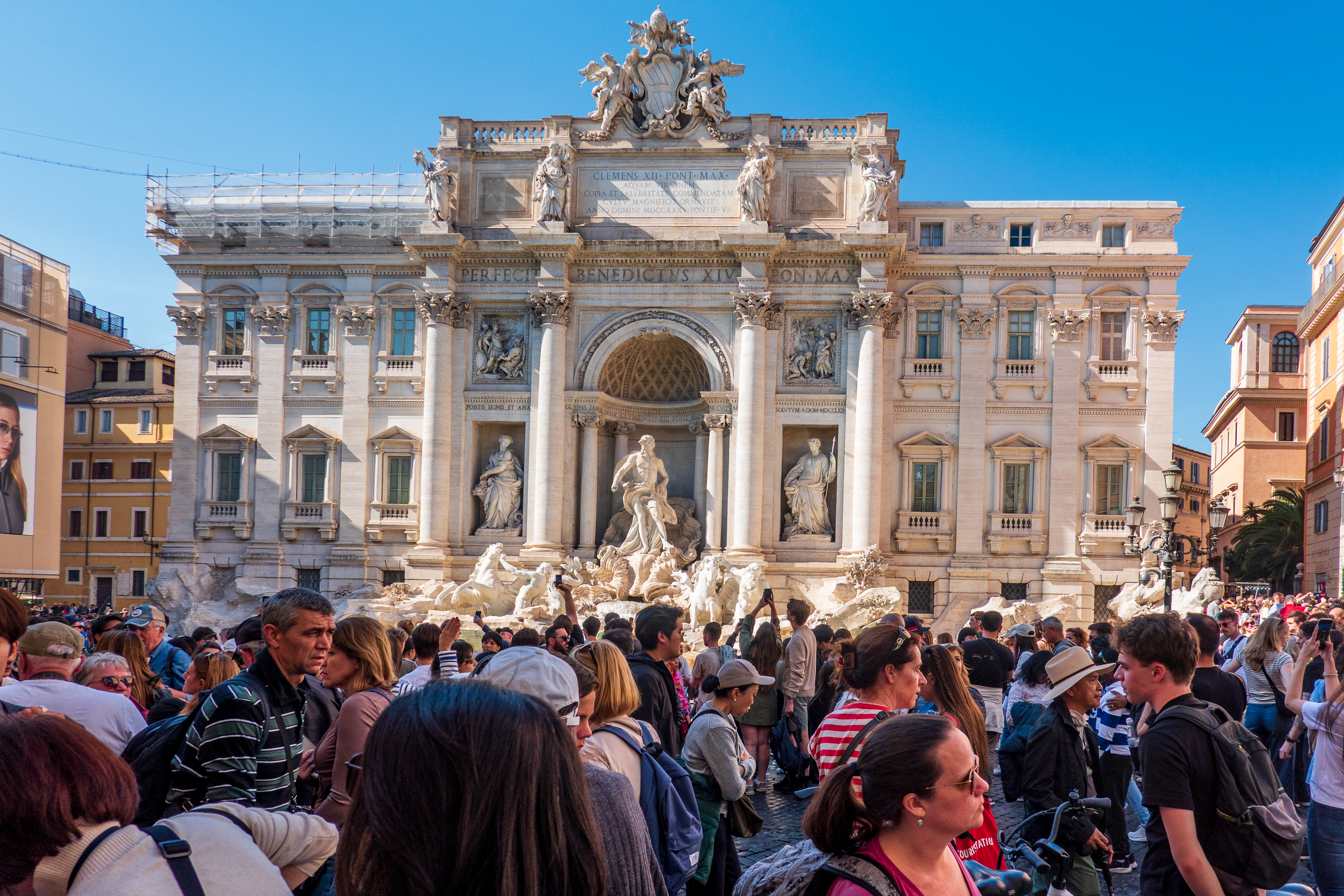
We then headed to the Trevi fountain, to commune with a couple of thousand other visitors. At least that is what it seemed like! That box checked, we enjoyed a gelato to recover and then headed back to the train station.
Nifty street with bridges.
Yes, there is a fountain there.
Our third day was Vatican Day. We saw the Vatican in the company of a friend, a former colleague from our time in Bangui. Javier, originally from Venezuela, is now the Chief of Protocol for the Holy See.
Javier complains that the job is giving him grey hair.
Protocol is a challenge under the best of circumstances – do it right and nobody notices; get something wrong and EVERYBODY notices. As you might imagine, the Pope’s passing created tremendous amounts of work.
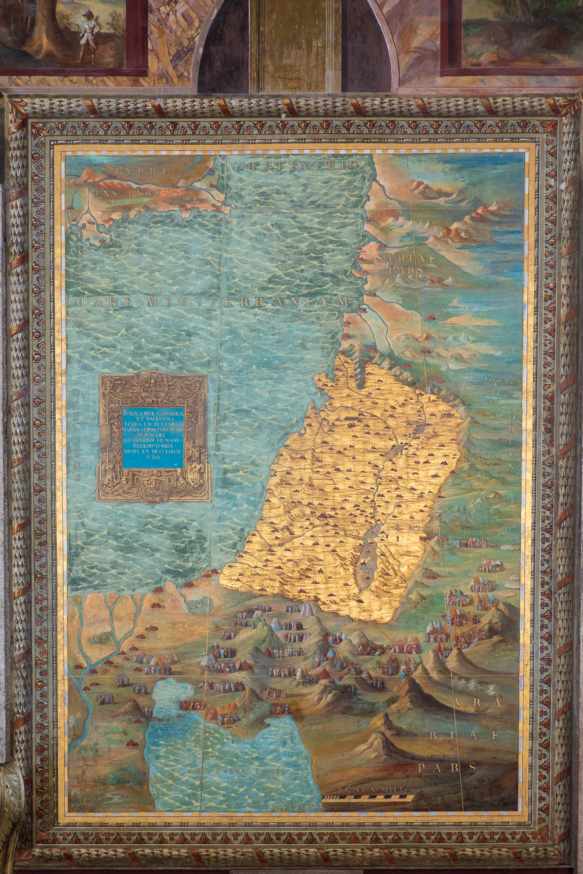
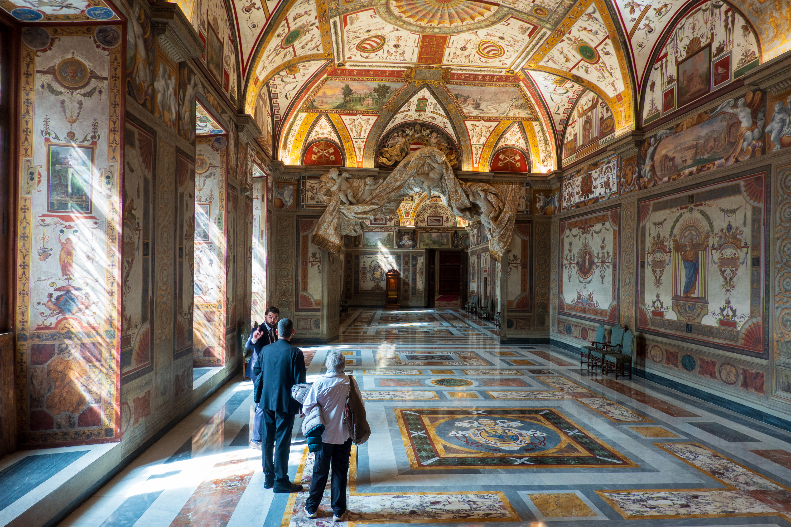
It was an amazing visit, and the memory of it will stay with us forever. We started in the corridors, or loggias, of the administrative office buildings of the Vatican’s Department of State, where Raphael painted the stories of the Bible, from the creation onwards, on the ceilings. Quite amazing. We have worked in a lot of office buildings, but never one like this.
Javier took our picture in front of the map always shown to the Australian ambassador. Can you see why?
The Holy Land, done in gold.
Walking the loggia of history.
Ceiling detail.
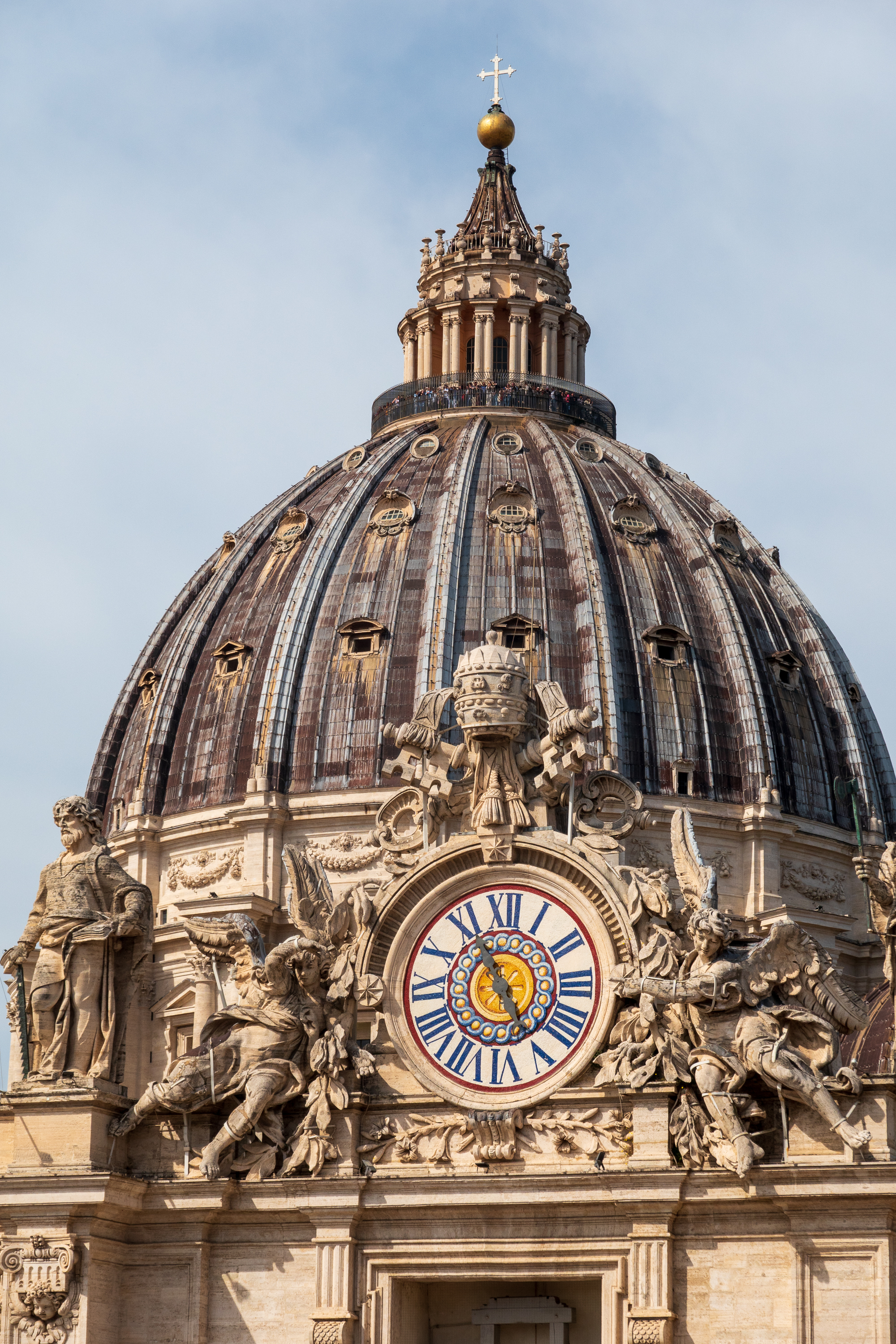
We also viewed the Basilica of St. Peter from above.
Setting up for Easter Sunday. A few people are expected. Sadly, no coffee hour after the service.
The dome of the basilica.
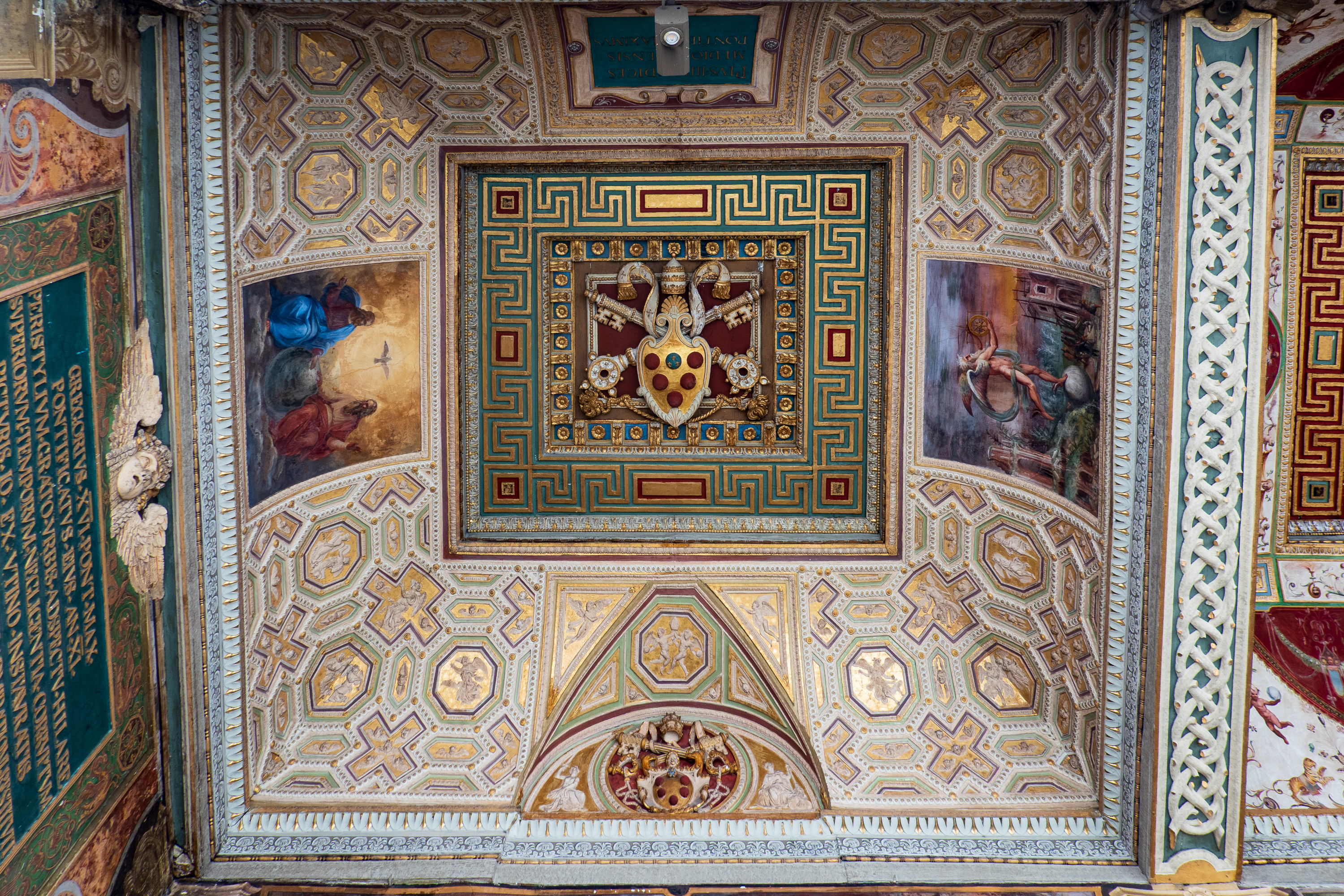
We then followed the conclave processional route through the Hall of Dukes and the Hall of Kings. At the time of our visit the Pope was out of hospital and in residence. Since his death, our visit takes on a special note as the incredible decoration of these rooms will be yet again seen on TV screens when the conclave to elect a new Pope begins. While the Sistine Chapel is open to tourists – so many that we could not peek in – these rooms are not open to the public. And yet their level of decoration is the same or greater than the Sistine Chapel.
Every detail is significant – note the keys, symbol of the authority of the Pope. This is the hall of dukes, which leads to the hall of kings.Pope, assisted by a Cardinal, receiving royalty – symbol of Papal authority over secular rulers. (Who, historically, have not always agreed.)
We took a break to visit Vatican gardens, where every plant mentioned in the Bible is grown. The garden is quiet and peaceful and very well maintained. The wisteria was in full bloom. Just lovely.
Nice to take a break after the intensity of all of the Baroque art.
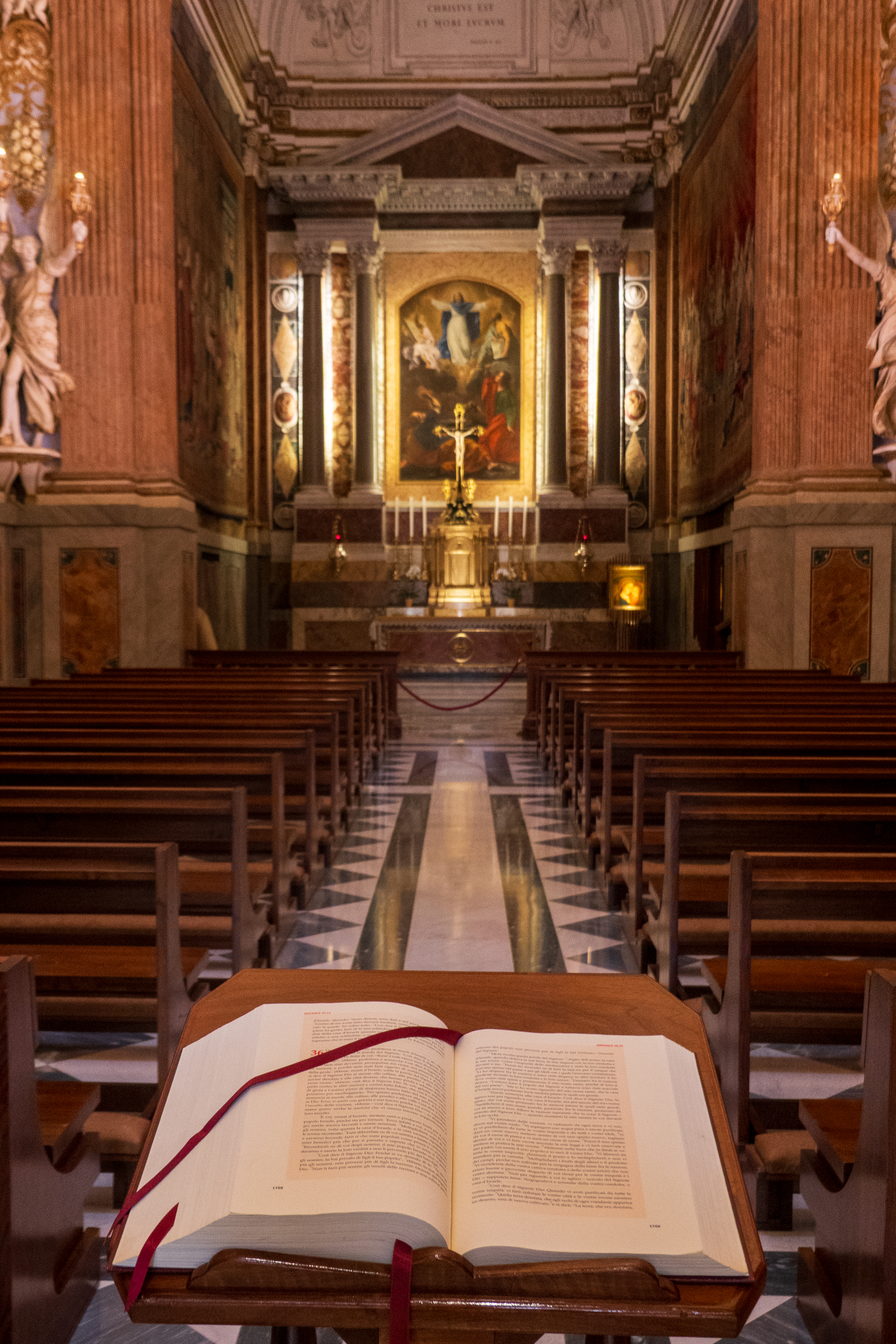
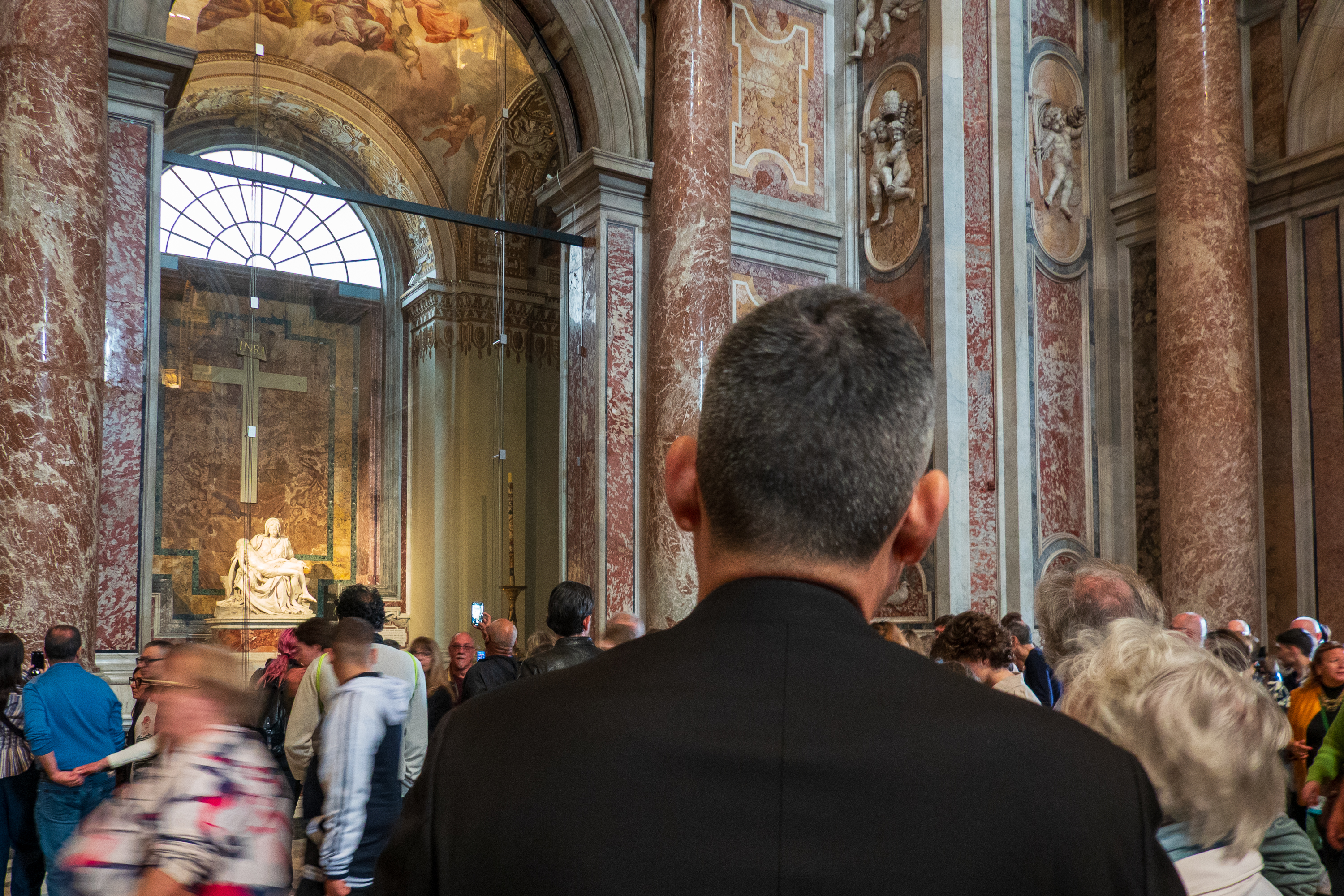
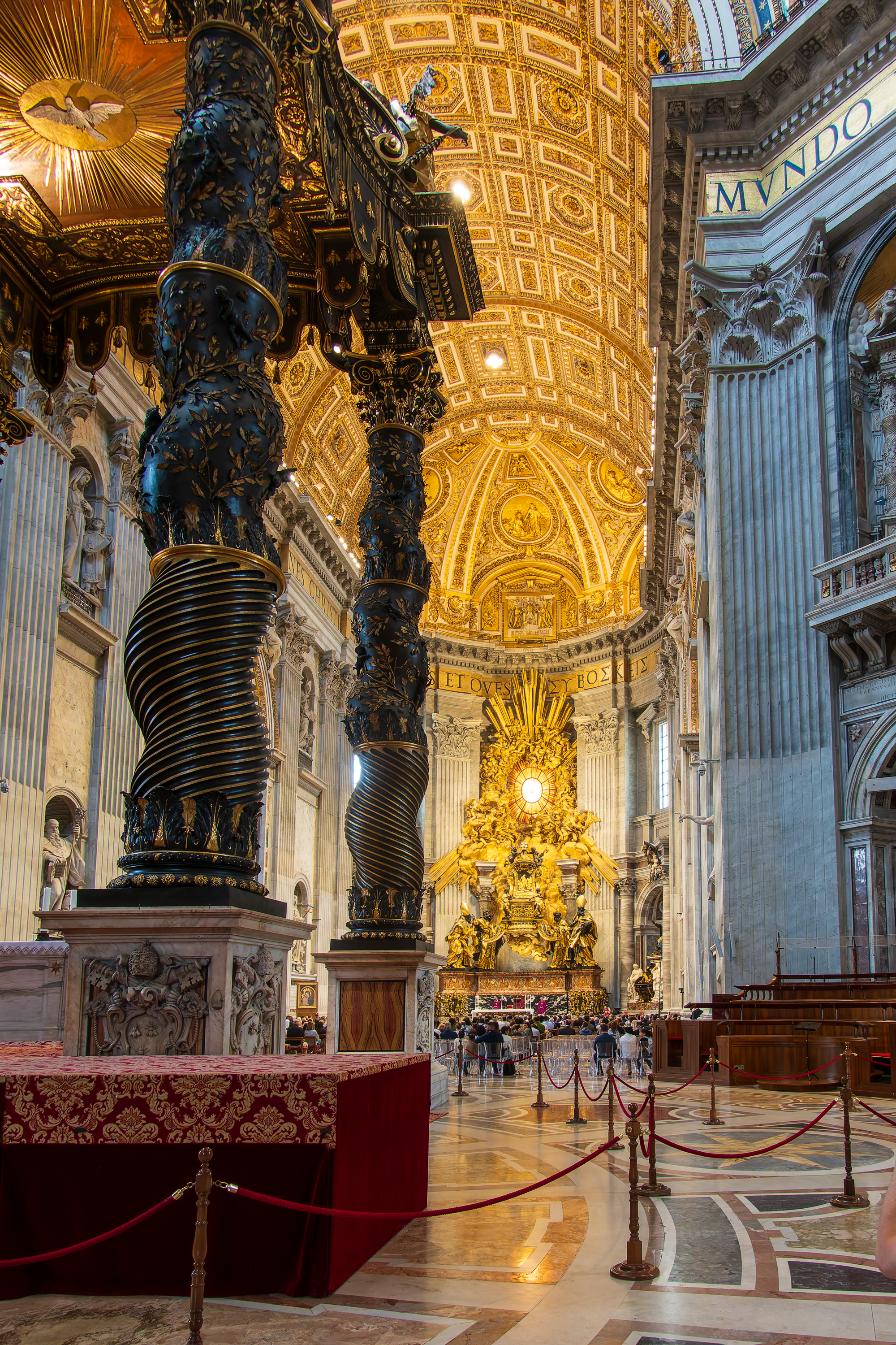
A quick visit to the Basilica came next. Despite the crowds, we marveled at the Pieta, by Michelangelo and the baldachin (https://en.wikipedia.org/wiki/St._Peter%27s_Baldachin) above the grave of Saint Peter. The frescoes everywhere were amazing.
Javier and Denise peer through the crowds.
It really is as amazing as reputed.
Amazing that there is a lot of evidence that Saint Peter really is buried right here.
We had a most interesting experience during our visit. A gentleman, perhaps hearing us speaking English, approached Javier and asked for his blessing. Javier gave it, of course. But it was a poignant reminder that not all of the visitors were tourists like us – many are true pilgrims. We discussed with Javier at length how hard it is to balance the role of the Basilica as a living church with the demands of tourism. (A challenge not unique to Saint Peter’s.) Seems that Pope Francis was particularly concerned about maintaining a dignified church while still making anyone feel welcome. During our visit we could see a section of the Basilica cordoned off for a reaffirmation of wedding vows. It really is an active church.
We then headed to the Residence for lunch. We ate in what is basically the cardinals’ dining hall. Even looks a bit like a college dining room – not at all decorative. (A bit of a jolt after so many ornate spaces.) Until his illness, the Pope ate lunch here every day, his table was just over there. And yes, there was pasta and it was very good.
Proving that no challenge was too great, Javier even drove us back to the campground because he wanted to see our camper. We had to make an extra circuit because there is an impassable median outside the campground! Hopefully, we can return a bit of Javier’s hospitality this Fall when he visits Washington.
Javier wanted our picture with the truck.
We were stunned to learn that you cannot simply visit the Forum – you must get tickers in advance, and there were none left. So we broke down and booked a tour of the Forum and the Colosseum. Not our favorite way to visit anywhere but we had no choice. There are great guides and there are others. Sadly, we had one of the others, but it would have made little difference had we visited on our own. Everywhere was packed with people. Between the crowds and the weather, we did not get any great images of the Forum or the Colosseum. Pity, but you will just have to visit on your own!
Forum Romanum
Inside of the Colosseum, showing a bit of the floor over the underground passages.
But we came, we saw, we learned, and returned to the campground feeling that we had packed as much into four days as was possible. Clearly, it was Javier who made it all special.
We were heading for Genoa to take the ferry to Morocco, but as we were now in Holy Week, we had found little availability in campgrounds north of Rome. We did find space at a sosta below Assisi, so that was our next stop.
Fred was not all that interested in Rome; we tend to avoid big cities and Rome certainly qualifies as big. But we have a colleague from our tour in Bangui, currently at the Vatican, and he had invited us to visit. And visit we did. Of course, every element of our visit has taken on new meaning with the passing of Pope Francis and the election of Pope Leo.
Arriving in Rome, we went to the campground recommended by our friends, Ron and Ton. (https://travelintiger.com) The campground, La Via Flaminia (https://www.villageflaminio.com/en/), is close to a station with regular trains into Rome and, once there, easy access to the Metro.
The first thing to greet us upon checking in was this blast from the past. We first encountered Rotel in Tamanrasset, in 1974. Always had a soft spot for them as it is a kind of a wild way to travel. And, back in Tamanrasset, they cleaned up an absolutely disgusting ablution block to the point that we could use it. (We had been planning to simply drive out into the desert each day; it was that grim.) (https://www.rotel.de/index.html)
This beast is fairly simple. In Tamanrasset they had a Mercedes bus, the “hotel” trailer, and finally a 6×6 truck to carry fuel, spares, and mechanics.
In 1958, Fred and his mother spent six months in Rome when they were evacuated from Amman during the Iraqi revolution of 1958. (https://en.wikipedia.org/wiki/14_July_Revolution) Fred remembers grilled cheese sandwiches on the Via Veneto, just up from the US embassy, so, of course, we returned to the site and Fred relived childhood memories.
Looking down the Via Veneto towards the chancery.
When the money ran low, we moved to a pensione, the Ludovici. This may be it, now a hotel. We had the corner room on the third or fourth floor. Even had a sink in our room!
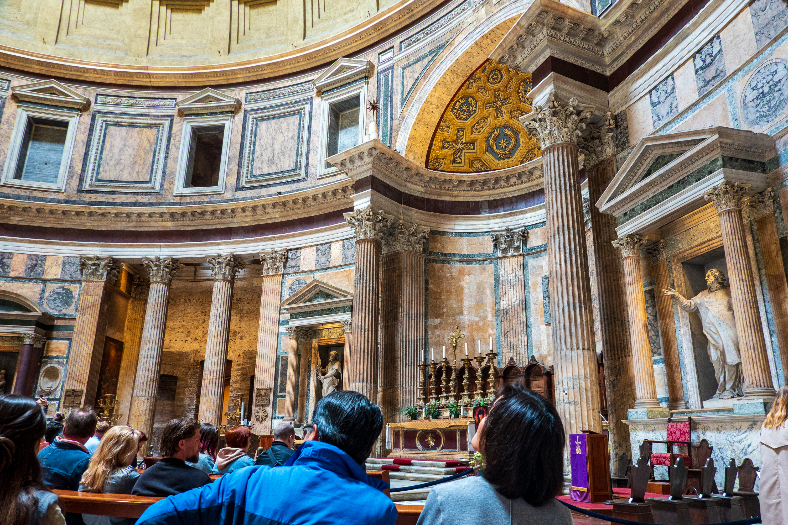
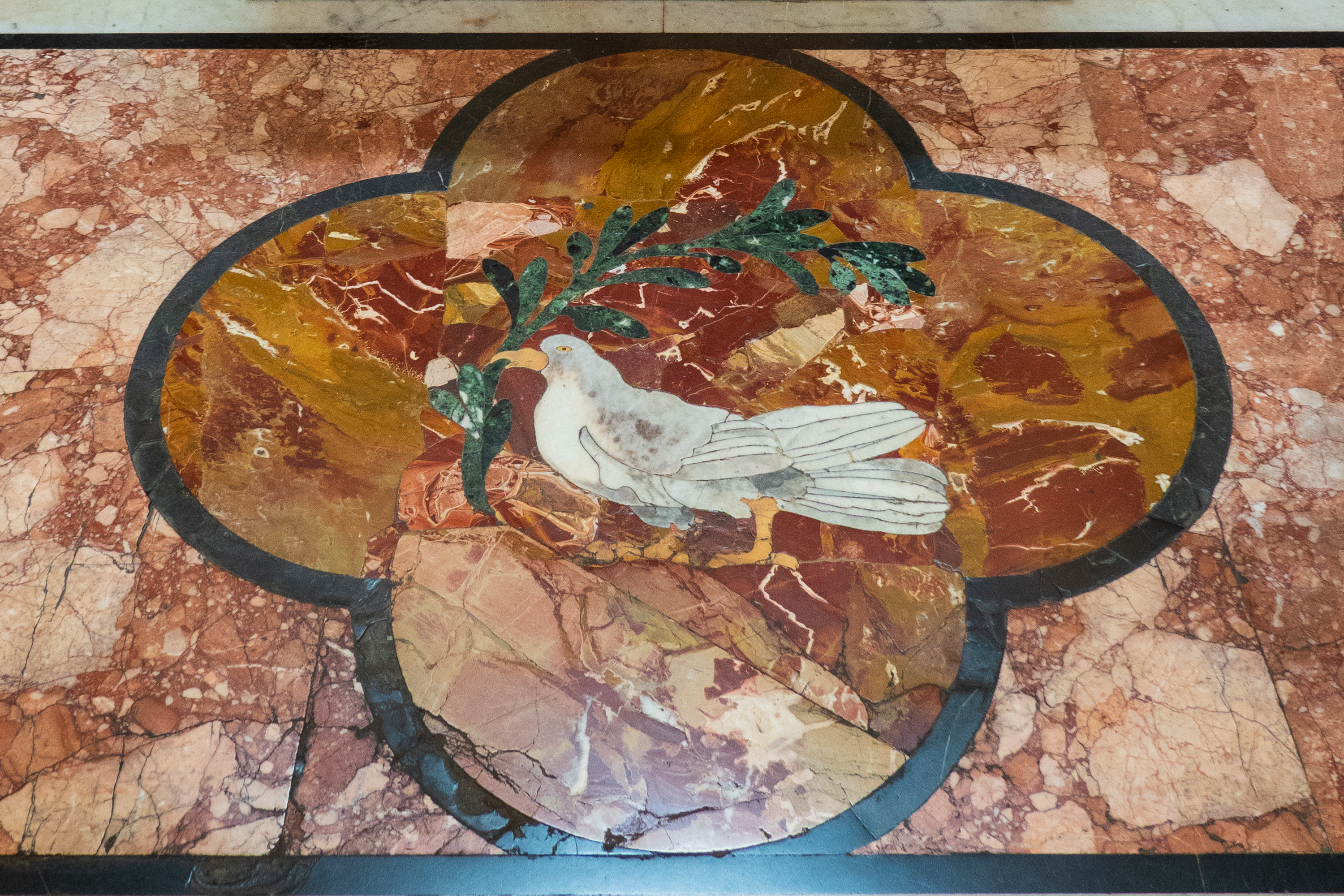
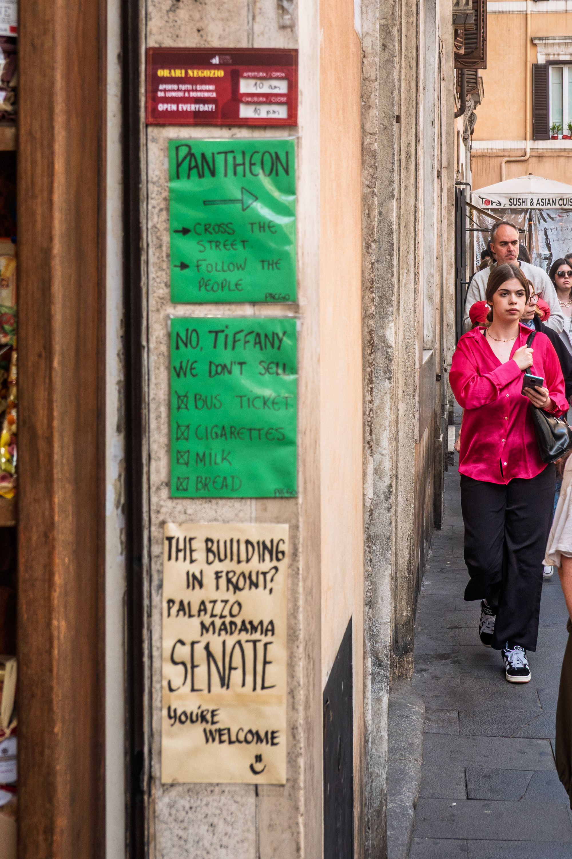
Turning to serious tourism, we visited the Pantheon, just a train, metro, and a hike away.
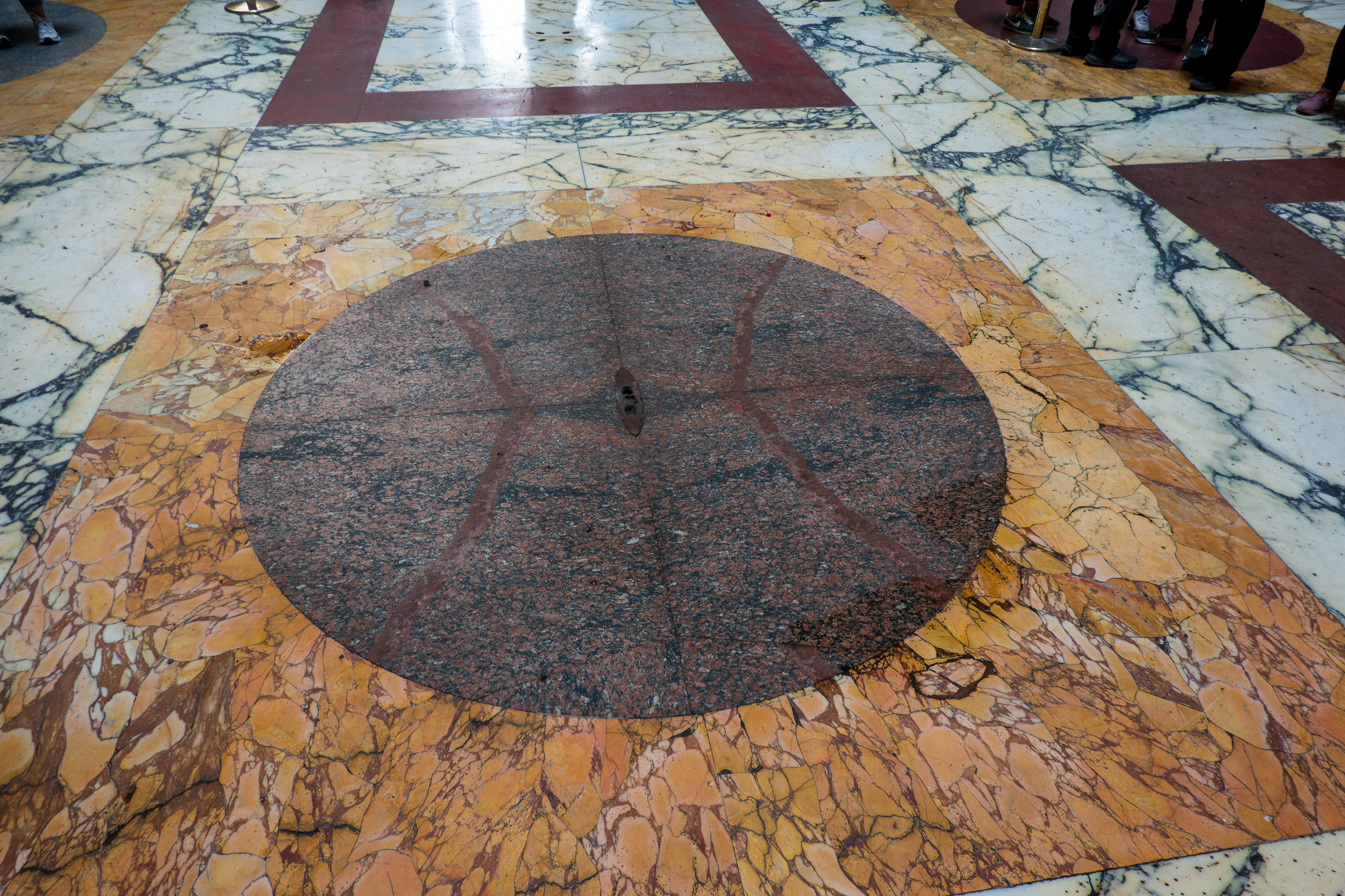
We joined the (not too bad) crowds and marveled at the oculus in the ceiling that lets in the rain, and the drain below it that lets it out.
Everyone was looking up.
The oculus casts a nifty round spot of light.
And the rain exits here.
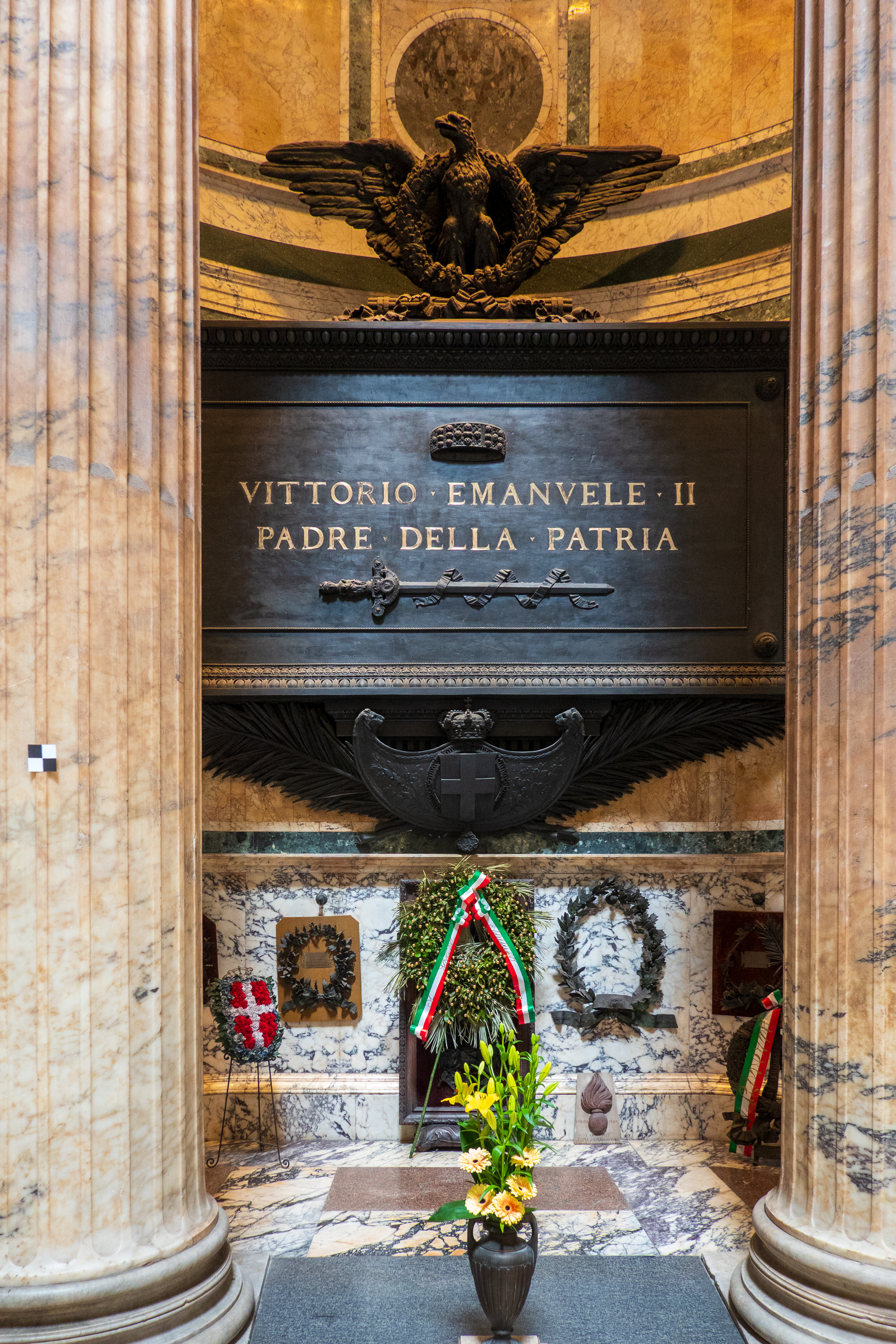
Tomb of Victor Emmanuel.
Ceiling detail in the entrance.
Doors, big doors.
Originally built by Hadrian from 118 to 125 AD in a form governed by circles and squares, it later became a Baroque styled church. (https://en.wikipedia.org/wiki/Pantheon,_Rome)
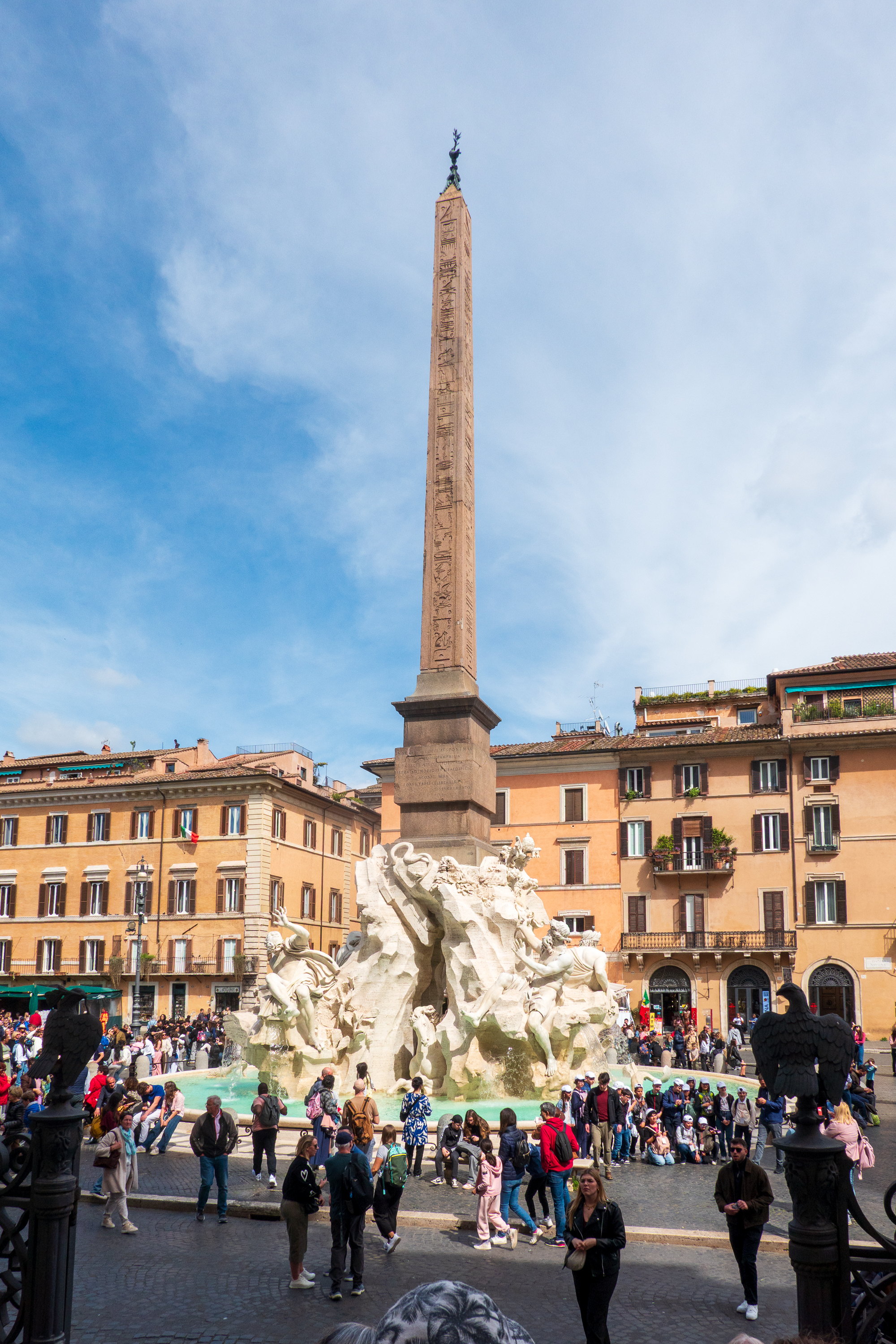
We then headed to the Piazza Navona, to admire Bernini”s Fountain of the Four Rivers, representing the Danube, the Plata, the Ganges and the Nile.
The square
The fountain, one of at least two, actually.
Quite an amazing piece of sculpture. We wandered into the Church of Sant’ Agnes in Agone, designed by Borromini. Another very ornate and spectacular church. (https://en.wikipedia.org/wiki/Sant%27Agnese_in_Agone) And Agone has nothing to do with physical agony.
They were quite spectacular. Fred, being taller, got a better view than Denise did. There were tour groups blocking our view.
You may or may not like baroque art, but you have to agree that it is stunning, and a bit different from the Baptist church where we were married. The idea was to provide a view of heaven. One can debate the theology, but the beauty is amazing – a riot of colors and textures of paint, marble and gold. A lot of gold.
In Rome and Pompeii both, we became very aware of crowds of tourists, both in tours and individually. And it was only April. We were glad that we had not come in June or July. How bad are the crowds? Try this: